See a SLIDESHOW
of swimming hole photos in these states.
This
swimming hole listing is by
www.swimmingholes.org
AGUA CALIENTE PARK
(AGUA)
|
|
| TOWNS |
SAN DIEGO, ALPINE, BORREGO SPRINGS |
| LAT,
LON |
lat=32.95169,
lon=-116.30582(source:UScampgrounds) (accuracy: exact)
LINK
TO GOOGLE MAP |
| STATE |
CA |
| WATER |
Hot springs |
| TYPE |
Natural hot spring fed into
man-made
pools |
| DESCRIPTION |
"Agua Caliente County Park is a
regional camping park located
in the Anza Borrego Desert and is best known for its geothermally
heated springs. Three naturally fed pools provide different ways of
enjoying the park's mineral water: There are two pools outdoors, and an
indoor therapeutic spa is heated to 102 degrees and outfitted with
Jacuzzi jets. The park is very popular during the winter and has
numerous camping sites (full hook-ups, partial hook-ups, non hook-up
and tent sites, and a caravan area for large groups) available. Hikers
will enjoy miles of trails that meander through the park's canyons and
across its hillsides." |
|
| AREA |
Anza-Borrego
State Park area |
| SANCTION |
Official |
| FEE |
Yes - see web site above |
| FACILITIES |
All facilities. |
| ACTIVITIES |
Hot tubbing, swimming |
| PHONE |
760-765-1188 |
| CAMPING |
Yes, very popular in winter, get
reservations: 877-565-3600 |
| BATHING
SUITS |
Required |
| DIRECTIONS |
"111 miles from San Diego. From
Ramona
through Julian: East on
State Highway 78 to Scissors Crossing then south 26 miles on Highway S2
to the park entrance. From Interstate 8: East on Interstate 8 and exit
at Ocotillo, then 22 miles north on Highway S2 to the park entrance." |
| CONFIDENCE |
Very confident |
| VERIFIED |
No |
| DATE
UPDATED |
4/2010 |
This
swimming hole listing is by
www.swimmingholes.org
AQUATIC PARK
(AQUA)
|
|
| TOWNS |
SAN FRANCISCO, GHIRARDELLI SQUARE |
| LAT,
LON |
lat=37.807292,
lon=-122.423542(source:DeLorme) (accuracy: exact)
LINK
TO GOOGLE MAP |
| STATE |
CA |
| WATER |
San Francisco Bay |
| TYPE |
Spring-fed pool |
| DESCRIPTION |
In the heart of San Francisco, in the
Golden Gate National
Recreation Area, is Aquatic Park: a small beach on a lagoon in the San
Francisco Bay which is a historic swimming place and is still used and
open to the public. The water is not pristine (and sometimes real cold)
but some folks swim year around. There are at last two clubs (open to
the public for a small fee) for people who swim here. For photos and
information, see: DOLPHIN
CLUB , SOUTH
END CLUB. For other information see: GORP
, FROMMERS
. |
|
| AREA |
Golden Gate National Recreation Area GGNRA |
| SANCTION |
Official |
| FEE |
Yes - see web sites above |
| FACILITIES |
Changing facilities, bathrooms in
Dolphin and South End club facilities. |
| ACTIVITIES |
Swimming |
| PHONE |
(415)561-4700(GGNRA) |
| CAMPING |
None at site |
| BATHING
SUITS |
Required |
| DIRECTIONS |
Take cable car to Ghirardelli Square
then walk north to Aquatic Park (parking very limited). |
| CONFIDENCE |
Very confident |
| VERIFIED |
No |
| DATE
UPDATED |
12/4/2006 |
This
swimming hole listing is by
www.swimmingholes.org
AUBURN
AREA
[2 PLACES]
(AUBU)
|
|
| TOWNS |
SACRAMENTO, RENO (NV),
AUBURN |
| STATE |
CA |
| WATER |
American River |
| TYPE |
River |
| DESCRIPTION |
There are a number of swimming
holes
along the North Fork of the American River outside of Auburn in the Auburn State
Recreation Area . See DIRECTIONS below for
details. |
| AREA |
Auburn State Recreation Area |
| SANCTION |
Unofficial |
| FEE |
None |
| FACILITIES |
Unknown |
| ACTIVITIES |
Swimming |
| PHONE |
530-885-4527 |
| CAMPING |
There are several camping places
along
the river. |
| BATHING
SUITS |
Unknown |
| DIRECTIONS |
From Sacramento, take
I-80
east to Exit 119 at Auburn. Take RT 49 south, then:
CLARKS
HOLE [CLAH]:
There are a number of swimming holes along the North Fork of the
American River outside of Auburn in the Auburn State
Recreation Area .
Clark's Hole is one of the best. YOUTUBE .
A short but steep trail down to the
hole with rugged cliffs around. This is just above where the Middle
Fork American joins the North Fork American - it is generally not
recommended that you swim in the Middle Fork, which is a challenging
whitewater rafting river. The Recreation Area stretches for miles along
both forks. To get here: and
take RT
49 south. Keep on Rt 49 through Auburn. In about 3 miles RT 49 will
cross the American River. Park near here and follow the trail upstream
on the North Fork. In about .5 miles of hiking you will pass under a
highway bridge (Forrestville Rd) and in about another .25 miles you
will come to Clark's Hole, big and deep. LAT,
LON
lat=38.9293,
lon=-121.0385 (source:
DeLorme) (accuracy: approximate)
LINK TO GOOGLE MAP. Pretty confident. Not verified. Updated
4/2010.
UNIVERSITY
FALLS [UNIV]: Beautiful series of low falls,
waterslides and swimming holes. PHOTO
,
YOUTUBE , YOUTUBE .
. (The
following
directions are by Tim
Joyce.) Arrive early (before 10 a.m.) or late
(after 3 p.m.) to avoid the boom
box-and-cooler crowd. Best time to visit is July and during the summer.
Early in the season
the falls are too strong. This swimming hole is dog friendly. As with all swimming
holes, swim at your own
risk; there are no lifeguards at University Falls and there have been
accidents.
University Falls is 30 miles (50 minutes) east of Auburn. To
get here from Auburn, continue on RT 49 south to the town of
Cool. Go east
on RT 193 to Georgetown. Go left onto Main St. (you will know you are
in Georgetown because all the trucks and motorcycles park in the middle
of main street. Traffic passes on both sides); this
is Wentworth Springs Rd. There is a grocery store in town here. Also,
there are no other gas stations on route, so plan on gassing up in
Georgetown. Take this road (Wentworth Springs Road) out
of town for about 12 miles. Note: The El Dorado Ranger Station will be
about half way on this road on your right. It is a good place to stop
for a free map. They also have well maintained restrooms.
This is the closest legal restrooms to the falls. Better stop for
junior there.
Just
after
passing into the town of Quintette, find parking on the left
(you will know you have crossed into Quintette because there is a road
marker on the right as you enter the town). The parking is on the left
side of the road near the gate. A large yellow gate has been
constructed to prevent vehicles from accessing the service road you
will be hiking on. The yellow gate we are talking about it the gate
right before the University of Berkeley Headquarters (Blodgett
Experimental Forest Headquarters) entrance way. If you go by the
Blodgett Forest Headquarters entrance way, you have gone too far.
Google maps shows the yellow gate and limited parking area if you are
interested in looking at it prior to your hike. Please don't
block the gate or access to the service road or you will get towed!!
Note:
this is not an easy swimming hole to find. One wrong turn and you
will end up in the woods hiking for a long time. Please bring enough
back-up water and food for your hike. However, the hike is fairly easy
and
not
that steep (except the final 1/4 mile descent). Junior should be
able to handle it if you follow these directions.
From
the
yellow gate, allow 90 minutes to walk in. Walk past the bright
yellow gate; 200 feet past the gate, continue straight on the fire road
(Note that the trail forks at about 200 feet past the gate. Stay
straight or on the right at this first fork. The left turn at the fork
descends down into an old logging area.
You will know you have gone the wrong way if the road is not clear. The
correct hiking road is wide and clear and should not require anything
more than sneakers).
Hike
for
about 0.5 miles until you reach a second fork. You will know
you have reached this fork because right in the center of the fork is a
Forest sign road marker (12N67B). The markings on the sign
have been
scratched by vandals. However, it is still legible. Go left at this
fork and hike about 1 mile down until you reach a large clearing.
(Note: Prior to reaching this clearing you will pass one or two
dead-end distracter trails on the right and then some newly planted
trees (Blodgett Experimental Forest)). There are some logs and rocks
marked with blue arrows at the clearing. At the clearing the trail
continues straight or turns sharply to the right and heads down hill.
Follow the arrows and trail to the right and down hill. Follow the
trail down hill for 0.25 miles. The trail then turns sharply left and
then continues down until the road. At the road you need to take a
sharp hair pin turn to the right. You will be walking along the Pilot
Creek water canal, flume etc.. which will always be on your right. You
will pass a pile of gravel also. The trail then bends left.
You
need to
follow this road with the flume on your right for about 0.5
miles (the flume or water canal will always be on your right). Just as you
have almost given up hope, there is an obvious sign on your
left. There is also a tree marked with blue wording that says
"Falls". Follow this trail left and down about 100 feet until
the next clearing. At the clearing you will be tempted to go
straight.
Don't do it! There is a tree with a park sign on it that is a
distracter. It is like a Siren calling you in the wrong direction away
from your goal. Follow the trail to the right. There are some blue
arrow markers guiding you in the correct direction (right). It's a
little brushy. The trail descends fairly steeply for about 0.25 miles.
The first steep descent will require you to "hike a bike" if you biked
in and didn't walk. It is too steep to ride down - not recommended. Walking is fine. The
trail then flattens and proceeds down
again steeply. You will pass an overturned red pick up truck on your
left. At this point you should hear the falls. There is a second blue
pick up truck on your right as you proceed further down to the bottom
of the trail. The swimming area starts right near the second truck. To
reach the top of the falls keep walking down the trial. It takes you to
the top of the falls. The 3 main water slides are just below. The water
slides are each 30 to 80 feet wide and about 12 to 15 feet deep.
LAT,
LON
lat=38.9293, lon=-121.0385 (source: measured by another)
(accuracy: approximate)
LINK TO GOOGLE MAP. Very confident. Verified by another.
Updated 4/2010.
Please
be careful at the lower Falls!! A number of people have been
killed around the 4th water slide. It is difficult to reach and the
drop beyond this slide is treacherous. A rope has been constructed to
help for getting out of the pool. Don't trust it. People
have missed the rope and have been washed over the falls. Please be
careful!!
Hikers,
Please read this link!!! http://www.wikiloc.com/wikiloc/view.do?id=121383
|
| CONFIDENCE |
Very confident |
| VERIFIED |
By another |
| DATE
UPDATED |
4/2010 |
This swimming hole listing is by
www.swimmingholes.org
BASS LAKE
(BASS)
|
|
| TOWNS |
SAN FRANCISCO, MARIN, BOLINAS |
| LAT,
LON [N83/W84] |
lat=37.9507, lon=-122.7645(source:
DeLorme) (accuracy: exact)
LINK
TO GOOGLE MAP |
| STATE |
CA |
| WATER |
Bass Lake |
| TYPE |
Lake |
| DESCRIPTION |
Hike 2.6 miles (each way) to
escape the
crowds in Point Reyes
National Seashore and join the bathing-suit-optional, laid back folks
at Bass Lake. No real beach here and sometimes a bit muddy but good
swimming, a great ambiance and a rope swing to play on. Even when it is
foggy on the road, it is often clear at the lake. See web sites for
more info:NATIONAL
SEASHORE , NUDE
BEACHES OF MARIN COUNTY. |
|
| AREA |
Point Reyes National Seashore |
| SANCTION |
Unofficial |
| FEE |
None |
| FACILITIES |
Unknown |
| ACTIVITIES |
Swimming, Rope Swing |
| PHONE |
(415) 663-1092 (National Seashore) |
| CAMPING |
Walk-in, primitive camping (only)
at the
National Seashore |
| BATHING
SUITS |
Optional (very!) |
| DIRECTIONS |
From San Francisco, take RT 101
across
the Golden Gate then RT
1 north. Just past Bolinas Lagoon, turn left at the exit to Bolinas
(may be unsigned). Follow the road along the lagoon until it ends then
take Olema-Bolinas Road to the stop sign at Mesa Road. Go right on Mesa
Rd. and go about 4 miles where it turns to dirt and ends at a parking
area. There is a sign at the trailhead by the lot which will direct to
Palomarin Trail. The hike to the lake is about 2.3 to 2.6 miles one
way. Although the ocean breeze makes this hike fairly cool in the summer
you should still bring water.
Your hike will take you past a grove of eucalyptus trees. After you
pass the eucalyptus trees you will pass by a cliff on your left that
gives you a beautiful view of the Pacific ocean. You then will proceed
up a hill for about 1 mile.
You then come to a trail intersection that reads "Coast Trail" ,
Wildcat camp 3.3 miles or Palomarin trail 2.2 miles. Stay on the
Palomarin trail. Follow this trail until you reach another trail marker
that says "Bass Lake". You turn left at this sign and follow the trail
down to the lake. You will know you are on the right trail since you
will get a view of the lake on your left.
The actual trail to the waters edge is not easy to locate. It is about
0.6 miles down on the left just past the end of the lake. It is not
easy to spot on your left since there is much poison ivy. You know you
have missed it if the trail starts to slightly ascend and the canopy
begins the thicken. If you take this trail it will take you to a
clearing close to the lake where most people camp and sun bathe. The
rope swing is another 0.2 miles past this small camp. In the attached
photos you can see the tree with the rope swing (it is the large tree
on the water at about 1 PM in both photos). On a hot day I have seen up
to 30-40 people here. Most of the time you will have the place to
yourself.
When you come to a grass meadow walk to the lake - there are 3 paths. |
| CONFIDENCE |
Very confident |
| VERIFIED |
By another |
| DATE
UPDATED |
4/2010 |
This swimming hole listing is by
www.swimmingholes.org
BIG SUR AREA
[4 PLACES]
(BIGS)
|
|
| TOWNS |
SAN FRANCISCO, MONTEREY, BIG SUR |
| LAT,
LON |
lat=36.24828,
lon=-121.77803(source:
DeLorme) (accuracy:general area)
LINK
TO GOOGLE MAP |
| STATE |
CA |
| WATER |
Varies - see below |
| TYPE |
Varies - see below |
| DESCRIPTION |
At the heart of the wild and
remote Big
Sur is the
deservedly-popular Pfeiffer-Big Sur State Park, through which courses
the Big Sur River just before it empties into the Pacific. Of course,
you can swim in the Pacific nearby (at Andrew Molera State Beach) but
there are also several fresh water swimming holes in the Big Sur River
in Pfeiffer-Big Sur S.P.. South of here, along the coast, is Eslen hot
springs and other swimming holes. For details see DIRECTIONS below. |
| AREA |
Pfeiffer-Big Sur S.P./ Los Padres
N.F. /
Esalen Institute |
| SANCTION |
Varies |
| FEE |
Yes |
| FACILITIES |
Full facilities in Pfeiffer-Big
Sur
State Park |
| ACTIVITIES |
Swimming/Hot Tubbing |
| PHONE |
831-667-2315 (Pfeiffer-Big Sur
State
Park), (831)667-3000 (Esalen) |
| CAMPING |
At Pfeiffer-Big Sur S.P.,
extremely
popular, must get reservations early, call (800)444-PARK (Mistix) |
| BATHING
SUITS |
Varies - see below |
| DIRECTIONS |
From Monterey, go south on RT 1,
then:
CAMPGROUND
[CAMP]:Follow
signs to Pfeiffer - Big Sur State Park on RT 1. Enter
the Pfeiffer- Big Sur State Park. The charge to get into the park
is $10.00 (June, 2010). In the Big Sur
river
where it passes by the campground is a deep hole with a large rock
forming a pleasant and accessible swimming hole enjoyed by many
campers. LAT, LON lat=36.25026, lon=-121.78214(source: Topozone )
(accuracy: approximate)
LINK TO GOOGLE MAP. Bathing suits for sure. PHOTO. Very confident.
Verified. Updated 12/15/2005.
NOTE: People often confuse Preiffer-Big Sur State
Park with Julia Pfeiffer Burns State Park. Julia Pfeiffer Burns State
Park is named after Julia Pfeiffer Burns, a well respected pioneer
woman in the Big
Sur country. The park stretches from the Big Sur coastline into nearby
3,000-foot ridges. It features redwood, tan oak, madrone, chaparral,
and an 80-foot waterfall that drops from granite cliffs into the ocean
from the Overlook Trail. A panoramic view of the ocean and miles of
rugged coastline is available from the higher elevations along the
trails east of Highway 1. As you are traveling south from Carmel you
will encounter Pfeiffer -Big Sur State Park first. Julia Pfeiffer Burns
State Park is further south on Highway 1. |
GORGE [GORG]:
Also in the Pfeiffer
- Big Sur State Park: For a spectacular swimming hole setting, go to
the far eastern end of the road along the river in the park then hike
upstream along the Big Sur river for about 10 minutes, some scrambling
over rocks and wading in water is required, to get to the gorge. Here a
deep pocket of cold water is surrounded by massive smooth rocks. PHOTO
1 , PHOTO 2
. A report from a visitor:"The large swimming area quickly became
overcrowded while we were there. However, the downstream area offers a
fine area for Jacuzzi soaking, splashing and swimming in a smaller,
more intimate setting. I was amazed to see that virtually everyone was
overlooking the river portion as they walked to the main pool
upstream". LAT, LON lat=36.24815, lon=-121.76988(source: measured)
(accuracy: exact)
LINK TO GOOGLE MAP.
Bathing suits for sure. For good swimmers only, it can be difficult to
find a place to scramble out on the boulders. Very confident. Verified.
Updated 12/15/2005.
To get here, enter the Pfeiffer- Big Sur State Park. The
charge to get into the park
is $10.00 (June, 2010). Proceed to the Lodge which will be
on your
right. The Lodge has a restaurant and bathrooms. There is also a
general store here. At the fork near the Lodge, bear left (it
actually is the middle road)
and follow this road along until you reach parking area #3 or #4. You
will know you are on the correct road because the river will be on your
right side. The correct parking for The Gorge is at the end of the
road. At parking area #3 there is a paved path with a sign indicating
that The Gorge is 0.6 miles. Follow the paved path up the hill until
you reach the river. There is a plank bridge to cross the river. After
crossing the river follow the road to the left through the camping area
until you reach a clearly marked trail. Follow the trail up the river
for about 0.2 miles. Note that the best approach is to stay to the
right. The path will take you almost all the way to The Gorge. You will
reach a point you can not go any further and will have to drop straight
down into the river (there is a log you must climb over). Most people
remove their shoes here. At this point you will need to cross the river
to the other side. It is shallow enough to wade across. The water is
not
too deep here. The trail continues on the left side until you reach the
rock impound at the base of The Gorge. If you follow these directions
you will only need to cross the river once and will not need to boulder
hop. If you cross too early on the left side you may have to boulder
hop or cross back in a deep section of the river.
Note: There is no jumping at The Gorge. Also, recently there have been
significant deposits of sand on the bottom of The Gorge area making it
much more shallow than in 2009. The only deep section
now is on the side of The Gorge near the rock impound. It is about 8
feet deep. However, the good news is there is more beach area for
chairs.
ESALEN HOT
SPRINGS
[ESAL]:
While
you are in the neighborhood, go further down RT 1 for a late night
visit to the beautiful hot springs at Esalen Institute. Natural hot
water is led into stone pools above the thundering Pacific. (The old
pools were destroyed in mud slides in 1998, but are now rebuilt - as of
9/04.) Photos of new pool and facility:
PHOTO , PHOTO .
Unless you are staying at Esalen, you can only use the pools from 1AM
to 3AM (yes, AM!), for which you pay $20.00 a person and for which you
MUST make reservations ahead, either in person or by calling
831-667-3047. (There is also a new "personal retreat" program for
"Friends of Esalen" whereby you can register to spend one or more days
partaking of programs, including the hot springs, without being in a
particular workshop. See the web site for details.) Bathing suits are
not necessary. Outstanding experience, worth losing a little sleep
over, don't miss it! LAT, LON lat=36.126250, lon=-121.641742(source:
Topozone ) (accuracy: approximate)
LINK TO GOOGLE MAP. (Lots of mind-expanding workshops at
Esalen too; see their web site at www.esalen.org
). To get here from Pfeiffer; continue down Rt 1 to signs for
Esalen Institute. Very confident. Verified. Updated 12/15/2005.
SALMON CREEK FALLS
[SALF]:
Awesome waterfall near the south end of Big Sur area (Los Padres N.F.)
with great swimming hole in pool at the bottom. PHOTO , PHOTO, PHOTO . Bathing suits may
be optional. LAT, LON : lat=35.81601, lon=-121.35673(source:
measured) (accuracy:exact)
LINK TO GOOGLE MAP
. To get here, go way south on RT 1, 7.5 miles south of Gorda. There is
a tight turn in the road with a large parking spot on the east side of
the road. You can see the waterfall from the road. Park and look near
the south side of the bridge for the Salmon Creek trailhead (you may
have to hunt a bit for this but it is marked). Follow the trail for
about 5 minutes until it comes to a clear area like a campsite and
follow one of the small trails down to the creek. You
will tell you are on the right trail because it does not require
"bush-whacking" to get to the falls. (Alternately, simply
follow the sound of the water, and you will arrive at the base of the
falls.)
You
may be tempted to take a few trails that
aren't marked that appear closest to the creek (North side of the river
& bridge. Most people will be parking and walking down toward
the
trail head).
One trail has a steep section and requires you to maneuver around a
tree root near a dangerous trench and then cross a log bridge
under a
tree canopy. The other heads up the Canyon wall to the left. The log
bridge route will get you to the river and the falls. The other will
take you to Never Never Land (don't go this way). It is much easier to
just return safely back to the road and head further down (south) to
the marked trail head. There is a lot of poison oak in the area heading
up to the falls, so be careful!
Follow the trail for
about 5 minutes until it comes to a clear area like a campsite and
follow one of the small trails down to the creek. Alternatively,
the trail can also travel up to a small cave area with campsite. There
is an access way down that requires you to enter the cave and slide
down a
rock and then exit the cave. Be careful. It is good fun. This will take
you to nearly the rock buttress at the base of the falls (described
below).
To
get to the base of the large falls will require you to
either get wet by navigating through the river or to climb over a very
large rock buttress. Climbing over the rock involves a few awkward
maneuvers, but can be done, even by children. Salmon Creek Falls is about
120 feet high and is
not easy to photograph (because it is so high and the canyon is so
narrow to access the basin). The best spot to photograph the falls is
probably on the top of the rock buttress. The water from the falls is
split into two or more downward flowing streams by a large rock
balanced at the top of the falls. This is a falls that evokes the
response "Wow".
For a beautiful picture of the falls and video please see
http://swimmingholesofcalifornia.blogspot.com
or
http://waterfallpage.blogspot.com.
Salmon falls is one of three top rated falls in Big Sur. The other two
falls that are nearby include McWay Falls and Limekiln falls. Salmon is
the only falls with a swimming hole. For more info
and maps
see
Water Falls West . Very confident. Verified by another.
Updated 6/2010.
|
| CONFIDENCE |
Varies-see above |
| VERIFIED |
Varies-see above |
| DATE
UPDATED |
12/15/2005 |
This
swimming hole listing is by
www.swimmingholes.org
BLACK CANYON
(BLAC)
|
|
| TOWNS |
SAN DIEGO, RAMONA,MESA GRANDE |
| LAT,
LON |
(parking place) lat=33.12470 , lon=-116.80211 (source:
map) (accuracy:approximate)
LINK
TO GOOGLE MAP |
| STATE |
CA |
| WATER |
Black Canyon Creek |
| TYPE |
Creek/falls |
| DESCRIPTION |
Easy hike in a beautiful desert
canyon along
creek with several swimming holes fed by small waterfalls.
|
| AREA |
Cleveland N.F. |
| SANCTION |
Unofficial |
| FEE |
To
park on any Cleveland
National Forest
lands, you must
display an Adventure Pass,
available at ranger
stations, as well as outdoor stores like REI. |
| FACILITIES |
None |
| ACTIVITIES |
Swimming |
| PHONE |
None |
| CAMPING |
Camping at Dos Picos County Park,
off
RT 67 west of Ramona. |
| BATHING
SUITS |
May be optional |
| DIRECTIONS |
From RT 78 just east
of Ramona, turn left
(north) onto Magnolia Avenue,
which soon turns into Black Canyon Road.
At about 7.3 miles you come to the intersection with Sutherland Dam
Road -
continue straight on Black Canyon Road
and cross the bridge.
IN a short distance is the intersection with Santa Ysabel
Truck Trail (on the left), dirt road with a gate. The road goes steeple
downhill. Park near here and walk down the Santa Ysabel Truck
Trail
for less than a half-mile (if the gate is open and you have the correct
vehicle, you might drive down this road.)
At the bottom of the hill, walk along
the Santa Ysabel Truck Trail road
east for a short way. You’ll soon see where the
road crosses the creek and
backtracks to climb up the northern slope of Santa Ysabel gorge. Don’t
cross
the creek, but stay to the right, and you’ll see an old wooden placard
that
signals the beginning of the trail. LAT, LON (of trailhead) lat=
33.12718, lon=-116.80351(source:
map) (accuracy: approximate)
LINK TO GOOGLE MAP. The trail
is not heavily traveled so it’s a little faint in
places, but still visible. In a bit less than a mile, you’ll
begin to come to swimming holes.
|
| CONFIDENCE |
Pretty confident |
| VERIFIED |
No |
| DATE
UPDATED |
10/12 |
This
swimming hole listing is by
www.swimmingholes.org
BLOW HOLE
(BLOW)
|
|
| TOWNS |
SANTA ANNA, LAGUNA BEACH |
| LAT,
LON |
lat=33.52696, lon=-117.77018
(source: map) (accuracy:approximate)
LINK
TO GOOGLE MAP |
| STATE |
CA |
| WATER |
Pacific Ocean |
| TYPE |
Cave in rocks near beach where
ocean waves fill and empty. |
| DESCRIPTION |
CAUTION: THIS IS FOR STRONG SWIMMERS,
PROPERLY EQUIPPED, WITH DIRECTIONS BY AN EXPERIENCED DIVER AND
ASSISTANCE STANDING BY! Look at the videos above and assess your skills
before you attempt to dive here. The
location is the town of Laguna Beach at Pearl Street Beach at the north
end of Woods Cove.
LINK TO INFO |
| AREA |
Laguna Beach |
| SANCTION |
Unofficial |
| FEE |
Unknown |
| FACILITIES |
Unknown |
| ACTIVITIES |
Swimming, Diving |
| PHONE |
None |
| CAMPING |
No camping at site. |
| BATHING
SUITS |
Required |
| DIRECTIONS |
In Laguna Beach, take Diamond St.
to Ocean Way at the beach. Park and walk north on the beach to the
rocks. CAUTION: Hazardous and rip conditions are
often present. The surf breaks off the reef to the south and is a
shore break. The area is fairly rocky with reefs at the north and south
ends. Sometimes small rips set up just to the north of the tower. There
is no climbing, jumping or diving off Arch Rock.
|
| CONFIDENCE |
Very confident |
| VERIFIED |
No |
| DATE
UPDATED |
3/2013 |
This swimming hole listing is by
www.swimmingholes.org
BUCKEYE-TRAVERTINE
[3 PLACES]
(BUCK)
|
|
| TOWNS |
CARSON CITY (NV), BRIDGEPORT (CA) |
| STATE |
CA |
| WATER |
Buckeye Creek/Hot Springs |
| TYPE |
Hot Springs |
| DESCRIPTION |
Here is another hot-cold combo;
two hot
springs and a cold
creek in close proximity to each other. See DIRECTIONS below for
details. |
| AREA |
Toiyabe N.F. |
| SANCTION |
Unofficial |
| FEE |
None |
| FACILITIES |
Picnic tables, Toilets near
Buckeye at
campground. None at Travertine. |
| ACTIVITIES |
Hot Tubbing, Wading |
| PHONE |
Unknown |
| CAMPING |
There is camping at Buckeye in a
National Forest campground. |
| BATHING
SUITS |
Optional (very) |
| DIRECTIONS |
Both Buckeye and Travertine Hot
Springs
are south of Reno and Carson
City NV. on RT 395 near Bridgeport in CA. To get there:
TRAVERTINE [TRAV]:
Travertine is a
hot spring only, but a very interesting one with a great view of the
Sierra-Nevada mountains (if you can overlook the dusty quarry yards
nearby.) The hot springs are in travertine pools, rock hard and white
as snow. PHOTO . To get
there: Take RT 395
south from Carson City to Bridgeport (CA). Continue about .3 miles
south of Bridgeport then go east (left) on Jack Sawyer Rd. (paved).
Where the road turns right, continue straight onto an unpaved road.
Pass the quarry site, up a hill to the hot springs site. There are both
lower and upper pools. LAT, LON lat=38.24569, lon=-119.20494(source:
Topozone ) (accuracy: exact)
LINK TO GOOGLE MAP.
BUCKEYE [BUCE]: Buckeye is a great
hot spring alongside Buckeye Creek where you can cool off (not deep
enough to swim) and camp within walking distance. To me, this place has
it all! To get there: Take RT 395 south from Carson City to Bridgeport
(CA). Just before you get into Bridgeport on RT 395, turn west (right)
on Twin Lakes Rd. about 7 miles to FR 017. Turn north (right) onto FR
017 for 3 miles until after you cross the creek for the second time and
you meet FR 038. If you go left here, you get to Buckeye Campground.
For the hot springs, continue straight up to the top of the hill where
there is a flat parking area. Park here. The hot springs are down the
trail toward the creek, some on the hillside and some right down by the
creek. LAT, LON lat=38.23881, lon=-119.32633(source: Topozone )
(accuracy: approximate)
LINK TO GOOGLE MAP.
CARSON HOT SPRINGS
RESORT
[CARS]:
While you are in the Carson City area, check out the Carson Hot Springs
Resort. LAT, LON lat=39.19346, lon=-119.75297(source: map)
(accuracy: exact)
LINK TO GOOGLE MAP. The new owner says, "We have bought this
small hot spring
resort in Carson City, Nevada. The location is in Carson City and
offers some unique experiences. The facility has been in use since
1849. Take a look at our web site. www.carsonhotspringsresort.com""
|
| CONFIDENCE |
Very confident |
| VERIFIED |
Yes |
| DATE
UPDATED |
11/13/2001 |
This swimming hole listing is by
www.swimmingholes.org
CEDAR CREEK FALLS
(CEDA)
|
|
| TOWNS |
SAN DIEGO, RAMONA |
| LAT,
LON |
lat=32.9898, lon=-116.730(source:
web
site) (accuracy:approximate)
LINK
TO GOOGLE MAP |
| STATE |
CA |
| WATER |
Cedar Creek |
| TYPE |
Falls |
| DESCRIPTION |
NOTE: As of 7/4/2011,the Forest
Service has closed this trail due to complaints of property owners and
a fatal accident wherein a man fell from the trail into to water. No
estimate of when it will open again.
Hot, dry and steep 2.5 mile each way hike to a fantastically beautiful
90 foot waterfall with pool at the foot and
rocks all around. Also known as DEVIL"S PUNCHBOWL". CAUTION: PEOPLE HAVE DIED JUMPING HERE. DO
NOT JUMP!
The hike out is steep uphill, better be in good hiking shape and take
lots of drinking water. Apparently a lot of folks in CA are in shape as
this place is heavily visited and often has a lot of trash. Take an
empty bag with you and bring out more trash than you bring in, please.
This place dries up in mid-summer, so go well before that. |
| AREA |
Cleveland N.F. |
| SANCTION |
Unofficial |
| FEE |
To
park on any Cleveland
National Forest
lands, you must
display an Adventure Pass,
available at ranger
stations, as well as outdoor stores like REI |
| FACILITIES |
None |
| ACTIVITIES |
Swimming |
| PHONE |
none |
| CAMPING |
Camping at Dos Picos County Park,
off
RT 67 west of Ramona. |
| BATHING
SUITS |
May be optional |
| DIRECTIONS |
Take I-15 north from San Diego
then
take the Scripps Poway
Parkway Exit. Take the Scripps Poway Parkway Exit East about 9 miles
then turn left onto RT 67 and go about 6 miles then turn right onto Dye
Rd. and go about 1.8 miles. Turn left on Ramona St. and go a short way
then turn right on Warnock Dr. and go about .8 miles then turn right
again on San Vicente Rd.. Go about 5 miles on San Vicente then turn
left on Ramona Oaks Rd. and go about 3 miles and turn right onto
Cathedral Way and go .2 miles then turn right onto Thornbush Rd, and
find a place to park. Hike downhill to Cedar Creek then upstream to the
foot of the falls - 2.5 miles each way. No better hiking directions. |
| CONFIDENCE |
Pretty confident |
| VERIFIED |
No |
| DATE
UPDATED |
11/09 |
This swimming hole listing is by
www.swimmingholes.org
CHICO AREA
[6 PLACES]
(CHIC)
|
|
| TOWNS |
SACRAMENTO, OREVILLE, CHICO |
| STATE |
CA |
| WATER |
Varies-see below |
| TYPE |
Varies-see below |
| DESCRIPTION |
There are an abundance of
swimming
holes near Chico, some even
right in town and others north and east of there - some in the Plumas
N.F.. For details, see DIRECTIONS below. |
|
| AREA |
Plumas N.F. (some) |
| SANCTION |
Varies-see below |
| FEE |
Varies-see below |
| FACILITIES |
Unknown |
| ACTIVITIES |
Swimming |
| PHONE |
Unknown |
| CAMPING |
There are several campgrounds,
some
east of Oroville and others near Storrie in the N.F.. |
|
| BATHING
SUITS |
Varies-see below |
| DIRECTIONS |
From Sacramento, take I-5 about
150
miles north to Oreland then RT 32 east to Chico. Then:
BIDWELL PARK[BIDW]:
There is a
long, linear park along the Big Chico Creek, beginning in the town of
Chico and going to the northeast. Lower Bidwell Park is right in Chico
and is accessed from downtown via Vallambrosa Avenue and there are
several swimming holes here in the Big Chico River. Some of these are
called "The Bank" (near Manzanita Avenue, has a rope sometimes), and
"One Mile" (One Mile may have lifeguards) and "The Wall". To get to Upper Bidwell
Park, take Wildwood Rd. north out of town and follow signs to the park.
Here, the swimming holes, going from south to north along the Big
Chico, are called "Bear Hole",
Salmon Hole and Browns
Hole . Brown's hole seems to be the best - somewhat remote
and with fewer crowds. CAUTION ON SALMON HOLE AND BEAR HOLE
In June, 2007, a man tried to jump into Salmon Hole from a cliff at the
south end of the hole and was fatally injured when he hit the bank
instead. Do not jump from this cliff. Both these places sometimes have
fast moving water and it is possible to be swept away and/or underneath
rocks. Do not swim in fast moving currents.
MAP
(with some holes) ,
VISITOR INFO . LAT, LON lat=39.7622, lon=-121.7923(source:
DeLorme) (accuracy: general area)
LINK TO GOOGLE MAP. Not verified. Pretty confident. Updated
12/4/2006.
BUTTE CREEK[BUTT]:
East of Chico,
along Butte Creek, are more swimming holes - said to be more
family-friendly than along Big Chico. From town, take Skyway Rd east
then go left (east) on Honey Run Rd. to the parking area (pay fee) near
the Honey Run Covered Bridge or park along the road (completely off the
road or you may be ticketed). The water is easily accessible with flat
rocks and sandy areas. GO further up Honey Run Rd. and you may find
more solitary (bathing suits optional) swimming areas. Much of the land
along the creek is private property - obey "no trespassing" signs. LAT,
LON lat=39.72900, lon=-121.70528(source: DeLorme) (accuracy: general
area)
LINK TO GOOGLE MAP. Not verified. Very confident. Updated
12/4/2006.
The following places are best accessed from Oroville, which is a bit
southeast of Chico:
FEATHER RIVER [FEAT]:
There are a
number of swimming holes in the North Fork of the Feather River in the
Plumas N.F. northeast of Oroville. No specific information, just look
for folks enjoying the river. From Oroville, take RT 70 northeast into
the N.F. and look for places down the embankment in the river. LAT, LON
lat=39.8576, lon=-121.3904(source: DeLorme) (accuracy: general area)
LINK TO GOOGLE MAP. Not verified. Very confident. Updated
12/4/2006.
FEATHER FALLS [FEAF]:
This is
about an 8 mile round trip hike in the Plumas N.F. to 640 foot high
Feather Falls, which has a which has an observation deck with a great
view. The swimming holes are NOT at the bottom of the falls, but BEFORE
you get to the observation deck on this trail, the trail will fork and
you take the right fork uphill and in about .25 miles you will come to
the Fall River (which feeds Feather Falls) and several swimming holes.
TO get here, from Oroville, take RT 162 east (Olive Hwy) for 6.7 miles,
turn right on Forbestown Road for 6.3 miles, turn left on Lumpkin Road
for 11.4 miles to the signed turnoff for Feather Falls. Turn left at
sign and drive 1.5 miles to the trailhead. LAT, LON lat=39.64306,
lon=-121.27333(source: DeLorme) (accuracy: general area)
LINK TO GOOGLE MAP. Not verified. Pretty confident. Updated
11/24/2007.
GRIZZLY CREEK [GRIC]:
Continue on
RT 70 along the Feather River (as above) and go about 1 mile past the
Arch Rock Campground to where Grizzly Creek joins the Feather River and
park on the right. Walk upstream on the right, through tunnels, to the
first pool which is about a 10 minute walk past the second tunnel. If
you scramble upstream about another 20 minutes or so there is another
pool. LAT, LON lat=39.8611, lon=-121.3628(source: DeLorme-p) (accuracy:
general area)
LINK TO GOOGLE MAP. Not verified. Very confident. Updated
12/4/2006.
ROCK CREEK [ROCK]:
Continue on RT
70 along the Feather River (as above) and go about 1 mile past the
Cresta Dam to the area where Rock Creek comes in from the north to join
the Feather River. There are several swimming holes near here. YOUTUBE .
To get
to the first, park at the first wide spot and scramble upstream (not
much of a trail) on the right side of Rock Creek for about 20 minutes
to small waterfall and swimming hole. For another, easier to get to, a
drive about another .5 miles to another parking spot and walk north
about .25 miles along an old road to where there is a water slide into
a large pool and a number of other smaller holes nearby. If you
continue to walk upstream from here, on the left bank, and squeeze
between some boulders, there is yet another hole. LAT, LON lat=39.9078,
lon=-121.3636(source: DeLorme-p) (accuracy: general area)
LINK TO GOOGLE MAP. Not verified. Very confident. Updated
12/4/2006.
|
| CONFIDENCE |
Very confident |
| VERIFIED |
No |
| DATE
UPDATED |
11/24/2007 |
This swimming hole listing is by
www.swimmingholes.org
CULL CANYON
(CULL)
|
|
| TOWNS |
SAN LEANDRO, HAYWARD, CASTRO VALLEY |
| LAT,
LON |
lat=37.70769,
lon=-122.05476(source:
map) (accuracy: approximate)
LINK
TO GOOGLE MAP
|
| STATE |
CA |
| WATER |
Cull Creek
|
| TYPE |
Lake
|
| DESCRIPTION |
Dammed creek makes swimming area
with sandy beach in Cull Canyon Regional Recreation Area. |
|
| AREA |
Cull
Canyon Regional Recreation Area |
| SANCTION |
Official
|
| FEE |
Yes, see web site |
| FACILITIES |
All facilities |
| ACTIVITIES |
Swimming |
| PHONE |
510-537-2240 |
| CAMPING |
None at site |
| BATHING
SUITS |
Required |
| DIRECTIONS |
- From I-580 eastbound in Castro
Valley, take the Grove Way exit. Turn to the north (left) on
Grove Way. Turn left onto Cull Canyon Road and continue to
the park entrance on the left hand side.
- From I-580 westbound, take the
Castro Valley exit and continue west (left) on Castro Valley Blvd. to
Crow Canyon Road. Turn right on Crow Canyon, then left on Cull Canyon
Road and continue to the park entrance on the left.
|
| CONFIDENCE |
Very confident |
| VERIFIED |
No |
| DATE
UPDATED |
10/2012 |
This swimming hole listing is by
www.swimmingholes.org
DEATH VALLEY AREA
[2 PLACES]
(DEAT)
|
|
| TOWNS |
FURNACE CREEK, PANAMINT SPRINGS
|
| STATE |
CA |
| WATER |
Varies - see below |
| TYPE |
Varies - see below |
| DESCRIPTION |
Surprising desert oases -
waterfall
swimming and water play places near
Death Valley N. P.. For details, see DIRECTIONS below. |
|
| AREA |
Varies - see below |
| SANCTION |
Unofficial |
| FEE |
Varies - see below |
| FACILITIES |
Unknown |
| ACTIVITIES |
Swimming, water play |
| PHONE |
Varies - see below |
| CAMPING |
Developed camping at Panamint Springs, Furnace Creek and Texas Wells in Death Valley N. P. |
| BATHING
SUITS |
Unknown |
| DIRECTIONS |
From Furnace Creek in Death Valley N. P., take RT 190 north
then west to the junction with Panamint Valley Road (at Panamint Springs), then:
DARWIN FALLS [DARW]:
Very special oasis in the desert - said to have water all year. About a 1 mile (each way) canyon hike leads to a series of
waterfalls, one of which has a deep pool at the bottom for swimming.
To
get here, continue on RT 190 west past the Panamint Valley Rd.
to Panamint Springs. Continue on RT 190 then, 1 mile west of
Panamint Springs, turn south (left) on an unsigned road (dirt but is
usually passable by automobiles)
and follow it about 2.5 miles. Just before you get to the "4
wheel drive" sign, take a turnoff to the right to small
parking area (at 36.3277,-117.5147). Park and hike on the
well-used trail about 1 mile to the falls(do not hike up the "4 wheel
drive" road, keep down by the creek, hiking directions .
There are several stream crossing involved and you go through a
couple of fences. The pool that is deep enough to swim may
not be at the first falls you come to but continue to the other falls.
LAT,
LON
lat=36.32077, lon=-117.5245 (source: web site)
(accuracy: exact)
LINK TO GOOGLE MAP.
Very confident. Partially verified, 11/2013. Updated 11/2013.
GREAT
FALLS [GREA]:
Picnic area and water play place at foot of Great Falls in the Great
Falls Basin area in the Searles Valley west of Death Valley N. P..
Probably only has water in the Spring. Loose sand means four wheel
drive will likely be required. To get here, take Panamint Valley Rd.
south from RT 190. BEFORE you get to Trona (north of Trona), just
before the golf course on the east side (left - has a small sign),
there is a sandy road on the west side (right) leading up to the Great
Falls Basin area. If you miss the little golf course sign - easy to do
- and come to the high school in Trona, then turn around and it is 4.7
miles north (back the way you came) of the high school to this same
dirt road. The turn onto this road is at 35.8328, -117.3375. There is a
BLM sign and map at the beginning of this dirt road. Drive up this
rough sandy road (designated P 28 on the BLM map) and turn right on
road P 27 and go as far as you can. Park and hike up the canyon to the
falls (unknown length of hike - not too far we think) where there is a
BLM picnic area. The falls has two levels, the lower is easy to reach
but has only shallow water. The upper has a very deep pool of very cold
water surrounded by huge boulders but climbing up the rocks may be
dangerous and should be undertaken only if you feel confident and safe
in doing so. LAT, LON
lat=35.85609,
lon=-117.3809
(source: DeLorme)
(accuracy: approximate)
LINK TO GOOGLE MAP. Uncertain. Partially verified, 11/2013. Updated 11/2013. |
| CONFIDENCE |
Pretty confident |
| VERIFIED |
Partially |
| DATE
UPDATED |
11/2013 |
This swimming hole listing is by
www.swimmingholes.org
FOREST GLEN
(FORE)
|
|
| TOWNS |
EUREKA, FORTUNA, REDDING, FOREST
GLEN |
| LAT,
LON |
lat=40.37702315,
lon=-123.3269428(source:
map) (accuracy:approximate)
LINK
TO GOOGLE MAP |
| STATE |
CA |
| WATER |
South Fork of the Trinity River |
| TYPE |
River |
| DESCRIPTION |
Swimming place in river at
National Forest campground. |
| AREA |
Forest Glen Campground, Shasta
Trinity N. F. |
| SANCTION |
Unofficial |
| FEE |
None |
| FACILITIES |
All facilities at campground |
| ACTIVITIES |
Swimming, Snorkeling |
| PHONE |
None |
| CAMPING |
Camping at site. |
| BATHING
SUITS |
Customary |
| DIRECTIONS |
From Eureka, take RT 101 south
about 20 miles to Exit 685. Then take RT 36 east about 62 miles (enters
the Shasta Trinity N. F.) to signs for the Forest Glen Campground. The
swimming place is in the river at this campground. |
| CONFIDENCE |
Very confident |
| VERIFIED |
No |
| DATE
UPDATED |
3/2013 |
This swimming hole listing is by
www.swimmingholes.org
GODS BATH
(GODS)
|
|
| TOWNS |
STOCKTON, SONORA |
| LAT,
LON |
lat=37.9858,
lon=-120.0530(source:
map) (accuracy:approximate)
LINK
TO GOOGLE MAP |
| STATE |
CA |
| WATER |
Clavey River |
| TYPE |
River |
| DESCRIPTION |
Clamber over boulders for 150
yards to beautiful smooth rock pools fed by small falls. |
| AREA |
Stanislaus N. F |
| SANCTION |
Unofficial |
| FEE |
None |
| FACILITIES |
None |
| ACTIVITIES |
Swimming |
| PHONE |
None |
| CAMPING |
No camping at site. |
| BATHING
SUITS |
Customary (popular spot) |
| DIRECTIONS |
From Sonora, take RT 17 (Tuolumne
Rd.) east into Tuolumne. In Tuolumne, turn north to keep on RT 17
(Carter Rd.) then continue onto Buchanan Rd. then keep right onto FR
1ON4. (From here the directions are much too complicated, best to put
the coordinates in your GPS to get there.) The coordinates will take
you to a bridge over the Clavey River. (It takes about a total of 1
hour 15 minutes from Sonora to this bridge). Park near the bridge and
climb down to river on west side of bridge. Walk upstream, clambering
over boulders, for about 150 years.(.
|
| CONFIDENCE |
Very confident |
| VERIFIED |
No |
| DATE
UPDATED |
3/2013 |
This swimming hole listing is by
www.swimmingholes.org
HAPPY CAMP AREA
[7 PLACES]
(HAPP)
|
|
|---|
|
TOWNS | YREKA, CRESCENT CITY, HAPPY CAMP |
|---|
|
STATE | CA |
|---|
|
WATER | Varies - see below |
|---|
|
TYPE | Varies - see below |
|---|
|
DESCRIPTION |
Many great swimming holes in the Klamath National Forest near Happy
Camp, which is between Yreka and Crescent City. For details, see
"directions" below. |
|---|
|
AREAS | Klamath National Forest |
|---|
|
SANCTION | Unofficial |
|---|
|
FEE | None |
|---|
|
FACILITIES |
At Happy Camp and at the campgrounds nearby |
|---|
|
ACTIVITIES |
Swimming, Jumping |
|---|
|
PHONE | None |
|---|
|
CAMPING | There are several national forest campgrounds along RT 96 both east and west of Happy Camp. |
|---|
|
BATHING SUITS | Unknown |
|---|
|
DIRECTIONS |
From Yreka (at I-5) take RT 263 north about 7 miles then RT 96 west
(into the Klamath N. F.) about 65 miles to Happy Camp. Then:
THE EDDY [EDDY]: Popular family swimming
place in Indian Creek (a tributary of the Klamath River) with tubing
possible. To get here from Happy Camp, go north on Grayback Rd. (may be
known also as Indian Creek Rd.) about 3 miles. No more detailed
directions. The swimming place is here in Indian Creek - some people
tube from here down to the Klamath River (about 3.5 miles). LAT, LON:
lat=41.83270,lon=-123.38277(source:Map) (accuracy: approximate) LINK TO GOOGLE MAP Pretty confident. Not verified. Updated 3/2014.
INDIAN CREEK - SOUTH FORK [INDI]: Small
waterfall in South Fork Indian Creek with swirly Jacuzzi-like water to
massage your back. To get here from The Eddy (above) continue north on
Grayback Rd.(may be known also as Indian Creek Rd.) about 5 more miles
then turn west (left) on South Fork Rd then keep left at the fork to
stay on South Fork Rd. (FR 17N32). You will shortly come to a bridge
over the South Fork Indian Creek. The Jacuzzi place is here at this
bridge (or at another bridge over Indian Creek further west on this
road - not totally sure). LAT, LON: lat=41.87892,
lon=-123.43273(source:Map) (accuracy: approximate) LINK TO GOOGLE MAP Uncertain (of exact location). Not verified. Updated 3/2014.
ELK CREEK HOLES[ELKC]: Swimming holes in
creek. To get here from Happy Camp, take Elk Creek Rd. south, cross the
Klamath River bridge, turn right to stay on Elk Creek Rd. then keep
left at several forks to stay on Elk Creek Rd.. Go about 5 miles where
you will come to the Five Mile Bridge over Elk Creek at a left fork in
Elk Creek Rd.. If you continue straight here (DONT cross the bridge)
onto FR 45N19, you will soon come to a couple of turn-off places where
there are several swimming holes. LAT, LON: lat=41.74770,
lon=-123.3554(source:Map) (accuracy: approximate) LINK TO GOOGLE MAP Uncertain (of exact location). Not verified. Updated 3/2014.
SULPHUR SPRINGS [SULP]: Complicated 7 mile
drive on (dirt ?) forest roads leads to a small warm springs near
the Sulphur Springs N. F. campground on Elk Creek. WEB INFO .
To get to the Sulphur Springs Campground from the Five Mile Bridge over
Elk Creek (above), DO cross the bridge and from there go another 5
miles on Elk Creek Rd. to where there is another bridge across Elk
Creek on your left. Here you turn left (DONT go straight on Elk Creek
Rd.) and try to stay on FR 15N06 for about 3 more miles as it winds and
forks all around. (Don't know how good the signs are in here -
basically you are trying to get to the Sulphur Springs Campground, so
there may be signs. It would seem very easy to get lost. It would be
best if you put the below lat/lon in your GPS and see if you can follow
that.) Once you get to the campground, park and cross on the footbridge
and turn right to go the warm spring.
From the campground, there is also a short (but strenuous hike) on the
Elk Creek Trail. In the Sulphur Springs Campground, park and cross on
the footbridge and turn left onto the Elk Creek Trail which will take
the more adventurous (and physically fit) to a deep swimming hole with
jumping rocks around. LAT, LON (of the Sulphur Springs Campground):
lat=41.66062 , lon=-123.31937(source:Map) (accuracy: approximate) LINK TO GOOGLE MAP Pretty confident. Not verified. Updated 3/2014.
CLEAR CREEK 1[CLE1]: Eight miles on a winding
dirt road and a 1 mile hike takes you to a series of beautiful swimming
holes in Clear Creek, a tributary of the Klamath River. To get here
from Happy Camp, go southwest on RT 96 (Klamath River Hwy) about 5
miles to the Wingate Bar Access to the Klamath River. Turn north
(right) on FR 16N10 (dirt road) and follow it about 1.5 miles as it
winds around then continue straight onto FR 15N32 and go about 6 miles
more then continue straight onto FR 15N27 for a short way until the
road ends. Here there is a small campground and a trailhead. Park and
walk this trail, continuing upstream on Clear Creek, for about 1 mile
to where the trail crosses a bridge over Clear Creek. The swimming
holes are near here in Clear Creek. LAT, LON (of trailhead):
lat=41.72866, lon=-95.07253(source:Map) (accuracy: approximate) LINK TO GOOGLE MAP Pretty confident. Not verified. Updated 3/2014.
CLEAR CREEK 2 [CLE2]: Easier access to a nice
swimming place in Lear Creek a bit further south along the Klamath
River. No hike. To get here, continue southwest on RT 96 from Wingate
(above) about 1 mile to the village of Clear Creek where there is an
old store (now a home). Park across the road from this house and walk
down to the creek where the swimming place is. LAT, LON: lat=41.71012,
lon=-123.44805(source:Map) (accuracy: approximate) LINK TO GOOGLE MAP Pretty confident. Not verified. Updated 3/2014.
|
|---|
|
CONFIDENCE | See above |
|---|
|
VERIFIED | See above |
|---|
|
DATE UPDATED | 3/2014 |
|---|
This swimming hole listing is by
www.swimmingholes.org
HARBIN HOT SPRINGS
(HARB)
|
|
| TOWNS |
SACRAMENTO, WILLIAMS, MIDDLETOWN |
| LAT,
LON |
lat=38.78767,
lon=-122.65556(source:
DeLorme) (accuracy:exact)
LINK
TO GOOGLE MAP |
| STATE |
CA |
| WATER |
Harbin Hot Springs |
| TYPE |
Hot Springs |
| DESCRIPTION |
Harbin Hot Springs is a
well-established, nicely
developed commercial hot springs with multiple pools, overnight
facilities, restaurant, conference facilities, courses, meetings and
other activities. Clothing optional in some places. Fees apply,
reservations required for lodging, not for camping. WEB SITE . DIRECTIONS AND
MAP . |
| AREA |
None |
| SANCTION |
Official |
| FEE |
Yes, see web site |
| FACILITIES |
All facilities |
| ACTIVITIES |
Hot Tubbing, Courses, Conferences |
| PHONE |
707) 987-2477 |
| CAMPING |
Camping at site - fee. |
| BATHING
SUITS |
Optional in many places |
| DIRECTIONS |
From Sacramento drive North on
I-5 for
58 miles to the town of
Williams. Exit West on CA 20 for 37 miles. Turn Left onto CA 53, which
turns into CA-29 south, into Middletown. Arriving in Middletown turn
right onto Hwy 175. Drive three short blocks to Barnes St. (Big Canyon
Rd.) and turn right. Drive 1.2 miles to Harbin Springs Road, turning
left at the fork at the top of the hill. Follow road for 2 miles to the
gate house. |
| CONFIDENCE |
Very confident |
| VERIFIED |
Yes, 8/08. |
| DATE
UPDATED |
8/26/2008 |
This swimming hole listing is by
www.swimmingholes.org
HATCHET CREEK
(HATC)
|
|
| TOWNS |
REDDING, BURNEY |
| LAT,
LON |
lat=40.87232, lon=-121.8955 (source:
DeLorme)
(accuracy:approximate)
LINK
TO GOOGLE MAP |
| STATE |
CA |
| WATER |
Hatchet Creek |
| TYPE |
Falls |
| DESCRIPTION |
Beautiful
falls
with deep pool below and jumping opportunities. There is a shallow
beach area in front of the falls and to the left side of the falls
(looking at the falls). Both are ideal for sunbathing. There are also a
number of nice rocks to recline or lay on. |
| AREA |
unknown |
| SANCTION |
Unofficial |
| FEE |
none |
| FACILITIES |
none |
| ACTIVITIES |
Swimming, jumping |
| PHONE |
None |
| CAMPING |
unknown |
| BATHING
SUITS |
Customary |
| DIRECTIONS |
From
Redding, take RT 299 east for 35 miles. Turn left on Big Bend road and
drive 0.8 miles to the bridge over Hatchet Creek. Park in the dirt
parking area on the right. The trail to the falls
is in
the
back of the parking area on the right side. It is under 1/4 of a mile
to the swimming hole. At the point you can visualize the falls, the
trail forks. Stay on the lower route toward
the
water
and proceed up the right bank to get as close as possible to the falls.
You may have to enter the water. It is only about knee deep. The other
trail leads up toward the lip of the falls. |
| CONFIDENCE |
Very confident |
| VERIFIED |
By Tim Joyce |
| DATE
UPDATED |
8/10 |
This swimming hole listing is by
www.swimmingholes.org
HOT CREEK
(HOTC)
|
|
| TOWNS |
BISHOP, MAMMOTH LAKES, YOSEMITE
N.P. |
| LAT,
LON |
lat=37.6903, lon=-118.8403(source:
USGS)
(accuracy:approximate)
LINK
TO GOOGLE MAP |
| STATE |
CA |
| WATER |
Hot Spring Creek |
| TYPE |
Hot Creek |
| DESCRIPTION |
NOTE:
AS OF APRIL 2011, BATHING
IS PERMANENTLY NOT ALLOWED AT THIS LOCATION, NO MATTER WHAT
YOU
MAY READ ELSEWHERE. DONT GO THERE EXPECTING TO GET IN.
This note came in 2008:"I noticed your
report of swimming in
Hot Creek near Bishop, Calif. I was there in 2006 and it was closed to
swimming due to increased seismic activity and the hot springs
increased from scalding to boiling. There is another hot spring in the
area but I can not remember it's name but it was located beyond a US
Ranger station."
This from a newspaper report in 12/2008:"...Hot Creek and several hot
springs pools near the mountain draw many bathers each year. But
federal parks officials have fenced off Hot Creek and banned swimming
there because of the risk of extreme temperature changes. More than a
dozen people have been killed or scalded in the creek since the 1960s,
according to signs posted around the creek. Still, hot springs fans
regularly ignore the signs and scale the fences to soak in the
super-charged waters. [Some] hot springs enthusiasts suggest bathers
use a thermometer, tied to a string, to test water"
The hot springs come up in the midst of a cold creek. Look at the
photos. These notes from a visitor:"There have been a few people who
really got scalded there because they did not watch where they went in
the water. You gradually wade/walk out through the cold water until you
start feeling the "hot" water. Then you have to be careful to not go
right into it, or you will really get scalded! But all in all, its a
great place to visit. If you are ever in this area, GO THERE! There are
generally two main hot water vents (places) to soak there in the
stream, one downstream and one upstream, and located maybe 200 feet
apart from each other. There are also some other thermal features on
shore, like fumaroles (steam vents), and in one area a boiling pool of
water." See also: HOT
SPRINGS ENTHUSIAST. |
| AREA |
Inyo N. F. |
| SANCTION |
Unofficial (but semi-developed) |
| FEE |
none |
| FACILITIES |
Primitive toilets, changing rooms |
| ACTIVITIES |
Hot bathing |
| PHONE |
None |
| CAMPING |
Camping north on RT 395 at Oh
Ridge,
south on RT 395 at Aspen Park. |
| BATHING
SUITS |
Customary (big crowds sometimes) |
| DIRECTIONS |
From Mammoth Lakes, go 4-5 miles
east on
RT 395 then turn north
(left) on Hot Creek Hatchery Rd/ Airport. After less than a mile, you
will see a sign to "Hot Creek Geothermal Area". The last mile or so,
before the parking lot, is unpaved. |
| CONFIDENCE |
Very confident |
| VERIFIED |
No |
| DATE
UPDATED |
12/2008 |
This swimming hole listing is by
www.swimmingholes.org
HUMBOLDT REDWOOD AREA
[4 PLACES]
(HUMB)
|
|
| TOWNS |
EUREKA, SCOTIA, REDCREST, WEOTT,
MIRANDA, GARBERVILLE |
| LAT,
LON |
lat=40.3225, lon=-123.9928(source:
DeLorme) (accuracy:general area)
LINK
TO GOOGLE MAP |
| STATE |
CA |
| WATER |
Eel River, South Fork Eel River |
| TYPE |
River |
| DESCRIPTION |
South of Eureka and Fortuna, RT
101 is
closely paralleled by
the "Avenue of the Giants" (old RT 101?) which runs through the
beautiful
Humboldt Redwoods State Park
area and alongside the Eel River and the South Fork of the Eel River.
There are numerous swimming places in these two rivers which are
popular and easily accessed from the Avenue.
The visitor to this area should definitely stop at a visitor center
ASAP and buy the Humboldt Redwoods State Park map ($2.00) which shows
the area, the Avenue and rivers as well as the swimming holes! We do
not attempt to detail all the swimming holes which are shown on the
map, but to highlight a few of the best. For details, see DIRECTIONS
below. |
| AREA |
Humboldt Redwoods S. P. |
| SANCTION |
Semi-official (no life guards) |
| FEE |
No |
| FACILITIES |
All facilities along the Avenue
and at
the State Park campgrounds |
| ACTIVITIES |
Swimming, tubing |
| PHONE |
707-946-2409 |
| CAMPING |
Camping at Hidden Springs,
Burlington
and Albee Creek, three State park campgrounds. Get reservations. |
| BATHING
SUITS |
Required |
| DIRECTIONS |
From Eureka and Fortuna, take RT
101
south, then:
SCOTIA FIREMENS PARK
[SCOT]:
This
one is off of RT 101 in the town of Scotia before you get to (north of)
Humboldt Redwood S. P.. Get of RT 101 at Scotia, go left on Main St.
(through a pretty downtown area) then right on Bridge St.. Continue on
Bridge St. over a pond and through a neighborhood and through a mill
gate (if it is open - if not, you are out of luck) to a ball field and
small park. Park here and walk down to the river. PHOTO .
There is a concrete jetty here that you may be able to jump off the end
of but CHECK WATER DEPTH AND CURRENTS BEFORE YOU DO SO! LAT, LON : lat=40.47573,
lon=-124.10759(source: measured) (accuracy:approximate)
LINK TO GOOGLE MAP. Very confident. Verified 8/08. Updated
8/9/2008.
Continue south on RT 101 and then access the Avenue of the Giants at
Redcrest and continue south. On the State Park map, you will see
swimming holes along this road beginning just south of Redcrest, but the
best places are near the Founders Grove and south of there:
LEATHERWOOD BAR
[LEAT]:
A popular swimming spot and scenic area - just a little bit tricky to
get to. PHOTO 1 , PHOTO 2 .
After you pass the Dyerville Overlook going south on the Avenue, drive
just a short way and follow the signs as if you were going to get on RT
101 south (but you will not). Go slowly! Just as you make a right hand
turn then another and you will seem to be on the ramp to RT 101 BUT
turn right onto an unsigned gravel/dirt road (you don’t actually get on
RT 101 at all). Drive down this road a short way and park and walk down
to the gravel river bed and sandy beach. You are there! (You can also
leave without getting on RT 101). LAT, LON : lat=40.35385,
lon=-123.92775(source: measured) (accuracy:approximate)
LINK TO GOOGLE MAP.Very confident. Verified 8/08. Updated
8/9/2008.
WOMENS FEDERATION
GROVE
[WOME]: A pretty but not so populated swimming spot and
scenic area - easy to find and to park.
PHOTO 1 , PHOTO 2 .
From the Leatherwood Bar (above), go about .7 miles south on the Avenue
to signs for the Womens Federation Grove. Turn in and go down this
narrow road to a large parking area near the river. Park and walk down
to the river. Enjoy! LAT, LON : lat=40.34269,
lon=-123.93881(source: measured) (accuracy:approximate)
LINK TO GOOGLE MAP.Very confident. Verified 8/08. Updated
8/9/2008.
GARDEN CLUB GROVE
[GARD]:
Even less populated swimming spot and scenic area - easy to find and to
park. PHOTO .
Continue south on the Avenue to the Visitor Center at the Burlington
Campground (buy the map here if you haven't already) and go about 2
more miles south to the signs for the Garden Club Grove. Park and walk
down to the river. Enjoy! LAT, LON : lat=40.29219,
lon=-123.90210(source: measured) (accuracy:approximate)
LINK TO GOOGLE MAP.Very confident. Verified 8/08. Updated
8/9/2008.
|
| CONFIDENCE |
Very confident |
| VERIFIED |
Yes, 8/08 |
| DATE
UPDATED |
8/9/2008 |
This swimming hole listing is by
www.swimmingholes.org
KERN RIVER AREA
[2 PLACES]
(KERN)
|
|
| TOWNS |
BAKERSFIELD, LAKE ISABELLA,
KERNVILLE |
| STATE |
CA |
| WATER |
Varies-see below |
| TYPE |
Varies-see below |
| DESCRIPTION |
Great swimming places near and in
Sequoia National Forest. See DIRECTIONS below for details. |
| AREA |
Sequoia N. F. |
| SANCTION |
Unofficial |
| FEE |
Varies-see below |
| FACILITIES |
Varies-see below |
| ACTIVITIES |
Swimming |
| PHONE |
Unknown |
| CAMPING |
At Limestone Campground |
| BATHING
SUITS |
Unknown |
| DIRECTIONS |
From Bakersfield take RT 178 east
through the spectacular Kern
River Canyon to the town of Lake Isabella. Then take RT 155 north to
Kernville and continue north on Sierra Way (aka: Mountain Rd., RT 99,
Kern River Hwy.) into the Sequoia N. F., then:
LIMESTONE CAMPGROUND
[LIME]:
Swimming place in the Kern River at the Limestone Campground. To get
here, continue north on Sierra Way past Fairview Campground to the
Limestone Campground. The swimming place is here in the Kern River. No
more specific directions - no parking information. LAT, LON : lat=35.965980,
lon=-118.480017(source: Google) (accuracy:approximate)
LINK TO GOOGLE MAP. Pretty confident. Not verified. Updated
4/24/08.
BRUSH CREEK [BRUS]:
Several swimming places and slides in a desert canyon along Brush
Creek. PHOTO 1 , PHOTO 2 , PHOTO 3.
To get here, continue north on Sierra Way to just past the Limestone
Campground, see on the left a large parking area signed "Brush Creek
River Access" (popular boating access to the Kern River). Park here and
walk across the road to a trail that goes up Brush Creek. There are
numerous swimming holes in the first 1.25 miles up this creek. LAT, LON
: lat=35.9711, lon=-118.4714(source: DeLorme)
(accuracy:approximate)
LINK TO GOOGLE MAP. Pretty confident. Not verified. Updated
10/4/04.
|
| CONFIDENCE |
Very confident |
| VERIFIED |
Yes |
| DATE
UPDATED |
4/24/08 |
This swimming hole listing is by
www.swimmingholes.org
LAKE ARROWHEAD AREA
[2 PLACES]
(LAKA)
|
|
| TOWNS |
SAN BERNADRINO, LAKE ARROWHEAD,
HESPERIA
|
| STATE |
CA |
| WATER |
Deep Creek |
| TYPE |
Creek/ Hot Springs
|
| DESCRIPTION |
Hot and cold spots on the Pacific
Crest Trail northwest of Lake Arrowhead in the San
Bernardino N. F. Both are on Deep
Creek and you can hike from one to the other on the PCT but we describe
here a different trailhead for each as it makes for shorter
hiking. For details, see DIRECTIONS below. |
|
| AREA |
San Bernardino N. F. |
| SANCTION |
Unofficial |
| FEE |
None |
| FACILITIES |
None
|
| ACTIVITIES |
Swimming, hot tubbing |
| PHONE |
None |
| CAMPING |
Deep Creek Hot Springs is managed by the United
States Forest Service and does not allow camping within 1 mile of the hot
springs. New privately owned camping facility and parking area opened to the
public in 2020, 1.75 miles away from the hot springs.
Deep Creek Hot Springs
Campground
|
| BATHING
SUITS |
Optional (VERY optional at Deep
Creek Hot Springs) |
| DIRECTIONS |
From San Bernardino:
AZTEC
FALLS [AZTC]:
Cliff jumping from 5 ft to 50 ft
into a deep pool at the foot of 60 foot Aztec Falls. Seen in
Red Bull diving show. Hike 1 mile on the Pacific Crest
Trail. In San
Bernardino N. F. To get here from San Bernardino,
go north on RT 18 to Crest Park then go 3.1 miles
north on RT 173 through Lake Arrowhead to Hook
Creek Road. Travel 3 miles east on Hook Creek Rd., then bear left a
short distance on Squint Ranch Road to a right-hand descent that leads
.45 miles to Splinter's Cabin and access to the Pacific Crest Trail.
Park here and hike 1 mile north on the PCT to Aztec.
LINK TO PHOTO , YOUTUBE. .
LAT/LON (parking)
lat=34.27257, lon=-117.12893(source:
map) (accuracy: approximate)LINK
TO GOOGLE MAP LAT/LON (falls) lat=34.2797,
lon=-117.1286
(source: map) (accuracy: approximate)
LINK
TO GOOGLE MAP. Very
confident.
Not verified. Updated
10/12. (There is also a swimming/jumping place near here called DEVILS HOLE which is often done
as a hike along with Aztec Falls. YOUTUBE .
Short but very steep hike down and back up. Get local hiking info for
details.)
DEEP
CREEK HOT SPRINGS [DEEC]:
(Description, photos and directions by Jim Tighe) "Natural
hot springs
with
man-made rock soaking pools, located along Deep Creek in the San
Bernardino National
Forest. WIKIPEDIA ARTICLE Springs are directly beside Deep
Creek, which
flows northerly through Deep
Creek
Canyon
from Lake Arrowhead
toward the Mojave River.
PHOTO, PHOTO, PHOTO, PHOTO,PHOTO Soaking pool temperatures range around 104
degrees Fahrenheit, with each pool being slightly different than the
others. The springs
can be accessed from the Bowen
Ranch, the Pacific Crest Trail, or a number of National Forest
trailheads in
the area. One small, sandy beach is located
directly across Deep Creek from the springs, and another is located
immediately
upstream of the springs and on the same side of the river. Several other small
beaches are located up
and down the creek, among the wooded riparian zone along Deep Creek’s
banks. The spring
area is historically VERY clothing- optional.
A varied mixture of clothed and nude
visitors
will normally be present at any given time.
There is no “nude” or “clothed” area,
and visitors mingle together, fully
dressed, partially dressed, or totally naked, as they feel comfortable. If you choose to be nude,
there is no need to
find an area away from the crowd, and you can freely wander around the hot springs
area or up
and down Deep Creek wearing nothing at all.
IF YOU ARE OFFENDED BY NUDITY, YOU WILL
NOT ENJOY DEEP CREEK HOT
SPRINGS!!"
"To get here From San Bernardino,
take I-15 north to Hesperia. Directions
to Bowen Ranch are given, as it is the most popular location. Beginning from the
intersection of Interstate
15 and Main
Street,
in Hesperia,
CA,
proceed east on Main Street
for approximately 6
miles. Turn left
onto Rock
Springs Road.
Rock Springs
road will become Roundup Way,
and will change from
pavement to dirt. (Do
not be confused by
Deep Creek Road,
which goes to the spillway where Deep Creek enters the Mojave
River. You can access the Pacific
Crest Trail at the
spillway, if you don’t want to go to Bowen Ranch.)
Continue on Rock Springs Road/Roundup Way
for
approximately 6 miles. Turn
right onto Bowen
Ranch Road.
About 0.5 miles along Bowen Ranch
Road, you should find a hard
left curve, with a fence made of old tires on the right. About half-way down Bowen Ranch
Road, you should come to a
cattle gap with a sign “Entering National Forest”. Follow Bowen Ranch
Road for approximately 5.5
miles total, take the left fork, and continue approximately 0.25 mile
further. Note that
your GPS may tell you to turn where
no roads exist…these are old roads that cross private property. Just stick to the main
road, don’t take any
forks, and your GPS will correct itself shortly.
High-clearance vehicles are recommended
due
to rough roads and ruts, although small cars can make it with care."
"Most visitors access the springs from the Bowen Ranch (fee to park
and/or camp), which borders the National Forest boundary.
From Bowen Ranch, the hot springs are approximately 2.5 miles away,
accessible by hiking, only. Bowen Ranch is clothing-optional,
and nude campers may be present. The hike from Bowen Ranch to
Deep Creek Hot Springs takes approximately 45 minutes going toward the
springs, and a bit longer going back toward Bowen Ranch. This
is due to an elevation change of about 1000 feet between the two
points. Hikers should be in good physical condition, and
should take plenty of water. This is a desert environment,
and temperatures can reach well over 100 degrees Fahrenheit during the
daytime. Shade along the trails is virtually non-existent,
and it is recommended that hiking in should be done early and hiking
out should be done just before sundown. If you depart the hot
springs area just as the sun reaches the ridge to the west, there will
be shade along most of the trail, while there will still be enough
daylight to reach Bowen Ranch. The Deep Creek Hot Springs
area is “day-use only”, and camping within one mile of the river is not
allowed. Keep in mind that after a day of soaking in the hot
springs, the uphill hike to Bowen Ranch can be strenuous."
LAT,
LON
(Bowen Rach parking place) lat=34.36370,
lon=-117.16198
(source: map)
(accuracy: approximate)
LINK TO GOOGLE MAP.
LAT,
LON
(of hot spring) lat=34.3394, lon=-117.1769 (source: measured)
(accuracy: exact)
LINK TO GOOGLE MAP.
Very confident. Verified by another. Updated
10/12.
|
| CONFIDENCE |
Very confident |
| VERIFIED |
Varies - see above |
| DATE
UPDATED |
10/12 |
This swimming hole listing is by
www.swimmingholes.org
MCCLOUD
AREA
[2
PLACES]
(MCCA)
|
|
| TOWNS |
REDDING, MT. SHASTA, MCCLOUD |
| STATE |
CA |
| WATER |
McCloud River |
| TYPE |
River/Falls |
| DESCRIPTION |
Swimming holes along the McCloud
river south of the town of McCLoud, see DIRECTIONS for details.
|
| AREA |
Shasta-Trinity National Forest |
| SANCTION |
Unofficial
|
| FEE |
None
|
| FACILITIES |
Bathrooms at lower, middle, and
upper
falls.
|
| ACTIVITIES |
Swimming, Fishing, and some
Kayaking.
|
| PHONE |
None
|
| CAMPING |
Fowlers
Camp and Ah-Di-Na N.F.
campgrounds.
|
| BATHING
SUITS |
Unknown
|
| DIRECTIONS |
From
Redding, take
I-5 north to town of Mt. Shasta. Take the RT 89 east exit. Drive RT 89
east about 5.5 miles through the town of McCloud, then:
MCCLOUD
FALLS (MCCL):Short
but moderate/strenuous hike
to
three
waterfalls
in the Shasta-Trinity National Forest
with swimming holes at pools at the bottom. web info
,
web info ,
web photos. You
can opt to hike to each of the falls on the trails or drive to them
individually. All three swimming holes are beautiful. The middle falls
being the favorite. Free maps and directions are
available at the Ranger
Station in McCloud (5-7 miles west of Fowler Campground). Camping at Fowlers Camp N.F.
campground. Bathrooms at the falls. Lat=41.24222,
lon=-122.02619(source:
DeLorme) (accuracy:general area)
LINK
TO
GOOGLE MAP
From RT 89
east of McCloud, turn south (right) at the sign for Fowlers
Camp (on Fowlers Public Camp Rd.) , then drive 1.2 miles to
the Lower Falls parking area. Park and hike the Upper McCloud River
Trail upstream, starting at Lower Falls. Middle Falls is at about 1
mile in and is a favorite swimming hole. Upper Falls is about 2.5 miles
in. All three falls have swimming places at the bottom and the first
two can be pretty crowded on a hot day. All the falls are well marked
and having parking lots and paved walkways to the falls "overlook". The
middle and upper falls have about a 1 mile hike on well maintained
trails. The lower falls has the best area for sun bathing. The middle
and upper falls have limited space and rock surfaces. The middle falls
is the most user friendly. The road to reach each of the falls is paved.
The portion of the road to the middle and upper falls has a number of
giant potholes so you might want to drive at a slow to moderate speed.
This is a dog and kid friendly place. Although children should be
closely watched since all of the falls have some steep adjoining cliffs
near the "Overlook" areas. Each of the falls have picnic areas. The
best picnic areas being at the upper and then lower falls. The upper
falls swimming hole is really only usable later in the summer when
water flow is low.
Note: If driving from the Bay an alternate route is available that you
can stop at McArthur-Burney Falls. This route also may be easier than
the above route since the Fowler Campground
is located on route 89 about 7-8 miles east of McCloud.
Take I-5 north toward Redding. From I-5, take exit #680/LAKE
BLVD onto CA-299
E
toward BURNEY/ALTURAS.
The falls are clearly
marked and easy to find in Burney, CA. An entrance fee is required.
There is an "overlook" to view the falls. The hike to the base of the
falls is about 1.2 miles. From Burney to Fowler Campground in McCloud
you need to go as follows:
- Starting
in BURNEY,
CA on MAIN
ST
go toward SAGINAW ST
- Continue
on STATE
HIGHWAY 299
E(CA-299)
- Bear
Left on STATE
HIGHWAY 89(CA-89)
- Continue
to follow CA-89
-until you reach
Fowler Campground on your left. (from Burney it is about 40 miles).
MCCLOUD
RIVER PRESERVE (MCCR): From
the Nature Conservancy Web Site: "The McCloud River is one of California's
aquatic jewels. Located near the top of California, north of the Sierra
Nevada and at the southern end of the Cascade Range, the McCloud snakes
its way down a scenic canyon beneath the rugged slopes of 14,000-foot
Mount Shasta. The cool waters of the river roil with life."
Fly fishing AND swimming holes. Get a map at the
USFS office
in McCloud or at the trailhead if you can - it is said to show swimming
holes. One hole is called the
Cattle Camp Swimming Hole.
To
reach the McCloud River Preserve from
McCloud: In the town of McCloud, turn
right at the gas station onto Squaw Valley Road
and set your trip odometer. Bear right at 9.3 miles, staying on FS road
11. At
the 11.9-mile mark, turn right at the sign for "Ah-di-na" campground
and the McCloud River Preserve. The road gets progressively rougher
from this
point: high clearance vehicles are recommended. At the 18-mile mark
you'll pass
the Forest Service "Ah-di-na" campground. Park near the end of the
road at the 19-mile mark. After
parking at the end of a U.S. Forest Service road,
cross a foot bridge and follow the sign to the preserve, which you'll
reach
after walking a gently descending, one-third mile walk along the lower McCloud
River.
At the preserve entrance you will
find a picnic area, staff cabins and an information kiosk with variety
of
interpretive materials and maps. It is a three mile hike one
way if you go all the way. LAT/LON
(parking)
lat=41.11312,
lon=-122.11827 (source:
map) (accuracy: approximate) LINK
TO GOOGLE MAP
|
| CONFIDENCE |
Pretty confident
|
| VERIFIED
|
No
|
| DATE
UPDATED |
10/12
|
This swimming hole listing is by
www.swimmingholes.org
MEMORIAL PARK
(MEMO)
|
|
| TOWNS |
REDWOOD CITY, LA HONDA |
| LAT,
LON |
lat=37.27350,
lon=-122.28983(source:
DeLorme) (accuracy:approximate)
LINK
TO GOOGLE MAP |
| STATE |
CA |
| WATER |
Pescadero Creek |
| TYPE |
Creek |
| DESCRIPTION |
Walk path along Pescadero Creek to
find
wading and swimming places. |
| AREA |
San Mateo County Memorial Park |
| SANCTION |
Unofficial |
| FEE |
Unknown |
| FACILITIES |
All facilities |
| ACTIVITIES |
Swimming, wading |
| PHONE |
Unknown |
| CAMPING |
Camping at the site |
| BATHING
SUITS |
Required |
| DIRECTIONS |
From I-280 near Redwood City, take
Exit
28 at Woodside Rd. / RT
84 and go west. Cross Skyline Blvd., staying on RT 84, and go through
the town of La Honda. Turn left onto Pescadero Rd. and continue to the
park entrance on the left. |
| CONFIDENCE |
Pretty confident |
| VERIFIED
|
No |
| DATE
UPDATED |
12/2008 |
This swimming hole listing is by
www.swimmingholes.org
MONO HOT SPRINGS
(MONO)
|
|
| TOWNS |
FRESNO, BISHOP |
| LAT,
LON |
lat=37.326,
lon=-119.018(source:
map) (accuracy:approximate)
LINK
TO GOOGLE MAP |
| STATE |
CA |
| WATER |
South Fork of San Joaquin River |
| TYPE |
Creek/Hot Springs |
| DESCRIPTION |
Natural hot springs along side of
river, swimming places in river. Next to a National Forest campground.
With a bit of walking, you can get to more private swimming areas too.
There is also a
private resort here too, with cabins and camping and spas. |
| AREA |
Sierra National Forest |
| SANCTION |
Unofficial |
| FEE |
Unknown |
| FACILITIES |
All facilities at campground |
| ACTIVITIES |
Hot tubbing, Swimming, Wading |
| PHONE |
Unknown |
| CAMPING |
Camping at the site in Mono
National Forest campground (accepts reservations). |
| BATHING
SUITS |
Customary |
| DIRECTIONS |
From Fresno, take RT 168 east for
about 68 miles into the National Forest (at 32 miles, take a sharp left
to stay on RT 168). Turn right onto Big Creek Rd and go 4.7 miles then
continue onto Kaiser Pass Rd and go 12.0 miles. Turn left and proceed
to the Mono National Forest Campground (pass the private resort in
order to get to the N. F. campground). |
| CONFIDENCE |
Pretty confident |
| VERIFIED
|
No |
| DATE
UPDATED |
3/2013 |
This swimming hole listing is by
www.swimmingholes.org
NAVARRO AREA
[5 PLACES]
(NAVA)
|
|
| TOWNS |
MENDOCINO, FT. BRAGG, NAVARRO, PHILO |
| STATE |
CA |
| WATER |
Navarro River |
| TYPE |
River |
| DESCRIPTION |
Several swimming holes along RT
128 in
the Navarro River. See DIRECTIONS below for details. |
| AREA |
None |
| SANCTION |
Unofficial |
| FEE |
None |
| FACILITIES |
None |
| ACTIVITIES |
Swimming |
| PHONE |
None |
| CAMPING |
Camping at Navarro
Redwoods S.P.
and Hendy Woods S.P. |
| BATHING
SUITS |
Customary |
| DIRECTIONS |
From Ft. Bragg or Mendocino on
the
coast, take RT 1 south then take RT 128 southeast. Then:
ROADSIDE 128 [ROA8]:
Go southeast
on RT 128 and watch the milepost signs. Just past milepost 3.00/3.01
pull out on the south (right) side of the road just before the guard
rail begins. (Going northwest on RT 128, the nearest milepost before
this spot is 3.08) Park and walk between two redwoods trees down to the
river and the swimming hole. PHOTO
. LAT, LON : lat=39.17876,
lon=-123.70181(source: Measured) (accuracy:exact)
LINK TO GOOGLE MAP . Very confident. Verified 8/08. Updated
8/9/2008.
NAVARRO RIVER REDWOODS S. P. [NAVP]:
Continue a short way east on RT 128 to the Navarro River Redwoods State Park. At the Paul Demmick campground in this park there is river swimming under the redwoods. LAT, LON : lat=39.17332
lon=-123.67164 (source: Map) (accuracy: approximate)
LINK TO GOOGLE MAP . Pretty confident. Not verified. Updated 9/2014.
PHILO [PHIL]:
Continue southeast
on RT 128 past Navarro and, before you get to Philo, look for a road on
the south (right) side on RT 128 that is the Philo-Greenwood Rd. (a
sign at the intersection says "Elk"). Go down this road a short way,
just past Apple Farm you will cross a wooden bridge and, just on the
far side of this bridge, pull off on the right in a pull out area. (You
can see the sign for Hendy Woods S.P. across the road from here. Hendy Woods S. P. has swimming in the Navarro River too.). Walk
down to the river under this bridge - the swimming hole is here. PHOTO 1 , PHOTO 2 . LAT, LON : lat=39.08553,
lon=-123.48508(source: Measured) (accuracy:exact)
LINK TO GOOGLE MAP . Very confident. Verified 8/08. Updated
8/9/2008.
INDIAN CREEK C. P. [INDI]:
Continue southeast on RT 128 past Philo, at mile marker 23.48 - 1 mile
east of Philo, 5 miles west of Boonville - on the bank of Indian Creek
is Indian Creek County Park under tall redwood trees. Swim in the
creek, tire swing on trees. Fee $5 for day use
(has camping also). LAT, LON : lat=39.06116,
lon=-123.43658(source: Map) (accuracy:approximate)
LINK TO GOOGLE MAP . Very confident. Not verified. Updated
8/2014.
|
| CONFIDENCE |
Very confident |
| VERIFIED |
Some, 8/08 |
| DATE
UPDATED |
8/2014 |
This swimming hole listing is by
www.swimmingholes.org
ROCK POOL
(ROCP)
|
|
| TOWNS |
THOUSAND OAKS, MALIBU |
| LAT,
LON (Parking lot) |
lat=34.09677,
lon=-118.7168(source:
map) (accuracy:approximate)
LINK
TO GOOGLE MAP |
| STATE |
CA |
| WATER |
Malibu Creek |
| TYPE |
Creek |
| DESCRIPTION |
Hike about 3 miles round trip (easy level hike but hot - bring
water) in Malibu Creek State Park to a very popular creek swimming
hole. Whole family fun, but come on weekdays if you can, it gets
crowded. Great jumping place. No lifeguards. STATE PARK WEB SITE . |
| AREA |
Malibu Creek State Park |
| SANCTION |
Unofficial |
| FEE |
Parking fee $12 in 2013. |
| FACILITIES |
All facilities at park |
| ACTIVITIES |
Swimming, jumping |
| PHONE |
Unknown |
| CAMPING |
Camping at the State Park (accepts reservations). |
| BATHING
SUITS |
Required |
| DIRECTIONS |
From the Pacific Coast Highway (RT 1), turn north on Malibu
Canyon Road and go about 6 miles to the park entrance (0.25 miles
before Mulholland Highway). From Thousand Oaks area, exit the Ventura
Freeway (I-101) on Las Virgenes Road (RT N1) and go south 4 miles
(cross Mulholland Hwy) to the park entrance. Pay fee and park in the
main parking lot. Go to the office and get a map and/or information
about how to walk to the Rock Pools. (To avoid the fee, you apparently
can park on Mulholland somewhere west of Las Virgenes Road and walk
directly to the Rock Pools. Better study a map well and/or get local
knowledge before you attempt this.) |
| CONFIDENCE |
Very confident |
| VERIFIED
|
No |
| DATE
UPDATED |
1/2014 |
This swimming hole listing is by
www.swimmingholes.org
RUSSIAN RIVER AREA
[2 PLACES]
(RUSA)
|
|
| TOWNS |
SANTA ROSA, WINDSOR, GUERNEVILLE |
| STATE |
CA |
| WATER |
Russian River |
| TYPE |
River |
| DESCRIPTION |
The Russian River is a popular
canoeing, swimming and tubing
area. There are a number of swimming holes, for details, see DIRECTIONS
below. |
| AREA |
Varies - see below |
| SANCTION |
Unofficial |
| FEE |
None |
| FACILITIES |
Varies - see below |
| ACTIVITIES |
Swimming, canoeing, tubing |
| PHONE |
None |
| CAMPING |
Walk-in primitive camping at
Willow
Creek Environmental Campground |
| BATHING
SUITS |
Varies - see below |
| DIRECTIONS |
From Santa Rosa on RT 101, go
north on
RT 101 about 6 exits then take River Rd. west toward Guerneville, then:
SUNSET [SUNT]:
Sunset is a very
well known swimming hole in the Russian River in Sonoma County Sunset
Park near Guerneville. This has traditionally been a clothing optional
place, with a primarily gay crowd, but the county has been opposing the
clothing optional aspect and the crowd seems pretty diverse now and mostly in bathing suits. PHOTO .
To get here from River Road going west, after you pass Steelhead Beach
Regional Park and after you cross the bridge over the Russian River,
but before you get to Guerneville, see on the south (left) side of the
road "Sunset Rd." sign. DO NOT TURN INTO SUNSET RD. - there is no
parking on Sunset Rd.. Instead, park in a pay parking lot ($7 day) on
the river side of the road. There is no paring on the road.
Walk down Sunset Rd. then turn right at the sign for the Sonoma County Park and walk downstream. There are
several swimming beaches you can walk to along this part of the Russian
River. Find your special place and enjoy. Be aware that, if you go au
naturel, the county may bother you as may the boy scout troops canoeing
by! LAT, LON lat=38.50409, lon=-122.93080(source: measured)
(accuracy:exact)
LINK TO GOOGLE MAP. Very confident. Verified 8/08. Updated
7/2013.
WILLOW CREEK BEACH
[WICB]:
Near
the coast, where the Russian River empties into the Pacific, is the
Sonoma Coast State Beach and its Willow Creek Environmental Campground
(1/4 mile walk-in sites, hidden among trees along the river). Hangout,
swim and enjoy the river. To get here, continue west on River Road (RT
116) from Guerneville. When you get to RT 1, turn south (left) and
cross the bridge then turn east (left) on Willow Creek Rd., then turn
left when you see the Willow Creek Camp sign. Drive past the house and
along the dirt road until you reach the camp parking lot. No better
directions. LAT, LON lat=38.43106, lon=-123.06983(source:
measured) (accuracy:approximate)
LINK TO GOOGLE MAP. Pretty confident. Not verified. Updated
12/08.
|
| CONFIDENCE |
See above |
| VERIFIED |
See above |
| DATE
UPDATED |
12/2008 |
This swimming hole listing is by
www.swimmingholes.org
SALINAS AREA
[2 PLACES]
(SALA)
|
|
| TOWNS |
SAN JOSE, SALINAS, GREENFIELD |
| STATE |
CA |
| WATER |
Varies - see below |
| TYPE |
Varies - see below |
| DESCRIPTION |
Multiple swimming holes and
jumping
places north and south of Salinas off RT 101. For details, see
DIRECTIONS below. |
|
| AREA |
Varies - see below |
| SANCTION |
Unofficial |
| FEE |
Varies - see below |
| FACILITIES |
Unknown |
| ACTIVITIES |
Swimming, jumping |
| PHONE |
Varies - see below |
| CAMPING |
Developed camping at Henry Coe S.
P. and
Arroyo Seco N.F. Campground |
| BATHING
SUITS |
Unknown |
| DIRECTIONS |
From San Jose, take RT 101 south
toward
Salinas, then:
CHINA HOLE
[CHIN]:
Ten
mile loop hike to a small swimming hole in hot landscape in Henry Coe
S. P.. Sandy beach, flat rocks to lounge on. Take plenty of water to
drink! State Park Web
Site see
especially the hiking page. To get here, continue south on RT 101 about
15 miles south of San Jose to Morgan Hill. RT 101 has three Morgan Hill
exits. The middle one, East Dunne Avenue, is the one you take to get to
the park. Heading south on 101, take the exit, turn left at the stop
light, and cross over 101. You'll be heading east and climbing into the
hills through residential areas for the first three miles. At the top
of the first ridge of hills, when you come to a Y in the road, look for
a sign that says "Henry W. Coe State Park, 10 miles." You'll bear right
at the Y. The road crosses a bridge and follows alongside Anderson
Reservoir for a ways. Then it turns into a narrow, winding, scenic
mountain road. Continue to the visitors center (the campground is near
here) and ask for information and a map of the China Hole Loop Trail.
It is a 10 mile loop (10 miles total distance) and the swimming hole is
about 5 miles into the loop. Carry at least four quarts of water per
person. LAT, LON lat=37.172683, lon=-121.492538(source: DeLorme)
(accuracy: general area)
LINK TO GOOGLE MAP. Pretty confident. Not verified. Updated
11/09.
ARROYO SECO
RIVER[ARRO]:
Multiple swimming holes and jumping places on a 45 minute hike along a
fire road that parallels the Arroyo Seco River from the Arroyo Seco
Campground west of Greenfield in the Los Padres N. F.. There is a
developed N.F. camping at Arroy Seco Campground. To get here, continue
on RT 101 south past Salinas and exit at Greenfield and take Oak Ave
west for 1.5 miles, turn south (left) on 14th St then quickly west
(right) on Elm Ave. Go about 4.1 miles on Elm then turn left to stay on
RT 16/Elm Ave and continue about 7 more miles. Then a slight left
(west) onto Arroyo Seco Rd and go another 5 miles and park at the gorge
parking area above the Arroyo Seco campground. Take the trail steeply
uphill from the first creek crossing next to two trash cans. The
swimming holes are along this stretch of the river with a good one at
about a 45 minutes hike from the parking lot.
LAT, LON lat=36.23472, lon=-121.48333(source: Google maps) (accuracy:
general area)
LINK TO GOOGLE MAP. Pretty confident. Not verified. Updated
11/09. |
| CONFIDENCE |
Pretty confident |
| VERIFIED |
No |
| DATE
UPDATED |
11/09 |
This swimming hole listing is by
www.swimmingholes.org
SANTA BARBARA AREA
[5 PLACES]
(SANB)
|
|
| TOWNS |
SANTA BARBARA |
| STATE |
CA |
| WATER |
Varies- see below |
| TYPE |
Varies- see below |
| DESCRIPTION |
Popular swimmingholes in the Los
Padres
N.F. near Santa Barbara. For details, see DIRECTIONS below. |
| AREA |
Los Padres N. F. |
| SANCTION |
Unofficial |
| FEE |
None |
| FACILITIES |
None |
| ACTIVITIES |
Swimming, Jumping (make sure of
the
depth first), Sliding |
| PHONE |
Unknown |
| CAMPING |
Nearby in the National Forest |
| BATHING
SUITS |
Customary |
| DIRECTIONS |
Directions are from Santa Barbara:
SEVEN FALLS [SEVE]:
(NOTE: Area
closed beginning in 2009 due to fires - check before you go) Series of
deep, narrow tubs in Mission Creek in the Los Padres N.F.. Small falls
and chutes connecting them. Close to Santa Barbara, popular and with
lots of people on a warm weekend day, but worth it. Water levels may be
low late in the season.
NEWS ARTICLE WITH PHOTOS .
To get here, in Santa Barbara take Los Olivos Rd. east to Foothills Rd.
(RT 192). Go right a short way on Foothills then left on Mission Canyon
Rd.. Follow Mission Canyon Rd. then bear left onto Tunnel Rd. and
follow it to the locked gate. (Be sure to park legally here!) The total
hike is about 1.5 miles: Walk on the paved road past the locked gate.
In about 3/4 mile you come to the bridge across Mission Creek. Continue
on the road, which is shortly no longer paved, past the turnoff to
Tunnel Trail then turn left onto Jesusita Trail. Where this trail
descends to the creek, turn right and hike upstream. For the next 1/4
mile the trail is in and out of the creek until you reach the narrows
at the beginning of Seven Falls. LAT, LON : lat=34.4732,
lon=-119.70799(source: DeLorme) (accuracy:approximate)
LINK TO GOOGLE MAP. Very confident. Not verified. Updated
12/08.
WHITE ROCK [WHIT]:Swimming places in the Santa
Ynez river accessed from the White Rock Day Use Area in the Los Padres
N. F.. Several N. F. campgrounds are nearby. From Santa Barbara, go
west on RT 101 then northwest on RT 154 (San Marcos Rd.) past the San
Marcos Pass into the Los Padres N. F.. Turn east (right) on Paradise
Rd. and take that road past the Paradise Campground to the White Rock
Day Use Area. Park here and scout the Santa Ynez river for swimming
places. No better directions. LAT, LON : lat=34.54389, lon=-119.8047(source: map)(accuracy:approximate)
LINK TO GOOGLE MAP. Pretty confident. Not verified. Updated
12/08.
RED ROCKS [REDR]:
Popular swimming
place near Gibraltar Dam in the Los Padres N. F.. Can be pretty crowded
on weekends. Litter too. Sandy beach and low rock to jump from. Here is
a report from a disappointed visitor in 2005: "The place was wholly
disappointing. Low water, lot's of trash and graffiti, and general
evidence of abuse and over use. I was surprised since it is very remote
and to get there you must travel a long, seemingly endless road. Maybe
this place would be better earlier in the year during higher water, but
it was rather unappealing. I didn't even go in the water!" Be
forewarned!
From the White Rock Day Use Area (above) continue east on Paradise Rd.
until it ends (you will have to ford the river several times). Park and
hike on the lower trail near the Santa Ynez River for about .25 miles
to the swimming hole.
There may be more secluded swimming holes upstream from this one. LAT,
LON : lat=34.53932, lon=-119.70625(source: measured)
(accuracy:exact)
LINK TO GOOGLE MAP. Very confident. Not verified. Updated
12/08.
SESPE GORGE [SESP]:
Two main
swimming holes at this location, about 36 miles north of Ventura. There
are about 4 places where you can jump, ranging in height from 10-30
feet.
YOUTUBE .
On weekends and after school (3pm) on hot days it gets crowded.
To get here, from Santa Barbara take RT 101 south to exit 70B (near
Ventura) then take RT 33 north through Ojai. Set your odometer where RT
33 crosses Fairview Rd. north of Ojai. Go about 19 miles more on RT 33
to the swimming places in Sepse Creek. (If you have a GPS, use the
coordinates below to know when you are there). LAT, LON : lat=34.580343,
lon=-119.260846(source: measured by another) (accuracy:exact)
LINK TO GOOGLE MAP. Pretty. Not verified. Updated
3/2013.
PUNCHBOWLS [PUNC]:
A
series of huge swimming holes in Santa Paula Canyon near Santa Paula
and Ojai. A pretty strenuous hike, multiple wet creek crossings, about
3.5 miles each way. YOUTUBE
,
YOUTUBE . From Ventura, take RT 126 east then take the 10th
Street exit in Santa Paula. Turn left onto 10th Street. At the fourth
traffic signal (the cross-street is Santa Paula St., bear slightly to
the right; at this point 10th Street becomes Ojai Rd./CA-150. Continue
on RT 150 about 5 miles to the area of Thomas Aquinas College.
Park in the trailhead parking on the south (left) side of the
road just east of (before) the bridge, across from Thomas Aquinas
College. You will walk through a portion of the campus to reach the
trailhead. The
trail takes you through St.Thomas Aquinas College,
then along the shady banks of Santa Paula creek to a series of giant
swimming holes known as the Punchbowls. A spectacular 25 foot waterfall
fills a rock pool just past Big Cone Camp. LAT, LON (drive to):
lat=34.427571, lon=-119.089664 (source: map) (accuracy: approximate) LINK
TO GOOGLE MAP. Pretty confident. Not verified. Updated 10/12.
|
| CONFIDENCE |
Pretty confident |
| VERIFIED |
No |
| DATE
UPDATED |
10/12 |
This swimming hole listing is by
www.swimmingholes.org
SANTA CRUZ AREA
[4 PLACES]
(SANA)
|
|
| TOWNS |
SAN JOSE, SANTA CRUZ |
| STATE |
CA |
| WATER |
Varies - see below |
| TYPE |
Varies - see below |
| DESCRIPTION |
Multiple swimming holes and
jumping
places near Santa Cruz. For details, see DIRECTIONS below. |
|
| AREA |
Varies - see below |
| SANCTION |
Unofficial |
| FEE |
Varies - see below |
| FACILITIES |
Unknown |
| ACTIVITIES |
Swimming, jumping |
| PHONE |
Varies - see below |
| CAMPING |
Developed camping at Henry Cowell
Redwoods S. P. |
| BATHING
SUITS |
Unknown |
| DIRECTIONS |
Directions are from Santa Cruz:
HENRY COWELL
REDWOODS S. P. [HENR]:
Long-time swimming places in the San Lorenzo River in Henry Cowell
State Park north of Santa Cruz. Developed camping also in the State
Park.
Park web Site .
Directions begin at the main entrance to the State Park which is about
6 miles north of Santa Cruz on RT 9, just south of Felton. There is a
fee to enter the park - you dont really have to enter the park to go to
these places but it might help to go in and get a trail map first.
From the main park entrance, set your
odometer and drive south on RT 9 (toward Santa Cruz).
The first place is called the "Garden of Eden Beach" and is very
beautiful. PHOTO , PHOTO .
About 1.3 miles south of the park entrance (just south of the Toll
House Resort) on RT 9 is a big turnout parking area on the east side
(left) of RT 9. Park and walk past the gate on the right which has
small park rules signs. This is Ox Trail - take it steeply downhill and
bear right to the railroad tracks. For Joyce's beach, follow the dirt
path across the railroad tracks (there is no name to the beach so I
named it after myself). Some people call this Huck Finn's Hollow. There
are some trails down to the river and small beaches near here. PHOTO .
To get to the Garden of Eden Beach, turn right and walk along the
railroad tracks until you see a trail on the left and a sign. Descend
down the trail for about 1/4 of a mile or less to the beach or swimming
hole.
LAT, LON : lat=37.023392,
lon=-122.058262 (source: measured
by another)
(accuracy:approximate)
LINK TO GOOGLE MAP.Note
that in and around the Garden of Eden some people have
chosen to use this area
as clothing optional. However, this is generally not encouraged by the
park.
Another place, at a deep, cool bend in the river, is called Big Rock Hole
and is on the Rincon Trail. Drive south on RT 9 until you are about 3
miles south of the park entrance. There is a wide turnout on the east
(left) side of RT 9 with a tree in the middle. The Rincon Fire Trail
starts at the tree. Park and hike 1/2 mile downhill, wade across the
river, then cross a sandy island to get to the Garden of Eden swimming
hole.
There are some other swimming places along the Rincon Trail where it
turns left and follows the river. If you stay left all the way the
trail goes for 1-2 miles to Frisbee beach.
Frisbee Beach
Note the other place to swim at is called the "dam". There is a dam
that forms a small swimming hole. This is just before Frisbee beach.
Very confident. Verified by another. Updated 4/2010.
JUNCTION PARK
[JUNC]: Long-time swimming place with
rope swing in the San Lorenzo River in a park in the town of Boulder
Creek. PHOTO .
From Felton and Henry Cowell Redwoods S. P. drive north on RT 9 to the
town of Boulder Creek. Turn east (right) onto Middleton Rd. at the fire
station. Junction Park is at the intersection of Middleton and Railroad
Avenue. There is also a swimming place at a dam - DAM PHOTO
, to get there, continue on Middleton Rd. and turn onto East Lomond
Street. Park by the bridge and climb down to a small concrete dam.
Junction park has limited parking, bathrooms, picnic tables, and great
facilities for BBQ. LAT, LON lat=37.12609, lon=-122.12131(source:
DeLorme) (accuracy: approximate)
LINK TO GOOGLE MAP. Pretty confident. Not verified. Updated
11/09. |
| CONFIDENCE |
Pretty confident |
| VERIFIED |
No |
| DATE
UPDATED |
11/09 |
This swimming hole listing is by
www.swimmingholes.org
SEQUOIA N. P. AREA
[4 PLACES]
(SEQU)
|
|
| TOWNS |
FRESNO, BAKERSFIELD, VISALIA,
THREE
RIVERS, SEQUOIA N.P., SEQUOIA N. F. |
| STATE |
CA |
| WATER |
Varies-see below |
| TYPE |
Varies-see below |
| DESCRIPTION |
Great swimming places near and in
Sequoia National Park. See DIRECTIONS below for details. |
| AREA |
Sequoia N. P. |
| SANCTION |
Unofficial |
| FEE |
Varies-see below |
| FACILITIES |
Varies-see below |
| ACTIVITIES |
Swimming |
| PHONE |
Unknown |
| CAMPING |
In National Park |
| BATHING
SUITS |
Customary |
| DIRECTIONS |
From Visalia (between Fresno and
Bakersfield) take RT 198 east to the town of Three Rivers then:
| MARBLE
FORK [MARB]:
Continue east on RT 198 into Sequoia N. P.(called "General's Hwy" in
the park) to the Potwisha Campground. In the campground, across from
site #15, is a short dirt road to a small parking area. A trail leaves
this area and goes upstream along the Marble Fork. (If you cannot park
in this small area, park in a large area across the road from the
campground and walk in). Go past the chain across the trail and walk up
this trail. There are spur trails on the left that go down to the
creek. The first hole is at the end of the first spur trail. PHOTO .
It is large and deep and has a rope swing on a tree on the opposite
shore. There are said to be other swimming holes further up this trail.
LAT, LON : lat=36.5196, lon=-118.8013(source: DeLorme)
(accuracy:approximate)
LINK TO GOOGLE MAP. Very confident. Verified 4/2008. Updated
4/24/08. |
PARADISE CREEK [PARC]:
Continue
east on RT 198 in Sequoia N. P. to the Buckeye Flats Campground. The
hike begins on the east side of the campground near site 28 (not sure
where to park if you are not camping). The Paradise Creek Trail goes
along the north bank of the Kaweah River (not the swimming place) and
then goes down to cross a wooden bridge. Cross the bridge and continue
straight on the trail to Paradise Creek. The trail turns and goes up
Paradise Creek to several falls and pools for swimming. LAT, LON : lat=36.51831,
lon=-118.76064(source: DeLorme) (accuracy:approximate)
LINK TO GOOGLE MAP. Pretty confident. Not verified. Updated
11/09.
TOKOPAH FALLS [TOKO]:
Continue on
RT 198 to Lodgepole Village and campground. In the campground, go past
the market/nature center then turn left toward campsites 151 to 214 -
the trail to the falls begins on the right just after you make this
turn. Take the trail for the easy hike to Tokopah Falls. You will find
nice swimming holes and flat rocks (for sunning) 1.25 miles in. LAT,
LON : lat=36.6085, lon=-118.6909(source: DeLorme)
(accuracy:approximate)
LINK TO GOOGLE MAP. Pretty confident. Partially verified
4/08. Updated 4/24/08.
STONY CREEK [STON]:
Continue on RT
198 to Stony Creek Village. Behind the lodge hike downstream about .5
miles on Stony Creek for several popular swimming holes and a natural
water slide. PHOTO PHOTO (Watch the locals on the slide to avoid hurting your
butt!). LAT, LON : lat=36.665693, lon=-118.834486(source:
DeLorme) (accuracy:approximate)
LINK TO GOOGLE MAP. Pretty confident. Partially verified
4/08. Updated 4/24/08.
|
| CONFIDENCE |
Pretty confident |
| VERIFIED |
Yes, partially |
| DATE
UPDATED |
4/24/08 |
This swimming hole listing is by
www.swimmingholes.org
SMITH RIVER AREA
[3+ PLACES]
(SMIT)
|
|
| TOWNS |
CRESCENT CITY (CA), GRANTS PASS(OR) |
| STATE |
CA |
| WATER |
Middle Fork and South Fork of the
Smith
River |
| TYPE |
Varies-see below |
| DESCRIPTION |
East of Crescent City, which is
on the
extreme northern coast
of California, among the giant redwoods are lots of swimming holes in
the Middle Fork and South Fork of the Smith River. Some are in Jedediah
Smith S. P. and the rest are in the Six Rivers N. F.. For details, see
DIRECTIONS below. |
|
| AREA |
Jedediah Smith S. P. and Six
Rivers N. F. |
| SANCTION |
Unofficial |
| FEE |
None |
| FACILITIES |
All facilities in the S. P. |
| ACTIVITIES |
Swimming, tubing |
| PHONE |
Unknown |
| CAMPING |
In Jedediah Smith S. P. |
|
| BATHING
SUITS |
Varies-see below |
| DIRECTIONS |
From Crescent City, which is on
the
extreme northern coast of California, take RT 199 east, then:
MIDDLE FORK SMITH
RIVER
[MIDS]:
After you pass the Jedediah Smith S. P. on scenic route 199, the road
begins to parallel the Middle Fork Smith River for about 33 miles,
eventually going into Oregon. There are many swimming holes along here,
said to be deep, clear and clean. No specific directions - look for
parked cars and folks enjoying the water (on a warm day, there may be
many!). (There may also be an unofficial sandy beach on the river right
in the State Park too.)
For more info see:
Jedediah Smith S. P.,
Link to picture of swimming hole on Middle Fork . LAT, LON
lat=41.8182, lon=-124.0383(source: DeLorme) (accuracy: general area)
LINK TO GOOGLE MAP. Not verified. Pretty confident. Updated
12/4/2006.
SOUTH FORK SMITH RIVER
[SOUS]: If
you want a little more solitude and some hiking, the South Fork Smith
River may be for you. To get here, after you pass the Jedediah Smith S.
P. on RT 199, continue to milepost 7.2 on RT 199, turn right (south)
onto South Fork road (RT 427) and continue 13.7 miles to the G-O Road
(Forest Service Route 15). Turn right onto the G-O Road and travel 3.5
miles to FS road 15N39 on the left - turn left. Follow this gravel road
2 miles to the South Kelsey trailhead at the end of the road.
TRAILHEAD: LAT, LON lat=41.65347, lon=-123.86478(source: DeLorme)
(accuracy: approximate)
LINK TO GOOGLE MAP.
Park and follow the South Kelsey trail down to the river and walk
upstream along the river about 1 mile to where Buck Creek comes in from
the south - the Buck Creek campsite and a large swimming hole are here.
FIRST HOLE: LAT, LON lat=41.6505, lon=-123.8461(source: DeLorme-p)
(accuracy: exact)
LINK TO GOOGLE MAP.
If you continue to hike upstream about another 2.75 miles to where
Eightmile Creek comes in, there is another large swimming hole here.
SECOND HOLE: LAT, LON lat=41.6433, lon=-123.8097 (source: DeLorme-p)
(accuracy: exact)
LINK TO GOOGLE MAP. Not verified. Pretty confident. Updated
12/4/2006.
|
| CONFIDENCE |
Pretty confident |
| VERIFIED |
No |
| DATE
UPDATED |
12/4/2006 |
This swimming hole listing is by
www.swimmingholes.org
STANDISH HICKEY AREA
[2 PLACES]
(STAH)
|
|
| TOWNS |
EUREKA,LEGGETT,GARBERVILLE |
| STATE |
CA |
| WATER |
South Eel River |
| TYPE |
RIVER |
| DESCRIPTION |
A couple of family-friendly
places to
cool off on RT 101 about
mid-way between Eureka and SF. For details, see DIRECTIONS below. |
| AREA |
Standish Hickey SRA, Smith
Redwoods
State Reserve |
| SANCTION |
Unofficial |
| FEE |
Day use fee at Standish Hickey |
| FACILITIES |
All facilities in Standish Hickey |
| ACTIVITIES |
Swimming |
| PHONE |
707-925-6482 (Standish Hickey) |
| CAMPING |
Camping at Standish Hickey |
| BATHING
SUITS |
Customary |
| DIRECTIONS |
Go to Leggett, on RT 101 about
mid-way
between Eureka and SF
(where RT 101 going north turns from 4 lane to 2 lane and RT 1 goes off
to the west) go north on RT 101, then:
STANDISH HICKEY
S.P.[STAN]:
A short downhill hike (uphill returning!) to a popular swimming place
in the South Eel River in the Standish
Hickey
S. P. . PHOTO.
Here there is a rock outcrop and sandy beach area and deep pool (and no
shade - take your hat and sunscreen!). To get here from Legett, go
north on RT 101 about 1.5 miles to the Standish Hickey State Park. The
swimming hole in the South Eel River here is accessed from the Day Use
Area. Pay day use fee, park in the Day Use Area and walk past the
campfire area then follow a path downhill about .3 miles to the river
far below. LAT, LON lat=39.87931, lon=-123.73806(source:
DeLorme) (accuracy:general area)
LINK TO GOOGLE MAP. Verified. Very confident. Updated 4/2010.
SMITHE REDWOODS STATE
RESERVE [SMIT]:
Swimming places in the Eel River for the little ones and the
not-so-little ones too! No fee here. To get here, continue north on RT
101 from Standish Hickey and, just before you cross Dora Creek, there is
a turn out on the west side of the road - the Frank and Bess Smithe
Grove. Park here and walk down to the river where there is shallow
place for the little ones. If you walk north (downstream) along the
river you come to a bend where there is a deeper place and rocks to
jump from. LAT, LON lat=39.8986, lon=-123.7511(source:
DeLorme) (accuracy:approximate)
LINK TO GOOGLE MAP. Not verified. Very confident. Updated
4/2010. |
| CONFIDENCE |
Very confident |
| VERIFIED |
See above |
| DATE
UPDATED |
4/2010 |
This swimming hole listing is by
www.swimmingholes.org
SWITZER FALLS
(SWIT)
|
|
| TOWNS |
PASADENA, ALTADENA |
| LAT,
LON |
lat=34.26640,
lon=-118.14483(source:
map) (accuracy:general area)
LINK
TO GOOGLE MAP |
| STATE |
CA |
| WATER |
the Upper Arroyo Seco River |
| TYPE |
Falls |
| DESCRIPTION |
Hike 4.5 miles (round trip) to
very popular falls.
INFO ABOUT FALLS . |
| AREA |
Angeles National Forest |
| SANCTION |
Unofficial |
| FEE |
Yes. Must buy Adventure Pass prior
to driving up here. Some sold at Clear Creek Ranger Station. |
| FACILITIES |
Picnic tables, toilets |
| ACTIVITIES |
Swimming, jumping |
| PHONE |
Unknown |
| CAMPING |
No camping at the site. |
| BATHING
SUITS |
Customary (very popular) |
| DIRECTIONS |
From I-210 (Foothills Fwy), Exit
20 (in Pasadena) take RT 2 (Angeles Crest Hwy) north (into the National
Forest) for a total of about 10 miles to the Switzer Falls picnic area.
Park here (very crowded on weekends). For very detailed hiking
directions, see this page:
YELP INFO |
| CONFIDENCE |
Pretty confident |
| VERIFIED
|
No |
| DATE
UPDATED |
3/2013 |
This swimming
hole listing is by
www.swimmingholes.org
TAHOE AREA
7 PLACES]
(TAHO)
|
|
| TOWNS |
TRUCKEE, TAHOE CITY, SQUAW VALLEY |
| LAT,
LON |
lat=39.139, lon=-120.244(source:
DeLorme) (accuracy:general area)
LINK
TO GOOGLE MAP |
| STATE |
CA |
| WATER |
Varies - see below |
| TYPE |
Varies - see below |
| DESCRIPTION |
Several swimming holes in
California,
west and south of Lake
Tahoe - including the Eldorado N. F. and Desolation Wilderness. For
details, see DIRECTIONS below. |
| AREA |
Varies - see below |
| SANCTION |
Unofficial |
| FEE |
Unknown |
| FACILITIES |
Unknown |
| ACTIVITIES |
Swimming |
| PHONE |
Unknown |
| CAMPING |
Unknown |
| BATHING
SUITS |
Unknown |
| DIRECTIONS |
SHIRLEY
CANYON [SHIR]: The
waterfall pools along the Shirley Canyon trail in Squaw Valley offer
the perfect chance to cool off. It is a great, beautiful hike up
Shirley Canyon any time of year but this is a very seasonal swimming
place. The flow may be too strong in spring and too little late in the
summer - so be careful. Along the trail, there are several pools large
enough to take a dip or to swim, depending on the flow level.
To get here: From exit 194 on I-80 (near Truckee), go south on RT 89 to
the signs on the right for "Squaw Valley". Turn west (right) on Squaw
Valley Rd., follow the main road to the west through the entire Squaw
Valley development area until you come to the westernmost end of the
road where there are condominium buildings. The trailhead is rather
apparent in between the condo buildings. Park here, but be careful NOT
to park in the private condo parking areas - there is public parking
along the road right at the trailhead for the Shirley Canyon trail.
Hike up this beautiful trail along Squaw Creek and you will find pools
of various sizes. PHOTO 1
, PHOTO 2 . LAT, LON lat=39.203892,
lon=-120.251241(source: google maps) (accuracy:general area)
LINK TO GOOGLE MAP. Verified. Very confident. Updated 12/6/06.
SHIRLEY LAKE [SHIL]:
If you
continue up this canyon (about 2.5 miles one way from the parking
area), you will come to the pristine, beautiful Shirley Lake, which is
described by a visitor:"The real gem here is Shirley Lake. It's a small
alpine pond filled with crystal clear, snowmelt offering an arctic dip
in the hottest heat of summer. Edged with snow even in July, the beauty
of Shirley Lake is beyond description." PHOTO
1 , PHOTO 2 .
Polar bear swimming! SHIRLEY LAKE: LAT, LON lat=39.20217,
lon=-120.27053(source: DeLorme) (accuracy:exact)
LINK TO GOOGLE MAP. Verified. Very confident. Updated
12/6/06.
FIVE LAKES [FIVL]: Somewhat steep hike, 2.5 miles each way, to mountain lakes with several swimming spots. Continue
south on RT 89 (from Squaw Valley Rd. above) and, in less than 2 miles,
turn west (right) on Alpine Meadows Rd.. Drive about 2 miles on
Alpine Meadows Rd. to the Five Lakes Trailhead (small sign just off the
road) on the right. Hike 2.5 miles (climbing about 1000 feet) on
the sunny trail (take a hat and water). INFO ON HIKE MORE INFO ON HIKE.
You will enter the Granite Chief Wilderness then shortly come to the
first lake on your left. If you continue on the trail, the two
largest lakes will be on your left also. There are some nice
swimming spots with large rocks to enter from on these two lakes and
the small stream connecting them. LAT, LON (of trailhead) lat=39.17935,
lon=-120.22970 (source:map) (accuracy: approximate)
LINK TO GOOGLE MAP. LAT, LON (of lakes) lat=39.17535,
lon=-120.25227 (source: map) (accuracy: approximate)
LINK TO GOOGLE MAP. Not verified. Very confident. Updated 9/2014.
TRUCKEE RIVER [TRUC]:
Continue
south on RT 89 (from above) and the road continues to parallel the
Truckee River. There are ample opportunities to swim in the river,
however, there is a very deep, very large swimming hole here: after you
pass Alpine Meadows road on your right go approximately 2 miles more
and look for a small dirt pull off on the right side of the road near
the rather obvious swimming hole. RT 89 is rather featureless and it is
difficult to give meaningful points of reference. However, if you keep
an eye to the river as you are traveling south on RT 89, you will
easily spot this large swimming area.in the Truckee River offers one of
the best places to swim. PHOTO 1
, PHOTO 2 .
There is a commercial tubing rafting operation near Lake Tahoe that
rents tubes and rafts to travel up the Truckee River. The flow along
the river is controlled by a dam release, so water levels can vary
dramatically but even when the water is very low and many people have
to walk their tubes and rafts through the water this swimming hole
remains nice and cool and deep. There are several campgrounds on RT 28
and RT 89 circling Lake Tahoe. LAT, LON lat=39.16503,
lon=-120.17415(source: measured) (accuracy:exact)
LINK TO GOOGLE MAP. Verified. Very confident. Updated
12/5/06.
THE POTHOLES ON
SILVER FORK
[POTH]:
The Silver Fork of the American River begins at Silver Lake and forms
some potholes on a granite rock surface which are great for swimming.
See the web site
ABOUT LAKE TAHOE
for photos and details. To get here from Tahoe, continue south on RT 89
to Picketts Junction then turn east (right) on RT 88 and continue past
Kirkwood toward Silver Lake. Just past the Silver Lake West Campground
(on the north side) is a road on the south side to Kit Carson lodge.
Park here on the south side, cross the road and walk through the
campground (or, if you are camping here, no need to park!) Follow the
trail that goes along the river and walk (easy hike) about 20 minutes
to the potholes. LAT, LON : lat=38.67906, lon=-120.13127(source:
DeLorme) (accuracy:approximate)
LINK TO GOOGLE MAP. Very confident. Not verified. Updated
1/10/2005.
MOORE CREEK
[MOOR]:
Swimming hole in the North Fork Mokelumne River at a national forest
campground. To get here from Siler Lake (above) continue west on RT 88
about 15 miles then turn south (left) on Ellis Rd. (FR 92) at the signs
for Lumberyard Campground. Go about 8.5 miles south on Ellis Rd. then
turn east (left) on Salt Springs Rd. (FR 8N50) and go about 2.5 miles
then turn east on FR 7N08 and go about .5 miles to the Moore Creek
campground, The swimming hole is very near here. See the web site
MOORE CREEK . LAT, LON : lat=38.47883,
lon=-120.26864(source: DeLorme) (accuracy:approximate)
LINK TO GOOGLE MAP. Pretty confident. Not verified. Updated
1/4/2006.
GROVER HOT SPRINGS S.
P.[GROV]:
Grover has hot and cold both. Naturally hot water is led into a
concrete swimming pool (next to a cool swimming pool) and, with a short
hike of about 1.5 miles each way, a waterfall with a cool place to swim
in the pool below. Camping and all facilities are at the State Park.
LAT, LON : lat=38.7008, lon=-119.8392(source: DeLorme)
(accuracy:approximate)
LINK TO GOOGLE MAP.
To get here from Tahoe or Picketts Junction, continue south on RT 89 to
Markleeville. Follow signs to Grover Hot Springs S. P..
The hot and cool pools are well signed once you are in the State Park -
there is a $5.00 per person/per use fee (in 2004) to use the hot/cold
pools.
To get to the swimming hole at the falls, hike about 1.5 miles each way
and cool off in a swimming hole in the Hot Springs Creek. Here is a
quote from web site: "The trail starts at
the end of the campground on a dirt road ($3.00 per vehicle parking
fee.) This is the Burnside Lake Trail. There are a couple junctions to
look for. Shortly after starting the hike, you will come to a junction
with a single track trail to the left. Follow this trail. Then at about
1 mile, you reach another trail junction. Go left to follow Hot Springs
Creek (the Burnside Lake Trail continues right). When you come to a
boulder-filled area, you need to climb straight up and over the
boulders (do not go down to the creek here). After you climb over the
boulders, pick up the trail again. The waterfall is only a few minutes
away." LAT, LON :lat=38.69819, lon=-119.86321(source: above
web site) (accuracy:exact)
LINK TO GOOGLE MAP. Very confident, Verified 9/04. Updated
9/24/2004.
|
| CONFIDENCE |
Varies-see above |
| VERIFIED
|
Varies-see above |
| DATE
UPDATED |
1/10/2005 |
This swimming
hole listing is by
www.swimmingholes.org
TULE RIVER AREA
[3 PLACES]
(TULE)
|
|
| TOWNS |
BAKERSFIELD, PORTERVILLE |
| STATE |
CA |
| WATER |
Varies-see below |
| TYPE |
Varies-see below |
| DESCRIPTION |
Swimming places in Sequoia
National
Forest. See DIRECTIONS below for details. |
| AREA |
Sequoia N. F. |
| SANCTION |
Unofficial |
| FEE |
Varies-see below |
| FACILITIES |
Varies-see below |
| ACTIVITIES |
Swimming |
| PHONE |
Unknown |
| CAMPING |
At Camp Wishon or Hidden Falls or
several others |
| BATHING
SUITS |
Unknown |
| DIRECTIONS |
From Bakersfield take RT 99 north
to RT
65 north to
Porterville. In Porterville, take RT 190 east past Lake Success and
Springville into the Sequoia N. F., then:
HIDDEN FALLS [HIDD]:
Easy access
from the Hidden Falls N. F. Campground to a beautiful falls and shallow
pool below (not really deep enough to swim) in the Middle Fork Tule
River. To get here from Springville, go east on RT 190 a short way and
turn north (left) on Balach Park Rd and go 3.4 miles then turn east
(right) on Bear Creek Mtn. Rd.. Continue up this narrow, winding road,
keeping right at the Mountain Home Conservation Camp (a correctional
facility). Follow signs to Hidden Falls Campground. The falls is an
easy hike from the campground. LAT, LON : lat=36.2569,
lon=-118.6625 (source: DeLorme-p) (accuracy: approximate)
LINK TO GOOGLE MAP.
(There are also said to be swimming holes to be found by driving to
Moses Gulch Campground, which is a short way south of Hidden Falls
Campground, and hiking downstream from there.) Pretty confident.
Partially verified 4/08. Updated 4/24/08.
| LOWER
COFFEE CAMP [LOWC]: Picnic area by the
Middle Fork Tule River that has also a great swimming place. PHOTO .
To get here from Springville, continue east on RT 190 (past Balach Park
Rd. above) to the signs for the Lower Coffee Camp Day Use Area. The
swimming place is right here in the river. Toilets and picnic tables
too - no camping here. LAT, LON : lat=36.1490, lon=-118.7525
(source: Measured) (accuracy:exact)
LINK TO GOOGLE MAP. Very confident. Verified. Updated 4/24/08. |
| CAMP
WISHON [CAMW]: Swimming place in North
Fork Tule River at Wishon national forest campground. YOUTUBE
,
YOUTUBE . To get here from LOWER
COFFEE CAMP (above), continue east on RT 190 for about 4 miles then
turn north (left) on Wishon Dr. then, in a short distance, keep right
to stay on Wishon Dr., (becomes Forest Road 208) and go about 4 lies to
the Wishon campground. The swimming place is in the river at this
campground. LAT, LON : lat=36.18899, lon=-118.66119 (source:
Map) (accuracy:approximate)
LINK TO GOOGLE MAP. Pretty confident. Not verified. Updated
3/2013. |
|
| CONFIDENCE |
Varies- see above |
| VERIFIED |
Varies- see above |
| DATE
UPDATED |
3/2013 |
This swimming
hole listing is by
www.swimmingholes.org
VAN DUZEN RIVER AREA
[ 5 PLACES]
(VANA)
|
|
| TOWNS |
EUREKA, FORTUNA |
| STATE |
CA |
| WATER |
Van Duzen River |
| TYPE |
River |
| DESCRIPTION |
Many family-friendly swimming
places in
the Van Duzen River. See DIRECTIONS below for details. |
| AREA |
near Grizzly Creek Redwoods S. P. |
| SANCTION |
Varies - see below |
| FEE |
Varies - see below |
| FACILITIES |
Varies - see below |
| ACTIVITIES |
Swimming |
| PHONE |
none |
| CAMPING |
Camping at Van Duzen County Park
and
Grizzly Creek Redwoods S. P. |
| BATHING
SUITS |
Required |
| DIRECTIONS |
From Eureka, go 20 miles
southeast on
RT 101 to Fortuna, then
turn east on RT 36 (set odometer) and drive about 10 miles. Then:
PAMPLIN GROVE [PAMP]:
Just past 10
miles, slow down and on the right see a suddenly-appearing small
driveway between trees with a very small sign that says "Pamplin Grove"
(a detached part of Van Duzen County Park). This place is sometimes
closed, but if it is open pay the fee and go to the day use area. Walk
down to the river and here is a great swimming hole. LAT, LON : lat=40.49955,
lon=-123.98236(source: Measured) (accuracy:exact)
LINK TO GOOGLE MAP . Very confident. Verified 8/08. Updated
8/9/2008.
VAN DUZEN COUNTY PARK
[VAND]:
Continue east on RT 36 another couple of miles and come to the main
part of Van Duzen County Park. There is camping and picnicking here and
toilet facilities. There are two swimming places:
First: After you pay the fee, turn immediately left and park in the
gravel lot. Walk down the short path to the dry gravel river bed then
turn left and walk over the gravel to the water. PHOTO . LAT, LON : lat=40.48748,
lon=-123.97184(source: Measured) (accuracy:exact)
LINK TO GOOGLE MAP . Very confident. Verified 8/08. Updated
8/9/2008.
Second: "Swimmmers Delight" - After you pay the fee, go straight and
keep right to the day use area by the river. This is a great swimming
place and very popular BUT it was closed in 8/2008 because of rocks
that fall from the bluffs above. Don't know when it might re-open. PHOTO . LAT, LON : lat=40.48913,
lon=-123.97874(source: Measured) (accuracy:exact)
LINK TO GOOGLE MAP . Very confident. Verified 8/08. Updated
8/9/2008.
CHEATHAM GROVE [CHEA]:
A short way
past the Van Duzen County Park on RT 36 you will cross a bridge over
the Van Duzen River. Turn left and park at Cheatham (redwood) Grove
just past the bridge. No fee, no facilities. The swimming hole is under
the bridge. PHOTO . But
the real stars here are the spectacular redwoods, so take a stroll
through the grove for sure!
REDWOODS PHOTO . LAT, LON : lat=40.48326,
lon=-123.96289(source: Measured) (accuracy:exact)
LINK TO GOOGLE MAP . Very confident. Verified 8/08. Updated
8/9/2008.
GRIZZLY REDWOODS S. P.
[GRIZ]: A really cool, family-type swimming hole! PHOTO . Camping at the site,
all facilities. Day use fee about $6. PARK WEB SITE
.
To get here: Go about 5 miles more east on RT 36 and see signs for the
state park. Enter, pay fee and go to the day use area on the right.
Walk past the outdoor amphitheater down to the river and enjoy! LAT,
LON : lat=40.48684, lon=-123.90512 (source: Measured)
(accuracy:exact)
LINK TO GOOGLE MAP . Very confident. Verified 8/08. Updated
8/9/2008.
|
| CONFIDENCE |
Very confident |
| VERIFIED |
Yes, 8/08 |
| DATE
UPDATED |
8/9/2008 |
This swimming
hole listing is by
www.swimmingholes.org
WILLOW CREEK AREA
[7 PLACES]
(WILA)
|
|
| TOWNS |
REDDING, HELENA, WILLOW CREEK |
| STATE |
CA |
| WATER |
Varies-see below |
| TYPE |
Varies-see below |
| DESCRIPTION |
Very scenic RT 299 runs west from
Redding on I-5 to the Eureka
area, mostly along the Trinity River. There are a number of fine
swimming holes along here in the Trinity River and tributaries. See
"DIRECTIONS" below for details. |
| AREA |
Shasta-Trinity N.F. |
| SANCTION |
Unofficial |
| FEE |
None |
| FACILITIES |
Varies-see below |
| ACTIVITIES |
Swimming, tubing |
| PHONE |
Unknown |
| CAMPING |
Camping at a number of N.F.
campgrounds
along this route. |
| BATHING
SUITS |
Varies-see below |
| DIRECTIONS |
Directions below are from east to
west.
From Redding, take RT 299 west to Helena, then:
PARADISE POOLS [PARA]:
Very clear water pools below rocky bluffs in the North Fork Trinity
River. PHOTO 1 , PHOTO 2
. To get here, in Helena, go north on East Fork Rd about 1 mile and
cross the bridge over the river then park in a clearing on the left
just past the bridge. Walk on a path (sometimes narrow and high above
the river) about .25 miles upstream from here to a series of pools in
the river below. LAT, LON : lat=40.78722,
lon=-123.135(source: Measured) (accuracy:exact)
LINK TO GOOGLE MAP . Very confident. Verified 8/08. Updated
8/9/2008.
BIG FLAT [BIGF]:
Climb down a path to a scenic swimming place in the Trinity River west
of Helena. Cool rock formations.
PHOTO 1 , PHOTO 2.
To get here, continue west on RT 299 from Helena. Just past the town of
"Big Flat", see on the right a sign that says "Turn out to allow
passing". Park here in a large area on the south (left) side of the
road and take a path that descends to the river to a sandy beach by a
large rock. LAT, LON : lat=40.73628, lon=-123.19359 (source:
Measured) (accuracy:approximate)
LINK TO GOOGLE MAP . Very confident. Verified 8/08. Updated
8/9/2008.
| SKUNK
POINT [SKUN]: A
not-so-pretty name for a nice, family swimming hole at a N.F. picnic
area. Picnic tables and rest rooms. Pretty spot to eat and play in the
Trinity River. PHOTO .
To get here from
Big Flat (above), continue a short way west on RT 299 until you see the
signs for the Skunk Point Picnic Area on the south (left) side. LAT,
LON : lat=40.73655, lon=-123.23438(source: Measured)
(accuracy:exact)
LINK TO GOOGLE MAP . Very confident. Verified 8/08. Updated
8/9/2008. |
TISH TANG [TISH]:
Swim in a big
sweep of the Trinity River at an established Hoopa Indian Reservation
campground and park. Pay $3 day use fee, unknown fee for camping. There
is an expansive gravel bar here along the river - park and walk along
the gravel to the river unless you are sure your vehicle will not get
bogged down. PHOTO . To
get here, continue
west from Skunk Point (above) on RT 299 to Willow Creek then turn north
on RT 96 and go about 8 miles to the signs for the Tish Tang Park on
the right. Drive down the dirt road to the gravel then park and walk
over the gravel to the river. There is a rock to jump from at the south
end of the gravel bar. LAT, LON : lat=41.023,
lon=-123.638(source: Measured) (accuracy:exact)
LINK TO GOOGLE MAP . Very confident. Verified 8/08. Updated
8/9/2008.
BIG BAR [BIGB]:
Another big sweep of the Trinity River to swim at. No fee. PHOTO 1 , PHOTO 2
. To get here from Tish Tang (above), continue north on RT 96 through
Weitchpec then go about another 10 miles to signs for the Big Bar area
on the right. LAT, LON : lat=41.25210, lon=-123.63610(source:
Measured) (accuracy:exact)
LINK TO GOOGLE MAP . Very confident. Verified 8/08. Updated
8/9/2008.
| BOISE
[BOIS]: A delightful little Jacuzzi drop and pool in
Willow Creek behind the Boise N.F. campground. Cold water! PHOTO
. This is back on RT 299 just west of Willow Creek. See the sign for
the Boise campground. Either camp there (nice spot) or ask the host if
and where you can park to go down to the swimming hole. Go to the trail
at the rear of the campground and hike down the somewhat steep but very
short and do-able trail to the river. It is a loop trail but both loops
go to the swimming hole at the bottom. LAT, LON : lat=40.9466,
lon=-123.65968(source: Measured) (accuracy:exact)
LINK TO GOOGLE MAP . Very confident. Verified 8/08. Updated
8/9/2008. |
FISH HATCHERY [FISH]:
Not the
greatest swimming hole but a really nice walk along the Mad River under
the cottonwoods to a traditionally-clothing-optional remote swimming
area in the river. Water may be shallow in the heat of summer. PHOTO 1 , PHOTO 2
. This is a long way west on RT 299 from Willow Creek (or east of
Arcata) in the town of Blue Lake. Take the Blue Lake exit from RT 299
and drive a short way to Chartin Rd. where you go right then in a short
distance go left on South Railroad St.. Go to the end of South Railroad
St. then go right on Hatchery Rd. and go a couple of miles to the Mad
River Fish Hatchery at the end of Hatchery Rd..
Keep to the right and drive to the far end of the parking area at the
fish hatchery where there is a picnic table and rest room. Park here
and walk through the fence opening past the sign that says "Fishing
Access for Handicapped". Walk to the right alongside and parallel to
the tanks on an asphalt path. When the asphalt ends, continue straight
on a dirt path. In a short way this path will end where there is a
short rocky descent to the river. Go down the rocks (easy path) and
ford the river if currents permit - it may be waist deep or deeper at
the far side here so be ready for this and don't try to cross if it is
too deep or too swift. There is no bridge.
On the far side, walk in the upstream direction (there is an old road
you can walk on) for about .5 miles until you come past the first river
bend and find clothing-optional swimming places and small beachy areas.
LAT, LON : lat=40.84594 lon=-123.98465(source: Measured)
(accuracy:exact)
LINK TO GOOGLE MAP . Very confident. Verified 8/08. Updated
8/9/2008. |
| CONFIDENCE |
Very confident |
| VERIFIED |
Yes, 8/2008 |
| DATE
UPDATED |
8/9/2008 |
This swimming
hole listing is by
www.swimmingholes.org
YOSEMITE N. P. AREA
[14 PLACES]
(YOSE)
|
|
| TOWNS |
MERCED, YOSEMITE VILLAGE |
| STATE |
CA |
| WATER |
Varies -see below |
| TYPE |
River |
| DESCRIPTION |
There are many swimming holes in
Yosemite - here
are a few where visitors may pretty-much legally swim. See "DIRECTIONS"
below for details. |
| AREA |
Yosemite N. P. |
| SANCTION |
Unknown |
| FEE |
May be a fee to enter Yosemite
N.P.
depending on where you enter. |
| FACILITIES |
All facilities at the park. |
| ACTIVITIES |
Swimming, jumping |
| PHONE |
Unknown |
| CAMPING |
At the Park - get reservations if
you
want to stay in the
valley. There are tents and cabins in Curry Village in the Yosemite
Valley.
There is a campground at Wawona as well - probably less crowded because
it isn't in the Valley. |
| BATHING
SUITS |
Required |
| DIRECTIONS |
Along
RT 140 from
Mariposa/southwest entrance and Yosemite valley area:
BRYCEBURG RECREATION
AREA
[BRYC]: Camping, rafting and swimming in a BLM Recreation
Area along the Merced River.
BLM INFO .
From Mariposa, take RT 140 12 miles to Bryceburg. At Bryceburg, cross
the bridge over the Merced River and drive downstream on an old
railroad grade that is now a road (appears to be a dead end). There are
several campgrounds and swimming holes along here. No better
directions. LAT, LON lat=37.59589, lon=-119.98450(source: DeLorme)
(accuracy: general area)
LINK TO GOOGLE MAP. Pretty confident. Not verified. Updated
12/2008.
HITES COVE [HITE]:
A place to swim
in the South Fork Merced River, a hike off of RT 140. Take Rt 140 (past
Bryceburg, above) to where the Merced River and South Fork Merced
Rivers come together at a large bridge. Park at a turnout on the north
side of the bridge and cross the road and go toward the river (there
are some chalets here). Find the trail along the South Fork and follow
it toward the Hites Cove area. There will be some side trails off to
the river and swimming holes. No better directions. LAT, LON
lat=37.64972, lon=-119.88503(source: DeLorme) (accuracy: general area)
LINK TO GOOGLE MAP. Pretty confident. Not verified. Updated
5/2007.
MERCED RIVER [MERC]:
A favorite
spot to swim in Yosemite Valley off RT 140. Continue east on RT 140 and
swim in the Merced River at the sandy bars between Clark's Bridge and
Sentinel Beach near Housekeeping Camp beach. LAT, LON lat=37.74178,
lon=-119.58331(source: DeLorme) (accuracy: approximate)
LINK TO GOOGLE MAP. Pretty confident. Not verified. Updated
5/2007.
Along RT 41 from
Oakhurst/south entrance to Yosemite (no fee at this entrance):
FISH
CAMP FALLS [FISF]: Three falls and two swimming
holes. The middle hole is popular due to the
sculptured granite. The top falls is the most photogenic. There is no
real
swimming hole at the first falls. All the falls are
about 25 feet in height.
To get here from
Oakhurst, drive north on RT 41 for 15 miles to the turn off
on Big Sandy Road
(aka Jackson Rd.) about
0.5 miles south of Fish Camp. Set odometer. Turn east (right)
and drive 2.5 miles to a dirt pullout on the right. On the
left is a
metal
gate. Go past the gate and follow the trail past an old abandoned
cabin. The trail tracks along the flume for about 0.5 miles until you
reach the
first falls. The other two falls are about 300 yards beyond the first
falls. The trail ends at the top of the last falls.
LAT, LON lat=37.47073, lon=-119.61622(source: map)
(accuracy: general area)
LINK TO GOOGLE MAP.Very confident. Verified by Tim Joyce.
Updated 8/10.
SKINNY
DIP [SKIN]: Two
falls with steep slab rocks and small, deep pools at the bottom.
YOUTUBE , YOUTUBE .
To get here from Fish Camp Falls, continue east on Big Sandy
Road (aka Jackson Rd.) another 1.0 miles up the hill for a total of 3.5
miles from RT 41. Skinny Dip is a little difficult to locate, but the
GPS
coordinates(below) should be correct. On Big Sandy Rd. there is a small
pull off on the right just before the road banks to the left. The trail
down to the river is covered over by some tree branches. It is right
over a small drain pipe. You can't see the drain pipe easily either
unless you traverse
over the side of the road slightly. LAT, LON lat=37.46694444,
lon=-119.6041667 (source: measured-p)(accuracy: exact) LINK TO GOOGLE MAP.
Just
downstream from Skinny Dip (about 200 yards) are the slabs and several
swimmable pools called ARROWHEAD
(may be fewer people too than Skinny Dip). LAT, LON lat=37.4672,
lon=-119.6075
(source: measured-p)(accuracy: exact)
LINK TO GOOGLE MAP.
It
is basically a few slabs downstream and easy to get to from Skinny Dip.
To get to Arrowhead just go to Skinny
Dip and
walk down stream. That is the easiest way. Very
confident. Verified by Tim
Joyce. Updated 8/10.
WAWONA [WAWO]:
Another favorite
spot to swim in Yosemite but not in the Valley - it is in the South
Fork Merced River near the Wawona Hotel on RT 41 near the south border
of the park. Maybe not as crowded as places in the Valley. To get here,
continue north on RT 41 from Fish Camp and go to Wawona. To
get here from
the Wawona Hotel, walk the path from the hotel to the old barn (for
square dances) and follow the road beside the barn to the end of the
road and walk down the path there to the swinging bridge to the river
on the left. LAT, LON lat=37.53869, lon=-119.65583(source: DeLorme)
(accuracy: approximate)
LINK TO GOOGLE MAP. Pretty confident. Not verified. Updated
5/2007.
CHILNUALNA CREEK
[CHIL]:
Near the
one above, but an uphill hike of about 1 mile to get there. Enter the
park near the south side on RT 41 and go to Wawona (see above also). Go
past the Wawona
with the Golf Course on the left. Chilnualna Rd. will be about 0.5
miles on the right. It is a sharp right turn and easy to miss. The road
continues for about 2 miles and weaves its way through a series
of homes, schools and town homes. You will come to an incline and the
dirt parking lot will be on the right. There is a bathroom here. The
trail head and trail are actually up on the left about
another 1/4 of a mile. If you reach a bridge going over Chilnualna
Creek you have gone too far.
The trail climbs along the creek which will be to your right. The lower
Chilnualna Creek Falls are about 0.5 miles up the trail. You can't miss
them. Hike about 1 mile up this trail and, where the trail goes off to
the left, keep to the right and go another .25 miles upstream. Here
there is a beautifully contoured rock basin and a great swimming hole. Photo of lower Chilnualna Falls .
Locals refer to this swimming hole as "The Ledge", for obvious reasons.
This is not an easy swimming hole to reach and requires a third class
scramble to reach it. It is not recommended early in the year because
the water flow is fairly high and in at least one point you must cross
the falls and river (ropes are recommended for early spring). Further,
the easiest approach is via the rocks adjacent to the falls. This area
can get quite slippery in spring and early summer. Later in the summer
it should be dry.
"Honeymooners" is a clothing optional tub which is positioned just
above "The Ledge". It can only be accessed by ascending a very steep
small path on the east side of the creek (right side looking at the
rocks). It
ascends between the rocks. A trail then runs along the top of the cliff
and descends down to a dangerous ledge which you must "tip toe" across
to reach the tubs. These tubs are clothing optional and can not be
easily viewed
from below. However, from the tubs the entire creek is visible. One
local said she saw a bear on the adjoining cliff one year, so take
precautions.
For some pictures of "The Ledge" and "Honeymooners" see
swimmingholesofcalifornia.blogspot .
Note that both Honeymooners and The Ledge are not family friendly
swimming holes because they require some extensive climbing on third
class scrambles.
If you go back and continue up the main trail another 3 miles you will
get to Chilnualna Falls which is another water-play place.
LAT, LON lat=37.55544, lon=-119.62722(source: DeLorme) (accuracy:
approximate)
LINK TO GOOGLE MAP. Pretty confident. Not verified. Updated
5/2007.
Along RT 120 from
Groveland/northwest entrance to Yosemite:
RAINBOW POOLS [RAIP]:
The Rainbow
Pools are popular swimming hole on the south fork of the Tuolumne
river. You can swim, jump from low ledges or watch courageous kids jump
from the very high ones. PHOTO,
PHOTO , YOUTUBE .
To get here from
Groveland (western side of
Yosemite) go about 13 miles east on RT 120 (toward
Yosemite National Park). The Rainbow Pool turnoff is on the right just
before the highway bridge over the South Fork of the Tuolumne River.
This is just before the road to Cherry Lake/Sweetwater Camp on the
left. There is a marker sign and the
road proceeds down to the falls. The road is one way and there are
parking and bathrooms near the falls. For some beautiful
photos of Rainbow Falls please see waterfallpage.blogspot.com , swimmingholesofcalifornia.blogspot.com
, link
to pictures and history . LAT, LON
lat=37.82156,
lon=-120.01236(source: DeLorme) (accuracy: approximate)
LINK TO GOOGLE MAP. Very confident. Verified by another.
Updated
5/31/2010.
CARLON FALLS [CARL]: A
15-foot waterfall on the
South Fork Tuolumne River feeds a
popular swimming hole - cold relief on a summer day. LOTS
OF INFO ON WEB SITE , YOUTUBE .
To get here,
continue on RT 120 and look for the turnoff to Camp Mather and Hetchy
Hetchy and turn onto Evergreen Road.
About a mile on Evergreen Road look for a pullout on the
north side of the bridge near the "Carlon Day Use Area" sign.
This pullout is where the Carlon Falls Trail begins.
LAT,LON lat=37.81412, Lon=-119.86170 (source: map) (accuracy:
approximate)
LINK TO GOOGLE MAP. Very
confident. Not verified.
Updated
10/2012.
CASCADE CREEK [CASC]:
(Description, photos
and directions by Timothy H. Joyce, used by
permission) Beautifully wooded, boulder-lined,
aquamarine creek in
Yosemite N. P. near Crane Flat and Tamarack Flat. PHOTO , PHOTO
, PHOTO , PHOTO
. The hike to Cascade Creek is about 2 to 2.4 miles one way or 4-5
miles roundtrip. Save enough energy for the hike back since it is all
uphill. You are also at fairly high elevation, so bring lots of extra
water! This is a moderate level hike. LAT, LON (of the Tamarack
Flat campground) lat=37.752,
lon=-119.737 (source:
map) (accuracy: approximate)
LINK TO GOOGLE MAP. LAT, LON (of Cascade Creek) lat=37.7425,
lon=-119.7055 (source:
map) (accuracy: approximate)
LINK TO GOOGLE MAP. Very
confident. Verified by another. Updated 10/12.
To
get here, continue east on RT 120 from Rainbow Pools (above) to
Crane Flat Campground. Then drive northeast 3.75 miles up the
Tioga Road to the Tamarack Flat Campground turnoff, immediately before
the Gin Flat scenic turnout. Drive southeast down the old Big Oak Flat
Road to the east end of Tamarack Flat Campground, 3.25 miles. The road
is paved and slightly bumpy, but in good shape.
The hiking trail
is the actual road you are driving on. Access will be blocked at a turn
around point at the end of the campground. There are bathrooms at the
campground. Just before you reach a prominent cluster of rocks--ideal
for rock-climbing
practice--your road begins a steady descent to Cascade Creek. At a road
switchback just 240 yards before the bridge across this creek, you'll
see a junction with a trail to the new Big Oak Flat Road.
Along
the first 200 yards below its bridge, Cascade Creek splashes down low
cascades into small pools,
and in late season these make nice
"swimming holes." Before then the creek is likely to be too swift for
safe frolicking, particularly since the water-polished rock can be
quite slippery. Explore up and down stream (no real trail) to find the
places in the photos.
POHONO BRIDGE [POHO]:
Nice little
swimming hole in the Merced River in the heart of the Yosemite Valley
under a bridge. To get here continue east on RT 120 then turn south
(right) on Big Oak Rd. and/or just head for Yosemite Village on RT 140.
Take RT 140 east toward Yosemite Village . Where RT 140 forks, to
become Northside Dr and Southside Dr., turn right and, here the Pohono
Bridge crosses the river. The swimming place is here.
Link to pictures , YOUTUBE .
LAT, LON lat=37.7166,
lon=-119.666(source: DeLorme) (accuracy: approximate)
LINK TO GOOGLE MAP. Pretty confident. Not verified. Updated
4/2010.
TUOLUMNE/WATERWHEEL
[TUOW]:
Here's
a several-day backpacking hike featuring spectacular waterfalls and
swimming holes along the Tuolumne River - at least 20 miles roundtrip
to the swimming areas, 40 miles roundtrip if you do the entire trail.
The trailhead is north of the valley, on RT 120 (Tioga Road) near
Lembert Dome, which is well signed. Park at the trailhead and take the
Waterwheel Falls/Pate Valley trail to the west along the Tuolumne River.
You will pass California Falls and shortly after Waterwheel Falls
Return Creek will come in from the north. From here to Pate Valley
there are said to be numerous swimming holes along this trail. No
better directions. LAT, LON lat=37.93172, lon=-119.46569(source:
DeLorme) (accuracy: general area)
LINK TO GOOGLE MAP. Pretty confident. Not verified. Updated
5/2007.
From Coulterville,
which
is south of Groveland at RT 49 and RT 132, also on the west side of
Yosemite:
DIANA FALLS [DIAN]:Huge,
deep hole
in a rocky basin at the foot of Diana Falls. To get here from
Coulterville, follow Main St. out of town to the east. Main St. becomes
Greeley Hill Road. Follow Greeley Hill Road up the hill and all the way
until the Bridge over the North Fork of the Merced River. Greeley Hill
Road forks at the top of the hill. Make sure to stay right at the fork.
That is it!
There is trash and graffiti at this site and there is often a forest
service ranger parked on the road to watch the parking lot for abuse.
Note that the trail is well marked and there is a gate near the parking
area. The parking area will be on the left side of the road just before
the bridge. Note that if you cross the bridge and go too
far, the road changes to dirt. The hike in is about 1 mile to the
confluence of Bean Creek. The falls are about 200 yards further up the
trail on Bean Creek and will be on your left. Also, there are a few
tubs down stream from the falls. They tend to be clothing optional and
hidden. LAT, LON lat=37.7433, lon=-120.0455(source: Measured by
another) (accuracy: exact)
LINK TO GOOGLE MAP. Very confident. Verified by another.
Updated 4/2010.
|
| CONFIDENCE |
See above |
| VERIFIED |
See above |
| DATE
UPDATED |
4/2010 |
This swimming
hole listing is by
www.swimmingholes.org
YUBA RIVER AREA
[12 PLACES]
(YUBA)
|
|
| TOWNS |
SACRAMENTO, YUBA CITY, NEVADA CITY |
| STATE |
CA |
| WATER |
South Yuba River |
| TYPE |
River |
| DESCRIPTION |
Many swimming holes in the
branches of the Yuba River and tributaries, near Nevada City. See
DIRECTIONS below for details. |
| AREA |
Tahoe National Forest |
| SANCTION |
Unofficial |
| FEE |
None |
| FACILITIES |
Unknown |
| ACTIVITIES |
Swimming |
| PHONE |
Unknown |
| CAMPING |
Nearby - see below |
| BATHING
SUITS |
Unknown |
| DIRECTIONS |
From Sacramento, take I-80
northeast to
Exit 119 at Auburn.
Take Rt 49 north toward Grass Valley. (Note that Rt 49 and Rt 20
overlap at one point.) Follow Rt 49/20 into Nevada City. Then:
EDWARDS CROSSING
[EDWC]:
Apparently a very popular (i.e., crowded) spot on the South Yuba but
quieter places are nearby. PHOTO
, PHOTO. To get
here from Nevada City, at the split
of Rt 20 and Rt 49 in Nevada City turn left (sharp left) (Nevada City
Carriage Company is on the right). Drive for about
1/4 of a mile or less. North Bloomfield road is the second road on the
right after Coyote Rd.( there is a fire station at the corner). Take
North Bloomfield road for about 1 mile until the "T" in the road and
bear right.
Follow North Bloomfield road for about 8 miles until the South Yuba
Recreation area and Edwards Crossing. The last mile of road to Edwards
Crossing is very narrow and steep, so take it slow. The road is paved
all the way until Edwards Crossing. It is much better to approach
Edwards Crossing from the south side of the bridge. The road on the
north side
is not paved. Also, the parking is on the south side of the bridge and
that is where the bathrooms are located.
This is a very popular place so get there early since the parking can
fill up quickly. ("I got there at 9 AM and was the only one there in
April.
However, at 11 AM there were about 40 cars!!!") This place is right
here under the bridge. LAT, LON : lat=39.330197,
lon=-120.984125 (source: DeLorme) (accuracy:exact)
LINK TO GOOGLE MAP. Very confident. Verified by another.
Updated 6/2010.
MOUNTAIN
DOG [MOUN]: Where
Spring Creek comes into the South Yuba, there is
a small falls and nice swimming hole - bathing suits optional. Park at
Edwards Crossing (above), but avoid the crowds by hiking downstream on
a trail along the north side of the river about a mile to the side
creek and falls. PHOTO, PHOTO , PHOTO
,
YOUTUBE , YOUTUBE .
.
For a
beautiful view of the
swimming area and a video taken in April, 2010, please see swimmingholesofcalifornia.blogspot.com/.The
trail to "Spring Creek" is located on the north
side of the bridge. It is easy to find and locate. The hike is about 1
mile to the creek and
swimming holes. Here, and a bit further downstream, are the swimming
places. LAT, LON : lat=39.3322, lon=-120.98944(source:
measured by another) (accuracy: exact)
LINK TO GOOGLE MAP. Very confident. Verified by another.
Updated 3/2013.
NORTH CANYON [NORC]:
A beautiful canyon with a bunch of swimming places in the South Yuba
River upstream of Edwards Crossing.
PHOTO , PHOTO
, PHOTO
, PHOTO , PHOTO
, PHOTO LAT, LON : lat=39.34028,
lon=-120.9489(source: measured by another) (accuracy: approximate)
LINK TO GOOGLE MAP. Very confident. Verified by another.
Updated 4/2010. There are at least two ways to get here:
FIRST WAY: The first way is the easier, quite level and
about 5-6 miles round
trip. To get here, from Edwards Crossing (above) continue on North
Bloomfield Rd about 1 mile to signs for the South Yuba Campground. From
the campground, hike the South Yuba Trail south to the river then east
along the river to North Canyon. The swimming holes are in North
Canyon.
Here is a report from Tim Joyce using this trail in 5/2010: "Yesterday we hiked North Canyon
via the South Yuba trail (South Yuba
Campground). It was much easier than the Humbug trail hike. Although
this is still a very hot Canyon and people need to be advised to bring
enough water (at least 2 bottles each). From the trail head
it is
about 2 miles to Overlook point and then
another 1 mile to the North Canyon Spur Trail (this is the trail that
heads down to the river with the switchbacks). There is a marker at the
spur trail. The spur trail does not look like a trail since it is
slightly overgrown. It is easy to miss and people need to note
that is right across from the marker sing in North Canyon. As you
proceed down the trail it gets better. The trail down to the canyon has
a number of "switch
backs". It is about 0.4 miles. So the hike distance is about 6-7 miles
round trip for this hike.
"You
can pick
up the South Yuba Trail at the end of the upper parking
area at the South Yuba campground. I recommend taking the North
Bloomfield road to Edwards Crossing. Crossing the bridge and driving up
the dirt road about 3 miles until
you reach the South Yuba Campground exit. It will be on the right and
descends down a hill. The road is dirt, but in good condition and
easily drivable by any car. You proceed down
the hill and come to a fork. You proceed to the right. The lower road
goes to the campground. The upper to the parking. The parking area is
obvious. You
can park in this top lot. Note that there are bathrooms here.
"The
trail to
the South Yuba trail is actually not labeled and is at
the
back of this parking lot. You just follow this unmarked trail down and
it will go for about 0.5 miles until you reach a sign
indicating the South Yuba Trail. You will know you are on the right
trail since it parallels the road to the campground which you will see
from the trail. There are no markers along the way,
but this is the only trail down. After hiking a while you will reach
the trail head. There is a big sign and it is obvious. Note at this
sign the South Yuba is to the left and goes up
the slight incline.
"At
Overlook
point there are picnic tables, but no real view. The
best view of the Canyon is about 0.2 miles from the North canyon Spur
trail (see attached photo). You can see the entire canyon.
We
encountered a number of mountain bikers on this trail. The trail is
fairly level with some slight inclines. I would rate it of moderate
difficulty. However, it is a long way to the Canyon floor. I would
recommend this for the hike first and the swimming hole
second. If you are going to use the swimming hole you need to leave
early. Otherwise, you will find yourself reaching the hole and then
having to hike back almost
immediately to avoid hiking in the dark. The river flow is
strong in May and nearly non-existent in September,
so people need to plan accordingly.
SECOND WAY: The second way is more strenuous and
begins in
Malakoff Diggins S.P..
To get here, from Edwards Crossing (above) continue on North Bloomfield
Rd to Malikoff Diggins S.P. (has camping). This from a visitor:” In the
State Park, take the Humbug Trail (2.4 miles one way) then the South
Yuba Trail (1.5 miles one way) down to the river and the swimming
holes. The hike down the Humbug trail is about 2.4 miles (there is a
picnic table at the end of the trail to rest). The Humbug trail is
fairly steep so people should leave early since the hike is long and
you don't want to be hiking up this trail in the dark due to the
ledges. You must then pick up the South Yuba trail and hike around
another 1.5 miles to reach a series of switch backs. This is a long
hike. Then, after you hike the South Yuba trail
you must take a series of switchbacks down to the river. This will
deliver you to the hole. Note that this is really a 9-10 mile hike to
the swimming hole and back. People really need to bring plenty of water
on this hike. Visiting too early in the year the waters can be strong.
In September, most of the water will have left the canyon so it is not
as wonderful."
SHANGRI-LA [SHAN]:
A very popular
(i.e. - crowded) swimming place under the RT 49 bridge over the South
Yuba River but a much quieter place a short way upstream. The place at
the bridge is has boulders and swimming tunnels and slides that are
absolutely exceptional and worth putting up with the crowd. YOUTUBE .
To get here
from Nevada City, take RT 49 northwest to where it crosses over the
South Yuba River. The main swimming hole is right here at the bridge
with the other upstream. Hike about 1/3 mile upstream to a much quieter
place which is the best spot for swimming and high jumping into emerald
green water with only a few others around. LAT, LON : lat=39.29799,
lon=-121.08922(source: DeLorme) (accuracy: general area)
LINK TO GOOGLE MAP. Pretty confident. Not verified. Updated
12/2008.
SOUTH YUBA RIVER S. P.
[SOUP]: A
linear, discontinuous state park along the South Yuba River with
several swimming places along the way. To get here from SHANGRI-LA
(above), continue on RT 49 northwest about 5 miles then turn west
(left) on Pleasant Valley Rd. and go 7.5 miles to the South Yuba River
S. P. Bridgeport Visitors Center near Bridgeport. Stop
by the visitor center for a trail guide or to get other basic
information about the park.
There is a wooden
truss bridge here and several trails up and down the river begin near
this bridge. Try the Point
Defiance Trail and Loop: From parking area cross covered bridge and
turn immediately left (west) downriver. Follows river downstream to
where the river flows into Englebright Lake. Also
the Cemetery/ Virginia Turnpike Loop Trail: A half hour
gentle stroll with a great swim hole at the end. Follow signs from
Visitor Center parking area.
The short "River Overlook/Bridgeport trail goes below the
visitors center and downstream a short distance to a family beach for
swimming. Another trail, the Kneebone Beach Trail, goes upstream on the
south side of the river .4 miles to a scenic swimming hole outlined by
granite rocks. LAT, LON : lat=39.29222,
lon=-121.19381(source: DeLorme) (accuracy: general area)
LINK TO GOOGLE MAP. Pretty confident. Not verified. Updated
12/12/2005.
MIDDLE YUBA BRIDGE [MIDB]: There
is a swimming
hole under the Middle Yuba Bridge that is very popular. Many people go
there since there are bathrooms and parking.
PHOTO , PHOTO
To get here,
continue north on RT 49 until you cross the bridge over the Middle Yuba
River.
LAT, LON : lat=39.39407, lon=-121.08455(source:
DeLorme) (accuracy: approximate)
LINK TO GOOGLE MAP. Very confident. Verified by another.
Updated 5/10.
MUSHROOM HOLE [MUSH]:
In the Tahoe
National Forest in the Middle Yuba River is a popular, deep hole with a
large, mushroom-shaped rock to jump from. [NOTE: It is no longer
possible to go the way described below to reach Mushroom Hole or
Strawberry - the landowner has constructed an electric fence. We are
seeking another way to get here. Skip it for now.] To get here, on RT
49 cross the bridge over the Middle Yuba
River then make an immediate left turn onto Moonshine Creek Rd. Go 1
mile then park and do not block any driveways as there is private
property hereabouts. Look for a trail on the left that goes steeply
down (wear sturdy shoes) to the river then hike downstream for about
1/2 mile. The first swimming hole is known as Strawberry and is often
crowded but if you continue about 250 yards further downstream you will
come to Mushroom Hole. Watch out for poison oak. LAT, LON : lat=39.38353,
lon=-121.10006(source: DeLorme) (accuracy: exact)
LINK TO GOOGLE MAP. Very confident. Verified by another.
Updated 4/10.
OREGON CREEK [OREG]:
Beautiful hole with large flat rocks all around. Clothing optional.
PHOTO
, PHOTO, PHOTO, YOUTUBE
,
YOUTUBE . This
is not a deep hole - maybe about
6-8 feet max. DO NOT DIVE HERE- there have been a
number of
injuries. There is also a few little tubs
that have circulating water that acts like a hot tub. One falls steps
down and the other braids together. You
can actually go under the falls. There is an air space and plenty of
room for about 3 people. Also at the top
of the step down falls is a pot hole you can submerge into and go
through a secret passage to the middle rock where you can come up. It
is very
neat.
To get here, set your odometer at the Middle Yuba Bridge and go a
little under 1.0 mile north on RT 49 from the bridge over the Middle
Yuba and park at a small turn off on the right side of the road (look
closely, this turn off is not easy to find. Note that right before the
turn off there is a rusted guard rail with a white road marker that
says YUB 49. That is the first marker you will see while driving. Next
to this marker and closer to the parking place is a second white marker
that has the number 101 on it. If you still can't find it and
are in doubt, the road is marked here with
the number 213') . There is a big dirt hump at the parking area you go
over to get to the trail. Walk a short way (.25 miles) or less down a
well-maintained trail to Oregon Creek and the swimming hole. LAT,
LON : lat=39.404972, lon=-121.0754(source:
measured by another) (accuracy: exact)
LINK TO GOOGLE MAP. Very confident. Verified by another.
Updated 3/2013.
DOWNIEVILLE AREA[DOWN]:
Downieville, on the North Yuba River, is a center for mountain biking
with lots of trails along the river. Many swimming holes are accessible
on these trails. YOUTUBE .
Details are not presented here, ask at local bike outfitters about
rides and swimming holes. Downieville is on RT 49 about 44 miles from
Nevada City. As you approach Downieville on RT 49 you will be
paralleling the river where you may see additional swimming holes. LAT,
LON : lat=39.55952, lon=-120.82770(source:
DeLorme) (accuracy: approximate)
LINK TO GOOGLE MAP. Pretty confident. Not verified. Updated
3/2013.
INDIAN SPRINGS [INDI]:
Another
location in the South Yuba River with clear water and waterfalls to sit
under and plenty of flat warm granite rocks to lie on and sunbathe. To
get here from Colfax on I-80, continue on I-80 east towards Reno. Exit
at Eagle Lakes road near Donner Summit (Exit 164). Go north under the
freeway and follow the road around to the west and you will come to
Indian Springs campground. The swimming hole is here in the river. LAT,
LON : lat=39.33419, lon=-120.58503(source: DeLorme)
(accuracy: approximate)
LINK TO GOOGLE MAP. Pretty confident. Not verified. Updated
12/12/2005.
LAKES BASIN CAMPGROUND
[LAKE]: Not
really in the Yuba River Area, but not too far away either. Near
BLAIRSDEN, SIERRAVILLE and GRAEAGLE. At the Lakes Basin Campground in
the Plumas N.F. there is a swimming hole in an unnamed creek. To get
here from I-80 (above), continue on I-80 east to exit 196 (Truckee
area) and take RT 89 north through Sierraville (Stay on RT 89) through
Clio to Graeagle (before Blairsden). In Graeagle look for the
intersection of RT 89 and Forest Rd. 24 (Gold Lake road or Gold Lake
Forest Rd.) and turn west (left) on RT 24 and go about 7 miles to the
campground sign. The swimming hole is in a creek in or near the
campground. LAT, LON : lat=39.70064, lon=-120.65908(source:
DeLorme) (accuracy: approximate)
LINK TO GOOGLE MAP. Pretty confident. Not verified. Updated
12/28/2007.
JOHNSVILLE [JOHN]:
Not
really in the Yuba River Area, but not too far away either. Near
BLAIRSDEN, SIERRAVILLE and GRAEAGLE. YOUTUBE
,
YOUTUBE . Beautiful pool, jumping and VERY cold water. Very
near the Plumas-Eureka State Park, where there is camping and all
facilities. To get here from Graegle (above) go north on RT A14 and
continue onto Johnsville Rd.. Keep on Johnsville Rd for about 5 miles
where the road make a very sharp right hand curve. Continue around the
curve and, in a short distance, park in the Johnsville Cemetery parking
lot. Walk down the path, steep at first, for about .5 mile total to
Jamison Creek. The falls and swimming hole are here. LAT, LON : lat=39.7607303,
lon=-120.6954985 (source: map) (accuracy: approximate)
LINK TO GOOGLE MAP. Pretty confident. Not verified. Updated
3/2013.
|
| CONFIDENCE |
Varies -see above |
| VERIFIED
|
No |
| DATE
UPDATED |
3/2013 |
HOME/
|

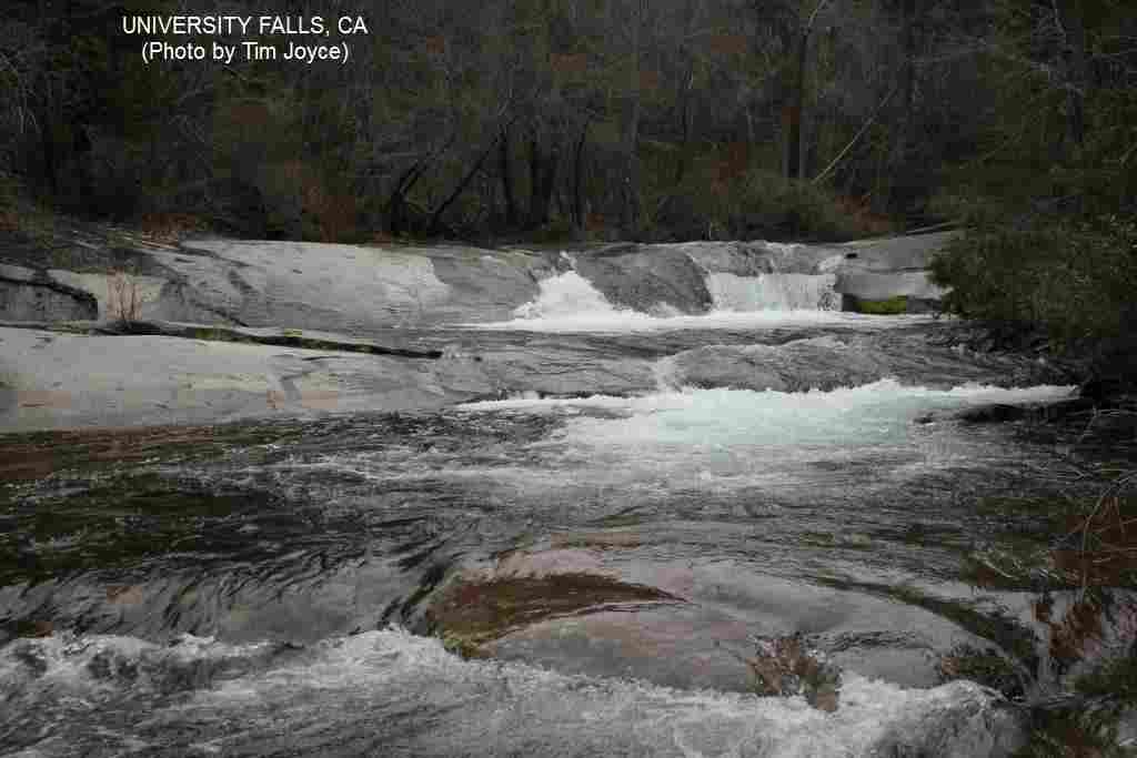
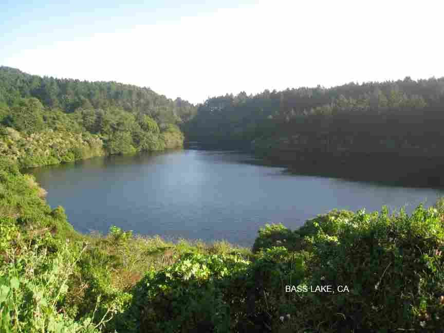
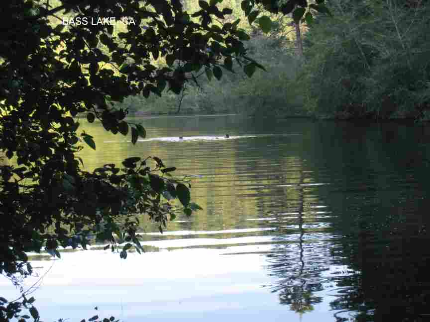
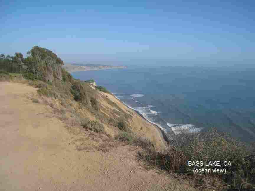
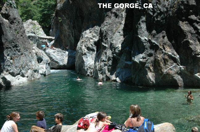
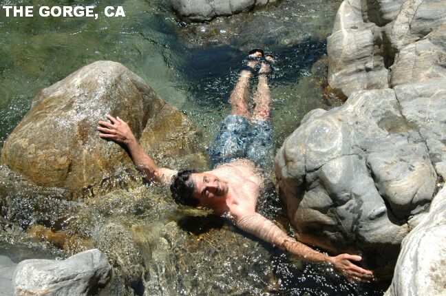
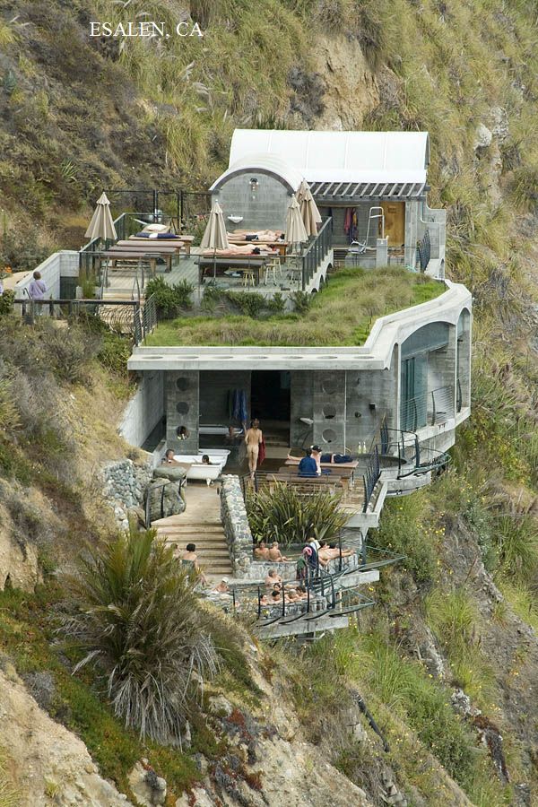
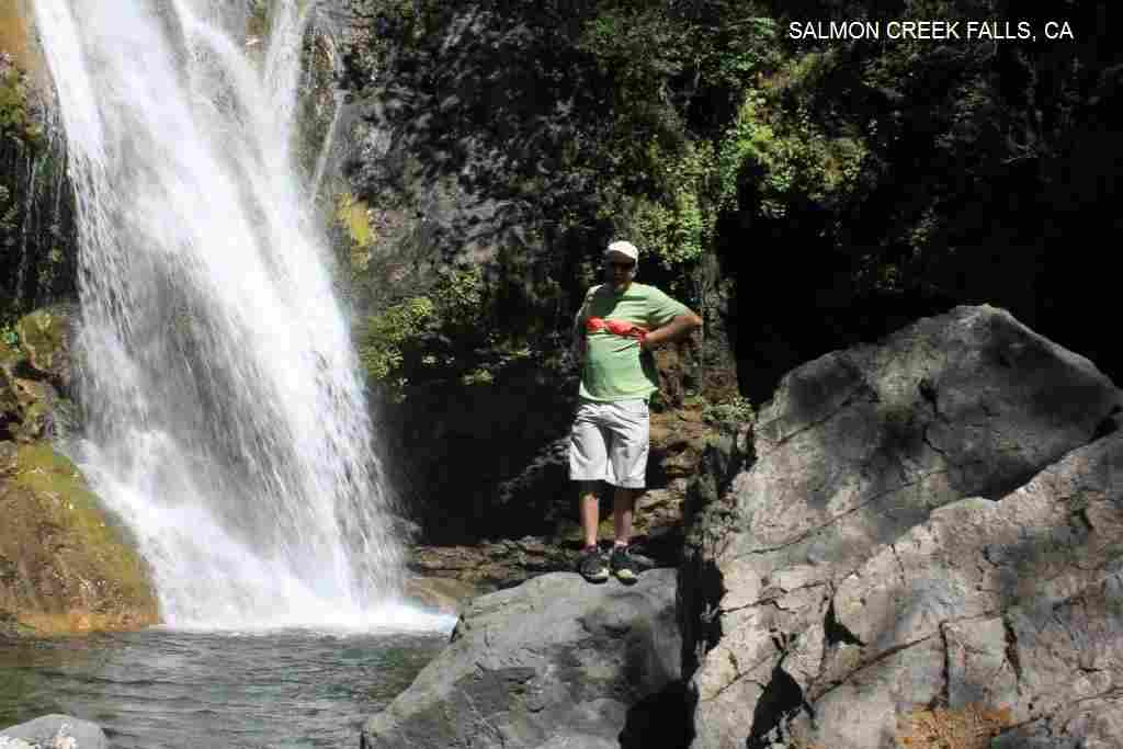
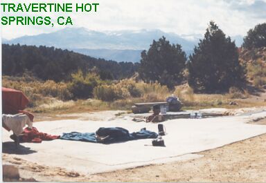
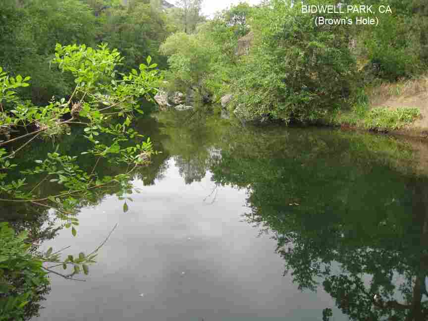
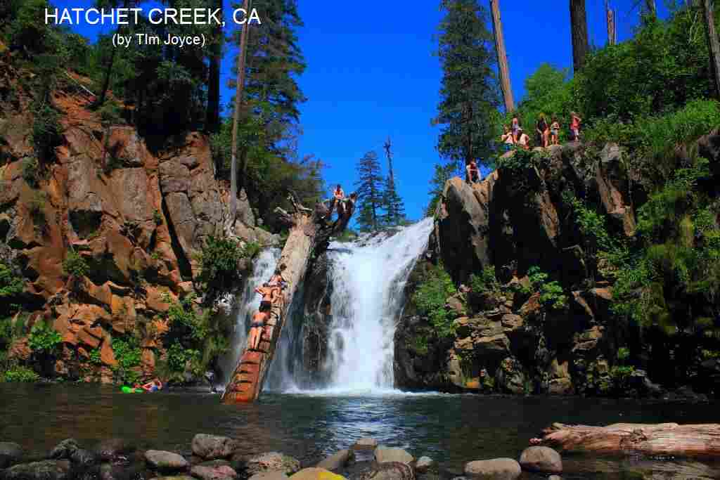
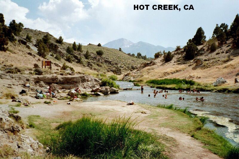
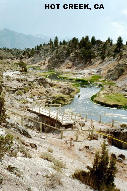
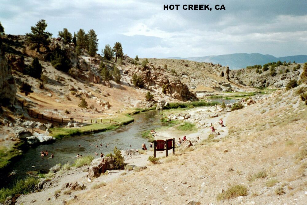
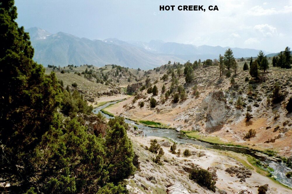
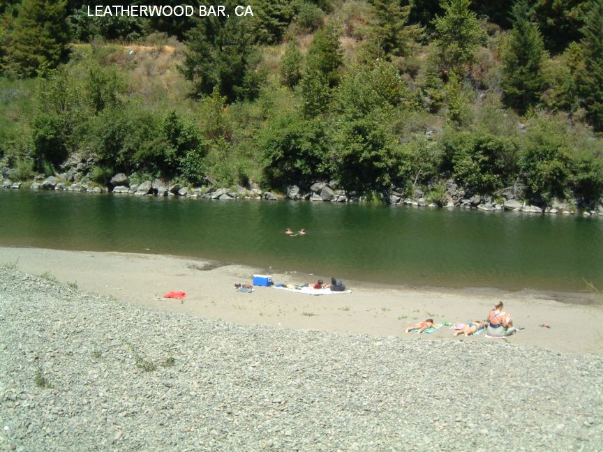
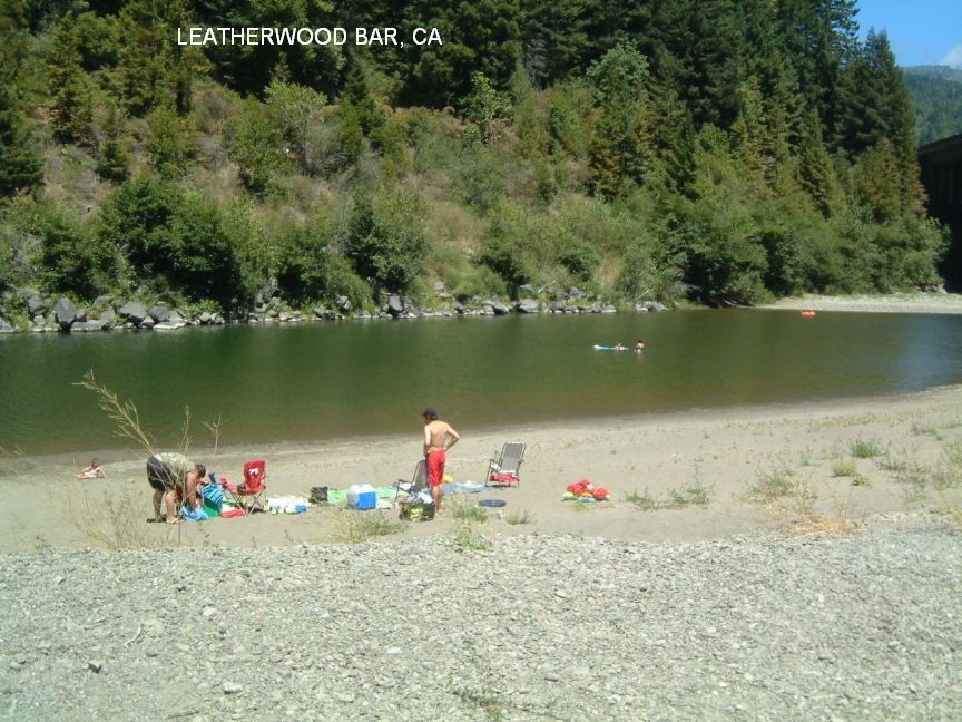
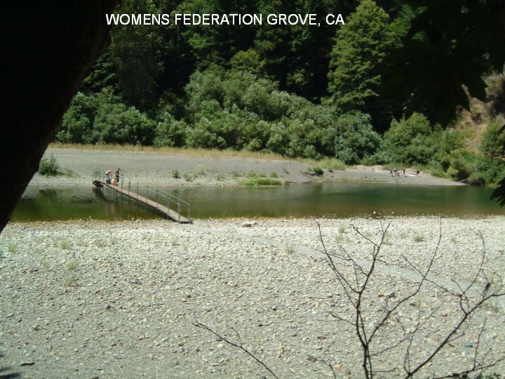
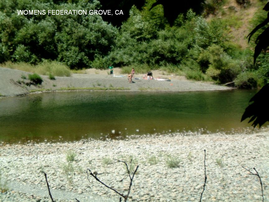
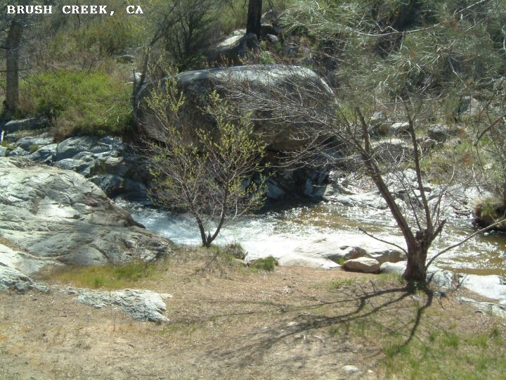
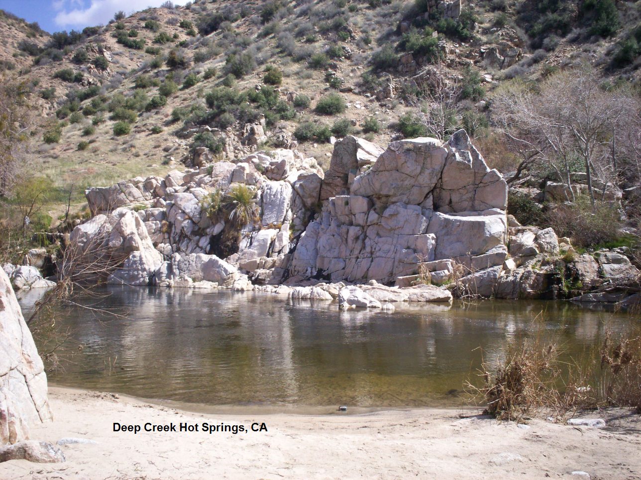
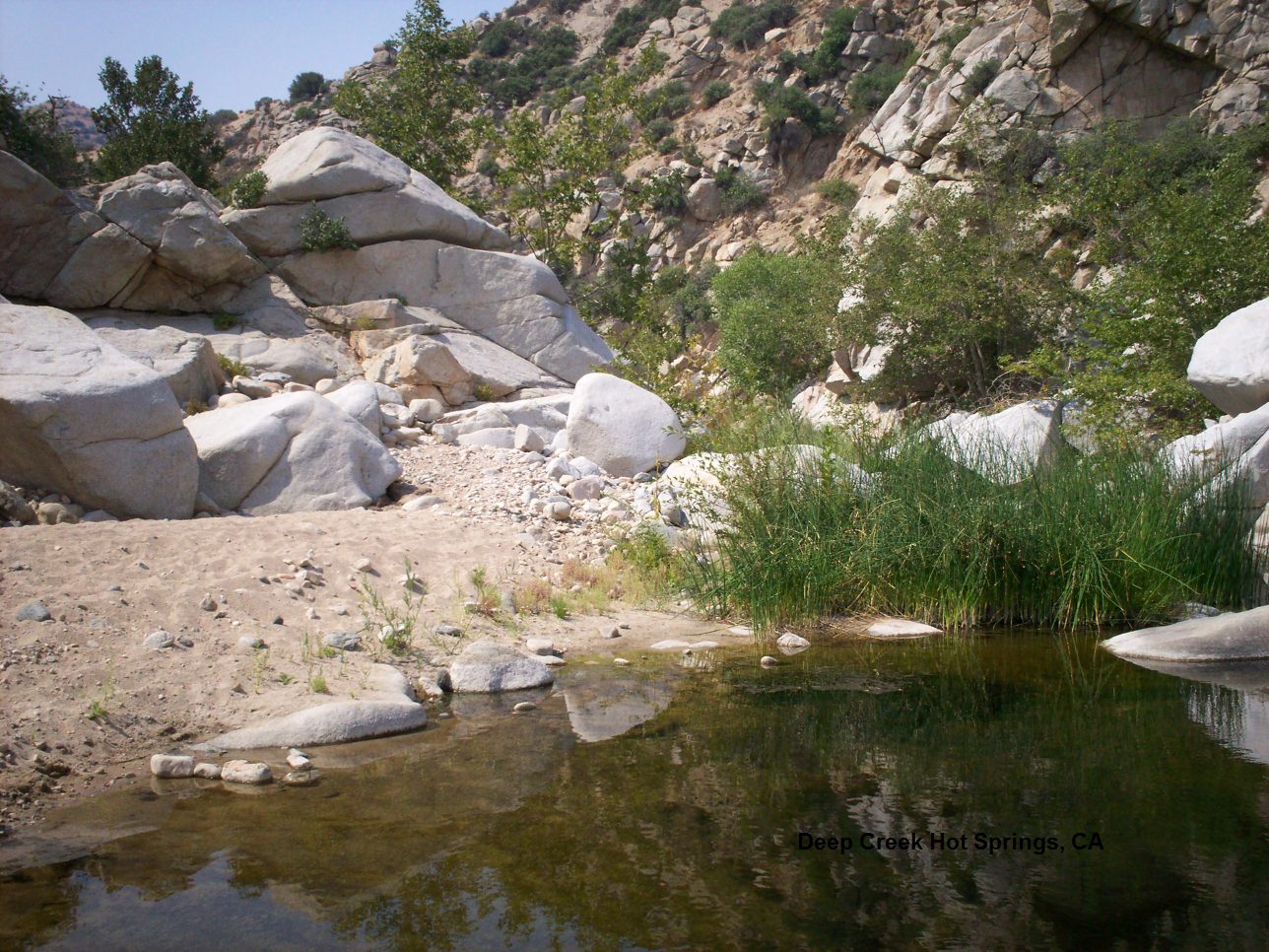
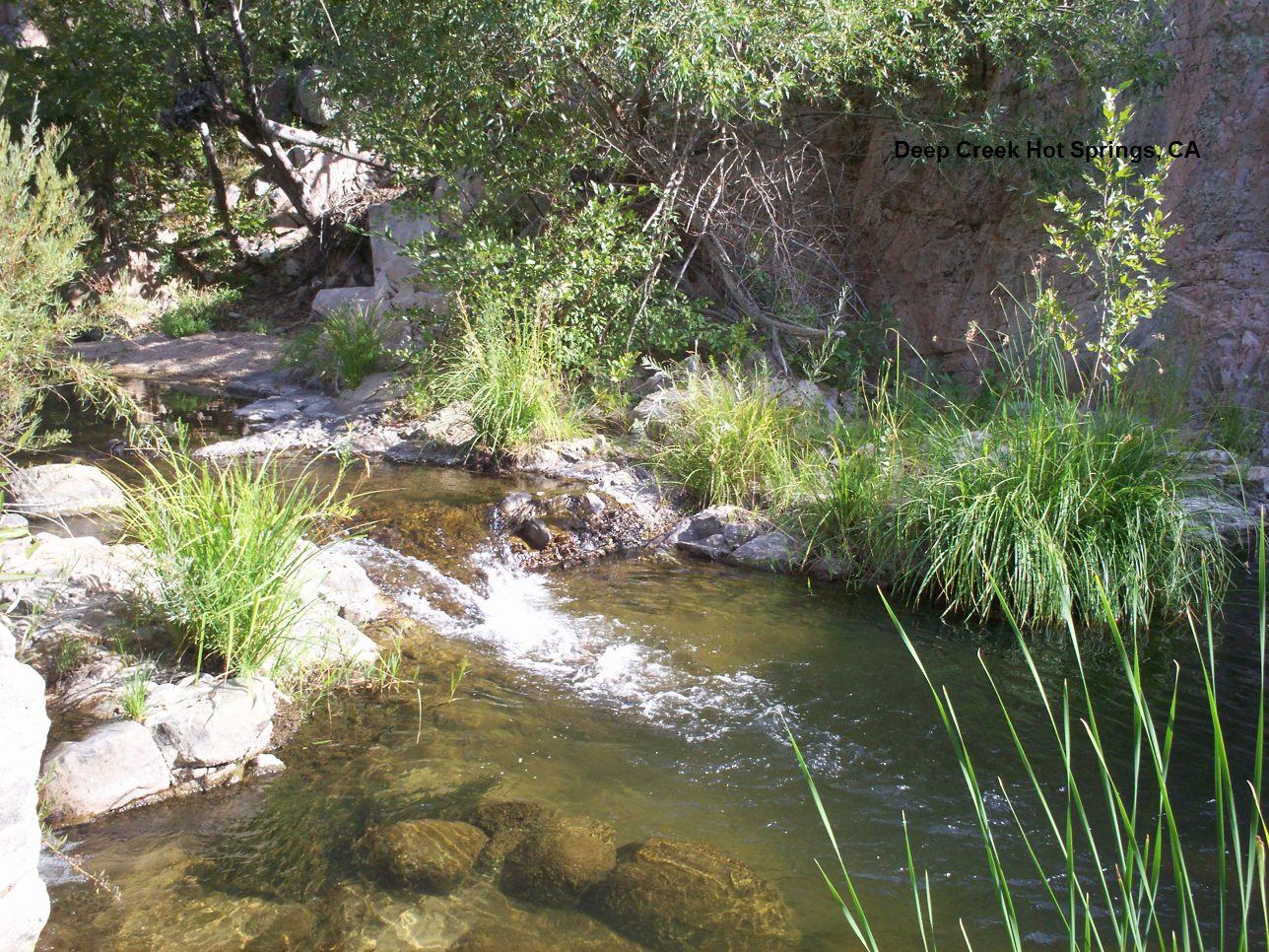
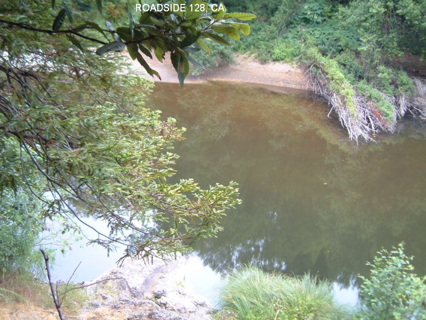
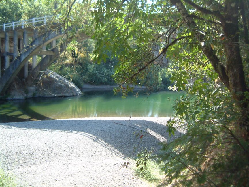
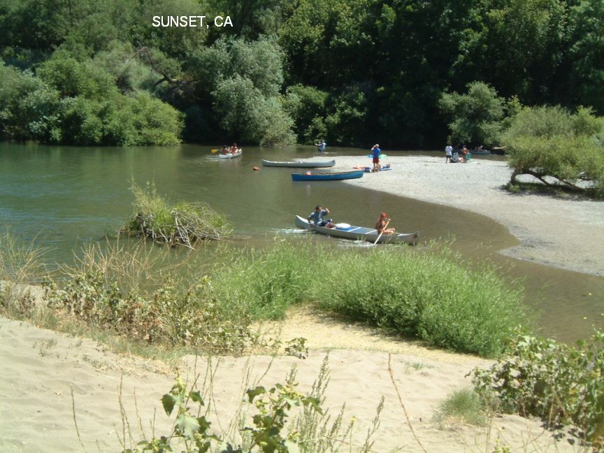
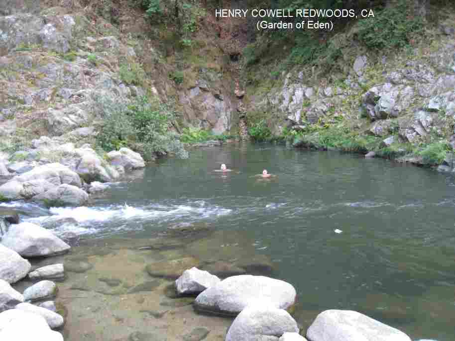
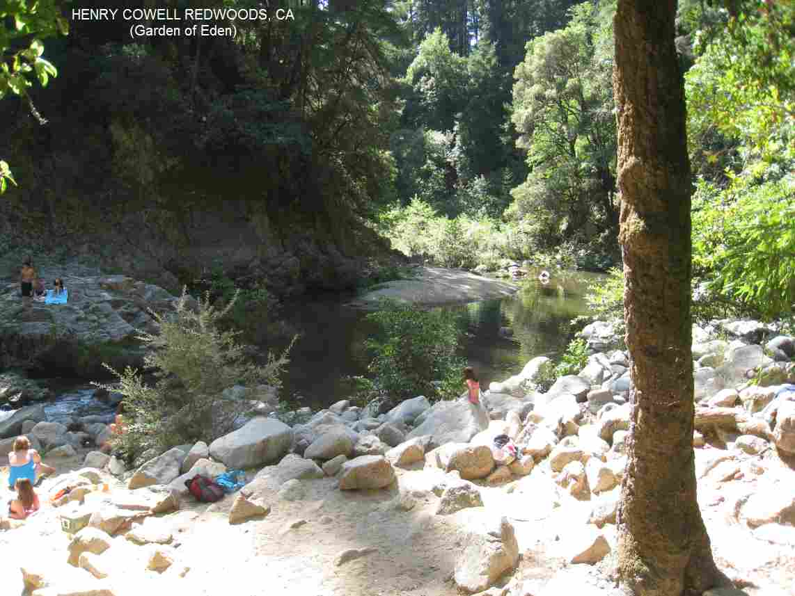
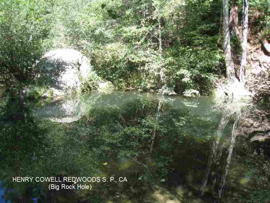
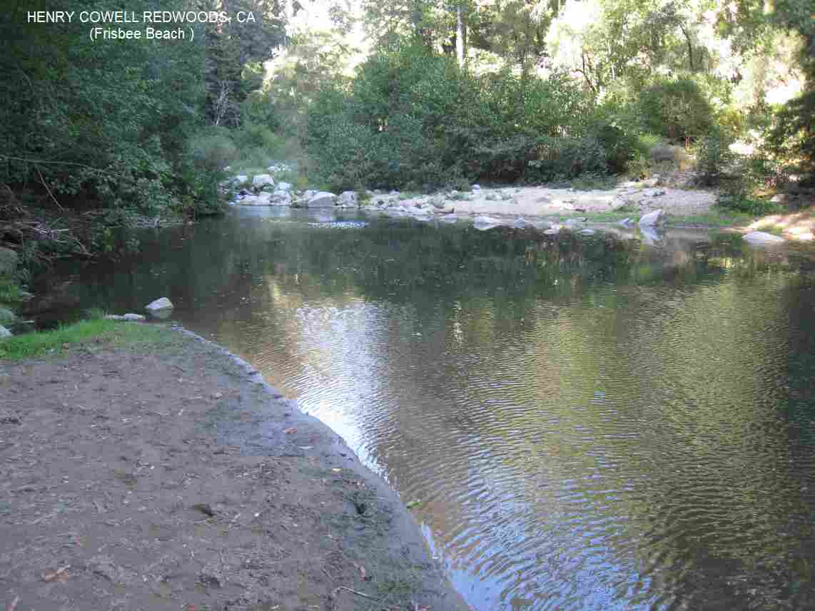
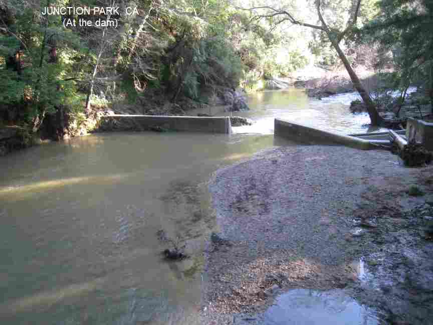
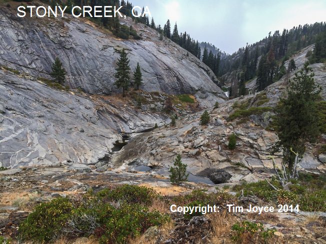
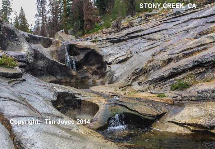
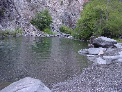
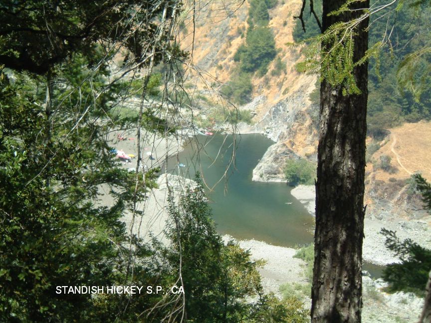
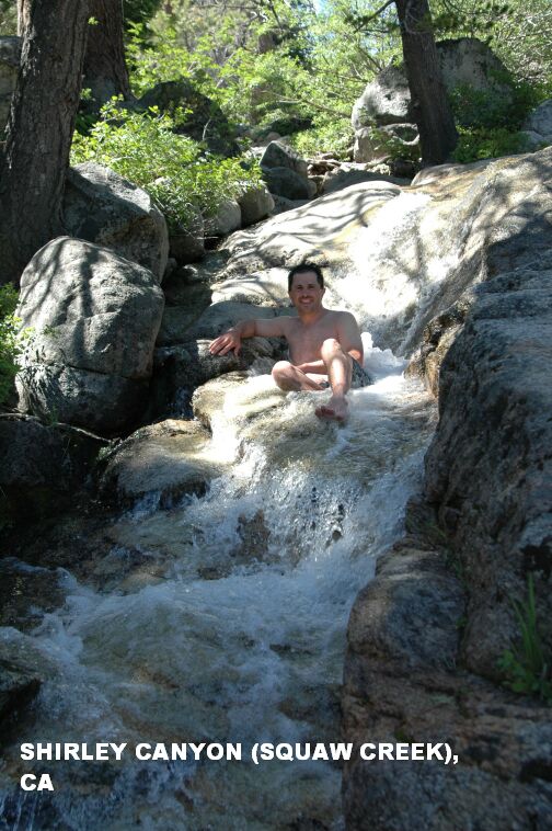
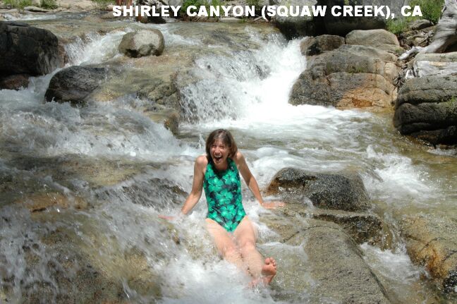
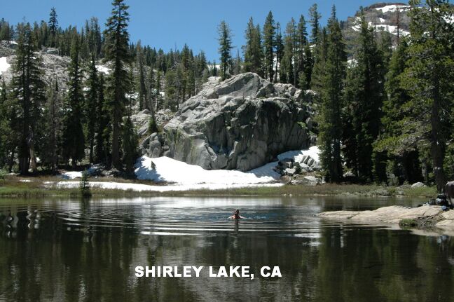
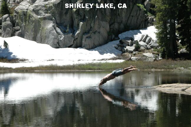
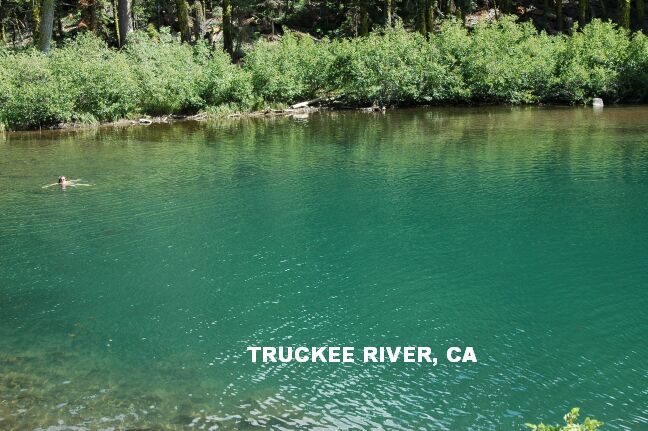
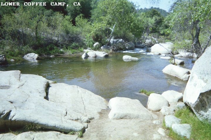
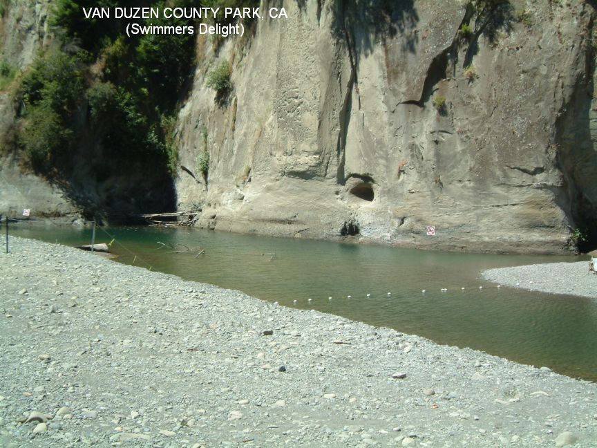
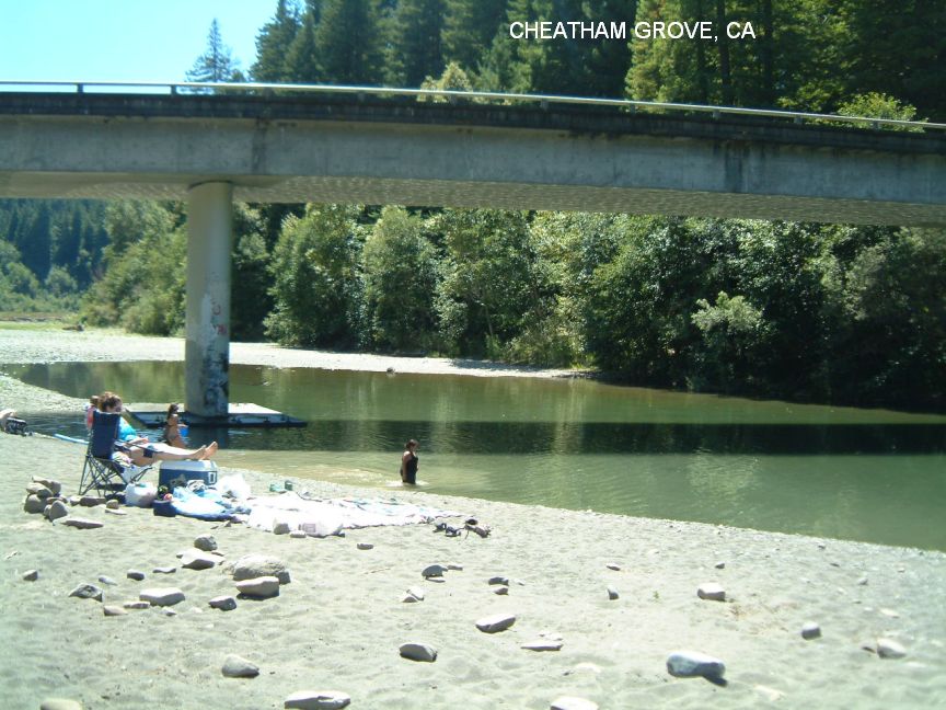
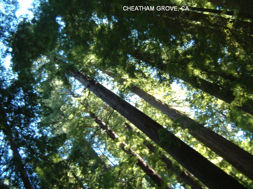
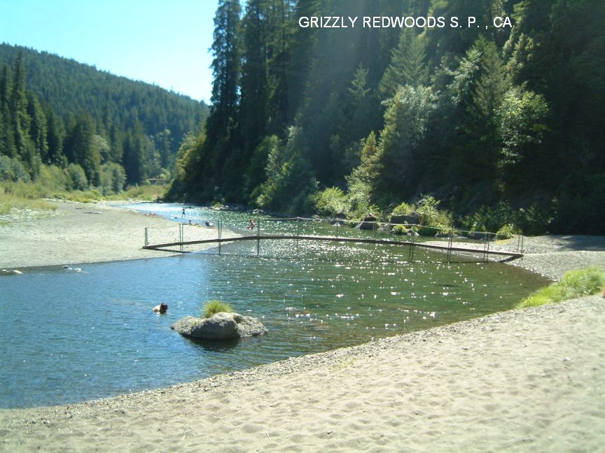
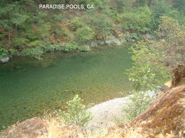
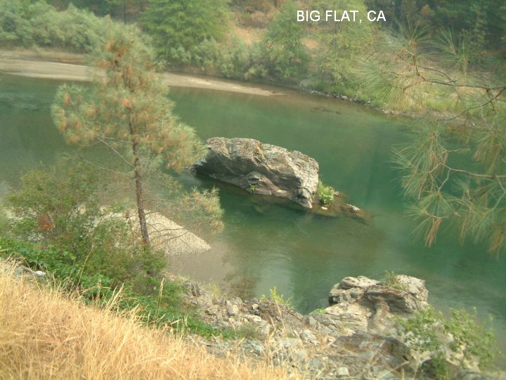
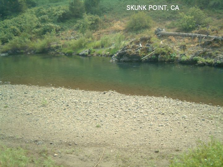
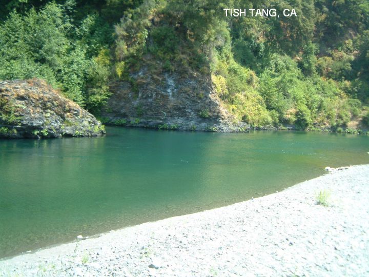
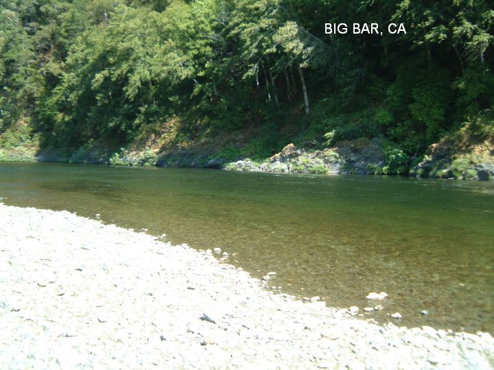
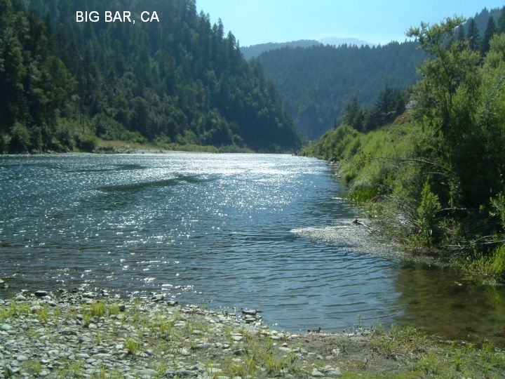
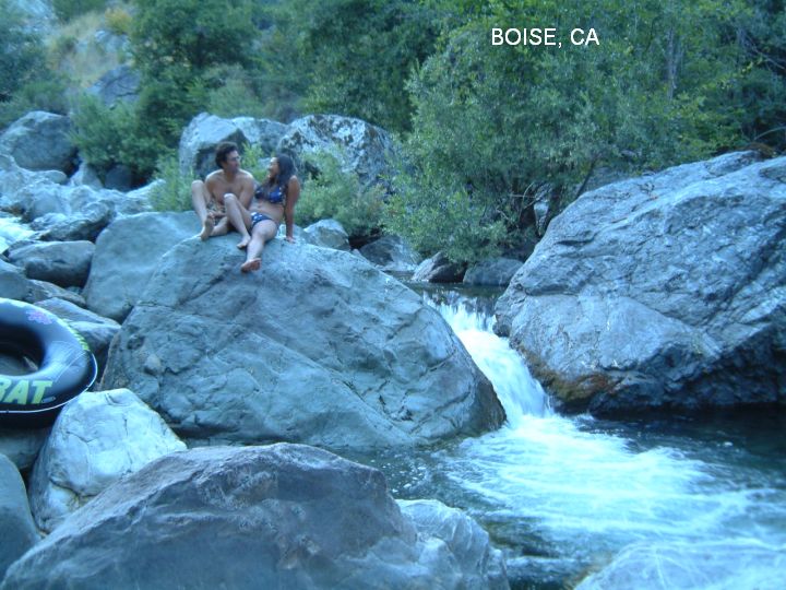
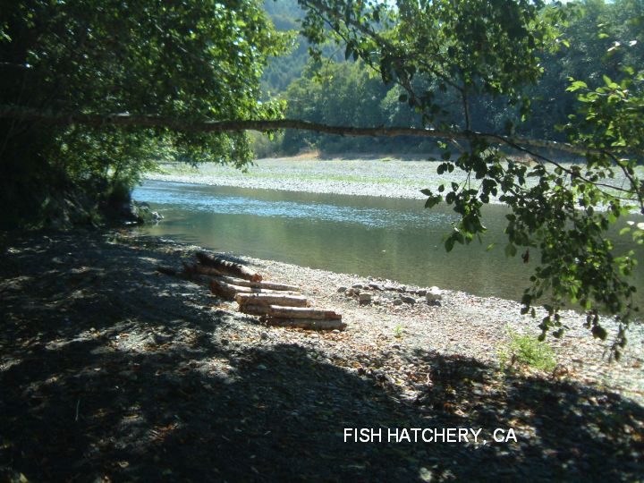
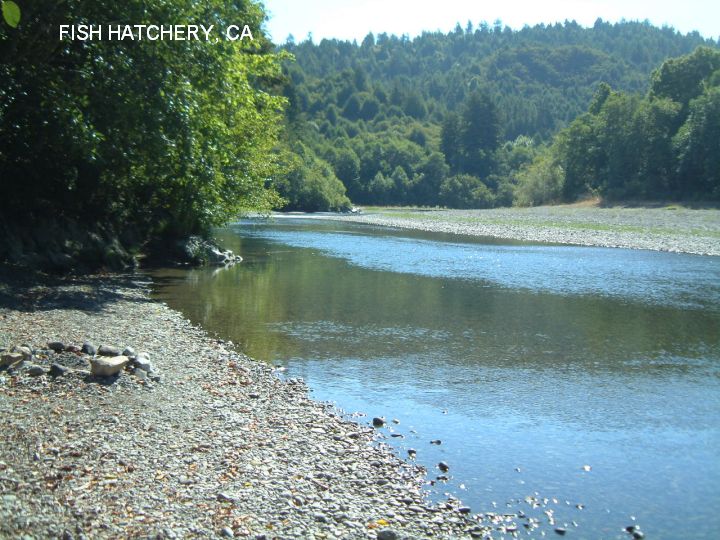
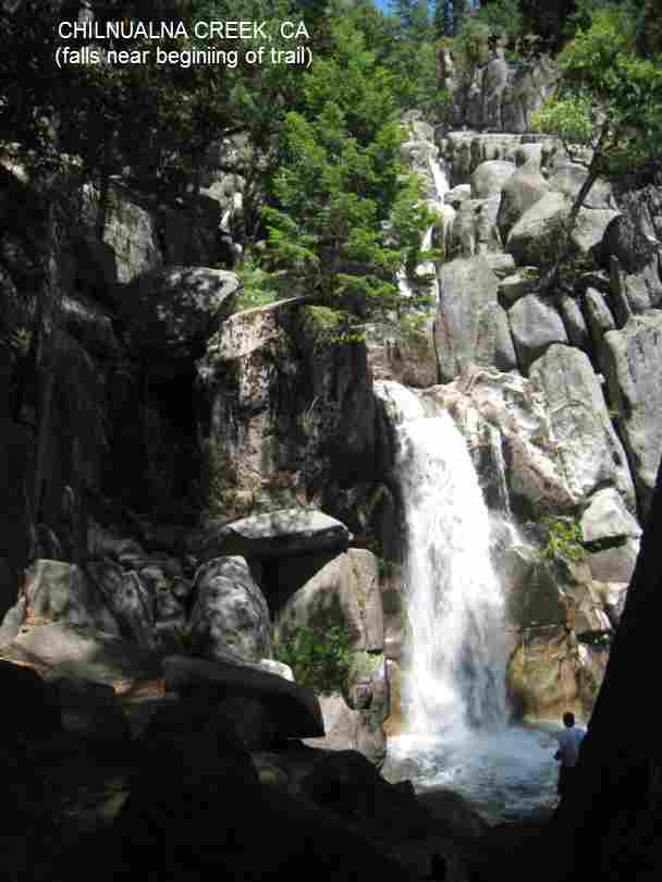
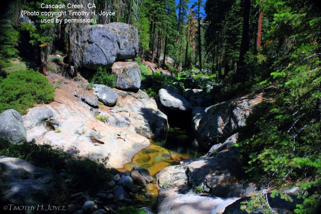
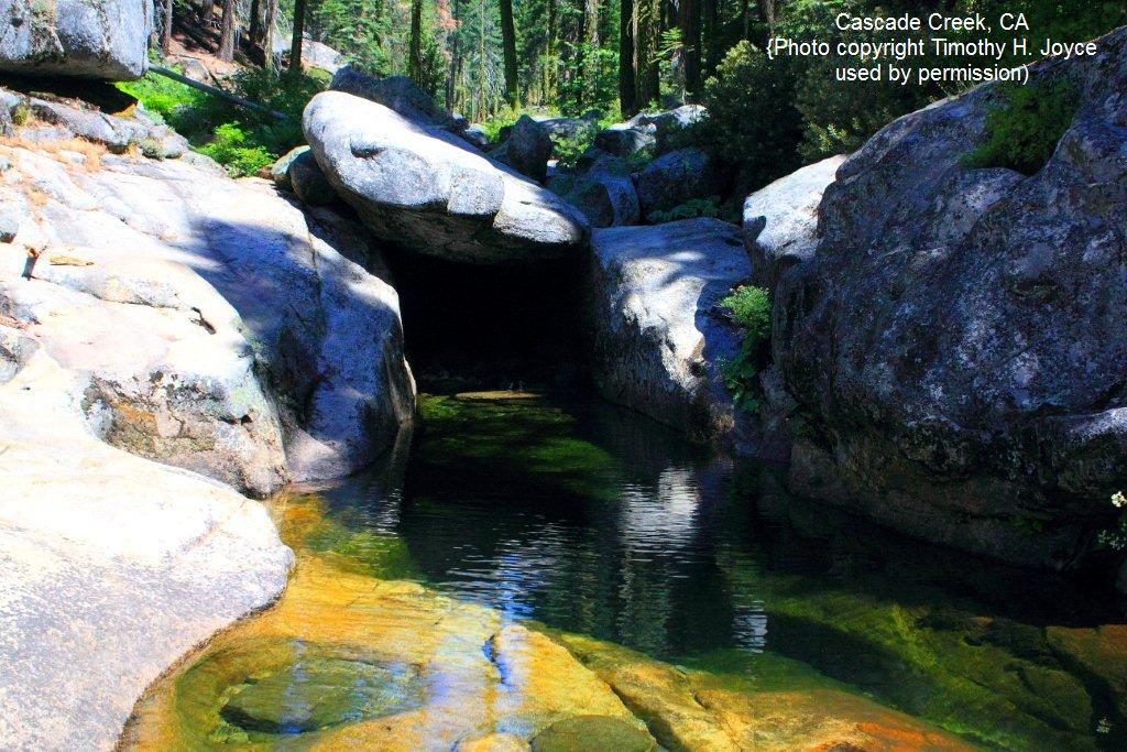
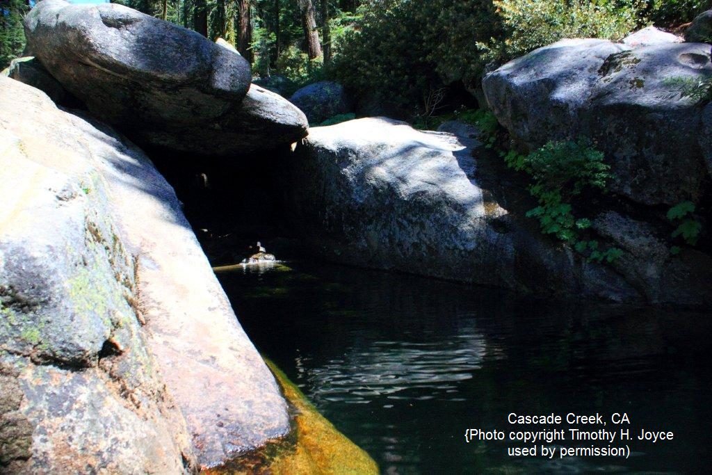
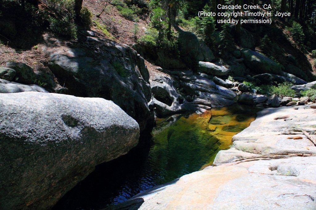
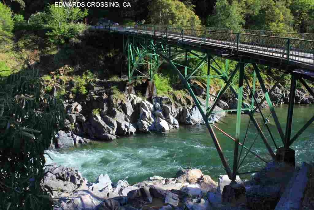
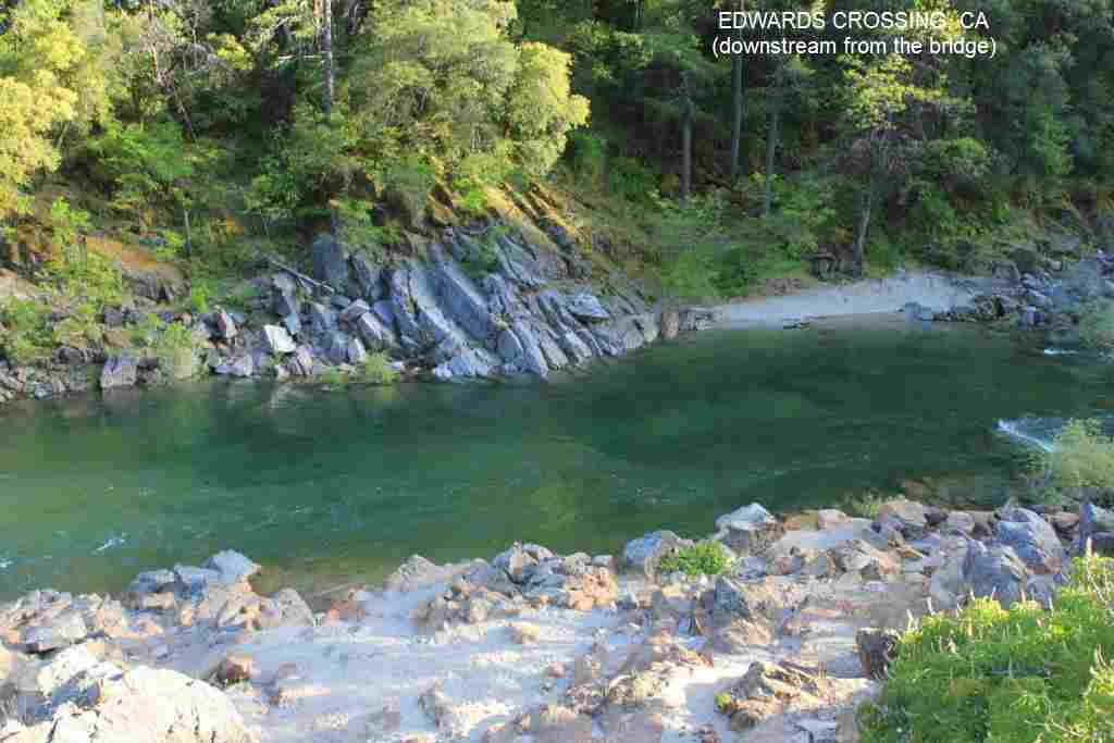
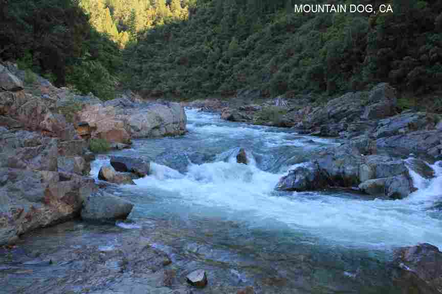
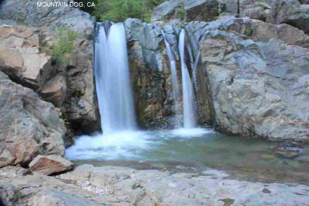
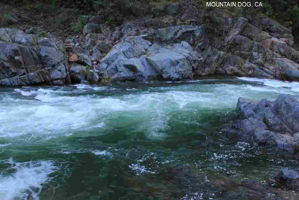
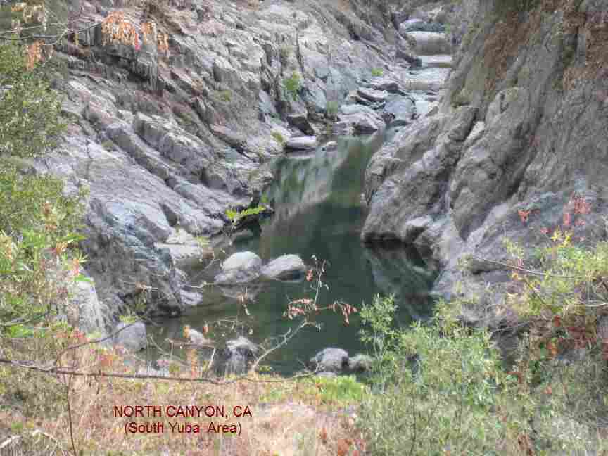
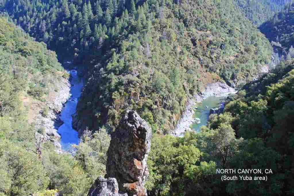
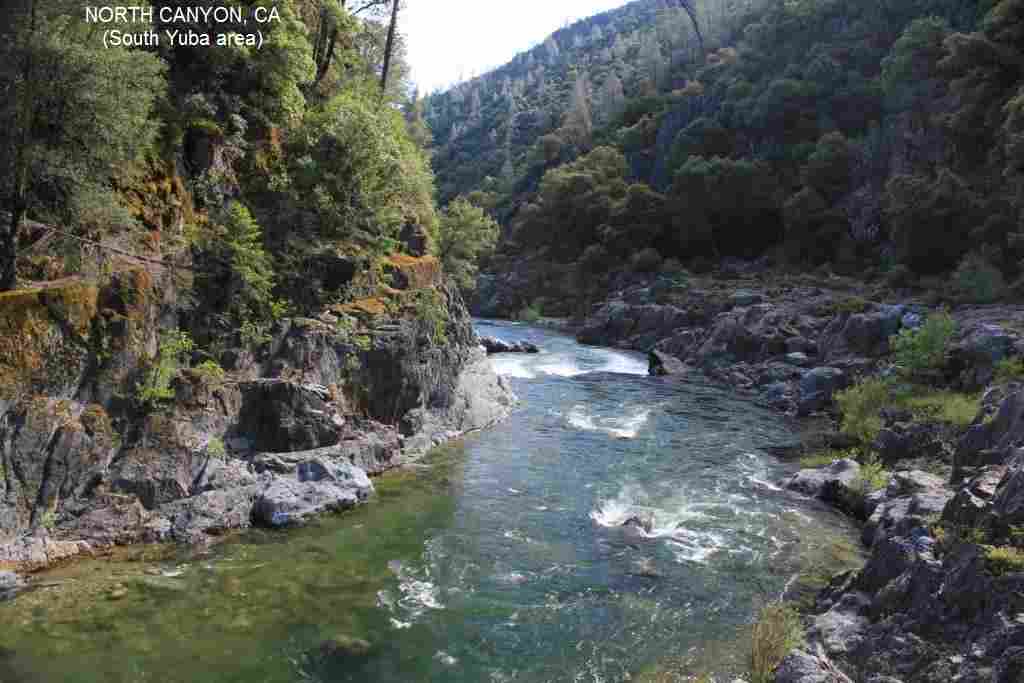
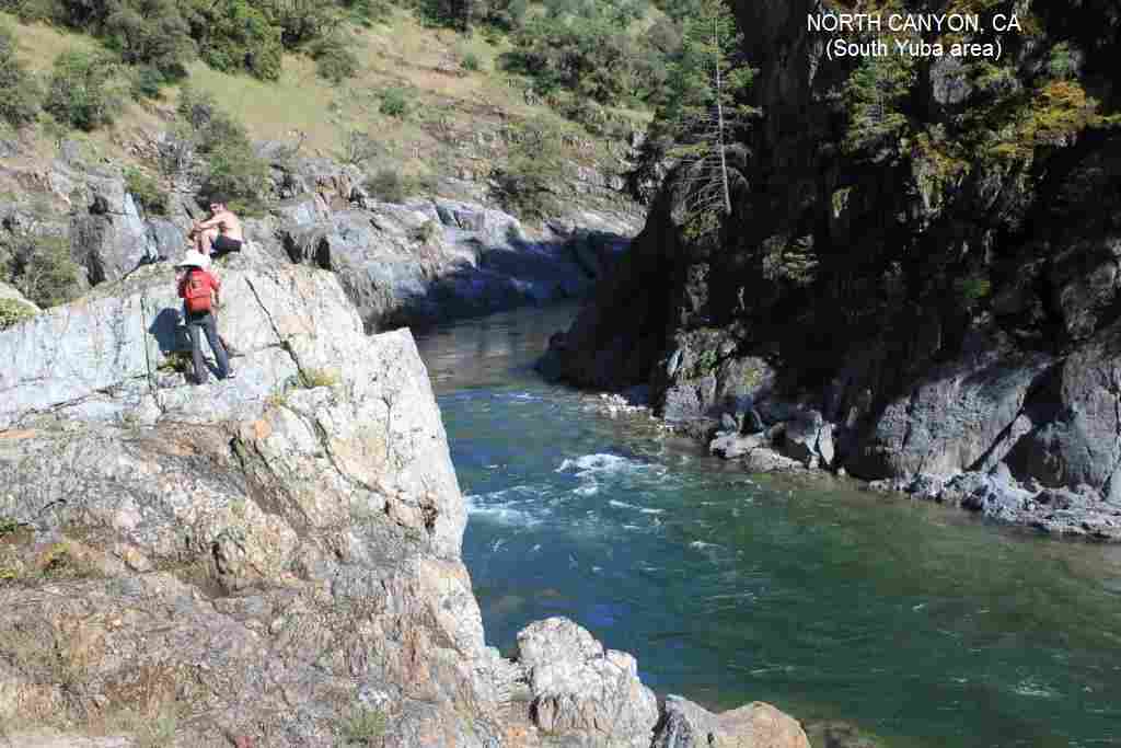
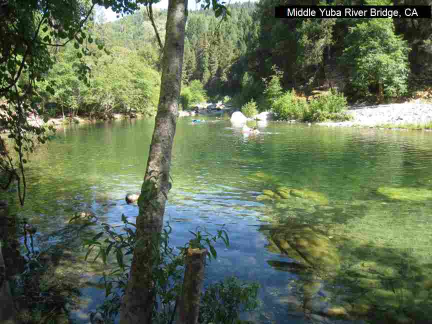
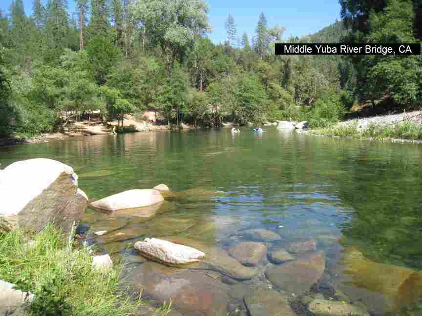
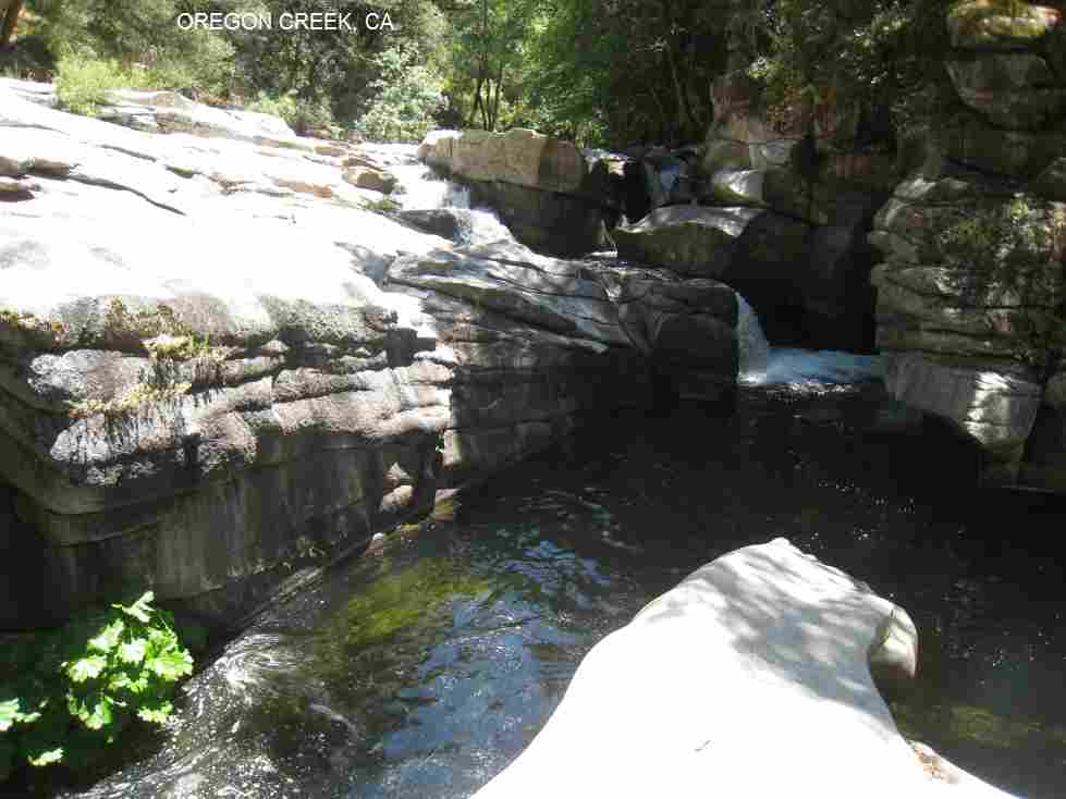
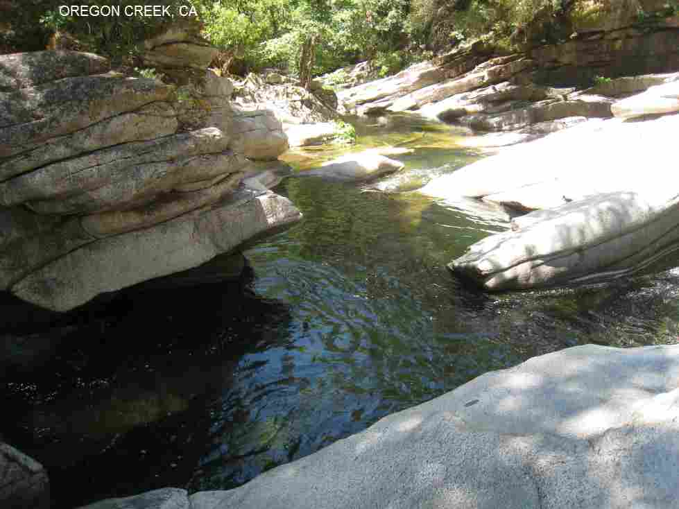