See a SLIDESHOW of swimming hole photos in this state.
This swimming hole listing is by
www.swimmingholes.org
ARNOLD VALLEY
POOL
(ARNO)
| |
|---|
|
TOWNS | LEXINGTON, LYNCHBURG, NATURAL BRIDGE, GLASGOW |
|---|
|
LAT, LON | lat=37.56572, lon= -79.48064(source: Topozone) (accuracy: approximate)
LINK TO GOOGLE MAP |
|---|
|
STATE | VA |
|---|
|
WATER | East Fork Elk Creek |
|---|
|
TYPE | Creek |
|---|
|
DESCRIPTION | This is a primo, classical swimming hole! Really nice pool in creek, always deep enough to swim, nice gradual slope, good for kids. Also a 4-5 foot slide into the deepest part of the pool and (sometimes) a rope to swing from.
NOTE: Wade in here before you jump! There are hidden rocks in the pool and the water is shockingly cold!
Up the gravel road past the "pool" about .5 mile or less on the left, there is a piped spring where you can get fresh spring water which is safe to drink. (Said to be "verified"). The locals seem to think there is an entrance to an underground cave at the bottom of the pool and they also think it is about 30 ft deep at the deepest spot (others say there is no cave and it is not more than 10 feet deep!). The water temperature is VERY COOL. I would not recommend this place to those sensitive to cold. But otherwise, on a hot day, it is a great place to swim. |
|---|
|
AREAS | George Washington N.F. |
|---|
|
SANCTION | Unofficial |
|---|
|
FEE | No |
|---|
|
ACTIVITIES |
Swimming, Sliding, Rope swing |
|---|
|
FACILITIES | None |
|---|
|
PHONE | None |
|---|
|
CAMPING | Very nearby is campground at Cave Mountain Lake in Jefferson N.F.
which has a beautiful swimming lake. Tends to fill up on weekends and there are no
reservations. |
|---|
|
BATHING SUITS | Unknown |
|---|
|
DIRECTIONS | This is a great swimming hole but you must follow these directions very carefully to find it. Here are two ways:
From the Blue Ridge Parkway: (near Lexington and Natural Bridge) At Petit's Gap, which is at milepost 71, turn off on the UNMARKED unpaved road to the west, which is Forest Road 35. This is a winding, sometimes rough, gravel road. After you wind down the mountain for several miles, the road will level off and cross a small bridge over the East Fork creek and will run along this creek, with the creek on your left. You will pass several apparent parking pull-offs along here but ignore these until you cross over the second small bridge over the creek. The pull-off you want is .1 miles BEFORE you cross this second bridge. Go back and enjoy!
From I-81: (near Lexington and Natural Bridge) Take exit 180, then RT 11 south to Natural Bridge. Then take RT 130 east to Natural Bridge Station. Then take RT 759 south to RT 781 east. RT 781 will run along the East Fork creek, with the creek on your left (RT 781 eventually becomes Forest Road 35). When you cross over a small bridge over the creek and the creek is now on your right, go .1 miles past this bridge and the pull-off for the swimming hole is on your right. |
|---|
|
CONFIDENCE | Very confident |
|---|
|
VERIFIED | Yes, 6/01 |
|---|
|
DATE UPDATED | 6/18/2008 |
|---|
This swimming hole listing is by
www.swimmingholes.org
BEN SALEM WAYSIDE
(BENS)
| |
|---|
|
TOWNS | BUENA VISTA, LEXINGTON |
|---|
|
LAT, LON | lat=37.7516, lon= -79.3921(source: DeLorme) (accuracy: approximate)
LINK TO GOOGLE MAP |
|---|
|
STATE | VA |
|---|
|
WATER | Maury River |
|---|
|
TYPE | River |
|---|
|
DESCRIPTION | Deep place in river at roadside picnic area is local swimming hole. Easy on/off if you get overheated while traveling on I-81. Stop at a cool, shady place for a picnic and a dip! |
|---|
|
AREAS | None |
|---|
|
SANCTION | Unofficial swimming, official picnicking |
|---|
|
FEE | No |
|---|
|
ACTIVITIES |
Swimming, Picnicking |
|---|
|
FACILITIES | Picnic tables, pit toilets (bad!) |
|---|
|
PHONE | None |
|---|
|
CAMPING | Nearest are: West of Lexington at Lake Robertson County Park and in Buena Vista at Glen Maury Park. |
|---|
|
BATHING SUITS | Customary, very exposed location |
|---|
|
DIRECTIONS | From I-81 at Exit 188 (Lexington, Buena Vista) go east on RT 60 toward Buena Vista a short distance to the well-signed Ben Salem Wayside on the left. Swim in river right there at picnic area. BE CAREFUL IF CURRENTS ARE STRONG! |
|---|
|
VERIFIED | Yes, 6/01 |
|---|
|
DATE UPDATED | 6/18/2001 |
|---|
This swimming hole listing is by
www.swimmingholes.org
BIG MARYS CREEK SLIDE
(BIGM)
| |
|---|
|
TOWNS | STAUNTON, STEELE'S TAVERN,
VESUVIUS |
|---|
|
LAT, LON | lat=37.87111, lon= -79.20536(source: DeLorme) (accuracy: approximate)
LINK TO GOOGLE MAP |
|---|
|
STATE | VA |
|---|
|
WATER | Big Mary's Creek |
|---|
|
TYPE | Slide |
|---|
|
DESCRIPTION | This is a very beautiful sliding place in a rock trough hollowed out
by a small falls with a pool at the bottom. Can be busy with VCU college students and kids from a nearby camp. Go early in the day or camp at the site for an early start. |
|---|
|
AREAS | George Washington N.F., St. Mary's Wilderness |
|---|
|
SANCTION | Unofficial |
|---|
|
FEE | No |
|---|
|
ACTIVITIES |
Swimming, Sliding |
|---|
|
FACILITIES | None |
|---|
|
PHONE | None |
|---|
|
CAMPING | People camp right by the falls on a flat area but there are no facilities there. The closest established camping is at Sherando Lake in the George Washington N.F. which has a nice swimming lake. Also nearby is Cave Mountain Lake in Jefferson N.F.
near
Natural Bridge, which has a beautifully developed sites and a nice swimming lake. Both camping places tend to fill up on
weekends and there are no reservations at either. |
|---|
|
BATHING SUITS | Unknown |
|---|
|
DIRECTIONS | From Staunton, go south on I-81 to Exit 205, (RT 606, Raphine/Steele's
Tavern.) Go east on RT 606 thru Steele's Tavern to the junction with RT 11, jog left briefly on Rt 11, then right onto RT 56 toward Vesuvius. Don't take the first left onto Rt 608, but follow RT 56 until it splits and RT 608 south goes right. Take RT 608 south for about 2.6 miles to a gravel road on the left (called "Nature Camp Trail") with a prominent sign for a Nature Camp run by the Virginia Federation of Garden Clubs -this is Forest Road 104 (unsigned). (If you go more than 3.5 miles on Rt 608, you have definitely missed FR 104.) Turn east (left) onto FR 104 which follows Big Mary's Creek. Continue up FR104 (gravel) for exactly 1.3 mi. to an apparent wide parking place on right side of road with a steep path leading down into the woods. It is a very short but steep climb down to the swimming place. (See also "St. Marys Falls") |
|---|
|
CONFIDENCE | Very confident |
|---|
|
VERIFIED | Yes |
|---|
|
DATE UPDATED | 8/27/2001 |
|---|
This swimming hole listing is by
www.swimmingholes.org
BIG OTTER RIVER
(BIGO)
| |
|---|
|
TOWNS | LYNCHBURG, BEDFORD |
|---|
|
LAT, LON | lat=37.31030, lon= -79.39352(source: Map) (accuracy: approximate)
LINK TO GOOGLE MAP |
|---|
|
STATE | VA |
|---|
|
WATER | Big Otter River |
|---|
|
TYPE | River |
|---|
|
DESCRIPTION | Traditional swimming hole near the confluence of the Big Otter River and Elk Creek. This from a local fan: "There is a smooth rock and tiny beach to sit on a normal levels and a rope swing. Plenty of local kids swim here, as evidence by small footprints in the sand. Elk Creek can stay muddy for days after local rainfall, but the pool at the confluence can be quite deep for this little creek (6-10ft), with shifting sandbars, depending on flow. (Also good put-in spot for canoeing Big Otter for smallmouth bass. The take-out for a canoeing trip would be the RT 24 bridge at:37.24557,-79.34897 )" |
|---|
|
AREAS | None |
|---|
|
SANCTION | Unofficial |
|---|
|
FEE | No |
|---|
|
ACTIVITIES |
Swimming, canoeing |
|---|
|
FACILITIES | None |
|---|
|
PHONE | None |
|---|
|
CAMPING | Nearest is Smith Mountain Lake S. P. - south of here. |
|---|
|
BATHING SUITS | Customary, very exposed location |
|---|
|
DIRECTIONS | From Lynchburg, take RT 460 west out of Lynchburg, VA. for about 21 miles. Turn north (right) on RT 706 just before the bridge over Big Otter River. Go about 600 feet on RT 706, following RT 706 around left-hand bend and down a small hill. Parking is on left side of road before the small bridge over Elk Creek. |
|---|
|
VERIFIED | Yes |
|---|
|
DATE UPDATED | 7/2018 |
|---|
This swimming hole listing is by
www.swimmingholes.org
BIG ROCK FALLS
(BIGR)
| |
|---|
|
TOWNS | LURAY, ELKTON |
|---|
|
LAT, LON | lat=38.4954, lon= -78.4241(source: Measured) (accuracy:exact)
LINK TO GOOGLE MAP |
|---|
|
STATE | VA |
|---|
|
WATER | Mill Prong Creek |
|---|
|
TYPE | Waterfall |
|---|
|
DESCRIPTION | A very nice, easy and pretty hike in the Shenandoah N. P. (about 3 miles round trip) to a lovely little falls with a nice little swimming hole at the bottom. Sliding down the falls is possible depending on water level. Gradual entrance, not too deep, easy current. Camp used by President Hoover is also nearby. |
|---|
|
AREAS | Shenandoah N. P. |
|---|
|
SANCTION | Unofficial |
|---|
|
FEE | National Park entrance fee applies |
|---|
|
ACTIVITIES |
Swimming |
|---|
|
FACILITIES |
None |
|---|
|
PHONE | None |
|---|
|
CAMPING | None at site. |
|---|
|
BATHING SUITS | Unknown |
|---|
|
DIRECTIONS | From Skyline Drive, drive to the Milam Gap parking area; just south of Milepost 52. The Appalachian trail crosses Skyline Drive here. Park and cross the road on the AT and very shortly turn left onto the blue-blazed Mill Prong Trail (well marked by concrete post). Hike down this trail, crossing streams twice, until, just after the second crossing (about 1 mile total), you come to an intersection with a horse trail on the left (also well marked by concrete post). Do not go left on the horse trail but continue straight - the trail is now yellow blazed. Go about another .5 miles to where the trail goes down to Mill Prong Creek and crosses it - this is Big Rock Falls. The swimming place is at the foot of the falls. (If you continue down this trail a short distance, you will come to Camp Hoover and historical information about this place.)
|
|---|
|
CONFIDENCE | Very confident |
|---|
|
VERIFIED | Yes, 3/2003 |
|---|
|
DATE UPDATED | 6/2010 |
|---|
This swimming hole listing is by
www.swimmingholes.org
BLACKSBURG
HOLE
(BLAC)
| |
|---|
|
TOWNS | BLACKSBURG, RADFORD |
|---|
|
LAT, LON | lat=37.24964, lon= -80.60908(source: DeLorme) (accuracy: approximate)
LINK TO GOOGLE MAP |
|---|
|
STATE | VA |
|---|
|
WATER | New River |
|---|
|
TYPE | River |
|---|
|
DESCRIPTION | Swimming hole in major river, can have strong currents,
be very careful. Not for children or weak swimmers. Popular with
students from VPI and Radford, sometimes crowded.
Several miles upstream is a dam (that forms Claytor Lake) which
sometimes dumps water into the river. There is no warning system and the
river level can rise suddenly and the current increases.
|
|---|
|
AREAS | None |
|---|
|
SANCTION | Unofficial |
|---|
|
FEE | No |
|---|
|
ACTIVITIES |
Swimming, Tubing (commercial tubing nearby) |
|---|
|
FACILITIES |
None |
|---|
|
PHONE | None |
|---|
|
CAMPING | Claytor Lake S.P is nearby, also has swimming
lake. |
|---|
|
BATHING SUITS | Required |
|---|
|
DIRECTIONS | From Blacksburg, take RT 685 (Price's Fork Rd.) west toward Radford
for 3.5 mi.. Turn right on RT 652 (McCoy Rd.) for 7.5 mi.. Go right on RT 625 (Big Falls Rd.)
and cross over railroad tracks. Go about 1-2 mi. (past commercial business on right; "New River
Junction") to roadside parking areas. Swimming place is here in river. Strong currents, be very
careful. |
|---|
|
CONFIDENCE | Very confident |
|---|
|
VERIFIED | No |
|---|
|
DATE UPDATED | 8/21/2019 |
|---|
This swimming hole listing is by
www.swimmingholes.org
BLOWING SPRINGS
(BLOW)
| |
|---|
|
TOWNS | LEXINGTON, COVINGTON, WARM SPRINGS |
|---|
|
LAT, LON | lat=38.06481, lon= -79.88817(source: measured) (accuracy: exact)
LINK TO GOOGLE MAP |
|---|
|
STATE | VA |
|---|
|
WATER | Back Creek |
|---|
|
TYPE | Creek |
|---|
|
DESCRIPTION | Several deep swimming/wading places in creek an easy walk from the Blowing Springs national forest campground. Looks like it could be a good tubing place too since there is a trail you can easily walk back upstream. |
|---|
|
AREAS | George Washington N.F. |
|---|
|
SANCTION | Unofficial |
|---|
|
FEE | No |
|---|
|
ACTIVITIES |
Swimming, tubing |
|---|
|
FACILITIES |
None |
|---|
|
PHONE | None |
|---|
|
CAMPING | At site. |
|---|
|
BATHING SUITS | Customary (near trail and campground) |
|---|
|
DIRECTIONS | From I-64 at Covington, go north on RT 220 to Warm Springs then go west (left) on RT 39 about 10 miles to the signs for Blowing Springs Recreation Area. (See also JEFERSON POOLS and COWPASTURE RIVER AREA near Warm Springs). Go to the back of the campground where there is a trailhead and sign "Back Creek Gorge Trail". Hike this easy, level trail which soon goes downstream along the creek and in about .5 miles (10 minutes) there is a major offshoot trail that heads down to the river. Here there is a broad, low falls across the river and a deep swimming place below. PHOTO . For another place, continue downstream about another .25 miles (5 minutes) to where there is a deep swimming place with large, flat rocks at the bank. PHOTO
I think this could also be a fun tubing place - put in near the entrance to the campground (there is a short trail right by the entrance that goes down to the creek) and take out at the swimming place mentioned above and walk back to the campground.
|
|---|
|
CONFIDENCE | Very confident |
|---|
|
VERIFIED | Yes, 5/04 |
|---|
|
DATE UPDATED | 5/18/2004 |
|---|
This swimming hole listing is by
www.swimmingholes.org
BLUE
HOLE - BERGTON
(BLUB)
| |
|---|
|
TOWNS | HARRISONBURG, BROADWAY, BERGTON |
|---|
|
LAT, LON | lat=38.75619, lon= -78.93769(source: DeLorme) (accuracy: exact)
LINK TO GOOGLE MAP |
|---|
|
STATE | VA |
|---|
|
WATER | North Fork Shenandoah River |
|---|
|
TYPE | River |
|---|
|
DESCRIPTION | NOTE: The terrain has been changed here in recent years by flooding - there used to be a swimming hole here all summer, but now it is gone late in the summer when the water levels are low. The Forest Service told us they plan to dredge that area out so that the swimming hole is more like it used to be but didn't know when this might be done.
Forest Service picnic area that is a long-time family swimming hole. Grassy areas and gravel areas - bring river shoes and towels to lie on. Several picnic tables. Nice place to take kids. Rocks to jump from at various heights, depth good. There are vault-type toilets here (in very poor shape and very dirty as of 2010 - Forest Service plans to replace them but doesn't know when) - best to change into your suit in your car or elsewhere.
shade. |
|---|
|
AREAS | George Washington N.F. |
|---|
|
SANCTION | Unofficial |
|---|
|
FEE | No |
|---|
|
FACILITIES |
Picnic tables, toilets (poorly maintained) |
|---|
|
ACTIVITIES |
Swimming,
Jumping |
|---|
|
PHONE | Unknown |
|---|
|
CAMPING | None real close by, camping in George Washington N.F. some
distance away. Brandywine campground is nice and not too far. To get there, go west on
RT 33 from Harrisonburg into West Virginia to signs for Brandywine Recreation Area.
Very nice campground, lake swimming, beautiful setting. |
|---|
|
BATHING SUITS | Customary |
|---|
|
DIRECTIONS | From Harrisonburg, go north on I-81 to Exit 257. Take RT 259 (Maryland Rd.) west through Broadway (be sure to stay on RT 259 as it turns and name changes to W. Lee St. then to Brocks Gap Rd.). About 15 mi from Broadway turn left on Rt 820 (Bergton Rd.). Take Rt 820 west just about 2 mi then turn left on Blue Hole Rd. (there may be a sign here for Blue Hole Picnic Area). Drive in and the swimming hole and picnic area are on the left. You'll see the outhouse on the right. Enjoy! |
|---|
|
CONFIDENCE | Highly confident |
|---|
|
VERIFIED | Yes |
|---|
|
DATE UPDATED | 7/2010 |
|---|
This swimming hole listing is by
www.swimmingholes.org
BLUE HOLE - JONESVILLE
(BLUJ)
| |
|---|
|
TOWNS | JONESVILLE |
|---|
|
LAT, LON | lat=36.68783, lon= -83.10501(source: map) (accuracy: general area)
LINK TO GOOGLE MAP |
|---|
|
STATE | VA |
|---|
|
WATER | Powell River?? |
|---|
|
TYPE | River |
|---|
|
DESCRIPTION | Long-time local swimming hole near Jonesville in Lee County way down in southwestern VA near the TN border. Really don't know any more about it than that. Coordinates are only general area. Please tell us if you know where it is. |
|---|
|
AREAS | Unknown |
|---|
|
SANCTION | Unofficial |
|---|
|
FEE | No |
|---|
|
FACILITIES |
None |
|---|
|
ACTIVITIES |
Swimming |
|---|
|
PHONE | none |
|---|
|
CAMPING | Camping in the N.F. at Cave Springs campground which is northeast of Jonesville. |
|---|
|
BATHING SUITS | Unknown |
|---|
|
DIRECTIONS | From Abingdon, VA (on I-81) take I-81 south into TN then take I-26 northwest to Kingsport, TN. In Kingsport, follow RT 23 north then continue onto RT 58 and follow RT 58 all the way to Jonesville, VA. This is about 90 miles total from Abingdon. The swimming hole is in or near Jonesville. Could be in the Powell River??? At Oxford Ford (36.66188,-83.1005)?? Apparently there is a spring called Blue Spring that empties into the North bank of the Powell River, don't know exactly where, maybe near Oxford Ford ??? Really don't know any more about it than that. Coordinates are only general area. Please tell
me if you know where it is. |
|---|
|
CONFIDENCE | Very uncertain as to location |
|---|
|
VERIFIED | No |
|---|
|
DATE UPDATED | 12/2012 |
|---|
This swimming hole listing is by
www.swimmingholes.org
BREAKS INTERSTATE PARK AREA
(BREA)
|
|
|---|
This swimming hole listing is by
www.swimmingholes.org
BULLPASTURE GORGE
(BULL)
| |
|---|
|
TOWNS | STAUNTON, MCDOWELL, WILLIAMSVILLE |
|---|
|
LAT, LON | lat=38.21331, lon= -79.59131(source: measured) (accuracy: exact)
LINK TO GOOGLE MAP |
|---|
|
STATE | VA |
|---|
|
WATER | Bullpasture River |
|---|
|
TYPE | River |
|---|
|
DESCRIPTION | Long-time local swimming place in a bend within the beautiful gorge of the Bullpasture River. Wooden ladder up a tree with (sometimes) a high rope to swing from - be sure to swing out a ways if the river is low. Swinging foot bridge, gravelly beach. |
|---|
|
AREAS | Highland State Wildlife Management Area |
|---|
|
SANCTION | Unofficial |
|---|
|
FEE | No |
|---|
|
ACTIVITIES |
Swimming, rope swing |
|---|
|
FACILITIES |
None |
|---|
|
PHONE | None |
|---|
|
CAMPING | Blowing Springs and Hidden Valley national forest campgrounds are southwest of here, west of Warm Springs. (Blowing Springs also has a swimming hole - see "BLOWING SPRINGS") |
|---|
|
BATHING SUITS | Customary |
|---|
|
DIRECTIONS | From Staunton, go west on RT 250 (very scenic and historic road) to McDowell then turn south (left) on RT 678 - set your odometer - you are going to go a total of 11.5 miles down this road to the swimming hole. As you approach the gorge, you will see the "Machen" retreat center on your right, then RT 609 also on your right. At 2.0 miles past RT 609 (in the Bullpasture Gorge) see on your left an unmarked gravel road that goes down to a parking area which has an information sign for the Wildlife Management Area (and a sign that says "no swimming"). (If you get to Williamsville, go back 2.1 miles to this road.) Park and walk the swinging bridge across the river, you will see the gravel beach and rope swing downstream. There is another swimming place a bit further downstream from this as well PHOTO .
|
|---|
|
CONFIDENCE | Very confident |
|---|
|
VERIFIED | Yes, 5/04 |
|---|
|
DATE UPDATED | 11/2012 |
|---|
This swimming hole listing is by
www.swimmingholes.org
CHARLOTTESVILLE AREA
[2 PLACES]
(CHAR)
| |
|---|
|
TOWNS | CHARLOTTESVILLE, CROZET |
|---|
|
STATE | VA |
|---|
|
WATER | Varies - see DIRECTIONS |
|---|
|
TYPE | Varies - see DIRECTIONS |
|---|
|
DESCRIPTION | Two nice swimming places north of Charlottesville. For details, see DIRECTIONS below.
|
|---|
|
AREAS | None |
|---|
|
SANCTION | Official |
|---|
|
FEE | Yes |
|---|
|
ACTIVITIES |
Swimming, Wading |
|---|
|
FACILITIES |
All facilities |
|---|
|
PHONE | Varies - see DIRECTIONS |
|---|
|
CAMPING | Varies - see DIRECTIONS |
|---|
|
BATHING SUITS | Required |
|---|
|
DIRECTIONS | From Charlottesville:
CAMP ALBEMARLE [CAMP] Camp Albemarle is primarily an outdoor/nature educational camp for kids associated with the Albemarle County Schools. WEB SITE. They (Elly Tucker) contacted us to say that they do have a lovely swimming hole in the Moorman's River and that groups NOT from Albemarle County are welcome. You must have a GROUP of 15 persons or more. The fee for day use (including to swim) is $5.00 per person. Overnight accommodations (bunk houses, boys and girls separately) are available for a fee or you can set up your tent and camp there. Be sure to contact them (Phone: 434-924-6376) BEFORE you plan to take your groups there. You can e-mail Elly Tucker at elly@virginia.edu. From Charlottesville, take RT 601 northwest. Be careful to keep on RT 601 as it turns several times! Before you get to Free Union, RT 601 crosses the Moorman River. On the left is 4-H Camp Rd. Camp Albermarle is here. See their website (above) for a detailed map. LAT, LON :lat=38.14050, lon= -78.55650 (source: map) (accuracy: exact) LINK TO GOOGLE MAP. Very confident. Not verified. Updated 11/2012.
|
MINT SPRINGS VALLEY PARK [MINT] A county park with two spring-fed ponds and beaches for swimming on both. Hiking trails too. Fee to swim. 6659 Mint Springs Park Road, Crozet, VA 22932, phone (434)296-5844.
WEB SITE. To get here from Charlottesville, take RT 250 west then RT 240 north. Turn left onto Route 788 (Rail Road Avenue) then turn right onto Route 684 (Mint Springs Road); Turn left into Park. LAT, LON :lat=38.08396, lon= -78.72905 (source: map) (accuracy: approximate) LINK TO GOOGLE MAP. Very confident. Not verified. Updated 11/2012. |
|
|
|---|
|
CONFIDENCE | Very confident |
|---|
|
VERIFIED | No |
|---|
|
DATE UPDATED | 11/2012 |
|---|
This swimming hole listing is by
www.swimmingholes.org
CAMPBELL CREEK
(CAMB)
| |
|---|
|
TOWNS | MARION |
|---|
|
LAT, LON | lat=37.87456, lon=-79.00281(source: measured) (accuracy: exact)
LINK TO GOOGLE MAP |
|---|
|
STATE | VA |
|---|
|
WATER | Campbell Creek |
|---|
|
TYPE | Waterfall/Creek |
|---|
|
DESCRIPTION | Swimming places in creek, pool at bottom of falls and others nearby. A 6 miles hike, round trip, much on the AT and a good bit of elevation change to get there. Good if you are looking for a serious hike one day, but otherwise maybe not worth the hike as the swimming holes are not the most impressive. |
|---|
|
AREAS | George Washington N.F.
|
|---|
|
SANCTION | Unofficial |
|---|
|
FEE | None |
|---|
|
FACILITIES |
none |
|---|
|
ACTIVITIES |
Swimming |
|---|
|
PHONE | None |
|---|
|
CAMPING | Backpack camping at A.T. shelter on trail. Nearby is car camping in George Washington N.F. at Sherando Lake, off of RT 664 south of Waynesboro. Crowded on summer weekends. |
|---|
|
BATHING SUITS | Optional - pretty remote |
|---|
|
DIRECTIONS | (Wear long pants, there is lots of poison ivy on this trail!) From Waynesboro, take the Blue Ridge Pkwy south to where RT 664 crosses it (at about milepost 12; Reed's Gap). Turn east (left) onto RT 664 and immediately there is a parking area on the right. Park here and find the A.T. trail that leaves this parking area to the south, initially just a path across a grassy field next to the woods.
Hike the AT trail south and in about 1.6 miles you come to the Maupin Field Shelter, a typical A.T. trail shelter (there is a spring behind this shelter for water, purify it to be sure!.) Here you will depart from the A.T. and follow instead the Mau-Har trail (so named because it connects the Maupin and Harper's Creek shelters using a short cut along Campbell Creek; an alternative to the A.T.). This Mau-Har trail does not receive as much use as the A.T. so it may be a bit overgrown with poison ivy. The Mau-Har trail begins to the left rear of the shelter as you face it and is signed after you go a few yards down the trail.
After about 1 mile on the Mau-Har trail, the trail goes down a long log staircase to Campbell Creek, crosses the creek and follows the creek downstream on the other side. In about another .25 miles, there is Campbell Creek Waterfall, where it may be possible to swim. I think the better swimming hole is a short distance downstream from here. See photos of both spots above.
|
|---|
|
CONFIDENCE | Very confident |
|---|
|
VERIFIED | Yes, 5/02 |
|---|
|
DATE UPDATED | 6/3/2002 |
|---|
This swimming hole listing is by
www.swimmingholes.org
CASCADE
FALLS
(CASC)
| |
|---|
|
TOWNS | ROANOKE, BLACKSBURG, PEMBROKE |
|---|
|
LAT, LON | lat=37.3673, lon= -80.5763(source: DeLorme) (accuracy:exact)
LINK TO GOOGLE MAP |
|---|
|
STATE | VA |
|---|
|
WATER | Little Stony Creek |
|---|
|
TYPE | Waterfall |
|---|
|
DESCRIPTION | Outstanding swimming place below a lacy 60 foot waterfall.
Somewhat strenuous 2 mile gradual uphill hike to falls, easy walk back down. Great
swimming if you can take the cold water. Easy, gradual entrance to swim, nice gravel
bottom, deep places further out. Can walk under falls also. Very photogenic area of New
River Valley. Very unsafe to jump from falls into pool. Near Virginia Tech. Mountain
Lake Resort (where "Dirty Dancing" was filmed) is nearby also. |
|---|
|
AREAS | Cascade Falls Recreation Area , Jefferson N.F.
|
|---|
|
SANCTION | Unofficial |
|---|
|
FEE | $3.00 to park, bring exact change |
|---|
|
FACILITIES |
Toilets,
Picnic tables |
|---|
|
ACTIVITIES |
Swimming |
|---|
|
PHONE | None |
|---|
|
CAMPING | White Rocks N.F. campground is nearest, in Jefferson N.F..
Continue west on Rt 460 to north on Rt 635 to get to White Rocks. |
|---|
|
BATHING SUITS | Customary |
|---|
|
DIRECTIONS | From Blacksburg, go west on RT 460 about 18 mi to Pembroke,
turn north on RT 623 to Cascade Rec Area. It is a 2 mi hike to the waterfall.
|
|---|
|
CONFIDENCE | Very confident |
|---|
|
VERIFIED | Yes |
|---|
|
DATE UPDATED | 12/15/1999 |
|---|
This swimming hole listing is by
www.swimmingholes.org
CEDAR CREEK FALLS
(CEDF)
| |
|---|
|
TOWNS | ABINGDON, LEBANON |
|---|
|
LAT, LON | lat=36.9627, lon= -82.0524(source: Topozone) (accuracy:exact)
LINK TO GOOGLE MAP |
|---|
|
STATE | VA |
|---|
|
WATER | Big Cedar Creek |
|---|
|
TYPE | Falls |
|---|
|
DESCRIPTION | Also known as "Big Falls". This description from a fan:" The falls are normally warm on a sunny day due to the creek being exposed to the sun most of it's winding path. The hole is at the foot of the falls and is approx 50' wide and 25' long by 10' deep. You can jump off the base of the falls on the eastern end fairly safely. I would tread in before attempting to jump in to insure depth."
|
|---|
|
AREAS | Pinnacle Natural Area Preserve (State) |
|---|
|
SANCTION | Unofficial |
|---|
|
FEE | No |
|---|
|
ACTIVITIES |
Swimming, Jumping |
|---|
|
FACILITIES |
None |
|---|
|
PHONE | None |
|---|
|
CAMPING | None at site. |
|---|
|
BATHING SUITS | May be optional |
|---|
|
DIRECTIONS | Cedar Creek Falls are in southwester Virginia, about 25 miles north of Abingdon. From I-81 at Abingdon, take ALT RT 58 west through town to U.S. RT 19 north. Go about 20 miles to Business 19 into Lebanon. At the second light, turn left on RT 82 west. Go 1.1 mile to RT 640 (Glade Hollow Road) and turn right. Go 4.2 miles (at fork, stay right on RT 640, now called River Mountain Rd.) and turn left on RT 721 (a gravel road, signed "State Park Rd."). Go 0.8 mile to the parking area on the left.
Park and cross the creek on the swinging bridge. (It looks like you could swim right here at the bridge also.) Follow the path downstream a short way to join up with the road after it crosses the submerged bridge. Walk 0.7 mile to a large parking area (no longer accessible by vehicle).
From this abandoned parking area, find the trail on the left as you enter the parking area (large rock and sign) and walk along this trail to the north 0.2 mile - the falls are very visible on the right.
|
|---|
|
CONFIDENCE | Very confident |
|---|
|
VERIFIED | Yes, 6/2006 |
|---|
|
DATE UPDATED | 5/2011 |
|---|
This swimming hole listing is by
www.swimmingholes.org
COWPASTURE RIVER AREA
(COWP)
[2 PLACES]
| |
|---|
|
TOWNS | CLIFTON FORGE, MILLBORO SPRINGS | |
|---|
|
LAT, LON | lat=37.95289, lon= -79.70336(source: measured) (accuracy: general area)
LINK TO GOOGLE MAP |
|---|
|
STATE | VA |
|---|
|
WATER | Varies-see below |
|---|
|
TYPE | Varies-see below |
|---|
|
DESCRIPTION | Swimming holes in Cowpasture River and tributaries. See DIRECTIONS below for details. |
|---|
|
AREAS | George Washington N.F. |
|---|
|
SANCTION | Unofficial |
|---|
|
FEE | No |
|---|
|
ACTIVITIES |
Swimming |
|---|
|
FACILITIES |
None |
|---|
|
PHONE | None |
|---|
|
CAMPING | Lake Moomaw Rec. Area. (west of here) in George Washington N.F.. |
|---|
|
BATHING SUITS | Unknown |
|---|
|
DIRECTIONS | From Clifton Forge, go east on I-64 and exit onto RT 42 north, then:
PADS CREEK [PADS] A very scenic area along Pads Creek - not exactly swimming holes but several small falls with small, shallow swimming/wading places below the falls. PHOTO 1 , PHOTO 2 , PHOTO 3 , PHOTO 4. To get here from I-64 and RT 42 north there are two ways:
1) If you have a vehicle that can drive though sandy-bottom fords in the creek (probably 4 wheel drive, high clearance), go about 3.4 miles north on RT 42 then turn east (hard right) on RT 630. Go about 3.7 miles (through ford in creek, past Copeland) then go east (right) on Forest Rd. 129. Go about .8 miles on FR 129 to where the road crosses Pads Creek again, park and walk along the road.
2) Otherwise, to come at it from the north and not ford the creek, go much farther north on RT 42 to Milboro Springs (you will pass the turn off for swimming hole COW1, see below) , then take RT 633 east to Milboro. Continue on RT 633 another 3.4 miles south from Milboro, (keeping to the right where you have a choice, passing Bubbling Spring recreation area- a nice picnic area with a natural spring) and turn right onto Forest Rd 129. Go about 5 miles on RT 129 to where the road fords Pad Creek.
Whichever way you go, park near this ford and walk along the creek. There are several small falls within .5 miles of here with small swimming/wading area below each falls. LAT, LON :lat=37.89221, lon= -79.67896 (source: measured) (accuracy:approximate) LINK TO GOOGLE MAP. Very confident. Verified 5/04. Updated 5/04.
COWPASTURE 1 [COW1] Nice, large swimming holes in the Cowpasture River. To get here, from I-64 and RT 42 go about 11 miles north on RT 42 then turn west (left) on RT 632. It's a dirt road. Go about .5 miles to the first intersection and take the righmost road at this intersection (ignore the confusing sign at this intersection.) Go another .3 miles to a fork in the road. There are two swimming holes here:
First place: Stay to the left this fork and go about .7 miles farther to a parking lot overlooking the Cowpasture river. Park and walk on the path down the hill to the swinging bridge - don't cross the bridge PHOTO OF BRIDGE . There is a good swimming spot with a gravel beach just downstream from this bridge. PHOTO OF BEACH . There is also access across the bridge to the Hickman Draft hiking area and the National Forest.
Second place: At the fork take the sharp right up the hill. The road goes about .3 miles across the side of the hill then down to the river (Rough road, requires some clearance under your vehicle. It requires 4x4 when it's wet. As an alternative, You could walk it easily.) Immediately at the bottom of the hill, you will see the river - turn left into a small parking area. This is near the canoe put-in. The swimming place is in the river right here. (If you get to the turn around place, you have gone a bit too far.) There is a big tree with a rope swing and a places for primitive tent camping next to the river which is about 25 yards wide and 10-15 deep at this point. PHOTO AT CANOE PUT IN . If you put in a canoe (or an inner tube) you can float around the bend to a canoe take out spot a little ways past the swinging bridge. LAT, LON lat=37.95698, lon= -79.69555(source: measured) (accuracy: exact) LINK TO GOOGLE MAP.
|
|---|
|
CONFIDENCE | Very confident |
|---|
|
VERIFIED | Yes, 5/04 |
|---|
|
DATE UPDATED | 5/18/2004 |
|---|
This swimming hole listing is by
www.swimmingholes.org
DARK HORSE HOLLOW
(DARK)
| |
|---|
|
TOWNS | WYTHEVILLE |
|---|
|
LAT, LON | lat=36.98073, lon= -81.18665(source: DeLorme) (accuracy:exact)
LINK TO GOOGLE MAP |
|---|
|
STATE | VA |
|---|
|
WATER | Stony Fork Creek |
|---|
|
TYPE | Creek |
|---|
|
DESCRIPTION | Water play/swimming hole at recreation area in Jefferson National Forest. Sandy beach. Easy loop hiking trail. Warning: water may be still, shallow and appear dirty late in the summer - not inviting for swimming. This from a visitor in:" This park is now closed and has been for the last two years - there is a metal gate that is locked. Foot traffic is allowed into the area. There is now a tree that has fallen across the entrance road but can still by pass it, and get into the park. You can pull off the main road, and park on either side of the entrance up to the gate. A short walk down a paved roadway into the original park to the swimming area (1/8 to 1/4 mile). There are still some picnic tables there. Grass has sort of grown up some. Due to being closed, no traffic, this area is now very private and secluded. Bathing Suits would now be optional in the swimming area, there is good coverage from the trees, etc. There is a small sandy man made beach area just as you go into the swimming area, it is deep in the middle of the area. Do not dive in this area. Area is fed from a natural stream of water. No fee for this area since closing. No one bothers you there. There are several other places along the stream, where some short paths travel to the water, for wading, or play. Many secluded areas in this park."
|
|---|
|
AREAS | Jefferson National Forest |
|---|
|
SANCTION | Unofficial |
|---|
|
FEE | No |
|---|
|
ACTIVITIES |
Water play, Swimming |
|---|
|
FACILITIES |
Toilets, maybe picnic tables |
|---|
|
PHONE | None |
|---|
|
CAMPING | None at site - Stony Fork N.F. campground is father up RT 52 then turn right on RT 717. |
|---|
|
BATHING SUITS | Optional |
|---|
|
DIRECTIONS | From I-81 exit 70 at Wytheville, take RT 52 north about 6 miles to signs for the Dark Horse Hollow recreation area.
|
|---|
|
CONFIDENCE | Very confident |
|---|
|
VERIFIED | Yes |
|---|
|
DATE UPDATED | 11/4/2008 |
|---|
This swimming hole listing is by
www.swimmingholes.org
DEVILS BATHTUB AREA
[6 PLACES]
(DEVI)
| |
|---|
|
TOWNS | KINGSPORT(TN), BIG STONE GAP(VA), FORT BLACKMORE(VA) |
|---|
|
LAT, LON | lat=36.8187, lon= -82.6324(source: Measured) (accuracy:general area)
LINK TO GOOGLE MAP |
|---|
|
STATE | VA |
|---|
|
WATER | Devils Fork/ Stony Creek |
|---|
|
TYPE | Varies- see below |
|---|
|
DESCRIPTION | Several swimming holes in the Devil's Fork area of southwestern VA. For details, see DIRECTIONS below. [See also nearby "LITTLE STONY FALLS AREA" swimming hole.]
|
|---|
|
AREAS | Jefferson N.F. |
|---|
|
SANCTION | Unofficial |
|---|
|
FEE | No |
|---|
|
ACTIVITIES |
Swimming, Sliding |
|---|
|
FACILITIES |
None |
|---|
|
PHONE | None |
|---|
|
CAMPING | None at site, but primitive camping is allowed in the national forest. |
|---|
|
BATHING SUITS | Optional, very remote |
|---|
|
DIRECTIONS | These holes are not really close to anywhere! On a map, look due north of Kingsport (TN) and southeast of Big Stone Gap (VA) to where Rt 65 and Rt 72 come together at Fort Blackmore, VA in Scott County. From the intersection of Rt 65 and Rt 72 at Fort Blackmore, follow RT 619 north (past Rt 653) about five miles to the intersection of Rt 619 and Rt 657. (There is an apparent swimming hole and rope swing at this bridge - but may be on private land.) Go left on RT 619 over a small bridge. Then:
STONY CREEK [STON] This from a fan:" This hole is on the way to The Devil's Bathtub. It is a very large deep hole in Stony Creek, depending on the rain and season. It is close to a house but permission is not necessary and has always been granted to use the hole or to fish. Upon looking at the hole it appears 5' deep but it is near 12' most of the year. In crystal clear waters looks can be deceiving. There is a large tree that has been turned into a diving board. It can be very slippery." PHOTO 1 , PHOTO 2
LAT, LON lat=36.82069, lon= -82.61833(source: DeLorme) (accuracy:approximate) LINK TO GOOGLE MAP. To get here: "After going over the bridge that crosses Stony Creek (at Campbell's Store ) turn right on RT 657 and go 0.5 mile. There will be a small bridge and you can park here. Walk along the creek behind the house that sits there and the hole is easy to find. Permission is not necessary but always nice to ask and he enjoys the visitors." Pretty confident. Verified by another. Updated 2/5/07.
DEVILS BATHTUB [DEVB] This is deep pool of crystal clear water in a natural rock tub on the Devils Fork creek. Bathtub is a rock tub fed by a small waterfall on the Devil's Fork. The tub is about 14 feet long, 5 feet wide and looks like a bathtub. Narrow chutes lead downstream to a larger swimming hole.
LAT, LON lat=36.81338, lon= -82.64778(source: Measured) (accuracy:approximate)
LINK TO GOOGLE MAP.
To get here; from the intersection of RT 619 and RT 657, continue on RT 619 for about another 0.4 miles, and turn left onto a narrow gravel road (FS 2631 I think) beside a white house with a chain link fence. Follow this (very rutted gravel) road for less than .5 mile, keeping right when the road forks. (If, instead, you go left at he first fork, there is an apparent swimming hole just past the barricade at the end of this short road.) You will come to a dead end at a circular parking area. Park here and, to find the trail, go up the wooden stairs (yes, stairs!) out of the circular parking area onto a forest road (there is a gate blocking this road.) This is Devil's Fork Trail. Follow it and, after about 0.25 miles, this road crosses the creek (keep in mind that there are several creeks in this area, the first one you cross is NOT the one you'll be following). Follow the dirt road for 150 more feet and look for a yellow blazed hiking trail to your left that goes into the woods. (The yellow blazes are wearing off - so look carefully - it is easy to get off the trail.) Turn left here to stay on the trail. (Do not follow the dirt road up the hill, this trail also has yellow blazes, but goes to the top of the mountain). You will come to another creek. Now follow the yellow-blazed trail up along the creek. All told, it is about 1.5 miles of pretty easy hiking (if you dont get lost!) up to the Devil's Bathtub. Along this trail you will come to several apparent swimming places before you get to the Devils Bathtub itself. Holes 1-4 (below) all come before Devil's Bathtub. The third hole is the main swimming hole, but it's not the bathtub.
HOLE #1: The first apparent swimming hole you will come is early into the 1.5 mile hike. It is difficult to judge the depth from the trail, but it is only about three feet deep. It is also down the bank, so I would recommend skipping this one. PHOTO HOLE 1 .
HOLE #2: The second swimming hole you will come to is a pool of water that forms where the creek emerges from flowing between two large rocks. It also has a large log overhead. The water here appears shallow, but it is actually about six feet deep at the deepest point. Do not try to jump off the log, there are submerged rocks that sick up further than they appear to from the surface. You might try jumping feet first from the rock across the creek, but be sure to scope out the right area to jump first. PHOTO HOLE 2 .
SLIDE: Just downstream from Hole #3 (see below) where the trail crosses the creek, there is a sliding waterfall that goes down about 15 feet into a small pool. It looks like it would be fun to slide on, but it is actually pretty bumpy". The sliding waterfall is fed by the water spilling out of Hole 3. PHOTO OF SLIDE .
HOLE #3: This is the main swimming hole. It is the largest swimming hole you will come to before the bathtub and it is fed by a small waterfall. It is about 10 feet deep at its deepest point. There is a log that stretches across the water. If you want to jump off this log, make sure to jump out far and don't dive head-first because the water is only three feet deep under the log. If you like to snorkel, bring your diving mask because there are some interesting formations under the water. There is a small rock canyon about three feet wide and ten feet deep where the waterfall spills into the pool. PHOTO HOLE 3
HOLE #4: From Hole 3, you can continue up the trail, or walk up the creek about 150 feet to get to the fourth hole and the Devil's Bathtub. If you decide to go up the creek, you might want to go barefoot. The rocks are very slick and there is no broken glass. This hole is fed by the small waterfall that spills out of the Devil's Bathtub. It is about five feet deep at its deepest point. You probably won't see this one from the trail, but you will see it when you get down to the bathtub. PHOTO HOLE 4
DEVILS BATHTUB This is the Devil's Bathtub (In September 2006 the sign pointing the way was a little ways upstream from the bathtub and was leaning against a tree. It's no longer in the ground.) This report from a visitor:" The Devil's Bathtub was one of the coolest things I have ever seen. It actually did look just like a large deep bathtub. The water in the bathtub and all the swimming holes was blue and crystal clear. I brought my diving mask and snorkel along, and the bottom of the bathtub looked really neat under the water. The bathtub was about 10 to 12 feet deep. This was also a very clean place, it didn't look like it got many visitors (probably because it's somewhat difficult to find and because the nearby Stony Creek swimming hole seems to be more popular). I didn't see any broken glass at all, and the only trash we found was a sock and one beer can, which we carried out." PHOTO A OF DEVILS BATHTUB , PHOTO B OF DEVILS BATHTUB , PHOTO C OF DEVILS BATHTUB , PHOTO D OF DEVILS BATHTUB . Very confident. Verified by another. Updated 1/5/2007.
|
|---|
|
CONFIDENCE | Very confident |
|---|
|
VERIFIED | By another |
|---|
|
DATE UPDATED | 1/5/2007 |
|---|
This swimming hole listing is by
www.swimmingholes.org
DOUBLE FORD
(DOUB)
| |
|---|
|
TOWNS | WARRENTON, CULPEPER, RIXEYVILLE |
|---|
|
LAT, LON | lat=38.60255, lon= -78.00278(source: Map) (accuracy:approximate)
LINK TO GOOGLE MAP |
|---|
|
STATE | VA |
|---|
|
WATER | Hazel River |
|---|
|
TYPE | River |
|---|
|
DESCRIPTION | Pretty shallow - thigh deep water. More of a put-in place for tubes canoes and kayaks than a swimming hole. |
|---|
|
AREAS | None |
|---|
|
SANCTION | Unofficial |
|---|
|
FEE | None |
|---|
|
FACILITIES |
None |
|---|
|
ACTIVITIES |
Swimming |
|---|
|
PHONE | None |
|---|
|
CAMPING | None at site |
|---|
|
BATHING SUITS | Customary |
|---|
|
DIRECTIONS | From Warrenton, take RT 211 southwest then RT 229 south to Rixeyville. In Rixeyville, take RT 640 (Monumental Mills Rd) west about 2.6 miles then (just before you cross the river) turn right on Butler Store Rd (RT 628) and go a very short way to the bridge over the Hazel River. The swimming hole is very near this bridge. No better directions. |
|---|
|
CONFIDENCE | Very confident |
|---|
|
VERIFIED | By others |
|---|
|
DATE UPDATED | 7/2014 |
|---|
This swimming hole listing is by
www.swimmingholes.org
ELIZABETH FURNACE AREA
(ELIA)
[3 PLACES]
| |
|---|
|
TOWNS | WINCHESTER, FRONT ROYAL |
|---|
|
STATE | VA |
|---|
|
WATER | Passage Creek |
|---|
|
TYPE | Creek |
|---|
|
DESCRIPTION | Swimming holes in creek along road and also smaller holes near picnic area and behind campground. These swimming holes, in Passage Creek, tend to be much warmer and slower than the other ones in this area that come down off the mountains cold and fast. See DIRECTIONS below for details. |
|---|
|
AREAS | George Washington N.F. |
|---|
|
SANCTION | Unofficial |
|---|
|
FEE | No |
|---|
|
ACTIVITIES |
Swimming |
|---|
|
FACILITIES |
All facilities are at the campground or day use area. |
|---|
|
PHONE | None |
|---|
|
CAMPING | Elizabeth Furnace Campground in George Washington N.F. |
|---|
|
BATHING SUITS | Customary |
|---|
|
DIRECTIONS | Take I-66 to Exit 6 (RT 340) just north of Front Royal. Take RT 340 south then, at the first light, take RT 55 west (right) about 7 mi to RT 678. Take RT 678 south (left). (Set your odometer here.) You will soon enter the George Washington N.F.. and be driving alongside Passage Creek. The swimming places in the creek from north to south along RT 678 are:
(For a good hike to warm up before you swim, turn left off of RT 678 at RT 619 (about 1.2 miles from RT 55.) at the sign for the fish hatchery and continue back this road until you come to a gravel parking area on the right with a sign "Massanutten Trail". Park and hike this trail (blazed white), along a gurgling brook at times, climbing gradually for about 1.75 miles to a spectacular promontory overlooking the north end of the Fort Valley and the fish hatchery. Here, turn left on a tight switchback and climb a steep, rocky trail just a short distance more and you will come out on top of Buzzard Rock in a fragrant pine forest on a rocky floor and a steep drop hundreds of feet down to Passage Creek. This Buzzard Rock is directly above the swimming hole below of the same name, but there is no short cut down unless you brought a hang glider - you must go back down the way you came! It is about 3.5 miles round trip and will take you about 2 hours.) LAT, LON OF TOP OF BUZZARD ROCK lat=38.9419, lon= -78.3020 (source: measured) (accuracy: exact) LINK TO GOOGLE MAP)
BLUE HOLE [BLUZ] This is a traditional "Blue Hole", even marked as such on USGS and other maps. PHOTO . To get here, on RT 678, about 2 miles south of the RT 55 intersection, there is a small dirt pull-off on the east (left) side of the road. If you look toward the creek, you will probably see a long swinging rope hanging from a tree on the far side of the creek. Park and walk to a deep place in the creek. LAT, LON lat=38.94136, lon= -78.30520 (source: measured) (accuracy: exact) LINK TO GOOGLE MAP.
BUZZARD ROCK HOLE [BUZZ] (Also known as the "Red Hole") This is a great little swimming hole in Passage Creek. Continue south on RT 678 and park at the SECOND paved parking area on the right (about 2.5 miles from RT 55 or 1.3 miles from RT 619, the fish hatchery road.) Walk back along the road (north) until you get around the bend in the road (about .25 mile). Here, in Passage Creek, you will see a very large, flat rock sloping down to the creek. There is a deep swimming hole and small rapids to play in. PHOTO , PHOTO , PHOTO. THERE ARE HIDDEN ROCKS IN THIS HOLE, DO NOT JUMP unless you can see clearly. LAT, LON :lat=38.94296, lon= -78.30770(source: measured) (accuracy:exact) LINK TO GOOGLE MAP
ELIZABETH FURNACE [ELIZ] Further south on RT 678 you will see signs for the Elizabeth Furnace Rec. Area. This is a nice campground and not too far from Washington DC if you are visiting. If you are camping, there is a short path to a swimming hole from the back of the family campground. PHOTO. This path begins in the rear of campsite #16 by the green water fountain. Take this path, you may have to clamber over a couple of fallen logs and watch out for poison ivy.
If not camping, turn into the area signed "Day Use Picnic Area". There is a place to play in the creek right at the bridge to the picnic area but not quite deep enough to swim PHOTO BY BRIDGE. Go all the way to the rear of the lot, right hand side (south) and follow a path that roughly follows the creek south until you get to a clear place on the river bank that is across the creek from the campgrounds. There is a small deep place at the bottom of a gentle rapid that is just big enough and deep enough to swim. LAT, LON lat=38.92589, lon= -78.32947 (source: measured) (accuracy: exact) LINK TO GOOGLE MAP.
|
|---|
|
CONFIDENCE | Very confident |
|---|
|
VERIFIED | Yes |
|---|
|
DATE UPDATED | 6/2011 |
|---|
This swimming hole listing is by
www.swimmingholes.org
FAIRY STONE S. P.
(FAIR)
| |
|---|
|
TOWNS | ROANOKE, WYTHEVILLE, ROCKY MOUNT |
|---|
|
LAT, LON | lat=36.7890, lon= -80.0857(source: DeLorme) (accuracy: general area)
LINK TO GOOGLE MAP |
|---|
|
STATE | VA |
|---|
|
WATER | Fairy Stone Lake/ Philpott Reservoir |
|---|
|
TYPE | Potholes/jacuzzis |
|---|
|
DESCRIPTION | This from a visitor: "Go to Fairystone park, rent a paddle boat and head out towards the right, keep going, you'll come to what seems to be a parking lot with about an inch of water covering it but I don't think it's man made - all the water runs off through these spectacular smooth rocks that make the best natural jucuzzies in the world. The rest of the water runs into a beautiful cove in Phillpott Lake but you can only get there by boat, and it's also the only place in the world that grows fairystones, rocks that you find in the shape of Jesus' cross. You should visit this beautiful spot." You can also launch your own boat or rent other kinds of boats - no gasoline motors, though. Also has "official" swimming at a lake beach. WEB SITE .
|
|---|
|
AREAS | Fairystone State Park
|
|---|
|
SANCTION | Unofficial |
|---|
|
FEE | See web site above |
|---|
|
FACILITIES |
All facilities |
|---|
|
ACTIVITIES |
Swimming, Boating |
|---|
|
PHONE | See web site above |
|---|
|
CAMPING | At site, rental cabins too. |
|---|
|
BATHING SUITS | Required |
|---|
|
DIRECTIONS | From Roanoke, take RT 220 south a long way around Rocky Mount to just before Martinsville then take RT 57 west (becomes Fairy Stone Park Hwy.) then turn right at Fairystone Lake Dr RT 346 to the park. |
|---|
|
CONFIDENCE | Pretty confident |
|---|
|
VERIFIED | No |
|---|
|
DATE UPDATED | 11/4/2008 |
|---|
This swimming hole listing is by
www.swimmingholes.org
FALLS OF DISMAL
(FALL)
| |
|---|
|
TOWNS | BLACKSBURG, PEARISBERG |
|---|
|
LAT, LON | lat=37.18836, lon= -80.90036(source: DeLorme) (accuracy:exact)
LINK TO GOOGLE MAP |
|---|
|
STATE | VA |
|---|
|
WATER | Dismal Creek |
|---|
|
TYPE | Waterfall |
|---|
|
DESCRIPTION | Several falls, the water is deep enough under the upper falls to swim and places to jump. Locals often leave trash and broken glass; carry more trash out than you bring in, please - and DON'T GO BAREFOOT!
This from a visitor in 2007: "This area is in the National Forest, but is very secluded due to the tree coverage. Some very large flat rocks around water area, for laying out, swimming area is very private now, over the last few years, the tree coverage hides it from the road nearby. You can hear traffic if any comes, most goes on by. The road is at the top of the hill, and makes a 90 degree turn around area, although, swimming and other areas are now very secluded and private due to trees growing, hiding from road, which is a dirt/gravel road into national area, and campgrounds. Not a lot of traffic on this road, almost need to know about it, to get there. Very nice for swimming, playing, laying out, secluded, private area."
|
|---|
|
AREAS | Jefferson N.F.
|
|---|
|
SANCTION | Unofficial |
|---|
|
FEE | None |
|---|
|
FACILITIES |
Unknown |
|---|
|
ACTIVITIES |
Swimming |
|---|
|
PHONE | None |
|---|
|
CAMPING | Walnut Flats and White Pine Horse Camp are very nearby camping
areas in the Jefferson N.F. |
|---|
|
BATHING SUITS | Optional |
|---|
|
DIRECTIONS | From I-81 near Pulaski, Exit 98, take RT 100 north. Go 11.5 miles then left on RT 42. Go about 10 miles then turn right on RT 606. In 1 miles, turn right on RT 671 (FR 201). The pavement ends in about .5 miles then go another .5 miles to the wide place in the road (brown trash bins on the right) where there is parking for a limited number of cars. The (short) path to the Falls of Dismal begins here. There is a wooden sign set back in the trees saying "Dismal Falls". There is a pool under the upper falls big enough to swim.
|
|---|
|
CONFIDENCE | Very confident |
|---|
|
VERIFIED | No |
|---|
|
DATE UPDATED | 6/3/2002 |
|---|
This swimming hole listing is by
www.swimmingholes.org
FALMOUTH RIVERSIDE PARK
(FALM)
| |
|---|
|
TOWNS | FREDERICKSBURG, FALMOUTH |
|---|
|
LAT, LON | lat=38.32108, lon= -77.46762(source: measured) (accuracy: approximate)
LINK TO GOOGLE MAP |
|---|
|
STATE | VA |
|---|
|
WATER | Rappahannock River |
|---|
|
TYPE | River |
|---|
|
DESCRIPTION | Traditional family swimming place in Rappahannock River. Gradual entry for the kids, lots of tubing and families, some areas chest deep in spring but may not be deep enough to swim at low water levels but BE CAREFUL OF CURRENTS HERE AT HIGH WATER LEVELS. |
|---|
|
AREAS | None |
|---|
|
SANCTION | Official park, swimming allowed and widely practiced by all ages but discouraged on sign. |
|---|
|
FEE | None |
|---|
|
FACILITIES |
None |
|---|
|
ACTIVITIES |
Swimming, picnicking |
|---|
|
PHONE | None |
|---|
|
CAMPING | North of here off I-95 at Prince William Forest Park |
|---|
|
BATHING SUITS | Required |
|---|
|
DIRECTIONS | From I-95 at Exit 133A merge onto US-17 BUS S/Warrenton Rd toward Falmouth for 2.1 miles. Turn right at Cambridge St, go a short way then bear right onto West Cambridge St. (before you cross the bridge over the Rappahannock River). Turn left onto King St go under the RT 1 bridge, continue straight onto River Rd. then look for the signs for Falmouth Riverside Park on your right. |
|---|
|
CONFIDENCE | Very confident |
|---|
|
VERIFIED | Yes |
|---|
|
DATE UPDATED | 6/2010 |
|---|
This swimming hole listing is by
www.swimmingholes.org
FOSTER
FALLS
(FOST)
| |
|---|
|
TOWNS | WYTHEVILLE, PULASKI |
|---|
|
LAT, LON | lat=36.88639, lon= -80.85897(source: DeLorme) (accuracy: approximate)
LINK TO GOOGLE MAP |
|---|
|
STATE | VA |
|---|
|
WATER | New River |
|---|
|
TYPE | Waterfalls |
|---|
|
DESCRIPTION | Several small falls- tubing, canoeing-rentals of tubes
and canoes. Maybe some places deep enough to swim but mostly shallow tubing place. Convenient parking areas so you can park a car downstream and drive back up to the
tube/canoe put-in place. This is the headquarters of the New River Trail State Park.
|
|---|
|
AREAS | New River Trail State Park
|
|---|
|
SANCTION | Official |
|---|
|
FEE | Unknown |
|---|
|
FACILITIES |
Picnic tables, toilets, concession, rentals, restored train depot. |
|---|
|
ACTIVITIES |
Tubing, Canoeing, maybe swimming |
|---|
|
PHONE | Unknown |
|---|
|
CAMPING | Camping at site, by reservation only, call 1-800-933-
PARK. |
|---|
|
BATHING SUITS | Required |
|---|
|
DIRECTIONS | From Wytheville, take I-81 north to exit 80 (RT 52). Take RT 52 south until it crosses the New River. Then take RT 608 east and follow signs to the New River Trail State Park.
|
|---|
|
CONFIDENCE | Very confident |
|---|
|
VERIFIED | Yes |
|---|
|
DATE UPDATED | 10/10/2001 |
|---|
This swimming hole listing is by
www.swimmingholes.org
GOSHEN
PASS AREA
[2 PLACES]
(GOSA)
| |
|---|
|
TOWNS | LEXINGTON |
|---|
|
STATE | VA |
|---|
|
WATER | Maury River |
|---|
|
TYPE | River |
|---|
|
DESCRIPTION | The Maury River goes through a beautiful gorge called "Goshen Pass" and there are several very fine swimming places along this stretch. (May depend on river level, at low levels the swimming holes are not apparent.) The drive is extremely scenic and is designated a Virginia Scenic Byway. [See also "Jefferson Pools"] |
|---|
|
AREAS | Goshen Wildlife Management Area (State) |
|---|
|
SANCTION | Unofficial |
|---|
|
FEE | No |
|---|
|
ACTIVITIES |
Swimming, Tubing, Body surfing rapids |
|---|
|
FACILITIES | None |
|---|
|
PHONE | None |
|---|
|
CAMPING | Closest is Lake Robertson County Park, near Lexington and Collierstown. Nicely developed, wooded county campground, near Lexington, VA. Go West on I-64 from Lexington and take Rt 60 and Rt 646 to Collierstown. Claytor Lake S.P is nearby, also has swimming lake. |
|---|
|
BATHING SUITS | Customary |
|---|
|
DIRECTIONS | Take I-81 to exit 191 (I-64 west) then I-64 west to exit
55 (just north of Lexington), go about 7 miles west on RT 39 to the
intersection with RT 252 (set odometer). Then:
GOSHEN PASS [GOSH] Numerous swimming/tubing
places in the Maury River. PHOTO ,
PHOTO , PHOTO ,
PHOTO , PHOTO. To get here from
Rockbridge Baths, continue on RT 39 about 2 miles to the little town of
Wilson Springs (see small sign) where the road will begin following the
Maury River and go into a beautiful gorge (The drive is extremely scenic
and is designated a Virginia Scenic Byway). From this point, there are
numerous good swimming places, most very visible from the road.
One popular place is as described in this from a visitor in 2011:
"Measuring from Wilson Springs, at 1.3 miles from the Wilson Spring sign
(or 5.2 miles from the intersection of RT 252 and RT 39) there are
several spots for parking. Within about 100 yards there are probably
15-20 spots. These lead down to a beautiful section of the river. Even
during this relatively dry summer the river was just over 6 feet deep in
spots. There is a nice little rapid that you can slide/bump down. There
are a few rocks you can jump off into deep water. About 30 people on a
summer Thursday afternoon but it did not feel crowded. Lots of families.
All wearing bathing suits." LAT, LON lat=37.92876, lon= -79.44124
(source: map) (accuracy: approximate)
LINK TO GOOGLE MAP. Very confident. Verified. Updated 12/2012.
SWINGING BRIDGE [SWIN] Another swimming place in
the Maury River. To get here from the place described above in Goshen
Pass, continue on RT 39 about 3 miles and, just where you come out of
the gorge, there is a gravel road on the right. Go a very short way on
this road to the swinging bridge and a beach in the Maury River. May be
trash here, and a "no swimming" sign. LAT, LON lat=37.94799, lon=
-79.46111 (source: map) (accuracy: approximate)
LINK TO GOOGLE MAP. Pretty confident. Not verified. Updated 12/2012.
|
|---|
|
CONFIDENCE | Varies - see above |
|---|
|
VERIFIED | Varies - see above |
|---|
|
DATE UPDATED | 12/2012 |
|---|
This swimming hole listing is by
www.swimmingholes.org
HUMPBACK
BRIDGE
(HUMP)
| |
|---|
|
TOWNS | LEXINGTON, COVINGTON |
|---|
|
LAT, LON | lat=37.79994, lon= -80.04614(source: DeLorme) (accuracy:exact)
LINK TO GOOGLE MAP |
|---|
|
STATE | VA |
|---|
|
WATER | Dunlap Creek |
|---|
|
TYPE | Creek |
|---|
|
DESCRIPTION | Swimming hole in creek below historic humpback covered bridge. Very scenic park and picnic area, close to I-64. Swinging rope hangs from bridge. Check water
depth, low and not swimmable in dry weather but a nice place to stop and wade and picnic anyway. |
|---|
|
AREAS | Humpback Bridge Park |
|---|
|
SANCTION | Unofficial |
|---|
|
FEE | None |
|---|
|
FACILITIES |
Toilets,
Picnic tables |
|---|
|
ACTIVITIES |
Swimming, rope swing |
|---|
|
PHONE | None |
|---|
|
CAMPING | Blue Bend camp ground in Monongahela N.F. in West Virginia is
nearby and has a great swimming hole also (See WV, 71-BLU). |
|---|
|
BATHING SUITS | Customary |
|---|
|
DIRECTIONS | On I-64 just west of Covington, watch for a brown sign indicating "Humpback Bridge" (exit 10). Follow signs to park. Swimming place is under bridge. Sometimes too shallow to swim but a nice wading/picture-taking place.
|
|---|
|
CONFIDENCE | Very confident |
|---|
|
VERIFIED | Yes |
|---|
|
DATE UPDATED | 12/15/1999 |
|---|
This swimming hole listing is by
www.swimmingholes.org
JEFFERSON POOLS
(JEFF)
| |
|---|
|
TOWNS | LEXINGTON, WARM SPRINGS |
|---|
|
LAT, LON | lat=38.053635, lon= -79.780409(source: measured by another) (accuracy:exact)
LINK TO GOOGLE MAP |
|---|
|
STATE | VA |
|---|
|
WATER | Underground hot spring |
|---|
|
TYPE | Hot spring |
|---|
|
DESCRIPTION | Natural hot springs at 96-98 degrees bubble up from a rock floor into large pools which are housed in old wooden buildings, one for men, one for women, built in the 1700-1800's. Very relaxing, quiet scene, with bubbles coming up from below to tickle and soothe. See web site for fees and hours (fee is about $17.00 per hour per person - time not really enforced - includes towel and changing room) bathing suits are optional. 12:00 - 2:00 is "family soak" time, and as such they are co-ed and NOT clothing optional. (The picture of the pool shown on the web site is NOT Jefferson pools - see our pictures above). Primitive buildings, no heat other than that arising from the warm water. A nice stop on a cool day. Near the famous, old Homestead Hotel and resort, well worth a look. |
|---|
|
AREAS | None |
|---|
|
SANCTION | Official |
|---|
|
FEE | About $17.00 per person per hour. |
|---|
|
ACTIVITIES |
Bathing |
|---|
|
FACILITIES |
Changing rooms, Toilets |
|---|
|
PHONE | 540-839-7741 |
|---|
|
CAMPING | None at site. Nearby are two George Washington N. F. campsites; Hidden Valley (the nicest and closest) and Blowing Springs. |
|---|
|
BATHING SUITS | Optional (sexes segregated) |
|---|
|
DIRECTIONS | From I-64 near Lexington, A, take exit 16A to RT 220 north for 26.4 miles. Turn left at Bath St (before the intersection with Route 39 East).
Landmark: The Homestead resort (off of US 220) is 5 miles south of Jefferson Pools. The Jefferson Pools are a couple of large, old whitewashed buildings in Warm Springs at the intersection of RT 39 and RT 220. Go to the gift shop first to pay.
|
|---|
|
CONFIDENCE | Very confident |
|---|
|
VERIFIED | Yes, 10/01 |
|---|
|
DATE UPDATED | 10/2014 |
|---|
This swimming hole listing is by
www.swimmingholes.org
KEEP LOUDOUN BEAUTIFUL PARK
(KEEP)
| |
|---|
|
TOWNS | LEESBURG |
|---|
|
LAT, LON | lat=39.08534, lon= -77.51721(source: Map) (accuracy: Approximate)
LINK TO GOOGLE MAP |
|---|
|
STATE | VA |
|---|
|
WATER | Goose Creek |
|---|
|
TYPE | Creek |
|---|
|
DESCRIPTION | Kayak put in and swimming place in a Loudon County Park. Swimming is unofficial, no lifeguard. Address is: 43055 Golf Club Rd., Leesburg, VA 20175 |
|---|
|
AREAS | Keep Loudon Beautiful Park |
|---|
|
SANCTION | Unofficial |
|---|
|
FEE | Unknown |
|---|
|
FACILITIES | Unknown |
|---|
| ACTIVITIES | Swimming, kayak put in, fishing
|
|---|
|
PHONE | 703-777-0343 |
|---|
|
CAMPING | None on site. |
|---|
|
BATHING SUITS | Customary |
|---|
|
DIRECTIONS | From Leesburg, go east on RT 7 then south (right) on Crosstrail Blvd. Go a short way then turn left on Russell Branch Parkway then turn left again on Cochran Mill Rd. and continue onto Golf Club Rd. Tuscarora Creek and Goose Creek converge in this park. The kayak put in and swimming place are near here. No better directions. |
|---|
|
CONFIDENCE | Pretty confident |
|---|
|
VERIFIED | No |
|---|
|
DATE UPDATED | 11/2012 |
|---|
This swimming hole listing is by
www.swimmingholes.org
LITTLE STONY FALLS AREA
(2 PLACES)
(LITT)
| |
|---|
|
TOWNS | ABINGDON, KINGSPORT(TN), COEBURN |
|---|
|
LAT, LON | lat=36.8700, lon= -82.4661(source: DeLorme) (accuracy:general area)
LINK TO GOOGLE MAP |
|---|
|
STATE | VA |
|---|
|
WATER | Little Stony Creek |
|---|
|
TYPE | Falls |
|---|
|
DESCRIPTION | Large pool at bottom of 25 foot falls, with rocks around.
|
|---|
|
AREAS | Jefferson N.F. |
|---|
|
SANCTION | Unofficial |
|---|
|
FEE | No |
|---|
|
ACTIVITIES |
Swimming |
|---|
|
FACILITIES |
None |
|---|
|
PHONE | None |
|---|
|
CAMPING | None at site, but primitive camping is allowed in the national forest. |
|---|
|
BATHING SUITS | Unknown (probably optional) |
|---|
|
DIRECTIONS | This hole is not really close to anywhere! [See also "Devils Bathtub Area" swimming hole.] On a map, look due north of Kingsport (TN) and southeast of Big Stone Gap (VA) to where RT 65 and RT 72 come together at Fort Blackmore, VA in Scott County. From the intersection of RT 65 and RT 72 at Fort Blackmore, follow RT 72 east through Dugannon heading toward Coeburn. Then:
HANGING ROCK RECREATION AREA [HANG] You will pass this well-signed national forest recreation area on RT 72. Just after you turn in here, immediately on the left, is a gravel pull out. If you park here and climb down a short, very steep trail to the creek, there is a huge apparent swimming hole with large flat rocks to enter from. PHOTO . LAT, LON lat=36.8584, lon= -82.4486 (source: measured) (accuracy: exact) LINK TO GOOGLE MAP. Very confident. Verified 7/2003. Updated 7/2003.
|
LITTLE STONY FALLS [LITS] Continue up RT 72 (a total of about 10 miles from Dugannon - about 3 miles before you get to Coeburn) and turn west (left) on RT 664 (look sharp-there is no sign here). Take RT 664 about 1.2 miles and go left onto FR 700 (there is a sign for Little Stony Falls here). Go about 1.3 miles on FR 700 then go left (at sign) on FR 701. In about .8 miles on FR 701 you will see a sign for Little Stony Falls and the parking area on the left for the trail to the Falls of Little Stony. Hike down this trail (turning left) a short distance to the falls. (There is also an apparent swimming hole off this trail just after you turn left. PHOTO above falls . ) The trail goes first over a bridge at the top of the falls then continues down rock steps to a rock platform at the bottom of the falls by the large pool. PHOTO at falls . A very convenient place to enter and to swim from! LAT, LON lat=36.8699, lon= -82.4617 (source: measured) (accuracy: exact) LINK TO GOOGLE MAP. Very confident. Verified 7/2003. Updated 7/2003. |
|
|
|---|
|
CONFIDENCE | Very confident |
|---|
|
VERIFIED | Yes, 7/2003 |
|---|
|
DATE UPDATED | 7/17/2003 |
|---|
This swimming hole listing is by
www.swimmingholes.org
LONGDALE
(LONG)
| |
|---|
|
TOWNS | LEXINGTON, CLIFTON FORGE, LONGDALE
FURNACE |
|---|
|
LAT, LON | lat=37.78983, lon= -79.70247(source: DeLorme) (accuracy:exact)
LINK TO GOOGLE MAP |
|---|
|
STATE | VA |
|---|
|
WATER | Unknown |
|---|
|
TYPE | Pond |
|---|
|
DESCRIPTION | Very nicely developed, scenic, safe place, dammed-up pond in
creek. Nice place to take kids. |
|---|
|
AREAS | George Washington N.F. |
|---|
|
SANCTION | Official |
|---|
|
FEE | $2.00 |
|---|
|
FACILITIES |
Picnic tables,
Toilets |
|---|
|
ACTIVITIES |
Swimming |
|---|
|
PHONE | Unknown |
|---|
|
CAMPING | Closest is Lake Robertson County Park, near Collierstown. Nicely
developed, wooded campground, near Lexington, VA. (Don't try to take RT 770 to Collierstown
from Longdale Furnace, it is very rough and steep. Go back east on I-64 and take RT 60 and RT 646
to Collierstown.) |
|---|
|
BATHING SUITS | Required |
|---|
|
DIRECTIONS | From I-64 west at Exit 35, (Longdale Furnace)
take RT 269 west a few miles to the signs for Longdale Recreation Area. Enjoy! |
|---|
|
CONFIDENCE | Highly confident |
|---|
|
VERIFIED | Yes |
|---|
|
DATE UPDATED | 12/15/1999 |
|---|
This swimming hole listing is by
www.swimmingholes.org
MATTS CREEK AREA
[2 PLACES]
(MATT)
| |
|---|
|
TOWNS | LEXINGTON, BUENA VISTA, GLASGOW |
|---|
|
STATE | VA |
|---|
|
WATER | James River/Matts Creek |
|---|
|
TYPE | River/Creek |
|---|
|
DESCRIPTION | Swimming places on the Appalachian Trail near the James River and near an A.T. shelter. A very pleasant 2.5 mile hike each way. Swimming holes near shelter will likely be very shallow late in the summer. For details, see DIRECTIONS below. (See also "Arnold Valley Pool" and "Ben Salem Wayside" swimming holes near here.) |
|---|
|
AREAS | George Washington/Thomas Jefferson N. F. |
|---|
|
SANCTION | Unofficial |
|---|
|
FEE | No |
|---|
|
ACTIVITIES |
Swimming |
|---|
|
FACILITIES | Shelter and picnic table at Matts Creek Shelter. |
|---|
|
PHONE | Unknown |
|---|
|
CAMPING | Developed camping nearby (south of here) at Cave Creek Lake. Primitive camping at sites along the A.T.. |
|---|
|
BATHING SUITS | May be optional, depending on solitude or crowd. |
|---|
|
DIRECTIONS | From I-81 at Exit 180 (Natural Bridge) go south on RT 11 to Natural Bridge, then east on RT 130 to Glasgow then south on RT 501 to a large parking area on the right (by the James River) for the Appalachian Trail. Cross the James River (impounded here behind a dam) on the spectacular foot bridge (a foot bridge named after Mr. William T. Foot, go figure!) FOOTBRIDGE PHOTO 1 , FOOTBRIDGE PHOTO 2 , FOOTBRIDGE PHOTO 3 . From here it is about a 2.5 mile hike (one way) to the Matts Creek Shelter as follows:
JAMES RIVER SWIMMING [JAME]: You could actually swim in the James River under the footbridge before you cross over. I was told there that some crazy local folk jump off the footbridge into the river but dont do it! After you cross the footbridge, you will come to a sign that says "A.T. S" (south) - keep walking. Very shortly you will come to a sign that says "A.T. N" (north) here you turn RIGHT (not left) and follow the trail upstream along the bank of the James River. In about 1 mile, you will pass signs that say "Camping Allowed" and "James River Face Wilderness". After this, the trail turns left (away from the James River) and begins following Matts Creek uphill. (Just before it turns left, there are some nice primitive camp sites on the right along the James River where one might camp and/or swim in the James JAMES RIVER CAMP/SWIM PLACE PHOTO . LAT, LON :lat=37.60433, lon= -79.40131(source: DeLorme) (accuracy:approximate) LINK TO GOOGLE MAP. Very confident. Verified 8/06. Updated 8/25/06.
MATTS CREEK SHELTER [MATC]: Continue hiking up the trail with Matts Creek on your right. DO NOT take a left at the sign which says "Matts Creek trail-RT 501" keep on straight and very soon you will come to the shelter and 2 little swimming holes. There may not be much of a swimming hole late in the summer when the water level is low - these pictures were taken late in the summer. SHELTER , SWIM UNDER BRIDGE AT SHELTER , OTHER SWIM HOLE NEAR SHELTER . LAT, LON :lat=37.5993, lon= -79.4137(source: Topozone) (accuracy:exact) LINK TO GOOGLE MAP. Very confident. Verified 8/06. Updated 8/25/06.
|
|---|
|
CONFIDENCE | Very confident |
|---|
|
VERIFIED | Yes, 8/2006 |
|---|
|
DATE UPDATED | 8/25/2006 |
|---|
This swimming hole listing is by
www.swimmingholes.org
MOUNTAIN RUN
(MOUN)
| |
|---|
|
TOWNS | HARRISONBURG, NEW MARKET |
|---|
|
LAT, LON | lat=38.49389, lon= -78.70306(source: measured) (accuracy: exact)
LINK TO GOOGLE MAP. Don't use
Google directions to get here! |
|---|
|
STATE | VA |
|---|
|
WATER | Mountain Run |
|---|
|
TYPE | Creek/Falls |
|---|
|
DESCRIPTION | Also known as "Fridely Gap Hole". Great little swimming hole at bottom of low, broad falls. About 20 feet wide, waist to chest deep, surrounded by rocks. |
|---|
|
AREAS | George Washington N.F. |
|---|
|
SANCTION | Unofficial |
|---|
|
FEE | No |
|---|
|
FACILITIES |
None |
|---|
|
ACTIVITIES |
Swimming |
|---|
|
PHONE | None |
|---|
|
CAMPING | None at site. |
|---|
|
BATHING SUITS | Optional (remote location) |
|---|
|
DIRECTIONS | Follow there directions carefully - use your odometer! From Harrisonburg, go north on I-81 to Exit 251. Set odometer. Take RT 11 north (right turn) for 1.2 miles then RT 724 east (easy to miss, go slowly, right turn) for 2.1 miles (becomes gravel). At T intersection, take RT 717 north (left turn) for .3 miles then resume on RT 724 east (right turn) for 1.3 miles. Take RT 620 north (left turn) for .6 miles then RT 722 east (right turn) for 2.5 miles (stay on RT 722 through a number of turns). Then take RT 868 east (right turn) at "Camp Overlook" sign for 1.1 miles (this becomes gravel where it is signed Forest Rd 1613) to the end of the road. (Parking place is at 38.49656, -78.70946 ; you CAN use this in your car GPS. ) See the signs there for where it is acceptable to park - there is private property around here.
Here are some alternative directions: From US-11 north from Harrisonburg, turn Right on Fellowship Road. Go 1.1 miles and go straight on Indian Trail Road. Go .4 miles and turn Right at Friedley's Gap Rd. Go 2.5 miles and turn Left on Mountain Valley Rd. Go .3 miles and take a gentle right at Armentrout Path. Go 2. miles and turn left on Airey Lane. Follow Airey lane 1.2 miles to marked public parking area. Trail Head
is straight ahead.
The road ends at a signed trailhead in the George Washington N. F.. Hike upstream on this trail about .5 miles almost to the confluence of Mountain Run with Fridely Run - about a 15-20 minute easy walk. Kids will enjoy the rock hopping - AND the swimming hole. The trail is not blazed but just follow the trail upstream - you may not see the creek always but you will hear it. You may have to scramble over a rock field and find the trail again on the other side. Near the end, the trail goes into the creek bed - you will have to rock-hop for a bit. Just past here is the swimming hole - a low falls over a broad and very sharp edged rock and a small, deep pool. This is the swimming hole (there may be others on the way up here depending on water levels). |
|---|
|
CONFIDENCE | Very confident |
|---|
|
VERIFIED | Yes, 1/06, 8/08 |
|---|
|
DATE UPDATED | 8/28/2008 |
|---|
This swimming hole listing is by
www.swimmingholes.org
NARROWS TOWN PARK
(NARR)
| |
|---|
|
TOWNS | BLACKSBURG, RADFORD, PULASKI, PEARISBURG, NARROWS |
|---|
|
LAT, LON | lat=37.27295, lon= -80.94476(source: DeLorme) (accuracy: general area)
LINK TO GOOGLE MAP |
|---|
|
STATE | VA |
|---|
|
WATER | Wolf Creek |
|---|
|
TYPE | Creek |
|---|
|
DESCRIPTION | The town park for Narrows has a swimming hole, slate-lined, on Wolf Creek - official, diving board, sometimes lifeguard, free. |
|---|
|
AREAS | Narrows Town Park |
|---|
|
SANCTION | Official |
|---|
|
FEE | No |
|---|
|
ACTIVITIES |
Swimming, diving |
|---|
|
FACILITIES |
Picnic Tables, Toilets |
|---|
|
PHONE | Unknown |
|---|
|
CAMPING | None at site |
|---|
|
BATHING SUITS | Required |
|---|
|
DIRECTIONS | From I-81 near Pulaski, Exit 98, take RT 100 north through Dublin and Pearisburg to Narrows, a total of about 30 miles. In Narrows, turn west (left) on RT 61 which runs along Wolf Creek. Go an unknown distance on (scenic) RT 61 to the Narrows Town Park on RT 61. There should be signs. |
|---|
|
CONFIDENCE | Very confident |
|---|
|
VERIFIED | No |
|---|
|
DATE UPDATED | 11/22/2007 |
|---|
This swimming hole listing is by
www.swimmingholes.org
NATURAL
CHIMNEYS
(NATU)
| |
|---|
|
TOWNS | HARRISONBURG, BRIDGEWATER, MT.
SALON |
|---|
|
LAT, LON | lat=38.35858, lon= -79.08511(source: DeLorme) (accuracy: approximate)
LINK TO GOOGLE MAP |
|---|
|
STATE | VA |
|---|
|
WATER | North River |
|---|
|
TYPE | River |
|---|
|
DESCRIPTION | There are several fairly shallow swimming places in the river here
that are frequented by people camping in the Natural Chimneys Regional Park.
|
|---|
|
AREAS | Natural Chimneys Regional Park |
|---|
|
SANCTION | Unofficial |
|---|
|
FEE | Yes, to enter campground |
|---|
|
ACTIVITIES |
Swimming |
|---|
|
FACILITIES |
Picnic Tables, Camping, Toilets |
|---|
|
PHONE | Unknown |
|---|
|
CAMPING | There is developed camping right at the site in Natural Chimneys
Regional Park but not much shade, mostly open sites. Also a very nicely developed campground
nearby at Todd Lake in George Washington N.F. To get there from Natural Chimneys
Regional Park , continue on RT 747 west through Mt. Solon about 7 mi to intersection with RT 730. Take RT 730 north through Stokesville and over
the 1 lane steel trestle bridge (see "Stokesville 1" for swimming hole here at bridge)
straight onto RT 718 (don't turn RT onto RT 730, go straight onto RT 718). Continue on RT
718
past another swimming hole (see "Stokesville 2" for swimming hole here) then left on
FR 95, follow signs to Todd Lake. Has a beautiful swimming lake
also. |
|---|
|
BATHING SUITS | Customary |
|---|
|
DIRECTIONS | From Harrisonburg, take RT 42 south (through Bridgewater) for
about 12 mi. to RT 747 at Mossy Creek. Take RT 747 west to Mt. Solon. Natural Chimneys
Regional Park is in Mt. Solon. The swimming areas are in the North River at the rear of the
campground; follow a well-worn trail from the rear of the campground down to the river's
edge. |
|---|
|
CONFIDENCE | Very confident |
|---|
|
VERIFIED | Yes |
|---|
|
DATE UPDATED | 12/15/1999 |
|---|
This swimming hole listing is by
www.swimmingholes.org
NORTH CREEK AREA
[3 PLACES]
(NORT)
| |
|---|
|
TOWNS | ROANOKE, LEXINGTON, BUCHANAN |
|---|
|
STATE | VA |
|---|
|
WATER | Jennings Creek/North Creek |
|---|
|
TYPE | Creek |
|---|
|
DESCRIPTION | Several nice swimming holes near and in the Jefferson N.F. near I-81 and Buchanan. For details, see DIRECTIONS below. |
|---|
|
AREAS | George Washington N. F. |
|---|
|
SANCTION | Unofficial |
|---|
|
FEE | No |
|---|
|
ACTIVITIES |
Swimming |
|---|
|
FACILITIES | Picnic tables, vault toilets at campground |
|---|
|
PHONE | Unknown |
|---|
|
CAMPING | Very nice camping at North Creek site, no reservations. To get here, continue on RT 614 to 3.3 miles from I-81 then turn left on FR 59 at the sign for North Creek Campground. There are a couple of small (but delightful) swimming places in North Creek (with jacuzzi and little chute) behind sites 7 - 11 in the North Creek Campground.PHOTO . (You need to be camping at North Creek Campground to enjoy this one - no drop ins). |
|---|
|
BATHING SUITS | The Jennings Creek swimming holes are very exposed and bathing suits are customary. Behind campsite 13 is pretty private - maybe bathing suits optional at night for a private group. |
|---|
|
DIRECTIONS | From I-81 at Exit 168 (Buchanan) go east on RT 614 (set odometer here). Go across the James River. Then:
JENNINGS CREEK 1 [JEN1]: Go 3.1 miles on RT 614 from I-81, see on left side of road a large swimming hole in Jennings Creek (may not be easy to see as it is below the road level) - but do not park here - park at large parking area on the right just beyond the curved concrete bridge and walk back to the swimming hole. PHOTO . LAT, LON :lat=37.54553, lon= -79.61578(source: measured) (accuracy:exact) LINK TO GOOGLE MAP. Very confident. Verified. Updated 10/12.
JENNINGS CREEK 2 [JEN2]: Go 3.8 miles on RT 614 from I-81 (do not turn onto FR 59), see on right side of road small gravel pull-out. Park here and walk to swimming holes in creek. PHOTO . LAT, LON :lat=37.539, lon= -79.618(source: measured) (accuracy:exact) LINK TO GOOGLE MAP. Very confident. Verified. Updated 10/12.
JENNINGS CREEK 3 [JEN3]: Swimming hole in Jennings Creek where the Appalachian Trail crosses Rt 614. Has provided cool relief to many a foot-weary and hot trail hiker! PHOTO . To get here from North Creek Roadside hole, continue on RT 614 to about 4.5 miles from I-81 where RT 614 will cross a bridge over Jennings Creek and the A.T. will cross the road here as well. The swimming hole is on the left at the bridge. LAT, LON :lat=37.52936, lon= -79.62258(source: measured) (accuracy: exact) LINK TO GOOGLE MAP. Very confident. Verified 8/2006. Updated 8/06.
|
|---|
|
CONFIDENCE | Very confident |
|---|
|
VERIFIED | Yes |
|---|
|
DATE UPDATED | 10/2012 |
|---|
This swimming hole listing is by
www.swimmingholes.org
NOTTOWAY FALLS
(NOTT)
| |
|---|
|
TOWNS | PETERSBURG, BLACKSTONE, CREWE |
|---|
|
LAT, LON [DRIVE TO] | lat=37.04592, lon= -78.15060(source: measured by another) (accuracy: exact)
LINK TO GOOGLE MAP |
|---|
|
LAT, LON [HIKE TO] | lat=37.045850, lon= -78.148867(source: DeLorme) (accuracy:approximate)
LINK TO GOOGLE MAP |
|---|
|
STATE | VA |
|---|
|
WATER | Nottoway River |
|---|
|
TYPE | Waterfall |
|---|
|
DESCRIPTION | Large cascade-type falls popular with locals - lots of swimming space at bottom. We received this report in 7/2010: "The parking lot is actually for the boat ramp and fishing only, so park out of the way and be discreet. A sign said the area would be closed for threat levels Orange and above, so the dam must be protecting something downstream that someone is calling a potential terrorist target. The water level was very low, okay for a dip, but not so good for swimming. Perhaps if I had walked further downstream it would have been better."
|
|---|
|
AREAS | None
|
|---|
|
SANCTION | Unofficial |
|---|
|
FEE | None |
|---|
|
FACILITIES |
Unknown |
|---|
|
ACTIVITIES |
Swimming |
|---|
|
PHONE | None |
|---|
|
CAMPING | None at site |
|---|
|
BATHING SUITS | Optional |
|---|
|
DIRECTIONS | From Petersburg, go west on RT 460 for about 40 miles to Crewe. In Crewe, take RT 49 south and go about nine miles to a bridge over the Nottoway River (look downstream to see the top of the falls). Continue about 1/4 mile and turn west (right) on an unpaved road to the river. Park in the parking area and walk downstream to the path leading to the falls. The swimming place is in the falls or at the bottom. BE VERY CAREFUL OF CURRENTS HERE AT HIGH WATER LEVELS! |
|---|
|
CONFIDENCE | Pretty confident |
|---|
|
VERIFIED | No |
|---|
|
DATE UPDATED | 7/2010 |
|---|
This swimming hole listing is by
www.swimmingholes.org
OLD RAG AREA
[7
PLACES]
(OLDR)
|
|
|---|
|
TOWNS | WARRENTON, SPERRYVILLE |
|---|
|
STATE | VA |
|---|
|
WATER | Varies (see below) |
|---|
|
TYPE | Falls/River |
|---|
|
DESCRIPTION | There are numerous (we list 6 locations) swimming holes at the
bottom of falls and elsewhere in rivers in the East Central region of the Shenandoah National
Park, in the vicinity of Old Rag Mountain (a very popular climb), south of Sperryville. All of
these swimming holes require hikes of varying length and strenuousness to reach. They can all
be hiked to down from Skyline Drive or up from the vicinity of RT 231, south of Sperryville or RT 211, west of Sperryville (see local area map). Several approach directions are suggested below in many instances. A fee is charged to travel Skyline Drive, but there is also a fee charged to hike up from lower end of several of these trails, depending on the season and weekend/weekday.
For detailed guidance on many of the hikes described below, see the book, "Circuit Hikes in Shenandoah National Park", or (archived) the on-line "Guide to Shenandoah N. P. and Skyline Drive" both of which include some of the hikes to swimming holes mentioned below.
CEDAR RUN FALLS [CEDA] (TO LOCAL AREA MAP) (See the book, "Circuit Hikes in Shenandoah National Park", Hike #14, for more detailed hiking directions) There is not only Cedar Falls but also several smaller falls and swimmable pools on this trail. LAT, LON :lat=38.542, lon= -78.367(source: Topozone-p) (accuracy:exact) LINK TO GOOGLE MAP
To get there from Sperryville, take RT 522 south through town (a very short distance) then turn south (right) on RT 231. Go about 10 miles on RT 231 then turn west (right) on RT 643 for about 5 miles then make a right on RT 600. Continue to the parking area for Whiteoak Canyon (you may have to pay).
Hike a short distance on the Whiteoak Canyon Trail, then, after you cross a bridge, turn left onto Cedar Run Trail. Follow this trail until after it crosses Cedar Run the first time (about 30 minutes from the beginning of Cedar Run Trail - it crosses right below the first falls then heads steeply up a hill on the far side - can be hard to see the trail here). You will see several falls beginning here, the uppermost and by far the biggest one (about 1.3 miles from the beginning of the Cedar Run Trail) , Cedar Run Falls (see CEDAR RUN FALLS PHOTO , YOUTUBE, YOUTUBE), has a huge pool at the bottom. To access this pool, you must go to the top of the falls, cross Cedar Run, then climb down the rocks along the far side of the falls. This crossing and climbing can easily be done at lower water levels BUT AT HIGHER LEVELS MAY NOT BE SAFE-use good judgment. At the top of this falls, there is also a
large pool with a sliding rock to slide down into the pool, but CHECK WATER LEVEL TO BE SURE THIS IS SAFE.
If you follow the trail on up from the falls, it will cross Cedar Run and then shortly (about 1.5 miles from beginning of trail) you will come to the Half Mile Cliffs, where there are also swimmable pools at the bottom of the cliffs. f you proceed up this trail an unknown distance, just before you get to Skyline Dr.(at Hawksbill Gap) there are also more swimmable cascades
HAZEL FALLS [HAZE]
(TO LOCAL AREA MAP)
(See the book, "Circuit Hikes in Shenandoah National Park", Hike #11, for more detailed hiking directions.) Hazel Falls (also known as "Cave Falls" as there is a cave there) has a shallow pool at the bottom of the falls, not good for swimming. PHOTO OF FALLS However, a little further downstream, there is a rectangular-shaped pool enclosed in sheer rock faces, a deep pool which is suitable for swimming. Very Confident. Verified 10/02. LAT, LON :lat=38.6355, lon= -78.2871(source: measured) (accuracy:exact) LINK TO GOOGLE MAP
To get there from Skyline Drive: A short distance south of the RT 211, Thornton Gap entrance to Skyline Dr. is the Hazel Mountain Overlook and just south of that is the Meadow Springs Parking Area". Park here and take the well-marked "Hazel Mtn. Trail" downhill to the east. At about 1.6 miles (there is a clearly marked post here) go left on the White Rocks Trail. Go about .8 miles on White Rocks Trail to another post which points to Cave Falls (Hazel Falls) to the right. Take this right path, which is short but steep with rock steps in places. When you get near the Hazel River, follow the trail to the right (upstream) and go to the falls. The pools are below the falls.
ROSE RIVER 1 [ROS1]
(TO LOCAL AREA MAP)
Several fine swimming holes in the Rose River, some very deep and clear, rocks to jump from (be careful of underwater rocks). YOUTUBE. Can't see holes from trail, follow directions carefully! LAT, LON :lat=38.5127, lon= -78.3879(source: Topozone) (accuracy:approximate) LINK TO GOOGLE MAP
I received this report from a visitor in 2003:"We visited this swimmin' hole yesterday and had a great time. It was right where the directions said it would be, off the fire road and up river. I
would suggest with younger kids to stay downriver right off the fire road, as getting up to the deeper holes was very difficult; lots of fallen trees, debris, thorns, and definitely not much of a trail, if any, in places. It was definite "bush-whackin'" as my husband called it. We all got very scratched up, but the water was great (COLD!). I guess if you're feeling adventurous, venture upstream for progressively bigger, deeper pools, but when we return, we'll
stay lower. The pools there are big and clear as well, though not very deep. As an added bonus we saw a good-sized bear right on the fire road (probably eating the beautiful raspberries, which are plentiful right now on both sides of the trail). Don't forget your water shoes/sandals to protect your feet in the water!!!"
To get there from Sperryville, take RT 522 through town (a very short distance) turn south (right) on RT 231. Continue on RT 231 to Banco, then go northwest (right) on RT 670 through Syria (see Graves Mountain Lodge swimming holes below). Stay on RT 670, it will turn into a dirt road then eventually end at a parking area for the trailhead. The hike begins on an old fire road, an easy walk, then at about 1.2 miles crosses a metal bridge. A short distance beyond the bridge, see a small fishing information sign on a post on the right side of the road. At this sign, there is a trail that goes off the road toward the river on the right. Follow this trail and go up stream. There is a place where it looks like the trail crosses the river-DO NOT CROSS OVER THE RIVER- stay on the south side of the river walking upstream. The trail is faint and disappears at places, continue on. After
walking about 8 minutes, you will pass the remains of an old stone wall on your right. Just past the wall, several paths go down to the river, there are about 3 swimming holes here. The best is the uppermost- a very large rock across the river with several trees on top of it and a very deep hole below. All of this is about a 10 minutes walk from the fire road. ROSE RIVER 1 PHOTO
GRAVES MOUNTAIN LODGE [GRAV]
(TO LOCAL AREA MAP)
This from a fan: I found this swimming hole while attending the annual Bluegrass Festival that occurs at Graves Mountain Lodge the weekend following Memorial Day every year. It is a small swimming hole (in the Rose River), but it does have a nice rope swing that my kids were able to swing off as well as us older kids. The hole is actually about 100ft on the left (on RT 670) before the Apple warehouse that you see as you approach the lodge, which is about 300 yds further on the left. We stayed the whole week after Memorial Day and my kids and the grownups too had a blast hanging out watching people swing. By the way, the festival is pretty awesome even if you don't like that type of music. Just being around fields full of people camping and having a good time is incredible. All the mountains all around are beautiful and White Oak Canyon and Old Rag Mountain are nearby, so a nice swimming hole after a long hike is the perfect end to a day. I am a firm believer in leaving things better than you found them, so we usually take a couple trash bags to places like that to clean up so others can continue to enjoy."
LAT, LON :lat=38.48697, lon= -78.32575(source: Measured) (accuracy: exact) LINK TO GOOGLE MAP. PHOTO , PHOTO , PHOTO. This is a large, all-summer swimming hole for the whole family. Not as deep as it once was and no longer has a rope swing but still a beautiful swimming hole. You can also eat a fine county-style meal and/or spend the night at the Lodge Check out Graves' website . To get there: Follow the directions above to Rose River 1, as you pass through Syria the swimming hole is on the left side of the road just before the apple warehouse (you cannot see the swimming hole from the road). There is a very wide grassy area there by the Rose River where you can park or you can park at the warehouse and walk back to the swimming hole. There is also a small place in the river right behind the warehouse that might be a nice waterplay place but not deep enough for swimming. Verified 10/08. Very confident. Updated 11/08.
ROSE RIVER 2 [ROS2]
(TO LOCAL AREA MAP)
(See the book, "Circuit Hikes in Shenandoah National Park", Hike #17, for more detailed hiking directions) At the far upper end of the Rose River,
up by Skyline Drive, is Rose River Falls, a 67 foot drop into a large, deep pool with a flat rock
alongside for easy access and sunning. LAT, LON :lat=38.5319, lon= -78.4096(source: Topozone) (accuracy:exact) LINK TO GOOGLE MAP
To get there you could hike up from below from the
vicinity of ROSE1(stay on the fire road up to Skyline Drive, then follow the Skyline Drive
directions).
It is much easier to hike down from Skyline Drive (2.6 miles, round trip, steep in parts). Park at
Skyline Drive milepost 49 (Fisher Gap parking area), walk to the north end of the parking area,
cross Skyline Drive (carefully, there is a curve here), walk a very short distance on the fire road
(100 ft) where you will see a trail on your right and a concrete trail marker post on your left.
Walk down this trail; it is a horse trail for the first0.5 miles, then at another concrete post, the
horse trail goes off to the left, you go to the right. In another0.5 miles you will see another
concrete post, indicating that Rose Falls are .3 miles further. Here there are several small
cascades then the 67 foot Rose Falls with an easily accessible, swimmable pool at the bottom.
Further down is a sort of very steep chute between rocks and a very high, steep drop from the
trail to the pool below this chute. DO NOT TRY TO CLIMB DOWN TO THE BOTTOM OF
THIS CHUTE, IT IS VERY HIGH, STEEP AND DANGEROUS. ROSE RIVER 2 PHOTO
WHITEOAK CANYON [WHIT]
(TO LOCAL AREA MAP)
(See the book, "Circuit Hikes in Shenandoah National Park", Hike #14, for more detailed hiking directions). This is on a trail (White Oak Canyon Trail) that has 5+ waterfalls in a total 5 mile round trip hike if you do the whole distance up and back. YOUTUBE. The trail is steep in places, but you can hike to a nice swimmable waterfall and back in much fewer that the whole 5 miles. Several falls are easy to get to off the trail and have a large pool at bottom for swimming. As you hike the trail, be on the lookout AND LISTEN for the roar of the
falls (you can't always see them from the trail).
Bathing suits are optional in some of the more secluded spots here. here. LAT, LON :lat=38.5565, lon= -78.3544(source:Topozone) (accuracy:approximate) LINK TO GOOGLE MAP
To get there from Sperryville, take RT 522 south through town (a very short distance) then turn south (right) on RT 231. Go about 10 miles on RT 231 then turn west (right) on RT 643 for about 5 miles then make a right on RT 600. Continue to the parking area for Whiteoak Canyon (you may have to pay).
Hike up Whiteoak Canyon Trail (past the left turn off for Cedar Run Trail). Keep hiking and listen for the falls. In less than
2 miles from the start, you will hear the first one (not visible from trail) that is just a short climb down from the trail that has a very large, swimmable pool at the bottom. FIRST FALLS PHOTO. At about 2 miles up, you will come to another falls with swimming at the bottom (fewer crowds here.). SECOND FALLS PHOTO.
For notes on places further up, I have this information from a regular user: "Just above that spot the man trail does a switchback and you leave the river then climb UP for about another mile. It's quite strenuous and eventually you come back to the river above what I call swimming hole 5 ( I count from the bottom up). The easiest and safest way to get to the best spots ( holes 4, then 3.) THIRD FALLS PHOTO, FOURTH FALLS PHOTO. is to walk down the creek bed from that trail crossing. If you go all the way up the trail you eventually go to Skyline Drive near one of the big campgrounds ( Big Meadows?) so you can walk down if you want . Once a person decides to walk down to holes 5, 4, and 3 you are in a pristine area where clothes are quite optional and you are secluded from all path traffic. I've seldom seen anyone there since it's hard to find and hard to get to. If you continue down past hole 3 there is a big cliff above hole 2 that you can walk down ( if it's dry) CAUTION- but there are a couple spots that are very dangerous. Even I get the heeby geebies in one spot. The safest way to get from 2 to 3 is actually to walk up the cliff face above spot 2 ( it's safer going uphill) . If you are brave and go for it..it really isn't too bad. Once you clear the first face it's paradise! from 3 to 4 there are really about 5-6 places to swim and spot 3 is awesome. Spot 4 has a real nice place to swim and spot 5 has a great area to lay on the rocks and catch rays."
NICHOLSON HOLLOW [NICH](TO LOCAL AREA MAP)
(See the book, "Circuit Hikes in Shenandoah National Park", Hike #11, for more detailed hiking directions) Small falls into a great hole,
hidden by large rocks, not visible from trail. Can't see from trail, listen carefully! Bathing suits may be optional here, not easily seen. LAT, LON :lat=38.5784, lon= -78.3029 (source: Topozone) (accuracy:approximate) LINK TO GOOGLE MAP
To get there from Sperryville, take RT 522 south through town (a very short distance) then turn south (right) on RT 231. Go about 10 miles on RT 231 then turn west (right) on RT 643 for about 5 miles then make a right on RT 600. Go to the parking area for Nicholson Hollow Trail (not as far as Whiteoak Canyon parking) (you may have to pay). Hike up the road from the parking area a short distance to a concrete marker on the north side of the road where the trail begins. Follow this
trail, it will ford 2 creeks, then follow the Hughes River upstream. After about 30 minutes from the start, you will pass an old stone wall on a ridge on the right, then you will hear a roar. Hike
off the trail toward the roar (a short distance) and you will see a small falls from between rocks
into a large pool. This is the swimming hole. NICHOLSON HOLLOW PHOTO
|
|---|
|
AREAS | Shenandoah N.P. |
|---|
|
SANCTION | Unofficial |
|---|
|
FEE | Yes, at the lower end (Sperryville approach) to Whiteoak, Cedar and Nicholson- $5 per person on summer weekends. To enter from Skyline Drive, the fee is $10.00 per car (good for 7 days).(1999 rates) |
|---|
|
ACTIVITIES |
Swimming |
|---|
|
FACILITIES |
None |
|---|
|
PHONE | None |
|---|
|
CAMPING | There are several established camp grounds in Shenandoah N.P.
on Skyline Drive. The closest is Big Meadows, others are Matthews Arm
and Lewis Mountain. These get full during busy times, some have reservations.
Primitive camping is allowed in most areas of the N.P but you must get a permit and
must camp a minimum number of feet from roads or trails. |
|---|
|
BATHING SUITS | See above |
|---|
|
DIRECTIONS | See above |
|---|
| CONFIDENCE | Very confident |
|---|
|
VERIFIED | Yes |
|---|
|
DATE UPDATED | 10/03/2002 |
|---|
This swimming hole listing is by
www.swimmingholes.org
OVERALL AREA
[2 PLACES]
(OVEA)
| |
|---|
|
TOWNS | FRONT ROYAL, BENTONVILLE, OVERALL |
|---|
|
STATE | VA |
|---|
|
WATER | Varies-see below |
|---|
|
TYPE | Creek/Falls |
|---|
|
DESCRIPTION | Several swimming places south of Front Royal in the Page Valley- off of RT 340. For details, see DIRECTIONS below. |
|---|
|
AREAS | Varies-see below |
|---|
|
SANCTION | Unofficial |
|---|
|
FEE | Varies-see below |
|---|
|
ACTIVITIES |
Swimming |
|---|
|
FACILITIES |
Varies-see below |
|---|
|
PHONE | Varies-see below |
|---|
|
CAMPING | Private camping at Gooney Creek Campground. Public camping at Matthews Arm Campground on Skyline Drive in Shenandoah N. P.(entrance fee and camping fee) (Matthews Arm campground tends to be crowded, reservations are available.) Walk-in camping (walk a very short distance) at Guest-Shenandoah State Park off RT 340. |
|---|
|
BATHING SUITS | Unknown |
|---|
|
DIRECTIONS | From Front Royal, go south on RT 340, then:
GOONEY CREEK [GOON] A swimming place in Gooney Run upstream in the Gooney Creek Campground, which is a private campground. Only persons camping there can access the swimming hole. There are nice campsites along the creek with tables and fire rings but the restrooms don't get any stars. PHOTO , PHOTO . LAT, LON lat=38.86822, lon= -78.24933(source: DeLorme) (accuracy:approximate) LINK TO GOOGLE MAP. Private campground has facilities for campers. Phone 540-635-4066 To get here: From Front Royal, go south on RT 340 about 6 miles, just before the bridge over Gooney Run see a sign on the right for Gooney Creek Campground and turn east (left) into the campground. The swimming hole is just beyond the campsite that is farthest upstream. Very confident. Verified 6/2011. Updated 6/2011.
OVERALL RUN [OVER] Several drops with 2-3 swimmable pools in Overall Creek running down from Skyline Drive (in Shenandoah N.P.). Also known as "The Ponds". Pretty easy hike of 1 mile each way. A very beautiful setting; unfortunately also very popular on weekends and sometimes littered. PHOTO 1 , PHOTO 2 , PHOTO 3.
LAT, LON lat=38.7895, lon= -78.3218(source: Topozone) (accuracy: approximate) LINK TO GOOGLE MAP. To get here: Continue south on RT 340 to Bentonville. In Bentonville, go left (east) on RT 613 (Bentonville-Browntown Rd). In about .5 miles, turn right on RT 630 (Thompson Hollow Rd). Follow this road 2 miles to a pull-out on the right with a brown National Park sign for the Thompson Hollow Trail. PARK HERE, DO NOT DRIVE FURTHER ON THE ROAD, IT IS A PRIVATE ROAD AND THERE IS NO PARKING FURTHER ON.
Park and walk along the road (now gravel), do not go right at intersections with other roads, continue straight. THERE IS LOTS OF PRIVATE PROPERTY AROUND HERE, STAY ON THE ROAD. In a short distance, the road will appear to become a driveway, where there is an address sign saying 2115 and there may be a cable to prevent cars from entering. Continue straight, step over the cable if necessary, and in a very short distance the road will begin to go steeply up to a private home. Here there is a very obvious trail that goes diagonally off to the right along a line of fence posts and a tree blazed blue. Take this trail and you will very shortly come to a Shenandoah N. P. sign and concrete post that tells you this is Thompson Hollow Trail and it is .8 miles to Overall Run Trail, which is where you are going.
Keep on this trail which goes gradually uphill, past another concrete post until you get to a third concrete post that marks the intersection with Overall Run Trail. Go right here onto Overall Run Trail and in a short distance you will hear the creek and come to an apparent "T" in the trail, with the left trail going over some rock outcroppings. Go left here down to the creek and the swimming holes are here. Sunny on summer afternoons. Very confident. Verified, 6/2011. Updated 6/2011.
|
|---|
|
CONFIDENCE | Varies-see above |
|---|
|
VERIFIED | Varies-see above |
|---|
|
DATE UPDATED | 6/2011 |
|---|
This swimming hole listing is by
www.swimmingholes.org
PANTHER FALLS
(PANT)
| |
|---|
|
TOWNS | LEXINGTON, BUENA VISTA |
|---|
|
LAT, LON | lat=37.70692, lon= -79.28886(source: DeLorme) (accuracy:exact)
LINK TO GOOGLE MAP |
|---|
|
STATE | VA |
|---|
|
WATER | Pedlar River |
|---|
|
TYPE | Falls |
|---|
|
DESCRIPTION | Beautiful falls with several deep swimming places. THERE ARE HIDDEN ROCKS AND STRONG CURRENTS HERE AND THERE HAVE BEEN FATALITIES. I recommend that you swim only in the lowest pool, at the bottom.
|
|---|
|
AREAS | George Washington N.F. |
|---|
|
SANCTION | Unofficial |
|---|
|
FEE | No |
|---|
|
ACTIVITIES |
Swimming |
|---|
|
FACILITIES |
None |
|---|
|
PHONE | None |
|---|
|
CAMPING | None at site. Camping nearby in George Washington N.F.. Nearest is Otter Creek Campground; go south on the Blue Ridge Pkwy. |
|---|
|
BATHING SUITS | Customary |
|---|
|
DIRECTIONS | From I-81 or the Blue Ridge Pkwy near Buena Vista, go east on RT 60. A very short distance east of the Blue Ridge Parkway, turn right at Panther Falls Rd which is signed (Forest Road 315). Follow this dirt road for about 3 miles (may be rough at places - take it easy) then PARK AT A VERY SMALL PARKING LOT ON THE LEFT with some posted signs. DO NOT PARK ON THE ROAD, CARS PARKED ON THE ROAD HAVE BEEN BROKEN INTO. There are often other cars in the lot- so there is some safety in numbers. Hike a short distance down the trail to the falls.
|
|---|
|
CONFIDENCE | Very confident |
|---|
|
VERIFIED | Yes, 6/01 |
|---|
|
DATE UPDATED | 6/2011 |
|---|
This swimming hole listing is by
www.swimmingholes.org
PAULS CREEK
(PAUL)
| |
|---|
|
TOWNS | CHARLOTTESVILLE, NELLYSFORD |
|---|
|
LAT, LON [DRIVE TO] | lat=37.92099, lon= -78.86708(source: DeLorme) (accuracy:approximate)
LINK TO GOOGLE MAP |
|---|
|
LAT, LON [HIKE TO] | lat=37.92416, lon= -78.86441(source: DeLorme) (accuracy:approximate)
LINK TO GOOGLE MAP |
|---|
|
STATE | VA |
|---|
|
WATER | Paul's Creek |
|---|
|
TYPE | Slides |
|---|
|
DESCRIPTION | Water slides, one into a "bathtub." THIS IS ACCESSED VIA A PRIVATE RESORT COMMUNITY - PLEASE BE RESPECTFUL OF THE PROPERTY AND RESIDENTS OR ACCESS MAY BE LIMITED IN THE FUTURE. |
|---|
|
AREAS | George Washington N.F. |
|---|
|
SANCTION | Unofficial |
|---|
|
FEE | No |
|---|
|
ACTIVITIES |
Swimming, sliding |
|---|
|
FACILITIES |
None |
|---|
|
PHONE | None |
|---|
|
CAMPING | Nearby is camping in George Washington N.F. at Sherando Lake, off of RT 664 south of Waynesboro. Crowded on summer weekends. |
|---|
|
BATHING SUITS | Unknown |
|---|
|
DIRECTIONS | From Charlottesville, take RT 250 west to RT 151 south (left). Follow RT 151 toward Nellysford. Turn west (right) at RT 613 (the first entrance to the Stony Creek resort development). Turn left on Rodes Valley Drive then left on Crawford's Climb. In about 1 mile, go right on Paul's Creek Court (this is not Paul's Creek Drive.) Park at the end of this short road. Follow the trail down hill and uphill, crossing the creek once, then find the first water slides. The upper slide ends in the "bathtub." Another .25 miles upstream (be careful to avoid the poison ivy) is the best slide. The round-trip hike is about 2 miles, but steep. Be careful of poison ivy. Also, some hikers have been stung by wasps on this trail, so be careful of these also. |
|---|
|
CONFIDENCE | Pretty confident |
|---|
|
VERIFIED | No |
|---|
|
DATE UPDATED | 6/2010 |
|---|
This swimming hole listing is by
www.swimmingholes.org
PINEY
RIVER
[PINE]
|
|
|---|
|
TOWNS | WARRENTON, SPERRYVILLE |
|---|
|
LAT, LON | lat=38.7105, lon= -78.2764(source: Topozone) (accuracy: general area)
LINK TO GOOGLE MAP |
|---|
|
STATE | VA |
|---|
|
WATER | Piney River |
|---|
|
TYPE | Falls/River |
|---|
|
DESCRIPTION | There are said to be numerous swimming holes along this river, one at the foot of a waterfall. (I have hiked down here about 3.5 miles, to where the trail crosses the Piney River the second time, and haven't found a really good swimming hole. The pictures above show what I have found - pretty small and shallow places near where the trail crosses the river the second time. I am uncertain about the existence of really good swimming places, but it is a nice trail - tell me if you find some!)
|
|---|
|
AREAS | Shenandoah N.P. |
|---|
|
SANCTION | Unofficial |
|---|
|
FEE | Via Skyline Dr, there is a $10.00 per car fee. (good for 7 days). |
|---|
|
ACTIVITIES |
Swimming |
|---|
|
FACILITIES |
All nearby on Skyline Dr. |
|---|
|
PHONE | None |
|---|
|
CAMPING | Matthews Arm Campground, Shenandoah N.P., is very near the Skyline
Drive end of this trail. This gets full during busy times. Primitive camping is allowed in most
areas of the N.P but you must get a permit and must camp a minimum number of feet from roads
or trails and no fires are permitted. |
|---|
|
BATHING SUITS | Unknown |
|---|
|
DIRECTIONS | From Skyline Drive: Just south of Rattlesnake Point Overlook, near Milepost 22, is a short paved road going to the east, to an old CCC camp. Piney Branch Trail leaves from the north (left) side of this road and is clearly marked. (The Appalachian Trail crosses near here also.) Park here and hike down the Piney Branch Trail. When you meet the Piney River, cross the river and continue a little ways further on this trail and then follow the trail to the right. In about a mile, it will come back to parallel the Piney River closely where you will follow it downstream. Keep following this trail along the river and look for swimming places. If you get to a waterfall, there is a swimmable pool below but there are also other swimming places upstream of this waterfall. |
|---|
|
CONFIDENCE | Uncertain |
|---|
|
VERIFIED | Partially, 10/05 |
|---|
|
DATE UPDATED | 11/13/2005 |
|---|
This swimming hole listing is by
www.swimmingholes.org
POTOMAC WAYSIDE
(POTO)
| |
|---|
|
TOWNS | FREDERICK (MD), HARPERS FERRY (WV) |
|---|
|
LAT, LON | lat=39.32003, lon= -77.71210(source: Map) (accuracy: approximate)
LINK TO GOOGLE MAP |
|---|
|
STATE | VA |
|---|
|
WATER | Piney Run/Potomac River |
|---|
|
TYPE | River beach |
|---|
|
DESCRIPTION | Right where VA, MD and WV come together near Harpers Ferry, there is a stream and waterfall that empty into the Potomac River. Here is a description for a visitor: This whole area is good for splashing around and taking pictures, but right at the base of the waterfall is a small, deep pool surrounded by large rocks that is deep enough to submerge in."
A message from a recent visitor says this place is just as nice and fun as
it always has been in the past.
|
|---|
|
AREAS | Potomac Wayside Park |
|---|
|
SANCTION | Unofficial |
|---|
|
FEE | None |
|---|
|
FACILITIES |
None |
|---|
|
ACTIVITIES |
Water play, swimming |
|---|
|
PHONE | None |
|---|
|
CAMPING | None at site |
|---|
|
BATHING SUITS | Customary |
|---|
|
DIRECTIONS | From Frederick (MD) take RT 340 west about 17 miles (toward Harpers Ferry) to the bridge over the Potomac River. Cross the bridge then SLOW DOWN and look for a gated pull-off on the north (right) side of RT 340 (just before you get to Harpers Ferry Rd on the south (left) side of the road.) This from a visitor:" There is a "unloading only" area for the river tubing outfitters that shuttle people there. Just past the unloading area there are 3 parking spots. These parking spots overlook the waterfall. You can head downhill right at the parking spots but it's a dangerous, steep trail with lots of roots to trip you. If you walk back to the unloading area, there is a wide, much safer trail for heading down. When you get towards the bottom of the hill, go to the left as soon as there is a trail. It will take you right to the base of the waterfall, which then turns into a stream that leads to the river." |
|---|
|
CONFIDENCE | Very confident |
|---|
|
VERIFIED | Yes |
|---|
|
DATE UPDATED | 06/2015 |
|---|
This swimming hole listing is by
www.swimmingholes.org
RICHMOND DOWNTOWN AREA
[2 PLACES]
(RICH)
| |
|---|
|
TOWNS | RICHMOND |
|---|
|
STATE | VA |
|---|
|
WATER | James River |
|---|
|
TYPE | River |
|---|
|
DESCRIPTION | Swimming/water play places right in downtown Richmond in the James River. For details, see DIRECTIONS below. |
|---|
|
AREAS | James River Park System - MAP OF JAMES RIVER PARK SYSTEM |
|---|
|
SANCTION | Unofficial |
|---|
|
FEE | No |
|---|
|
ACTIVITIES |
Swimming, Tubing |
|---|
|
FACILITIES | Varies - see below |
|---|
|
PHONE | None |
|---|
|
CAMPING | None at sites. |
|---|
|
BATHING SUITS | Customary, very exposed locations |
|---|
|
DIRECTIONS | From downtown Richmond, take 5th St. south, down toward the river, then:
BROWNS ISLAND [BROW] Right in the heart of downtown Richmond. It is hardly an island but is a nice park and has a small sandy beach and a rope swing into the river. The swimming place is at the upstream (west) end of the park and is directly under a railroad bridge. PHOTO . Not a bucolic setting at all! To get here from downtown, head south on 5th St. toward the river and park (if you can) on 5th St. before you get to the river. Brown's Island Park is directly at the foot of 5th St.. Walk upstream (to your right as you face the river) and look for the sandy beach under the railroad bridge and the rope swing also under the bridge. LAT, LON (parking): lat=37.5359, lon= -77.4436(source: Measured) (accuracy: Exact) LINK TO GOOGLE MAP.
BELLE ISLAND [BELL] This from a visitor in 2010:" Right in the heart of downtown Richmond. It is hugely popular in the summer months. There are all kinds of rocks and rapids, with plenty of pools and tubs for floating in, as well as the potential for tubing and kayaking - how beautiful this place is. PHOTO , PHOTO . The walk from the parking lot is also very short, only half a mile. It's also located very close to Hollywood Cemetery, which has a large Civil War memorial, and many famous gravesites. On Belle Isle itself, there are also informational signs telling the story of the island's history, including use as a site for prisoners-of-war in the Civil War. You can learn more information about Belle Isle". LAT, LON (parking): lat=37.5344, lon= -77.4476(source: Measured) (accuracy: Exact) LINK TO GOOGLE MAP. LAT, LON (swimming): lat=37.53, lon=-77.4553 (source: measured by another) (accuracy: exact) LINK TO GOOGLE MAP.
To get here from downtown, head south on 5th St. toward the river then turn right on Tredegar St. (at Brown's Island, above) and go a short way to the small parking lot on the right signed for Belle Island. This from a visitor in 2010: "Park and walk on the pedestrian walkway suspended beneath the bridge (provides some amazing views itself). The path ends at Belle Isle. From there, you can go to the right along a trail that loops around the entire island. The most popular spots to swim are along the right side of this trail, on the north side of the island (See points H and G on Belle Isle on the MAP OF JAMES RIVER PARK SYSTEM . It is hugely popular in the summer months. There are all kinds of rocks and rapids, with plenty of pools and tubs for floating in, as well as the potential for tubing. THE JAMES IS A BIG RIVER - BE CAREFUL IF CURRENTS ARE STRONG! Very confident. Verified 12/2012. Updated 12/2012.
|
|---|
|
VERIFIED | Yes |
|---|
|
DATE UPDATED | 12/2012 |
|---|
This swimming hole listing is by
www.swimmingholes.org
RIVERSIDE DRIVE AREA
[5 PLACES]
(RIVE)
| |
|---|
|
TOWNS | RICHMOND |
|---|
|
STATE | VA |
|---|
|
WATER | James River |
|---|
|
TYPE | River |
|---|
|
DESCRIPTION | Swimming/water play places in the James River along Riverside Drive which is along the south side of the James River to the west (upstream) of downtown Richmond. These are mostly in the James River Park System. For details, see DIRECTIONS below.
|
|---|
|
AREAS | James River Park System - MAP OF JAMES RIVER PARK SYSTEM |
|---|
|
SANCTION | Unofficial |
|---|
|
FEE | No |
|---|
|
ACTIVITIES |
Swimming, Tubing |
|---|
|
FACILITIES | Varies - see below |
|---|
|
PHONE | None |
|---|
|
CAMPING | None at sites. |
|---|
|
BATHING SUITS | Customary, very exposed locations |
|---|
|
DIRECTIONS | On the west side of Richmond, upstream on the James River, find where RT 147 crosses the James River on the Huguenot Bridge. All directions are from the south side of this bridge:
HUGUENOT FLATWATER [HUGU] A canoe launch/swimming access point on the James River just upstream of the Huguenot Bridge (RT 147). PHOTO , PHOTO . Has a parking lot and porta potti and a ramp down to the river. To get here, cross the James River (going south) on the Huguenot Bridge then turn right on Old Spring Rd. and right on Southampton Rd.. The parking area and access point are clearly signed where Southampton Rd. meets Riverside Dr. at the James River. You can also use the coordinates in your gps to get here. LAT, LON: lat= 37.55924, lon= -77.54661(source: Measured) (accuracy: Approximate) LINK TO GOOGLE MAP.
THE ARCH [ARCH] Also in the Huguenot Flatwater area but just downstream of the bridge. There is a tree that arches out over the river and has climbing ladder steps on it. PHOTO , PHOTO . Has a parking lot and is signed. To get here, cross the James River (going south) on the Huguenot Bridge then turn left on Cherokee Rd., left on Arrowhead Rd. and left on Oxford Pkwy.. Where Oxford Pkwy. meets Riverside Dr., directly ahead is a parking area (this is the mid-trail parking area - not signed as such). Park here and take the path to the river. Look for the arched tree. LAT, LON (parking): lat=37.5585, lon= -77.5416(source: Measured) (accuracy: Exact) LINK TO GOOGLE MAP.
THE ISLANDS [ISLA] Islands you can wade/swim out to in the James River. No facilities. Requires a short hike. To get here from the mid-trail parking area (same as for The Arch, above), take the same trail to the river but then walk to the right (downstream) less than .50 mile to where you see long islands with channels between them. Tubing is these channels is also popular. This is about where Shirley Rd. meets Riverside Dr. but there is no parking at that point. LAT, LON (parking): lat=37.5585, lon= -77.5416(source: Measured) (accuracy: Exact) LINK TO GOOGLE MAP.
THE Z DAM [ZDAM] Access to the James just below a 3 foot high dam. This is shown on the MAP OF JAMES RIVER PARK SYSTEM as "Riverside Meadows" at the "Z Dam". You may be able to park in the meadow there, or it may be closed with a chain. If it is closed, there is really no other parking. To get here from the mid-trail parking area (above), continue east on Riverside Dr. to where you see the dam in the river and the meadow on the left just beyond. If you can park, there is a path that goes to the river below the dam. LAT, LON: lat=37.55781, lon= -77.52756(source: Map) (accuracy: Approximate) LINK TO GOOGLE MAP.
PONY PASTURE [PONY] Many rocks in the river for clambering on and places to cool off in the water. May be places deep enough to swim. PHOTO , PHOTO . Large parking and picnic area and many family groups. This is shown on the MAP OF JAMES RIVER PARK SYSTEM as "Pony Pasture Rapids". To get here from the places above, continue east on Riverside Dr. to the signs for Pony Pasture Rapids park. LAT, LON: lat=37.55125, lon= -77.52036(source: Measured) (accuracy: Approximate) LINK TO GOOGLE MAP.
|
|---|
|
VERIFIED | Yes |
|---|
|
DATE UPDATED | 12/2012 |
|---|
This swimming hole listing is by
www.swimmingholes.org
ROARING RUN
(ROAR)
| |
|---|
|
TOWNS | CLIFTON FORGE, BUCHANAN, EAGLE ROCK |
|---|
|
LAT, LON | lat=37.70808, lon= -79.89344(source: DeLorme) (accuracy:exact)
LINK TO GOOGLE MAP |
|---|
|
STATE | VA |
|---|
|
WATER | Roaring Run |
|---|
|
TYPE | Falls/Creek |
|---|
|
DESCRIPTION | From a picnic area at an old iron forge, hike up a beautiful creek gorge to a falls. Swimming places are at the picnic area and along the creek and at the falls. See the display near the toilets that shows the trails. Take the trail that begins near this sign and hike up the gorge beside the creek to get to the falls. You will see swimming places along the way and at the falls. You may be able to slide at the falls, but BE CAREFUL!
The best swimming place may be right at the picnic area. Go to the last picnic table to the right as you enter the picnic area, then walk straight back to the creek. There is a large, deep hole right here under big rocks. |
|---|
|
AREAS | Jefferson N. F. |
|---|
|
SANCTION | Unofficial |
|---|
|
FEE | None |
|---|
|
FACILITIES |
Picnic tables, Nice vault toilets, No drinking water. |
|---|
|
ACTIVITIES |
Swimming, Hiking, Picnicking |
|---|
|
PHONE | None |
|---|
|
CAMPING | None at site. Camp at Douthat S. P. north of Clifton Forge or Lake Robertson County Park west of Lexington. |
|---|
|
BATHING SUITS | Customary, exposed area |
|---|
|
DIRECTIONS |
From Clifton Forge: From I-64 between Clifton Forge and Covington, take Exit 21
for Low Moor. Go
south on RT 696 for .3 miles. Turn right on RT 616 (Rich Patch Road) and
drive 5.4 miles. Turn left on RT 621 (Roaring Run Road) and go 3.2 miles to
recreation area entrance.
From I-81: Take exit 167 into Buchanan. In Buchanan, take RT 43 northwest to Eagle Rock. At Eagle Rock, cross the James River on RT 870 then take RT 220 north a short distance to RT 615. Take RT 615 west for 7 miles. Go right on VA 621 (Roaring Run Road)and go about 1 mile to recreation area.
|
|---|
|
CONFIDENCE | Very confident |
|---|
|
VERIFIED | Yes, 6/01 |
|---|
|
DATE UPDATED | 6/18/2000 |
|---|
This swimming hole listing is by
www.swimmingholes.org
ST. MARYS
FALLS
(STMA)
| |
|---|
|
TOWNS | STAUNTON, STEELE'S TAVERN,
VESUVIUS |
|---|
| |
LAT, LON | lat=37.93050, lon= -79.09967(source: DeLorme) (accuracy:general area)
LINK TO GOOGLE MAP |
|---|
|
STATE | VA |
|---|
|
WATER | St. Mary's River |
|---|
|
TYPE | Falls |
|---|
|
DESCRIPTION | This is a very beautiful wide but low falls with several swimming pools. NOTE: AS OF 4/2006 THIS TRAIL IS IN VERY POOR CONDITION FROM FLOODING - BUT PASSABLE WITH SOME DIFFICULTY. HERE IS A REPORT.
|
|---|
|
AREAS | George Washington N.F., St. Mary's Wilderness |
|---|
|
SANCTION | Unofficial |
|---|
|
FEE | No |
|---|
|
ACTIVITIES |
Swimming |
|---|
|
FACILITIES | None |
|---|
|
PHONE | None |
|---|
|
CAMPING | The closest established camping is at Sherando Lake in the George Washington N.F. which has a nice swimming lake. Also nearby is Cave Mountain Lake in Jefferson N.F. near Natural Bridge, which has a beautiful swimming lake. Both camping
places tend to fill up on weekends and there are no reservations at either. |
|---|
|
BATHING SUITS | Customary |
|---|
|
DIRECTIONS | From Staunton, go south on I-81 to Exit 205, (RT 606, Raphine/Steele's Tavern.) Go east on RT 606 thru Steele's Tavern to the junction with RT 11, jog left briefly on Rt 11, then right onto RT 56 toward Vesuvius. Go about 1 mile on Rt 56 then, before Vesuvius, turn north on RT 608. In about 2 miles RT 608 makes a right turn under a railroad bridge. Go about .3 miles past this bridge to Forest Rd. 41, called "St. Mary's Road". Turn east(right) on RT 41 and go past the "Blue Ridge Bear and Coon Club" to the parking area. This is a popular hiking place; there is a nice picnic area near the river by the parking area. Hike about 2 mi up the well marked (and well used) trail to the falls. The falls are the main swimming place but there are several very nice swimming places visible from the trail before you get to the falls. (See also "Big Mary's Creek Slide") |
|---|
|
CONFIDENCE | Very confident |
|---|
|
VERIFIED | Yes |
|---|
|
DATE UPDATED | 4/12/2006 |
|---|
This swimming hole listing is by
www.swimmingholes.org
STAUNTON/RAPIDAN RIVERS
[STAU]
|
|
|---|
|
TOWNS | CULPEPER, MADISON, SHELBY |
|---|
|
LAT, LON | lat=38.44377, lon= -78.36960(source: DeLorme) (accuracy: approximate)
LINK TO GOOGLE MAP |
|---|
|
STATE | VA |
|---|
|
WATER | Staunton River/Run, Rapidan River |
|---|
|
TYPE | River |
|---|
|
DESCRIPTION | There are numerous large, deep great swimming holes along these two rivers accessible by an easy hike up to the junction of the rivers then up either river a short distance from there.
|
|---|
|
AREAS | Shenandoah N.P. |
|---|
|
SANCTION | Unofficial |
|---|
|
FEE | None |
|---|
|
ACTIVITIES |
Swimming |
|---|
|
FACILITIES |
None. |
|---|
|
PHONE | None |
|---|
|
CAMPING | Unknown |
|---|
|
BATHING SUITS | Unknown |
|---|
|
DIRECTIONS | From Madison, go south on RT 29 to Shelby. In Shelby, go west on RT 662 (Shelby Rd.). Continue on RT 662 (it turns several times) to the end of the road. It ends at a parking area for the trailhead, which is on the Rapidan River. You will be in Shenandoah N.P. and the Rapidan Wildlife Management Area. There is an apparent swimming hole right here at the parking area. PHOTO
Follow the trail upstream along the Rapidan River. The trail departs a bit from the river, but there are some swimming places along here which cannot be seen unless you cut across through the woods to the river. One nice one is at .3 miles up from the trailhead, where the is a faint trail to the river ending at large rocks, chutes and deep holes in the river. PHOTO. At about .75 miles, there is a fork in the trail and a concrete marker. The Staunton River Trail goes to the left and the Rapidan trail continues straight ahead. If you continue straight up the Rapidan River trail, there is a great big swimming hole just a short distance from the fork.
If you go left onto the Staunton River Trail, at about .2 miles up this trail there is a water monitoring station and sign. In the Staunton River here, there is a small falls and very large, deep swimming hole. PHOTO , PHOTO. To get down to the river here, the easiest way is to go down right where the water monitoring equipment is. I dont know if there are other swimming holes up this trail, but I am told that if you hike up here about 2 more miles, you will come to Jones Cabin and a great 200 degree view of the valley below.
|
|---|
|
CONFIDENCE | Very confident |
|---|
|
VERIFIED BY WEBMASTER | Yes, 6/2001 |
|---|
|
DATE UPDATED | 4/2011 |
|---|
This swimming hole listing is by
www.swimmingholes.org
STOKESVILLE AREA
[2 PLACES]
(STOK)
| |
|---|
|
TOWNS | HARRISONBURG, BRIDGEWATER, MT.
SALON, STOKESVILLE |
|---|
|
STATE | VA |
|---|
|
WATER | North River |
|---|
|
TYPE | River |
|---|
|
DESCRIPTION | Two swimming holes in the North River. See descriptions below. |
|---|
|
AREAS | Near George Washington N.F. |
|---|
|
SANCTION | Unofficial |
|---|
|
FEE | No |
|---|
|
ACTIVITIES |
Swimming |
|---|
|
FACILITIES |
None |
|---|
|
PHONE | None |
|---|
|
CAMPING | Very nicely developed campground nearby at Todd Lake in George
Washington N.F. Continue on RT 718 past swimming holes then left on FR 95, follow
signs to Todd Lake. Has a beautiful swimming lake also. TODD LAKE PHOTO |
|---|
|
BATHING SUITS | Customary, visible from road |
|---|
|
DIRECTIONS | Take I-81 south past Harrisonburg about 2 exits to RT 257 west to Bridgewater. In Bridgewater, take RT 42 south (turn left) for about 3.5 mi. to RT 747 at Mossy Creek. Take RT 747 west (bear right) (through Mt. Solon) about 7 mi to intersection with RT 730. Take RT 730 north (turn right) about 1 mi until you reach Stokesville and a 1 lane steel trestle bridge. (if you get to RT 718, you went too far). Then:
NOTE: I was informed in 7/2005 that the two swimming holes below are both accessed over private property that is posted "no trespassing".
STOKESVILLE 1 [STO1]: This swimming place is in the river that flows under this bridge, in a bend that can be seen on the left of the bridge as you cross. Park car (can be difficult) and climb down beside bridge to creek, wade across the river and take short walk up gravel to bend. STOKESVILLE 1 PHOTO LAT, LON :lat=38.35414 , lon= -79.15028(source: DeLorme) (accuracy:exact) LINK TO GOOGLE MAP
STOKESVILLE 2 [STO2]: Continue straight over the trestle bridge, straight onto RT 718 (don't turn RT onto RT 730, go straight onto RT 718). About .6 mi. past Stokesville, there is an apparent parking area on the left. Follow a short path into the woods to some large rocks beside the North River. Swimming place is just below these rocks. STOKESVILLE 2 PHOTO LAT, LON :lat=38.36083, lon= -79.15839 (source: DeLorme) (accuracy:approximate) LINK TO GOOGLE MAP |
|---|
|
CONFIDENCE | Very confident |
|---|
|
VERIFIED | Yes |
|---|
|
DATE UPDATED | 7/26/2005 |
|---|
This swimming hole listing is by
www.swimmingholes.org
SUGAR HOLLOW
(SUGA)
[7 PLACES]
| |
|---|
|
TOWNS | CHARLOTTESVILLE, WAYNESBORO |
|---|
|
LAT, LON | lat=38.13942, lon= -78.75336(source: DeLorme) (accuracy:general
area)
LINK TO GOOGLE MAP |
|---|
|
STATE | VA |
|---|
|
WATER | Moorman's River; North and South Fork |
|---|
|
TYPE | River |
|---|
|
DESCRIPTION | The North Fork and South Fork of the Moorman's River in
Shenandoah N.P. (accessed from Waynesboro-Charlottesville area) have numerous excellent swimming holes. See below for details. (If you can only go to one place here, I recommend you go to Hole #5, "Blue Hole" on the South Fork, it is a super swimming hole!)
|
|---|
|
AREAS | Shenandoah N.P. |
|---|
|
SANCTION | Unofficial |
|---|
|
FEE | No |
|---|
|
ACTIVITIES |
Swimming, Jumping |
|---|
|
FACILITIES |
None |
|---|
|
PHONE | None |
|---|
|
CAMPING | RT 33 goes to Skyline Drive. Big Meadow campground is north
on Skyline, Loft Mountain is south. Both are Shenandoah N. P. campgrounds, tend to be
crowded, reservations are available at Big Meadows. |
|---|
|
BATHING SUITS | Varies depending on isolation |
|---|
| DIRECTIONS | From I-64 between Waynesboro and Charlottesville, take Exit 107 onto RT 250 east (toward Crozet) then turn left (north) onto RT 240 continuing toward Crozet. In Crozet, where RT 240 turns right, continue straight onto RT 810. Take RT 810 to White Hall then turn left (west) on RT 614. At an old, white building, signed "Piedmont Store", where the main road makes a sharp right turn, DO NOT GO RIGHT BUT TAKE THE SMALL ROAD TO THE LEFT OF THE GROCERY which is still RT 614, now called Sugar Hollow Road. Follow Sugar Hollow Road (along the Moorman's River) for 4.7 miles to the Charlottesville Reservoir.
Continue up this road and you will see in front of you a dam and reservoir. Continue on this road past the dam and past the reservoir, where you will see under the trees a dirt parking area with some signs of the trees. Park here. From here, there are two trails: The South Fork Moorman's River Trail and the North Fork Moorman's River Trail. There are swimming holes on both forks:
NORTH FORK MOORMAN'S RIVER TRAIL: From the parking area, hike on up the road you were driving on. Soon there will be a sign saying it's now the Shenandoah National Park. There's one obvious trail in this area. Follow this trail along the North Fork and, in less than a mile, right where the trail crosses the river for the second time, you'll come to what I call swimming hole #2 (I am told it is called "Snake Hole" by locals). (Hole #1 was deleted, so the numbers now begin with #2; sorry.) PHOTO OF HOLE #2 The trail continues (now on the right side of the river), and there is another swimming hole #3 very shortly. PHOTO OF HOLE #3
Hole #4, Big Branch Falls, is about .5 mi north of hole #3, a total of 1.8 mi north of the parking lot. The pool at the bottom of Big Branch Falls (about 40ft
high) is deep enough (2-3 feet) to get wet in and cool off. [Here are detailed directions to Big Branch Falls; hole #4: After hole #3, The Moormans River trail crosses Big Branch and to the left, before you cross the stream is a side trail with a concrete post marker. 0.1 miles to the falls which you can see. This is a total of about 1.8 miles from the
parking lot.] PHOTO OF HOLE #4
SOUTH FORK MOORMAN'S RIVER TRAIL: If you go south from the parking lot at the reservoir, you go on the South Fork Moormans River Trail which eventually goes up to Jarmans Gap and the Appalachian Trail. From the parking area, immediately cross the river on rocks and climb up the (very steep) far bank. Here you will find the fire road which is the trail. Hike up this fire road, continuing straight uphill (do not follow the road that goes off to the left). It eventually comes down to the South Fork and crosses the South Fork once and continues up the stream on the east side. The hole is about 1.5 miles from the parking lot on the right side of the trail (shortly before you get to the hole on the right - there is a "tall Chimney" in woods on your left.) (the hole is and clearly visible from the trail). It is a set of cascades and at least one huge, deep pool surrounded by rocks - this is hole #5, locally called Blue Hole. It usually has a rope swing and is very deep and suitable for CAREFULLY jumping from rocks. THIS IS A PRIMO PLACE - keep it nice, please! Bathing suits are customary at Blue Hole as it's right on the trail.
NOTE: The tree that once held the rope swing here has been cut down.
PHOTO 1-SMALL POOL ABOVE FALLS , PHOTO 2- THE FALLS , PHOTO 3-LARGE POOL BELOW FALLS. LAT, LON OF HOLE #5 lat=38.1218, lon= -78.7645(source: measured) (accuracy: exact) LINK TO GOOGLE MAP
Continuing up the trail, you cross the stream again and enter Shenandoah National Park (chain
across road). Another set of falls (Hole #6) is up the trail (2.0 miles from parking) just before the junction with the Turk Branch Trail. PHOTO OF HOLE #6 On the Turk Branch Trail at about .3 miles, where the trail crosses the stream, is another set of falls (Hole #7). Holes #6 and #7 are not deep enough to swim but nice places to get wet.
|
|---|
|
CONFIDENCE | Very confident |
|---|
|
VERIFIED | Mostly |
|---|
|
DATE UPDATED | 7/7/2016 |
|---|
This swimming hole listing is by
www.swimmingholes.org
TYE RIVER
(TYER)
[2 PLACES]
| |
|---|
|
TOWNS | WAYNESBORO |
|---|
|
STATE | VA |
|---|
|
WATER | Tye River |
|---|
|
TYPE | River |
|---|
|
DESCRIPTION | Small pool, big and deep enough to swim. NOTE: The property here is privately owned. The owner is pleased to allow people to continue to swim here. In the past, there has been some informal camping here and the owner does not want that to continue. Please respect his wishes and do not camp, litter or otherwise abuse this area or we may loose the ability to swim here. |
|---|
|
AREAS | Nearby are: George Washington N.F., Blue Ridge Parkway |
|---|
|
SANCTION | Unofficial |
|---|
|
FEE | No |
|---|
|
FACILITIES |
None |
|---|
|
ACTIVITIES |
Swimming |
|---|
|
PHONE | None |
|---|
|
CAMPING |
There used to be an informal camping area here - the private owner says NO MORE CAMPING HERE. Nearby is camping in George Washington N.F. at Sherando Lake, off of RT 664 south of Waynesboro. Crowded on summer weekends. |
|---|
|
BATHING SUITS | Customary |
|---|
|
DIRECTIONS |
Hole #1 [HOL1]: From Waynesboro, take the Blue Ridge Pkwy south about 30 miles (past "WHITE ROCK FALLS" swimming place, see elsewhere) to where RT 56 crosses the Parkway. Take RT 56 to the east (left turn). Follow RT 56 as it drops steeply around curves and, at about 6 miles (roughly), see on the right a sign for the "Tye River Wellness Center". Near here is a small pull-off on the side of the road for parking. The swimming hole is here in the river behind what used to be an informal camping area - NO MORE CAMPING HERE.
37.85447, -79.09176
LINK TO GOOGLE MAP
Hole #2 [HOL2]: At the intersection of RT 56 and 712, follow RT 72 northward towards
the Tye River. There is a pull off on the right before the bridge.
Follow the trail downstream for a few hundred yards and it will turn left
towards the river. You will pass a few very primitive camping areas then
find a fairly wide pool. Features (depending on water levels) gravel bar
with easy entrance to water. Mid depth (4-6') during average level. Cool
water even in summer, little to mild current. Large picturesque rock
formation across river.Great place for families with small children. Worms
to dig nearby, crayfish among the rocks, river has native and stocked trout,
smallmouth, sunfish.
CAUTION:
The property across the creek upstream of the rocks is private property.
Don't be tempted to use the picnic table or chairs that might be there.
Clothing Preferred. 37.827134,-79.011789
LINK TO GOOGLE MAP |
|---|
|
CONFIDENCE | Very confident |
|---|
|
VERIFIED | Yes, 5/02 |
|---|
|
DATE UPDATED | 2/8/2016 |
|---|
This swimming hole listing is by
www.swimmingholes.org
VIRGINIA CREEPER TRAIL AREA
[5 places]
(VACR)
| |
|---|
|
TOWNS | ABINGDON, DAMASCUS |
|---|
|
STATE | VA |
|---|
|
WATER | Whitetop Laurel Creek |
|---|
|
TYPE | Creek |
|---|
|
DESCRIPTION | Many swimming holes along the Virginia Creeper Trail. Most require biking or hiking to access. There are local shuttle services so you can hike or bike one way and get a ride back. WEB INFO AND MAPS , WEB INFO AND MAPS . For details, see DIRECTIONS below. |
|---|
|
AREAS | Washington/Jefferson N.F., Mount Rogers Area |
|---|
|
SANCTION | Unofficial |
|---|
|
FEE | No |
|---|
|
FACILITIES |
Vault toilets along trail |
|---|
|
ACTIVITIES |
Swimming |
|---|
|
PHONE | none |
|---|
|
CAMPING | Very nearby is camping in the N.F. at Beartree campground. |
|---|
|
BATHING SUITS | Unknown |
|---|
|
DIRECTIONS | From Abingdon (on I-81) take RT 58 east to "downtown" Damascus (set odometer here). From Damascus, continue east on RT 58,then:
WHITETOP LAUREL FALLS [WHIF] Swimming at falls on the Virginia Creeper Trail accessible by car with only a short walk. PHOTO , PHOTO , PHOTO , YOUTUBE . From Damascus, take RT 58 east for about 3 miles. Here on the south (right) side is a small un-signed turnout - about enough for 4 cars. You can see the Creeper Trail trestle from here and easily access it. Walk about .5 miles to the left (upstream) on the Creeper Trail and you will come to the Whitetop Laurel Falls. (If you can't park here, go about 1 mile further on RT 58 to the Straight Branch parking lot (big lot - has a sign and toilet) on the south (right) side of the road. Park and walk to the right (downstream) on the trail for about 1 mile to the Whitetop Laurel falls.) LAT, LON: lat=36.6341, lon= -81.7490(source: web site) (accuracy: approximate) LINK TO GOOGLE MAP. Very confident. Verified by another. Updated 9/2013.
CREEPER TRAIL HIKE/BIKE [CREE] If you hike or bike the trail from the Creek Junction Road access point to Damascus (about 15 miles on the trail), there are many swimming holes along the way. The good news is it is all downhill in this direction and is easy going and there are local bike rental and shuttle services to take you back to your car. The bridges (trestles) along the trail are numbered and, going in the direction (downstream) described here, the numbers will be decreasing from about 26 to about 21. Here are some photos named by the trestle number they are near: PHOTO , PHOTO , PHOTO , PHOTO , PHOTO , PHOTO , PHOTO .
To get to the upper end of the trail at the Creek Junction Road access point (if you hire a shuttle in Damascus they will take you here - easiest to hire a shuttle) continue east on RT 58 to about 10 miles from Damascus. There is a brown recreation sign on the right. Right after this sign, take a VERY sharp right turn (this is at 36.65444,-81.6656) onto a gravel rd. (this is Creek Junction Road - unsigned - easy to miss) and follow the road to its end at the Creeper Trail. (There is an apparent swimming place a very short walk down the trail from here at the first handicap fishing access platform PHOTO .) LAT, LON (of Creek Junction Road parking area): lat=36.64816, lon=-81.67232(source: map) (accuracy: approximate) LINK TO GOOGLE MAP. Very confident. Verified by another. Updated 9/2013.
|
|---|
|
CONFIDENCE | Very confident |
|---|
|
VERIFIED | By another |
|---|
|
DATE UPDATED | 9/2013 |
|---|
This swimming hole listing is by
www.swimmingholes.org
WARRENS FERRY
(WARR)
| |
|---|
|
TOWNS | CHARLOTTESVILLE, RICHMOND |
|---|
|
LAT, LON (Tubing put-in, Warrens Ferry) | lat=37.7636, lon= -78.5568(source: measured by another) (accuracy: exact)
LINK TO GOOGLE MAP |
|---|
|
LAT, LON (Tubing take-out, Hatton Ferry) | lat=37.7587, lon=-78.5129 (source: measured by another) (accuracy: exact)
LINK TO GOOGLE MAP |
|---|
|
LAT, LON (Jumping, Rock Island) | lat=37.7636, lon=-78.5430 (source: measured by another) (accuracy: exact)
LINK TO GOOGLE MAP |
|---|
|
STATE | VA |
|---|
|
WATER | James River |
|---|
|
TYPE | River |
|---|
|
DESCRIPTION | This from a visitor in 2010:"An extremely popular tubing
run in the James River upstream from Richmond. You put in at Warren Ferry (historic - no longer in operation) at the end of Warren Ferry Road, after crossing some train tracks. (If you are not into tubing, you can just park at Warren Ferry and enjoy
some nice swimming in the very shallow, slow moving river!) You take out at Hatton Ferry, which is still running - one of only two poled ferries still in operation in the US. If you only have one car, you can drive to Hatton ferry and park, then rent a tube and get shuttled up to the put-in spot by James River Runners for a small fee. If you are with a group and have two cars, you can leave one at Hatton Ferry, and drive the other one up to Warren Ferry to put in. Note that if you are doing this, you must park after the train tracks at Hatton (at the end of Hatton Ferry Road), and not in the private lots owned by the James River
Runners, unless you want to pay a fee."
"The stretch of river is about 2.5 miles, and is very relaxing on a hot
summer day. A bit before the halfway point, you get to Rock Island. This
is an extremely popular place. There are actually two islands, so the
river splits 3 ways. You want to go down the middle, between the two
islands. On the left, there is a sandy beach where you can leave your
tubes and then swim across to the other island on the right. This tiny
island has rock cliffs, and the water gets very deep. Cliff jumping from
these rocks is a very common activity, although there have been some
injuries there when the river was at low water levels. During normal flow
it should be safe; the water is at least 12 feet deep, I've jumped from
30 feet and never touched bottom. Exercise caution and use your judgment."
"Tubing this stretch of river is one of the most fun things my friends and
I did in summer. The water is very shallow and slow moving here - the
only parts where the water is deeper than about 4 feet are right around
Rock Island. It is very calm too; the only section where there are even
mild rapids is at Hatton, just before the take out point. These can be
navigated around as well (keep to the left). In many places your butt
will drag on the surface of big grass-covered rocks if you are sitting
too low in your tube! If you allow for ample time spent at Rock Island
swimming and jumping, the total float takes around 3-3.5 hours. If you
buy your own tubes in advance (K-Mart sells them for about $8) and have
two cars, you can do it all free of charge. NOTE: When you are approaching the rapids at the end of the run, make sure to keep to the left side of the river, where the take-out is!"
|
|---|
|
AREAS | None |
|---|
|
SANCTION | Unofficial |
|---|
|
FEE | No |
|---|
|
ACTIVITIES |
Swimming, Tubing |
|---|
|
FACILITIES | None |
|---|
|
PHONE | None |
|---|
|
CAMPING | None at site. |
|---|
|
BATHING SUITS | Customary, very exposed location |
|---|
|
DIRECTIONS | From Charlottesville, take RT 20 south to Scottsville then take James River Road until a T-intersection with Hatton Ferry Road. Make a left onto Hatton, and keep going for a few miles, passing train tracks and coming to the obvious parking site. Warren Ferry is on the same road, except you take a right at the T-intersection, continuing on James River Road until a split where you bear left onto Warren Ferry Road, then continue past train tracks to the obvious parking spot by the river. THE JAMES IS A BIG RIVER - BE CAREFUL IF CURRENTS ARE STRONG! |
|---|
|
VERIFIED | By another |
|---|
|
DATE UPDATED | 4/2011 |
|---|
This swimming hole listing is by www.swimmingholes.org
WILDCAT POOL
(WILD)
| |
|---|
|
TOWNS | MOUNT FAIR, YANCEY MILLS, CROZET |
|---|
|
LAT, LON | lat=38.17010, lon= -78.79362 (source: measured by another) (accuracy: exact)
LINK TO GOOGLE MAP |
|---|
|
STATE | VA |
|---|
|
WATER | Creek |
|---|
|
TYPE | Falls with small pool |
|---|
|
DESCRIPTION | An easy hike to a beautiful swimming hole! A primo swimming hole experience! A small falls
with a cozy pool and crystal clear water. |
|---|
|
AREAS | Shenandoah NP |
|---|
|
SANCTION | Unofficial |
|---|
|
FEE | Yes |
|---|
|
FACILITIES |
None |
|---|
|
ACTIVITIES |
Swimming, Hiking |
|---|
|
PHONE | None |
|---|
|
CAMPING | There are several established camp grounds in Shenandoah NP |
|---|
|
BATHING SUITS | Unknown |
|---|
|
DIRECTIONS | From the
Parking Area just south of the Moormons
River Overlook, hike 1.7 miles west to a trail junction. Take a right
onto this trail. Hike 0.9 miles on this trail until it
meets a north/south running trail at a T-junction.
Turn right, north, and hike approximately 0.6 miles to the swimming
hole. |
|---|
|
CONFIDENCE | See above |
|---|
|
VERIFIED | Partially |
|---|
|
DATE UPDATED | 07/10/2008 |
|---|
This swimming hole listing is by
www.swimmingholes.org
WHITE ROCK
FALLS
(WHIF)
| |
|---|
|
TOWNS | WAYNESBORO |
|---|
|
LAT, LON | lat=37.8964, lon= -79.0586(source: Topozone) (accuracy: approximate)
LINK TO GOOGLE MAP |
|---|
|
STATE | VA |
|---|
|
WATER | White Rock Creek |
|---|
|
TYPE | Falls |
|---|
|
DESCRIPTION | Small falls with pool at bottom for swimming; steep rocks all
around. Probably not enough water to swim in late summer, go in spring. |
|---|
|
AREAS | George Washington N.F., Blue Ridge Parkway |
|---|
|
SANCTION | Unofficial |
|---|
|
FEE | No |
|---|
|
FACILITIES |
None |
|---|
|
ACTIVITIES |
Swimming |
|---|
|
PHONE | Unknown |
|---|
|
CAMPING | Very nearby is camping in George Washington N.F. at Sherando Lake,
off of Rt 664 south of Waynesboro. Crowded on summer weekends. |
|---|
|
BATHING SUITS | Unknown |
|---|
|
DIRECTIONS | From Waynesboro, take Blue Ridge Pkwy south about 20 miles to
the Slack's Overlook parking area. Walk back (north) up the parkway a very short distance to the sign for the White Rock Falls Trail on the east side of the road. Follow this trail, which has yellow blazes. At about .8 miles, as you come around the face of a very large rock on the left, the yellow blazed trail makes a hard right into a switchback. Do not go right on the yellow trail but continue straight on an apparent trail that goes around the face of this rock. The falls are a short distance from this rock. There are several smaller falls here, some with
swimmable pools depending on the water flow. |
|---|
|
CONFIDENCE | Very confident |
|---|
|
VERIFIED | Yes, 8/01 |
|---|
|
DATE UPDATED | 9/28/2001 |
|---|
This swimming hole listing is by
www.swimmingholes.org
YORKTOWN BEACH
(YORK)
| |
|---|
|
TOWNS | WILLIAMSBURG, NEWPORT NEWS, YOURTOWN |
|---|
|
LAT, LON | lat=37.23829, lon= -76.50751(source: Map) (accuracy: exact)
LINK TO GOOGLE MAP |
|---|
|
STATE | VA |
|---|
|
WATER | York River |
|---|
|
TYPE | River beach |
|---|
|
DESCRIPTION | Two acre sandy beach on York River in downtown Yorktown. Grassy space for picnics. Often free music on summer evenings. Gentle current, good family place. Riverwalk Landing commercial development with many attractions is nearby web site. |
|---|
|
AREAS | Yorktown National Battlefield Park |
|---|
|
SANCTION | Official |
|---|
|
FEE | Unknown |
|---|
|
FACILITIES |
Bathrooms and showers |
|---|
|
ACTIVITIES |
Swimming |
|---|
|
PHONE | For Riverwalk Landing: 757-890-3500 |
|---|
|
CAMPING | None nearby |
|---|
|
BATHING SUITS | Required |
|---|
|
DIRECTIONS | Address is 425 Water Street, Yorktown, VA 23690. To get here from Williamsburg, take Colonial National Historic Parkway east about 13 miles. Turn left onto Fusiliers Redoubt Ramp and continue onto Water Street. Go under the bridge then the Riverwalk Landing and the beach will be on the left. Don't know about parking here. |
|---|
|
CONFIDENCE | Very confident |
|---|
|
VERIFIED | No |
|---|
|
DATE UPDATED | 12/2012 |
|---|
|
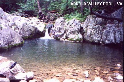
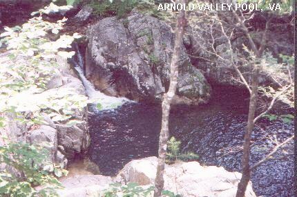
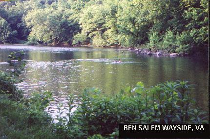
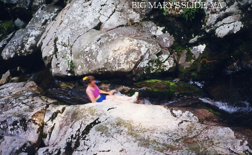
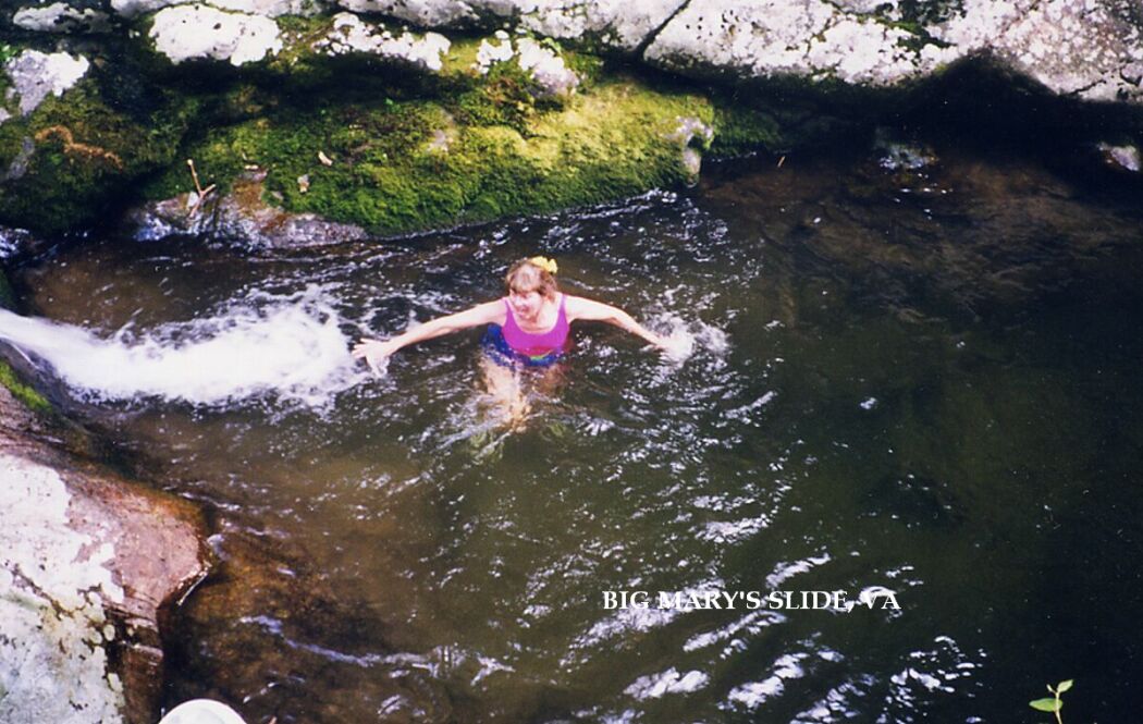
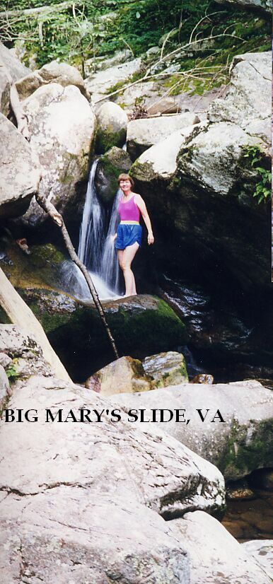
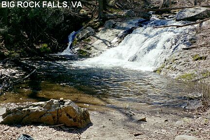
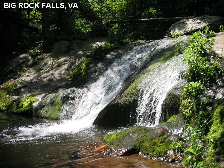
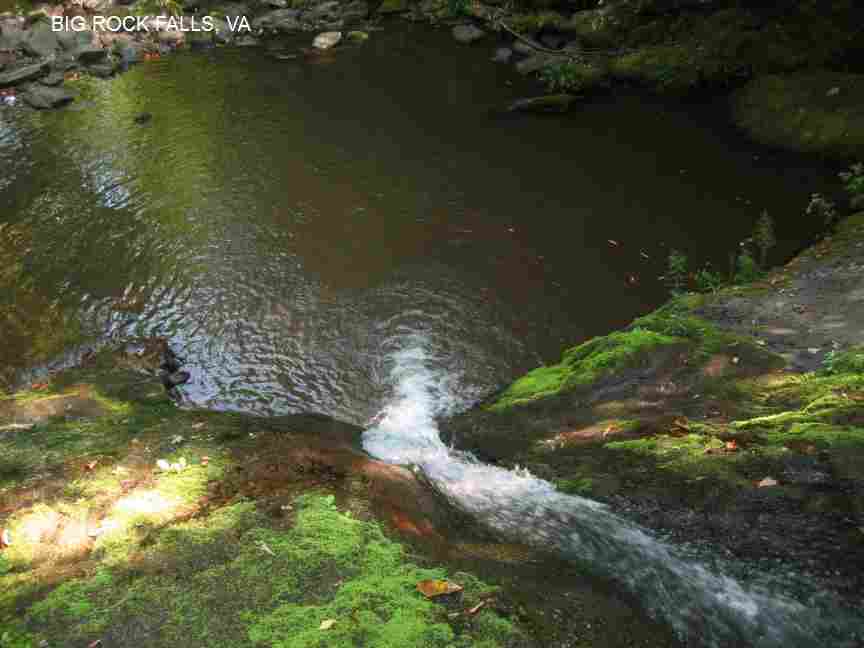
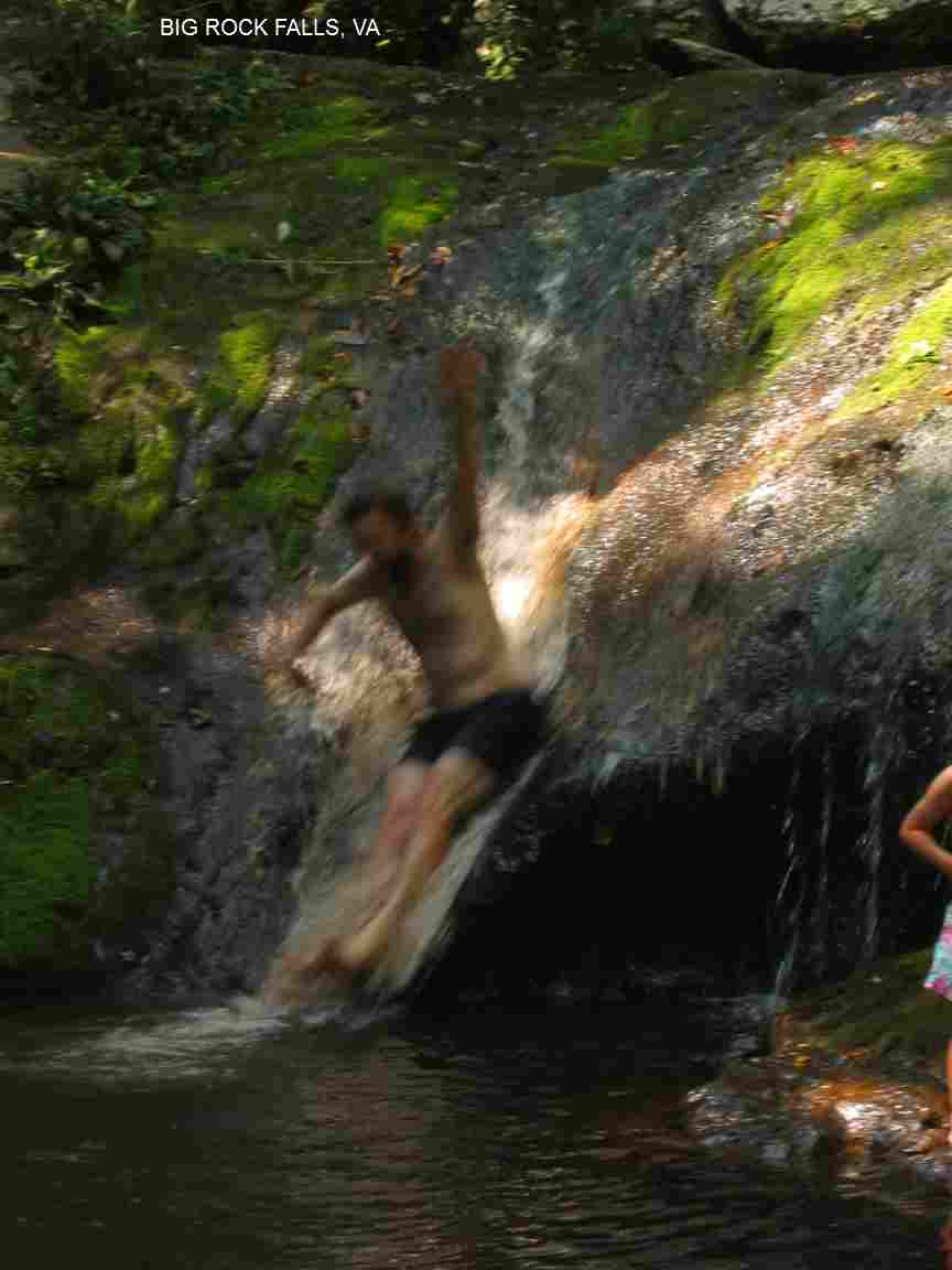
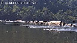
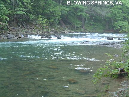
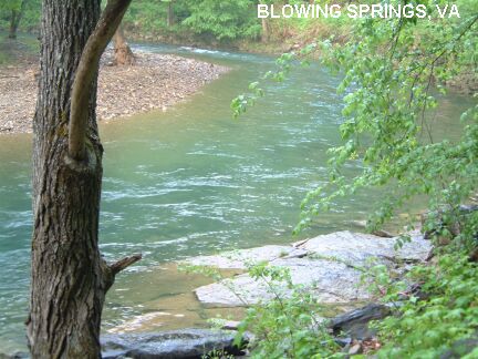
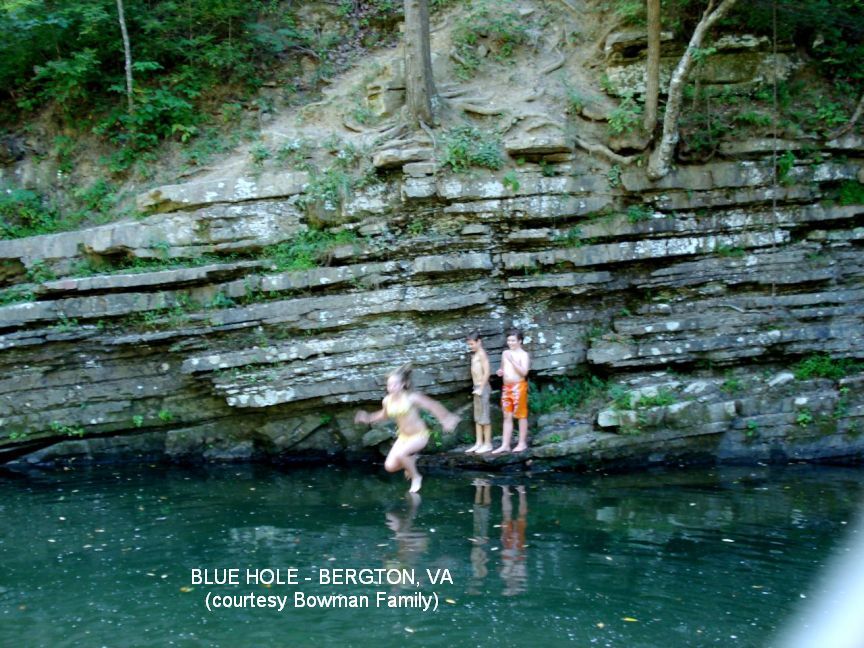
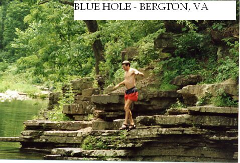
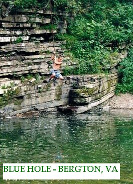
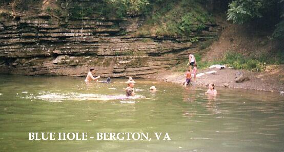
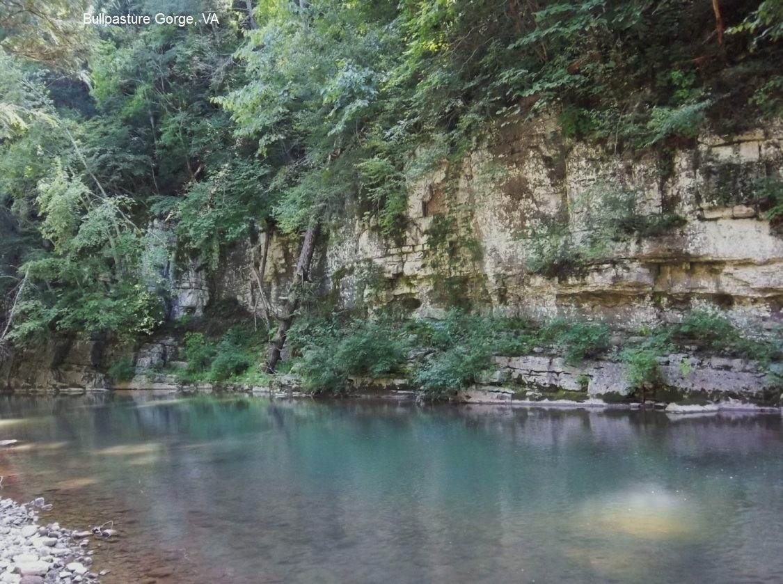
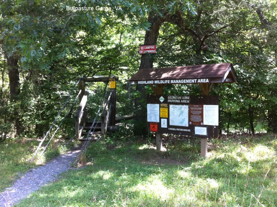
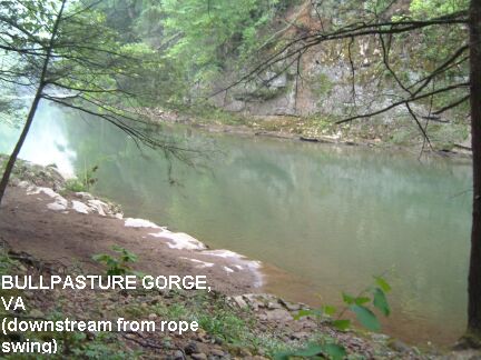
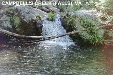
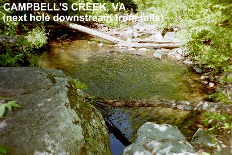
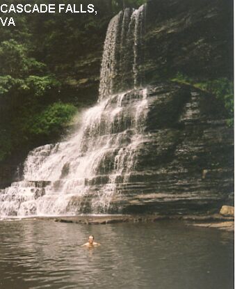
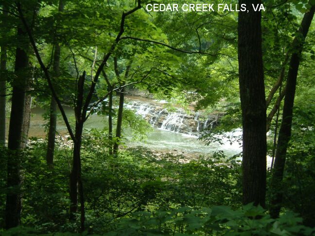
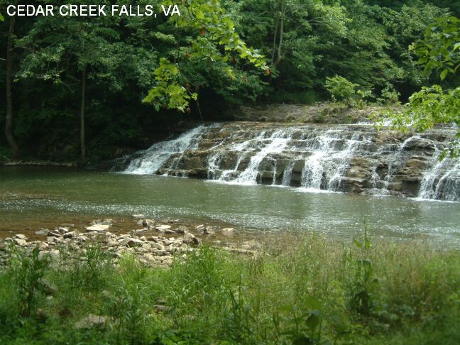
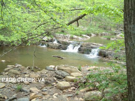
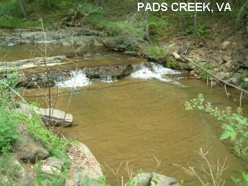
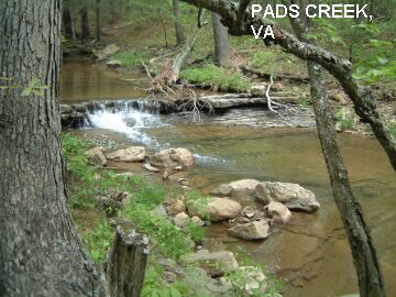
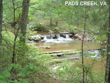
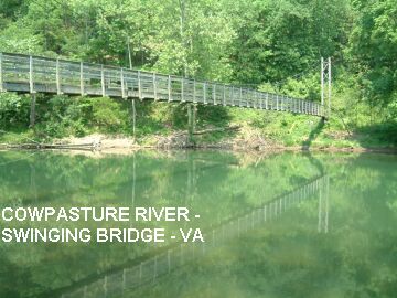
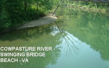
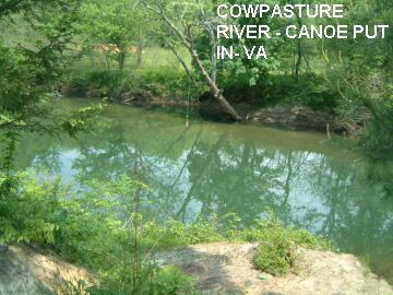
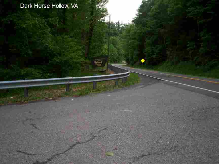
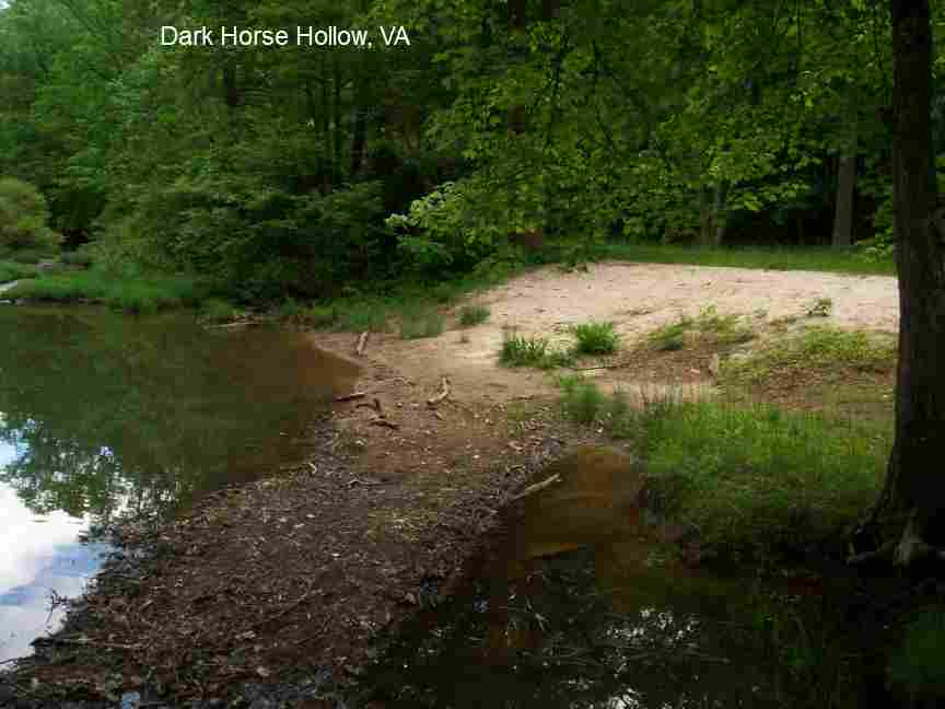
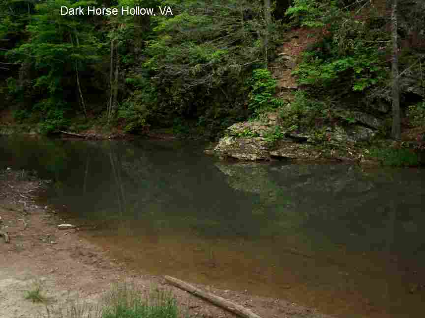
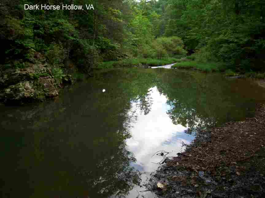
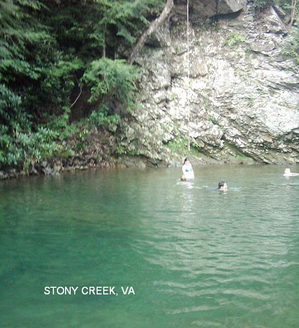
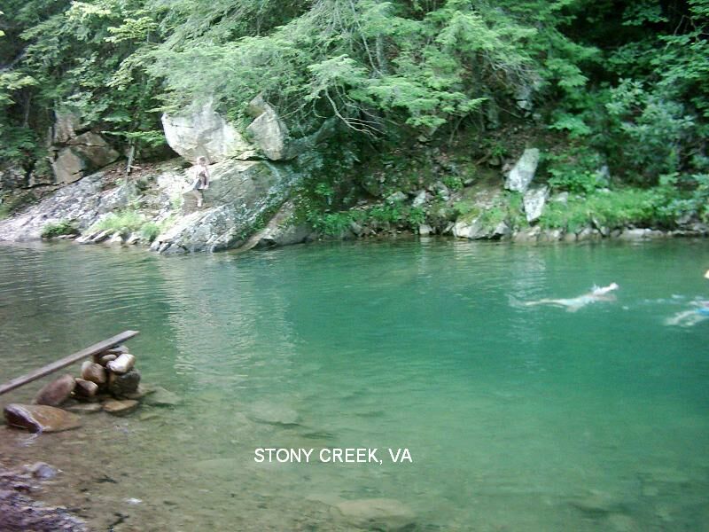
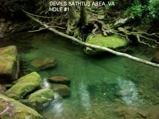
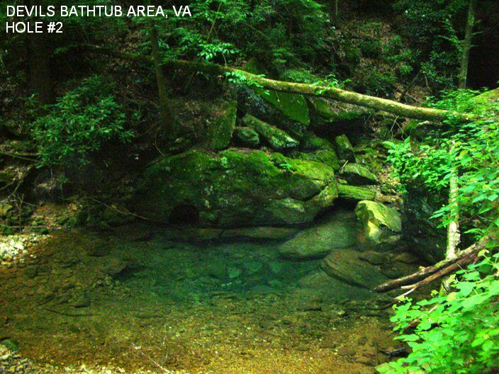
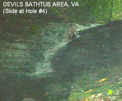
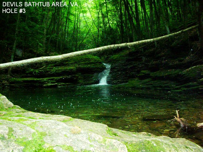
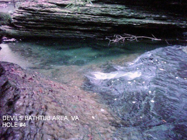
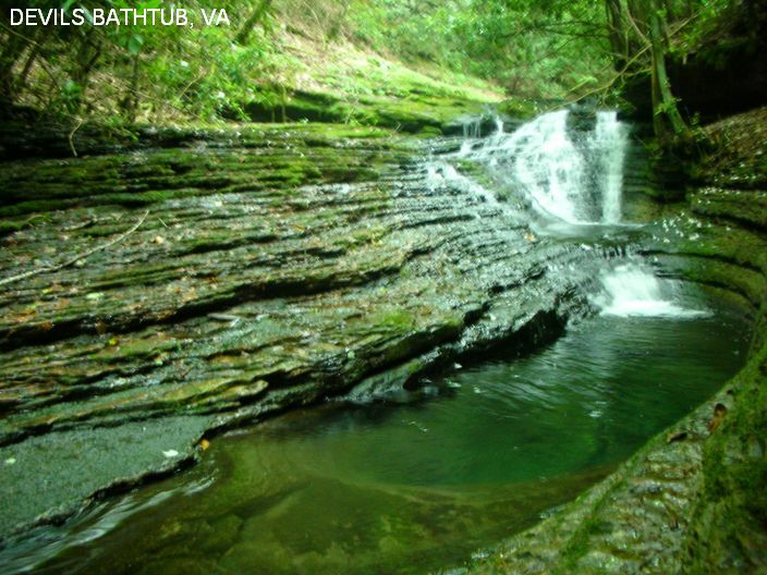
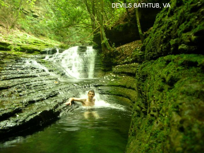
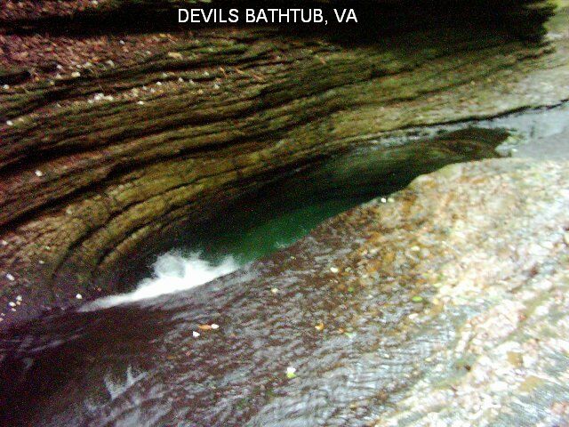
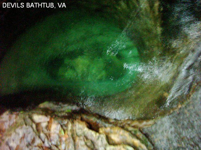
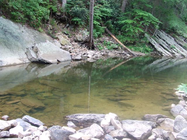
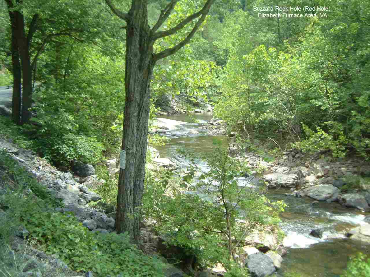
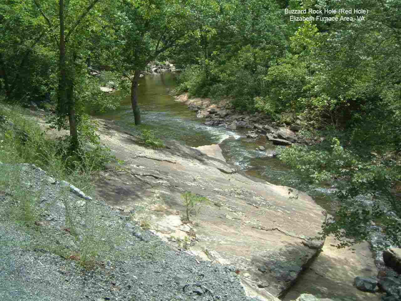
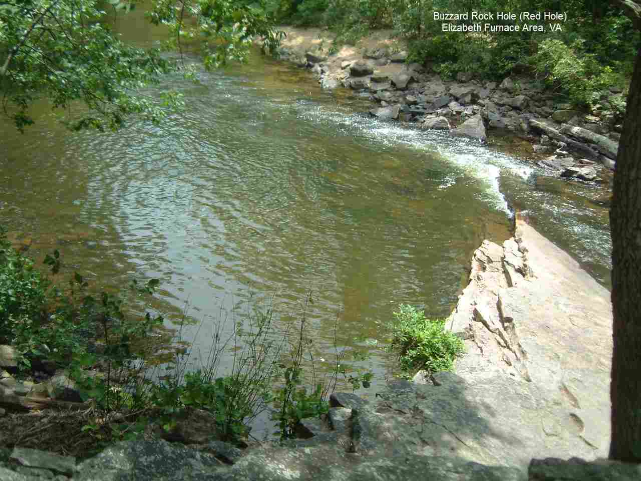
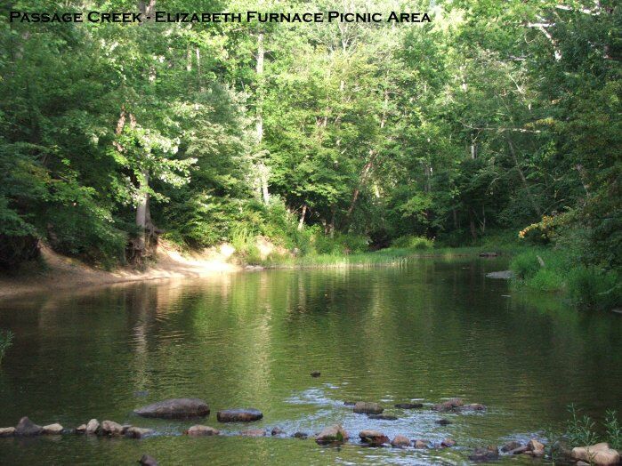
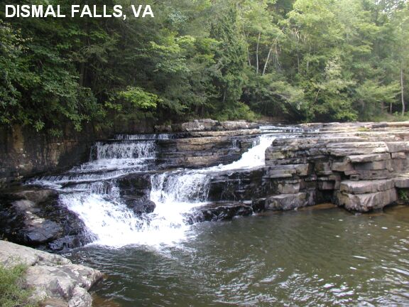
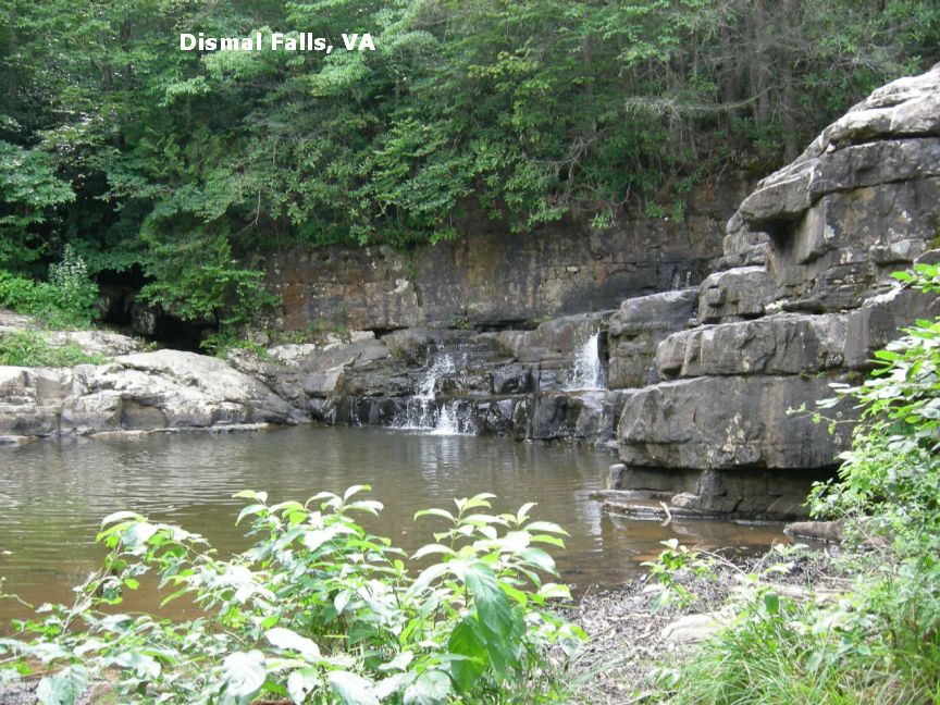
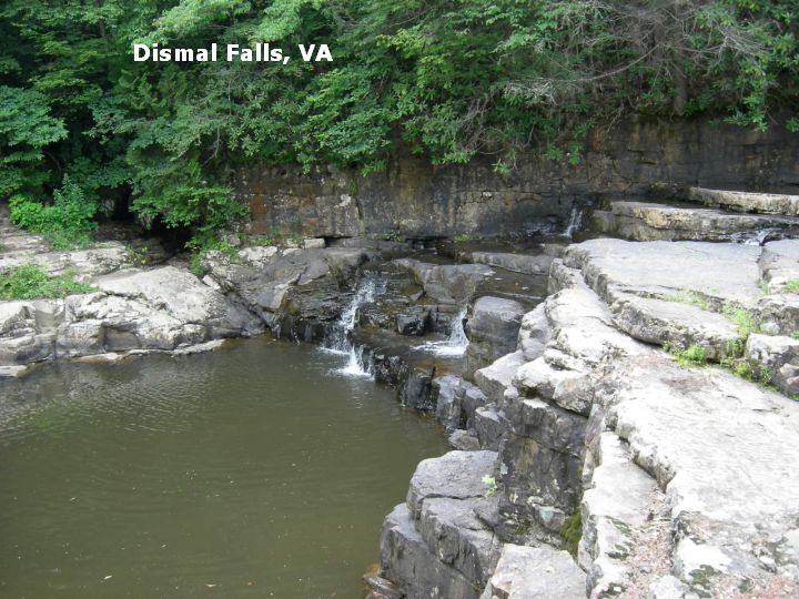
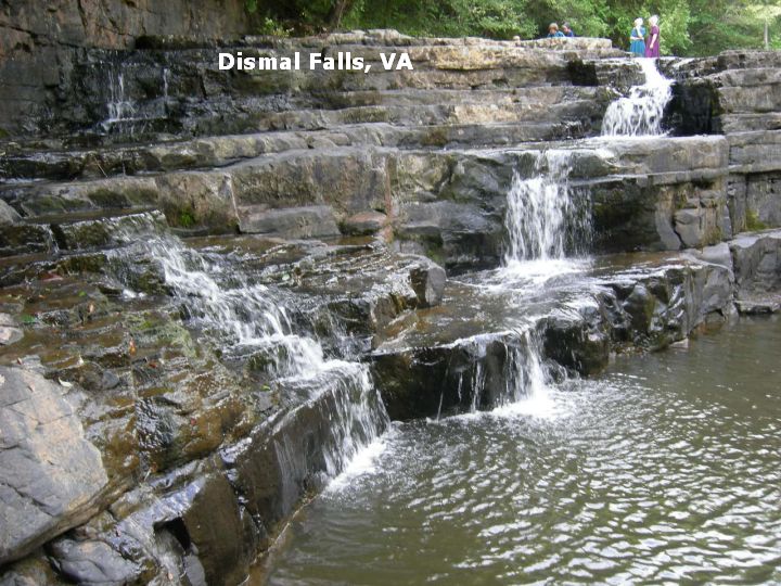
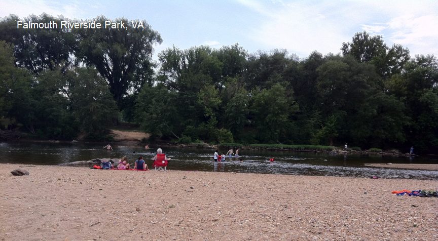
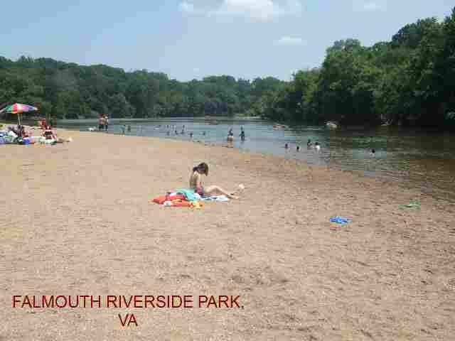
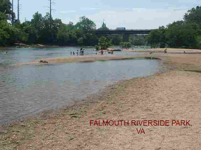
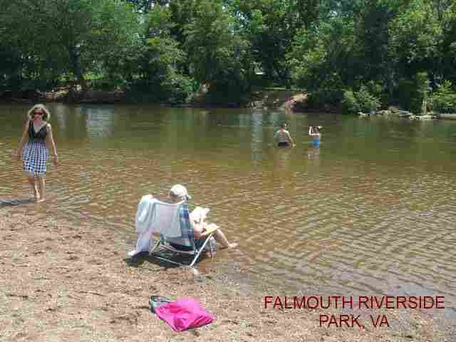
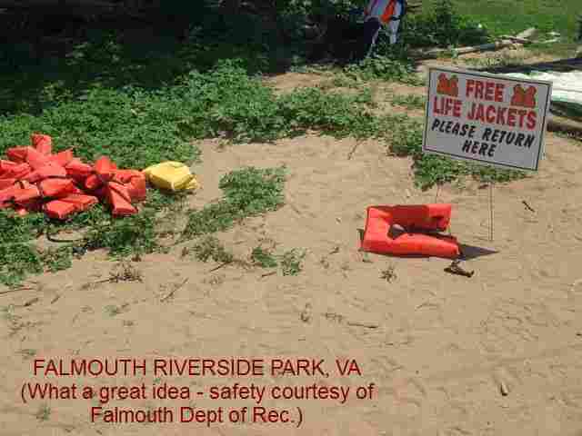
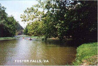
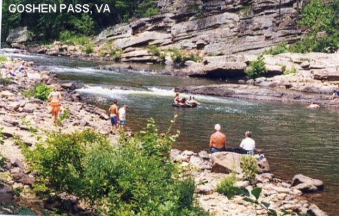
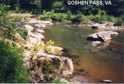
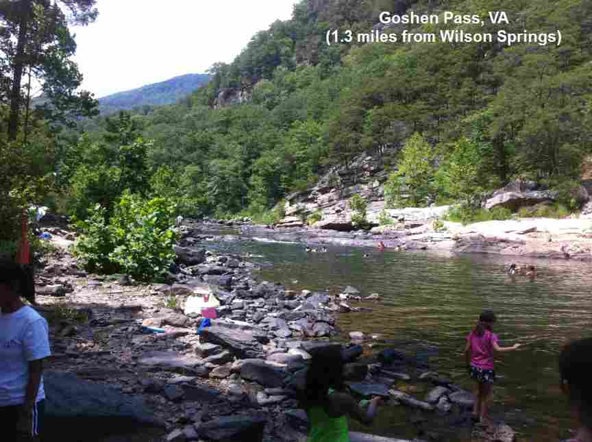
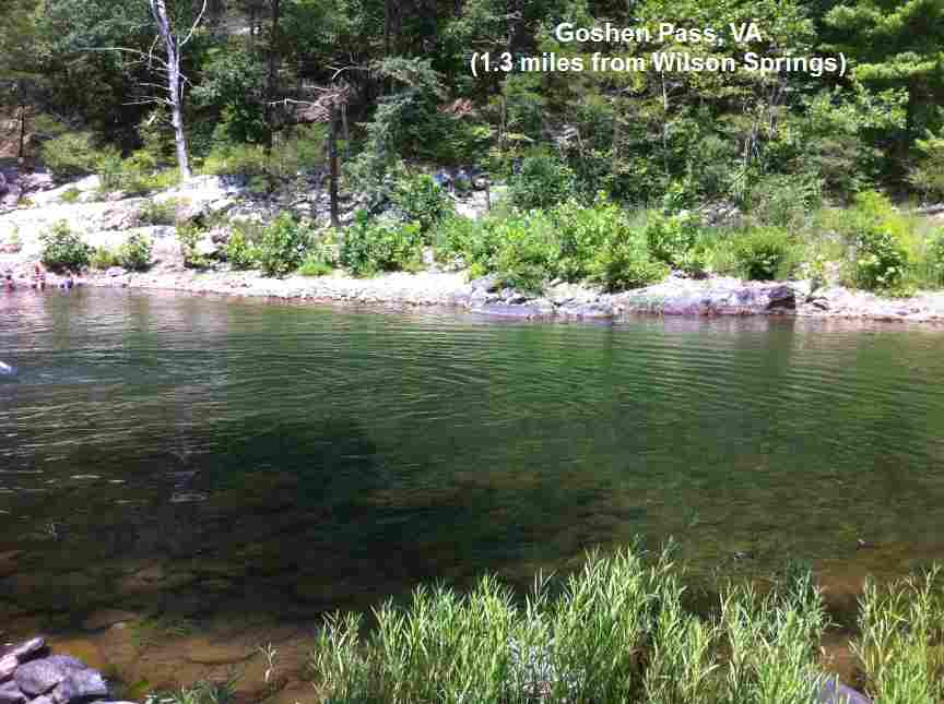
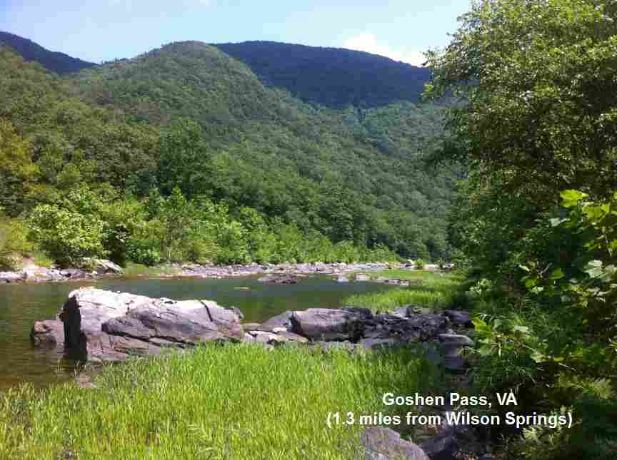
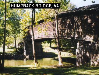
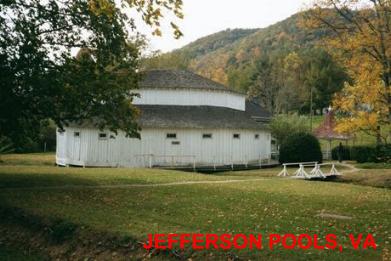
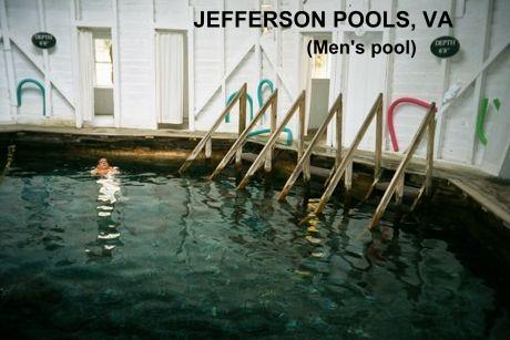
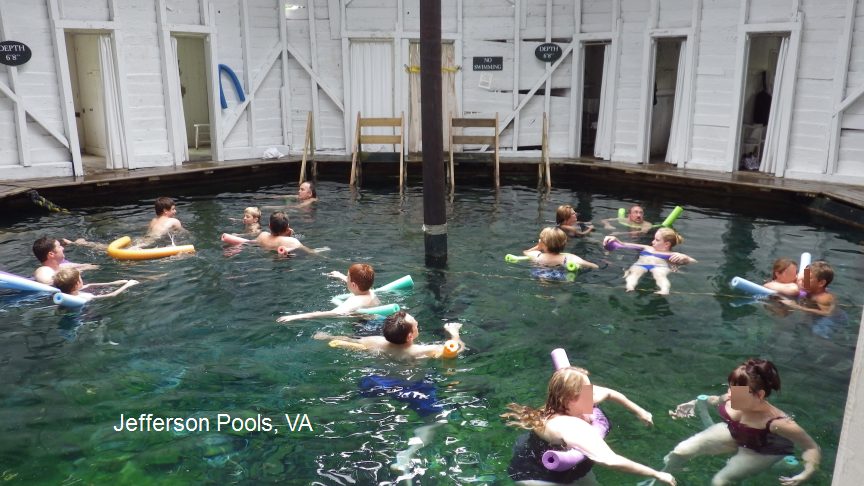
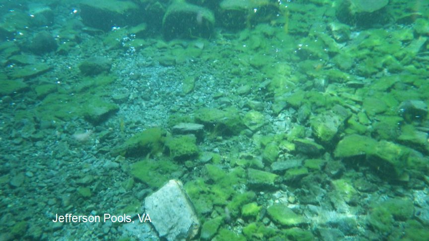
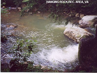
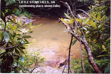
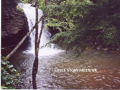
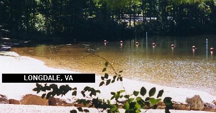
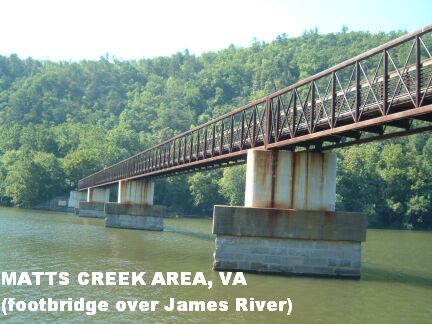
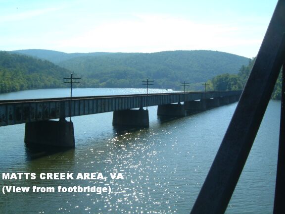
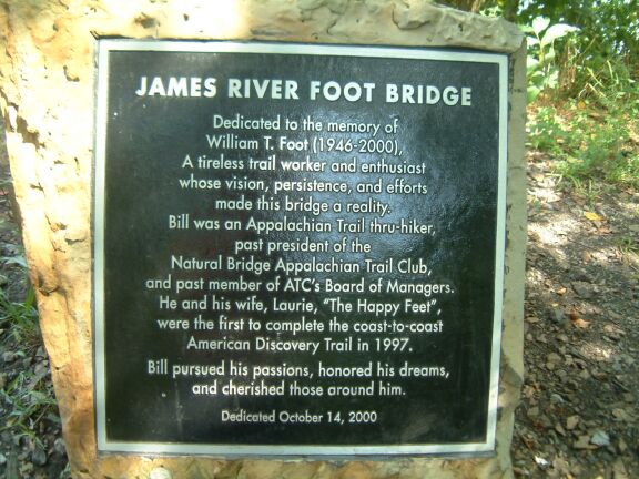
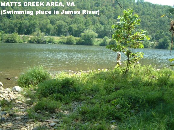
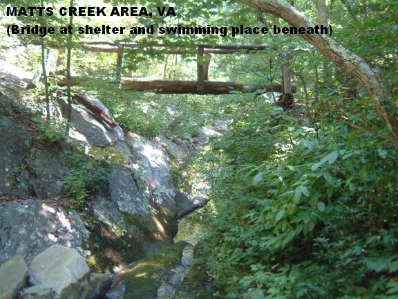
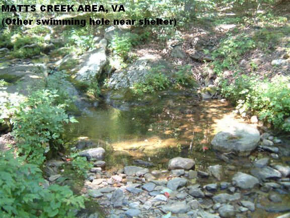
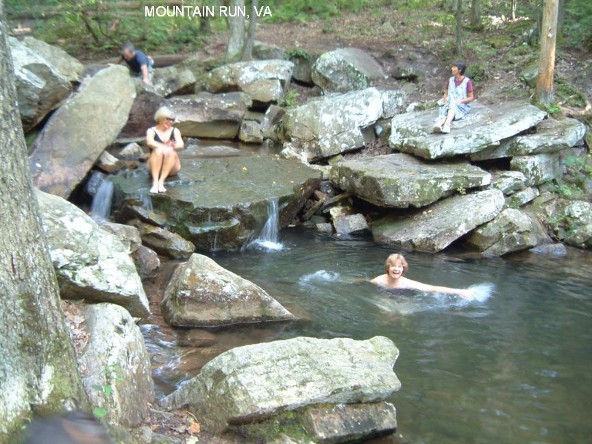
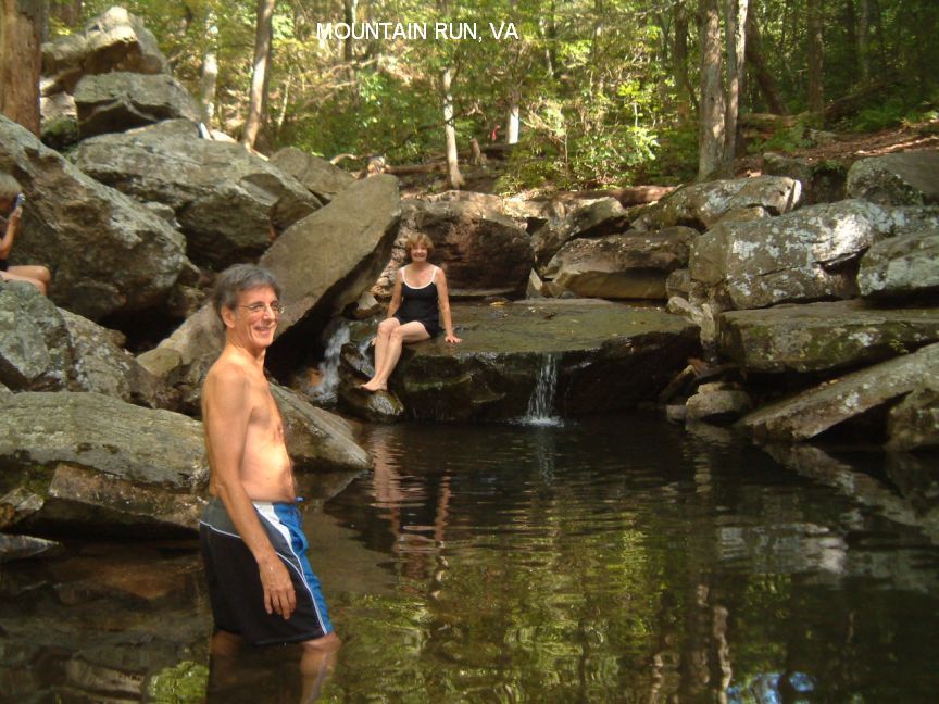
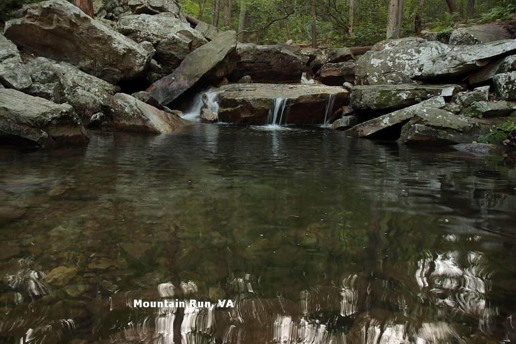
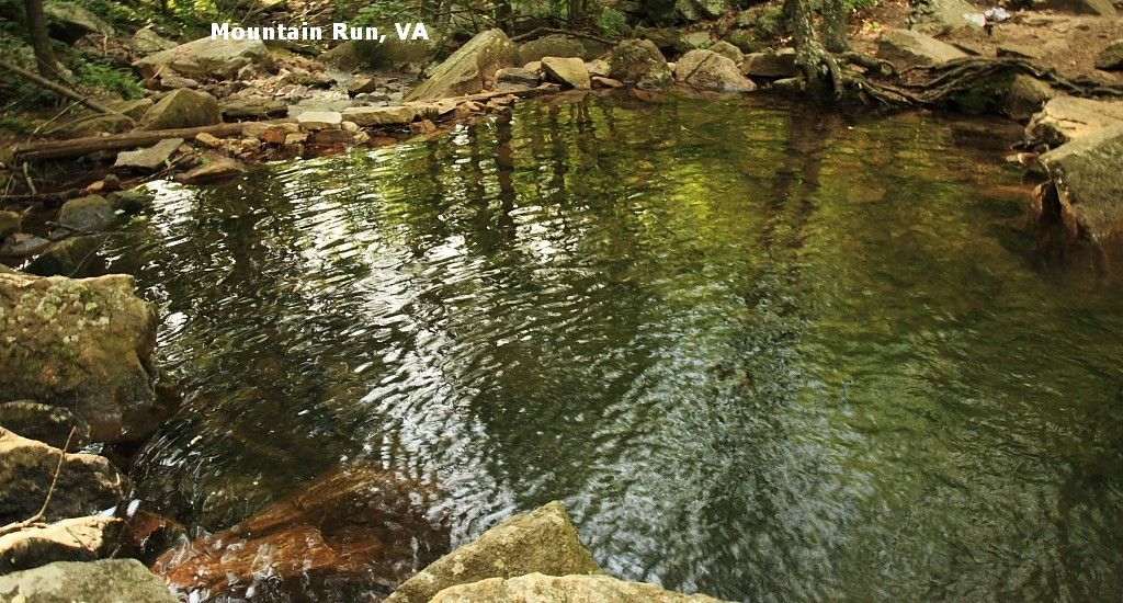
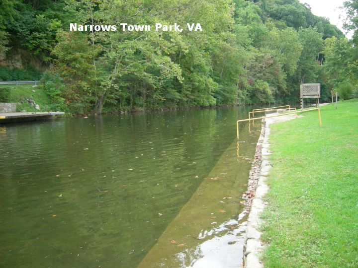
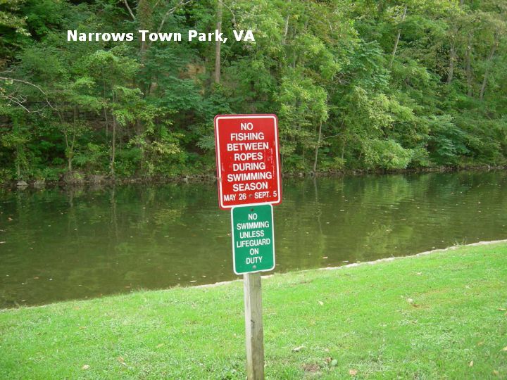
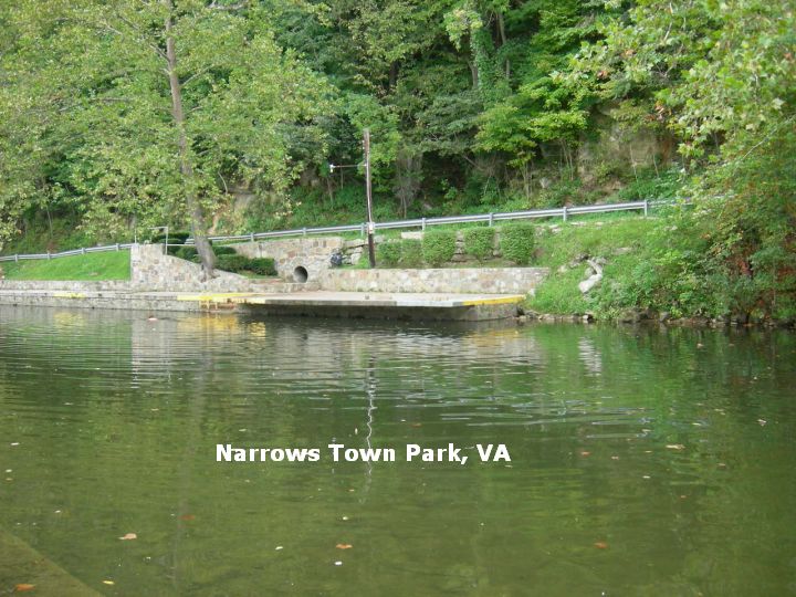
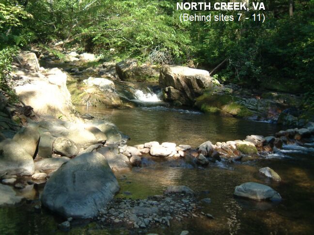
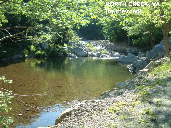
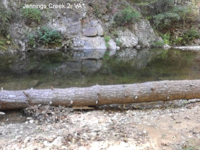
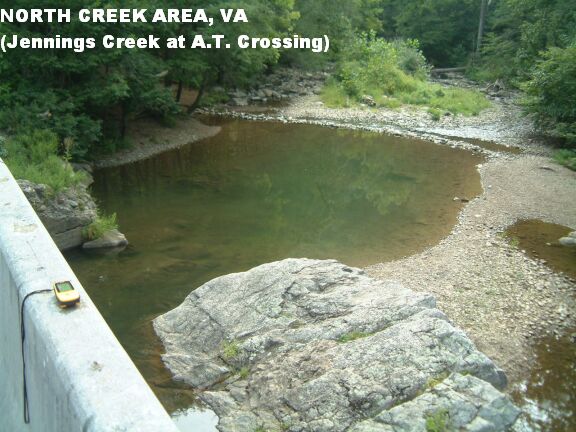
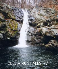
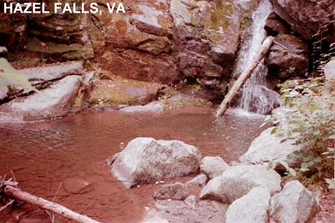
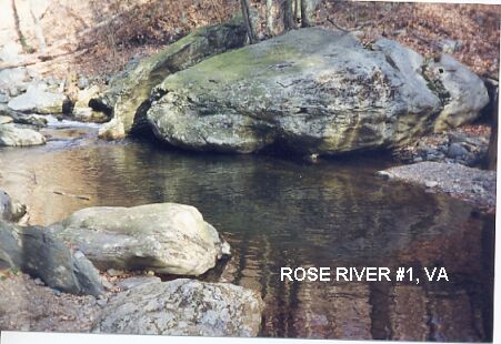
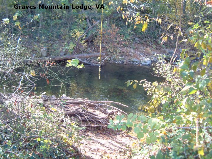
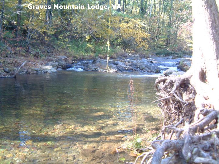
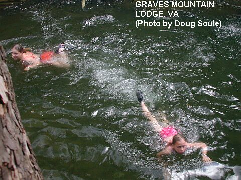
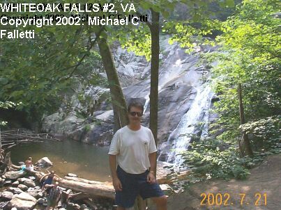
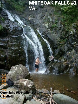
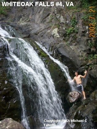
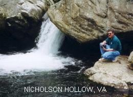
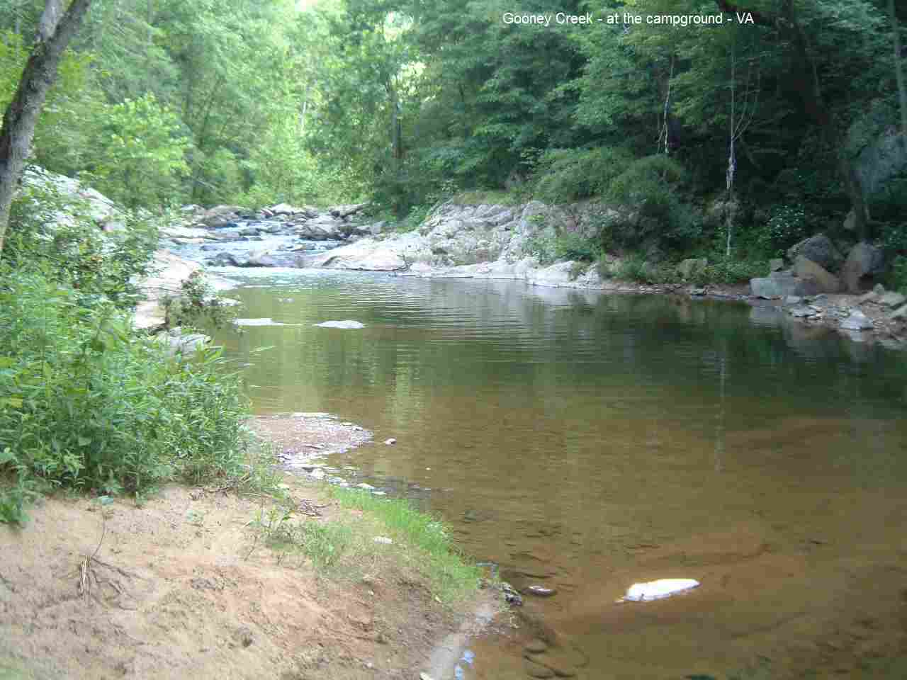
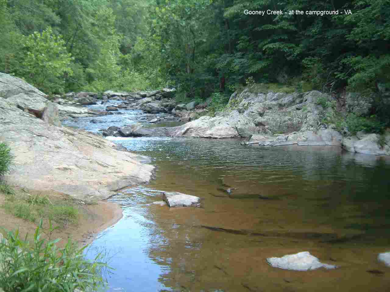
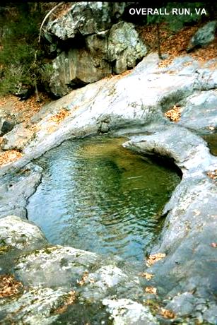
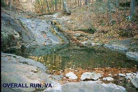
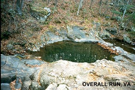
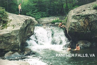
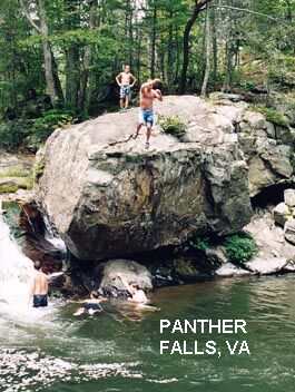
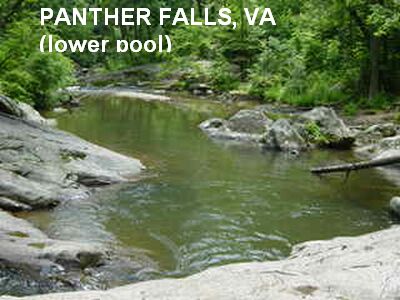
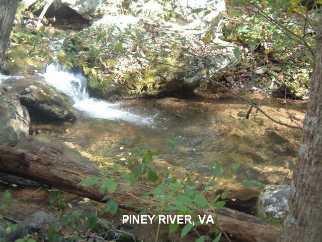
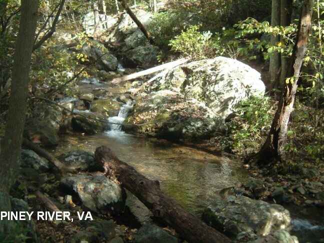
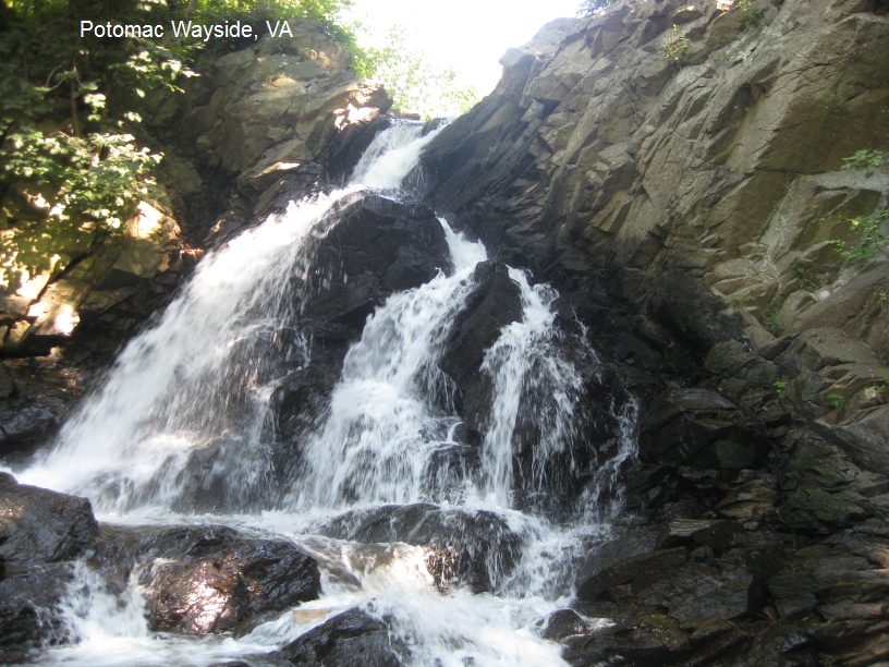
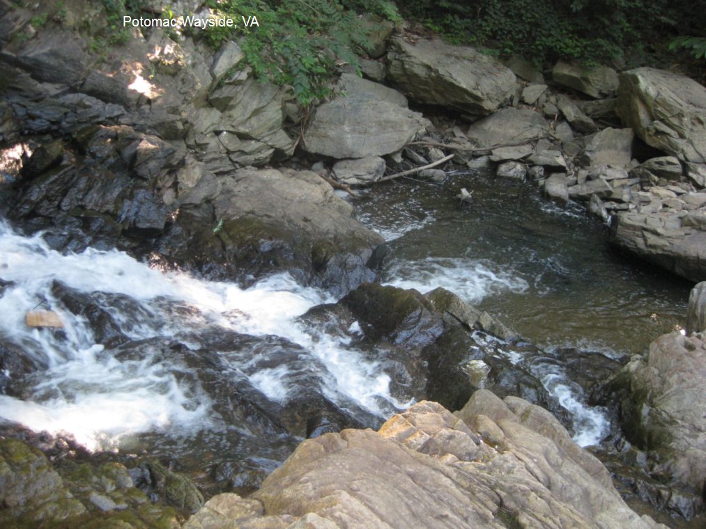
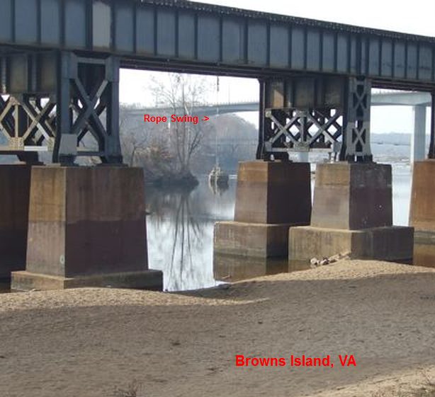
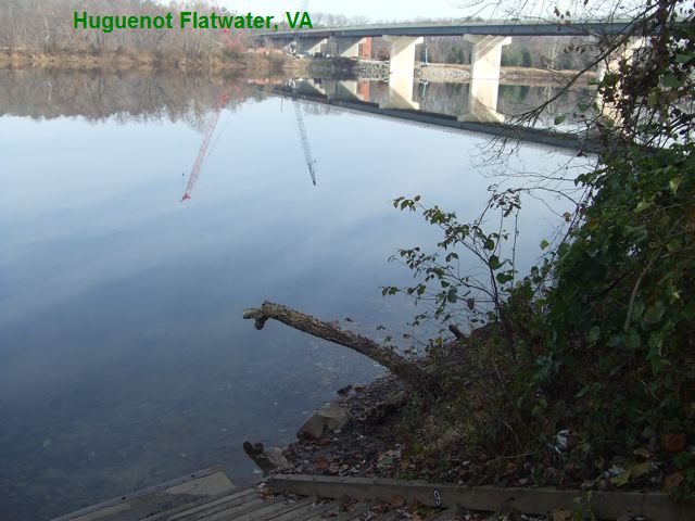
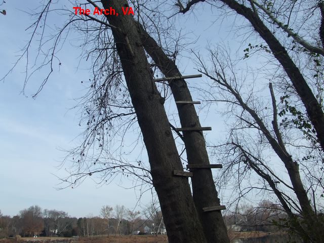
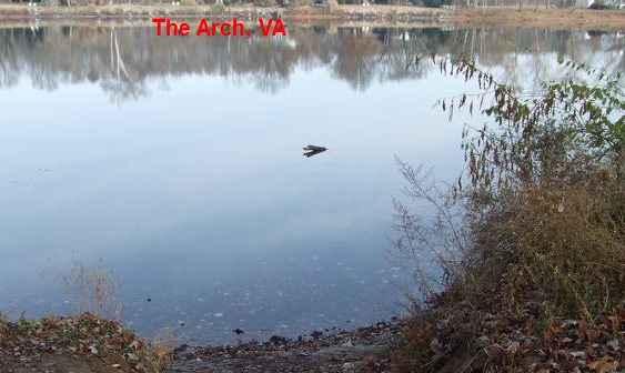
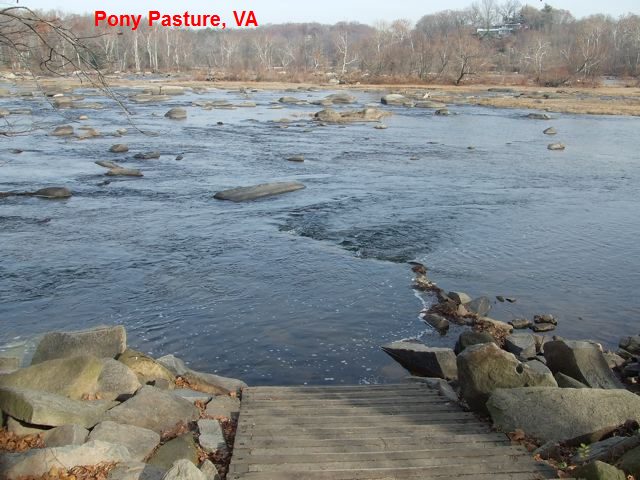
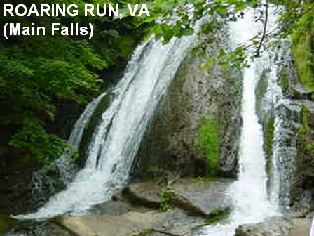
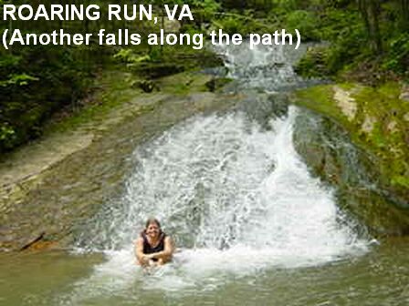
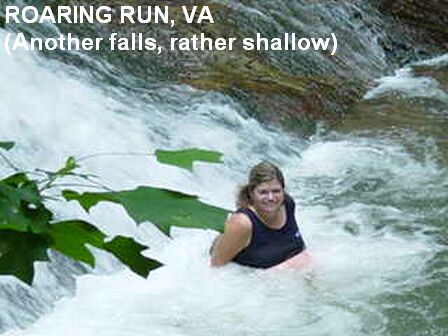
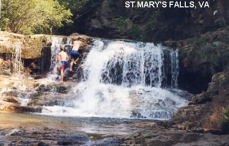
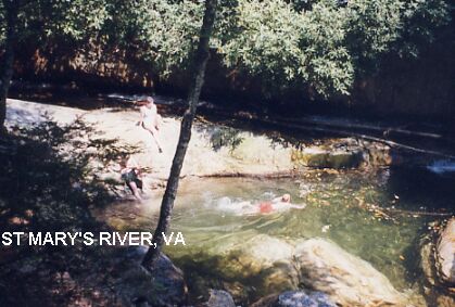
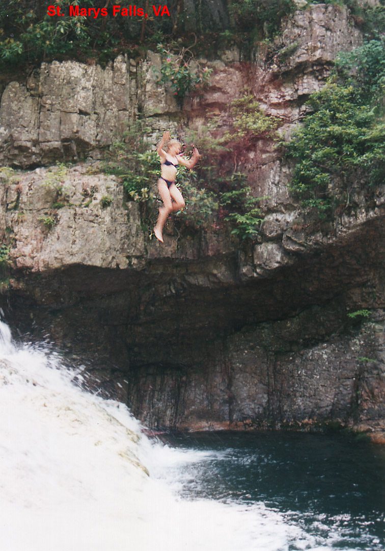
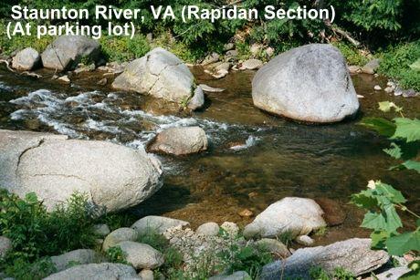
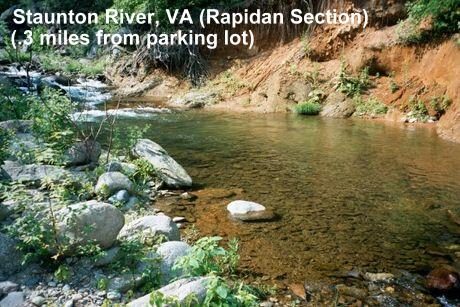
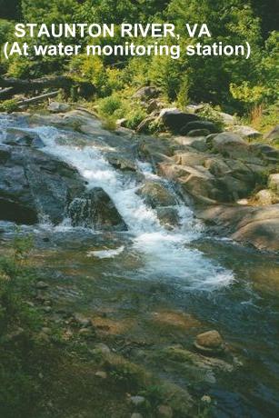
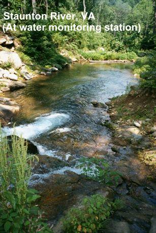
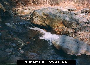
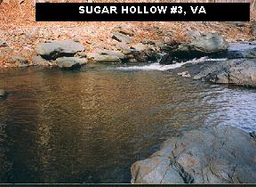
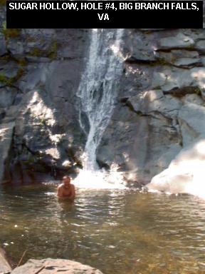
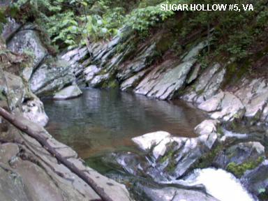
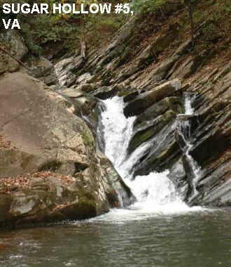
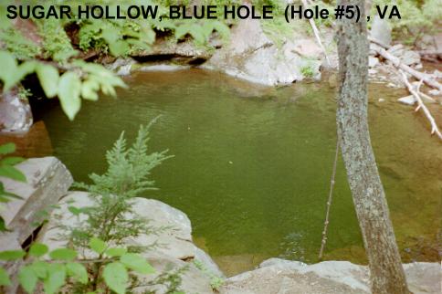
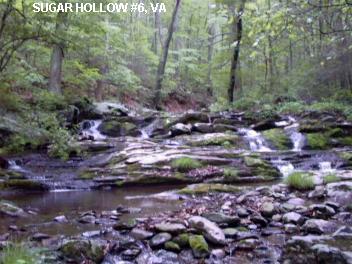
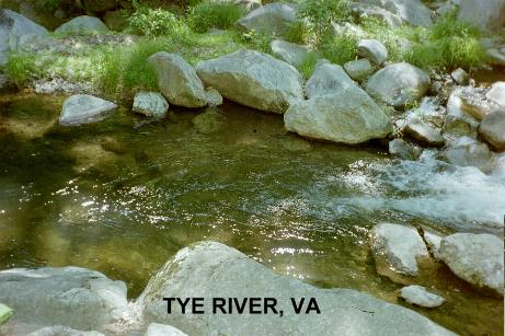
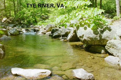
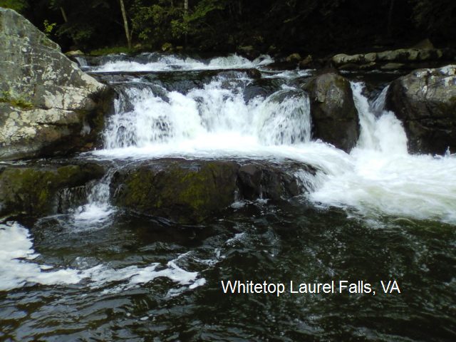
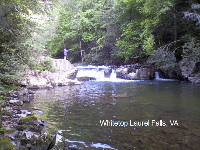
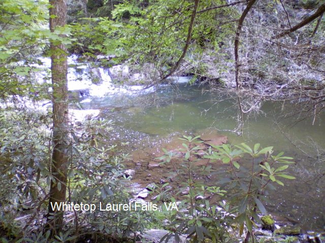
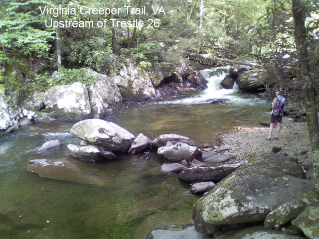
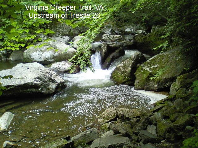
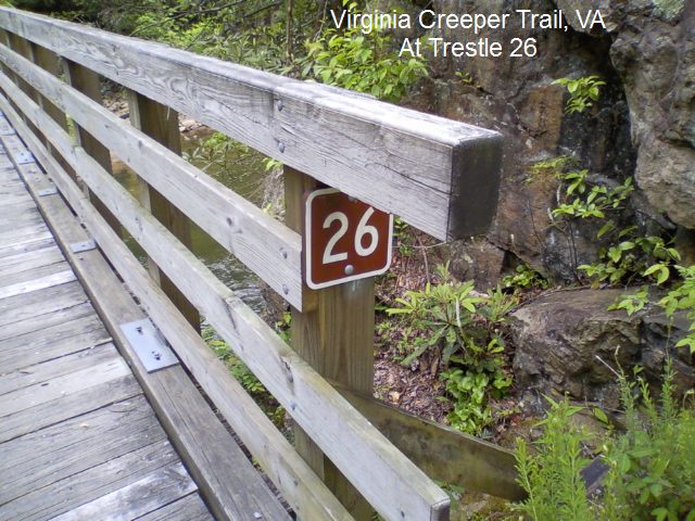
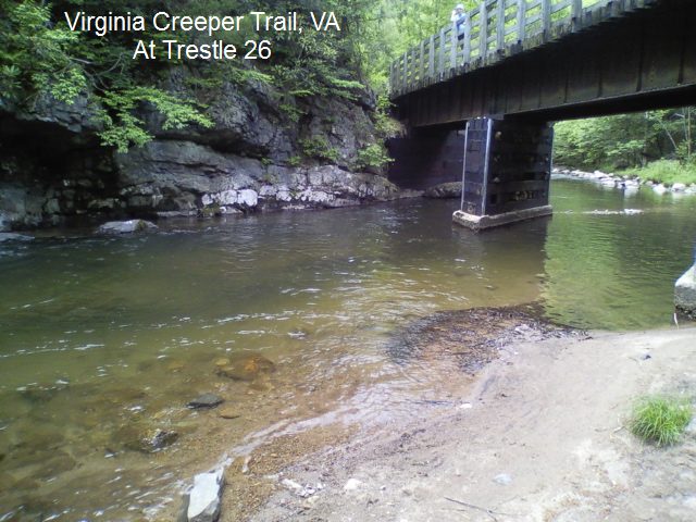
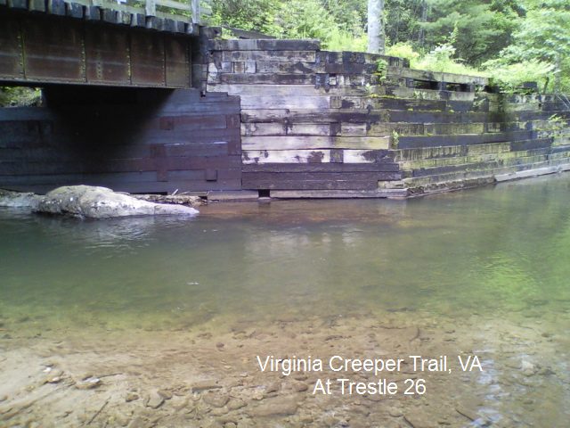
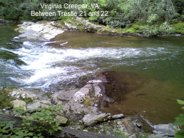
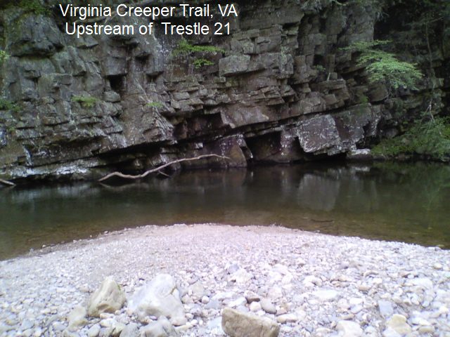
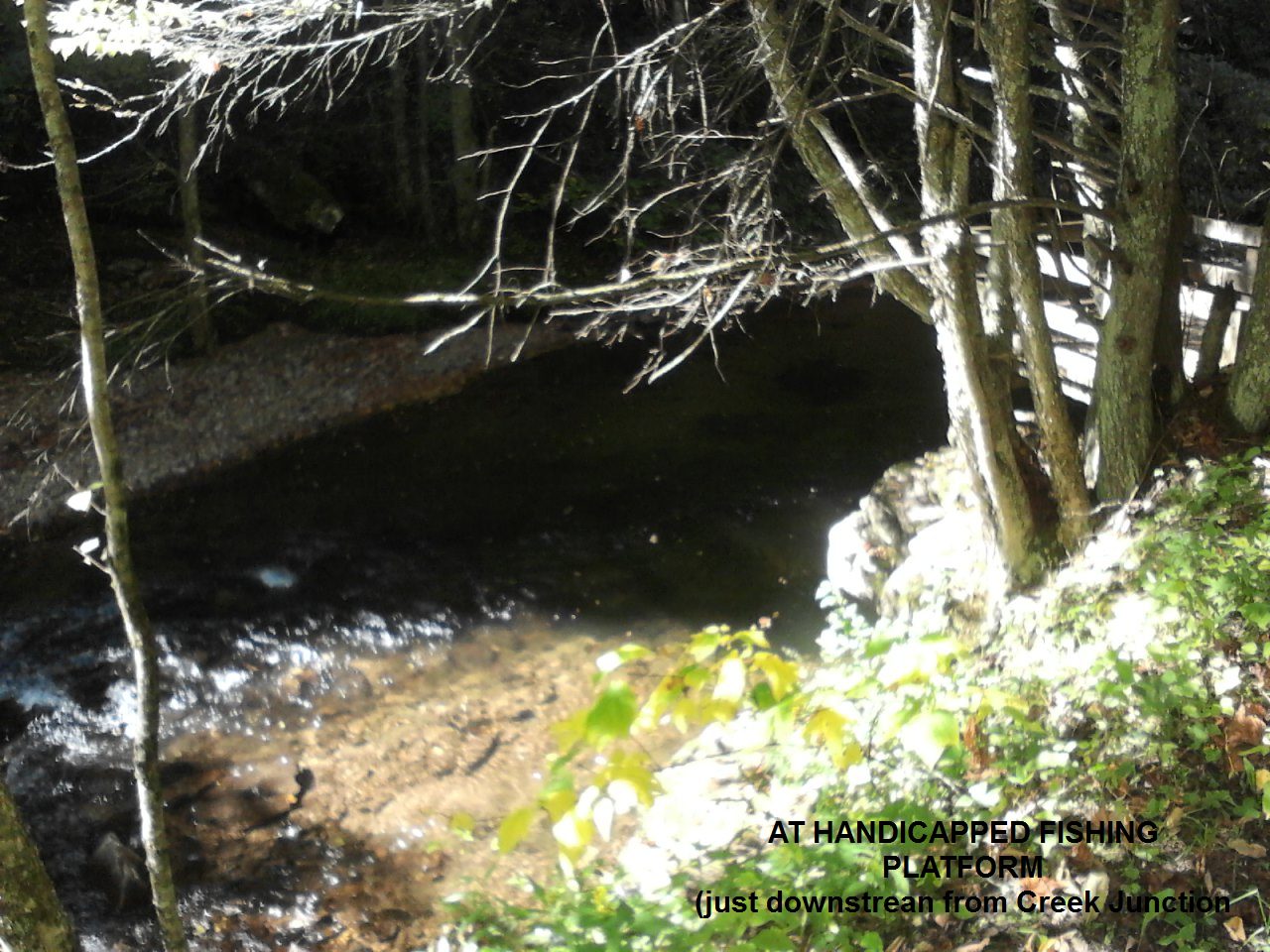
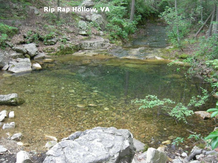
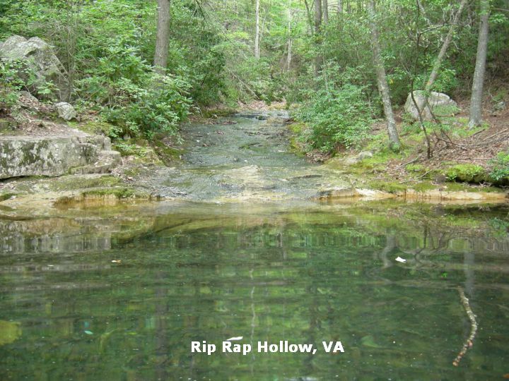
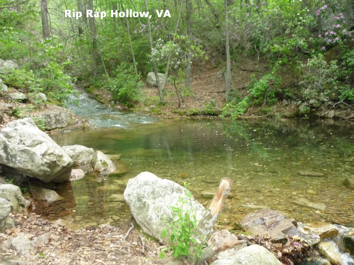
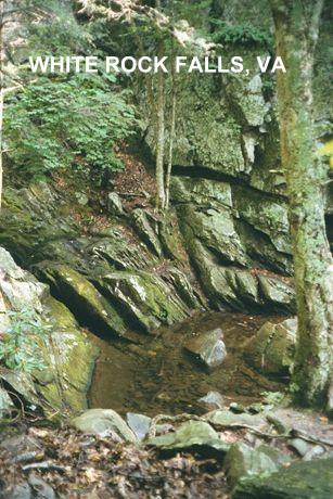