See a SLIDESHOW of swimming hole photos in this state.
This swimming hole listing is by
www.swimmingholes.org
BABY FALLS AREA
[2 PLACES]
(BABA)
|
|
|---|
|
TOWNS | KNOXVILLE, TELLICO PLAINS |
|---|
|
LAT, LON | lat=35.3265, lon=-84.1757(source: Topozone) (accuracy: general area)
LINK TO GOOGLE MAP |
|---|
|
STATE | TN |
|---|
|
WATER | Tellico River |
|---|
|
TYPE | Falls |
|---|
|
DESCRIPTION | Several swimming places in the Tellico River. For details, see DIRECTIONS below.
|
|---|
|
AREAS | Cherokee N. F. |
|---|
|
SANCTION | Unofficial |
|---|
|
FEE | No |
|---|
|
FACILITIES |
None |
|---|
|
ACTIVITIES |
Swimming, Jumping, Tubing, Sliding |
|---|
|
PHONE | none |
|---|
|
CAMPING | Nearby there are several camping areas in the National Forest. |
|---|
|
BATHING SUITS | Unknown |
|---|
|
DIRECTIONS | From Knoxville take I-75 south to RT 68 (about 1/3 of the way to Chattanooga). Take RT 68 south to Tellico Plains, about 35 miles total. From Tellico Plains, go 5.25 miles east on RT 165 and turn right onto Tellico River Road (FR 210, Cherohala Skyway) then go about 6 miles to Bald River Falls (there may be swimming here at Bald River Falls also - not certain). Then:
BABY FALLS [BABY]: Baby Falls, on the Tellico River, are about 15 feet high with a deep, large pool at the bottom. PHOTO 1 , PHOTO 2 , PHOTO 3. BE VERY CAREFUL HERE- IF THE RIVER CURRENTS ARE HIGH, DO NOT SWIM HERE!
This from a visitor:"There is some sort of grass that grows at the top of the falls, that is like astro-turf, and allows one to walk out to the middle of the top portion of the falls. When you jump in, the falls does not pull you under, but pushes you over to the side where you get out. Be careful here if jumping, and it is best not to be under the influence, as people have died here. One can climb down to pool area and swim, my wife likes to sit in the shallow water 30 - 40 yards up from the falls. There are swimming spots before you get to Baby Falls, but I did not see anybody in Bald River Falls swimming."
LAT, LON lat=35.3265, lon=-84.1757(source: Topozone) (accuracy: exact) LINK TO GOOGLE MAP . To get here from Bald River Falls (above), Baby Falls is 0.25 miles further on FR 210. Very confident. Verified. Update 9/22/08.
DAVIS BRANCH [DAVI]: Swimming place in Tellico River at Davis Branch national forest campground.
LAT, LON lat=35.27942, lon=-84.096(source: Topozone) (accuracy: exact) LINK TO GOOGLE MAP . To get here from Baby Falls (above), continue on RT 210 about 9 miles further to the Davis Branch Campground. There are also several other campgrounds further along on FR 210. Very confident. Verified. Updated 9/22/08.
|
|---|
|
CONFIDENCE | Very confident |
|---|
|
VERIFIED BY WEWBMASTER | Yes |
|---|
|
DATE UPDATED | 9/22/08 |
|---|
This swimming hole listing is by
www.swimmingholes.org
BACKBONE ROCK
(BACK)
|
|
|---|
|
TOWNS | BRISTOL(TN/VA), ABINGDON(VA) |
|---|
|
LAT, LON | lat=36.594, lon=-81.814(source: campground info) (accuracy: exact)
LINK TO GOOGLE MAP |
|---|
|
STATE | TN |
|---|
|
WATER | Beaver Dam Creek |
|---|
|
TYPE | Falls/Creek |
|---|
|
DESCRIPTION | Two swimming/water play places in national forest campground and recreation area. Located near "The World's Shortest Tunnel" and Backbone Falls. |
|---|
|
AREAS | Cherokee N. F. |
|---|
|
SANCTION | Unofficial |
|---|
|
FEE | No |
|---|
|
FACILITIES |
All facilities at campground |
|---|
|
ACTIVITIES |
Swimming |
|---|
|
PHONE | 423.476.9700 |
|---|
|
CAMPING | At site |
|---|
|
BATHING SUITS | Required |
|---|
|
DIRECTIONS | From Bristol, take RT 421 south for 20 miles to Shady Valley. Turn north (left) on RT 133 and go 8 miles to the Backbone Rock Campground. From Abingdon(VA), take RT 58 east to Damascus then RT 133 south. Swimming place is just behind site #1, down a gravel path with steps, in the creek in campground. (There is another shallow swimming hole (about 4-5 feet deep) behind the picnic shelter in the picnic area immediately north of the tunnel.) |
|---|
|
CONFIDENCE | Very confident |
|---|
|
VERIFIED BY WEWBMASTER | By another |
|---|
|
DATE UPDATED | 9/2014 |
|---|
This swimming hole listing is by
www.swimmingholes.org
SWIMMING HOLES
EAST
BIG SOUTH FORK AREA
[6
PLACES]
(BIGS)
|
|
|---|
|
TOWNS | KNOXVILLE, ONEIDA, RUGBY |
|---|
| LAT, LON | lat=36.6003, lon=-84.6753(source: DeLorme) (accuracy:general area)
LINK TO GOOGLE MAP |
|---|
|
STATE | TN |
|---|
|
WATER | Big South Fork of the Cumberland River (and others, see
below) |
|---|
|
TYPE | River |
|---|
|
DESCRIPTION | The Big South Fork National Recreation Area (BSFNRA) is a wonderland of
forest and water for canoeing, tubing, swimming, hiking and camping on the border between Kentucky and Tennessee. Stop somewhere and get the National Park Service map of the BSFNRA if you can, several of the roads and swimming holes mentioned below are at locations noted on the map. See also Blue Heronswimming hole in the Kentucky part of this park; it is also on the BSFNRA map).
See "DIRECTIONS" below for several swimming holes in this area.
|
|---|
|
AREAS | Big South Fork National Recreational Area
(BSFNRA) |
|---|
|
SANCTION | Unofficial |
|---|
|
FEE | No |
|---|
|
FACILITIES |
Toilets, Picnic Tables |
|---|
|
ACTIVITIES |
Swimming,
Boating |
|---|
|
PHONE | Unknown |
|---|
|
CAMPING | There are several camping areas in the BSFNRA. The
most central (and highly developed) is Bandy Creek campground. Might be crowded.
Beautifully developed campground, four star bathrooms & showers!
Mosquitoes sometimes. Horseback riding also. |
|---|
|
BATHING SUITS | Required |
|---|
|
DIRECTIONS | From Knoxville, about 40 mi northwest on I-75 then west on RT 63
for about 20 mi to intersection with RT 27. From here, see below for directions to individual
locations:
BURNT MILL BRIDGE [BURN]: (see BSFNRA LOCAL AREA MAP): This is a river access point for canoeing but has picnicking and swimming also. To get there go south on RT 27 to Elgin then take RT 52 west for less than 1 mile then take West Robbins Rd northwest (turn right) through Crossroads to the Burnt Mill Bridge over the Cumberland South Fork.
LAT, LON lat=36.38781, lon=-84.62942(source: Topozone) (accuracy:exact) LINK TO GOOGLE MAP
Not verified .
GENTLEMENS SWIMMING HOLE [GENT]: (See BSFNRA LOCAL AREA MAP):A deep pool in a rock amphitheatre on the Clear Fork River with clear, cool water. Originally planned to be used only by the men of Rugby. Rugby, an early utopian community, is well worth seeing. PHOTO 1 , PHOTO 2. See also the "Witches Cave" at the swimming hole. LAT, LON lat=36.37144, lon=-84.69703(source: Topozone ) (accuracy: approximate) LINK TO GOOGLE MAP.
To get there, go south on RT 27 to Elgin then take RT 52 west to Rugby. Stop at the Rugby visitor's center and get the brochure on the Gentlemen's Swimming Hole (this hole is no secret!). Continue west on RT 52 a short distance then turn north (right) at the sign for Laurel Dale Cemetery (on the right). Drive a short distance to the cemetery where the road end in a loop with picnic tables and a porta potty. Park here and follow signs to the trail to Gentlemens Swimming Hole. The trail begins as a very rutted dirt road (blaze on trees is red arrowhead). In about .3 miles the road ends but take the trail that goes off to the left(if you continue on this road-trail along the Clear Fork River, you will come to the confluence with White Oak Creek, called "Meeting of the Waters".) A bit down this trail you will intercept the river - the swimming hole is here. All told, the hike is said to be .4 miles each way. Verified .
|
BREWSTER BRIDGE [BREW]: (See BSFNRA LOCAL AREA MAP): This is a river access point for canoeing but has picnicking and swimming also. BREWSTER BRIDGE PHOTO. LAT, LON lat=36.35057, lon=-84.73173(source: Topozone ) (accuracy:exact) LINK TO GOOGLE MAP.
To get there go south on RT 27 to Elgin then take RT 52 west through Rugby (past Gentlemens Hole, above), continue on to Brewster Bridge over the Clear Fork River. Cross the bridge to the West side, continue west on RT 52 until you see a sign on the right saying "picnic area" pointing to a road on the left. Go left here, take this road to the bottom at the river. There is a deep place with rope swing and picnic tables.
Verified .
| |
LEATHERWOOD FORD [LEAT]: (See BSFNRA LOCAL AREA MAP): Very accessible, wide place in the Cumberland South Fork. Is primarily a canoe/kayak launch area (careful if you boat here, there is a BIG falls downstream a ways). Well developed, boardwalk along river, handicapped accessible, rest rooms, showers even! Swim and body surf small rapids depending on water level. LEATHERWOOD FORD PHOTO.
LAT, LON lat=36.4778, lon=-84.6690(source: Topozone ) (accuracy:exact) LINK TO GOOGLE MAP.
To get there, go north on RT 27 to Oneida then go west on RT 297 about 15 mi into Big South Fork park to sings for Leathwerwood Ford, before bridge over river. Swimming place is at low wooden bridge and slightly downstream from here.
O AND W Hole [OAND]: (See BSFNRA LOCAL AREA MAP - shown as "O & W Rapid") Excellent, popular local swimming hole in the Big South Fork of the Cumberland River (but 8 miles down a gravel road). Sandy bank, big rocks, deep water, several places to jump into river. O AND W HOLE PHOTO.
LAT, LON lat=36.4529, lon=-84.6441(source: Topozone ) (accuracy: approximate) LINK TO GOOGLE MAP.
To get there, go north on RT 27 to Oneida then go west on RT 297 about 2 mi, turn South (left) on Verdun Road toward the town of Verdun. At Verdun, do not take the sharp left curve on Verdun Rd. but keep straight onto O and W Road. (maybe not signed)which turns to gravel. (Set your odometer here, you will go about 8 miles down this gravel road in total.) Go down this road following North White Oak Creek (there may be some swimming places along here in high water) and you will eventually begin following the Big South Fork of the Cumberland on your left. Continue on this road until you have gone a total of about 8 miles on this gravel road then it crosses a trestle bridge high above the river. Park before you cross the river; there is a trail here along the river and a porta potty and plenty of space to park. Go down the wooden stairs down to the river on the left side of this bridge. The swimming hole can be seen from here, it is just upstream. Lots of rocks and deep holes. BE CAREFUL OF CURRENTS IN HIGH WATER, MAY BE UNSAFE IN HIGH WATER. Verified .
STATION CAMP [STAT]: (See BSFNRA LOCAL AREA MAP): This is a river access point for canoeing but has picnicking and swimming also.
LAT, LON lat=36.54836, lon=-84.66538
(source: Topozone ) (accuracy: approximate) LINK TO GOOGLE MAP
To get there, go north on RT 27 to Oneida then take RT 297 west to Station Camp Road north, follow this road to the river. Not verified .
|
|---|
|
CONFIDENCE | Very confident |
|---|
|
VERIFIED | Some, 10/99 |
|---|
|
DATE UPDATED | 11/18/2000 |
|---|
This swimming hole listing is by
www.swimmingholes.org
BLUE HOLE - BUFFALO RIVER
(BLUB)
|
|
|---|
|
TOWNS | NASHVILLE, DICKSON, JACKSON
|
|---|
|
LAT, LON | lat=35.86627, lon=-87.81990(source: Map) (accuracy:approximate)
LINK TO GOOGLE MAP |
|---|
|
STATE | TN |
|---|
|
WATER | Buffalo River |
|---|
|
TYPE | River |
|---|
|
DESCRIPTION | Traditional swimming place under a bridge in the Buffalo River. Possible to jump from bridge also (CHECK DEPTH FIRST).
|
|---|
|
AREAS | None |
|---|
|
SANCTION | Unofficial |
|---|
|
FEE | No |
|---|
|
FACILITIES |
None |
|---|
|
ACTIVITIES |
Swimming, Jumping |
|---|
|
PHONE | None |
|---|
|
CAMPING | Developed (private) campground at site. |
|---|
|
BATHING SUITS | Unknown |
|---|
|
DIRECTIONS | This from a visitor: "From Nashville, go west on I-40 to Exit 143 then go south on RT 13 a short way and turn west (right) on Cuba Landing Rd.. Follow Cuba Landing Rd. a bridge over the Buffalo River (called Blue Hole Bridge but probably not signed). You can access the river by tuning into the camp ground right after the bridge on the right (fee unknown). The bridge is okay to jump off of and you can swim in the river. There is also a pay-to-camp camp ground and canoe rental in the area. If you follow RT 13 south, you will see that the road crosses over the Buffalo River a couple of times. I believe you can access the river from these points as well."
|
|---|
|
CONFIDENCE | Pretty confident |
|---|
|
VERIFIED | No |
|---|
|
DATE UPDATED | 1/2013 |
|---|
This swimming hole listing is by
www.swimmingholes.org
BLUE HOLE - MILL CREEK
(BLUM)
|
|
|---|
|
TOWNS | BRISTOL, JOHNSON CITY, ELIZABETHTON
|
|---|
|
LAT, LON | lat=36.4362, lon=-82.0767(source: Topozone) (accuracy:approximate)
LINK TO GOOGLE MAP |
|---|
|
STATE | TN |
|---|
|
WATER | Mill Creek (Trib. of Stony Creek) |
|---|
|
TYPE | Stream |
|---|
|
DESCRIPTION | Cold, very beautiful and small swimming hole but never crowded. Here is what a recent visitor had to say, "It is located in a small but beautiful rocky gorge with cliffs as high as fifty feet. The stream that has a series of small waterfalls and cascades that spill into several pools (maybe 10 or 12 in all) over a length of about 200-300 yards. Most of the pools are not that deep, but probably at least four are over your head. The Blue Hole is the main pool and is centrally located amongst the other pools. The Blue Hole is approximately 40 ft. by 30 ft. I estimate it is 15 ft. deep at its deepest point. There is a 20 ft. cliff adjacent to it where people jump off into it. A small waterfall about 15 ft. high plunges into it. The water is very clear. The immediate surrounding area is wooded and the scenery is breathtaking. Development is just down the road but Blue Hole is on national forest land." A primo swimming hole!
|
|---|
|
AREAS | Cherokee N. F. |
|---|
|
SANCTION | Unofficial |
|---|
|
FEE | No |
|---|
|
FACILITIES |
None |
|---|
|
ACTIVITIES |
Swimming, Jumping |
|---|
|
PHONE | None |
|---|
|
CAMPING | None at site |
|---|
|
BATHING SUITS | Unknown |
|---|
|
DIRECTIONS | From Johnson City, go northeast to Elizabethton. Go northeast out of Elizabethton on RT 91 to Hunter.
There is a stop light in Hunter at the intersection of RT 91 and Blue Springs Rd. (which goes
to the right; the left turn road has a different name). There is an AMOCO station on the right at that intersection. From this intersection, continue east on RT 91 for 7.1 miles and turn left on Panhandle Rd. (there is no right turn at Panhandle). (If you come southwest on RT 91 from RT 421, it is 11 miles to Panhandle Rd.) (RT 91 is being widened at this time (6/02). Roadwork is taking place at the intersection of RT 91 and Panhandle Rd. The Panhandle Rd. sign will have to be taken down soon because of the construction. It may not be replaced until they finish the roadwork.)
Proceed up Panhandle Rd. exactly 0.9 miles. The first 0.7 miles of Panhandle Rd is paved. Then it turns to gravel. At exactly 0.9 miles there is a pull-out to the left where you can park. Park at that point and you'll notice a small forest road that is gated. Walk past the gate about 20 ft. and you'll see a pathway leading off to the left. Follow this pathway down the ravine and the Blue Hole is less than 100 yd. from there.
|
|---|
|
CONFIDENCE | Very confident |
|---|
|
VERIFIED | Yes, 10/02 |
|---|
|
DATE UPDATED | 10/02/2002 |
|---|
This swimming hole listing is by
www.swimmingholes.org
BLUE HOLE - OCOEE
(BLUO)
|
|
|---|
|
TOWNS | CHATTANOOGA, CLEVELAND, DUCKTOWN |
|---|
| LAT, LON | lat=35.06534, lon=-84.46296
(source: measured) (accuracy: exact)
LINK TO GOOGLE MAP |
|---|
|
STATE | TN |
|---|
|
WATER | Ocoee River |
|---|
|
TYPE | River |
|---|
|
DESCRIPTION | Great family swimming and snorkeling place. Numerous swimming holes in river, some 10-15 ft. deep; jumping and snorkeling, very clear water. Tunnels that one can swim through. Slippery rocks, be careful.
|
|---|
|
AREAS | Cherokee N. F. |
|---|
|
SANCTION | Unofficial |
|---|
|
FEE | Forest Service fee area; $3 parking fee in the lower Ocoee Whitewater Center
(OWC) lot. |
|---|
|
FACILITIES |
Toilets at visitor center |
|---|
|
ACTIVITIES |
Swimming, Jumping, Snorkeling |
|---|
|
PHONE | (423)496-5197 (Ocoee Whitewater Center; National Forest Service). If in doubt, call and ask about river level at "Blue Hole" before swimming, river is sometimes too high to swim safely. |
|---|
|
CAMPING | None at site. Thunder Rock N.F. campground is west of here on RT 64/74. There may be swimming in the river at Thunder Rock campground also. |
|---|
|
BATHING SUITS | Customary/optional - see below |
|---|
|
DIRECTIONS | From Cleveland, TN take RT 64/74 east many miles to just BEFORE the intersection with RT 68 (near Ducktown) you will see on the south (right) side of the road a major National Forest visitor center, whitewater center and huge parking areas (was built for Olympic whitewater events held here) There are two parking options here: 1) You can park near the visitor center building in a free lot (which is very close to the swimming hole) but only for 30 minutes. 2) If you are to stay more than 30 minutes, park in the "lower" lot where you pay a fee of $3.00 per car but can stay all day. Either way, walk to the Visitor Center then to the paved river path behind the center. Walk a very short distance upriver on the path under the bridge - cross a small stream on some stones. Past here on the right is the Blue Hole - a deep spot in the river, jumping places. Tunnels are both upstream and down stream from here. Look in the middle of the river for holes to the tunnels.
We received this extensive note from Paul W. Cashman, the guru of this swimming hole:� I maintain a small website dedicated to BLUO (as your code system calls it), full of info, pics and vids. It's at OCOEE BLUE HOLE. Your listing should mention that you shouldn't go swimming up there on weekends during the summer. The water level in that part of the river (Upper Ocoee) is controlled at TVA's Ocoee #3 dam, and the water is run high for rafting and kayaking on Saturdays and Sundays. see TVA's official site for this schedule .Even after the water subsides on Sunday, the water is still somewhat cloudy for about a day afterwards. In 2007, two years after I complained bitterly about being flooded out at Blue Hole with no warning, TVA installed an alarm system along the river near the Whitewater Center to warn of any water-level increases, since sometimes they have to release water through the river course due to rainfall, etc. Amber lights will flash and a siren and voice will sound. Once released, the higher flow takes about an hour to reach Blue Hole.
Also, in practice the farther up-river you walk, away from RT 64 and the Whitewater Center, the more secluded it gets and the fewer the people you encounter and the more optional bathing suits become. The river is full of holes, ranging from 'personal sized' up to Blue Hole itself, for about a 3-mile stretch from below the Whitewater Center to two miles upriver of Blue Hole, so there's always an opportunity to walk up the path or 'rock-hop' up the riverbed get away from people.
While your site focuses more on Blue Hole itself, the area of the river right near the day-use parking lot is the 'real' Walden Pond-esque section. There's a small waterfall right near the parking lot that's perfect for kids from paddling age on up, and there are also areas where older kids and adults can jump off rocks. About the only thing NOT present in the Upper Ocoee watercourse is a rope-swing...and that's only because there aren't any spots with trees overhanging the deeper holes. "
|
|---|
|
CONFIDENCE | Very confident |
|---|
|
VERIFIED | Yes, 7/07 |
|---|
|
DATE UPDATED | 6/09 |
|---|
This swimming hole listing is by
www.swimmingholes.org
CARMAC FALLS
(CARM)
|
|
|---|
|
TOWNS | NASHVILLE, COOKEVILLE, SMITHVILLE |
|---|
|
LAT, LON | lat=35.94506, lon=-85.77611(source: DeLorme) (accuracy:exact)
LINK TO GOOGLE MAP |
|---|
|
STATE | TN |
|---|
|
WATER | Chickamauga Creek |
|---|
|
TYPE | Creek/Falls |
|---|
|
DESCRIPTION | Swimming hole at foot of falls in Evins Mill State Natural Area on the private property of the Inn at Evins Mill. You must be registered at the Inn to swim at the falls. It is not open to walk in traffic. The Inn does allow folks to take hikes to the falls without spending the night but they must call ahead and make a reservations, and there is a fee to do that. Call for more details 615.269.3740. Visit the website WEB SITE . |
|---|
|
AREAS | Inn at Evins Mill, Tennessee State Natural Area |
|---|
|
SANCTION | Permitted with registration and fee |
|---|
|
FEE | Yes - see web site or call |
|---|
|
FACILITIES |
All facilities at Evins Mill |
|---|
|
ACTIVITIES |
Swimming at Carmac Falls permitted with registration and fee - call for details. |
|---|
|
PHONE | 615.269.3740 |
|---|
|
CAMPING | None at site - lodging available at Evins Mill Inn. Also camping and cabins nearby at . |
|---|
|
BATHING SUITS | Required |
|---|
|
DIRECTIONS | From Nashville, go east on I-40 to exit 268 (Buffalo Valley) then go south on RT 96 (past Edgar Evins S. P.) to RT 70. Go east (left turn) on RT 70 to Smithville. From the intersection of RT 70 and RT 56 in Smithville, continue east on RT 70 for 1.4 miles and turn right onto Evins Mill Road, look for Pirtle Nursery billboard. Follow Evins Mill Road another 1.4 miles, and Evins Mill is on the left (beware of sharp curve on Evins Mill Road!). There is a hiking trail to the base of the falls where the swimming hole is with registration and fee - call for details.
|
|---|
|
CONFIDENCE | Very confident |
|---|
|
VERIFIED | By owner |
|---|
|
DATE UPDATED | 7/09 |
|---|
This swimming hole listing is by
www.swimmingholes.org
CHICKAMAUGA CREEK
(CHIC)
|
|
|---|
|
TOWNS | CHATTANOOGA, SODDY DAISEY |
|---|
|
LAT, LON | (for parking area) lat=35.23755, lon=-85.23451(source: Forest Ranger) (accuracy: exact)
LINK TO GOOGLE MAP NOTE: These coordinates are for the parking area, not the swimming hole itself. If you use Google road directions, use these coordinates. See DIRECTIONS below for coordinates for the swimming hole. |
|---|
|
STATE | TN |
|---|
|
WATER | Chickamauga Creek |
|---|
|
TYPE | Creek |
|---|
|
DESCRIPTION | As of July 2018 this area is
closed for renovations. There is no indication when this area will re-open.
Many swimming holes along a trail, some beginning as close as 10 minute walk. Great for families. This is a State Natural Area and CLOSES 7 PM (I think they lock the gate). A very popular hole is known by locals as the "blue hole" - this hole has cliffs, a tree with climbing boards and a rope swing and is about 12-14 feet deep. YOUTUBE . A beautiful spot but, unfortunately, there is often trash strewn about - TAKE A BAG AND CARRY SOME OUT, PLEASE!
|
|---|
|
AREAS | North Chickamauga Creek Gorge |
|---|
|
SANCTION | Unofficial |
|---|
|
FEE | No |
|---|
|
FACILITIES |
Picnic Tables |
|---|
|
ACTIVITIES |
Swimming,
Jumping |
|---|
|
PHONE | None |
|---|
|
CAMPING | None at site |
|---|
|
BATHING SUITS | Unknown - probably optional at some places |
|---|
|
DIRECTIONS | Go north on RT 27 out of Chattanooga to the intersection with RT 153. Go 2.8 miles more on RT 27 (not the freeway; Dayton Pk.) to Montlake Rd. at a signal where a sign says "Montlake Country Club". (Well before you get to Soddy Daisey). Go west (left) on Montlake Rd. Go 1.1 miles on Montlake Rd. to sign that says "North Chickamauga CREEK GORGE". Turn left here down gravel drive and straight continue ahead to the far west end of the large gravel area and park.
The trail to the swimming hole(s) begins at the far west end of the parking area. The trail is very large - large enough to drive a car through, but it is blocked off. Follow the trail upstream and you will begin to see swimming holes after about 10 minutes. Eventually the trail will take you across the creek. After you cross the creek, you will come to the first large swimming hole: PHOTO , PHOTO , PHOTO , PHOTO , PHOTO .
The 1-plus mile walk to the "blue hole" is an easy hike and takes about 30 minutes and will lead to a very large rock with a cliff on the other side. The cliff has a tree with boards nailed to it. Photos of "Blue Hole": PHOTO , PHOTO
I received this clarification from a fan: "This is actually series of good swimming spots. In the section beside the dirt road, there are numerous small holes suitable for splashing around (some are deep enough to swim in). After crossing the creek, there are at least 2 blue holes large enough for serious swimming. The first is the one mentioned with the rope swing, tree and boulder overlooking a deep pool -- this pool is perhaps 25 feet across in either direction. The second pool is really amazing. also on your right off the trail, after the first one, between a large cliff 100 feet or so tall and a large boulder (maybe 15 feet tall above the water) perfect for sunbathing, jumping off, or apparently for drinking beer on (litter can be a problem) -- the hole is crystal clear and at least 15-20 feet deep at its deepest point."
|
|---|
|
CONFIDENCE | Very confident |
|---|
|
VERIFIED | Partially |
|---|
|
DATE UPDATED | 07/18 |
|---|
This swimming hole listing is by
www.swimmingholes.org
CONASAUGA AREA
[3 PLACES]
(CONA)
|
|
|---|
|
TOWNS | CLEVELAND (TN), OCOEE (TN), CONASAUGA (TN), DALTON (GA) |
|---|
|
STATE | GA/TN |
|---|
|
WATER | Jacks River/Conasauga River |
|---|
|
TYPE | Waterfall/River |
|---|
|
DESCRIPTION | Several swimming holes right near the border between GA and TN in the Cherokee N. F. (in TN) and the Chattahoochee N.F. (in GA). For details, see DIRECTIONS below. |
|---|
|
AREAS | Cherokee N.F., Chattahoochee N.F., Cohutta Wilderness Area |
|---|
|
SANCTION | Unofficial |
|---|
|
FEE | None |
|---|
|
FACILITIES |
Varies-see below |
|---|
|
ACTIVITIES | Swimming, snorkeling |
|---|
|
PHONE | Unknown |
|---|
|
CAMPING | Primitive camping near the Jacks River Falls (in restricted locations, see sign at site) and up and down the Jacks River. The area near falls was heavily over-used for camping, that is the reason for the restrictions - camp elsewhere, please. Developed camping at Sylco campground (N.F.) north of here. Organized camping at Fort Mountain S. P.; go south into Georgia on RT 411 to Chatsworth then east on RT 52 to the state park. Also camping at Lake Conasuaga N F. campground near there. |
|---|
|
BATHING SUITS | Customary, well travelled area |
|---|
|
DIRECTIONS | From Cleveland, TN go east on RT 64/74, then south on RT 411 (at Ocoee) for 6.6 miles (through Old Fort) then east (left) on RT 313 (signed Ladds Springs Rd.)(set odometer) Enter National Forest. In 3 miles, this road becomes "J. Wilson Rd." Keep straight on and, at 4 miles (from RT 411), turn right on FR 211. Go 4.4 miles on FR 211 (sometimes gravel) and see a parking area and picnic area on the right. The trailhead for trail #61 is here too.
|
SNORKELING HOLE [SNOR]: Park in the picnic area (has toilets and tables) and walk toward the footbridge but, instead of crossing, go to the left before the bridge and follow a trail to the river. Here is a sign for the "snorkeling hole", inviting you to don your mask and snorkel and see the fish below. PHOTO 1 , PHOTO 2 , PHOTO 3. LAT, LON: lat=34.99454, lon= -84.64120(source: measured) (accuracy: exact). LINK TO GOOGLE MAP. There is another hole downstream of here - to get there walk across the footbridge and in about 5 minutes walking along the river you will see this other hole: PHOTO . Verified 7/07. Very confident. Updated 7/19/2007. |
|
JACKS RIVER TRAIL [JACT]: Several swimming holes in the Jacks River along a trail that follows the river. PHOTO 1 , PHOTO 2. To get here from the snorkeling hole, continue on FR 221 eastward (do not take a bridge on the right that is FR 16) and in about .6 miles from the snorkeling hole cross a bridge and you will see on the right a well-signed trailhead for trail #13, which follows the Jacks River (this trail eventually goes to Jacks River Falls but is the longer hike to the falls, for a shorter hike see below).
Park and hike on this trail roughly 1 mile to a primitive camping place and a great swimming hole. There are others along this trail. LAT, LON lat=34.9844, lon= -84.6136(source: Topozone ) (accuracy: approximate) LINK TO GOOGLE MAP. Not verified. Pretty confident. Updated 11/8/2007.
JACKS RIVER FALLS [JACK]: (This one is in GA but accessed from TN.) An extremely scenic, 60 foot, waterfall with swimming in the pool at the bottom and perhaps in the river near the falls. To get here from the Jacks River Trailhead, Trail # 13 (above), continue driving on FR 221 eastward for about 1 more mile then take a very sharp right turn on FR 62. Follow this sometimes rough and steep road (but passable by car) for 4.3 miles to a big parking area on the left, signed trailhead on the right for the "Beech Bottom Trail", #64.
Park and hike the Beech Bottom trail about 3 miles (into Georgia and the Chattahoochee N.F. and the Cohutta Wilderness Area) to the Jacks River, where you will be just upstream of the Jacks River Falls. PHOTO . This area is heavily used for fishing, (primitive) camping and swimming; please follow camping rules and treat it gently! LAT, LON lat=34.9718, lon= -84.5725 (source: Topozone ) (accuracy: exact) LINK TO GOOGLE MAP. (There is also said to be a good swimming hole 1 mile upstream from Jacks River Falls, it is called Horseshoe Bend.) When leaving this area, we suggest you NOT continue on FR 62 (it returns to FR 211 eventually), but as FR 62 is quite rough, go back the way you came. Partially verified 7/07. Very confident. Updated 7/18/2007.
|
|---|
|
CONFIDENCE | Varies - see above |
|---|
|
VERIFIED BY WEBMASTER | Varies - see above |
|---|
|
DATE UPDATED | 11/8/2007 |
|---|
This swimming hole listing is by
www.swimmingholes.org
CUMMINS FALLS
(CUMM)
|
|
|---|
|
TOWNS | Cookeville |
|---|
|
LAT, LON | lat=36.2494, lon=-85.5717(source: USGS web site) (accuracy: exact)
LINK TO GOOGLE MAP |
|---|
|
STATE | TN |
|---|
|
WATER | Blackburn Fork |
|---|
|
TYPE | Falls |
|---|
|
DESCRIPTION | NOTE: This falls was private property but now has been acquired by the State has been incorporated into Cummins Falls State Park. Good news and congratulations to the Tennessee Parks and Greenways Foundation and all who worked on achieving this success.
Beautiful swimming place at bottom of falls. It is a 2.5 mile hike (round trip) steeply down into the gorge and back up and you will be walking in water part of the time. There can be a lot of people there on hot weekends. Wear water shoes - be careful of broken glass. PLEASE RESPECT THIS PLACE - IT HAS BEEN ABUSED TOO OFTEN. Bring a trash bag to Cummins Falls and carry out some of the beer can and other litter.
CAUTION: People have been injured and killed recently from falls while climbing around this falls. Do not climb alongside or above the falls or swimming hole.
I received this from a visitor:� You should add to the info section that Burgess falls is a short trip (10 minutes) in the opposite direction (away from Cookeville) on RT 135. It is definitely worth starting early so that you can visit both places." But I dont think there is swimming at Burgess Falls.
This from a visitor in 2010:"My husband, daughter and I just got back from a visit to Cummins Falls this morning and I have some updates for you! Once we crossed the river, here were plenty of things that looked like trails to the top of the ridge, and some were marked, but they lead to a logging or hunting road. If you generally head downstream (once you cross the river) you will come to the right trail. I also wanted to mention that while pets and children are welcome, the climb down into the gorge was too risky for us while carrying a nearly 2 year old in a backpack carrier. It's nearly straight down a rocky cliff with a rope tied to some roots at the top. There are lots of outcroppings and handholds, but no easy way down for small children or pets. We decided to play in the pools at the top of the falls and found a nice rope swing into a deeper part of the river there."
|
|---|
|
AREAS | None |
|---|
|
SANCTION | Unofficial |
|---|
|
FEE | No |
|---|
|
FACILITIES |
None |
|---|
|
ACTIVITIES |
Swimming |
|---|
|
PHONE | none |
|---|
|
CAMPING | Nearby there are several camping areas in the National Forest. (At North River Campground, there is a small hole to cool off in behind site #8.) |
|---|
|
BATHING SUITS | Unknown |
|---|
|
DIRECTIONS | At Cookeville on I-40, take exit # 286. Take RT 135 north through Cookeville until you reach West 12th Street (RT 290) . Make a left on West 12th and drive out RT 290 out of town for about 10 miles. Turn right onto Cummins Mill road (you'll see a lone gas station at the intersection). Continue on Cummins Mill Rd. for about 3.5 miles. There are no signs but you'll drop down into a little valley and there will be a wide paved shoulder on the left. Park there and the trail begins from the road.
Take the trail down to the overlook then switchback to the river (2.5 miles round trip). Wade cross the river (it's only ankle deep) and look for a trail that begins as a steep scramble up to the ridge top. Follow the ridge top trail for a few minutes until you see a rope and use the rope to (safely) get down to the river. Walk back up river to the hole. It sounds like a lot of work but it only takes about 15 minutes and its worth every minute!
|
|---|
|
CONFIDENCE | Very confident |
|---|
|
VERIFIED BY WEWBMASTER | No |
|---|
|
DATE UPDATED | 5/2013 |
|---|
This swimming hole listing is by
www.swimmingholes.org
ELROD FALLS
(ELRO)
|
|
|---|
|
TOWNS | KINGSPORT, MORRISVILLE, SNEEDVILLE |
|---|
|
LAT, LON | lat=36.43950, lon=-83.24953(source: DeLorme) (accuracy: approximate)
LINK TO GOOGLE MAP |
|---|
|
STATE | TN |
|---|
|
WATER | Unknown |
|---|
|
TYPE | Waterfall |
|---|
|
DESCRIPTION | Swimming in pool at bottom of 40 foot falls, also in creek above falls. There are at least 3 good swimming spots here, but it was too damp to climb up the side of the falls by myself. They also have a picnic area, but no bathrooms. This from a visitor: "There are handrails and a trail along the side of the creek to walk right up to the fall and there is a swim hole at the bottom, and people do swim there (but up at the top there is a house and cows that get into the creek so we don't swim there). If you do cross the creek at the bottom of the waterfall and climb up the slope there beside it (careful - may be steep and difficult) and get to the top of it and walk back on another trail there is a second waterfall that is even larger and prettier.
If you go up some more towards the right and then back over toward the creek there is a third waterfall but only a small one (Not worth the hike from the second one to it). This is where you see the cows and house. The first two are beautiful and the second is definitely worth the climb to it. This series of three waterfalls have stone formations normally found only in caves and is notable on the rock face of the second waterfall."
|
|---|
|
AREAS | None |
|---|
|
SANCTION | Unofficial |
|---|
|
FEE | Unknown |
|---|
|
FACILITIES |
None |
|---|
|
ACTIVITIES |
Swimming |
|---|
|
PHONE | None |
|---|
|
CAMPING | None at site. |
|---|
|
BATHING SUITS | Unknown |
|---|
|
DIRECTIONS | From I-81 Exit 8 (near Morristown) take RT 25E/32 north about 17 miles (through Morristown and across the lake) to RT 11 . Take Rt 11 east (right turn) a short way then RT 31 north (left turn). Take RT 31 north over the mountain and through Treadway then turn west (left) onto a gravel road with sign to Elrod Falls. Follow this road 0.6 miles and turn left onto a dirt road (Used to be a little bitty sign low to the ground that says "Falls" pointing that way). Follow 0.5 miles to the end. You drive almost right up to it. You can see it from the parking area. |
|---|
|
CONFIDENCE | Very confident |
|---|
|
VERIFIED | No |
|---|
|
DATE UPDATED | 1/2013 |
|---|
This swimming hole listing is by
www.swimmingholes.org
FALL CREEK FALLS S. P.
[4 PLACES]
(FALL)
|
|
|---|
|
TOWNS | CROSSVILLE, PIKEVILLE, SPENCER |
|---|
| LAT, LON | lat=35.6631, lon=-85.3545(source: DeLorme) (accuracy:general area)
LINK TO GOOGLE MAP |
|---|
|
STATE | TN |
|---|
|
WATER | FALL CREEK, CANE CREEK |
|---|
|
TYPE | Falls, Creek |
|---|
|
DESCRIPTION | Fall Creek Falls State Park embraces a large, beautifully wooded area of the Cumberland Plateau, crossed by several creeks and falls. There are several places to swim - see DIRECTIONS below for details.
|
|---|
|
AREAS | Cumberland Plateau, Fall Creek Falls S.P. |
|---|
|
SANCTION | Unofficial |
|---|
|
FEE | No |
|---|
|
FACILITIES |
Full facilities at the State Park Lodge |
|---|
|
ACTIVITIES |
Swimming, Jumping |
|---|
|
PHONE | Unknown |
|---|
|
CAMPING | At site |
|---|
|
BATHING SUITS | Customary |
|---|
|
DIRECTIONS | From Pikeville (on RT 127 south of Crossville) take RT 30 west to signs for the park. Swimming places are:
CANE CREEK CASCADES [CANC]: A swimming place which is located behind the nature center, and maybe 500 to 600 feet upstream
from Cane Creek Falls. PHOTO . LAT, LON lat=35.66277, lon= -85.34472 (source: map ) (accuracy: general) LINK TO GOOGLE MAP.
CANE CREEK FALLS [CANF]: Here is how a visitor describes the pool below Cane Creek Falls: "The real, and I mean real fantastic, hole is right below the falls itself. It is a huge swimming area with rocks to jump from, deep water and you can swim under the double falls. the most interesting thing about this hole is the trail down to it. the only way to it is down the steep canyon so the park installed a steel cable down the side of a cliff with a warning sign that the trail is very difficult and people with impaired heath should not attempt it. believe me it is quite a descent as you literally have to rappel your way down. however this did not seem to deter the many people who were down there swimming including me and a friend. it is well worth the climb and the ascent is
not as bad as long as you hold onto the cable." Follow signs to get here. PHOTO 1 , PHOTO 2 , PHOTO 3. LAT, LON lat=35.66303, lon= -85.34950 (source: map ) (accuracy: exact) LINK TO GOOGLE MAP.
FALL CREEK FALLS [FALC]: The main falls, where it is possible to swim in a large, deep pool at the bottom but it can be very windy and cool and high currents (sometimes) so it is not very inviting. Follow signs to get here. PHOTO 1 , PHOTO 2. LAT, LON lat=35.66807, lon= -85.35424 (source: map ) (accuracy: exact) LINK TO GOOGLE MAP.
CANE CREEK OTHER [CANO]: There are several other swimming places on Cane Creek, depending on water level. I don't have good directions to these. One is at a picnic area with large parking lots. LAT, LON lat=35.67082, lon= -85.35471 (source: map ) (accuracy: general) LINK TO GOOGLE MAP.
|
|---|
|
CONFIDENCE | Pretty confident |
|---|
|
VERIFIED BY WEWBMASTER | Partially, 10/00 |
|---|
|
DATE UPDATED | 12/17/2003 |
|---|
This swimming hole listing is by
www.swimmingholes.org
FRENCH BROAD
(FREN)
|
|
|---|
|
TOWNS | KNOXVILLE, NEWPORT |
|---|
| LAT, LON | lat=35.9294, lon=-83.0218(source: DeLorme) (accuracy:general area)
LINK TO GOOGLE MAP |
|---|
|
STATE | TN |
|---|
|
WATER | French Broad River |
|---|
|
TYPE | River |
|---|
|
DESCRIPTION | Apparent swimming places marked by well-used turn outs in road
(RT 25) along French Broad River East of Newport. |
|---|
|
AREAS | Cherokee N. F. |
|---|
|
SANCTION | Unofficial |
|---|
|
FEE | None |
|---|
|
FACILITIES |
None |
|---|
|
ACTIVITIES |
Swimming |
|---|
|
PHONE | None |
|---|
|
CAMPING | Unknown |
|---|
|
BATHING SUITS | Unknown |
|---|
|
DIRECTIONS | From Knoxville, take I-40 east to Newport. Take RT 25 east out of
Newport, look for pull-outs along road. Possible swimming places here. (Not sure.)
|
|---|
|
CONFIDENCE | Uncertain |
|---|
|
VERIFIED | no |
|---|
|
DATE UPDATED | 10/31/1999 |
|---|
This swimming hole listing is by
www.swimmingholes.org
FROZEN HEAD S. N. A.
[5 PLACES]
FROZ
|
|
|---|
|
TOWNS | KNOXVILLE, WARTBURG |
|---|
|
LAT, LON | lat=36.1368, lon=-84.4878 (source: measured) (accuracy: approximate)
LINK TO GOOGLE MAP |
|---|
|
STATE | TN |
|---|
|
WATER | Flat Fork Creek |
|---|
|
TYPE | Creek |
|---|
|
DESCRIPTION | Swimming holes along a trail in the Frozen Head State Natural Area near Wartburg. |
|---|
|
AREAS | Frozen Head S. N. A. |
|---|
|
SANCTION | Unofficial |
|---|
|
FEE | No |
|---|
|
FACILITIES |
All facilities |
|---|
|
ACTIVITIES |
Swimming |
|---|
|
PHONE | unknown |
|---|
|
CAMPING | At site |
|---|
|
BATHING SUITS | Customary |
|---|
|
DIRECTIONS | From Knoxville, take I-40 west to Pelissippi Parkway towards Oak Ridge then continue on RT 62 and runs directly thru Oak Ridge to Wartburg. Then, from Wartburg, take RT 62 east. Travel 2 miles and turn left on Flat Fork Road. Travel 4 miles to the park entrance. There is an apparent swimming hole across from the visitors center at the far right end of the wall along the creek. To get to the other swimming holes, drive past the visitors center and continue until the road ends at a turn-around and parking area. Walk up the trail along the creek. There is a nice, big swimming hole right at the beginning of the trail at the footbridge . Another about 5 minutes in . Another about 10 minutes in . Another about 15 minutes in at Deboro Falls. See also their web site at
FrozenHead.
|
|---|
|
CONFIDENCE | Very confident |
|---|
|
VERIFIED | Yes, 10/12 |
|---|
|
DATE UPDATED | 10/12 |
|---|
This swimming hole listing is by
www.swimmingholes.org
GOOCHIE FORD
(GOOC)
|
|
|---|
|
TOWNS | NASHVILLE, MURFREESBORO, READYVILLE |
|---|
|
LAT, LON | lat=35.83782, lon=-86.18920 (source: map) (accuracy: approximate)
LINK TO GOOGLE MAP |
|---|
|
STATE | TN |
|---|
|
WATER | East Fork Stones River |
|---|
|
TYPE | River |
|---|
|
DESCRIPTION | River swimming hole with rope swing.
|
|---|
|
AREAS | None |
|---|
|
SANCTION | Unofficial |
|---|
|
FEE | None |
|---|
|
FACILITIES |
None |
|---|
|
ACTIVITIES |
Swimming |
|---|
|
PHONE | None |
|---|
|
CAMPING | None at site |
|---|
|
BATHING SUITS | Customary |
|---|
|
DIRECTIONS | It is about a 1 hour drive from Nashville. From Nashville, take I-24 eastbound toward Chattanooga for 30.1 miles. Take exit 81B and merge onto South Church Street toward Murfreesboro. Turn right onto South Rutherford Boulevard and go 3.8 miles then turn right onto Mercury Boulevard. and go 8.6 miles. Turn left onto Old Woodbury Pike and go 1.9 miles then turn left onto Bivens Hill Road and go 0.7 miles then turn right onto Goochie Ford Road and go to the river. The swimming hole is here. |
|---|
|
CONFIDENCE | Pretty confident |
|---|
|
VERIFIED | No |
|---|
|
DATE UPDATED | 3/2011 |
|---|
This swimming hole listing is by
www.swimmingholes.org
GRUNDY FOREST AREA
(GRUA)
|
|
|---|
|
TOWNS | CHATTANOOGA, TRACY CITY, |
|---|
|
LAT, LON | lat=35.25028, lon=-85.75028 (source: Topozone)(accuracy: general area)
LINK TO GOOGLE MAP |
|---|
|
STATE | TN |
|---|
|
WATER | Little Fiery Gizzard Creek |
|---|
|
TYPE | Creek |
|---|
|
DESCRIPTION | This is an easy loop hike through a beautiful forest along a creek with numerous swimming holes, depending on water level.
The Grundy Forest Area is one of several spectacular natural areas in the in the South Cumberland Recreation Area State Park, on the Cumberland Plateau. This plateau, generally in the area between Crossville, TN and Monteagle, TN is the largest remaining forested plateau in the country. The state park is comprised of 10 distinct natural areas, several of which are deep gorges locally called "gulfs", scattered across this plateau. (There are great swimming holes in some of these areas, some listed herein!) The visitors center of the State Park is on RT 41 between Tracy City and Monteagle, via either exit 134 or 135 off I-24. Stop at the visitors center first if you can and get maps and information, several of the swimming holes noted here are on these maps.
See DIRECTIONS below for details.
|
|---|
|
AREAS | Grundy Forest State Natural Area, Cumberland Plateau |
|---|
|
SANCTION | Unofficial |
|---|
|
FEE | No |
|---|
|
FACILITIES |
Picnic tables and toilets at parking area |
|---|
|
ACTIVITIES |
Swimming |
|---|
|
PHONE | 931-924-2980 (state park office) |
|---|
|
CAMPING | No car camping in the 10 State Park areas. Camp at TVA campground "Foster Falls", on RT 41 between Tracy City and Jasper (there is also a swimming hole here- see DIRECTIONS below.) or at Fall Creek Falls S.P. |
|---|
|
BATHING SUITS | Unknown |
|---|
|
DIRECTIONS |
From Chattanooga go northwest on I-24 to Monteagle, then northeast on RT 41 to Tracy City. Stop at South Cumberland Recreation Area Visitors Center on RT 41 before Tracy City and get maps and information for the Grundy Forest Day Loop trail, which is described on the "Fiery Gizzard and Buggytop Trail Maps" (free) map. From Tracy City, continue southeast on RT 41 a short distance to the sign for Grundy Forest Area. Turn south (right) at this sign and follow road to the parking area at the picnic area. Park here and begin the trail to the right and behind the picnic shelter. Go to the right as you begin this 2 mile loop trail. The swimming holes are along this 2 mile trail, as described below.
If you proceed according to the instructions given on the narrative on the map, you will begin the loop trail by going to the right at the trailhead, going generally counterclockwise around the loop. (PS: If you detour to see the "CCC Camp" area as described on the loop map, DO NOT leave by following the sign in the CCC camp area that says "TRAIL>", go TO the loop trail the same way you came!) The holes and corresponding mileage as you hike this trail counterclockwise are:
HOLE 1 [HOL1]: at 1.0 miles - swimming hole, no name, no falls. HOLE 1 PHOTO
HANES HOLE FALLS [HANE]: at 1.1 miles - careful, pool is less than 6 feet deep. HANES HOLE FALLS PHOTO
SYCAMORE FALLS [SYCA]: at 1.3 miles, Sycamore Falls is reached by a detour off the Day Loop trail. If you cross the bridge here and go downstream on the main Fiery Grizzard trail about 1 mile you will come to Sycamore Falls and Plunge Pool; said to be the best swimming hole in this area. PHOTO 1 , PHOTO 2 . (Return to this bridge to continue on the Grundy Forest Day Loop trail.)
HOLE 2 [HOL2]: Between Hanes Hole Falls and Blue Hole Falls on day loop (unknown distance), no name. HOLE 2 PHOTO
BLUE HOLE FALLS [BLUE]: at 1.5 miles is Blue Hole Falls and plunge pool. BLUE HOLE FALLS PHOTO
END - 2.0 miles- End of Grundy Forest Day Loop trail.
There is also a swimming hole at the bottom of Foster Falls, which is in this area, although accessed from another direction:
FOSTER FALLS [FOST]: At Foster Falls, there is a huge swimming hole at the bottom of a 100 ft waterfall. PHOTO . It's a steep hike in (only about .3 miles) and of course back out. This from a visitor:"The hike down is quite beautiful, moderate difficulty. You end up at the end of a classic box canyon with 100ft. sheer rock walls on both sides. The waterfall itself is about 60ft. tall, with a good volume of water under normal conditions. The pool is about 120 feet in diameter and maybe 10 ft at its deepest point. Well worth a special trip. From the parking lot, a short walk leads to a new observation deck on the rim of the canyon, where you can see the waterfall from a few hundred yards away. Signs are posted directing you to the trail which leads down into the canyon." (The signs may not be too clear - you go down to the left of the observation deck.) This is also one of the south's premier rock climbing areas. Hike in camping is .5 mile from the parking lot. There are no fees. Foster Falls is
on RT 41 between Tracy City and Jasper (there is a TVA campground here also.)LAT/LON: lat=35.18177, lon=-85.67632(source: map) (accuracy: approximate)
LINK TO GOOGLE MAP
There may well be other swimming places in the Grundy Forest-Fiery Gizzard Area, I don't know.
|
|---|
|
CONFIDENCE | Very confident |
|---|
|
VERIFIED | Partially, 10/00 |
|---|
|
DATE UPDATED | 12/15/2003 |
|---|
This swimming hole listing is by
www.swimmingholes.org
HIWASSEE
(HIWA)
|
|
|---|
|
TOWNS | CHATTANOOGA, CLEVELAND, BENTON |
|---|
|
LAT, LON | lat=35.23389, lon=-84.54944(source: Topozone) (accuracy: approximate)
LINK TO GOOGLE MAP
|
|---|
|
STATE | TN |
|---|
|
WATER | Hiwassee River |
|---|
|
TYPE | River |
|---|
|
DESCRIPTION | Swimming place in State Scenic River. In
the rear of the Gee Creek campground, there is a path that runs along the river. At the upstream end of this path, there are deep places to swim and to jump. There is a boat ramp at the other end of this path; there the water is too shallow for swimming. Also a good place for tubing.
This cautionary note from a visitor, received 3/6/2003:" I wanted to update you on the Gee Creek info. I am from Chattanooga, and I was up there this past Fall, and the tree that had the rope swing attached (on the trail down from the put in), has fallen into the swimming hole, so unless it has been removed it's not much good right now, the tree sticks out of the water a good bit and all so it's obvious that it's there, but it takes up a large portion of the swimming hole and isn't safe anymore (I assume that no one has removed the tree, but as it was Sept., perhaps something has been done, I have not been back since.) Just thought you might like to give people warning of this) Thanks! Emily"
Another note from a visitor about another approach and a SNAKE ALERT for this area: "If you park in the larger parking lot for the river and head across the bridge you can walk along the rail road tracks to find plenty of swimming holes. However, this area is notorious for copperheads!!! Not only along the tracks, but by the river as well. I've also seen a rattlesnake on one occasion, despite being with a large group. I would say swimsuits are customary, ESPECIALLY on weekends... during the week days though, it is considerably less crowded.... last time I was there was a couple of years ago, on a weekend, and we passed about 3 other small groups going to various spots along the river. "
|
|---|
|
AREAS | Hiwassee Scenic River State Park |
|---|
|
SANCTION | Unofficial |
|---|
|
FEE | $10. for camping |
|---|
|
FACILITIES |
Picnic Tables, Toilets |
|---|
|
ACTIVITIES |
Swimming, Tubing, Canoeing |
|---|
|
PHONE | (615)338-4133 |
|---|
|
CAMPING | Camping at site - Gee Creek campground. There
are other National Forest campgrounds also in this area. |
|---|
|
BATHING SUITS | Customary |
|---|
|
DIRECTIONS | From Chattanooga, take I-75 north to Calhoun at RT 163. Take RT 163
east (slight jog at RT 11) to RT 411. Take RT 411 south to RT 30. Take RT 30 west a short
distance to the Gee Creek campground. |
|---|
|
CONFIDENCE | Very confident |
|---|
|
VERIFIED | Yes |
|---|
|
DATE UPDATED | 5/7/2000 |
|---|
This swimming hole listing is by
www.swimmingholes.org
HORSE CREEK AREA
(HORS)
|
|
|---|
|
TOWNS | JOHNSON CITY, GREENEVILLE, MT.
CARMEL |
|---|
|
LAT, LON | lat=36.10611, lon=-82.655(source: Topozone) (accuracy: approximate)
LINK TO GOOGLE MAP |
|---|
|
STATE | TN |
|---|
|
WATER | Horse Creek |
|---|
|
TYPE | Creek-fed, man-made pool |
|---|
|
DESCRIPTION | Creek is fed into man-made concrete pool. |
|---|
|
AREAS | Cherokee N. F. |
|---|
|
SANCTION | Official |
|---|
|
FEE | Unknown |
|---|
|
FACILITIES |
Picnic tables, Toilets |
|---|
|
ACTIVITIES |
Swimming |
|---|
|
PHONE | None |
|---|
|
CAMPING | At site. |
|---|
|
BATHING SUITS | Required |
|---|
|
DIRECTIONS | From Greeneville, take RT. 107 east for 6.5 miles to Cherokee National Forest sign. Take first right after sign and go 0.9 miles to campground road symbol (Horse Creek Park Rd.). Turn right onto Horse Creek Park Rd then:
HORSE CREEK CAMPGROUND[HORS]: Recreation Area/campground in Cherokee N.F. where a creek is fed into man-made concrete pool. Official swimming, camping as well. To get here from the directions above, stay on Horse Creek Rd. about 2 miles to the Horse Creek campground. LAT, LON: lat=36.10611, lon=-82.655(source: Topozone) (accuracy: approximate) LINK TO GOOGLE MAP . Verified. Very confident. Updated 1/30/2007.
OLD FORGE CAMPGROUND [OLDF]: Recreation Area/campground (walk-in tenting only - developed car camping at Horse Creek, above) in Cherokee N.F. by Jennings Creek, with wading and some places deep enough to swim depending on water level. To get here from the Horse Creek directions above, from Horse Creek Rd. turn west (right) onto Old Forge Rd. and go 2.8 miles to campground. There are places to play in the creek right near the campground. Also, take Jennings Creek Trail (#21) from the south end of the Old Forge Recreation Area and cross Jennings Creek at the swimming hole at the bottom of a falls. LAT, LON: lat=36.09086, lon=-82.68297(source: Topozone) (accuracy: approximate) LINK TO GOOGLE MAP . Not verified. Pretty confident. Updated 1/30/2007.
|
|---|
|
CONFIDENCE | Varies-see above |
|---|
|
VERIFIED | Varies-see above |
|---|
|
DATE UPDATED | 1/31/2007 |
|---|
This swimming hole listing is by
www.swimmingholes.org
LAUREL FORK
(LAUR)
|
|
|---|
|
TOWNS | JOHNSON CITY, ELIZABETHTON, HAMPTON |
|---|
|
LAT, LON | lat=36.27278, lon=-82.135(source: Topozone) (accuracy: approximate)
LINK TO GOOGLE MAP |
|---|
|
STATE | TN |
|---|
|
WATER | Laurel Fork |
|---|
|
TYPE | Creek |
|---|
|
DESCRIPTION | This easy part of the Appalachian Trail follows a scenic gorge along Laurel Fork creek to Laurel Falls. There are several swimming places, both in the creek and at the falls. It is a steep climb down to the falls. The hike is about 3 miles, round trip.
|
|---|
|
AREAS | Cherokee N. F. |
|---|
|
SANCTION | Unofficial |
|---|
|
FEE | No |
|---|
|
FACILITIES |
None |
|---|
|
ACTIVITIES |
Swimming |
|---|
|
PHONE | None |
|---|
|
CAMPING | Very pleasant camping nearby at Dennis Cove campground, which is further east on Dennis Cove Rd.. Also at Garden's Bluff campground which is north of Hampton on RT 321. |
|---|
|
BATHING SUITS | Customary (pretty well traveled hike) |
|---|
|
DIRECTIONS | From Johnson City, go northeast to Elizabethton. From Elizabethton, take RT 321 southeast to Hampton. In Hampton, follow signs to "Dennis Cove Recreation Area". This takes you onto Dennis Cove Rd.. Go east on Dennis Cove Rd., winding up the mountain about 4-5 miles until it crosses the Appalachian Trail (AT), where there is a parking area on the left and an information sign. (If you get to the Dennis Cove Campground, you have gone too far.) Park near the AT (parking my be scarce) and hike north on the AT (behind the information sign) in a gorge along Laurel Fork on the way to Laurel Falls. Here is what you encounter in sequence as you hike on this trail:
1. Very nice informal camping under high pine trees, on the right just after you begin. Possibly a swimming hole on the other side of the stream by a large rock in this camping area.
2. A sign that says "Pond Mountain Wilderness". Just past this sign, down a steep bank, is a sandy place and swimming hole.
3. A footbridge over the stream. Here there are swimming places both upstream and downstream at this bridge. PHOTO 1 , PHOTO 2 .
4. As you approach Laurel Falls, a sign that says "Laurel Falls" and "High Water Route". Take the Laurel Falls trail.
5. After a steep climb down stairs to Laurel Falls, a huge pool at the bottom of the falls. BUT be careful of currents; the Forest Service warns against swimming here so use caution. PHOTO OF FALLS .
6. As you climb down the stairs to the falls, just before you get to the bottom, there is a trail that goes off to the right, downstream. If you take this trail, just downstream from the falls, is a large swimming hole under the trees with much reduced current.
7. If you continue downstream on this trail (close by the creek), the trail goes around the face of a rock bluff. Just as you go around this face, there is a really nice sandy bottom swimming hole. The best of the lot! |
|---|
|
CONFIDENCE | Very confident |
|---|
|
VERIFIED | Yes, 4/02 |
|---|
|
DATE UPDATED | 4/10/2002 |
|---|
This swimming hole listing is by
www.swimmingholes.org
MAGNOLIA BRIDGE
(MAGN)
|
|
|---|
|
TOWNS | NASHVILLE, CLARKSVILLE, TENNESSEE RIDGE |
|---|
|
LAT, LON | lat=36.25919, lon=-87.87131(source: map) (accuracy: approximate)
LINK TO GOOGLE MAP |
|---|
|
STATE | TN |
|---|
|
WATER | Whiteoak Creek |
|---|
|
TYPE | Creek |
|---|
|
DESCRIPTION | This description from a visitor: "It is now a county park consisting of a naturally created lagoon for general swimming, a small natural chute for riding floaties, and a deeper hole on the far side where bigger kids, mostly boys, have rigged up a rope for jumping. The spring-fed creek keeps everything cool and clean." |
|---|
|
AREAS | None |
|---|
|
SANCTION | Unofficial |
|---|
|
FEE | None |
|---|
|
FACILITIES |
None |
|---|
|
ACTIVITIES |
Swimming, rope swing |
|---|
|
PHONE | None |
|---|
|
CAMPING | None at site. |
|---|
|
BATHING SUITS | Customary |
|---|
|
DIRECTIONS | From Nashville, take I-40 west about 56 miles to Exit 152. Then take RT 230 north about 15 miles (turn as necessary to keep on RT 230) then turn right onto RT 13. Go about 12 miles on RT 13 (turn as necessary to keep on RT 13) then turn left onto Tennessee Ridge Rd and go about 1.7 miles then turn left onto Halls Creek Rd and continue onto Greenbriar Rd/Houston County Rd. Turn right onto Houston County Rd/Houston Creek Rd and continue onto New Hope Rd then turn left onto White Oak Rd and go about 2 miles to the bridge over Whiteoak Creek just past the sign for "Magnolia", a town that is no longer. There are dirt roads that lead down to parking below the bridge.
|
|---|
|
CONFIDENCE | Pretty confident |
|---|
|
VERIFIED | No |
|---|
|
DATE UPDATED | 1/2013 |
|---|
This swimming hole listing is by
www.swimmingholes.org
METAL FORD
(META)
|
|
|---|
|
TOWNS | NASHVILLE, COLUMBIA, HOHENWALD |
|---|
|
LAT, LON | lat=35.5010, lon=-87.4598(source: DeLorme) (accuracy: approximate)
LINK TO GOOGLE MAP |
|---|
|
STATE | TN |
|---|
|
WATER | Buffalo River |
|---|
|
TYPE | Creek |
|---|
|
DESCRIPTION | This description from a visitor:� Wonderful local swimming hole at mile marker 382 on the Natchez Trace Parkway at a historic site called Metal Ford. It has a rope that people swing off of into the water. There are also a few picnic tables there. Also at Meriwether Lewis Campground at mile marker 385 there is also a wonderful stream there that the locals use also, when you turn into where the campground is keep going straight instead of turning into the campground at the end of the road is picnic area with tables, grills and restrooms. This is a great place for the kids to swim as it is only about knee deep. There is a water fall in this area that people stand under and play in the pools there also. It is at mile marker 391 on the Natchez Trace it is called Fall Hollow. " |
|---|
|
AREAS | Natchez Trace Parkway /TD> |
|---|
|
SANCTION | Unofficial |
|---|
|
FEE | none |
|---|
|
FACILITIES |
Picnic tables |
|---|
|
ACTIVITIES |
Wading, Swimming |
|---|
|
PHONE | Unknown |
|---|
|
CAMPING | Nearby at Meriwether Lewis Campground at mile marker 385. |
|---|
|
BATHING SUITS | Customary |
|---|
|
DIRECTIONS | From Nashville, take the Natchez Trace Parkway southwest about 70 miles to Mile Marker 382 at Metal Ford. The swimming hole is here. |
|---|
|
CONFIDENCE | Pretty confident |
|---|
|
VERIFIED | No |
|---|
|
DATE UPDATED | 1/31/2007 |
|---|
This swimming hole listing is by
www.swimmingholes.org
NARROWS OF THE HARPETH S. H. A.
(NARR)
|
|
|---|
|
TOWNS | NASHVILLE, PEGRAM |
|---|
|
LAT, LON | lat=36.14842, lon=-87.11969(source: Topozone) (accuracy: general area)
LINK TO GOOGLE MAP |
|---|
|
STATE | TN |
|---|
|
WATER | Harpeth River |
|---|
|
TYPE | River |
|---|
|
DESCRIPTION | NOTE: As of 8/2013, this place is posted with lots of signs saying "No Swimming". This is a section of the Harpeth River popular for canoeing but also with several swimming holes. This information from a local:� Actual swimming "hole" exists at end of old, slave-cut tunnel through ridge (former mill site) -- not always deep enough to meet criteria. Otherwise swimming is at deep spots in Harpeth River. Swimsuits are NOT optional as this is a state park area under the jurisdiction of the often-humorless Tennessee Department of Conservation."
|
|---|
|
AREAS | Narrows of the Harpeth State Historical Area |
|---|
|
SANCTION | Unofficial |
|---|
|
FEE | Unknown |
|---|
|
FACILITIES |
Unknown |
|---|
|
ACTIVITIES |
Swimming, Canoeing |
|---|
|
PHONE | (615)797-9052 |
|---|
|
CAMPING | Unknown |
|---|
|
BATHING SUITS | Required |
|---|
|
DIRECTIONS | From Nashville, take I-40 west to the interchange with RT 249 at exit 188. Take RT 249 north then turn west (left) on RT 70. There should be signs to the Narrows of the Harpeth S.H.A.. The swimming holes are in the Harpeth River in the S.H.A.. |
|---|
|
CONFIDENCE | Pretty confident |
|---|
|
VERIFIED | No |
|---|
|
DATE UPDATED | 1/31/2007 |
|---|
This swimming hole listing is by
www.swimmingholes.org
OBED SCENIC RIVER AREA
[5 PLACES]
(OBED)
|
|
|---|
|
TOWNS | KNOXVILLE, WARTBURG |
|---|
|
STATE | TN |
|---|
|
WATER | Varies - see below |
|---|
|
TYPE | Varies- see below |
|---|
|
DESCRIPTION | Swimming holes in and near the Obed Wild and Scenic River near Wartburg. Be sure to stop at the Obed Wild and Scenic River visitors center IN WARTBURG ON KINGSTON ST. and get a map (your gps will not be too reliable once you get into the area). <"http://www.nps.gov/obed/planyourvisit/upload/OBEDmap1.pdf"> LINK TO MAP. For details, see DIRECTIONS below. |
|---|
|
AREAS | Obed Wild and Scenic River, Catoosa WMA |
|---|
|
SANCTION | Unofficial |
|---|
|
FEE | No |
|---|
|
FACILITIES |
Varies - see below |
|---|
|
ACTIVITIES |
Swimming |
|---|
|
PHONE | Unknown |
|---|
|
CAMPING | At Rock Creek campground (no drinking water, see below) |
|---|
|
BATHING SUITS | May be optional in places |
|---|
|
DIRECTIONS | From Knoxville, take I-40 west to Pelissippi Parkway towards Oak Ridge then continue on RT 62 and runs directly thru Oak Ridge to Wartburg. Be sure to stop at the Obed Wild and Scenic River visitors center IN WARTBURG ON KINGSTON ST. and get a map. Then:
Eastern places - From Wartburg, take Catoosa Rd. southwest about 5 miles.
NEMO [NEMO]: You will see an entrance to a picnic area on the right side of Catoosa Rd. (before you cross the river). The picnic area has tables, toilets and changing rooms. Park in the picnic area and take the dirt path that goes under the bridges to the river. There are 2 rope swings and a huge deep swimming hole. PHOTO. LAT, LON: lat=36.0691, lon=-84.6615(source: Measured) (accuracy: approximate). LINK TO GOOGLE MAP . Verified 10/12. Very confident. Updated 10/12.
ROCK CREEK CAMPGROUND [ROCO]: Swimming holes in the river at the Rock Creek camping area just across the bridge from Nemo (above). PHOTO. Walk the dirt path to the river. LAT, LON: lat=36.070387, lon=-84.666202(source: Google Maps) (accuracy: approximate). LINK TO GOOGLE MAP . From picnic area (above) continue on Catoosa Rd. until you cross the river. As soon as you cross the bridge, turn right into Rock Creek campground. The swimming hole is here in the camping area. Verified 10/12. Very confident. Updated 10/12.
DADDYS CREEK [DADD]: Swimming holes at the bridge and near the Devils Breakfast Table, which is a very large flat rock that extends from the valley wall. CAUTION: lots of sharp rocks and deep areas - wear foot gear and be careful. LAT, LON: lat=36.05923, lon=-84.79274(source: measured) (accuracy: approximate). LINK TO GOOGLE MAP . To get here from Rock Creek Campground (above) continue on Catoosa Rd up out of the river gorge. (Use the map you got at the visitors center) You will come to the end of the blacktop and the entrance to Catoosa WMA which is at the location of the abandoned town of Catoosa - look for graveyard on the left. Go right on the dirt road for 8 miles to a 4 way intersection - can't miss it. Turn right (on Hebbertburg Rd) and go downhill to Daddys Creek, about a mile. To get to the Devil's Breakfast Table swimming hole, take a dirt path (a short walk) that leaves the parking area on the right as you face the river. (If you continue across Daddys Creek for 14 miles, you will come out a short distance from I-40 exit 322.) Verified 10/12. Very confident. Updated 10/12.
Western places - From Wartburg, take RT 27 northwest then RT 62 southwest (left turn) through Lancing then Ridge Rd. south (left turn) toward Lilly Bridge.
LILLY BRIDGE [LILL]: Huge swimming hole in the river at Lilly Bridge. PHOTO. Find the large, paved parking area with lined parking spaces, also rest rooms. Walk down the concrete (yes, concrete steps) steps and across the rocks to the river. (Before you head back Ridge Rd, go on a little further to the very scenic Lilly Bluff Overlook . LAT, LON: lat=36.1018, lon=-84.7181(source: measured) (accuracy: approximate). LINK TO GOOGLE MAP . Verified 10/12. Very confident. Updated 10/12.
JETT BRIDGE [JETO]: Jett Bridge and Access (for kayaks) has a very large area for picnics with nice tables, toilet and changing facilities and a swimming hole. PHOTO. LAT, LON: lat=36.12047, lon=-84.7457(source: measured) (accuracy: approximate). LINK TO GOOGLE MAP . To get here from the intersection of RT 62 and Ridge Rd, continue northwest on RT 62 then turn southwest (left) on RT 298. Continue to just before where RT 298 crosses the river and see on the right a sign and an entrance road to a picnic area. The swimming hole is at the picnic area. Verified 10/12. Very confident. Updated 10/12.
|
|---|
|
CONFIDENCE | Very confident |
|---|
|
VERIFIED | Yes, 10/12 |
|---|
|
DATE UPDATED | 10/12 |
|---|
This swimming hole listing is by
www.swimmingholes.org
OZONE FALLS
(OZON)
|
|
|---|
|
TOWNS | CROSSVILLE, CRAB ORCHARD, ROCKWELL |
|---|
|
LAT, LON | lat=35.88015, lon=-84.80913 (source: measured) (accuracy: approximate)
LINK TO GOOGLE MAP |
|---|
|
STATE | TN |
|---|
|
WATER | Fall Creek |
|---|
|
TYPE | Falls |
|---|
|
DESCRIPTION | Huge, deep pool at bottom of scenic, popular waterfall - cool water. It is a spectacular 110� waterfall. The plunge pool beautiful, the water is cool but very refreshing. It�s about 8 ft deep at the deepest point. The path is a little tricky since its steep and rocky but well worth the descent. Most folks stay on top and watch the water from Fall Creek cascade into the pool.
|
|---|
|
AREAS | Ozone Falls State Natural Area |
|---|
|
SANCTION | Unofficial |
|---|
|
FEE | None |
|---|
|
FACILITIES |
None |
|---|
|
ACTIVITIES |
Swimming |
|---|
|
PHONE | None |
|---|
|
CAMPING | None at site |
|---|
|
BATHING SUITS | Customary |
|---|
|
DIRECTIONS | From Crossville travel East on I-40 and exit at the Crab Orchard exit. Turn left off the exit ramp and go to the intersection of RT 70. (From Knoxville go west on I-40 and exit at Crab Orchard.) From Crab Orchard exit, turn right on RT 70 going east. The highway takes you straight to Ozone Falls, which is on the right about four miles east of the interstate exit. Park in the parking area on the right and follow the trail ahead to view the top of the falls. To go down to the bottom of the falls, from the parking area go to the right (as you face away from the road) and find a different path. This path goes gently down to the road again then over some rocks to the halfway point, where you can see the falls and the pool below very clearly. From here it is steeper down to the pool at the bottom but in all it appears to be a safe and not too difficult descent. |
|---|
|
CONFIDENCE | Very confident |
|---|
|
VERIFIED | Yes, 10/12 |
|---|
|
DATE UPDATED | 10/12 |
|---|
This swimming hole listing is by
www.swimmingholes.org
PINEY RIVER AREA
[2 PLACES]
(PINA)
|
|
|---|
|
TOWNS | CHATTANOOGA, SODDY DAISEY, DAYTON, SPRING CITY |
|---|
|
STATE | TN |
|---|
|
WATER | Piney River, Duskin Creek |
|---|
|
TYPE | River |
|---|
|
DESCRIPTION | The Piney River area has a 10 mile through-trail that leads to several swimming holes. For good information about this area, see the web site: PINEY RIVER TRAIL INFO For details of known swimming holes, see "DIRECTIONS" below. |
|---|
|
AREAS | Piney River Area |
|---|
|
SANCTION | Unofficial |
|---|
|
FEE | No |
|---|
|
FACILITIES |
Picnic tables, toilets |
|---|
|
ACTIVITIES |
Swimming |
|---|
|
PHONE | None |
|---|
|
CAMPING | None at site |
|---|
|
BATHING SUITS | Probably optional - remote |
|---|
|
DIRECTIONS | Go north on RT 27 out of Chattanooga (past Soddy Daisey and "Chickamaugua Creek" swimming hole, past Dayton and "Richland Creek" swimming hole) to Spring City. In Spring City, turn west onto RT 68, and then left onto Shut-In Gap Road at the western end of town. From here:
SWINGING BRIDGE [SWIN]: (See local area map)Go about 1 mile on Shut In Gap Rd. to the Piney River Picnic Area on the right. Park here and walk across the road and up a wooden stairway and see the sign at the Piney River trailhead. Take this trail about 2.2 miles along the Piney River to the swinging bridge over the river. There are deep holes for swimming near the suspension bridge. Very confident. Partially verified 10/12. LAT, LON (of parking area) lat=35.7131, lon=-84.8808(source: measured ) (accuracy: approximate) LINK TO GOOGLE MAP
WHITE PINES CASCADES [WHIT]: (See local area map) Go past the Piney River Picnic Area on Shut In Gap Rd. about another 5 miles to Forest Camp Rd (not signed) on the left at a post that says "Newby" "Duskin". Go down this gravel road, you come to a post that says "Dunskin" to the left and "Newby" to the right.
Here you can decide: If you want to walk rather than drive further on this sometimes rough road, go to the right to Newby Forest Camp and park there and hike the trail down toward Duskin Creek (this way will be about a 3 mile hike to the swimming hole). If you have a vehicle that can take the road, you want the Duskin fork, to the left. Drive as far as you can down this road (may be rough - you may have to park and walk) to the Duskin Creek bridge. LAT, LON (of parking area at Duskin Bridge) lat=35.69022, lon=-84.95009(source: map) (accuracy: approximate) LINK TO GOOGLE MAP Park at the Duskin Bridge (if you have driven this far) and take the trail east, down Duskin Creek toward the Piney River. (If you have hiked from the Newby Forest Camp, you will also come to this Duskin Creek Bridge.) At an unknown distance on this trail (but before you get to the Piney River) you will come to White Pines Cascades in Duskin Creek with fine pools for swimming. Very confident. Partially verified, 10/12.
You can hike through from one end to the other (Newby Branch Forest Camp to Picnic Area is best direction) if you have a ride back; it is about 10 miles total hike this way.
|
|---|
|
CONFIDENCE | Very confident |
|---|
|
VERIFIED | Partially, 10/12 |
|---|
|
DATE UPDATED | 10/12 |
|---|
This swimming hole listing is by
www.swimmingholes.org
RICHLAND CREEK
(RICH)
|
|
|---|
|
TOWNS | CHATTANOOGA, SODDY DAISEY, DAYTON |
|---|
|
LAT, LON | lat=35.5277, lon=-85.0223(source: Topozone) (accuracy: approximate)
LINK TO GOOGLE MAP |
|---|
|
STATE | TN |
|---|
|
WATER | Richland Creek |
|---|
|
TYPE | Creek |
|---|
|
DESCRIPTION | Outstanding easy hike and lots of swimming places for the whole family. This trail follows Richland Creek in the Laurel-Snow State Natural Area which has a number of small falls and swimming holes all along its length - no long hike required. The trail leads to a fork with trails to Laurel Falls and Snow Falls - there is swimming at both falls. Link to more information: LINK .
I received this description from a fan: "Richland Creek is better known as the Laurel-Snow Pocket Wilderness area. Beautiful country. Some of the best in Tennessee. Boulders the size of houses. Was a coal mine. There are still 20-30 old coke ovens to explore along with a 25 yard (maybe) deep mine you can still go in. It was safe enough but don't go into where any water is and look out for bats. There are also very good sites to climb and rappel. There are a few good swimming holes along the trail. The first most popular... more family oriented has a waterfall. Go down the hill where the old bridge was. The old bridge is past the stump. There are places to wade as well as dive. The next hole can be seen from the first. It is a big slab of rock about 10 ft high. It is the party area. People jump from that rock slab into the deep water. Up a bit more there is a natural levy on the river. Very nice place and not many people venture that far up stream. The areas around the popular hang out are not very clean so we always bring trash bags. Some to use, some to leave. The land is now owned by the Bowater Co. They allow camping with permission. "
This from a visitor in 2010:" At various points along the main trail there are several creeks entering Richland Creek that have good holes. Approximately .5 mile on the main trail and across Richlands Creek you can see Morgan Creek, which is the outflow from Snow Falls and the combination of Morgan and Tigues Creek. If one goes up that creek a ways, there are several nice swimming holes, although most of the really deep ones are quite far up, closer to the falls. There is one about 2 miles on the trail on the right hand side; a bridge goes over this one. It�s known as Holly Creek, and if you follow the creek up (not very well defined trails), there is an underground reservoir there which is pretty interesting, and a small waterfall. At that point, if you go right around the bluff after a mile you can access the rest of Holly Creek, and there are several BEAUTIFUL, deep and private holes for swimming. For anyone who goes off trail, area is copperhead territory!"
|
|---|
|
AREAS | Laurel-Snow State Natural Area |
|---|
|
SANCTION | Unofficial |
|---|
|
FEE | No |
|---|
|
FACILITIES |
Unknown |
|---|
|
ACTIVITIES |
Swimming |
|---|
|
PHONE | None |
|---|
|
CAMPING | None at site |
|---|
|
BATHING SUITS | Unknown |
|---|
|
DIRECTIONS | Go north on RT 27 out of Chattanooga (past Soddy Daisey and "Chickamaugua Creek" swimming hole) to Dayton. From downtown Dayton, drive north on RT 27 for about 1 mile then go left on Walnut Grove Road. In about .6 miles turn left on Back Valley Road and go about .6 miles to the (gravel) Pocket Wilderness Road. Turn right and park when the road ends. Hike up the trail along Richland Creek. (Careful; cars have been broken into here.) Swimming places are all along here in creek. Eventually you reach a fork, the right hand trail goes to Laurel Falls and the left to Snow Falls.
|
|---|
|
CONFIDENCE | Very confident |
|---|
|
VERIFIED | Yes, 10/12 |
|---|
|
DATE UPDATED | 10/12 |
|---|
This swimming hole listing is by
www.swimmingholes.org
ROCK CREEK
(ROC1)
|
|
|---|
|
TOWNS | BRISTOL, JOHNSON CITY, ERWIN |
|---|
|
LAT, LON | lat=36.13694, lon=-82.3525(source: Topozone) (accuracy: approximate)
LINK TO GOOGLE MAP |
|---|
|
STATE | TN |
|---|
|
WATER | Rock Creek |
|---|
|
TYPE | Creek-fed, man-made pool. |
|---|
|
DESCRIPTION | Creek is fed into man-made concrete-bottom stream-fed pool. This from a visitor in 2010:"There is a sandy beach with stone and concrete stairs down to the pool. There is a short man-made waterfall from the stream-fed pipe that flows down into the pool. It's not the best place to swim simply because when the water level is low, the water only comes up to an adult's waist, but it's refreshing. In June the temp was freezing; in August it is pleasant." |
|---|
|
AREAS | Cherokee N. F. |
|---|
|
SANCTION | Official |
|---|
|
FEE | Yes |
|---|
|
FACILITIES |
Picnic tables, Toilets |
|---|
|
ACTIVITIES |
Swimming |
|---|
|
PHONE | 423-638-4109 |
|---|
|
CAMPING | At site. |
|---|
|
BATHING SUITS | Required |
|---|
|
DIRECTIONS | From Johnson City, go southeast on I-181 to the exit for Erwin. In Erwin, go west on RT 107 then (at the sign for the "Rock Creek Recreation Area") turn east on RT 395 for about 3 miles to Rock Creek Recreation Area. Follow the signs to the main bathhouse with ample parking; the bathhouse has toilets and showers. Day-use fee is $2. |
|---|
|
CONFIDENCE | Very confident |
|---|
|
VERIFIED | Yes 10/02 |
|---|
|
DATE UPDATED | 3/2011 |
|---|
This swimming hole listing is by
www.swimmingholes.org
ROCK ISLAND S. P.
(ROC2)
|
|
|---|
|
TOWNS | CHATTANOOGA, COOKEVILLE, SPARTA |
|---|
| LAT, LON | lat=35.81386, lon=-85.63672(source: DeLorme) (accuracy:exact)
LINK TO GOOGLE MAP |
|---|
| STATE | TN |
|---|
|
WATER | Upper Caney Fork River |
|---|
|
TYPE | River |
|---|
|
DESCRIPTION | The Rock Island State Park has an excellent swimming hole downstream from the Great Falls dam (called locally "blue hole".) Waterfalls, cliffs to jump off of, a swinging rope hidden behind some cliffs and trees. There is also a lake here with an official swimming beach.
|
|---|
|
AREAS | Rock Island S. P. |
|---|
|
SANCTION | Unofficial at the falls |
|---|
|
FEE | Unknown |
|---|
|
FACILITIES |
Picnic tables, toilets |
|---|
|
ACTIVITIES |
Swimming, jumping |
|---|
|
PHONE | (615)686-2471 |
|---|
|
CAMPING | At the State Park. |
|---|
|
BATHING SUITS | Unknown |
|---|
|
DIRECTIONS | From Chattanooga, go north on RT 127 to Dunlap, then northwest on RT 8
and continue on RT 111 to Sparta. Then southwest on RT 705 to the town of Rock Island and signs for the Rock Island State Park. In the park, hike down the twin falls overlook. In this area, there are cliffs and swimming places. (No more specific directions available) |
|---|
|
CONFIDENCE | Uncertain |
|---|
|
VERIFIED | no |
|---|
|
DATE UPDATED | 10/31/1999 |
|---|
This swimming hole listing is by
www.swimmingholes.org
SAVAGE GULF AREA
[3 PLACES]
(SAVA)
|
|
|---|
|
TOWNS | CHATTANOOGA, TRACY CITY, ALTAMONT |
|---|
| LAT, LON | lat=35.4517, lon=-85.6206(source: DeLorme) (accuracy:general area)
LINK TO GOOGLE MAP |
|---|
|
STATE | TN |
|---|
|
WATER | Fire Scald Creek |
|---|
|
TYPE | Creek |
|---|
|
DESCRIPTION |
The Savage Gulf Area is one of several spectacular natural areas in the in the South Cumberland Recreation Area State Park, on the Cumberland Plateau. This plateau, generally in the area between Crossville, TN and Monteagle, TN is the largest remaining forested plateau in the country. The state park is comprised of 10 distinct natural areas, several of which are deep gorges locally called "gulfs", scattered across this plateau. (There are great swimming holes in some of these areas, some listed herein!) For a hiking trip report to this area, see www.mountaindiver.com
The visitors center of the State Park is on RT 41 between Tracy City and Monteagle, via either exit 134 or 135 off I-24. Stop at the visitors center first if you can and get maps and information, several of the swimming holes noted here are on these maps. There is no developed camping in these areas, some primitive camping (backpack in) is designated. Camp at Fall Creek Falls S.P. nearby. For details to swimming holes, see "DIRECTIONS" below.
|
|---|
|
AREAS | Savage Gulf State Natural Area, Cumberland Plateau |
|---|
|
SANCTION | Unofficial |
|---|
|
FEE | No |
|---|
|
FACILITIES |
Picnic tables at parking area |
|---|
|
ACTIVITIES |
Swimming |
|---|
|
PHONE | 931-924-2980 (state park office) |
|---|
|
CAMPING | No car camping in the 10 State Park areas. Camp at TVA campground "Foster Falls", on RT 41 between Tracy City and Jasper or at Fall Creek Falls S.P. |
|---|
|
BATHING SUITS | Unknown |
|---|
|
DIRECTIONS | From Chattanooga go northwest on I-24 to Monteagle, then northeast on RT 41 to Tracy City. (Stop at South Cumberland Recreation Area Visitors Center or RT 41 before Tracy City and get maps and information) From Tracy City, proceed northwest on RT 56 to Altamont. In Altamont, continue on RT 56 1.2 miles past the courthouse there is a sign for "Greeter Falls'. Turn east (right) at this sign and follow it to the "Greeter Falls Parking Area".
Park here and walk across street to the trailhead. As you enter the trail, you will see a sign saying "Blue Hole Trail .5 Miles" to the right or "Greeter Falls" to the left. Whichever trail you take, you can get to both swimming holes. Blue Hole is just upstream of Greeter Falls. Couldn't be easier and couldn't be better.
LAT, LON lat=35.43445, lon=-85.70291(source: Topozone ) (accuracy: approximate) LINK TO GOOGLE MAP
Very confident. Verified. Updated 1/29/2001
|
BLUE HOLE [BLUS]: This is a PRIMO swimming hole! It is an easy hike to very large, exceedingly beautiful and deep swimming hole, called "Blue Hole". I have 3 photos to try to give you an idea of this spectacular hole. Don't miss it, and don't mess it up! BLUE HOLE PHOTO 1 , BLUE HOLE PHOTO 2 , BLUE HOLE PHOTO 3. LAT, LON lat=35.43281, lon=-85.69935(source: map ) (accuracy: approximate) LINK TO GOOGLE MAPVery confident. Verified. Updated 1/29/2001.
| |
GREETER FALLS [GREE]: Swim in pools at the top and at the bottom of Greeter Falls. PHOTO , PHOTO , YOUTUBE .. LAT, LON lat=35.4343, lon=-85.69624(source: web site) (accuracy: exact) LINK TO GOOGLE MAPVery confident. Verified. Updated 1/29/2007
There is also a swimming hole at the bottom of Savage Falls, which is in this area, although accessed from another direction:
SAVAGE FALLS [SAVF]: Savage Falls has a large pool at the bottom of a 30 foot water fall. This hole is on the north side of Savage Gulf. (If you prefer less company this is said to be a better choice than Greeter Falls.) LAT, LON lat=35.4411, lon=-85.5537(source: web site ) (accuracy: exact) LINK TO GOOGLE MAP
Directions are similar to those for Greeter Falls except as you proceed northwest on RT 56 from Tracy City, turn right on RT 108 through Gruetli Laager then turn left on RT 399. In about 4 miles, look for the Savage Gulf North ranger station. It is about a 2 mile flat hike in to Savage Falls. There is camping near the parking lot and above the falls. There are no fees. No photo. Pretty confident. Not verified. Updated 12/14/2003.
|
|---|
|
CONFIDENCE | Varies - see above |
|---|
|
VERIFIED | Some - see above |
|---|
|
DATE UPDATED | 12/14/2003 |
|---|
This swimming hole listing is by
www.swimmingholes.org
SMOKY MOUNTAIN - NORTH AREA
(SMON)
|
|
|---|
|
TOWNS | GATLINBURG, SERVIERVILLE, PITTMAN CENTER |
|---|
| LAT, LON | lat=35.7244, lon=-83.3991(source: Topozone) (accuracy:general area)
LINK TO GOOGLE MAP |
|---|
|
STATE | TN |
|---|
|
WATER | Little Pigeon River |
|---|
|
TYPE | River |
|---|
|
DESCRIPTION | Several swimming places along the Little Pigeon River in Great Smoky Mtn. N. P. near the entrance at Pittman Center. This is east of the Gatlinburg entrance. (Be forewarned - Gatlinburg is a very congested, touristy area.) For details, see "DIRECTIONS" below.
NOTE: I received the following CAUTIONARY email in 6/04 from a Great Smoky Mountains National Park official - Visual Information Specialist, Great Smoky Mountains National Park: "Water recreation is not recommended in the park -- in fact drowning is one of the leading causes of accidental death in the park. Several people drown each year in the park... We are not banning swimming/tubing in the park, but we are trying to get the message out that we don't encourage water sports and explain the very real dangers involved in swimming in park waters. I did notice that you do provide valuable safety information about swimming dangers on your site, but I'm afraid that many visitors disregard your information once they get here. (emphasis added) They just don't realize how strong the currents in mountain streams can be. Nor do they believe that their feet can become trapped by the rocks in the stream bed, sometimes with tragic consequences. The park's water safety recommendations can be found at
WATER SAFETY INFO . "
MAY WE ADD TO THE ABOVE: In our experience, the National Park Service and the National Forest Service allow much more leeway to their visitors to explore and enjoy their lands than do many State and local authorities. PLEASE DO NOT ABUSE THE FREEDOM YOU ENJOY and definitely DO NOT DISREGARD the safety principles espoused on this site when you visit.
|
|---|
|
AREAS | Great Smoky Mtn. N. P. |
|---|
|
SANCTION | Unofficial |
|---|
|
FEE | None |
|---|
|
FACILITIES |
None |
|---|
|
ACTIVITIES |
Swimming |
|---|
|
PHONE | None |
|---|
|
CAMPING | Nearby, in Smoky Mtns. N.P., at Cades Cove campground (crowded, reservations needed) or at Look Rock campground (much less crowded). Cherokee N.F. is also nearby and has camping. |
|---|
|
BATHING SUITS | Customary |
|---|
|
DIRECTIONS | From I-40 east of Knoxville, Exit 407, take RT 66 south to Servierville. Then take RT 411 east (thus avoiding Gatlinburg) then RT 416 south to Pittman Center and enter the Smoky Mtn. N. P. here. Take a right on RT 321 then, very shortly, a left onto Greenbrier Rd. (may be unsigned), which parallels the Little Pigeon River. At the first parking area, very large, on the right, there is a great swimming hole across the road in the river. PHOTO 1 , PHOTO 2 , YOUTUBE (This swimming hole is NOT on the Roaring Fork Nature Trail, as this video title may imply.) . There are other swimming holes along this road in the first 2-3 miles. LAT, LON:lat=35.7244, lon=-83.3991(source: Topozone) (accuracy: general area). LINK TO GOOGLE MAP
If you drive about 3 miles up this road and turn left over a bridge and drive about 1.5 miles more, you will come to a trailhead for a trail to Ramsay's Cascades. It is about a 4 mile hike each way to the Cascades where there may be swimming (not verified). On the way, there is verified swimming as follows:
1. At the footbridge just after you begin the hike.
2. About .3 miles up this trail there is another swimming place. LAT, LON:lat=35.703, lon=-83.354(source: measured) (accuracy: exact). LINK TO GOOGLE MAP
3. At 1.5 miles up this trail the trail goes into a turn-around loop and there is a swimming place here. PHOTO . LAT, LON:lat=35.703, lon=-83.334(source: measured) (accuracy: exact). LINK TO GOOGLE MAP .
4. There may be swimming at Ramsays Cascades (not sure) at 4 miles up this trail.
At Pittman Center, if you take a left on RT 321 and then take a right when you get to RT 32 (Cosby Hwy) and follow signs to the Cosby Campground, there is a water play and swimming hole place right at the campground (35.752,-83.21) in Cosby Creek as shown here: YOUTUBE .
|
|---|
|
CONFIDENCE | See above |
|---|
|
VERIFIED | See above |
|---|
|
DATE UPDATED | 1/2013 |
|---|
This swimming hole listing is by
www.swimmingholes.org
SMOKY MOUNTAIN - CENTRAL AREA
[8 PLACES]
(SMOC)
|
|
|---|
|
TOWNS | KNOXVILLE, MARYVILLE, TOWNSEND, GATLINBURG |
|---|
|
|
|---|
|
STATE | TN |
|---|
|
WATER | Varies, see below |
|---|
|
TYPE | Falls/River |
|---|
|
DESCRIPTION | Swimming places along the Little River Rd. and Cades Cove Rd. - best accessed via the Townsend entrance to Great Smoky Mtn. N. P.. For details, see "DIRECTIONS" below.
NOTE: I received the following CAUTIONARY email in 6/04 from a Great Smoky Mountains National Park official - Visual Information Specialist, Great Smoky Mountains National Park: "Water recreation is not recommended in the park -- in fact drowning is one of the leading causes of accidental death in the park. Several people drown each year in the park... We are not banning swimming/tubing in the park, but we are trying to get the message out that we don't encourage water sports and explain the very real dangers involved in swimming in park waters. I did notice that you do provide valuable safety information about swimming dangers on your site, but I'm afraid that many visitors disregard your information once they get here. (emphasis added) They just don't realize how strong the currents in mountain streams can be. Nor do they believe that their feet can become trapped by the rocks in the stream bed, sometimes with tragic consequences. The park's water safety recommendations can be found at
SAFETY INFO . "
MAY WE ADD TO THE ABOVE: In our experience, the National Park Service and the National Forest Service allow much more leeway to their visitors to explore and enjoy their lands than do many State and local authorities. PLEASE DO NOT ABUSE THE FREEDOM YOU ENJOY and definitely DO NOT DISREGARD the safety principles espoused on this site when you visit.
|
|---|
|
AREAS | Great Smoky Mtns. N.P. |
|---|
|
SANCTION | Unofficial |
|---|
|
FEE | None |
|---|
|
FACILITIES |
Some, at Metcalf Bottoms picnic area |
|---|
|
ACTIVITIES |
Swimming |
|---|
|
PHONE | None |
|---|
|
CAMPING | Nearby, in Smoky Mtns. N.P., at Cades Cove campground (crowded, reservations needed) or at Look Rock campground (much less crowded) and at Elkmont Campground. Also established camping nearby at Abrams Creek, a National Park campsite (small, fills up often). Cherokee N.F. is also nearby and has camping. |
|---|
|
BATHING SUITS | Customary |
|---|
|
DIRECTIONS | From Knoxville, go south on RT 129 about 17 mi to Maryville. In Maryville, take RT 321 east through Townsend to entrance to Great Smoky Mtn. N. P.. (There are a number of places along RT 321 BEFORE you get to Townsend where there is both water play and tubing in the river along this road. To find one, look for pull out-parking/picnicking areas as you go along RT 321. One of the first you will come to is known as "Hillbilly Swimming Hole" and is at a dam. PHOTO of the dam , YOUTUBE .) Then:
|
THE Y [THEY]:This is a deep, wide place in the clear Little River, very near a bridge where you will find lots of people swimming, jumping and tubing on a warm day. YOUTUBE . Large parking area. To get there, it is at the bridge over Little River just where you enter the National Park from Townsend. Just before this bridge, there is a very large, paved parking on the left, the swimming place is at the bridge. There is also a lot of tubing here - tubes can be rented nearby in Townsend. LAT, LON: lat=35.65975, lon=-83.7078(source: Measured) (accuracy: exact). LINK TO GOOGLE MAP . PHOTO of THE Y . Very confident. Verified.
| |
Turning north (left) on Little River Rd., from the Townsend entrance there are a number of swimming places, in the order below: (If you come south on Little River Rd. from Gatlinburg, reverse the directions below, beginning at the Elkmont turn off) (Be forewarned - Gatlinburg is a very congested, touristy area.)
THE STEPS [STEP]: (Our name for this place) Initially the river is on the left of Little River road. At about 1 mile past The Y, just after you go over a bridge, the river is now on the right. There are steps down to the river on the right side and a small parking area. This is a nice family swimming hole (The Steps is just our name for it.) PHOTO . LAT, LON: lat=35.670, lon=-83.681(source: measured) (accuracy: exact). LINK TO GOOGLE MAP Verified 4/02. Very confident
THE SINKS [SINK]: About 4.5 miles past (north of) "The Steps" on Little River Rd., you cross another bridge so that the river is now on the left. Under this bridge are a series of small falls, rapids and pools, up to 6 ft deep. CAUTION: DO NOT CLIMB AROUND THE FALLS OR SWIM AT THE FALLS - GO DOWNSTREAM FROM THE FALLS TO SWIM. THERE HAVE BEEN SEVERAL DROWNINGS AT THE FALLS OF PERSONS WHO WERE CLIMBING ON THE FALLS AND FELL IN AND WERE HELD UNDERWATER AT THE BOTTOM BY THE FORCE OF THE FALLS. You can see how strong the currents are at the falls in this video: YOUTUBE . To get there, cross the bridge and park in a parking area on the right side, with an information sign (there is no sign on the road itself). If the currents are low, you might swim at the Sinks (but not in the falls) themselves: PHOTO , PHOTO . If the currents are high, take the trail downstream (that leaves from the parking area) a short distance, over a hill, and you will find more secluded, slower current, swimming places: PHOTO , PHOTO , PHOTO . LAT, LON: lat=35.66917, lon=-83.66194(source: measured) (accuracy: exact). LINK TO GOOGLE MAP Verified 4/02. Very confident.
NEXT BRIDGE [NEXT]: (Our name for this place) About 4 miles past (north of) "The Sinks" on Little River Rd (past Metcalf Bottoms picnic area), you cross another bridge so that the river is now on the right. Cross the bridge, park at the gravel pullout on the right, and walk down to the river to a swimming hole. (Next Bridge is just our name for it.) PHOTO 1 , PHOTO 2 . LAT, LON: lat=35.669, lon=-83.626(source: measured) (accuracy: exact). LINK TO GOOGLE MAP Verified 4/02. Very confident
ELKMONT [ELKM]: About 9 miles past (north of) "The Sinks" on Little River Rd. is the turn off for the Elkmont Campground. This is a nice campground (though perhaps it fills up fast) and a good base to visit many of the places mentioned here. (There is said to be a swimming hole in the river in the campground too - unverified.) For swimming holes, go up this road to near the campground then keep left at a sign that says ".6 miles Little River Trail". Drive to the end of this road and park BUT DO NOT BLOCK THE GATE. Walk past the gate and up the road/trail for about 1.3 miles. The trail will go between two small rocks and about 500 feet after that you will see a fallen white log laying diagonally just off the right side of the trail. You have just passed a steep path down to the river on the left which leads down to a huge, deep swimming hole with beautifully clear water and big rocks to hang out on. PHOTO . The coordinates are pretty accurate for this first spot and may also help you find it as it is hard to see from the trail. (Continue about .5 miles further on this trail and you will come to the Husky Branch Falls swimming hole as shown in this video: YOUTUBE . ) LAT, LON: lat=35.6489, lon=-83.5600 (source: measured) (accuracy:exact). LINK TO GOOGLE MAP . Very confident. Verified 4/2008. Updated 1/2013.
Going back to The Y, where you entered the Park, and turning south (right) on Laurel Creek Road and going toward Cades Cove, there are swimming places as below: (The traffic at Cades Cove can be very heavy and slow and there is no way to pass anyone; try to go down here in an off-peak time.)
LYNN CAMP [LYNN]: Immediately after you turn south (right) from The Y onto Laurel Creek Road take a left onto Middle Prong Rd. toward Tremont. Drive about 5 miles to the end of this road and park DO NOT BLOCK GATE. Pass the gate and walk about .6 miles up the Middle Prong Trail. Count the log benches as you go and, at the 3rd log bench, go down to the river where there is a falls with nice swimming holes both below and above the falls. PHOTO . LAT, LON: lat=35.6161, lon=-83.6617 (source: measured) (accuracy:exact). LINK TO GOOGLE MAP . Very confident. Verified 4/2008. Updated 4/2008.
ABRAMS FALLS [ABRA]: This is a major falls with swimming places below (verified) and above (not verified) the falls. It is a very popular place; you will not be alone! YOUTUBE .
NOTE: We received this CAUTIONARY email in 8/2006:"I wanted to mention that swimming at Abrams Falls can be very dangerous and should not be attempted at the falls themselves. We were visiting the Smokies last month and while we were there, a young man drowned because he got too close to the falls and the force of the water drove him under. He got lodged under a overhang and couldn't come back up." SO STAY AWAY FROM THE FALLING WATER HERE!
To get here: go all the way to the west end of Cades Cove. There is parking and signs to Abrams Falls, a 2.5 mile hike each way. (You can hike between Abrams Falls and the Abrams Creek Campground on the Little Bottoms trail, about 5 miles each way, and there are swimming holes along this hiking trail at about half way, at an area called "Little Bottoms". See "SMOKY MOUNTAIN - SOUTH AREA; LITTLE BOTTOMS" swimming hole for more information about this and for directions from Abrams Creek Campground.) PHOTO . LAT, LON:lat=35.60833, lon=-83.87972 (source: Topozone) (accuracy: exact). LINK TO GOOGLE MAP Verified 4/02. Very confident.
|
|---|
|
CONFIDENCE | Varies - See above |
|---|
|
VERIFIED | Varies - See above |
|---|
|
DATE UPDATED | 4/10/2008 |
|---|
This swimming hole listing is by
www.swimmingholes.org
SMOKY MOUNTAIN - SOUTH AREA
[3 PLACES]
(SMOS)
|
|
|---|
|
TOWNS | KNOXVILLE, MARYVILLE, CHILHOWEE |
|---|
|
STATE | TN |
|---|
|
WATER | Varies, see below |
|---|
|
TYPE | Varies, see below |
|---|
|
DESCRIPTION | Swimming places very close to the southwestern end of Great Smoky Mtn. N. P.. See "DIRECTIONS" below for details.
NOTE: I received the following CAUTIONARY email in 6/04 from a Great Smoky Mountains National Park official - Visual Information Specialist, Great Smoky Mountains National Park: "Water recreation is not recommended in the park -- in fact drowning is one of the leading causes of accidental death in the park. Several people drown each year in the park... We are not banning swimming/tubing in the park, but we are trying to get the message out that we don't encourage water sports and explain the very real dangers involved in swimming in park waters. I did notice that you do provide valuable safety information about swimming dangers on your site, but I'm afraid that many visitors disregard your information once they get here. (emphasis added) They just don't realize how strong the currents in mountain streams can be. Nor do they believe that their feet can become trapped by the rocks in the stream bed, sometimes with tragic consequences. The park's water safety recommendations can be found at
SAFETY INFO . "
MAY WE ADD TO THE ABOVE: In our experience, the National Park Service and the National Forest Service allow much more leeway to their visitors to explore and enjoy their lands than do many State and local authorities. PLEASE DO NOT ABUSE THE FREEDOM YOU ENJOY and definitely DO NOT DISREGARD the safety principles espoused on this site when you visit.
|
|---|
|
AREAS | Varies, see below |
|---|
|
SANCTION | Unofficial |
|---|
|
FEE | No |
|---|
|
FACILITIES |
None |
|---|
|
ACTIVITIES |
Swimming |
|---|
|
PHONE | none |
|---|
|
CAMPING | At Look Rock campground on Foothills Parkway (tends to be less crowded). Also established camping nearby at Abrams Creek, a National Park campsite (small, fills up often). Cherokee N.F. is also nearby and has camping |
|---|
|
BATHING SUITS | Unknown |
|---|
|
DIRECTIONS | From Knoxville, go south on RT 129 through Maryville and Tallassee to Chilhowee. Continue on RT 129, then:
ABRAMS CREEK CAMPGROUND [ABRC]: A developed but small Great Smoky Mtn. National Park campground, accessible by car from the southern end of the park, along Abrams Creek. There are several places to wade/swim in the creek and it looks like a great tubing place for short runs. One deep hole is right inside the entrance to the campground. PHOTO . Park at the campground entrance information sign, where it says only campers cars past this point. Walk past that point along the road and you will very shortly see a deep. easily accessible hole in the creek. The coordinates here are: LAT, LON: lat=35.60957, lon=-83.93536(source: measured) (accuracy: exact). LINK TO GOOGLE MAP . To get here, from Chilhowee continue east on RT 129 then turn northeast (left) on Happy Valley Rd.. Follow this road to signs for the Abrams Creek Campground. Verified 7/2003. Very confident. Updated 7/2003.
LITTLE BOTTOMS [LITT]: Little Bottoms is a trail which connects Abrams Falls (see SMOKY MOUNTAIN - CENTRAL AREA - ABRAMS FALLS swimming hole) with the Abrams Creek Campground and follows Abrams Creek. It looks to be about a 5 mile hike, each way, between Abrams Falls and Abrams Creek Campground. At about halfway between Abrams Falls and Abrams Creek Campground on this trail, there is a huge, sprawling, backpacker's primitive camp area (no facilities, no auto access), beside Abrams Creek. There are said to be several good size swimming holes in the creek here. LAT, LON: lat=35.6154, lon=-83.9115(source: DeLorme) (accuracy: general area). LINK TO GOOGLE MAP Not verified. Pretty confident. Updated 7/2003.
WILDCAT FALLS [WILD]: Three falls close together in Slickrock Creek with a crystal clear swimming hole at the bottom. Looks to be about a 7 mile hike each way. LINK TO PHOTO 1 , LINK TO PHOTO 2 .Not really in Great Smoky Mtn. N. P. but nearby in Cherokee N. F., Slickrock Wilderness Area (right on the TN/NC state line) . To get there from Chilhowee, take RT 129 east to where it makes a sharp left turn near the Cheoah Dam. From near here, find Forest Trail #42 and follow it along the Tennessee River and up the Slickrock Creek to Wildcat Falls. (If you drive a bit further to Tapoco, there appears to be a trail from here that goes up to join Trail #42 on Slickrock Creek but I don't know the number of this trail and, while it may be shorter, it may be quite steep.). LAT, LON: lat=35.4274, lon=-83.9993(source: Topozone) (accuracy: approximate). LINK TO GOOGLE MAP , WILDCAT FALLS PHOTO
A whole other approach to Wildcat Falls from further south (requiring less hiking) is: From Knoxville take I-75 south to RT 68. Take RT 68 south to Tellico Plains, about 35 mi. (See nearby "BABY FALLS" swimming hole). In Tellico Plains, take RT 165 (Indian Boundary Rd.) east to the vicinity of Indian Boundary Lake where you will come to an intersection of several roads. Here, take FR 35 past Indian Boundary lake and campground, continue onto FR 35-1 to Double Camp Campground, then take FR 59 to where it makes a very sharp turn to the left (or right, I think). Here is a parking area (parking for the Big Fat Gap trailhead) and a number of trails. Two ways to go from here: 1) Take trail #106 to the east to trail #42 which goes south along Slickrock Creek to Wildcat Falls. (May be the shorter route - about 2 miles.) 2) Take trail #95 southeast then trail #139 southeast then trail #42 north along Slickrock Creek to Wildcat Falls. Not verified. Pretty confident. Updated 7/2003
|
|---|
|
CONFIDENCE | Varies, see above |
|---|
|
VERIFIED BY WEBMASTER | Varies, see above |
|---|
|
DATE UPDATED | 7/17/2003 |
|---|
This swimming hole listing is by
www.swimmingholes.org
STILLHOUSE HOLLOW FALLS
(STIL)
|
|
|---|
|
TOWNS | NASHVILLE, COLOMBIA, LAWRENCEBURG, SUMMERTOWN |
|---|
| LAT, LON | lat=35.4643, lon=-87.2698(source: DeLorme) (accuracy:approximate)
LINK TO GOOGLE MAP |
|---|
|
STATE | TN |
|---|
|
WATER | Trib. to Big Bigby Creek |
|---|
|
TYPE | Falls |
|---|
|
DESCRIPTION | Swimming place at bottom of high falls in Stillhouse Hollow Falls S.N.A., a 90-acre state natural area . PHOTO AND INFO
|
|---|
|
AREAS | Stillhouse Hollow Falls S.N.A. |
|---|
|
SANCTION | Unofficial |
|---|
|
FEE | None |
|---|
|
FACILITIES |
None |
|---|
|
ACTIVITIES |
Swimming |
|---|
|
PHONE | Unknown |
|---|
|
CAMPING | Unknown |
|---|
|
BATHING SUITS | Unknown |
|---|
|
DIRECTIONS | From Nashville, take I-65 south then RT 412 west to Columbia. Then take RT 43 south 21 miles (3 miles before you get to Summertown) and look for signs to the Stillhouse Hollow Falls S.N.A. (in vicinity of Rockdale). Follow the signs and go to the falls, the swimming hole is here below the falls.
|
|---|
|
CONFIDENCE | Pretty confident |
|---|
|
VERIFIED | no |
|---|
|
DATE UPDATED | 11/13/2007 |
|---|
This swimming hole listing is by
www.swimmingholes.org
STONES RIVER RENTALS
(STON)
|
|
|---|
|
TOWNS | NASHVILLE, MURFREESBORO, CHRISTIANA |
|---|
| LAT, LON | lat=35.74090, lon=-86.34851(source: map) (accuracy:approximate)
LINK TO GOOGLE MAP |
|---|
|
STATE | TN |
|---|
|
WATER | Middle Fork Stones River |
|---|
|
TYPE | River |
|---|
|
DESCRIPTION | River outfitter with canoe rentals, camping, and a swimming hole. Swimming hole has swing over the water and dock. |
|---|
|
AREAS | Stones River Rentals |
|---|
|
SANCTION | Official |
|---|
|
FEE | $5 per carload to swim in 2012. See web site for other fees. Facility can be rented for private parties. |
|---|
|
FACILITIES |
All facilities |
|---|
|
ACTIVITIES |
Swimming, jumping, canoeing |
|---|
|
PHONE | 615.663.4851 |
|---|
|
CAMPING | Camping at site |
|---|
|
BATHING SUITS | Required |
|---|
|
DIRECTIONS | From Nashville, take I-24 east about 25 miles to Exit 84A then turn right on Joe B Jackson Pkwy then turn left onto Elam Rd and go about 2 miles (at one point turn left to stay on Elam Rd) then go left onto Rucker Rd for 2 miles to Stones River Rentals. Address is
2789 Rucker Road, Christiana,TN,37037 |
|---|
|
CONFIDENCE | Very confident |
|---|
|
VERIFIED | By another |
|---|
|
DATE UPDATED | 1/2013 |
|---|
This swimming hole listing is by
www.swimmingholes.org
TURLEY HOLE
(TURL)
|
|
|---|
|
TOWNS | NORRIS, LAKE CITY, CARYVILLE, TURLEY |
|---|
| LAT, LON | lat=36.36919, lon=-84.27539(source: DeLorme) (accuracy:approximate)
LINK TO GOOGLE MAP |
|---|
|
STATE | TN |
|---|
|
WATER | Cove Creek/Turley Branch |
|---|
|
TYPE | Creek |
|---|
|
DESCRIPTION | Beautiful and secluded creek swimming place just off I-75 with a swing rope places to jump. Water may be too low to swim if it has been dry. |
|---|
|
AREAS | None |
|---|
|
SANCTION | Unofficial |
|---|
|
FEE | None |
|---|
|
FACILITIES |
None |
|---|
|
ACTIVITIES |
Swimming, jumping, rope swing |
|---|
|
PHONE | None |
|---|
|
CAMPING | Unknown |
|---|
|
BATHING SUITS | Unknown |
|---|
|
DIRECTIONS | From Knoxville, take I-75 north to Exit 141 (Onieda/Huntsville) and take a right onto Howard Baker Hwy (RT 63) and go 2.9 miles and look for old road on your left - it's "old RT 63". (Some gravel road in this section). Follow this road until you see a concrete bridge on your right. Turn onto that bridge and follow that road and you will see a place where people have pulled over and a sandy trail this is it. If you go over another bridge you went too far - you just passed it. |
|---|
|
CONFIDENCE | Very confident |
|---|
|
VERIFIED | By another |
|---|
|
DATE UPDATED | 6/2014 |
|---|
This swimming hole listing is by
www.swimmingholes.org
TWISTING FALLS
(TWIS)
|
|
|---|
|
TOWNS | JOHNSON CITY, ELIZABETHTON, HAMPTON, BOONE (NC) |
|---|
|
LAT, LON | lat=36.2309, lon=-81.97517(source: Topozone) (accuracy: exact)
LINK TO GOOGLE MAP |
|---|
|
STATE | TN |
|---|
|
WATER | Elk River |
|---|
|
TYPE | Falls |
|---|
|
DESCRIPTION | CAUTION: There were more accidents here in 2010. We do not know the proximate cause of these accidents, but be very careful here and do not become the next accident.
Sometimes referred to as "Twisted Falls" or "Compression Falls". This is a set of swimming holes located at the top and bottom of a 30-40 foot waterfall. You can slide off the waterfall and take a 30 foot plunge into the lower pool. There is an upper pool located at the brink of the main falls, which is fed by a smaller waterfall (about 10-15 feet). This upper pool is lined with cliffs where people can jump from heights ranging from about 10-40 feet. There may be more swimming holes with places to jump upstream from these two pools, but accessing this area requires scaling the 15-foot rock face using the knotted rope dangling into the upper pool.
Link to YouTube video. Article about a drowning here .
This from a visitor": I would highly recommend hiking boots, and poles for those who are less nimble. Although short, the trail is steep and difficult; my friend tried to do the hike in all-terrain sandals and ended up falling a couple of times."
|
|---|
|
AREAS | Cherokee N. F. |
|---|
|
SANCTION | Unofficial |
|---|
|
FEE | No |
|---|
|
FACILITIES |
None |
|---|
|
ACTIVITIES |
Swimming, Jumping |
|---|
|
PHONE | None |
|---|
|
CAMPING | None at site. Camping nearby at Dennis Cove campground, which is on Dennis Cove Rd.. Also at Garden's Bluff campground which is north of Hampton on RT 321. |
|---|
|
BATHING SUITS | Unknown |
|---|
|
DIRECTIONS | From Johnson City, go northeast to Elizabethton. From Elizabethton, take RT 321 southeast to Hampton. (See also "Laurel Fork" swimming hole, which is near here.) Continue on RT 321, turn south (right) onto Poga Rd . (This intersection is next to a gas station/restaurant.) To stay on Poga Rd. (which is not well marked), turn left onto a bridge that crosses a river, and then turn right on the road that follows the river you just crossed. After about 4 miles on Poga Rd., turn right on Clawson Rd. After 0.5 miles, turn right on Dark Ridge Rd. When the road forks, bear right and follow the road to the end. As you near the end of the road, you will see an old barn on a hill on left side of the road. link to picture of barn. When you reach the end of the road, there will be an apparent parking area in front of a gated dirt road.
The correct trail is to the right of the parking area and has yellow blazes (do not take the gated dirt road). This is a short trail that will lead to a small clearing beneath some power lines. As you approach the clearing, the trail that goes down to the river is on the left. This trail is short, but very steep (there are no switchbacks, it is a direct path down the side of the gorge). Once you reach the river, you should have a partial view of Twisting Falls upstream. Work your way along the riverbank to the swimming hole at the base of the falls. To access the swimming hole at the top of the falls, take the steep trail on the right side (when facing upstream) of the river.
|
|---|
|
CONFIDENCE | Very confident |
|---|
|
VERIFIED | By another, 8/08 |
|---|
|
DATE UPDATED | 9/20/2008 |
|---|
This swimming hole listing is by
www.swimmingholes.org
WALLS OF JERICHO
(WALL)
|
|
|---|
|
TOWNS | CHATTANOOGA, WINCHESTER, SCOTTSBORO (AL) |
|---|
|
LAT, LON | lat=34.9894, lon=-86.1031(source: DeLorme) (accuracy: exact)
LINK TO GOOGLE MAP |
|---|
|
STATE | TN/AL |
|---|
|
WATER | Turkey Creek |
|---|
|
TYPE | Falls |
|---|
|
DESCRIPTION | Very spectacular wild, scenic area with massive limestone amphitheatre in the Southern Cumberland Plateau (on the border between TN and AL) where water cascades 200 feet over limestone cliffs. Clear, green pool at bottom for swimming (may be too shallow to swim at lower water levels). Now preserved by the Nature Conservancy. Strenuous, steep hike 3.5 miles each way. LINK TO WEB INFORMATION . |
|---|
|
AREAS | Cumberland Plateau |
|---|
|
SANCTION | Unofficial |
|---|
|
FEE | No |
|---|
|
FACILITIES |
Unknown |
|---|
|
ACTIVITIES |
Swimming |
|---|
|
PHONE | None |
|---|
|
CAMPING | Primitive camping at site. |
|---|
|
BATHING SUITS | optional - very remote) |
|---|
|
DIRECTIONS | From Chattanooga, take I-24 west to Monteagle then RT 41 west to Winchester then RT 16 south across the state line into Alabama. Just after crossing into Alabama, look on the right for a gravel parking area with a yellow gate and an information kiosk. Park there and follow directions on the map at the trailhead. A tent-only camping area is available at the bottom.
The hike is about 3.5 miles each way and is strenuous. Steeply downhill much of the way in and, of course, uphill coming out. Be equipped for a serious hike (water, shoes, walking stick, rain gear)! The trail is well marked but is often muddy and several streams have to be crossed, you will get wet. Stream levels rise quickly during thunderstorms and crossing them can be hazardous in swift water. Plan on a minimum of six hours to make the round trip, which includes a two-hour stay in the gorge.
The hike is downhill initially to the bottom of the Hurricane Creek gorge. Then upstream along Turkey Creek on a rugged trail to the Walls of Jericho amphitheatre where the cascades are and the swimming place. |
|---|
|
CONFIDENCE | Very confident |
|---|
|
VERIFIED | No |
|---|
|
DATE UPDATED | 12/21/2004 |
|---|
HOME
|

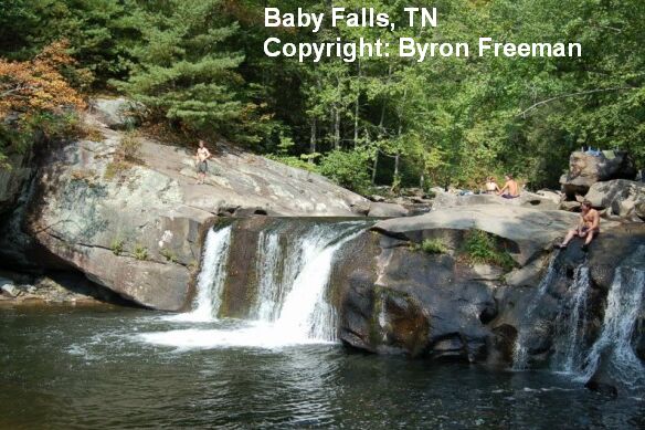
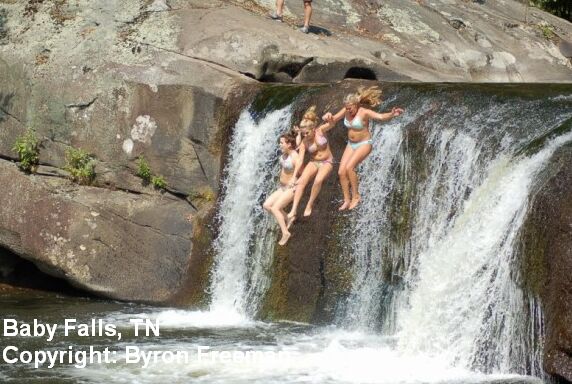
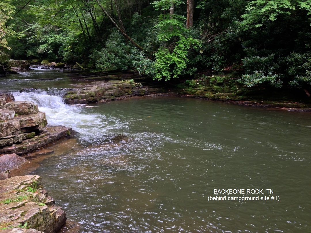
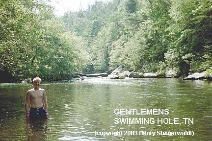
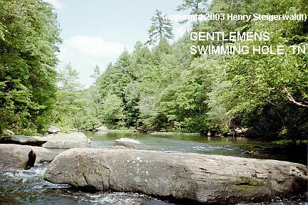
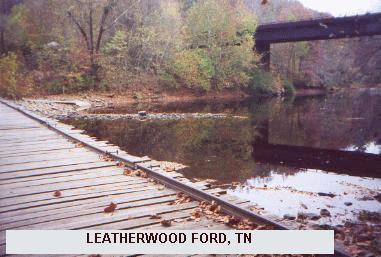
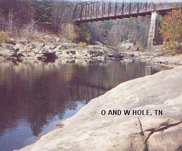
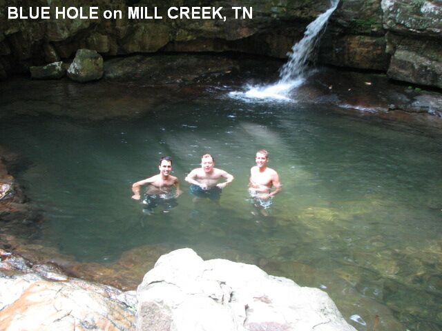
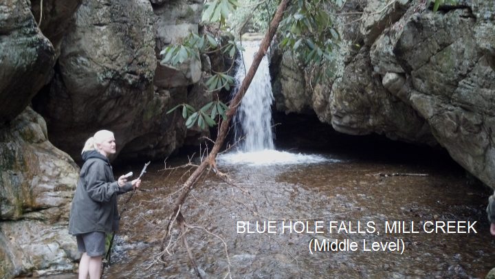
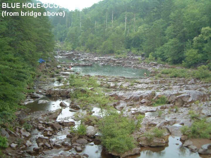
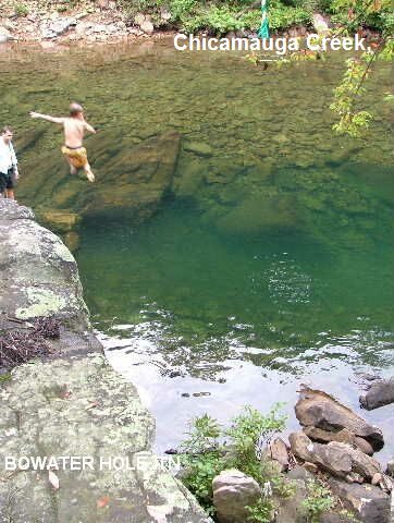
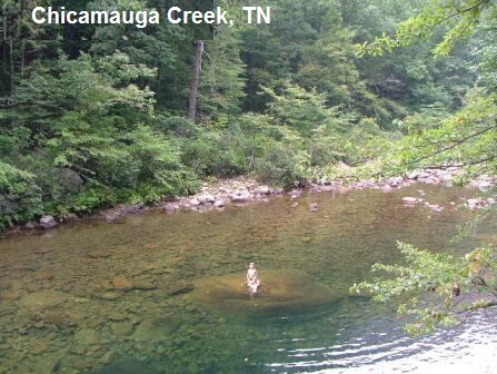
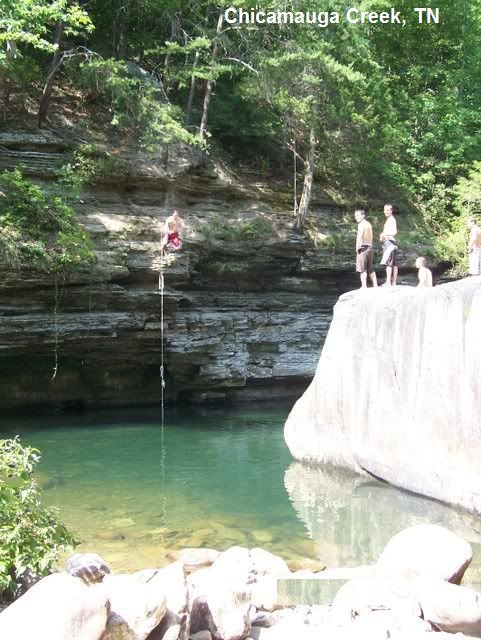
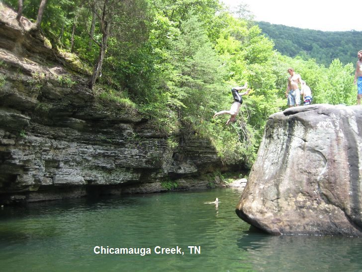
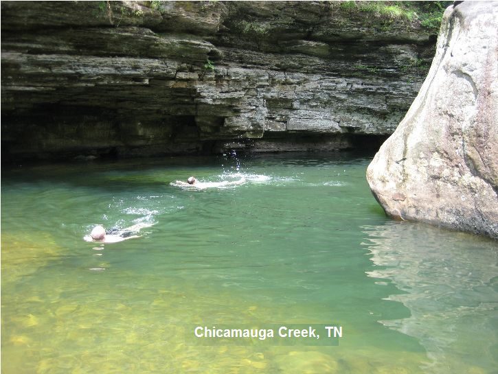
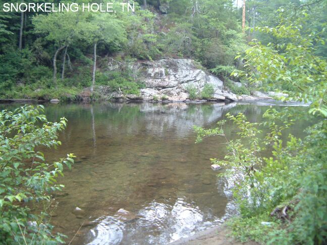
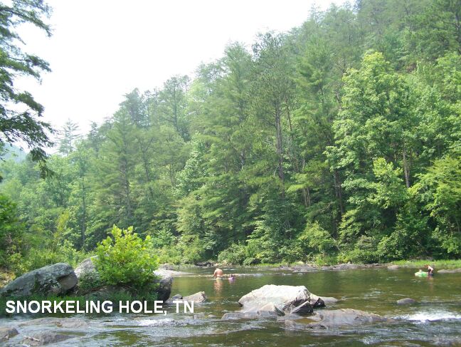
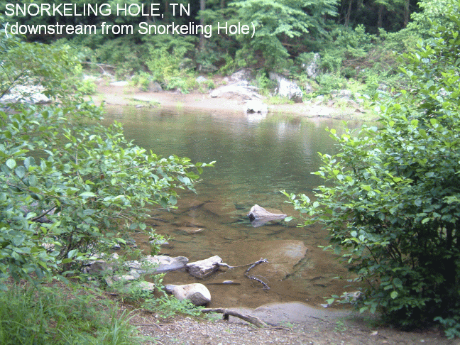
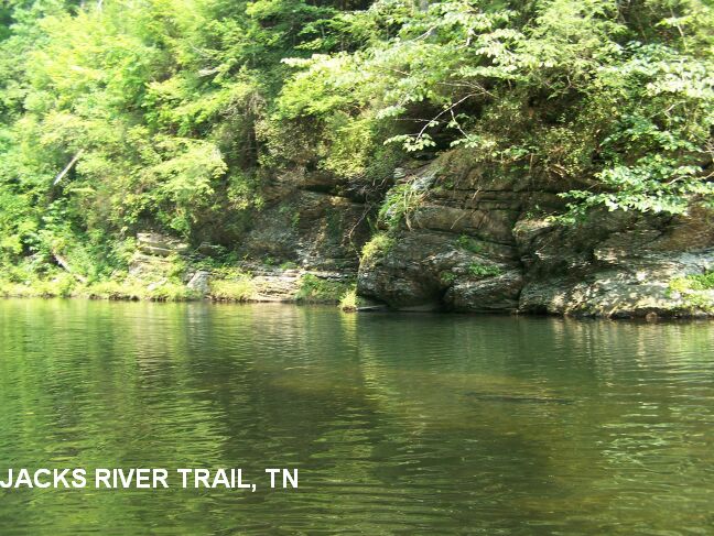
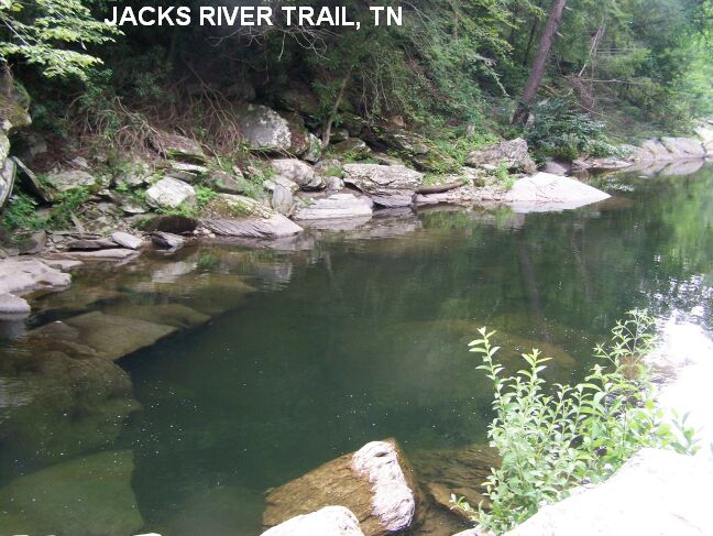
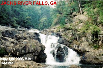
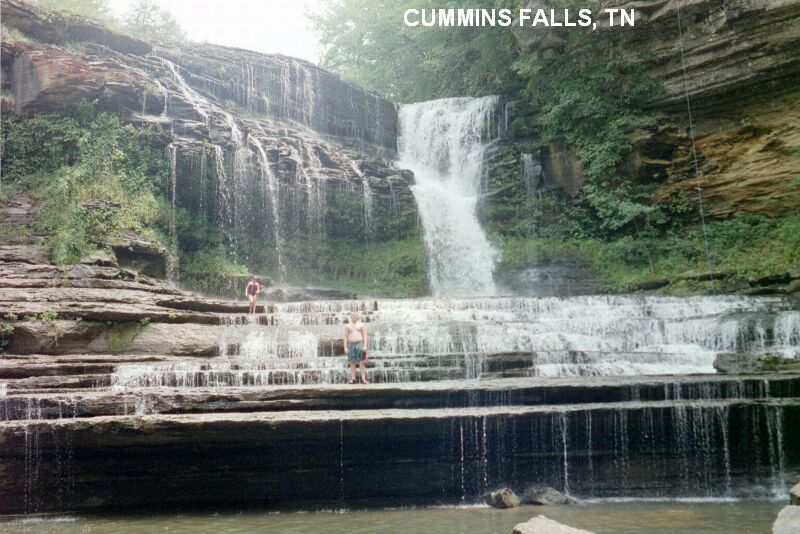
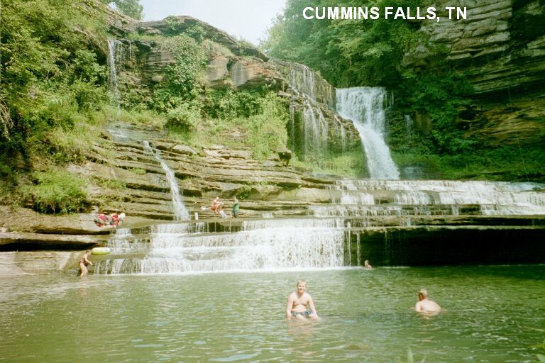
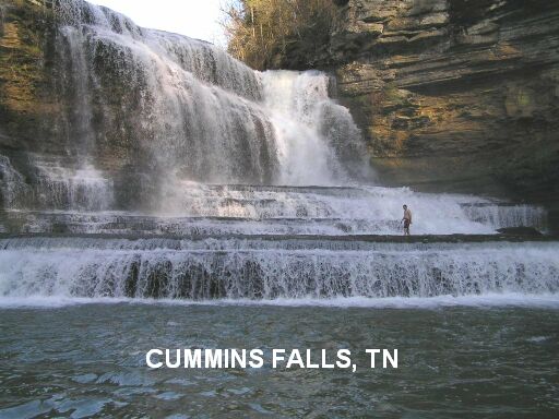
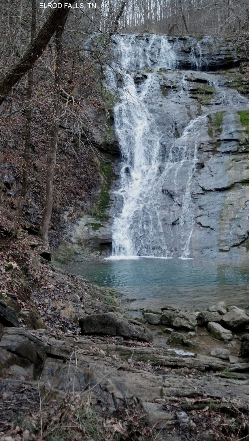
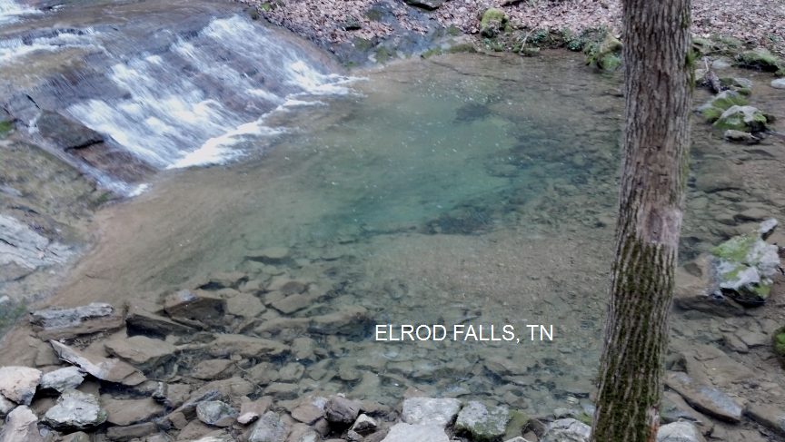
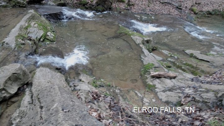
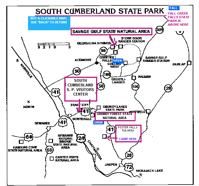
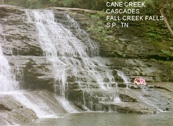
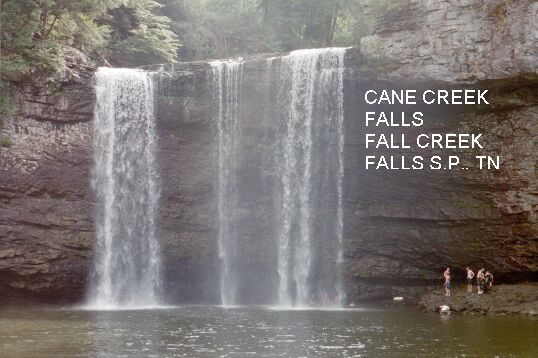
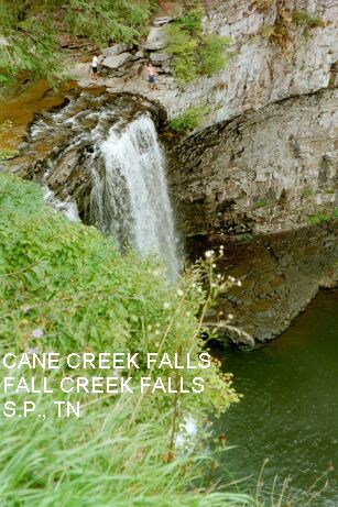
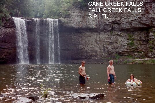
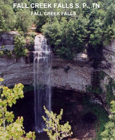
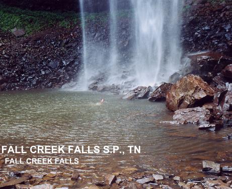
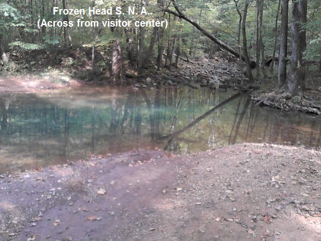
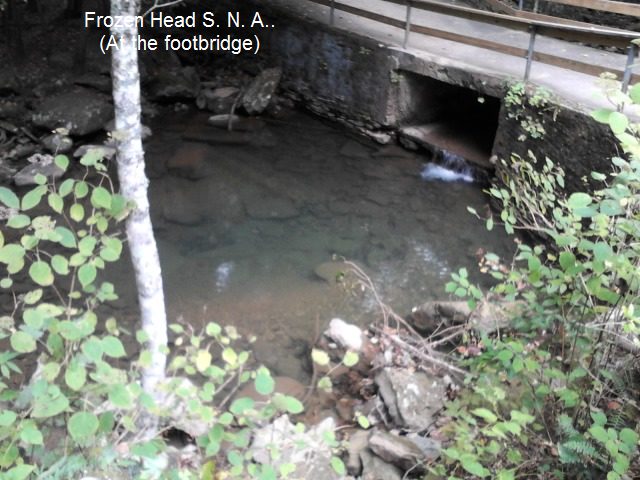
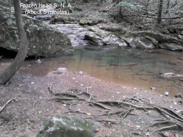
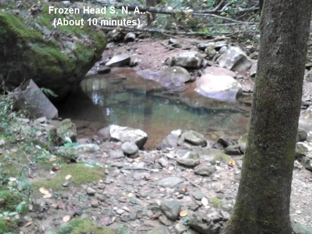
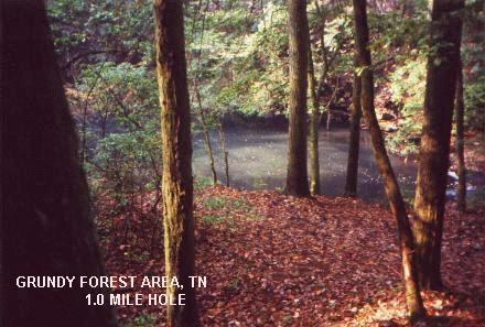
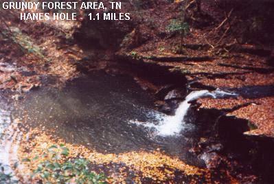
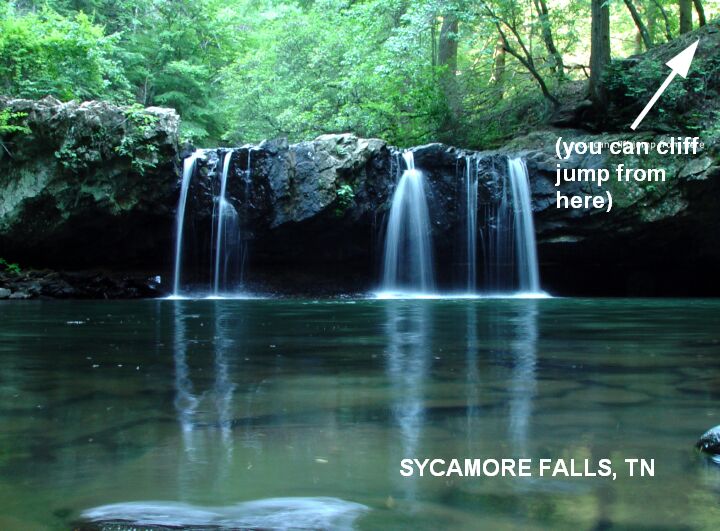
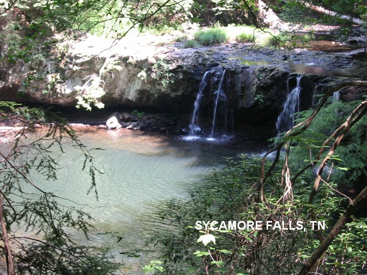
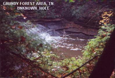
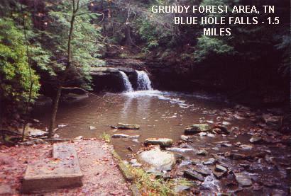
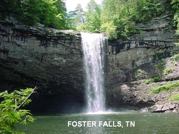
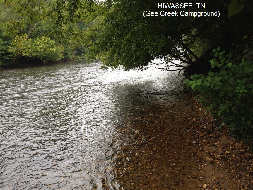
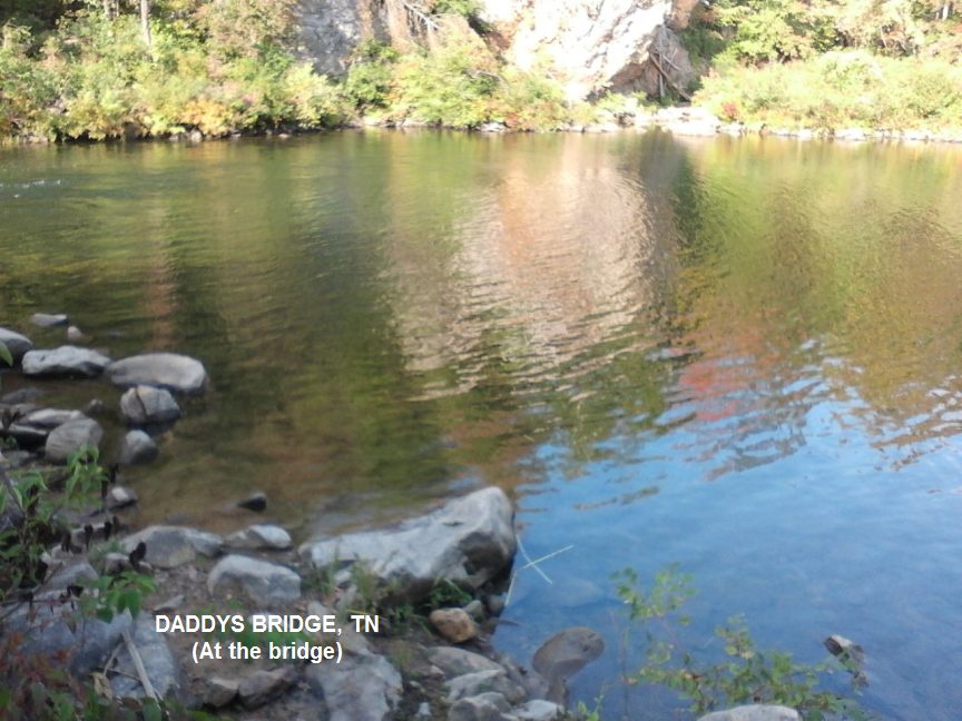
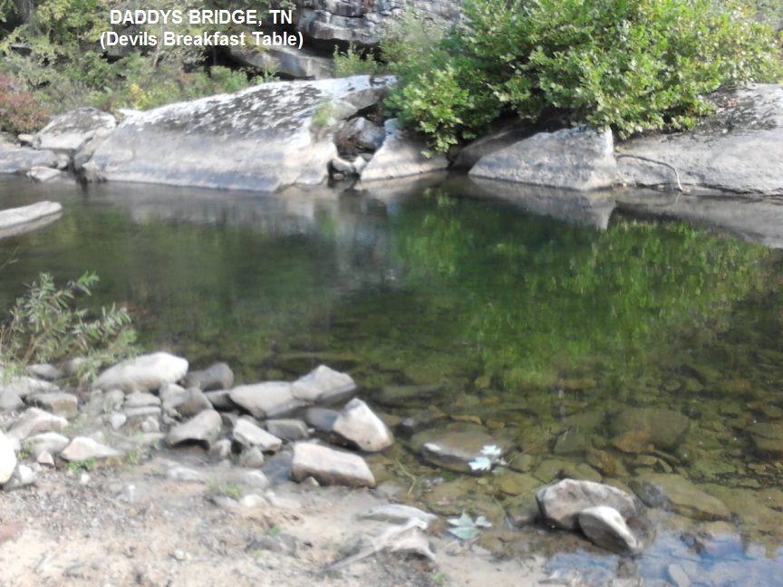
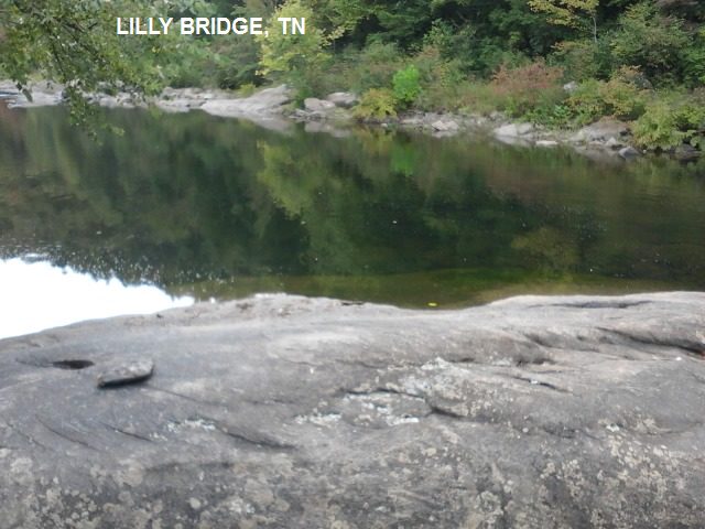
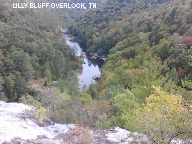
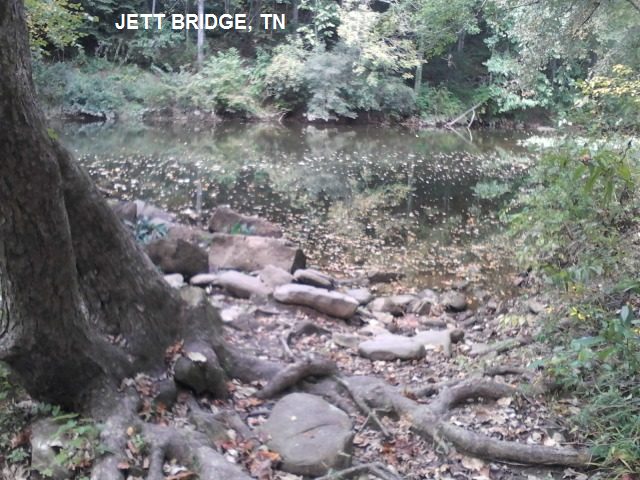
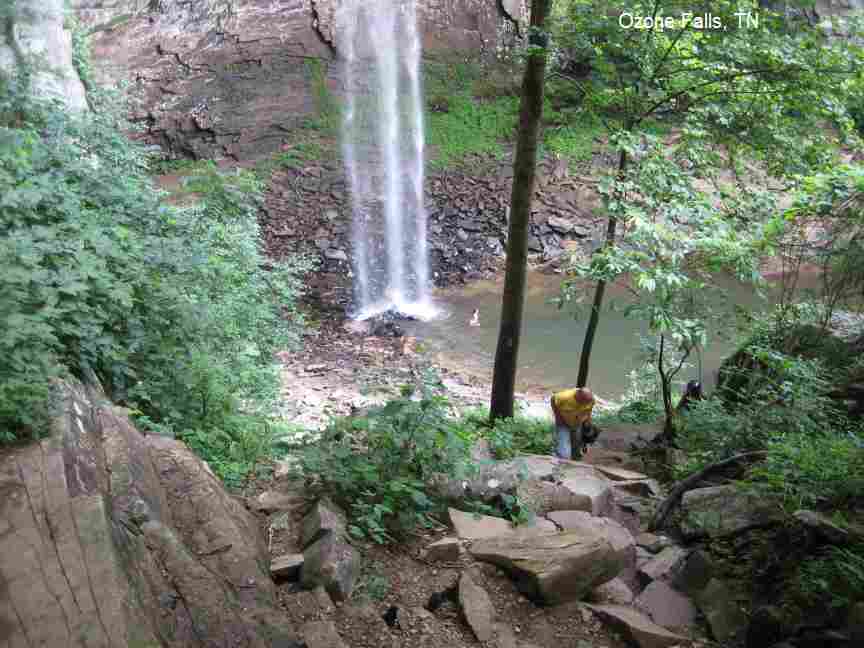
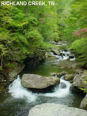
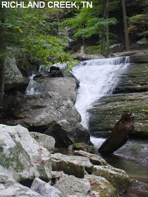
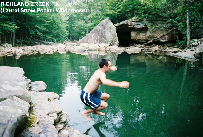
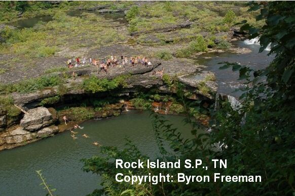
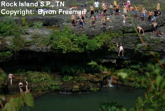
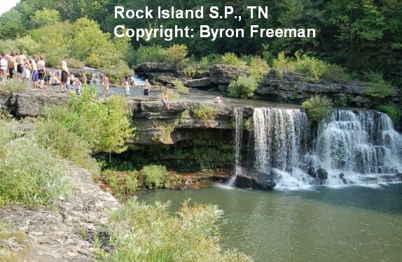
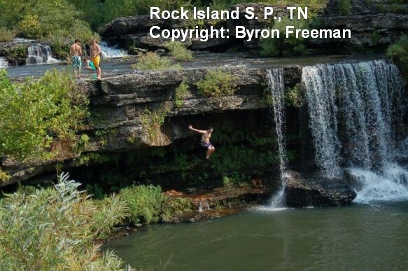
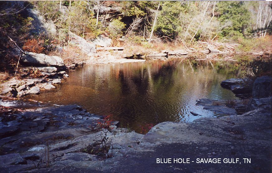
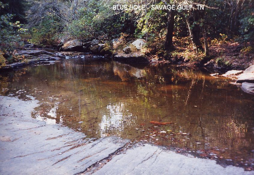
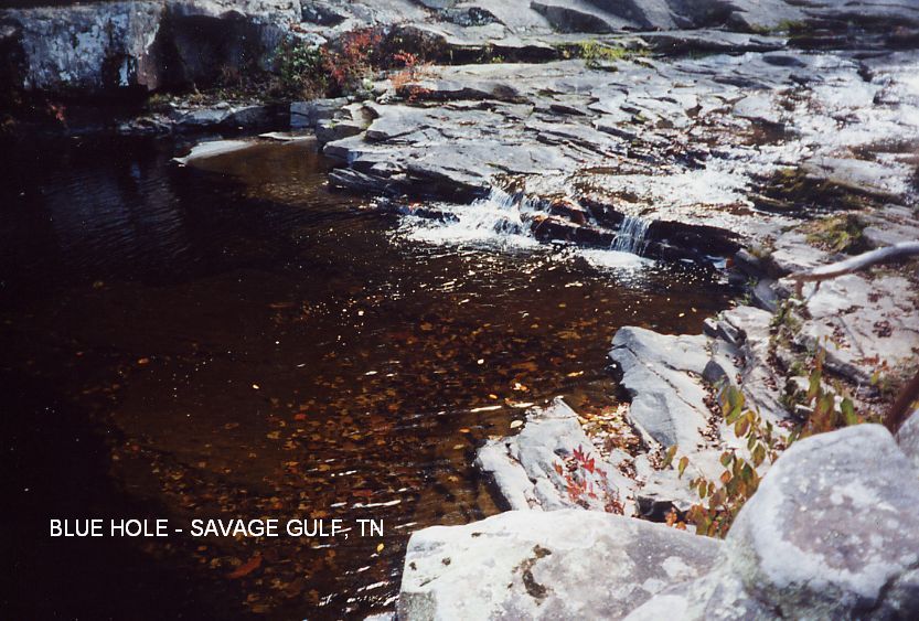
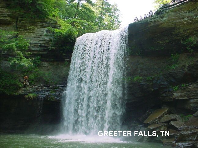
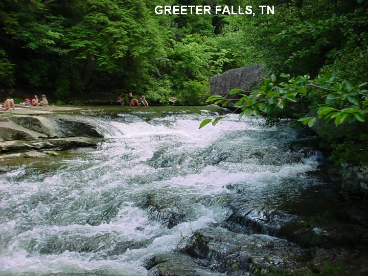
![TO SMOKY MOUNTAIN AREA MAP [180KB]](TNSMOK.jpg)
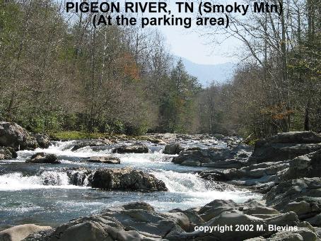
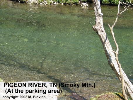
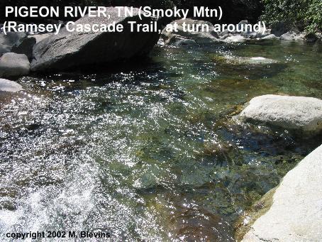
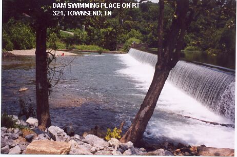
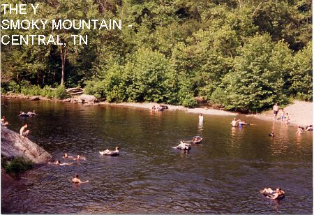
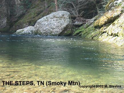
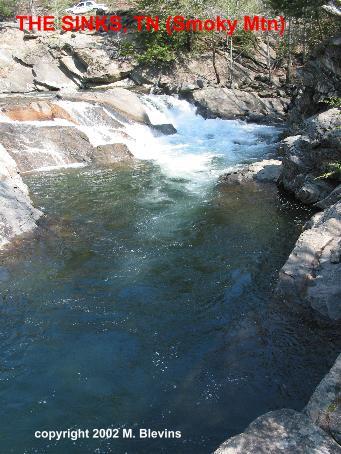
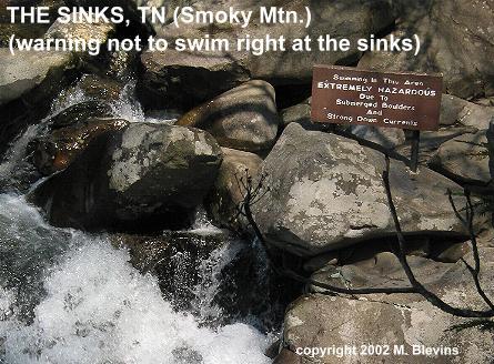
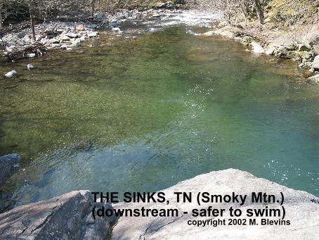
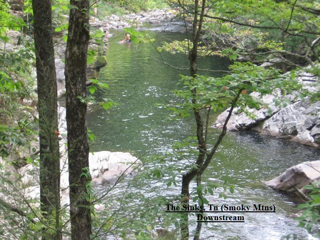
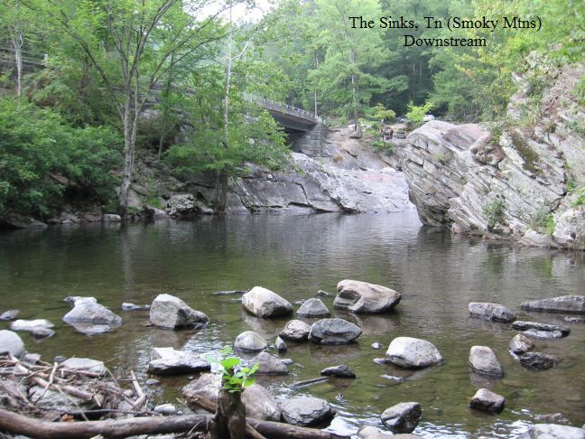
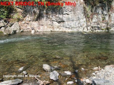
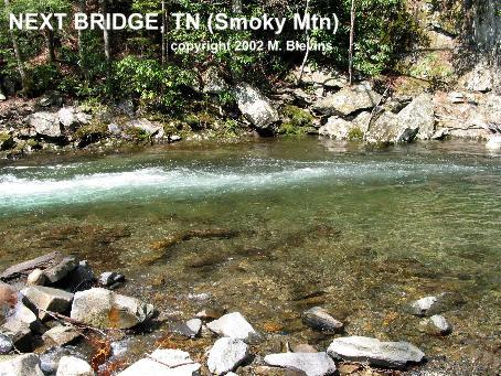
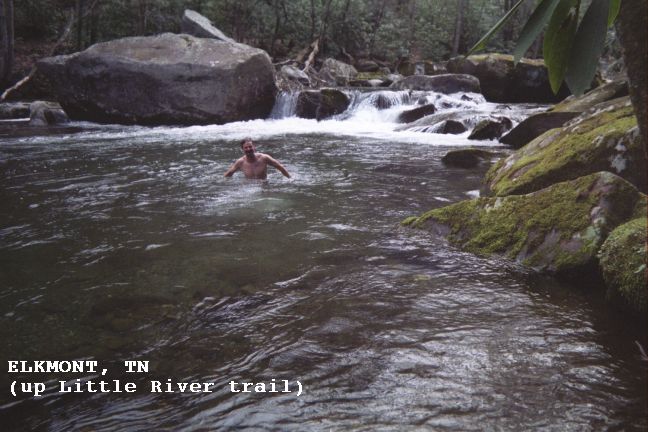
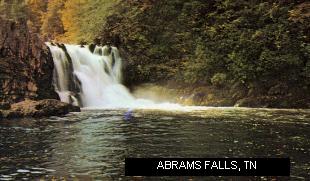
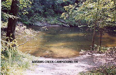
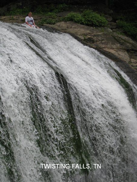
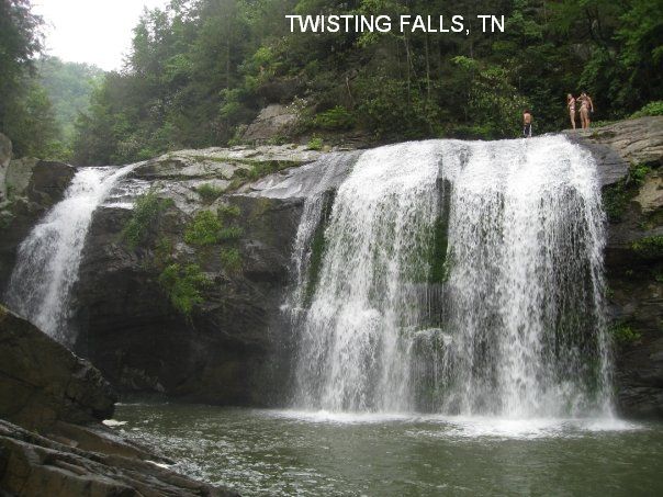
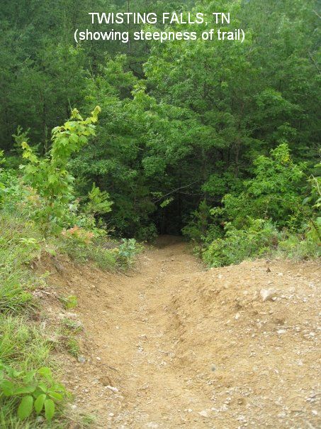
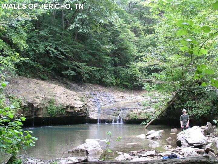
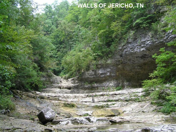