ONTARIO & QUEBEC |
|---|
Click here to see the home page and learn about swimming holes in other states
This swimming hole listing is by www.swimmingholes.org
|
| |
|---|---|---|
| TOWNS | NIAGRA FALLS (Canada), ST. CATHERINES | |
| LAT, LON | 43.11048,-79.26906 LINK TO GOOGLE MAP | |
| PROVINCE | ON | |
| WATER | unknown | |
| TYPE | River/Falls | |
| DESCRIPTION |
Hike to waterfall where you can swim in the relatively warm water below the falls. This from a recent visitor: "The hike to Decew Falls in Ontario is about 15 min to a half hr, but that's depending on which path you take. Both paths have ropes that you kind of rock climb down a hill with. I think it would be important to add that you have to use a rope to get down to the swimming hole in case people who aren't able to do that try to go there. Its not hard but it is steep and there's water that runs down the first rope. The second rope is easier (no water, less steep) but makes the hike about a half hour." | |
| AREAS | none | |
| SANCTION | Unofficial | |
| FEE | None | |
| FACILITIES | Unknown | |
| ACTIVITIES | Swimming | |
| PHONE | none | |
| CAMPING | none at site. | |
| BATHING SUITS | unknown | |
| DIRECTIONS |
From St. Catherine s (northwest of Niagara Falls, Canada) take RT 406 south then Decew Rd west. I think you access the river trail along this road. Take the trail that winds along beside the river to the falls. Swim at the falls. | |
| CONFIDENCE | Pretty Confident | |
| VERIFIED | No | |
| DATE UPDATED | 2/20/2016 |
This swimming hole listing is by www.swimmingholes.org
|
| |
|---|---|---|
| TOWNS | NOELVILLE, WOLSELEY BAY | |
| LAT, LON | lat=46.10047, lon=-80.16454, (source: map) (accuracy: approximate) LINK TO GOOGLE MAP | |
| PROVINCE | ON | |
| WATER | unknown | |
| TYPE | River | |
| DESCRIPTION | Also known as "The Washing Machine" because of the whirlpool there. To get here requires a boat and a 6 mile (each way) trip over the water. Swim in rapids and whirlpool. Also scuba diving. Best time are first weeks of August for fewer bugs and warmer water. Boats can be rented at Wolseley Bay (46.10567,-80.26706) or you can launch your own. Ask locally for over-the-water directions. Also, the coordinates above should be pretty accurate. | |
| AREAS | unknown | |
| SANCTION | Unofficial | |
| FEE | None | |
| FACILITIES | Unknown | |
| ACTIVITIES | Swimming | |
| PHONE | none | |
| CAMPING | none at site. | |
| BATHING SUITS | unknown | |
| DIRECTIONS | From Ottawa, go nw on RT 17 about 275 miles to Hager then RT 535 south to Noelville then take RT 64 and then unknown roads (ask locally) east to Wolseley Bay (46.10567,-80.26706). Rent or launch boat here and get directions to Five Finger Rapids. Ask locally for over-the-water directions. Also, the coordinates above should be pretty accurate. | |
| CONFIDENCE | Pretty Confident | |
| VERIFIED | No | |
| DATE UPDATED | 1/2011 |
This swimming hole listing is by www.swimmingholes.org
|
| |
|---|---|---|
| TOWNS | TORONTO, OWEN SOUND, BRUCE PENINSULA | |
| LAT, LON | lat=45.24468 lon=-81.5243, (source: map) (accuracy: approximate) LINK TO GOOGLE MAP | |
| PROVINCE | ON | |
| WATER | Georgian Bay | |
| TYPE | Bay/Cave | |
| DESCRIPTION | Way up northwest of Toronto is Bruce Peninsula National Park, between Lake Huron and the Georgian Bay. The Bay has created eroded areas including caves under overhanging cliffs. Hike about .5 hour then climb down the cliff to get to the caves and swimming places. Cold water. WEAR STURDY SHOES AND BE CAREFUL CLIMBING DOWN but pretty much anyone can do it. PARK WEB SITE , TRIP ADVISOR , MORE INFO . | |
| AREAS | Bruce Peninsula National Park | |
| SANCTION | Unofficial | |
| FEE | Unknown | |
| FACILITIES | Unknown | |
| ACTIVITIES | Swimming, Caving | |
| PHONE | Unknown | |
| CAMPING | At Cyprus Lake campground in the National Park. | |
| BATHING SUITS | Customary | |
| DIRECTIONS | (This is about 4 hours drive northwest of Toronto.) From Toronto, take RT 10 northwest to Chatsworth. In Chatsworth, join RT 6 going north and stay on RT 6 as it turns and twists all the way up to the Bruce Peninsula and the National Park there. In the park, turn east and go past the Cyprus Lake campground to where the road ends and there is a parking area. Park and hike about .5 hours to the Georgian Bay and the cliffs and caves below. | |
| CONFIDENCE | Pretty Confident | |
| VERIFIED | No | |
| DATE UPDATED | 12/2013 |
This swimming hole listing is by www.swimmingholes.org
|
| |
|---|---|---|
| TOWNS | SHERBROOKE, COOKSHIRE | |
| LAT, LON | lat=45.393146, lon=-71.555328, (source: map) (accuracy: approximate) LINK TO GOOGLE MAP | |
| PROVINCE | QC | |
| WATER | North Eaton River | |
| TYPE | River | |
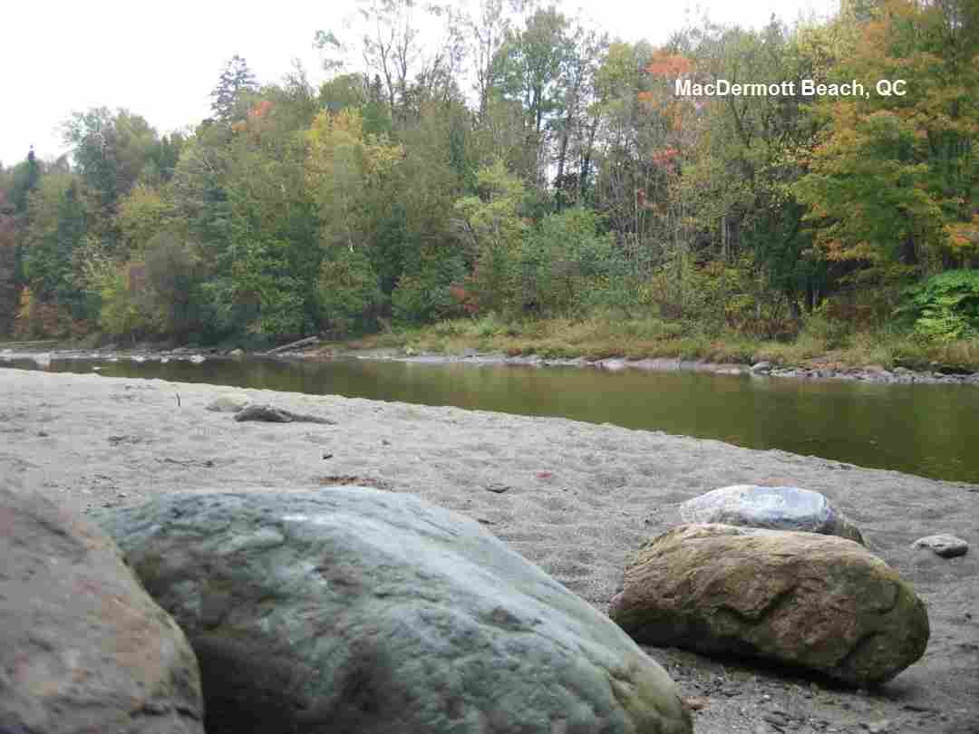
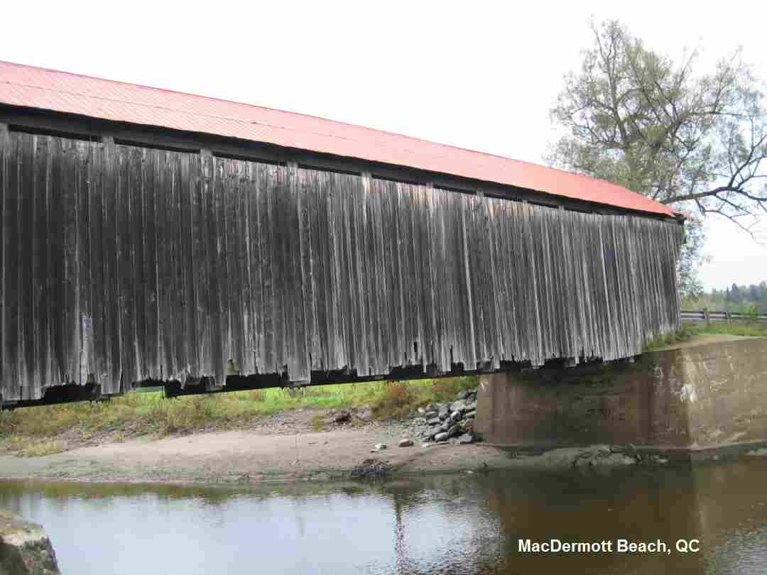
| DESCRIPTION | This is a riverside beach and swimming hole beside the historic McDermott covered bridge built in 1886. On McDermott road on the North Eaton river in a remote part of Quebec's Eastern Townships. It is deep enough to swim underwater and there is often a short swinging rope. The beach is on the shallow side of the river, away from the main current. It is located on a quiet road in the middle of quiet farmland, a few hundred feet from the main highway. The Quebec government calls it a pastoral setting. | |
| AREAS | none | |
| SANCTION | Unofficial | |
| FEE | None | |
| FACILITIES | None | |
| ACTIVITIES | Swimming | |
| PHONE | None | |
| CAMPING | None at site. | |
| BATHING SUITS | Customary | |
| DIRECTIONS | From Sherbrooke, go east on RT 108 to Cookshire. From Cookshire, take RT 212 southeast about 5 miles then turn right on MacDermott Rd.. Swimming place is under bridge over river. | |
| CONFIDENCE | Pretty confident | |
| VERIFIED | No | |
| DATE UPDATED | 1/2011 |
This swimming hole listing is by www.swimmingholes.org
|
| |
|---|---|---|
| TOWNS | TORONTO, PETERBOROUGH, COBOURG, BRIGHTON | |
| PROVINCE | ON | |
| WATER | Lake Ontario | |
| TYPE | Lake | |
| DESCRIPTION | Several sandy beaches on or near Lake Ontario - northeast of Toronto. For details, see DIRECTIONS below. | |
| AREAS | none | |
| SANCTION | Official | |
| FEE | None | |
| FACILITIES | Varies - see below | |
| ACTIVITIES | Swimming | |
| PHONE | None | |
| CAMPING | None at site. | |
| BATHING SUITS | Required | |
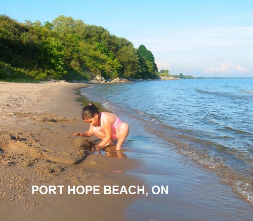
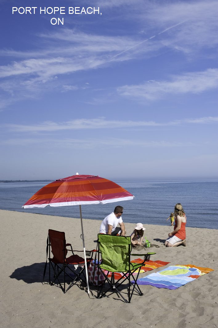
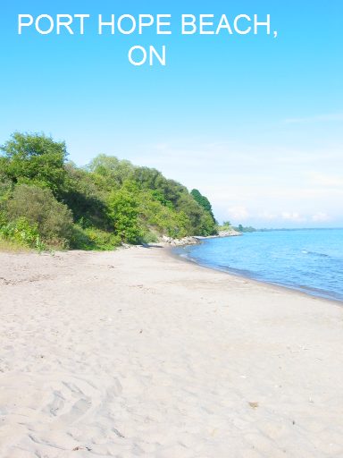
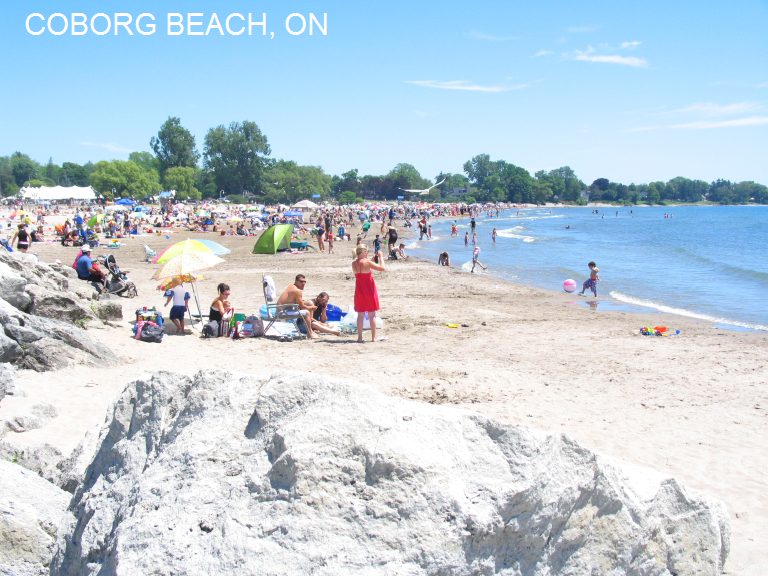
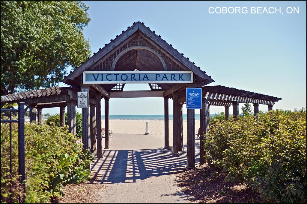
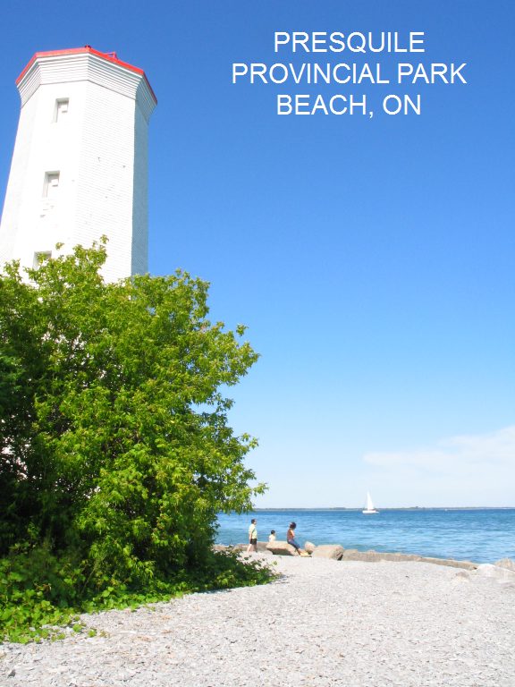
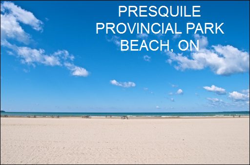
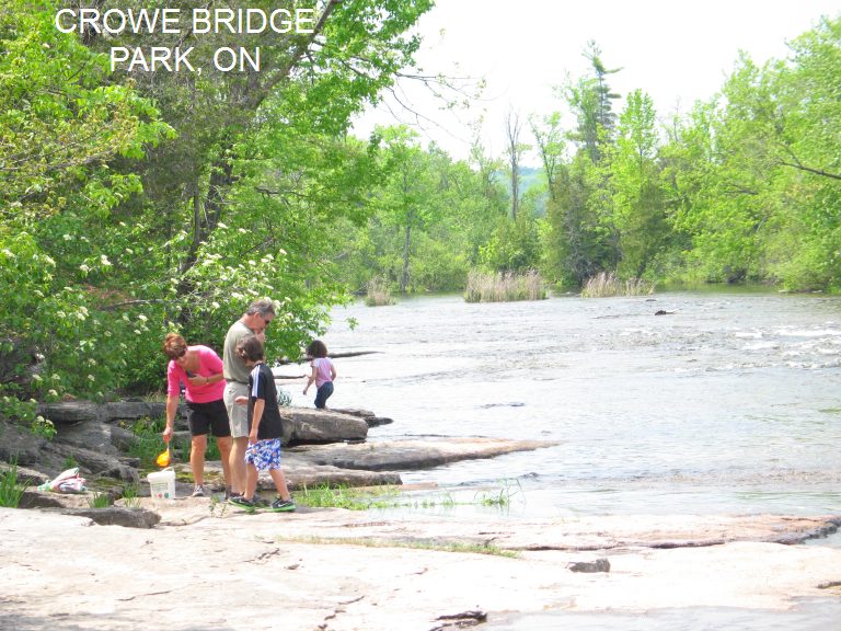
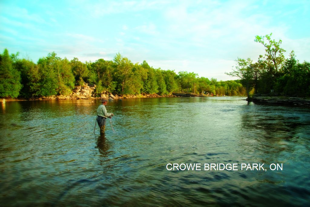
| DIRECTIONS | In Toronto, head north on RT 404 then turn northeast on RT 401. Go about 56 miles to the town of Port Hope. Then: PORT HOPE BEACH[PORH]: Sandy beach on Lake Ontario on the Waterfront Trail - walk .5 miles to the preserved main street of Port Hope. PHOTO , PHOTO , PHOTO . Has bathroom, playground. To get here, take RT 401 (McDonald/Cartier Hwy) to Port Hope at Exit 464 then go south and follow Ontario Street until you reach Lake Ontario and the Waterfront Trail. LAT, LON lat=43.94495 lon=-78.28951(source: map) (accuracy: approximate) LINK TO GOOGLE MAP Pretty confident. Verified by another. Updated 9/2014. COBOURG BEACH[COBO]: Sandy beach on Lake Ontario near the Waterfront Trail in Cobourg. Close to Cobourg historic district. PHOTO , PHOTO . Lifeguards in season. Has bathroom, showers, canteen, picnic shelter, small water park, playground. To get here, take RT 401 (McDonald/Cartier Hwy) to Cobourg at Exit 474 then go south and follow Division Street until you reach Lake Ontario and the Waterfront Trail. LAT, LON lat=43.95845 lon=-78.1639(source: map) (accuracy: approximate) LINK TO GOOGLE MAP Pretty confident. Verified by another. Updated 9/2014. PRESQUILE PROVINCIAL PARK BEACH [PRES]: Sandy beach on Lake Ontario in Presquile Provincial Park near Brighton. PHOTO , PHOTO .Beach is on the south shore of the park. Fee $15 per car. Camping at site. All facilities. To get here, take RT 401 (McDonald/Cartier Hwy) to Brighton at Exit 509 then go south on RT 30 into Brighton and take RT 2 west (right) and look for provincial park signs. LAT, LON lat=43.99528 lon=-77.7274(source: map) (accuracy: approximate) LINK TO GOOGLE MAP Pretty confident. Verified by another. Updated 9/2014. LOST BAY - DEVILS LAKE [LOSB]:NOTE: Can only be gotten to by boat or kayak from public boat launch. Bathing suits optional. This from a visitor: "Very private location no cottages, some camping on the weekend. Many exposed rock outcroppings for sunbathing and the water is perfect for swimming. Good weather will attract several couples and families to the many rocky outcroppings for day trips. there is one level spot that is popular for over night tent camping. There is a fire pit and a table made by previous campers. It is common practice to cleanup an leave nothing behind. No facilities." To get here, take RT 401 (McDonald/Cartier Hwy) east to Kingston. From Kingston, go north on Perth Rd to the Devil Lake public launch, head to the far north west bay (lost bay). INFO ABOUT THE PADDLING ROUTES . LAT, LON (of boat launch) lat=44.57599 lon=-76.42231(source: map) (accuracy: approximate) LINK TO GOOGLE MAP LAT, LON (of Lost Bay swimming place) lat=44.59096 lon=-76.43421(source: map) (accuracy: approximate) LINK TO GOOGLE MAP Pretty confident. Not verified. Updated 9/2014. CROWE BRIDGE PARK [CROW]: Swimming/water play in the Crowe River - limestone river bed, small stepped falls. PHOTO , PHOTO . Formerly a campground, the Crowe Bridge Park is now a nice place to picnic, hike the former campgrounds and paddle your feet in the shallow river in either the falls or the calm waters leading up to the falls. Is in the Crowe River Conservation Area. Has bathrooms. To get here, take RT 401 (McDonald/Cartier Hwy) to Exit 509 then go north on RT 30 into Campbellford then turn right on Bridge St. and cross the river then turn immediately left on Front St. N. (RT 38) and drive up the river. Stay on RT 38 as it bends right (east) away from the river then turn north (left) on Crowe River Rd.. Just before Crowe River Rd. crosses the river, Crowe Bridge Park will be on your left. LAT, LON lat=44.37986, lon=-77.75226(source: map) (accuracy: approximate) LINK TO GOOGLE MAP Pretty confident. Verified by another. Updated 9/2014. | |
| CONFIDENCE | Pretty confident | |
| VERIFIED | By another | |
| DATE UPDATED | 9/2014 |
This swimming hole listing is by www.swimmingholes.org
|
| |
|---|---|---|
| TOWNS | LONDON, ST. MARYS | |
| LAT, LON | lat=43.2487295, lon=-81.1516608 , (source: map) (accuracy: general area) LINK TO GOOGLE MAP | |
| PROVINCE | ON | |
| WATER | Quarry | |
| TYPE | Quarry | |
| DESCRIPTION | Town-operated quarry swimming with lifeguards, entry fee (about $5.00). | |
| AREAS | none | |
| SANCTION | Official | |
| FEE | About $5.00 | |
| FACILITIES | Unknown | |
| ACTIVITIES | Swimming | |
| PHONE | 519-284-2340 ext. 623 | |
| CAMPING | none at site. | |
| BATHING SUITS | required | |
| DIRECTIONS | Dont know exactly where this place is. It is in St. Mary's which is north of London. Should not be too hard to find - ask locally. No better directions. | |
| CONFIDENCE | Very confident | |
| VERIFIED | No | |
| DATE UPDATED | 1/2011 |
This swimming hole listing is by www.swimmingholes.org
HOME
|
| |
|---|---|---|
| LAT, LON | lat=45.64566, lon=-75.91859, (source: map) (accuracy: approximate) LINK TO GOOGLE MAP | |
| PROVINCE | QC | |
| WATER | Gatineau River | |
| TYPE | River | |
| DESCRIPTION | Long-time locally popular swimming place in the Gatineau River in Wakefield, with large, flat rocks to enter from and sunbathe on. Historic covered bridge above. While the public has used this spot to swim for many years, it is apparently privately owned. Be respectful of this heritage and do not leave trash or cause trouble. DO NOT JUMP FROM THE COVERED BRIDGE OVERHEAD, the police are enforcing and may issue citations for jumping from the bridge. | |
| AREAS | none | |
| SANCTION | Unofficial | |
| FEE | None | |
| FACILITIES | None | |
| ACTIVITIES | Swimming | |
| PHONE | None | |
| CAMPING | None at site. | |
| BATHING SUITS | Required | |
| DIRECTIONS | From Ottawa, go north on RT 93 / Rt 5 about 20 miles to until the end of RT 5 at Wakefield. Then go north on RT 105 and RT 366 east across the Gatineau River. Immediately after you cross the river go south (right) on Chemin de Wakefield Heights Rd.. Go about .3 miles down this road to the old covered bridge crosses the river. The rocks and swimming place are under the bridge. DO NOT JUMP FROM THE COVERED BRIDGE OVERHEAD, the police are enforcing and may issue citations for jumping from the bridge. | |
| CONFIDENCE | Pretty confident | |
| VERIFIED | No | |
| DATE UPDATED | 9/2014 |