
Click here to see the home page and learn about swimming holes in other states
This swimming hole listing is by www.swimmingholes.org
|
TOWNS | COLUMBUS, DELAWARE, SUDBURY | LAT, LON | lat=40.28915 lon=-82.95553(source:map) (accuracy:approximate) | LINK TO GOOGLE MAP
STATE | OH |
WATER | Alum Creek Reservoir |
TYPE | Lake |
DESCRIPTION | This from a skinny-dipping fan: "At Alum Creek Reservoir (north of Columbus) - there are many coves and rocky/gravelly outcroppings on the east side of the lake, north of the RT 36/37 bridge, and in particular north of the Howard Rd. bridge. RESERVOIR MAP . From the put-in boat ramp on the east side of the Howard Rd. bridge, it is a 15-30 minute paddle in a canoe to a number of places where swimming and skinny dipping are safe and possible." | "There is enough visibility to see if anyone is coming (e.g. other boats) and cover up - technically nudity is not allowed but there aren't many people up in the area and I have never had a problem. The areas I am talking about are pretty challenging to reach on foot - I haven't seen many hikers. My favorite place is a wide semi-circular cliff about 1/2 mile north of Howard Road on the east side of the lake; there are narrow gravel "beaches" at the base of the cliff on the north end of it." If you dont have a boat, park at the boat ramp as above and walk across Howard Rd. (dont walk across the bridge) to the north. There is a trail through the woods, that brings you to good lake access about 1/2 mile north."
AREAS | Alum Creek Reservoir |
SANCTION | Unofficial |
FEE | None |
FACILITIES |
None |
ACTIVITIES |
Swimming |
PHONE | None |
CAMPING | None at site |
BATHING SUITS | Optional (in places) |
DIRECTIONS | From Columbus, take I-71 north to Exit 131 at RT 36/37. Go west on RT 36/37 a short way then turn north (right) on RT 35 (N 3 Bs and K Rd.) then turn west (left) on Howard Rd.. Just before you come to the bridge over the Reservoir, there is a public boat ramp on the south (left) side of Howard Rd.. Park here and proceed as above in the DESCRIPTION depending if you have a boat or not.
|
CONFIDENCE | Pretty confident |
VERIFIED | By another |
DATE UPDATED | 12/2013 | |
|---|
This swimming hole listing is by www.swimmingholes.org
|
TOWNS | WHEELING (WV), CAMBRIDGE (OH), BARNESVILLE (OH), WOODSFIELD (OH) | LAT, LON | lat=39.78015, lon=-81.05743(source:map) (accuracy:approximate) | LINK TO GOOGLE MAP
STATE | OH |
WATER | Sunfish Creek |
TYPE | Creek |
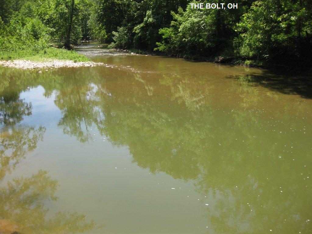
DESCRIPTION | This from a fan:� It is a swimming hole that is 5 or 6 ft. deep. It has been said that Sunfish Creek is one of the few creeks where you are cleaner coming out than going in. We heard it is called The Bolt because back in the 20's or 30's someone drilled into the big rock and bolted a diving board to it. When I met my husband there 41 years ago, big pieces of the iron bolt were still there. We went back this summer to celebrate our 40th anniversary, and while almost everything is the same, there isn't as much of the iron left as once was." |
AREAS | None |
SANCTION | Unofficial |
FEE | None |
FACILITIES |
None |
ACTIVITIES |
Swimming |
PHONE | None |
CAMPING | None at site |
BATHING SUITS | Unknown |
DIRECTIONS | From Woodsfield (which is about 10 miles south of I-70 about half way between Wheeling (WV) and Cambridge (OH)- it is also a short way southeast of Barnesville): In Woodsfield, get on RT 26 north. Drive about 4.5 miles, staying on RT 26 as it turns often. You'll go down a steep winding hill, cross a small bridge over Sunfish Creek, then start up another hill. Start watching for a small pull off on the right side of the road. There is a worn path to The Bolt there. Follow it down to the creek, and you'll come to a huge boulder. The swimming hole is here.
|
CONFIDENCE | Pretty confident |
VERIFIED | By another |
DATE UPDATED | 12/2013 | |
|---|
This swimming hole listing is by www.swimmingholes.org
|
TOWNS | CLEVELAND, CHAGRIN FALLS |
STATE | OH |
WATER | Chagrin River |
TYPE | River/Falls |
DESCRIPTION | The Chagrin River goes through the town of Chagrin Falls southeast of Cleveland and has a number of falls and swimming places. See DIRECTIONS below for details. |
AREAS | Varies-see below |
SANCTION | Unofficial |
FEE | None |
FACILITIES |
Unknown |
ACTIVITIES |
Swimming |
PHONE | Unknown |
CAMPING | None at site |
BATHING SUITS | Customary |
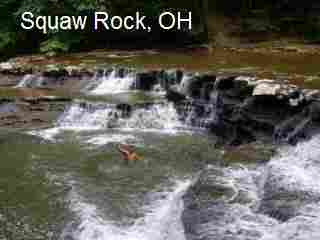
DIRECTIONS | From the town of Chagrin Falls southeast of Cleveland: | CHAGRIN FALLS [CHAG]: The town is named after the falls which are right in town. It is a 20 ft. water fall right smack in town where you can usually swim and fish in the hole at the bottom with no problem. PHOTO . Dont jump here as the police may come after you. The swimming hole is like a half acre, depth of 10-15ft and water is really nice end of summer but very cold until then. Follow the signs to the Chagrin Falls viewing area then and take the worn down to the falls and swimming hole. LAT, LON : lat=41.43113, lon=-81.39210(source:map) (accuracy:approximate) LINK TO GOOGLE MAP. SQUAW ROCK [SQUA]: In the South Chagrin Reservation (a Cleveland Metro Park), southwest of Chagrin Falls, there is a broad, low horseshoe-shaped falls with water play and swimming (depending on depth) below the falls. To locals this place will always be known as Squaw Rock, but officially the name has been changed to Henry Church Rock. Here the Chagrin River drops about 20 feet over a flat shale rocks into the pool. PHOTO . In most areas the river is very shallow but at the bottom of the falls may be 4-5 feet deep. The river is rarely more than half a foot deep in most places, but at the base of the falls there are depths of 3 to 4 feet. To get here from Chagrin Falls (southeast of Cleveland), take Maple St. west then Miles Rd. west and enter the South Chagrin Reservation. Follow the signs to "Squaw Rock" then take the Squaw Rock Trail path down to the river. It is a short trail but is narrow and sloping along the river. LAT, LON : lat=41.41571, lon=-81.42236(source:map) (accuracy: General Area) LINK TO GOOGLE MAP.
CONFIDENCE | Pretty confident |
VERIFIED | No |
DATE UPDATED | 2/2011 | |
|---|
This swimming hole listing is by www.swimmingholes.org
|
TOWNS | MANSFIELD, BELLVILLE | LAT, LON | lat=40.6021, lon=-82.4744(source:DeLorme) (accuracy:exact) | LINK TO GOOGLE MAP
STATE | OH |
WATER | Clear Fork River |
TYPE | River |
DESCRIPTION | Swimming hole in northern Ohio on the Clear Fork River. Deep end, shallow area, grassy beach. Suitable for kids, place to jump. AS OF 7/06, POSTED NO TRESPASSING but folks are still swimming there. |
AREAS | None |
SANCTION | Unofficial |
FEE | None |
FACILITIES |
Unknown |
ACTIVITIES |
Swimming |
PHONE | Unknown |
CAMPING | East of here on RT 97 at Mohican Memorial S. F. |
BATHING SUITS | Required |
DIRECTIONS | From Mansfield, take RT 13 south to Bellville then RT 97 east about 2.5 miles and turn south (right) on Dill Rd. then west (right) on Gatton Rocks Rd. Go about .15 miles to the swimming hole (near the Wade-Gatton Nursery.)
|
CONFIDENCE | Pretty confident |
VERIFIED | No |
DATE UPDATED | 3/4/2007 | |
|---|
This swimming hole listing is by www.swimmingholes.org
|
TOWNS | CINCINNATI, DAYTON, XENIA, YELLOW SPRINGS |
STATE | OH |
WATER | Little Miami River, Caesars Creek |
TYPE | River/Creek |
DESCRIPTION | The Little Miami River and Caesar's Creek, in the area near Xenia, are paralleled by paths and offers hiking, biking and swimming opportunities. See DIRECTIONS below for details. |
AREAS | Varies-see below |
SANCTION | Unofficial |
FEE | None |
FACILITIES |
Unknown |
ACTIVITIES |
Swimming |
PHONE | Unknown |
CAMPING | Nearby at John Bryan State Park or at Caesar Creek State Park |
BATHING SUITS | Varies-see below |
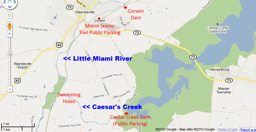
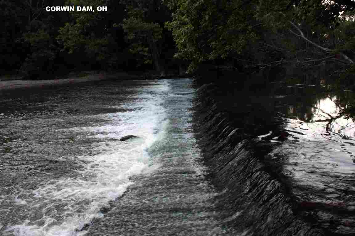
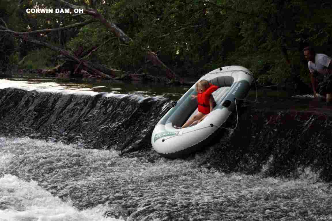
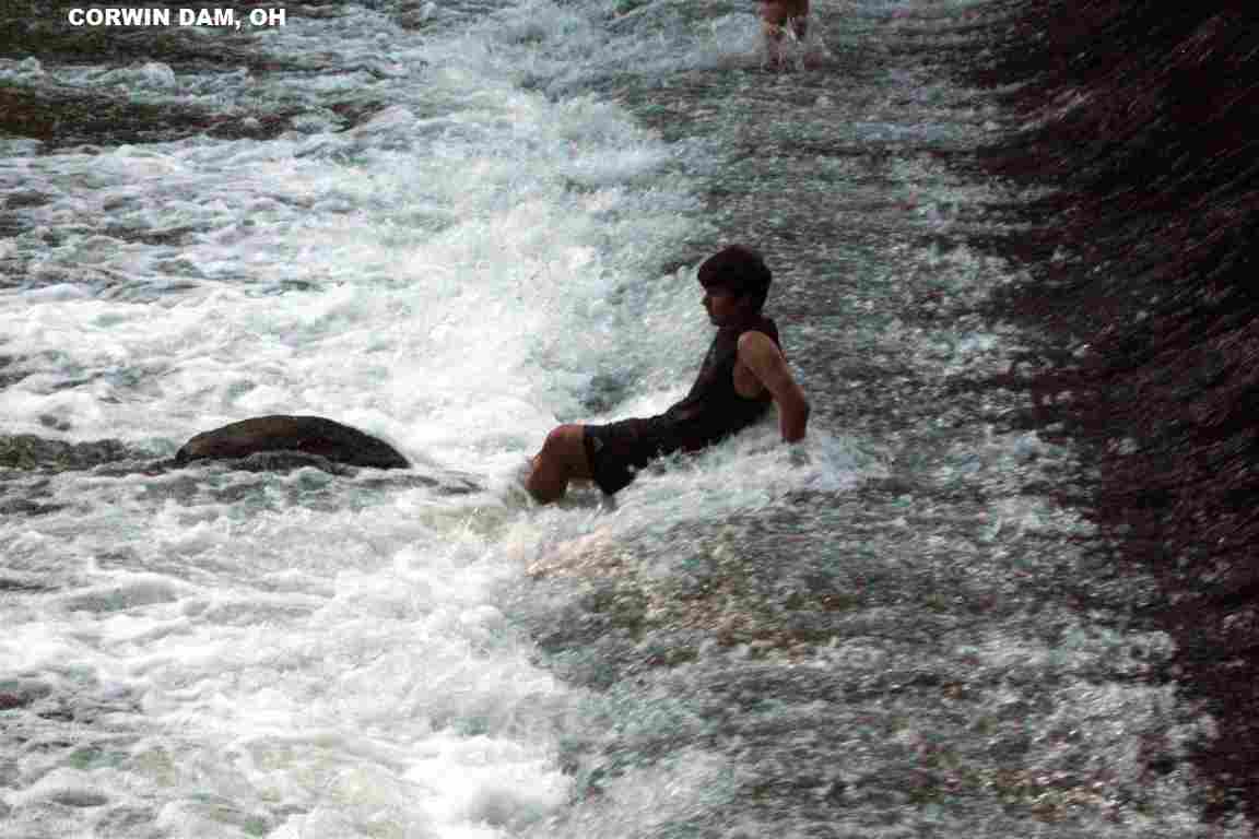
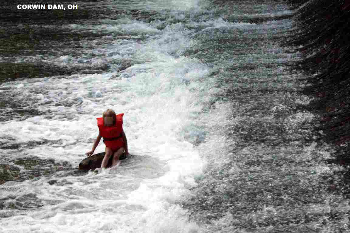
DIRECTIONS | Places are near Xenia, most directions are from Xenia: | CAESARS CREEK [CAES]: A section of Caesar's Creek, near the Little Miami River, about 1 mile long with many places where people swim and skinny dip. There are dozens of great swimming holes on this section of river, accessible only by trails. Two ways to get here: You can access them either by parking at the Caesar's Creek dam see map and walking the trails West along Caesar's Creek, or you can park in Corwin (see Miami Scenic Trail Public Parking on map) and walk South on the Scenic Trail (bike path) until you get there. Either way you're looking at a 2-4 mile hike. There are some more remote places where bathing suits may be considered optional. There is a large campground there in the Caesar Creek State Park which is a few miles away. The nearest public phone and restrooms is at the lower dam parking area and in Corwin where there are restrooms and payphones along the bike path. LAT, LON : lat=39.49133, lon=-84.09925(source:DeLorme) (accuracy:approximate) LINK TO GOOGLE MAP. To get here from Xenia, take RT 42 south to Waynesville. In Waynesville, go east on North St/Corwin Rd. to Corwin. To walk south from Corwin, park in Corwin at the at Miami Scenic Trail Public Parking. To walk West from the Caesars Creek Dam, in Corwin go east on Clarksville Rd. (County Rd 37). Park at the "Lower Dam" parking area at the Caesar�s Creek Dam, then walk across the old bridge across the river and turn down stream. After crossing the second old agricultural bridge, you will start to see some swimming holes. CAUTION There is a slight chance that they may open a flood gate at the dam and water levels will rise quickly, and you will get a little flash flood. A horn is supposed to warn persons downstream before this happens. This shouldn't cause a problem, unless you get to far from shore or are a poor swimmer. Very confident. Not verified. Updated 7/2010.
OREGONIA: (OREG) Two swimming places very close together in the Little Miami River near Oregonia. Bathing suits are required. LAT, LON : lat=39.4519, lon=-84.0977(source:DeLorme) (accuracy:approximate) LINK TO GOOGLE MAP. To get here from Caesar's Creek (above), continue south on Corwin Rd. (also known as Little Miami river road) to RT 12 just north of Oregonia. The first swimming place is where RT 12 (Oregonia road) crosses a new bridge spanning the Little Miami. The second Oregonia place is about .25 miles down-stream in the village of Oregonia itself at the site of the old bridge. The two sites are close enough that you can swim back and forth between them. Pretty confident. Not verified. Updated 11/27/2004. FIRST PLACE: The little Miami runs under the new RT 12 bridge in a long slower moving section of water. Access is by trails running down from the bridge. There are small sandy areas big enough for 2 or 3 people to lay out on towels at the edge of the water, and you can also lay under the bridge if you want. Nearby trees provide shade if desired. This is an established, tolerated swimming hole that people use daily and that appears to be a perfectly legal place to swim. There are no posted "no swimming" signs. Signs prohibit jumping from bridge. SECOND PLACE: This site is at the north end of the town of Oregonia where the old "jumping" bridge used to cross the river before it collapsed. No more jumping, but people still swim in the river here, and this is where the locals go to cool off on warm afternoons. KIL-KARE HOLE: (KILK) Swimming hole in the Little Miami River between Dayton and Xenia, under a bridge that carries the bikeway across the river. In the Little Miami State Scenic Preserve. Clear and cool. Bathing suits are needed at this exposed site. LAT, LON : lat=39.7067, lon=-83.9992(source:Topozone) (accuracy:exact) LINK TO GOOGLE MAP. This report from a visitor in 2010:"I would like to confirm that the location you have for Kil Kare in Ohio is accurate. Very nice place to go. About 15 minute hike to get to location. Rope swing and something to jump off as well, plenty deep and safe." To get here from Xenia, go west on RT 35 (toward Dayton) and turn north (right) at signs to the "Kil-Kare" speedway (this may be signed either Trebein Rd. or Valley Rd.). Follow the Kil-Kare signs then, when the road crosses the bike path, stop and hike about .25 mile west (to the left) to the bikeway (old railroad) bridge over the Little Miami River. The swimming hole is right at the bridge. Pretty confident. Verified by another. Updated 2/2011.
CONFIDENCE | Pretty confident |
VERIFIED | No |
DATE UPDATED | 2/2011 | |
|---|
This swimming hole listing is by www.swimmingholes.org
|
TOWNS | CLEVELAND, YOUNGSTOWN, WARREN, GARRETTSVILLE | LAT, LON | lat=41.31875, lon=-81.03567(source:map) (accuracy:approximate ) | LINK TO GOOGLE MAP
STATE | OH |
WATER | Quarry |
TYPE | Quarry |
DESCRIPTION | Privately owned quarry park with swimming, camping and other events. Beautiful blue-green water, swimming beach and cliff jumping. Photos and lots of info on their WEB SITE . |
AREAS | Nelson Ledges Quarry Park (This is NOT the Nelson Kennedy Ledges State Park, which is nearby) |
SANCTION | Official |
FEE | Yes, see web site |
FACILITIES |
All facilities |
ACTIVITIES |
Swimming, jumping |
PHONE | 440-548-2716 |
CAMPING | At site |
BATHING SUITS | Required |
DIRECTIONS | From Youngstown, take RT 422 northwest through Warren then RT 305 west (left) then Nelson Ledge Rd. north (right) to the signs for Nelson Ledges Quarry Park (This is NOT the Nelson Kennedy Ledges State Park, which is nearby). |
CONFIDENCE | Very confident |
VERIFIED | No |
DATE UPDATED | 2/2011 | |
|---|
This swimming hole listing is by www.swimmingholes.org
| NO PHOTOS | |
|---|---|---|
| TOWNS | CLEVELAND,CHAGRIN FALLS, BURTON | |
| LAT, LON | lat=41.457, lon=,-81.213(source:map) (accuracy:approximate ) LINK TO GOOGLE MAP | |
| STATE | OH | |
| WATER | Lake | |
| TYPE | Lake | |
| DESCRIPTION | Small swimming beach on a secluded natural lake. Families picnic place, never crowded WEB SITE . | |
| AREAS | Punderson State Park | |
| SANCTION | Official | |
| FEE | Unknown | |
| FACILITIES | All facilities | |
| ACTIVITIES | Swimming, Water play | |
| PHONE | 440.564.2279 | |
| CAMPING | At site | |
| BATHING SUITS | Required | |
| DIRECTIONS | From the east side of I-271 (Cleveland Outerbelt) take exit 29 (at Moreland Hills) and RT 87 east (variously named Woodmere, Woodland and Kinsman Rd). Stay on RT 87 east for about 20 miles to signs for Punderson State Park. | |
| CONFIDENCE | Very confident | |
| VERIFIED | No | |
| DATE UPDATED | 10/2014 |
This swimming hole listing is by www.swimmingholes.org
| |
TOWNS | PITTSBURGH (PA), EAST LIVERPOOL (OH), CALCUTTA (OH), FREDERICKTOWN (OH) | LAT, LON (of parking) | lat=40.712061 lon=-80.546578 (source: measured by another) (accuracy: approximate) | LINK TO GOOGLE MAP
STATE | OH |
WATER | North Fork of Little Beaver Creek |
TYPE | Creek |
DESCRIPTION | Access to this swimming hole has been permanently
closed. Please do not visit this place. | https://www.reviewonline.com/news/community-news/2017/05/beaverkettle-farms-closes-to-public/
AREAS | Beaverkettle wildlife sanctuary |
SANCTION | Unofficial |
FEE | None |
FACILITIES |
None |
ACTIVITIES | None |
PHONE | None |
CAMPING | None at site |
BATHING SUITS | Not Applicable |
DIRECTIONS | No directions are give as this site is not permanently
closed. |
CONFIDENCE | Confident |
VERIFIED | By another |
DATE UPDATED | 06/2019 | |
|---|
This swimming hole listing is by www.swimmingholes.org
|
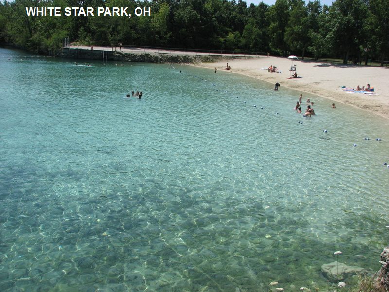
TOWNS | COLUMBUS, DELAWARE, SUDBURY | LAT, LON | lat=41.373137 lon=-83.318731(source: measured by another) (accuracy:approximate) | LINK TO GOOGLE MAP
STATE | OH |
WATER | White Star Quarry |
TYPE | Quarry/Lake |
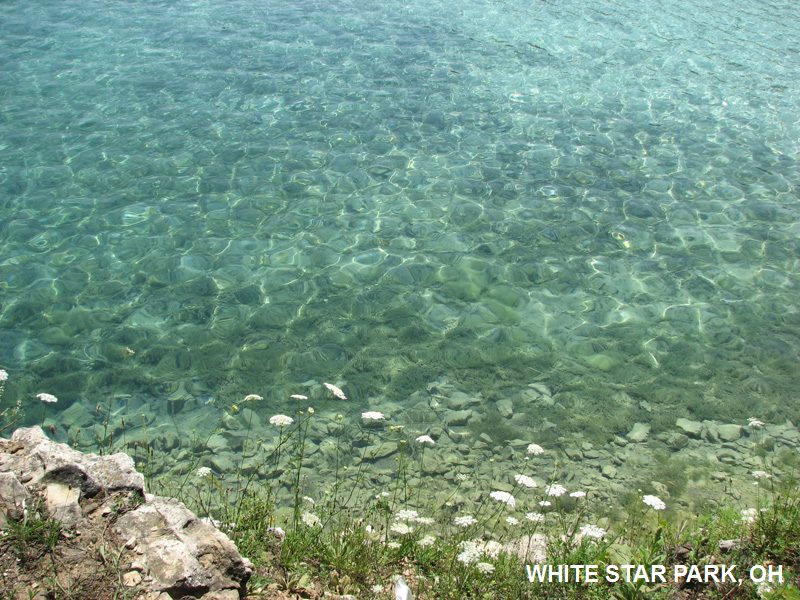
DESCRIPTION | This from a fan: "Unlike any quarry, lake or pond I've ever been in. The beach is fine white sand and the water an extremely clear beautiful teal blue. At the buoy barrier you can very clearly see to the bottom, an easy 15' - 18'. From that point as you gaze into the depths beyond where swimmers are allowed to go the color is a deep royal blue." WEB SITE.
|
AREAS | White Star Park (a Sandusky County park) |
SANCTION | Official |
FEE | Yes, $5.00 in 2013 |
FACILITIES |
Pit toilets |
ACTIVITIES |
Swimming, diving, (non-motor) boating, hiking | PHONE | (419)334-4495 |
CAMPING | Camping at site (some hookups, no reservations) |
BATHING SUITS | Required |
DIRECTIONS | (South of Gibsonburg on S.R. 300, S. Main St.) From the town of Fremont southwest of Sandusky: Take RT 20 (north or west) also referred to as W. State St. to RT 600, which is a smaller road. Left onto 600 to the center of Gibsonburg. Turn left onto S Main St and proceed one mile to the park entrance, also on the left (901 S Main St). Large parking lot, the quarry cannot be missed.
|
CONFIDENCE | Very confident |
VERIFIED | By another |
DATE UPDATED | 12/2013 | |
|---|
HOME