See a SLIDESHOW of swimming hole photos in this state.
This swimming hole listing is by
www.swimmingholes.org
ASHOKAN AREA
[2 PLACES]
(ASHO)
|
|
TOWNS | KINGSTON, MARBLETOWN, ASHOKAN, BOICEVILLE, WEST SHOKAN, SUNDOWN |
|---|
|
STATE | NY |
|---|
|
WATER | Varies-see below |
|---|
|
TYPE | Varies-see below |
|---|
|
DESCRIPTION | Several swimming holes near the Ashokan Reservoir in the Catskills. For details, see DIRECTIONS below. |
|---|
|
AREAS | Catskill Preserve |
|---|
|
SANCTION | Varies-see below |
|---|
|
FEE | Varies-see below |
|---|
|
FACILITIES |
None |
|---|
|
ACTIVITIES |
Swimming, Jumping |
|---|
|
PHONE | None |
|---|
|
CAMPING | Kenneth Wilson State Park is near Boiceville. Camping is allowed in the Catskill Nature Preserve anywhere in the preserve - spring summer and fall and below 3500 feet in winter. (Primitive camping, I assume.) |
|---|
|
BATHING SUITS | Customary |
|---|
|
DIRECTIONS | From Kingston on I-87 at Exit 19:
MARBLETOWN BEACH [MARB]: Official town park/beach on Lower Esopus Creek. Small fee charged, lifeguards seasonally. (Do not swim without lifeguards present).
To get here from Kingston on I-87 at Exit 19, take RT 28 west a very short distance then turn south on RT 209. Go about 7 miles south on RT 209 through Marbletown. About 1.5 miles past Marbletown, go west (right) on Tongore Rd. Go about 1.25 miles on Tongore Rd. then, just past Bogart Ln. on the left, turn right on a small road that leads to the park and beach. LAT, LON :lat=41.87423, lon= -74.1414(source: map ) (accuracy: approximate). LINK TO GOOGLE MAP. Very confident. Not verified. Updated 9/2014.
VERNOOY FALLS [VERN]: Scenic hike (about 2 miles one way) to a beautiful waterfall and swimming hole in Vernooy Kill surrounded by pines and shrubs. LINK TO PHOTO. Here is a description by a fan:" This hole is in the Catskill nature preserve and camping is allowed anywhere in the preserve - spring summer and fall and below 3500 feet in winter. Vernooykill is a wonderful place. The water is cold all summer. The hike in has an elevation gain of about 600 feet, most of it in a one mile stretch. It will get your blood flowing."
To get here from From RT 209 in Kerhonkson, follow Samsonville Rd north for
3.4 miles and bear left at the "Y" intersection onto Upper Cherrytown Rd.
Follow Upper Cherrytown Rd for 4.5 miles to a parking area on the right. The
trail to the falls is on the opposite side of the road. The NY State
Department of Environmental Conservation has published a very nice
map
of the area.
LAT, LON 41.87194, -74.37083 . LINK TO GOOGLE MAP. Very confident. Not verified. Updated
2/15/2016 | |
CONFIDENCE | Varies -see above |
|---|
|
VERIFIED | Varies -see above |
|---|
|
LAST UPDATE | 2/15/2016 |
|---|
|
|---|
This swimming hole listing is by
www.swimmingholes.org
AU SABLE AREA
[5 PLACES]
(AUSA)
|
|
TOWNS | PLATTSBURGH, AU SABLE FORKS, JAY, UPPER JAY, |
|---|
|
STATE | NY |
|---|
|
WATER | Ausable River |
|---|
|
TYPE | River |
|---|
|
DESCRIPTION | Swimming holes/pools in the Ausable River. See below. |
|---|
|
AREAS | Adirondack Park |
|---|
|
SANCTION | Unofficial |
|---|
|
FEE | No |
|---|
|
FACILITIES |
Picnic Tables nearby |
|---|
|
ACTIVITIES |
Swimming |
|---|
|
PHONE | None |
|---|
|
CAMPING | Unknown |
|---|
|
BATHING SUITS | Unknown |
|---|
|
DIRECTIONS | From way north on I-87, get off at Exit 34, Keeseville. Go south on RT 9N to Au Sable Forks, then:
THE DAM [DAMT]: Continue south on RT 9N into Au Sable Forks. Turn west (right) on Mill Rd. (County Route 9T). You will be traveling along the south shore of the Au Sable River. When you get to the dam (before Murphy Rd.) (you may need to ask locally) there is a swimming place upstream of the dam. LAT, LON lat=44.44124, lon=-73.69054(source: DeLorme) (accuracy: approximate) LINK TO GOOGLE MAP
Uncertain. Not verified. Updated 12/13/2002.
|
COVERED BRIDGE [COVE]: A popular local swimming hole by a falls and historic covered bridge in Jay. Lots of rocks and flat ledges above falls, many deep swimming holes, slide down falls. LINK TO PHOTO. As of summer 2008, this area has been made into a park but the swimming hole is still here. To get here: Return to RT 9N south and continue couth on 9N to the town of Jay. In Jay, turn east (left) on CR 22 (I think) to the covered bridge over the East Branch Ausable River. The swimming place is here near the bridge. LAT, LON lat=44.37286, lon=-73.72500(source: DeLorme) (accuracy: approximate) LINK TO GOOGLE MAP. Pretty confident. Not verified. Updated 12/13/2002. |
|
THE FLUME [FLUM]: Two-level waterfall on the West Branch Ausable River with a huge, deep pool below - a favorite local swimming hole. CAUTION: THERE HAVE BEEN DROWNINGS HERE RECENTLY - DO NOT JUMP INTO THE WATERFALL AND DO NOT SWIM IF THERE ARE STRONG CURRENTS. PHOTO. To get here: from Jay (above) go west on RT 86 through Wilmington. Continue on RT 86 as it turns south and go to where RT 86 crosses the West Branch Ausable River (just before the Hungry Trout Restaurant). Park in a small parking area just north of this bridge, cross the road (carefully!) and walk to the edge of the gorge. WEB INFO , MORE WEB INFO The two water falls are below and downstream of here and the pool is downstream of the second falls. LAT, LON lat=44.3664, lon=-73.8406(source: web site) (accuracy: approximate) LINK TO GOOGLE MAP. Very confident. Not verified. Updated 9/2014.
BIG POOL [BIGP]: Return to RT 9N and continue south to Stone House Rd. on the west (right) side of 9N before you get to Upper Jay. Park here at Stone House. Walk across RT 9N and follow the property line east about 500 feet to Wedding Corner and go down the steps at the river (if the water is low enough). This is Big Pool, a swimming area. AT, LON lat=44.35713, lon=-73.74651(source: DeLorme ) (accuracy: approximate) LINK TO GOOGLE MAP. Pretty confident. Not verified. Updated 12/13/2002.
THE ROCK [ROCT]: About .1 miles SOUTH of Stonehouse Road on RT 9N, turn east on Beach Spot drive. Here there is a beach and swimming hole called "The Rock". Pretty confident. LAT, LON lat=44.35207, lon=-73.75441(source: DeLorme) (accuracy: approximate) LINK TO GOOGLE MAP. Not verified. Updated 12/13/2002.
|
|---|
|
CONFIDENCE | See above |
|---|
|
VERIFIED | No |
|---|
|
LAST UPDATE | 12/13/2002 |
|---|
|
|---|
This swimming hole listing is by
www.swimmingholes.org
This swimming hole listing is by
www.swimmingholes.org
BLACK HOLE
(BLAC)
|
|
TOWNS | LAKE GEORGE, WARRENSBURG, WEVERTON |
|---|
| LAT, LON | lat=43.632, lon=-73.899(source: measured) (accuracy:approximate)
LINK TO GOOGLE MAP |
|---|
| STATE | NY |
|---|
| WATER | Mill Creek |
|---|
|
TYPE | Creek |
|---|
|
DESCRIPTION | Deep hole in creek with jumping rocks (always check depth first). Signed "Mill Creek Rec. Area".
This report from a visitor in 2009: "There were two rope swings out over the creek and the water in the center of the hole seemed quite deep. The water was a quite pleasant temperature especially for the Adirondacks. I would say since its close to the road that bathing suits are customary and everyone wore one. There are no facilities in the immediate area and as for camping you can't really do it near the creek but nearby there should be numerous places to consider on state land. The location is certainly unofficial but there are no signs indicating no swimming that I saw." |
|---|
|
AREAS | Mill Creek Rec. Area |
|---|
|
SANCTION | Unofficial |
|---|
|
FEE | No |
|---|
|
FACILITIES |
none |
|---|
|
ACTIVITIES |
Swimming, jumping |
|---|
|
PHONE | none |
|---|
|
CAMPING | None at site |
|---|
|
BATHING SUITS | Unknown |
|---|
|
DIRECTIONS | From the town of Lake George, take RT 9 (not 9N) north then RT 28 north toward Weverton. You will cross the Hudson River (signed) at The Glen then continue north on RT 28 about 2.5 miles more and turn east (right) on Harrington Rd.. Go a bit more than 1 mile on Harrington Rd. to where it intersects Mill Creek. There is a pull-off on the right side. Dirt road before the bridge over Mill Creek. Park and walk an apparent path that is signed "No Littering" into woods. You will pass a barbeque pit, continue on to the creek. |
|---|
|
CONFIDENCE | Very confident |
|---|
|
VERIFIED | Yes, 8/2012 |
|---|
|
LAST UPDATE | 8/2012 |
|---|
|
|---|
This swimming hole listing is by
www.swimmingholes.org
BLUE LEDGES AREA
[2 PLACES]
(BLUE)
|
|
TOWNS | LAKE GEORGE, WEVERTOWN |
|---|
|
LAT, LON | lat=43.8175, lon=-74.1380(source: DeLorme-p) (accuracy:exact)
LINK TO GOOGLE MAP |
|---|
|
STATE | NY |
|---|
|
WATER | Upper Hudson River |
|---|
|
TYPE | River |
|---|
|
DESCRIPTION | Two mile hike to swimming and picnicking place in Upper Hudson River. Truly a beautiful spot, with sandy beaches and rock ledges. CAUTION: Spring water levels make this a dangerous, Class 5 rapids. Swim later in the summer, do not swim or stand in fast currents. |
|---|
| AREAS | Adirondack Park |
|---|
|
SANCTION | Unofficial |
|---|
|
FEE | No |
|---|
|
FACILITIES |
Unknown |
|---|
|
ACTIVITIES |
Swimming |
|---|
|
PHONE | Unknown |
|---|
|
CAMPING | None at site. |
|---|
|
BATHING SUITS | Unknown |
|---|
|
DIRECTIONS | From town of Lake George, take RT 9 north about 9 miles then RT 28 northwest, then:
BLUE LEDGES [BLUL]: Two mile hike to swimming and picnicking place in Upper Hudson River. Truly a beautiful spot, with sandy beaches and rock ledges. CAUTION: Spring water levels make this a dangerous, Class 5 rapid. Swim later in the summer, do not swim or stand in fast currents. LAT, LON lat=43.8175, lon=-74.1380(source: DeLorme-p) (accuracy:exact) LINK TO GOOGLE MAP. To get here from RT 28, go about 16 miles from RT 9 on RT 28 to North Creek (if you get to North River, you've gone too far). Turn right on RT 28N for about 9.5 miles to a few miles past Minerva (past Murdie's General Store) then go west (left) on Northwoods Club Rd.. Follow this road about 6 miles to Huntley Pond and the trailhead on the left. The trailhead is signed as 2.5 miles to destination. Parking on right side for 4-5 vehicles. Hike down this trail about 2.5 miles (maybe less) to the Upper Hudson River. The swimming hole and picnic area are here. There is primitive camping near a brook 3 miles back down the road. Very confident. Verified by W. Brunner, 7/02. Updated 12/10/2002
CEDAR RIVER [CEDA]: Swimming place with sand beach and popular picnic place on Cedar River. LAT, LON lat=43.79286, lon=-74.28958(source: DeLorme) (accuracy:exact) LINK TO GOOGLE MAP. To get here from RT 28, continue on RT 28 past North Creek (above) and past North River. Just past where RT 30 goes off to the south, at Indian Lake, turn north(right) onto Pelon Rd and keep left at the fork onto Benton Rd.. Go to the end of Benton Rd. where the picnic area and swimming place are. Unknown if there is a fee.
Pretty confident. Not verified. Updated 12/10/2002
|
CONFIDENCE | Varies- see above |
|---|
|
VERIFIED | Varies- see above |
|---|
|
LAST UPDATE | 10/31/2007 |
|---|
|
|---|
|
|---|
This swimming hole listing is by
www.swimmingholes.org
BUTTERMILK FALLS S. P.
(BUTT)
|
|
TOWNS | ITHACA |
|---|
|
LAT, LON | lat=42.41125, lon=-76.51300(source: DeLorme) (accuracy:exact)
LINK TO GOOGLE MAP |
|---|
|
STATE | NY |
|---|
|
WATER | Buttermilk Creek |
|---|
|
TYPE | Falls |
|---|
|
DESCRIPTION | Official swimming in large, deep pool at bottom of Buttermilk
Falls. Lifeguard, diving board. Close to highway; not as scenic as Treman (see Treman). Signs
say "NO SWIMMING" in stream in gorge above falls, but there is evidence that some do swim
there. |
|---|
|
AREAS | Buttermilk Falls S.P. |
|---|
|
SANCTION | Official in pool below falls |
|---|
|
FEE | Yes |
|---|
|
FACILITIES |
Toilet, Picnic tables, changing room, showers |
|---|
|
ACTIVITIES |
Swimming, diving (in pool below falls) |
|---|
|
PHONE | (607)-273-5761 |
|---|
|
CAMPING | Camping at site. |
|---|
|
BATHING SUITS | Required in pool below falls |
|---|
|
DIRECTIONS | From Ithaca, go SW on RT 96/13 about 3 miles, follow signs to
Buttermilk Falls S.P. |
|---|
|
CONFIDENCE | Very confident |
|---|
|
VERIFIED | Yes |
|---|
|
LAST UPDATE | 8/31/1999 |
|---|
|
|---|
SWIMMING HOLES EAST
CANAJOHARIE GORGE AREA
[1 LOCATION]
(CANJ)
|
|
TOWNS | UTICA, AMSTERDAM, CANAJOHARIE |
|---|
|
STATE | NY |
|---|
|
WATER | CANAJOHARIE River |
|---|
|
TYPE | River |
|---|
|
DESCRIPTION | A spectacular gorge area. Layered slate-like rocks make flat surfaces near water.
|
|---|
| AREAS | None |
|---|
|
SANCTION | Swimming said to be illegal |
|---|
|
FEE | None |
|---|
|
FACILITIES |
None |
|---|
|
ACTIVITIES |
Unknown |
|---|
|
PHONE | None |
|---|
|
CAMPING | None at site |
|---|
|
BATHING SUITS | Unknown |
|---|
|
DIRECTIONS | From Albany, take I-90 west to Exit 29 (Canajoharie). Take RT 10 south a short distance then east (left) on RT 5S to the first right turn onto Cunningham Rd. Continue uphill on Cunningham Rd.(keeping right to stay on Cunningham Rd.), then:
BOILING POT [BOIL]: NOTE: We received this information in 7/2012: "...I am a police officer in the Village of Canajoharie, New York. ... This area is posted as TRESPASS and numerous individuals have been arrested there so far this year [2012]. There is NO swimming in the Canajoharie Gorge at all..."
This is in Floral Park. Unique "Pothole" formation at park within village of Cahanjoharie. Has rope swing and jumping possibilities. Water often warm due to shallow shale bed within canyon. There may be other swimming places upstream and downstream of here. PHOTO , PHOTO , PHOTO . To get here from Cunningham Rd., go right onto Moyer St. (CR 93) then left onto Floral St.. The park and swimming hole are at the end of Floral St.. LAT, LON lat=42.89858, lon=-74.57197(source: DeLorme) (accuracy: approximate) LINK TO GOOGLE MAP. Pretty confident. Not verified. Updated 4/30/2009
CANAJOHARIE FALLS [CANA]: DELETED - MANY DEATHS AND ILLEGAL.
|
|---|
| CONFIDENCE | Pretty confident |
|---|
|
VERIFIED | Partially |
|---|
|
LAST UPDATE | 7/2012 |
|---|
|
|---|
This swimming hole listing is by
www.swimmingholes.org
CHAUTAUQUA GORGE AREA
[2 PLACES]
(CHAU)
|
|
TOWNS | BUFFALO, ERIE (PA), WESTFIELD |
|---|
| STATE | NY |
|---|
| WATER | Chautauqua Creek |
|---|
|
TYPE | Creek/Falls |
|---|
|
DESCRIPTION | Chautauqua Gorge is a very scenic site with a clothing-optional area located near Westfield in the westernmost part of New York. There are several small waterfalls which are very refreshing after hiking on a warm day. There are also small pools for soaking or swimming a few strokes and level space along the creek for sunbathing. Sandals are recommended as you may have to cross the creek a number of times along the way. |
|---|
|
AREAS | Chautauqua Gorge |
|---|
|
SANCTION | Unofficial |
|---|
|
FEE | No |
|---|
|
FACILITIES |
None |
|---|
|
ACTIVITIES |
Skinny dipping, Swimming |
|---|
|
PHONE | None |
|---|
|
CAMPING | Primitive camping in the gorge |
|---|
|
BATHING SUITS | Optional (at Skinny Dip area) |
|---|
|
DIRECTIONS | From the New York State Thruway (I-90) in far western NY, take the Westfield exit (Exit 60). Follow RT 394 a short distance south to the center of Westfield. Then:
SKINNY DIP FALLS AREA [SKIN]: Hike from Taylor Road through scenic gorge to traditionally nudist area. To get here from Westfield, turn right onto RT 20. After crossing a bridge, turn left at the first street, Chestnut Street (county road 21). Follow C.R. 21 south for about 3.3 miles and then turn left onto Ogden Road. Follow Ogden road 1.5 miles and then turn left onto Taylor Road (a gravel road). Follow Taylor Road a short distance to the dead end sign where there is a small parking area on the left. A very rough road continues down into a deep valley. Follow this until you reach the creek, then turn left (downstream). Soon you will see a sign painted on a rock saying "nudist area next one mile". From there, if you follow the creek, you will pass several swimming places FIRST HOLE,SECOND HOLE, THIRD HOLE until you get to Skinny Dip Falls LINK TO INFO AND PHOTOS . LAT, LON [HIKE TO] lat=42.25181, lon=-79.57414(source: DeLorme) (accuracy: approximate) LINK TO GOOGLE MAP. Very confident. Verified. Updated 7/2010
PICNIC AREA [PICN]: An easier way to get into the gorge, further south, i.e., upstream, of the way above. There is a very nice, deep swimming hole right at the bottom of this trail but it is hard to walk up or downstream from here unless you walk in the creek. PHOTO, PHOTO. To get here, stay on RT 394 through Westfield. When you get to Mayville, turn west (right) on RT 430. Go about 1.5 miles then turn west (right) on Hannum Rd.. Continue on Hannum Rd. about 3 miles (turns into gravel) to where there is a picnic area and some primitive (no tables, no water, porta-potties) camping. Park and hike pretty steeply downhill about 1/3 mile into the gorge at this point. The best swimming hole is to the right at the bottom of this trail. LAT, LON [DRIVE TO]: lat=42.23976, lon=-79.58730(source: measured) (accuracy:approximate) LINK TO GOOGLE MAP .Very confident. Verified. Updated 7/2010.
|
|---|
|
CONFIDENCE | Very confident |
|---|
|
VERIFIED | Yes |
|---|
|
LAST UPDATE | 7/2010 |
|---|
|
|---|
This swimming hole listing is by
www.swimmingholes.org
CHENANGO VALLEY S. P.
(CHEN)
|
|
TOWNS | BINGHAMTON, CHENANGO VALLEY |
|---|
| LAT, LON | lat=42.21306, lon=-75.84000 (source: DeLorme) (accuracy:approximate)
LINK TO GOOGLE MAP |
|---|
| STATE | NY |
|---|
| WATER | Unknown |
|---|
|
TYPE | Unknown |
|---|
|
DESCRIPTION | There is a very beautifully developed official swimming beach (with lifeguard) here in a glacier-scoured, spring-fed "kettle" lake. |
|---|
|
AREAS | Chenengo Valley S.P. |
|---|
|
SANCTION | Official |
|---|
|
FEE | Yes |
|---|
|
FACILITIES |
All facilities in State Park |
|---|
|
ACTIVITIES |
Swimming |
|---|
|
PHONE | 607-648-5251 |
|---|
|
CAMPING | Camping at site. |
|---|
|
BATHING SUITS | Required |
|---|
|
DIRECTIONS | From Binghamton, take I-88 northeast to RT 369 north. The park is 13 miles north of Binghamton.
|
|---|
|
CONFIDENCE | Very confident |
|---|
|
VERIFIED | Yes |
|---|
|
LAST UPDATE | 7/09 |
|---|
|
|---|
This swimming hole listing is by
www.swimmingholes.org
COLES CREEK S. P.
(COLE)
|
|
TOWNS | OGDENSBURG, MASSENA, WADDINGTON |
|---|
| LAT, LON | lat=44.8903, lon=-75.1410(source: DeLorme) (accuracy:approximate)
LINK TO GOOGLE MAP |
|---|
| STATE | NY |
|---|
| WATER | Coles Creek |
|---|
|
TYPE | Creek |
|---|
|
DESCRIPTION | Beach on river. |
|---|
|
AREAS | Coles Creek S.P. |
|---|
|
SANCTION | Unknown |
|---|
|
FEE | Yes |
|---|
|
FACILITIES |
Toilet,
Picnic tables |
|---|
|
ACTIVITIES |
Swimming |
|---|
|
PHONE | (315)-388-5636 |
|---|
|
CAMPING | Camping at site. |
|---|
|
BATHING SUITS | Unknown |
|---|
|
DIRECTIONS | From Waddington, go east on RT 37 about 5 miles. Follow signs.
|
|---|
|
CONFIDENCE | Pretty confident |
|---|
|
VERIFIED | No |
|---|
|
LAST UPDATE | 5/31/1999 |
|---|
|
|---|
This swimming hole listing is by
www.swimmingholes.org
CROTON POINT PARK
(CROT)
|
|
TOWNS | TARRYTOWN, OSSINING, CROTON-ON-HUDSON |
|---|
| LAT, LON | lat=41.178, lon=-73.896(source:map) (accuracy:approximate)
LINK TO GOOGLE MAP |
|---|
| STATE | NY |
|---|
| WATER | Hudson River |
|---|
|
TYPE | River |
|---|
|
DESCRIPTION | Town beach on river. web site |
|---|
|
AREAS | Croton Point Park |
|---|
|
SANCTION | Official |
|---|
|
FEE | Yes, see web site |
|---|
|
FACILITIES |
All facilities |
|---|
|
ACTIVITIES |
Swimming |
|---|
|
PHONE | (914) 862-5290 |
|---|
|
CAMPING | Camping at site. |
|---|
|
BATHING SUITS | Required |
|---|
|
DIRECTIONS | Croton Point Avenue, Croton-on-Hudson, NY
|
|---|
|
CONFIDENCE | Very confident |
|---|
|
VERIFIED | No |
|---|
|
LAST UPDATE | 11/2012 |
|---|
|
|---|
This swimming hole listing is by
www.swimmingholes.org
DURHAM AREA
[3 PLACES]
(DURH) |
|
|---|
| TOWNS |
ALBANY, DURHAM |
|---|
| STATE |
NY |
|---|
| WATER |
Varies - see below |
|---|
| TYPE |
Creek |
|---|
| DESCRIPTION |
River and falls locations just north of the Catskills. See DIRECTIONS below for details. |
|---|
| AREAS |
None |
|---|
| SANCTION |
Unofficial |
|---|
| FEE |
No |
|---|
| FACILITIES |
None |
|---|
| ACTIVITIES |
Swimming, fishing |
|---|
| PHONE |
none |
|---|
| CAMPING |
Commercial campgrounds nearby |
|---|
| BATHING SUITS |
Customary at both locations |
|---|
| DIRECTIONS |
New York State Thruway (I-90) to exit 21 (NY 23). At the end of the ramp go left then right onto Rt 23 west (set odometer), then:
LEEDS [LEED]: Go a short way on RT 23 west and turn right on Cauterskill Rd. then right on Main street into Leeds. On the right in Leeds, see the The Inn at Leeds where you can enjoy a good meal. After, go out to the rear of the parking lot and look in the woods for a tree with ropes that help you down a small but steep path to Catskill Creek. There is a bodacious swimming hole here. LAT, LON : lat=42.25446, lon=-74.08306(source: DeLorme) (accuracy: approximate) LINK TO GOOGLE MAP Pretty confident. Not verified. Updated 11/2012
CORNWALLVILLE CREEK [CORN]: From NY 23 west, bear right onto NY 145. Turn right onto Green County RT 67A (Darby's Irish Pub on corner/ blinking light) and park (room for 1 - 2 cars on shoulder). Proceed along shore to right without crossing bridge to several swimming holes. There is a small falls if you wade upstream under the bridge, do not step on private shoreline on this side of bridge. PHOTO , PHOTO , PHOTO . LAT, LON : lat=42.36856, lon=-74.08306(source: DeLorme) (accuracy: approximate) LINK TO GOOGLE MAP Very confident. Verified 8/2012. Updated 8/2012
CATSKILL CREEK [CATS]: On RT 67A, cross bridge over Cornwallville Creek and go to end of RT 67A. Turn left onto CR 67 and pull to park off left shoulder ( 1-2 cars). (The road on the other side of the creek is POSTED "NO PARKING".) Take the path back toward the bridge. PHOTO , PHOTO . There are a couple of steep ways to climb down (one with a rope to help you PHOTO ) or walk back under bridge to sandy beach PHOTO . LAT, LON lat=42.37456, lon=-74.07978(source: measured) (accuracy: approximate) LINK TO GOOGLE MAP. Very confident. Verified 8/2012. Updated 8/2012
|
|---|
| CONFIDENCE |
Very confident |
|---|
| VERIFIED |
Yes 8/2012 |
| LAST UPDATE | 8/2012 |
This swimming hole listing is by
www.swimmingholes.org
EEL WEIR S. P.
(EELW)
|
|
TOWNS | OGDENSBURG |
|---|
| LAT, LON | lat=44.6304, lon=-75.4761(source: DeLorme) (accuracy:approximate)
LINK TO GOOGLE MAP |
|---|
|
STATE | NY |
|---|
|
WATER | Unknown |
|---|
|
TYPE | River |
|---|
|
DESCRIPTION | River swimming. |
|---|
|
AREAS | Eel Weir S.P. |
|---|
|
SANCTION | Unknown |
|---|
|
FEE | Yes |
|---|
|
FACILITIES |
Toilet,
Picnic tables |
|---|
|
ACTIVITIES |
Swimming |
|---|
|
PHONE | (315)-393-1138 |
|---|
|
CAMPING | Camping at site. |
|---|
|
BATHING SUITS | Unknown |
|---|
|
DIRECTIONS | From Ogdensburg, go south on RT 812 about 4 miles, turn SW on RT
4 to park. |
|---|
|
CONFIDENCE | Pretty confident |
|---|
|
VERIFIED | No |
|---|
|
LAST UPDATE | 5/31/1999 |
|---|
|
|---|
This swimming hole listing is by
www.swimmingholes.org
FILLMORE GLEN S. P.
(FILL)
|
|
TOWNS | SYRACUSE, AUBURN, MORAVIA |
|---|
| LAT, LON | lat=42.702, lon=-76.389
(source: DeLorme) (accuracy:approximate)
LINK TO GOOGLE MAP |
|---|
|
STATE | NY |
|---|
|
WATER | Dry Creek |
|---|
|
TYPE | Creek |
|---|
|
DESCRIPTION | Very nice, small swimming area created by a dam across the creek somewhat downstream from a waterfall. 6-7 feet deep, lifeguards, jumping (no diving). Stairs to enter water - no beach but grassy area for sunning. Great family place - for older kids who can swim and don't need beach entrance. |
|---|
|
AREAS | Fillmore Glen S.P. |
|---|
|
SANCTION | Official - lifeguards |
|---|
|
FEE | Yes. $7 fee per car, free if you park outside the park and walk in (it is not a great distance to walk in) |
|---|
|
FACILITIES |
Toilet, Picnic tables |
|---|
|
ACTIVITIES |
Swimming, jumping |
|---|
|
PHONE | (315)-497-0130 |
|---|
|
CAMPING | Camping at site. |
|---|
|
BATHING SUITS | Required |
|---|
|
DIRECTIONS | from I-81 north of Cortland at Homer, take RT 90 west to Locke then RT 38 north toward Moravia. See signs to park just south of Moravia. |
|---|
|
CONFIDENCE | Very confident |
|---|
|
VERIFIED | Yes, 7/2006 |
|---|
|
LAST UPDATE | 7/31/2006 |
|---|
|
|---|
This swimming hole listing is by
www.swimmingholes.org
THE FLOATING POOL LADY
(FLOA) |
|
|---|
| TOWNS |
MANHATTAN, BRONX |
|---|
| LAT, LON | lat=40.8055556, lon=-73.8886111(source: Website) (accuracy:approximate)
LINK TO GOOGLE MAP |
|---|
| STATE |
NY |
|---|
| WATER |
Swimming Pool in East River |
|---|
| TYPE |
Swimming Pool in East River |
|---|
| DESCRIPTION |
Ann L. Buttenwieser, a former Parks Department official, had the great idea 25 years ago of putting a swimming pool on a barge and mooring it somewhere in the city's 578 miles of waterfront. In June 2007, it became a reality. "The pool is 25 meters long, or half the length of an Olympic-size pool. For swimmers who never learned the metric system, that works out to just over 82 feet. It will have seven lanes and be four feet deep. Also on board will be dressing rooms with bright-colored tops that look like outsize Legos." (excerpted from WEB SITE. ) The pool floats and it is planned to move it so we don't know where it will be in future summers (see DIRECTIONS below). See this site for more information: WEB SITE .
This is not the first floating pool in Manhattan - around 1900 there were several in both the Hudson and East Rivers - which used the actual river water back when it was cleaner than now. See Article for a history of such pools. |
|---|
| AREAS |
Unknown |
|---|
| SANCTION |
Official |
|---|
| FEE |
Unknown |
|---|
| FACILITIES |
Unknown |
|---|
| ACTIVITIES |
Swimming |
|---|
| PHONE |
718-802-0603 |
|---|
| CAMPING |
None at site |
|---|
| BATHING SUITS |
Required |
|---|
| DIRECTIONS |
It is at the tip of Baretto Point Park in the Bronx. Don't know where it will be in future summers. (Our job would be a whole lot easier if these dang swimming holes would stay put!) |
|---|
| CONFIDENCE |
Very confident |
|---|
| VERIFIED |
No |
|---|
| LAST UPDATE | 8/2009 |
This swimming hole listing is by
www.swimmingholes.org
GEORGE BRIDGE
(GEOR) |
|
|---|
| TOWNS |
ROCHESTER, SCOTTSVILLE |
|---|
| LAT, LON | lat=43.019129, lon=-77.746811(source: measured by another) (accuracy:exact)
LINK TO GOOGLE MAP |
|---|
| STATE |
NY |
|---|
| WATER |
Oatka Creek |
|---|
| TYPE |
Creek |
|---|
| DESCRIPTION |
This from a visitor:"Oatka Creek flows under a bridge on the Genesee Valley Greenway in the Village of Scottsville. Christened with spray paint by George Jarrett a generation ago, locals still call the spot "George Bridge". At 8' or 9', the creek is comfortably deep enough for jumping off the bridge and swinging from the rope swing. Fisherman occasionally use the spot. On a hot summer day, it will be crowded with local kids, RIT students, and older folks escaping the heat. Picnic tables and a grassy area nearby make it a comfortable lunch spot." |
|---|
| AREAS |
None |
|---|
| SANCTION |
Unofficial |
|---|
| FEE |
No |
|---|
| FACILITIES |
none |
|---|
| ACTIVITIES |
Swimming, jumping |
|---|
| PHONE |
none |
|---|
| CAMPING |
None at site |
|---|
| BATHING SUITS |
Customary |
|---|
| DIRECTIONS |
From Rochester, take I-390 to Exit 17 south. Head south on Scottsville Rd (RT 383) for 9.2 miles. In the Village of Scottsville, the road splits. Take the left fork (RT 251). You will immediately cross a bridge. After the bridge, take your first left into a small parking lot. Walk 50 yards to the swimming area. |
|---|
| CONFIDENCE |
Very confident |
|---|
| VERIFIED |
No |
|---|
| LAST UPDATE | 7/2010 |
This swimming hole listing is by
www.swimmingholes.org
GLENERIE
(GLEN) |
|
|---|
| TOWNS |
KINGSTON, SAUGERTIES, GLASCO |
|---|
| LAT, LON | lat=42.0217, lon=-73.977(source: measured) (accuracy:approximate)
LINK TO GOOGLE MAP |
|---|
| STATE |
NY |
|---|
| WATER |
Esopus Creek |
|---|
| TYPE |
Creek |
|---|
| DESCRIPTION |
Creek with deep holes and large sunning rocks. |
|---|
| AREAS |
None |
|---|
| SANCTION |
Unofficial |
|---|
| FEE |
No |
|---|
| FACILITIES |
none |
|---|
| ACTIVITIES |
Swimming, fishing, tubing, canoeing |
|---|
| PHONE |
none |
|---|
| CAMPING |
None at site |
|---|
| BATHING SUITS |
Customary |
|---|
| DIRECTIONS |
New York State Thruway (I-87) to exit 20 (NY 32). Take NY 32 south through Saugerties (there is a nice village beach PHOTO just before you take the bridge over the Esopus Creek). Keep right onto 9W when NY 32 splits to the left. Location is about 3 miles past this split at junction with Glasco Turnpike. There is a gravelly parking area on the left, enough for a few cars on the side of 9W. Walk across the road CAREFULLY. There is a large fence/gate with a no trespassing sign, and a short trail through some woods to the shore. From the shore you can walk through shallow water to the south where we found dozens of cascading falls all the way to the railway bridge high above, and could see passing freight trains. Also one can reach a wide, short set of falls. Maybe not much of swimming hole at low water. |
|---|
| CONFIDENCE |
Very confident |
|---|
| VERIFIED |
Yes 8/2012 |
|---|
| LAST UPDATE | 8/2012 |
This swimming hole listing is by
www.swimmingholes.org
HIGLEY FLOW AREA
[4 PLACES]
(HIGL)
|
|
TOWNS | OGDENSBURG, CANTON, COLTON, CLARE, PARISHVILLE |
|---|
|
STATE | NY |
|---|
|
WATER | Varies - see below |
|---|
|
TYPE | River |
|---|
|
DESCRIPTION | River swimming/jumping |
|---|
|
AREAS | Higley Flow S. P. nearby |
|---|
|
SANCTION | Varies -see below |
|---|
|
FEE | Unknown |
|---|
|
FACILITIES |
Toilet,
Picnic tables (at Higley Flow S. P.) |
|---|
|
ACTIVITIES |
Swimming |
|---|
|
PHONE | Unknown |
|---|
|
CAMPING | Camping at Higley Flow S. P. |
|---|
|
BATHING SUITS | Varies -see below |
|---|
|
DIRECTIONS | From Ogdensburg, go southeast on RT 68 to Canton, then:
ALLEN FALLS [ALLE]: Thirty-five foot falls on the West Branch of the Saint Regis River with a swimming hole at the bottom. To get here from Parishville turn north (left) on CR 47. Go past Rosenbarker Drive then go west (left) on Allen Falls Rd.. At the bridge, park on the left before you cross. Walk about .25 mile to the top of falls, then take a steep path down to bottom of falls. Careful, it is steep and footing may be loose. The swimming hole is at the bottom. LAT, LON (parking):lat=44.65315, lon=-74.85148(source: map) (accuracy:approximate) LINK TO GOOGLE MAP. LAT, LON (waterfall):lat=44.6558, lon=-74.8496(source: map) (accuracy:approximate) LINK TO GOOGLE MAP. Pretty confident. Not verified. Updated 11/2012.
STONE VALLEY [STOV]: This description from a user: It is a dam released flow in the Raquette River near Colton that is called Stone Valley and offers about 20 different places to get in the water. There is also world class white water rafting on this area during high water. The water is super clean as it comes from the mountains, there are really only local kids that go there, and it is not really patrolled by any officials which is great." Bathing suits may be optional at remote parts. LAT, LON :lat=44.56197, lon=-74.94372 (source: DeLorme) (accuracy:approximate) LINK TO GOOGLE MAP.
To get here from Canton, go through Canton on RT 68 to Colton, where RT 68 meets RT 56 at the Raquette River. This description from a user:" To get here from RT 68 near Colton, take RT 56 into the town of Colton and turn northeast (right) at the library onto Main Street then take a quick left (before the bridge) onto River Street. (This town is smaller than anything you can imagine and goggle maps don't even show the river that runs through it. There is not a stoplight in the town so people should not bother looking for anything more centrally located than the library). There is some parking in a dirt lot right along the river. After parking, walk down the dirt lane with the river along your right side continue through the gate, past the damn, and along a big green pipe until you come to a small wooden bridge that crosses the pipeline. Cross the bridge and continue along the trail. Along the trail you will find a ton of great places to swim, picnic or just lay out. Dogs are welcome and no one will bother you here with whatever you want to do. It's a great place, just please do not die here or litter, because then the officials will get uptight and that is not what anyone wants." Pretty certain. Not verified. Updated 12/22/06.
HIGLEY FLOW S. P. [HIGF]: Official swimming in Raquette River. Camping and all facilities at site. Bathing suits required. LAT, LON :lat=44.4995, lon=-74.9211(source: DeLorme) (accuracy:approximate) LINK TO GOOGLE MAP. To get here from RT 68 near Colton, go south on RT 56 to South Colton then west on Cold Brook Dr. to State Park. Pretty certain. Not verified. Updated 12/22/06.
LAMPSON FALLS [LAMP]: Lampson Falls, about 40 ft high and 100 ft wide, in the Donnerville State Forest, has a beach and unofficial swimming hole at the bottom of the falls. CAUTION: IN SPRING, THE CURRENT HERE CAN BE DANGEROUS - PEOPLE HAVE DROWNED IN THE SPRING CURRENT HERE It is a 15 minute hike in. To get here from Canton (not Colton), take County Rd. 27 south about 15 miles to Clare which is north of Degrasse. You should see a brown and yellow DEC sign on the west (right) side of the road at a dirt road with a gate across it. Park here and walk down that road in the State Forest about 15 minutes to the waterfall. LAT, LON (parking):lat=44.40491, lon=-75.06155(source: map) (accuracy:approximate) LINK TO GOOGLE MAP. LAT, LON (waterfall):lat=44.40564, lon=-75.07091(source: map) (accuracy:approximate) LINK TO GOOGLE MAP. Pretty confident. Not verified. Updated 11/2012.
|
|---|
|
CONFIDENCE | Pretty confident |
|---|
|
VERIFIED | No |
|---|
|
LAST UPDATE | 11/2012 |
|---|
|
|---|
This swimming hole listing is by
www.swimmingholes.org
KAATERSKILL AREA
(KAAF)
|
|
TOWNS | KINGSTON, SAUGCERTIES, PALENVILLE, TANNERSVILLE |
|---|
|
STATE | NY |
|---|
|
WATER | Varies - see below |
|---|
|
TYPE | Varies - see below |
|---|
|
DESCRIPTION | Varies - see below |
|---|
|
AREAS | Catskill Preserve |
|---|
|
SANCTION | Unofficial |
|---|
|
FEE | No |
|---|
|
FACILITIES |
None |
|---|
|
ACTIVITIES |
Swimming |
|---|
|
PHONE | None |
|---|
|
CAMPING | Nearby at North South Lake State Park |
|---|
|
BATHING SUITS | Varies - see below |
|---|
|
DIRECTIONS | From Kingston, go north on I-87 to Exit 20. Go north on
RT 32 for 6 miles then north on RT 32A then west on RT 23A. Then:
LITNER ROCK [LITN]: This from a visitor: A small 4' deep bowl in Cook Brook, just a few steps West off of Elka Park Rd. south of Tannersville, across from number "32" utility pole. A large bolder that forms the eastern wall of the pool is inscribed with a number of carved names and dates."
To get here from Kaaterskill Falls (above) continue west on RT 23A through Tannersille. On the west side of Tannersville, turn south (left) on Bloomer Rd, (set odometer) and keep right onto Elka Park Rd. (do not continue straight onto Platte Clove Rd.). You will cross Schoharie Creek then pass the post office (on the right) then you will cross Cook Brook. Shortly after you cross Cook Brook, look for a utility pole on the left that has the number "32" on it. (all told, this is about 2.25 miles from where you turned off RT 23A). Park where you can and walk to the west side of the road and find a small swimming hole. LAT, LON :lat=42.16843 lon=-74.14986(source: map) (accuracy: approximate). LINK TO GOOGLE MAP. Uncertain. Not verified. Updated 12/2013.
|
|---|
|
CONFIDENCE | Varies - see above |
|---|
|
VERIFIED | Partially |
|---|
|
LAST UPDATE | 12/2013 |
|---|
|
|---|
This swimming hole listing is by
www.swimmingholes.org
KEENE AREA
[3 PLACES]
(KEEA)
|
|
TOWNS | ELIZABETHTOWN, KEENE, KEENE VALLEY |
|---|
|
STATE | NY |
|---|
|
WATER | East Branch of the Ausable River |
|---|
|
TYPE | River/falls |
|---|
|
DESCRIPTION | Swimming places near Keene in the Adirondacks. See DIRECTIONS below. |
|---|
|
AREAS | Adirondack Park |
|---|
|
SANCTION | Unofficial |
|---|
|
FEE | Unknown |
|---|
|
FACILITIES |
Unknown |
|---|
|
ACTIVITIES |
Swimming |
|---|
|
PHONE | Unknown |
|---|
|
CAMPING | East of here off of I-87 are Sharp Bridge Campground and Lincoln Pond Campground. |
|---|
|
BATHING SUITS | Unknown |
|---|
|
DIRECTIONS | From I-87, get off at Exit 30 at RT 9. Take RT 9 north then continue straight onto RT 73 north, then:
MARCY FIELD [MARC]: Town of Keene Park with picnic tables and a nice, flat-water family swimming place in the East Branch of the Ausable River. WEB INFO . To get here, continue north on RT 73, paralleling the East Branch of the Ausable River. Go through Keene Valley, until you get to Marcy Field (airport) on your left (before you get to Keene). On your right, across from Marcy Field, is the park and swimming place. LAT, LON lat=44.22166, lon=-73.7863(source: map) (accuracy: approximate) LINK TO GOOGLE MAP. Pretty confident. Not verified. Updated 9/2014
HULLS FALLS [HULL]: Short waterfall with large pool at the bottom. Sandy beach. May be posted "no trespassing" on the north bank of the river - please obey signs. May be trash at site - please carry out trash. WEB INFO . To get here, continue north from Marcy Field (above) on RT 73 a very short way then (before you cross the river) bear left onto Hulls Falls Rd.. Go about 1 mile on this road to where it crosses the river. Before you cross the bridge, pull off on the side of the road. The falls and pool are below this bridge. LAT, LON lat=44.2351, lon=-73.7947(source: map) (accuracy: approximate) LINK TO GOOGLE MAP. Pretty confident. Not verified. Updated 9/2014
COMMUNITY CENTER [COMM]: On Church St., in Keene, there is an old school converted to a community center. Walk across the playing fields and there is a nice beach and swimming place in the river. To get here, continue north on RT 73 into Keene. Stay on RT 73 in Keene and, just after you cross the river, bear right onto Church St.. The Community Center and river beach are near here. LAT, LON lat=44.26032, lon=-73.79491(source: map) (accuracy: approximate) LINK TO GOOGLE MAP. Pretty confident. Not verified. Updated 9/2014.
|
|---|
|
CONFIDENCE | Pretty confident |
|---|
|
VERIFIED | No |
|---|
|
LAST UPDATE | 9/2014 |
|---|
|
|---|
This swimming hole listing is by
www.swimmingholes.org
KERHONKSON AREA
[2 PLACES]
(KERH)
|
|
TOWNS | ELLENVILLE, KERHONKSON, WAWARSING, ACCORD |
|---|
|
STATE | NY |
|---|
|
WATER | Varies - see below |
|---|
|
TYPE | Creeks |
|---|
|
DESCRIPTION | Swimming holes near Kerhonkson, Ellenville and Accord in the southern Catskills. For details, see DIRECTIONS below. |
|---|
|
AREAS | Catskills |
|---|
|
SANCTION | Unofficial |
|---|
|
FEE | No |
|---|
|
FACILITIES |
Unknown |
|---|
|
ACTIVITIES |
Swimming |
|---|
|
PHONE | None |
|---|
|
CAMPING | Unknown |
|---|
|
BATHING SUITS | Unknown |
|---|
|
DIRECTIONS | I-87 to Exit 18 (New Paltz). At exit go west on RT 299 thru New Paltz. Continue on RT 299, turn right on RT 44/55 (go past MINNEWASKA AREA swimming holes) to intersection with RT 209 at Pine Bush, near Kerhonkson. Then:
ELLENVILLE HOLES [ELLE]: Along RT 209, between Ellenville and Accord, are several swimming places beside the road. Some can be seen from road. They are either in Sandbury Creek or Rondout Creek. No better directions. To get here from intersection of RT 44/55 and Rt 209, turn left toward Ellenville (or right toward Accord) on RT 209 and drive, looking for swimming places. LAT, LON :lat=41.7752, lon=-74.3005(source: DeLorme) (accuracy:general area). LINK TO GOOGLE MAP. Uncertain. Not verified. Updated 3/10/2004.
WASHING MACHINE [WASH]: A small waterfall emptying into a very turbulent pool (the Washing Machine) which empties into a deep pool for swimming or jumping from the rocks. It is small and compact, the water clear and cold, with some shallower places for kids. To get here from the intersection of RT 44/55 and Rt 209, turn left toward Ellenville on RT 209 and go to Wawarsing (before you get to Ellenville). In Wawarsing, before you cross he bridge over Vernooy Kill, there is a paved road (Lundy Rd) on the north (right) side of RT 209. Take it and go about .8 miles (it becomes a dirt road shortly), and the washing machine will be on the left and visible from the road. LAT, LON :lat=41.76124, lon=-74.36212(source: map) (accuracy: approximate). LINK TO GOOGLE MAP. Pretty confident. Verified by another, 9/2013. Updated 12/2013.
|
|---|
|
CONFIDENCE | Varies-see above |
|---|
|
VERIFIED | Varies-see above |
|---|
|
LAST UPDATE | 12/2013 |
|---|
|
|---|
This swimming hole listing is by
www.swimmingholes.org
LAKEVIEW WMA
(LAKV)
|
|
TOWNS | SYRACUSE, WATERTOWN, OSWEGO |
|---|
| LAT, LON (drive to) | lat=43.7646, lon=-76.2148(source: measured) (accuracy: approximate)
LINK TO GOOGLE MAP |
|---|
|
STATE | NY |
|---|
|
WATER | Lake Ontario |
|---|
|
TYPE | Lake Beach |
|---|
|
DESCRIPTION | The Lakeview State Wildlife Management Area, on the eastern shore of Lake Ontario, has about 5 miles of undeveloped sand beach. This is a little known beach area and a traditionally nude beach (bathing suit optional). To get here, go to Southwick Beach State Park and walk south along the beach - it is more private the further south you walk and nude sunbathing becomes more common at the southern reaches. Do not walk on the dunes - there are Dune Stewards who patrol the dunes here. Better cover up if you meet a Dune Steward - they can give citations but are not inclined to do so if you cover up. |
|---|
|
AREAS | Lakeview WMA (State) |
|---|
|
SANCTION | Unofficial |
|---|
|
FEE | Parking fee at Southwick Beach State Park |
|---|
|
FACILITIES |
All facilities at Southwick Beach State Park |
|---|
|
ACTIVITIES |
Swimming, sunbathing |
|---|
|
PHONE | None |
|---|
|
CAMPING | At Southwick Beach State Park |
|---|
|
BATHING SUITS | Optional |
|---|
|
DIRECTIONS | From I-81 north of Syracuse, get off at Exit 40 and take RT 193 toward Ellisburg. Go about 8 miles (through Ellisburg) to the Southwick Beach State Park. Park and walk south on the beach.
|
|---|
|
CONFIDENCE | Very confident |
|---|
|
VERIFIED | Yes, 7/2014 |
|---|
|
LAST UPDATE | 7/2014 |
|---|
|
|---|
This swimming hole listing is by
www.swimmingholes.org
LAKE LUZERNE AREA
[2 PLACES]
(LAKL)
|
|
TOWNS | GLENS FALLS, SARATOGA SPRINGS, CORINTH, HADLEY |
|---|
|
STATE | NY |
|---|
|
WATER | Hudson River |
|---|
|
TYPE | River/Lake |
|---|
|
DESCRIPTION | Several swimming places in the Hudson River in the Glens Falls/Lake Luzerne area. (There is a traditional jumping place near here called "Hadley Bridge" where there have been many deaths. We do not include this location and we recommend strongly that you do not swim there.) For details, see DIRECTIONS below. |
|---|
|
AREAS | None |
|---|
|
SANCTION | Unofficial |
|---|
|
FEE | None |
|---|
|
FACILITIES |
None |
|---|
|
ACTIVITIES |
Swimming |
|---|
|
PHONE | None |
|---|
|
CAMPING | None at site |
|---|
|
BATHING SUITS | Optional at places |
|---|
|
DIRECTIONS | From I-87 at Saratoga Springs, take RT 9N north from Saratoga Springs to the village of Corinth, then:
SPIER FALLS [SPIE]: A great swimming spot that is fine for nude sunbathing and swimming. PHOTO , PHOTO , PHOTO , PHOTO . A lake above a dam in the upper Hudson River (no falls in sight). Rocky ledges that are great for sunbathing and swimming. The river is clean (far north of the GE concerns) and gorgeous with little current due to the downstream dam. Great quiet spot that is highly recommended. NOTE:
Brookfield Power owns this land. This from a recent visitor :"
Due to men exposing themselves and under
age drinking and numerous other things police agencies are patrolling more
often. This area is in a residential area and the residents will not
tolerate excessive noise and parties. The area is closed at dusk. Also
Brookfield power has its own security people making the rounds at night.
To get here from RT 9N in Corinth, take RT 24 east (right) (Spier Falls Rd.), stay on RT 24 as it makes a sharp left turn, then continue approx. 1 mile. Soon the Hudson River and a boat launch will come into view. Drive about .25 mile around the curve to the left where there is a parking area on the right side (sign says "Fallen Rock Zone". Walk across the road down to several rocky ledges that are great for sunbathing and swimming. Though nudity is not in the majority here, it is very common and accepted. Downstream over the next mile or so are several other spots that are available for nudism.
LAT, LON : lat=43.22269, lon=-73.76458(source: DeLorme) (accuracy: approximate) LINK TO GOOGLE MAP. Very confident. Verified 8/2012. Updated 8/2012.<
HUDSON RIVER [HUDS]: Places along the Hudson River north of Lake Luzerne where locals swim and tube in the river. River Road parallels the Hudson here so you can leave a car just north of Lake Luzerne (there is a canoe takeout and a parking area there) and float down the river in tubes or come down in a kayak or canoe. There are lots of sand bars where you can stop if you bring a lunch. NOTE:
: There is a falls downstream here called Rockwell Falls - be sure you know where it is before floating this section so you don't go over it. LAT, LON : lat=43.33886, lon=-73.85353(source: DeLorme) (accuracy: general area) LINK TO GOOGLE MAP. Pretty confident. Not verified. Updated 10/14/05.
To get here from RT 9N going north in Lake Luzerne, take a left (west) on Bay Road (a traffic light just after Cumberland Farms). Bay Road turns into Main Street and if you follow it straight to it's end it turns (north) right into River Road. Follow River Road up the Hudson River about 3 to 4 miles and you can get into the river for swimming almost anywhere.
|
|---|
|
CONFIDENCE | Pretty confident |
|---|
|
VERIFIED | No |
|---|
|
LAST UPDATE | 10/14/2005 |
|---|
|
|---|
This swimming hole listing is by
www.swimmingholes.org
LAKE PLACID AREA
[3 PLACES]
(LAKP)
|
|
TOWNS | KEENE, KEENE VALLEY, LAKE PLACID |
|---|
|
STATE | NY |
|---|
|
WATER | Varies-see below |
|---|
|
TYPE | Varies-see below |
|---|
|
DESCRIPTION | Several swimming places in the vicinity of Lake Placed. See DIRECTIONS below for details. |
|---|
|
AREAS | Adirondack Park |
|---|
|
SANCTION | Unofficial |
|---|
|
FEE | No |
|---|
|
FACILITIES |
Varies-see below |
|---|
|
ACTIVITIES | Swimming, Jumping, Sliding |
|---|
|
PHONE | None |
|---|
|
CAMPING | Unknown |
|---|
|
BATHING SUITS | Varies-see below |
|---|
|
DIRECTIONS | From I-87, get off at Exit 30 at RT 9. Take RT 9 north then RT 73 northwest (towards Lake Placid) to Keene Valley. Then:
JOHNS BROOK [JOHN]: Several swimming places along a heavily used trail on John's Brook - a clear, clean, cool mountain creek. To get here from RT 73 in Keene Valley: In Keene Valley, turn left at the bar in the center of town and head up the road along the creek (Interbrook Rd.? Adirondack Rd.?). Drive to the end (about 1.5 miles) to the trail head parking area (called "The Garden") for John's Brook Trail.
Hike John's Brook Trail southwest, towards Mt. Marcy, along John's Brook. (This is a loop trail but you should go the in the direction described here because if you go in the opposite loop direction you might find out on the way out that the water level where you cross John's Brook is too high, and you will have to go back the way you came.. an additional 6 miles to you day.) About .5 miles in, descend to the left on a trail which crosses the creek to the Southside Trail. Continue upstream on the Southside Trail (keep left at the fork) and in about 1.3 miles from the stream crossing you come to the first of several swimming holes. Shortly thereafter you will come to Tenderfoot Falls, a great sliding place. Continue up this trail and you will find additional swimming places, up to about 2.5 miles from the place you crossed the stream.
LAT, LON lat=44.1694, lon=-73.8400(source: DeLorme-p) (accuracy:general area) LINK TO GOOGLE MAP. Very confident. Not verified. Updated 3/4/04.
ROCKY FALLS [ROCK]: Hike 4.8 miles (each way) to a scenic cascade and swimming hole on Indian Pass Brook. To get here from RT 73 in Keene: Continue on north Rt 73 through Keene and, about 5 miles before Lake Placid, at a town called North Elba, turn south (left) onto Heart Lake Rd.. Go down this road to the end, at Heart Lake. Park and hike the VanHoevenberg Trail (probably signed) southwest from the lake through the valley of Indian Passage Brook. In about 4.8 miles, you should come to a cascade-type falls and swimming hole. LAT, LON lat=44.172, lon=-73.999(source: Delorme) (accuracy: approximate). LINK TO GOOGLE MAP. Pretty confident. Not verified. Updated 3/4/04.
COPPERAS POND [COPP]: Deep clear cool water, large rocks, jumping (there are underwater rocks, check first). Nudist spot - bathing suits optional. For camping, there is a lean-to at the site. PHOTO . To get here from RT 73 in Lake Placid: At the intersection of RT 73 and RT 86 in Lake Placid, turn north on RT 86.
(Set your odometer here.) Two ways from here:
First way: Roughly 4.5 miles from the intersection of RT 73 and RT 86 in Lake Placid, there is a trailhead on the right for a trail marked Owen Pond -it is about a 1.5 mile easy walk up this trail to Copperas Pond. When you get to the pond you can look across and see the rocks, you just follow the pond around the to the lean-to.
Second way: Roughly 6 miles from the intersection of RT 73 and RT 86 in Lake Placid, will be the Ausable River and 2 paved "Parking Areas" on the left. The first one is the main trail to Copperas Pond. It is about a .5 mile walk (uphill, strenuous) to the pond. When you get there follow the pond to the right, you will come across a lean-to. The trail stops there, but if you keep walking over to the rocks that you can see from the lean-to you can find many spots for sunning and swimming. Just follow the rocks, it looks harder than it is.
LAT, LON lat=44.332, lon= -73.89917 (source: Topozone ) (accuracy: exact) LINK TO GOOGLE MAP. Very confident. Not verified. Updated 3/4/04.
|
|---|
|
CONFIDENCE | Varies - see above |
|---|
|
VERIFIED | No |
|---|
|
LAST UPDATE | 3/4/2004 |
|---|
|
|---|
This swimming hole listing is by
www.swimmingholes.org
LONG LAKE AREA
[2 PLACES]
(LONG)
|
|
TOWNS | SARANAC LAKE, COREYS, LONG LAKE |
|---|
|
STATE | NY |
|---|
|
WATER | Varies- see below |
|---|
|
TYPE | Varies- see below |
|---|
|
DESCRIPTION | River swimming holes in Adirondack Park near Saranac Lake and Long Lake. |
|---|
| AREAS | Adirondack Park |
|---|
|
SANCTION | Unofficial |
|---|
|
FEE | No |
|---|
|
FACILITIES |
Unknown |
|---|
|
ACTIVITIES |
Swimming |
|---|
|
PHONE | Unknown |
|---|
|
CAMPING | Unknown |
|---|
|
BATHING SUITS | Unknown |
|---|
|
DIRECTIONS | From I-87, get off at Exit 30 at RT 9. Take RT 9 north then RT 73 northwest through Lake Placid to the town of Saranac Lake. In Saranac Lake, take RT 3 west for about 13 miles to Coreys Rd, which goes south to the town of Coreys. Turn south (left) on Coreys Rd. and then:
CANOE LANDING [CANO]: A canoe put-in place on the Raquette River in the Adirondack Park with a sandy beach and several swimming places. To get here, continue south on Coreys Rd. about 1.5 miles beyond Corey to where (near Axton Landing) there is a bridge over the Raquette River near the Stony Creek Ponds. Cross the bridge and park at the trailhead of the Stony Creek Pond Trail. Walk this trail south over a foot bridge, then bearing right, for a total of about 4 miles to a ranger cabin and canoe put in at a sandy beach. The swimming places are here. LAT, LON : lat=44.149, lon=-74.319(source: Topozone-p) (accuracy:exact) LINK TO GOOGLE MAP. Pretty confident. Not verified. Updated 12/13/02.
BIG EDDY [BIGE]: Small falls in the Cold River cascades into a gem of a swimming hole where the water slows down. The catch is, you have to go in late June at the earliest as the water will be too high otherwise. There are several smaller little holes where the bottom is a smooth rock that feels like it was made to be sat in. The water from behind you just barrels down on your shoulders and feels great! There is also a tiny rock peninsula that
heads out into the river where people have made fires. It looks pretty sweet at night! A real great spot! On the Northville/Placid trail which parallels he Cold River. LAT, LON : lat=44.098, lon=-74.234(source: Topozone) (accuracy:exact) LINK TO GOOGLE MAP.
To get here: Continue south on Coreys Rd. from the trailhead for the Stony Creek Pond (above) about 3.5 miles to a road that goes south (right turn) (unknown name). Follow this road about 9 miles to where it crosses the Cold River. Park near here and hike the Northville/Lake Placid Trail to the northeast, upstream along the north side of the Cold River. Hike about 2 miles to the Big Eddy rapid in the Cold River. This is the swimming hole. No better directions. Pretty confident. Not verified. Updated 12/13/02.
|
|---|
|
CONFIDENCE | Pretty confident |
|---|
|
VERIFIED | No |
|---|
|
LAST UPDATE | 12/13/2002 |
|---|
|
|---|
This swimming hole listing is by
www.swimmingholes.org
MAX SHAUL AREA
[1 PLACE]
(MAXS)
|
|
TOWNS | ALBANY, COBLESKILL, MIDDLEBURUGH |
|---|
|
STATE | NY |
|---|
|
WATER | Varies-see below |
|---|
|
TYPE | Creek |
|---|
|
DESCRIPTION | Swimming places near Max Shaul S.P.. For details, see DRIECTIONS below. |
|---|
| AREAS | Nearby is Max Shaul S. P. |
|---|
|
SANCTION | Unofficial |
|---|
|
FEE | No |
|---|
|
FACILITIES |
Nearby at Max Shaul S. P. |
|---|
|
ACTIVITIES |
Swimming |
|---|
|
PHONE | None |
|---|
|
CAMPING | None at site. Camping at Max Shaul S.P.; .25 mile south on RT 30. |
|---|
|
BATHING SUITS | Varies-see below |
|---|
|
DIRECTIONS | From Albany, take I-90 west then I-88 west to Central Bridge, then take RT 30 south through Middleburgh and Fultonham. Then:
|
MAX SHAUL [MAXL]: Deep pool at bend in Schoharie Creek. Sandy shore, rocky stream bed, rock ledges on opposite shore. Bathing suits customary (at least in daytime). PHOTO of parking , PHOTO of path , PHOTO , PHOTO . All facilities and camping nearby at Max Shaul S.P.; .25 mile south on RT 30. Very confident. Verified 7/02. Updated 10/10/05. LAT, LON : lat=42.55839, lon=-74.40250(source: DeLorme) (accuracy:approximate) LINK TO GOOGLE MAP. To get here continue south on RT 30 then RT 30 will cross the Schoharie Creek and a state rest area will be on the right. (If you get to Max Shaul S. P. you have gone .25 mile too far.) Just after you pass the rest area, at end of the guard rail on the right,
you will see a dirt track. Park off the side of RT 30. It is a one minute walk to the creek. Swimming places are right here in the creek.
| |
|
|---|
|
CONFIDENCE | Varies-see above |
|---|
|
VERIFIED | Varies-see above |
|---|
|
LAST UPDATE | 10/13/2005 |
|---|
|
|---|
This swimming hole listing is by
www.swimmingholes.org
MINNEWASKA AREA
[3 PLACES]
(MINA)
|
|
TOWNS | POUGHKEEPSIE, NEW PALTZ, MINNEWASKA |
|---|
|
STATE | NY |
|---|
|
WATER | Varies-see below |
|---|
|
TYPE | Varies-see below |
|---|
|
DESCRIPTION | Swimming places in the Minnewaska S. P./ Mohonk Preserve area. For details, see DIRECTIONS below. |
|---|
|
AREAS | Minnewaska S. P./ Mohonk Preserve |
|---|
|
SANCTION | Varies-see below |
|---|
|
FEE | Varies-see below |
|---|
|
FACILITIES | Varies-see below
|
|---|
|
ACTIVITIES |
Varies-see below |
|---|
|
PHONE | Unknown |
|---|
|
CAMPING | None at site |
|---|
|
BATHING SUITS | Varies-see below |
|---|
|
DIRECTIONS | I-87 to Exit 18 (New Paltz). At exit go west on RT 299 into New Paltz, then:
|
SPLIT ROCK HOLE [SPLH]:A unique swimming place in Coxing Kill. (NOTE: This iS NOT "Split Rock Falls", where we DO NOT recommend swimming due to many accidents.)
WEB INFO . Creek falls into small gorge in solid rock, runs out other end into pool. Can swim in gorge and in pool and downstream. Can jump into gorge. Bathing suits required. A significant parking fee is required ($12 per person in 2013.) Porta-John in parking area. PHOTO 1 , PHOTO 2 , PHOTO 3. LAT, LON lat=41.744549, lon=-74.197118(source: Measured) (accuracy: approximate) LINK TO GOOGLE MAP. To get here from New Paltz, take RT 299 thru New Paltz, over a bridge and in about 6 miles from New Paltz come to the end of RT 299 at RT 44/55. Turn west (right) on RT 44/55 then go over the mountain on RT 44/55 then turn right at the 2nd road on the right after you go over the top of the mountain (Clove Rd., about 2 miles from RT 299 intersection.). Keep to the right on this dirt road, over bridges, until you get to the large, manned, parking area on the left. Pay fee here and walk very short distance down path to swimming place.
| |
Also, if you walk across the bridge here at Split Rock, just past the bridge on the left there is a tree limb stairway. Go down and follow path for about 10 minute walk. Some trees are marked with yellow paint so it's easy to follow. There is a sign that you may encounter nude bathers on a tree. You will know when you get there. Not a very deep swimming hole, but wading and sunning are nice here and bathing suits are said to be a personal choice but rarely worn (optional). Very confident. Verified. Updated 11/11/2003.
LAKE MINNEWASKA [LAKM]: This description from a fan: "Lake Minnewaska: It's a very long story but with some good news finally. This used to be prime swimming hole territory until the mid 1980's. Marriott wanted to buy the whole area to drain for a luxury conference center but intense opposition from many sectors enabled NY State to buy the whole area instead. (Original owners couldn't afford to keep it.) Unfortunately, as some of us had foreseen, the State then outlawed swimming due to fears of lawsuits. Since 2002 swimming has been allowed in the lake (other than in the corralled area) after you pass a swimming test, which is given only at certain times, not by the Park, but by the Minnewaska Distance Swimmers Association. See their website (below) for information.
For information about the club and swim test, see MINNEWASKA SWIMMERS CLUB. LAT, LON lat=41.7252, lon=-74.2354(source: DeLorme) (accuracy: approximate) LINK TO GOOGLE MAP. To get here: Go over the mountain on RT 44/55 then continue past the turn off for Split Rock Hole. At about 5 miles from the RT 299 intersection, turn south (left) on Hamilton Point Trail. Follow this to Lake Minnewaska S. P. area. The swimming beach is on the lower eastern side of the lake. Pretty confident. Not verified. Updated 11/11/2003.
STONY KILL FALLS [STOK]: Spectacular, 87 foot high falls - but the swimming hole is ABOVE the falls, not below. Up there is a pool behind a rock dam. Wikipedia info . To get here: From Hamilton Rd, above, continue west on RT 44 about 4.25 miles more and turn left on Lower Granite Rd. (there may be an error here in the Wikipedia directions - they call it Minnewaska Trail Rd.) From the Wikipedia listing: Take the first left on Rockhaven Road and go a few miles, winding uphill. Near the end of Rockhaven Rd. bear left onto Shaft 2A road. (The road is marked by a very small piece of wood with "shaft 2A" written on it in small black letters.) Follow it to the end. There is no parking area but the area at the end of the road immediately before a gate can accommodate two cars."
From here, follow the "Hiking Guide" information in the Wikipedia listing link above (NOTE: In an email received 8/2011 we were informed that "...the only way to get to the site is by parking and walking by some critical city water infrastructure which is a fenced in and people would likely have to trespass on it to get to the site." Avoid trespassing in this area.) LAT, LON lat=41.72778, lon=-74.30101(source: GPSV) (accuracy: approximate) LINK TO GOOGLE MAP.
Pretty confident. Not verified. Updated 7/2016 |
|---|
|
CONFIDENCE | Varies- see above |
|---|
|
VERIFIED | Varies- see above |
|---|
|
LAST UPDATE | 7/2016 |
|---|
|
|---|
This swimming hole listing is by
www.swimmingholes.org
MOSQUITO POINT
(MOSQ)
|
|
TOWNS | KINGSTON, WINDHAM, JEWETT |
|---|
| LAT, LON | lat=42.26054, lon=-74.39859 (source: Measured by another) (accuracy:exact)
LINK TO GOOGLE MAP |
|---|
|
STATE | NY |
|---|
|
WATER | Schoharie Creek |
|---|
|
TYPE | Creek |
|---|
|
DESCRIPTION | Traditional swimming place in creek. Some apparent streambed damage from storm.
|
|---|
|
AREAS | Catskill Preserve |
|---|
|
SANCTION | Unofficial |
|---|
|
FEE | No |
|---|
|
FACILITIES |
None |
|---|
|
ACTIVITIES |
Swimming |
|---|
|
PHONE | None |
|---|
|
CAMPING | None |
|---|
|
BATHING SUITS | Customary |
|---|
|
DIRECTIONS |
From Kingston, go north on I-87 to Exit 21 (Hudson) the Catskill Exit at RT 23. Go west on RT 23 through Windham and Ashland. Turn south (LEFT) on RT 23A continue 3.8 miles to County RT 2 (sign says :"To Terra Books"). Go south (RIGHT) on RT 2 and, just across the bridge, on the left, there is a swimming place in the river below. |
|---|
|
CONFIDENCE | Very confident |
|---|
|
VERIFIED | Yes, 8/2012 |
|---|
|
LAST UPDATE | 8/2012 |
|---|
|
|---|
This swimming hole listing is by
www.swimmingholes.org
NASSAU AREA
[2 PLACES]
(NASS)
|
|
TOWNS | ALBANY, RENSSELEAR, NASSAU, KINDERHOOK |
|---|
|
STATE | NY |
|---|
|
WATER | Kinderhook Creek |
|---|
|
TYPE | Creek |
|---|
|
DESCRIPTION | Several swimming places in Kinderhook Creek east of Albany. For details, see DIRECTIONS below. |
|---|
| AREAS | None |
|---|
|
SANCTION | Unofficial |
|---|
|
FEE | No |
|---|
|
FACILITIES |
None |
|---|
|
ACTIVITIES |
Swimming, tubing |
|---|
|
PHONE | None |
|---|
|
CAMPING | None at site. |
|---|
|
BATHING SUITS | Customary |
|---|
|
DIRECTIONS | From Albany, take I-90 east (across the Hudson River), then:
JACKS CORNER [JACK]: Sandy beach in Kinderhook Creek by highway overpass with rope swing. This is a "local" place. PHOTO , PHOTO . Grills are left under the bridge, strangers (especially those without children) may get the "evil eye". To get here from I-90 east of Albany, get off at RT 20 and go east past the junction with RT 66. At the second bridge after RT 66, cross over Kinderhook Creek and park in large dirt lot on left. You can go under the bridge or take a path downstream a bit for more areas PHOTO . LAT, LON lat=42.4951, lon=-73.535(source: measured) (accuracy: approximate) LINK TO GOOGLE MAP. Very confident. Verified 8/2012. Updated 8/2012.
BEAVER COTTON MILL [BEAV]:Huge potholes and ravine at base of dam in Kinderhook Creek. PHOTO . To get here from I-90 east of Albany, get off at RT 9 and go south on RT 9 to Kinderhook. Turn east (left) onto Main St. Go east through town and, just past the junction with RT 203, on the right side there is a large paved parking area at an overlook - signed "Beaver Cotton Mill" PHOTO . Park here and walk back along RT 9 toward the bridge. Right beside the bridge abutment is a path going steeply down under the bridge to the river. Swimming hole is under RT 203 bridge in Kinderhook Creek.
LAT, LON : lat=42.413, lon=-73.674(source: measured) (accuracy:approximate) LINK TO GOOGLE MAP. Very confident. Verified 8/2012. Updated 8/2012. |
|---|
|
CONFIDENCE | Very confident |
|---|
|
VERIFIED | Yes, 8/2012 |
|---|
|
LAST UPDATE | 8/2012 |
|---|
This swimming hole listing is by
www.swimmingholes.org
NORTH HAVEN POND
(NORT)
|
|
TOWNS | EAST HAMPTON, SAG HARBOR, NORTH HAVEN |
|---|
|
LAT, LON | lat=41.01106, lon=-72.30231(source: DeLorme) (accuracy:approximate)
LINK TO GOOGLE MAP |
|---|
|
STATE | NY |
|---|
|
WATER | Unknown |
|---|
|
TYPE | Pond |
|---|
|
DESCRIPTION | Small, fresh water pond in the Hamptons on Long Island. Pretty pond, small beaches, rope swing. Local swimming place, dogs kids. Nice bike ride from Sag Harbor. |
|---|
| AREAS | None |
|---|
|
SANCTION | Unofficial |
|---|
|
FEE | No |
|---|
|
FACILITIES |
Unknown |
|---|
|
ACTIVITIES |
Swimming, rope swing |
|---|
|
PHONE | None |
|---|
|
CAMPING | None at site |
|---|
|
BATHING SUITS | Customary |
|---|
|
DIRECTIONS | From East Hampton (near the eastern tip of Long Island) go northwest on RT 114 through Sag Harbor and across the bridge. The pond is just off this road, only about 5 minutes drive from downtown Sag Harbor. |
|---|
|
CONFIDENCE | Pretty confident |
|---|
|
VERIFIED | no |
|---|
|
LAST UPDATE | 9/14/2001 |
|---|
|
|---|
This swimming hole listing is by
www.swimmingholes.org
ORE PIT POND
(OREP) |
|
|---|
| TOWNS | COPAKE FALLS |
|---|
|
LAT, LON | lat=42.12239, lon=-73.51450(source: DeLorme) (accuracy:approximate)
LINK TO GOOGLE MAP |
|---|
| STATE | NY |
|---|
| WATER | pond |
|---|
| TYPE | flooded quarry |
|---|
| DESCRIPTION | Roped off area of quarry with diving platform and lifeguards |
|---|
| AREAS |
Taconic State Park |
|---|
| SANCTION | official |
|---|
| FEE | $6.00 day use, camping depends on site type |
|---|
| FACILITIES |
Showers, lockers, wading pool, toilets |
|---|
| ACTIVITIES |
Swimming, fishing, camping, hiking, biking |
|---|
| PHONE |
518-329-3993 |
|---|
| CAMPING |
Ground; platform tent sites, 2 sizes of RV sites, cabins; 1-800-456-CAMP |
|---|
| BATHING SUITS | Bottoms required, tops optional |
|---|
| DIRECTIONS |
RT 22 to Copake Falls. Turn east onto RT 344. Park entrance is .25 mile on left. (Bash Bish Falls is 2 miles further down road) |
|---|
| CONFIDENCE |
Very confident |
|---|
| VERIFIED | By W. Brunner |
|---|
| LAST UPDATE |
12/26/2002 |
|---|
This swimming hole listing is by
www.swimmingholes.org
PETERSBURG AREA
[3 PLACES]
(PETE) |
|
|---|
| TOWNS |
TROY, EAGLE MILLS, PETERSBURG, NORTH PETERSBURG, HOOSICK |
|---|
|
| STATE |
NY |
|---|
| WATER |
Varies- see below |
|---|
| TYPE |
Varies- see below |
|---|
| DESCRIPTION |
Several swimming holes east of Troy. For details, see DIRECTIONS below. |
|---|
| AREAS |
None |
|---|
| SANCTION |
Unofficial |
|---|
| FEE |
No |
|---|
| FACILITIES |
None |
|---|
| ACTIVITIES |
Swimming |
|---|
| PHONE |
None |
|---|
| CAMPING |
Nearby |
|---|
| BATHING SUITS |
Customary |
|---|
| DIRECTIONS |
Take RT 2 east from Troy toward Eagle Mills, then:
EAGLE MILLS [EAGL]: Falls in Posten Kill with potholes and large swimmable pool. NOTE: Water shoes a must as there is considerable broken glass. PHOTO ,PHOTO . To get here: Continue east on RT 2 to Eagle Mills. Cross bridge over Posten Kill, park on the right, walk across the road and walk back over the bridge. On the far side of the bridge (right hand side), go around the end of the guardrail, pass to the left of the tree, and see a faint path that goes back toward the bridge and down a pretty steep rocky gully beside the bridge to the water. LAT, LON lat=42.72897, lon=-73.60408(source: measured) (accuracy:approximate). LINK TO GOOGLE MAP. Very confident. Verified 8/2012. Updated 8/2012.
JONES HOLLOW [JONE]: Falls in Little Hoosick River with huge potholes.
PHOTO PHOTO
PHOTO PHOTO
PHOTO Bathing suits customary - in town location.
Be careful swimming here in time of high water. To get here, continue east on RT 2 to Petersburg. Cross bridge over Little Hoosick River and park on right. Walk across road, step over guardrail and walk down steep path. LAT, LON : lat=42.74897, lon=-73.33910
LINK TO GOOGLE MAP. Very confident. Verified 8/2012. Updated
2/13/2016.
HOOSICK FLATS [HOOS]: Deep section in Hoosick River. Current is swift - NOTE: avoid area after heavy rains or thunderstorms. PHOTO , PHOTO . In Petersburg, turn north (left) on RT 22. Make the jog at RT 7 near Hoosick then continue north on RT 22. Look immediately for dirt roads on the right. Turn onto the second dirt road and drive a short way to the river. Most cars park on rocky bank, but be careful not to get stuck. LAT, LON :lat=42.86203, lon=-73.34169(source: measured) (accuracy:approximate) LINK TO GOOGLE MAP. Very confident. Verified 8/2012. Updated 8/2012.
|
|---|
| CONFIDENCE |
Very confident. |
|---|
| VERIFIED |
Yes, 8/2012 |
|---|
| LAST UPDATE |
8/2012 |
|---|
This swimming hole listing is by
www.swimmingholes.org
PHOENICIA AREA
[2 PLACES]
(PHOE)
|
|
TOWNS | KINGSTON, PHOENICIA, BIG INDIAN, OLIVEREA |
|---|
|
STATE | NY |
|---|
|
WATER | Varies-see below |
|---|
|
TYPE | Varies-see below |
|---|
|
DESCRIPTION | Swimming and tubing places in the Catskills near Phoenicia. For details, see DIRECTIONS below.
|
|---|
|
AREAS | Catskill Park |
|---|
|
SANCTION | Unofficial |
|---|
|
FEE | Varies-see below |
|---|
|
FACILITIES |
In Phoenicia |
|---|
|
ACTIVITIES |
Tubing, Swimming |
|---|
|
PHONE | Unknown |
|---|
|
CAMPING | Very nearby at Woodland Valley State Park |
|---|
|
BATHING SUITS | Customary |
|---|
|
DIRECTIONS | From I-87, get off at Exit 19, Kingston exit, RT 28. Go northwest on RT 28 about 25 miles to Phoenicia. Then:
|
ESOPUS CREEK [ESOP]: Popular tubing place in Esopus Creek right in Phoenicia. PHOTO. Several outfitters or bring your own tubes. Some rapids, some quiet sections. Ask for an outfitter that lets you start right at the dam rapid (some don't). Life jackets seem to be required. Camp very nearby at Woodland Valley State Park |
|
Here are some suggestions from a user: "The commercial outfitters offer 2 sections of river: upstream from Phoenicia & downstream. Upstream, they take you by bus & you float back. Downstream, you float from town & take train back Kids like the train, it's kind of cute. Upstream has more current and 1 significant rapid. Downstream is much slower floating. As I recall, there was maybe 1 rather small swimmable section the entire way and it's not road accessible. Otherwise, the river is basically too shallow. If you use a tube without the board on the bottom, you end up scraping (your) bottom much of the way. The entire river is dam controlled. On release days, it's said to be quite different but I've never experienced it personally. The outfitters know the release schedules, as do the local canoe & kayak clubs (and fishermen). Note that the water comes from below the dam so it's colder than you might
expect (at all times)." LAT, LON lat=42.08097, lon=-74.31533(source: DeLorme) (accuracy: approximate) LINK TO GOOGLE MAP. Very confident. Verified. Updated 3/10/04.
OTTER FALLS[OTTE]: In amongst rare Catskills virgin forest of Hemlock, Otter Falls cascades down about 30 feet to a large deep bowl that measures about 20-30 feet in diameter with a depth of about 6-8 feet at its center. It is on state land with a small side trail that leads to it. Otter falls is only about .5 mile from the popular Giant Ledge trail parking area (hairpin turn) which makes it an excellent stop after a hot sweaty hike. PHOTO ,PHOTO , PHOTO .
This report from a visitor in 2009:"I recently visited the Catskill Mts. and wanted to find a swimming hole for my friends to experience. I used to swim at many a "hole" in my youth. While googling around I found your site. We visited Otter Falls (Otte) and had such a wonderful time. Recent rains made this swimming hole into a giant frigid water jacuzzi. Getting down to the pool was a little hairy but it made it an adventure. We ran into another group who had been visiting this site for twenty years and they said they've never seen the falls so full of water. Usually it's a third of the volume that we saw."
To get here from RT 28 in Phoenicia: Continue west on Rt 28 through Shandaken to Big Indian. Turn south (left) on RT 47 (set odometer) and go about 6.6 miles to a telephone pole with mile post #167 1/2 on it. Other things to look for are the state land signs (the yellow ones with the DEC logo). This state land is the only State land on the west side of Route 47 in Big Indian Valley. (If you come to the "hairpin turn", an extremely sharp right hand turn, on RT 47, you have gone about .5 mile too far.)
The parking area and access to the trail is actually a little complicated to find. There is no designated parking area but once you park along the road, the trail is clear and very short. There is very limited parking at the trailhead; probably enough for once car. A good suggestion might be to park at the Giant Ledge train parking area and walk down the hill to the swimming hole, using the telephone pole numbers to find the path. It may take a few passes to find but eventually, the cascade and pool is very easy to find.
LAT, LON : lat=42.0314, lon=-74.4201(source: DeLorme) (accuracy:exact). LINK TO GOOGLE MAP. Very confident. Not verified. Updated 12/09.
|
CONFIDENCE | Very confident |
|---|
|
VERIFIED | Varies-see above |
|---|
|
LAST UPDATE | 12/09 |
|---|
|
|---|
|
|---|
This swimming hole listing is by
www.swimmingholes.org
POINT AU ROCHE S. P.
(POIR)
|
|
TOWNS | PLATTSBURG |
|---|
| LAT, LON | lat=44.7972, lon=-73.3767 (accuracy:approximate)
LINK TO GOOGLE MAP |
|---|
|
STATE | NY |
|---|
|
WATER | Lake Champlain |
|---|
|
TYPE | Lake |
|---|
|
DESCRIPTION | Secluded bay/beach. This is a customary nudist location for Quebecers.
|
|---|
|
AREAS | Point Au Roche S. P. |
|---|
|
SANCTION | Unofficial |
|---|
|
FEE | No |
|---|
|
FACILITIES |
Showers, Picnic Tables, Toilets |
|---|
|
ACTIVITIES |
Swimming |
|---|
|
PHONE | 518-563-0369 |
|---|
|
CAMPING | None at site |
|---|
|
BATHING SUITS | Optional |
|---|
|
DIRECTIONS | Drive north from Plattsburg(NY) on I-87 about 9 miles to Exit 40. You will see signs for either the Point Au Roche S. P. or Mooney Bay Marina. Follow these signs and take the second park entrance which leads to free parking at the nature interpretation center. Follow the eastern loop trail, a paved service road, from the parking area. Keep left at fork with "short cut trail". At .25 mile the road will turn to the right. There is a trail to the left at the beginning of the turn, which is the wrong one, and a smaller trail to the left at the end of the turn - this is the correct one. You will not have to go more that two or three minutes before reaching the water. Another two minutes will get you to the bay and small beach.
From a recent visitor:
Currently, there are more people who wear suits than there are who
skinny-dip, but they have never objected to nudity in this area. We'd like
to see more who prefer to go au
natural. There apparently has been a major effort to improve the
attractiveness of this beautiful, serene park. I observed no discarded trash
or broken glass along the way in the last three years. The paths are well
maintained and signs have been restored, so finding your way is quite easy
now. There are hiking trails all around the cove, and one particularly nice
one leads along the far shore of the beach to a high rocky bluff that
affords great views of Lake Champlain and the distant Vermont mountains.
There are several very easy access points from this trail to the beach. The
water has recently been very clear, clean, and weed-free--perfect for
swimming. And since it's shallow out about 20 or 30 feet from shore, the
water stays warm well into September if there hasn't been a cold snap. There
are not many other spots on northern Lake Champlain where you can find such
an ideal and large area to enjoy au
natural.
|
|---|
|
CONFIDENCE | Very confident |
|---|
|
VERIFIED | Yes |
|---|
|
LAST UPDATE | 7/2018 |
|---|
This swimming hole listing is by
www.swimmingholes.org
POINT ROCK
(POIN)
|
|
TOWNS | UTICA, ROME, POINT ROCK |
|---|
| LAT, LON | lat=43.38858, lon=-75.55665(source: DeLorme) (accuracy:approximate)
LINK TO GOOGLE MAP |
|---|
| STATE | NY |
|---|
| WATER | East Branch Fish Creek |
|---|
|
TYPE | Creek |
|---|
|
DESCRIPTION | Swimming hole in creek with whirlpool action.
This report from a visitor in 2009: "I grew up going there near my home. It's in Point Rock, New York, in Town of Lee. The swimming hole is in East Branch Fish Creek. I am deaf and I don't know what the hearing people (non-deaf) call that swimming hole but we deaf people (community) call it Black Hole because the water is almost black (dark rocks) and it's like a whirlpool that rotates. Its about 10 feet deep. " |
|---|
|
AREAS | None |
|---|
|
SANCTION | Unofficial |
|---|
|
FEE | No |
|---|
|
FACILITIES |
none |
|---|
|
ACTIVITIES |
Swimming |
|---|
|
PHONE | none |
|---|
|
CAMPING | Unknown |
|---|
|
BATHING SUITS | Unknown |
|---|
|
DIRECTIONS | From the New York State Thruway(I-90) at Exit 33 (set odometer) take RT 26 north into Rome. Continue on RT 26 (through several turns) through Rome to Stokes Corner, a total of about 10 miles from I-90. Then go west (left turn) onto Oneida County RT 53 (Stokes-Lee Center Road) and go straight about 4 miles to Lee Center and then go north (right turn) onto Point Rock Road (RT 67) and go about 5 miles until you arrive the hamlet of Point Rock. Pass the small town then take a left fork onto Yorkland Road. There is a dirt parking for cars on the right on Yorkland Road, that is the parking for the swimming hole in the East Branch Fish Creek. There is a stone stairs near the bridge to walk down and walk on the trail leading to the swimming hole.
|
|---|
|
CONFIDENCE | Pretty confident |
|---|
|
VERIFIED | No |
|---|
|
LAST UPDATE | 1/1/2010 |
|---|
|
|---|
This swimming hole listing is by
www.swimmingholes.org
RATTLESNAKE GULF
(RATT)
|
|
TOWNS | SYRACUSE, LA FAYETTE, TULLY VALLEY |
|---|
| LAT, LON (drive to) | lat=42.8702, lon=-76.1774(source: measured) (accuracy:exact)
LINK TO GOOGLE MAP |
|---|
|
STATE | NY |
|---|
|
WATER | Fall Creek |
|---|
|
TYPE | Falls |
|---|
|
DESCRIPTION | This is about a 2 mile round trip hike to 25 foot waterfall which splits and has swimming hole at bottom of right hand channel. The hike is made difficult because of downed trees, slippery places, loose rocks and holes along the way. Landslides are common here. Access to Rattlesnake Gulf on one side is via property leased by Adams Eden Camp, which is a privately-owned camp but is open to the public. The other side of Rattlesnake Gulf is private property and is posted no trespassing - so please stay off. A small fee is charged by Adams Eden Camp for day use (pay $4.00 for day use and register when you enter) and camping and other lodging is available for a fee also. Adams Eden Camp suggests you take a life guard if you go up here to swim. Adams Eden Camp web site .
We received this email in 2012: "Regarding Rattlesnake Gulf, near LaFayette/ Tully in New York State...we just visited this place today (8/27/12) and what a change from when we last visited (5/1/12 or so)! In periods of low water/ drought, this creek is completely unswimmable, with water only about 3 feet deep in the creek's deepest parts. Also it appears landslides have changed the course of the creek as well as water quality; the water is very murky and mosquito-infested!" Seems like a seasonal place.
|
|---|
|
AREAS | Adams Eden Camp/Rattlesnake Gulf |
|---|
|
SANCTION | Unknown |
|---|
|
FEE | Yes, small day use fee |
|---|
|
FACILITIES |
Camping, lodging |
|---|
|
ACTIVITIES |
Swimming, boating, hiking, other |
|---|
|
PHONE | 315-677-5121 |
|---|
|
CAMPING | At site |
|---|
|
BATHING SUITS | Required |
|---|
|
DIRECTIONS | From Syracuse, take I-81 S. to the US-20 W exit, EXIT 15. Turn left onto US 20 for 4 miles. Turn left onto Case Hill Rd. for 2.3 miles. Turn left onto South Cook Rd. for 0.6 miles. End at Adams Eden Camp (4812 S. Cook Rd. - the very end of Cook Rd.)
|
|---|
|
CONFIDENCE | Very confident |
|---|
|
VERIFIED | Yes |
|---|
|
LAST UPDATE | 7/2014 |
|---|
|
|---|
This swimming hole listing is by
www.swimmingholes.org
RED HOOK AREA
[3 PLACES]
(REHA)
|
|
TOWNS | RHINEBECK, RED HOOK, ELIZAVILLE, CLERMONT, TIVOLI |
|---|
|
STATE | NY |
|---|
|
WATER | Varies - see below |
|---|
|
TYPE | Creek/Falls |
|---|
|
DESCRIPTION | Swimming places in the Hudson Valley (not in the Hudson River) north of Rhinebeck in the Red Hook area. Frequented by Bard College students. PLEASE take out your trash and some others' as well. For details, see DIRECTIONS below.
|
|---|
|
AREAS | Varies - see below |
|---|
|
SANCTION | Unofficial |
|---|
|
FEE | No |
|---|
|
FACILITIES |
None |
|---|
|
ACTIVITIES |
Swimming |
|---|
|
PHONE | None |
|---|
|
CAMPING | No camping at sites |
|---|
|
BATHING SUITS | Unknown |
|---|
|
DIRECTIONS | From Rhinebeck, go north on RT 9 to Red Hook, then:
STONY CREEK FALLS [STOF]: Swimming place at falls in Tivoli Bays area in the Hudson Valley north of Rhinebeck - frequented by Bard College students. PLEASE take out your trash and some others' as well. To get here, in Red Hook turn west (left) on RT 199 (W. Market St.) then turn north (right) on RT 9G. Take 9G north about 3.5 miles then turn west (left) on Kidd Lane. Follow Kidd Lane into the Tivoli Bays area where you will cross a bridge over Stony Creek. Theres a dirt parking area immediately past the bridge. Park here and walk to the falls (you will likely hear the falls before you see them.) If you follow Stony Creek downstream, toward where it joins the Hudson River, there are said to be more pools. LAT, LON lat=42.04623 lon=-73.91142(source: map) (accuracy:approximate) LINK TO GOOGLE MAP. Pretty confident. Not verified. Updated 12/2013.
TWIN LAKES [TWIL]: Lake swimming and sunning place with floating dock and small grass beach area in Elizaville. To get here, from Red Hook continue north on RT 9 then go east (right) on Kerley Corners Rd. and continue to Elizaville. At the intersection in Elizaville, go west (left) on RT 19. Goa short distance to a large dirt turn out on the north (right) side on the North Twin Lake. Park and walk to the lake. NOTE: As of 2013, there was an issue with people walking across private property to get to the lake - we believe the town is working to resolve this - meantime, be respectful of the situation. LAT, LON lat=42.05981 lon=-73.7955(source: map) (accuracy:approximate) LINK TO GOOGLE MAP. Pretty confident. Not verified. Updated 12/2013.
JANSEN KILL [JANS]: Popular family swimming place under bridge in Jansen Kill (Creek). To get here, from Red Hook continue north on RT 9 (past Kerley Corners Rd.) and continue to Clermont. In Clermont, turn east (right) on Buckwheat Rd. and go about 1 mile to the bridge over Jansen Kill. The swimming hole is here at the bridge. LAT, LON lat=42.09946 lon=-73.8088(source: map) (accuracy:approximate) LINK TO GOOGLE MAP. Pretty confident. Not verified. Updated 12/2013.
|
|---|
| CONFIDENCE | Pretty confident |
|---|
|
VERIFIED | No |
|---|
|
LAST UPDATE | 12/2013 |
|---|
|
|---|
This swimming hole listing is by
www.swimmingholes.org
RIVER POOL AT BEACON
(RIVE) |
|
|---|
| TOWNS |
NEWBURGH, BEACON |
|---|
| LAT, LON | lat=41.50777, lon=-73.98539(source: map) (accuracy:approximate)
LINK TO GOOGLE MAP |
|---|
| STATE |
NY |
|---|
| WATER |
Swimming Pool in Hudson River |
|---|
| TYPE |
Swimming Pool in Hudson River |
|---|
| DESCRIPTION |
Unique, small, enclosed floating pool in Hudson River uses actual river water which is quite clean at this point. Park, picnic area, children's playground. Free. See this site for more information: WEB SITE . (See also "The Floating Pool Lady" above.) This is not the first floating pool in the New York area - around 1900 there were several in both the Hudson and East Rivers - which used the actual river water back when it was cleaner than now. See Article for a history of such pools. |
|---|
| AREAS |
Riverfront Park |
|---|
| SANCTION |
Official |
|---|
| FEE |
None |
|---|
| FACILITIES |
Unknown |
|---|
| ACTIVITIES |
Swimming, Wading |
|---|
| PHONE |
914-629-4598 |
|---|
| CAMPING |
None at site |
|---|
| BATHING SUITS |
Required |
|---|
| DIRECTIONS |
The Beacon River Pool is located just off the north shore of Riverfront Park a central destination for local youth and adults. The Park is only minutes away from Beacon's train station and ferry dock as well as regional attractions such as the DIA: Beacon and the Beacon Landing peninsula. The water quality at the River Pool site is one of the best in Dutchess County. To get here, From I-84 on the east side of the Hudson River Bridge near Beacon, take exit 11 and follow RT 9D (North Ave) south into Beacon. Continue straight onto Wolcott Ave then turn right onto Beekman St. Go a very short way then turn left onto Red Flynn Drive and continue to the Waterfront Park. The river pool is at the far side of the park, in the river.
|
|---|
| CONFIDENCE |
Very confident |
|---|
| VERIFIED |
Yes, 8/2012 |
|---|
| LAST UPDATE | 8/2012 |
This swimming hole listing is by
www.swimmingholes.org
ROCK STREAM
(ROCS)
|
|
TOWNS | ELMIRA, WATKINS GLEN, ROCK STREAM |
|---|
| LAT, LON | lat=42.46094, lon=-76.96828(source: DeLorme) (accuracy:general area)
LINK TO GOOGLE MAP |
|---|
|
STATE | NY |
|---|
|
WATER | Rock Stream |
|---|
|
TYPE | Creek |
|---|
|
DESCRIPTION | Swimming hole in creek. No better description. |
|---|
|
AREAS | None |
|---|
|
SANCTION | Unknown |
|---|
|
FEE | Unknown |
|---|
|
FACILITIES |
Unknown |
|---|
|
ACTIVITIES |
Swimming |
|---|
|
PHONE | None |
|---|
|
CAMPING | Unknown |
|---|
|
BATHING SUITS | Unknown |
|---|
|
DIRECTIONS | From Elmira, go north on RT 14 through Watkins Glen. About 4 miles north of Watkins Glen, at Gabriel's Junction, go west (left) onto RT 14A. Go about 6 miles on RT 14A to a crossing of Rock Stream. I think the swimming hole is near here. |
|---|
|
CONFIDENCE | Uncertain |
|---|
|
VERIFIED | No |
|---|
|
LAST UPDATE | 9/14/2001 |
|---|
|
|---|
This swimming hole listing is by
www.swimmingholes.org
ROSCOE AREA
[2 PLACES]
(ROSC)
|
|
TOWNS | LIBERTY, LIVINGSTON MANOR, ROSCOE |
|---|
|
STATE | NY |
|---|
|
WATER | Varies - see below |
|---|
|
TYPE | Varies - see below |
|---|
|
DESCRIPTION | Several swimming holes near Roscoe in the Catskills. For details, see DIRECTIONS below. |
|---|
|
AREAS | Catskill Forest Preserve |
|---|
|
SANCTION | Unofficial |
|---|
|
FEE | No |
|---|
|
FACILITIES |
Unknown |
|---|
|
ACTIVITIES |
Swimming |
|---|
|
PHONE | None |
|---|
|
CAMPING | Unknown |
|---|
|
BATHING SUITS | Unknown |
|---|
|
DIRECTIONS | Off RT 17 in the far southwestern corner of the Catskills is Roscoe. From here:
ROSCOE[ROSO]: Clear, clean, deep, private; rope swing on tree across creek, good current with perfect eddy. Hidden but easy access from highway rest area. NOTE: Very large, prominent sign there says "No Swimming, Climbing or Jumping". To get here from Roscoe: Drive east on RT 17 in the vicinity of Roscoe and stop at the rest area. The gentler, more gradual swimming hole is in the woods at the far left corner of the rest area PHOTO . A deeper hole, with rock abutment where an old bridge used to be, is in the far right corner PHOTO LAT, LON : lat=41.93258, lon=-74.91428(source: DeLorme) (accuracy:general area) LINK TO GOOGLE MAP. Very confident. Verified 8/2011. Updated 8/2011.
BEAVERKILL COVERED BRIDGE [BEAK]: Swimming hole in a public access area under a historic covered bridge. PHOTO , PHOTO , PHOTO . There is a deep swimming hole which is safe and beautiful (although not an "official" swimming place). Overhead is a great old covered wooden bridge. Grills and wooden tables for picnics, and bathrooms, etc. Camping very nearby
Link to campground info and photo. To get here from Roscoe: From RT 17, take exit 94 and follow RT 206 northwest for about 3 miles then turn east (right) on Craigie Clair Rd. and follow this road through Craigie Clair toward the Beaverkill Campground. The swimming hole is under the covered bridge just before the campground. LAT, LON : lat=41.98138
, lon=-74.83621(source: DeLorme) (accuracy:exact) LINK TO GOOGLE MAP. Very confident. Verified 8/2011. Updated 8/2011.
|
|---|
|
CONFIDENCE | Very confident. |
|---|
|
VERIFIED | Yes, 6/2020 |
|---|
|
LAST UPDATE | 6/2020 |
|---|
|
|---|
This swimming hole listing is by
www.swimmingholes.org
SALAMANCA
(SALA)
|
|
TOWNS | WARREN (PA), JAMESTOWN (NY), SALAMANCA (NY) |
|---|
| LAT, LON | lat=42.16557 lon=-78.74215(source: map) (accuracy:approximate)
LINK TO GOOGLE MAP |
|---|
|
STATE | NY |
|---|
|
WATER | Little Valley Creek |
|---|
|
TYPE | Creek |
|---|
|
DESCRIPTION | This from a local fan: "One of the first places we learned about 20+ years ago when we moved to Salamanca, NY was the small plunge-pool swimming-hole under the south edge of the West State Street bridge, over Little Valley Creek. The L.V. Creek is cool and clean all year round and is an easy park-n-dip! Kids play there all summer but you have to like to share because it's only about 20' across. About 4' deep in the center during average flows and in the shade of heavy brush on both banks. It's a good resting spot." |
|---|
|
AREAS | None |
|---|
|
SANCTION | Unofficial |
|---|
|
FEE | None |
|---|
|
FACILITIES |
None |
|---|
|
ACTIVITIES |
Swimming |
|---|
|
PHONE | None |
|---|
|
CAMPING | None at site |
|---|
|
BATHING SUITS | Customary |
|---|
|
DIRECTIONS | From downtown Salamanca (in far western NY, east of Jamestown off I-86) take E. State St. west and continue onto W. State St.. Keep left to stay on W. State St. where N. State St. goes off to the right. In a short distance, W. Sate ST. crosses Little Valley Creek. The swimming hole is under this bridge. Dont know where you can park. |
|---|
|
CONFIDENCE | Pretty confident |
|---|
|
VERIFIED | No |
|---|
|
LAST UPDATE | 12/2013 |
|---|
|
|---|
This swimming hole listing is by
www.swimmingholes.org
SALMON RIVER FALLS
(SALM)
|
|
TOWNS | SYRACUSE, PULASKI, ALTMAR |
|---|
| LAT, LON (drive to) | lat=43.549, lon=-75.9433(source: measured) (accuracy:approximate)
LINK TO GOOGLE MAP |
|---|
|
STATE | NY |
|---|
|
WATER | Salmon River |
|---|
|
TYPE | Falls |
|---|
|
DESCRIPTION | Short but VERY STEEP hike down to huge pool at the bottom of a 110 foot falls. Swimming is not permitted here but apparently people do. DEC WEB SITE. |
|---|
|
AREAS | Salmon River Falls State Unique Area |
|---|
|
SANCTION | Swimming not permitted |
|---|
|
FEE | None |
|---|
|
FACILITIES |
Unknown |
|---|
|
ACTIVITIES |
Hiking, other |
|---|
|
PHONE | Unknown |
|---|
|
CAMPING | None at site |
|---|
|
BATHING SUITS | Required |
|---|
|
DIRECTIONS | From Syracuse go north on I-81 to exit 36 at Pulaski. Turn right onto RT 13 and go about 6 miles to Altmar. In Altmar, turn left on Cemetery Street (CR 22) and go about 4 miles past the reservoir and right onto Falls Road. Follow the signs to Salmon River Falls - about 1.5 miles and park on the right.
Start on the Falls Trail then continue onto the Gorge Trail, which goes STEEPLY down to the bottom of the falls. This is a moderately STRENUOUS trail and you must come up it as well. Be very careful on the steep stairways and rough trail.
|
|---|
|
CONFIDENCE | Very confident |
|---|
|
VERIFIED | Yes, 7/2014 |
|---|
|
LAST UPDATE | 7/2014 |
|---|
|
|---|
This swimming hole listing is by
www.swimmingholes.org
SARANAC LAKES AREA
[6 PLACES]
(SARL)
|
|
TOWNS | SARANAC LAKE, TUPPER LAKE |
|---|
|
STATE | NY |
|---|
|
WATER | Varies-see below |
|---|
|
TYPE | Lake |
|---|
|
DESCRIPTION | Swimming holes on the Saranac Lakes - most only accessible by boat. The Saranac Lakes include Upper, Middle and Lower Saranac Lakes. Weller Pond is an often-associated water-body connected to Middle Saranac Lake. Between Lower and Middle Saranac Lakes is a self-operated lock (an operator is often on duty during summer daytime hours). |
|---|
|
AREAS | Adirondack Forest Preserve |
|---|
|
SANCTION | Unofficial |
|---|
|
FEE | No |
|---|
|
FACILITIES |
None |
|---|
|
ACTIVITIES |
Swimming, boating, hiking |
|---|
|
PHONE | none |
|---|
|
CAMPING | There are 20 primitive first-come first-serve free primitive campsites on Upper Saranac Lake. The state runs the Saranac Lake Islands campground - this campground has 87 fee-based primitive campsites (reserve at www.reserveamerica.com) spread across Lower Saranac Lake, Middle Saranac Lake and Weller Pond. The state also runs the Fish Creek Pond campground (just off Upper Saranac Lake) - this campground has 355 campsites and accommodates all equipment from tents to 40' RVs. |
|---|
|
BATHING SUITS | Varies-see below |
|---|
|
DIRECTIONS | From the center of the town of Saranac Lake, (set your odometer) take RT 3 west, then:
AMPERSAND BEACH [AMPE]: This is the only of these places that is accessible without a boat. Ampersand Beach is a beautiful half-mile long beach on Middle Saranac Lake. It is located near the popular trailhead to Ampersand Mountain and climbers often stop here for a refreshing swim after their descent. The waters are very shallow here - one can walk out 100 yards and be only waist deep - an excellent beach for young children. Swimsuits are customary during daylight hours. PHOTO . LAT, LON : lat=44.2550, lon=-74.2466(source: DeLorme) (accuracy:approximate) LINK TO GOOGLE MAP. To get here: From the center of the town of Saranac Lake, take RT 3 West for about 8.25 miles. Park at a parking area on the
north (right) side of the road, just across the road from the Ampersand Mountain trailhead. Follow trail from the left side of the parking area
to the north over a half mile long trail to Ampersand Beach on Middle Saranac Lake.
This beach is also boat/canoe accessible from the state
boat launch on NYS Route 3. From the state boat launch, head upriver (left) into Lower Saranac Lake. Then head westward into Middle Saranac
Lake, passing through the self-serve locks. The beach is located along the southern half of the west shore of Middle Saranac Lake. The distance
from the state boat launch is approximately six miles. Very confident. Not verified. Updated 1/21/2008. |
|
PICNIC POINT [PICN]: On Lower Saranac Lake, this is accessible by boat/canoe only. A nice place to stop off for lunch and a swim. It is right off one of the Adirondack classic canoe trails. The rock ledge is only about a foot above the water level, but the water here is deep. Because of the amount of nearby boat and canoe traffic, swimsuits are required.
PHOTO . LAT, LON : lat=44.2953, lon=-74.1985 (source: measured by another) (accuracy:approximate) LINK TO GOOGLE MAP. To get here: From the middle of the town of Saranac Lake take RT 3 west about 4 miles to the well marked state boat launch facility (16 miles east of Tupper Lake, and 4 miles west of Saranac Lake on RT 3.). In your boat, head upriver (left) into Lower Saranac Lake. Once you reach Lower Saranac Lake, the rock ledge is just west of here. This spot can be identified by the "Picnic Area" sign. The distance from the state boat launch is approximately one mile. Very confident. Not verified. Updated 1/21/2008.
BLUFF ISLAND [BLUF]: On Lower Saranac Lake, this is accessible by boat/canoe only. The prominent feature of Bluff Island is the 80-foot granite face that rises almost perpendicularly from the water. It is too dangerous to jump from here. However on the backside of the island is a much smaller 10-foot plunge. Picnic tables and a very small sandy landing make this a family friendly stop. The very small sandy area affords kids a place to wade and swim. This is a fun island to explore, but if climbing Bluff Point for the view, keep all children very well supervised. PHOTO , PHOTO . As this area is rather popular with families, swimsuits are recommended (and customary). LAT, LON : lat=44.2980, lon=-74.1992 (source: measured by another) (accuracy:approximate) LINK TO GOOGLE MAP.
This from a visitor in 2010:"This is a huge spot for cliff jumping. Ranging from 10-115 ft drops. I've done the 60 ft leap and it's a thrill. I don't suggest this to anybody unless they know what they are doing. Water is deep enough of course. won't hit bottom. but biggest problem is possibly hitting water in bad form." To get here: From the state boat launch on RT 3 (above), head upriver (left) into Lower Saranac Lake. Upon entering Lower Saranac Lake, the Bluff Point of Bluff Island is the obvious rock face dead ahead. Proceed around to the left side of the island to a sandy landing near the low rock cliff. The distance from the state boat launch is approximately one mile. Very confident. Not verified. Updated 1/21/2008. |
|
ROCKY LEDGE [ROCL]: On Lower Saranac Lake, this is accessible by boat/canoe only. Take a plunge from this rocky ledge into the deep cool waters on this classic Adirondack Lake. Although this swimming spot is on a major canoe route, it is quite private because paddlers hurriedly pass through this part of Lower Saranac Lake. Except for these paddlers, an occasional camper or early morning/late evening fisherman, this part of Lower Saranac Lake is much less active than the other portion. This rocky point is popular among Boy Scouts and other outdoor groups because it is on one of the classic Adirondack canoe trails. Most visitors linger only long enough for a quick lunch/snack and a dip. This rock ledge is accessible only by boat or canoe, and because of its isolation, most swimmers skinny dip here.
PHOTO 1 , PHOTO 2 . LAT, LON : lat=44.2859, lon=-74.2238(source: measured by another) (accuracy:exact) LINK TO GOOGLE MAP.
To get here: From the state boat launch on RT 3 (above), head upriver (left) into Lower Saranac Lake. Upon entering Lower Saranac Lake, head west. This sloped rocky point is located on the north shore of the west end of Lower Saranac Lake, between campsites 45 and 46. Campsite 45 is at the narrow section of the lake. Campsite 46 is on a rocky point. This swimming spot is on a smaller rocky point just before campsite 46. You can easily identify this location by a "No Camping" sign. There are hooks anchored into the rock here for you to tie up your boat/canoe. The distance from the state boat launch is approximately three miles.. Very confident. Not verified. Updated 1/21/2008.
WELLER POND [WELL]: This is accessible by boat/canoe only. Proficient map skills and
suitable maps are required. A beautiful remote pond and this rock ledge is a wonderful place to stop for lunch and a swim. It is not far from the terminus of the less-used canoe carry (portage) between Upper Saranac Lake and Weller Pond. The rock ledge is only about a foot above the water level, but the water here is deep. Solitude is almost always assured here, so skinny dipping is customary.
PHOTO . LAT, LON : lat=44.2842, lon=-74.2849(source: measured by another) (accuracy:exact) LINK TO GOOGLE MAP.
To get here: Proficient map skills and suitable maps are required. From the state boat launch on RT 3 (above), head upriver into Lower Saranac Lake. Then head westward into Middle Saranac Lake, passing through the self-serve locks. Head into the northernmost bay of Middle Saranac Lake and look for the Weller Pond outlet stream. The rock ledge is located in the northwestern part of Weller Pond. It is the obvious bare rock area on the western shore just north of Tick Island (campsite #84). The distance from the state boat launch is approximately ten miles.
Very confident. Not verified. Updated 1/21/2008.
TOMS ROCK [TOMR]: On Upper Saranac Lake, this is accessible by boat/canoe only. Tom's Rock (or Tommy's Rock, as the USGS map calls it) on Upper Saranac Lake is great for jumping. People go there just for that. The jump is anywhere from 8-12 feet, depending on where you stand (run). Also on Upper Saranac Lake, is Green Island. On the south side of Green Island, there is reportedly a rope swing. Bathing suits: unknown. LAT, LON : lat=44.3376, lon=-74.3196(source: measured by another) (accuracy:exact) LINK TO GOOGLE MAP.
To get here: This is accessible by boat/canoe only. Drive west on RT 3 from the boat ramp (above) to the junction with RT 30 - before the town of Tupper Lake. Drive north on RT 30 for 14.1 miles. Turn right onto Back Bay Road towards Saranac Inn (Back Bay Road is approximately 2 miles past the entrance to Fish Creek Pond State Campground). The state boat launch facility on Upper Saranac Lake is about a half mile down Back Bay Road. Launch your boat/canoe here. Tom's Rock is less than a quarter mile south of the state boat launch. Green Island is approximately another half mile further south from Tom's Rock. Green Island can be identified by the location of campsites #2 and #3 - these are first-come first-served
no-fee campsites. Very confident. Not verified. Updated 1/21/2008.
|
|---|
|
CONFIDENCE | Very confident |
|---|
|
VERIFIED | no |
|---|
|
LAST UPDATE | 1/21/2008 |
|---|
This swimming hole listing is by
www.swimmingholes.org
SKANEATELES
(SKAN)
|
|
TOWNS | SYRACUSE,SKANEATELES |
|---|
| LAT, LON | lat=42.94701, lon=-76.42910(source: map) (accuracy:approximate)
LINK TO GOOGLE MAP |
|---|
|
STATE | NY |
|---|
|
WATER | Skaneateles Lake |
|---|
|
TYPE | Lake |
|---|
|
DESCRIPTION | Almost as much fun to say ("scanny atlas", I think) as it is to visit. Not really a swimming hole, but a really beautiful official swimming place (lifeguards, fee) in a crystal clear lake. This is right in the town, which has very classy shops and restaurants. You can have a great meal, shop a while then take a swim all in walking distance. |
|---|
| AREAS | In town |
|---|
|
SANCTION | Official |
|---|
|
FEE | $3 per person to swim in 2011 |
|---|
|
FACILITIES |
Clean public restrooms very nearby in town |
|---|
|
ACTIVITIES |
Swimming |
|---|
|
PHONE | Unknown |
|---|
|
CAMPING | None at site |
|---|
|
BATHING SUITS | Required |
|---|
|
DIRECTIONS | From Syracuse, go south on I-81 then west on RT 20 to Skaneateles. Swimming place is right in the middle of town. |
|---|
|
CONFIDENCE | Very confident |
|---|
|
VERIFIED | Yes, 8/2011 |
|---|
|
LAST UPDATE | 8/2011 |
|---|
|
|---|
This swimming hole listing is by
www.swimmingholes.org
SIX MILE CREEK AREA
(SIXA)
|
|
TOWNS | ITHACA |
|---|
|
STATE | NY |
|---|
|
WATER | Six Mile Creek |
|---|
|
TYPE | Creek/Falls/Reservoir |
|---|
|
DESCRIPTION | There are several places where people swim in Six Mile Creek in the area south and east of Ithaca. See DIRECTIONS below for details.
|
|---|
|
AREAS | Six Mile Creek Gorge |
|---|
|
SANCTION | Unofficial |
|---|
|
FEE | No |
|---|
|
FACILITIES |
None
|
|---|
|
ACTIVITIES |
Swimming |
|---|
|
PHONE | None |
|---|
|
CAMPING | None at site, camp nearby at Robert H. Treman S.P. or Buttermilk Falls S.P. |
|---|
| BATHING SUITS | Optional in some locations |
|---|
|
DIRECTIONS | SIX MILE CREEK GORGE [SIXG]: There are several places where people swim in Six Mile Creek Gorge which is at the bottom of the very scenic Six Mile Gorge in Ithaca. Nudity is common. LAT, LON : lat=42.41972, lon=-76.46678(source: DeLorme) (accuracy:general area) LINK TO GOOGLE MAP. Very confident. Verified 8/2005. Updated 1/2010.
1. The Lower Reservoir - Has a sign "SWIMMING PROHIBITED" RESERVOIR PHOTO . People do often swim here from a large, flat rock - but you may be subject to arrest if you do.
2. Potter's Falls - is upstream of the lower reservoir and is the main swimming place in a large pool at the bottom FALLS PHOTO. There is a network of trails and it is easy to get lost so keep track of your route and ask directions of people you meet.
3. Upper reservoir - Upstream from Potter's Falls - this is the water source for Ithaca and swimming is definitely NOT permitted.
There are at least three ways to access Six Mile Gorge, the reservoirs, Potters Falls and other nearby areas.
From Ithaca, take Rt. 79 East approximately 1 mile then go right on Giles St (in residential
area). After about .5 mile, turn left before the bridge into a parking area. This is the entrance to
Six Mile Creek Gorge at the low end of the creek. Look at the map posted in the parking area. You want generally to
follow the "East Rim Trail" to the lower reservoir and then to Potters Falls, both of which are
shown on the map. This trail goes along the creek upstream - it is about 1 mile to the Lower Reservoir, unknown distance beyond here to Potters Falls and then the Upper Reservoir. You have to climb out of the gorge via a very steep trail before the 60-foot dam that holds the Lower Reservoir. Following the trail along the north side of the Lower Reservoir will take you to Potter's Falls. You must once again climb up and out of the gorge to the rim trail to get above the level of the next dam that holds the Upper Reservoir. This trail is a little dangerous right along the precipice for a short stretch.
Continue east on RT 79 and park at the entrance to the Upper Reservoir (there's signage, but it is easily found by the vegetation: a deep dark red pine plantation that comes right up to the highway). Follow the path through the pines to the reservoir and dam and head downstream on the trail to Potter's Falls. It's less walking from this direction, but of course you miss a lot of scenery.
|
|---|
|
CONFIDENCE | Varies - see above |
|---|
|
VERIFIED | Varies - see above |
|---|
|
LAST UPDATE | 8/2016 |
|---|
This swimming hole listing is by
www.swimmingholes.org
SPECULATOR AREA
[6 PLACES]
(SPEC)
|
|
TOWNS | GLENS FALLS, CHESTERTOWN, GRIFFIN, SPECULATOR |
|---|
|
STATE | NY |
|---|
|
WATER | Varies- See below |
|---|
|
TYPE | Varies- See below |
|---|
|
DESCRIPTION | Numerous swimming places in Adirondack Park near the town of Speculator. See DIRECTIONS below for details. |
|---|
|
AREAS | Adirondack Park |
|---|
|
SANCTION | Unofficial |
|---|
|
FEE | No |
|---|
|
FACILITIES |
Varies- See below |
|---|
|
ACTIVITIES |
Varies- See below |
|---|
|
PHONE | Unknown |
|---|
|
CAMPING | Nearby at Moffit Beach S.P. |
|---|
|
BATHING SUITS | Varies- See below |
|---|
|
DIRECTIONS |
From Glens Falls, go north on I-87 to Exit 25 (Chestertown exit) then go west on RT 8 into the Adirondack Park, past Wevertown (set odometer here), then:
FOX LAIR[FOXL]: Abandoned Adirondack estate, Fox Lair, now State property, has small gorge with deep swimming hole in the East Branch Sacandaga River. PHOTO . LAT, LON : lat=43.56026, lon=-74.11930(source: DeLorme) (accuracy:approximate) LINK TO GOOGLE MAP. To get here: Continue west on RT 8 to about 12 miles past Wevertown. Here you will see on the left (west) side of the road an embankment control project where there is grass planted in a green mesh. See the road (dirt/gravel) right at the far (west) end of this embankment project - but there is no place to park here. A very short distance further is another similar road, park here and walk back to the first road. Walk down this old estate road (it gets more narrow as you go down) only about 5 minutes and you will see on the left a set of concrete (yes!) stairs heading toward the river. The swimming place is here between two large rock banks. Very confident. Verified 8/2005. Updated 8/21/2005.
SHANTY BROOK [SHAN]: Deep hole at foot of 12 foot high falls in gorge of Shanty Brook. Pretty remote, bathing suits probably optional.
PHOTO1
PHOTO2 PHOTO3 . LAT, LON : 43.531636,-74.147650
LINK TO GOOGLE MAP. To get here: Continue west on RT 8 past Fox Lair (above) about 2 miles or so more to the Shanty Brook parking area - a large lot (with separate in and out driveways) on the south (left) side of RT 8 (there is a long box-type guardrail on the north side at this point). Walk northeast (back the way you came) along the road, after the end of the guardrail - about 800 feet from the parking area - on the north side of RT 8 to a dirt road that goes toward the East Branch Sacandaga River.
walk down to the East Branch of the Sacandaga and cross where the metal
cables used to be; look closely at the trees in order to see where it
looks like they used to be. On the other side, directly in front of you if
you crossed correctly, there is a dirt path, follow that and bear right, the
left looks more trodden, but bear right. The trail is pretty rugged, but
follow it for awhile, make sure to stay on it and not branch off at any
other old unmarked trails. After about 1-1.5 miles you should be able to
hear a waterfall rushing. You have to be very very attentive to this small
trail on the right that heads towards Shanty Brook. Follow this trail about
300 feet and you will be at the top part of the waterfall with a pool below
for swimming. Very confident. Verified by another. Updated 2/13/2016.
GRIFFIN[GRIF]: There are several swimming holes along the North Branch Scanadonga River near Griffin - including a falls. PHOTO 1 , PHOTO 2 . LAT, LON : lat=43.47321, lon=-74.22464(source: DeLorme) (accuracy:approximate) LINK TO GOOGLE MAP. To get here: Continue west on RT 8 to about 2.4 miles BEFORE (east of) the RT 8/30 intersection; look for where the guardrail on the north (right) side changes from box-type to cable-type). Between the two types of guardrail you will see a stop sign on a dirt road that angles to the right off of RT 8. You can drive on this road north along the bank of the East Branch to a bridge over the river. Cross the bridge and park. Walk to the left down the road (downstream) a very short way then see on the left a path that heads off toward the river. Follow this path a short distance to where huge, flat rocks slope steeply down to the river. This path is high above a rather steep bank and care should be taken not to slide down. There are also several primitive camp sites along this trail. The swimming holes are near here and downstream of here. There are several swimming holes along here and a falls.
Alternate directions: Park in the paved lot across RT 8 on the south (left) side of RT 8 (signed "trailhead - Georgia Brook, Cod Pond, Wells Lake"), cross RT 8 and walk down the dirt road. A trail on the left, about 100 feet down this road leads to a large swimmable pool that is very difficult to access from the other side of the bridge. Very confident. Verified 8/2005. Updated 8/22/2005.
AUGER FALLS [AUGE]: NY DEC Scenic area on Sacandaga River. Falls, swimming areas upstream from falls. Bathing suits sometimes optional- depends on the crowd. LAT, LON : lat=43.46722, lon=-74.24689(source: DeLorme) (accuracy:exact) LINK TO GOOGLE MAP. To get here: Continue west on RT 8 thru the intersection of RT 30 and RT 8. Go north (right) on RT 30/8 about 1.7 miles to the second right turn into a large dirt parking area. Cars parked near this entrance are usually cyclist vehicles. Turn right to trailhead for 1/2 mile hike to the falls. Swimming is not advised here- deep gorge, swift current. To swim in the pools drive straight to the far north (left) end of the parking lot. Follow path to river and follow downstream for choice of 3 pools. Very confident. Verified 8/2005. Updated 8/22/2005.
AUSTIN FALLS [AUST]: Adirondack picnic area with chute-type falls nearby, deep holes for swimming. PHOTO . LAT, LON : lat=43.501, lon=-74.280(source: Topozone) (accuracy:exact) LINK TO GOOGLE MAP. To get here: Continue north on RT 30/8 to where you see a closed and barriered bridge that goes to the right over the Sacandaga River to Old Highway 30. This is where you want to go but you can't go this way. Continue on RT 30/8 until you see the other end of this road where it comes back and rejoins RT 30/8 (sign just says "Snow plow turnaround"). Turn here and go 2.5 miles down this paved but bumpy road then park by the road. Walk down to the river and you will hear and see the chutes known as Austin Falls. WARNING: The flow can be very fast at some points here, be very cautious where you enter the water. Don't go in if you can't find a safe place. Very confident. Verified 8/2005. Updated 8/22/2005
DUG MOUNTAIN BROOK [DUGM]: Remote, Adirondack picnic area with sandy beach extending into the Jessup River - slopes very gradually, good for children. Falls nearby. LAT, LON : lat=43.59514, lon=-74.38989(source: DeLorme) (accuracy: general area) LINK TO GOOGLE MAP. Uncertain. Not verified. Updated 12/10/2002. To get here: There are two ways to get to the Dug Mtn. Brook Picnic Area, one by land and one by boat, both take a good bit of effort:
By Land: Continue west on RT 8/30 to Speculator. Go about 5+ miles north of Speculator on RT 30 to Whitaker Lake road (on the east (right) side), look for a large rock that has been painted like a pig face. PHOTO . This is a rough road, but you can drive a regular car maybe mile in, about as far as Camp Deerfoot, then park. Walk about 1 mile more down this road to where an old unused road heads north. Walk up this road past the road barrier, over the decrepit Cannon Brook bridge, for a total of about hour where you will come into a field of
trees and brush (Part of Indian Clearing) and an obscure fork in the trail. Take the left fork toward the Jessup River. Go north alongside of a swampy area then follow the east bank of the Jessup River, rough going, easy to get lost, use your compass. In about 30 minutes walking
along the bank of the river, you come to the Dug Mtn. Ponds and the Dug Mtn. Falls which
empty into the Jessup River. The picnic area and swimming hole (in the Jessup River) are
here.
By Boat: Go up RT 30 to the Indian Island Caretaker Headquarters off RT 30. Here there is a
public boat launch place. Ask how to get to the Dug Mtn. Brook Picnic Area, it may be 8 miles
by water from here, a good distance for a canoe!
|
|---|
|
CONFIDENCE | See above |
|---|
|
VERIFIED | By W. Brunner |
|---|
|
LAST UPDATE | 12/10/2002 |
|---|
|
|---|
This swimming hole listing is by
www.swimmingholes.org
SPLIT ROCK FALLS AREA
[5 PLACES]
(SPLA)
|
|
TOWNS | WETHERBEE, UNDERWOOD, ELIZABETHTOWN |
|---|
|
STATE | NY |
|---|
|
WATER | Varies-see below |
|---|
|
TYPE | Varies-see below |
|---|
|
DESCRIPTION | Swimming places near Elizabethtown in the Adirondacks. See DIRECTIONS below. |
|---|
|
AREAS | Adirondack Park |
|---|
|
SANCTION | Unofficial |
|---|
|
FEE | Unknown |
|---|
|
FACILITIES |
Unknown |
|---|
|
ACTIVITIES |
Swimming |
|---|
|
PHONE | Unknown |
|---|
|
CAMPING | Go east on RT 9 from Exit 30 to Sharp Bridge Campground. Also at Lincoln Pond Campground (below) |
|---|
|
BATHING SUITS | Unknown |
|---|
|
DIRECTIONS | From I-87, get off at Exit 30 at RT 9. Take RT 9 north to the junction with RT 73 then:
ROARING BROOK [ROAB]: From the intersection of RT 9 and RT 73, continue north on RT 9 toward Elizabethtown and you will pass some fishing places marked by tiny signs. Just after you see Roaring Brook Rd. on the west (left) side of the road, turn EAST (RIGHT) onto a small access road and go about .25 miles to the Bouquet River. Here there is a fishing spot with a deeper pool suitable for a dip. LAT, LON lat=44.17032, lon=-73.6080(source: DeLorme) (accuracy: approximate) LINK TO GOOGLE MAP. Uncertain. Not verified. Updated 9/2014
LINCOLN POND [LINC]: This is a State campground with a nice sandy swimming beach. From Rolling Brook (above) continue north on RT 9 to Elizabethtown. In Elizabethtown, turn east (right) on RT 9N. Just at the edge of Elizabethtown, there is a fork in the road - left goes to Westport and I-87, right (Lincoln Pond Rd.) goes to Lincoln Pond. The address is: 4363 Lincoln Pond Rd, Elizabethtown, NY 12932. LAT, LON lat=44.13990, lon=-73.5775(source: map) (accuracy: approximate) LINK TO GOOGLE MAP. Uncertain. Not verified. Updated 9/2014
BOUQUET BRIDGE [BOUQ]: From the intersection of RT 9 and RT 73, go on RT 73 west. After 0.3 mi, you will pass the South Fork of the Boquet River, where some spots may be found, but the best ones are at 1.3 mi from the intersection. There is a swimming hole on the left at a bridge with a good-large swimming size pool and ledges to jump from with heights maybe more than 20 '. There are also two marked primitive camping areas across the river from each other. Just across the road is a split rock with a 10 - 15' jump. There is an official trail starting from the southeast side of the river, several spots can be found in the first 5 minutes of walk.
After that, there is another spot that is about 30 minutes of walk, with a natural crevice where one can swim in low water season. PHOTO , PHOTO .
This from a visitor in 2010:"From the bridge follow the brook down. This is otherwise known as Angel Falls and it very nice to swim in. we have found a couple high jumping spots around 30 ft. water is deep in middle. but only middle. sides have rocks that come out about 3 ft. and the small water fall has a cave behind it you can stand in. fit about 8 or 9 people back in there. From the bridge going up the brook there is another spot to swim. about 15 or so ft deep. water is nice and warm. and has two spots to jump from around 25-30 ft." LAT, LON lat=44.113302, lon=-73.709048(source: Google Maps ) (accuracy: approximate) LINK TO GOOGLE MAP. Very confident. Not verified. Updated 2/2011.
SHOE BOX FALLS [SHOE]: Continue on RT 73 west to where the North Fork of the Bouquet River crosses the road (this is 1.6 miles east of the intersection with RT 9). Park near here. Hike southwest on an unmarked trail for about .75 miles on the left bank to the falls. It may be muddy and requires some rock climbing. The falls descends into narrow gorge in large rocks. The swimming hole is downstream from the falls. There is a rock at the water surface that one can dive under if you have the skills and the nerve.
LAT, LON lat=44.110, lon=-73.719(source: Topozone-p ) (accuracy: exact) LINK TO GOOGLE MAP
Very confident. Not verified. Updated 12/10/2002.
CHAPEL POND [CHAP]: Continue west on RT 73 (past the turn off for Shoe Box Falls) to Chapel Pond (parking unknown) with a small beach on right for fishing and maybe canoe access on the western end of the pond and there are climbers who use the cliffs on both sides of RT 73 in the area. A beautiful swimming pond. LAT, LON lat=44.13986, lon=-73.74822(source: DeLorme ) (accuracy: approximate) LINK TO GOOGLE MAP
Pretty confident. Not verified. Updated 11/10/2007.
ROARING BROOK FALLS [ROAR]: Go on RT 73 (past Chapel Pond but before Keene Valley) then, at the bottom of a down grade where you can see Roaring Brook Falls on the right, there is a VERY QUICK! turn off to parking on the right and a short hike to the falls which one can climb and stand under the water falling with small pools for wading or sitting. LAT, LON lat=44.1505, lon=-73.7604(source: Topozone) (accuracy: exact) LINK TO GOOGLE MAP
Pretty confident. Not verified. Updated 11/10/2007.
|
|---|
|
CONFIDENCE | Varies-see above |
|---|
|
VERIFIED | No |
|---|
|
LAST UPDATE | 11/10/2007 |
|---|
|
|---|
This swimming hole listing is by
www.swimmingholes.org
STONY BROOK S. P.
(STON)
|
|
TOWNS | ROCHESTER, DANSVILLE |
|---|
| LAT, LON | lat=42.5176, lon=-77.6921(source: DeLorme) (accuracy:approximate)
LINK TO GOOGLE MAP |
|---|
|
STATE | NY |
|---|
|
WATER | Unknown |
|---|
|
TYPE | River |
|---|
|
DESCRIPTION | River swimming, waterfalls, cold water, great place. This description from a fan who visited here since he was a boy: "The park follows a gorge created by the stream. There's a lower pool with lifeguards, and an upper pool not always with lifeguards. (NOTE: We had an email in 2008 that the upper pool is closed) But the best part of the park is a trail which follows the rim of the gorge. You enter the park at the lower pool and begin the approx two mile hike to the upper pool. There are 3 trails that link the lower and upper areas. One is along the gorge (going in the water along the trail is OK and there are 3 waterfalls); two trails are along either rim of the gorge. Moderately strenuous. End at the upper pool.
There's a concession stand, sometimes open, and that's where the camping is. You descend on the gorge trail alongside the stream to the lower pool. Spectacular views at the base of the gorge, about 150 or 200 feet deep. Several neat waterfalls - too big and dangerous to go over. Plenty of opportunity to sit in quiet pools. Whole deal takes about 2 or 3 hours depending on how much swimming you do. My favorite place on earth." Hey, I can't beat that endorsement!
|
|---|
|
AREAS | Stoney Brook S.P. |
|---|
|
SANCTION | Partially official |
|---|
|
FEE | Yes |
|---|
|
FACILITIES |
Toilet,
Picnic tables |
|---|
|
ACTIVITIES |
Swimming |
|---|
|
PHONE | (585)-335-8111 |
|---|
|
CAMPING | Camping at site. |
|---|
|
BATHING SUITS | Unknown |
|---|
|
DIRECTIONS | From Rochester, go about 45 miles south on I-390 to Exit 4 (Dansville). From Dansville, south about 2-3 miles on RT 36. |
|---|
| CONFIDENCE | Very confident |
|---|
|
VERIFIED | By another, 8/2003 |
|---|
|
LAST UPDATE | 4/30/2009 |
|---|
|
|---|
This swimming hole listing is by
www.swimmingholes.org
STRATFORD AREA
[4 PLACES]
(STRA)
|
|
TOWNS | ALBANY,GLOVERSVILLE, CANAJOHARIE, PINE LAKE, STRATFORD, SALISBURY CENTER |
|---|
|
STATE | NY |
|---|
|
WATER | Varies, see below |
|---|
|
TYPE | Varies, see below |
|---|
|
DESCRIPTION | Several swimming places in the southwestern Adirondack area. For details, see DIRECTIONS below. |
|---|
| AREAS | Adirondack area |
|---|
|
SANCTION | Unofficial |
|---|
|
FEE | No |
|---|
|
FACILITIES |
Varies, see below |
|---|
|
ACTIVITIES |
Swimming |
|---|
|
PHONE | Unknown |
|---|
|
CAMPING | Little Sand Point S.P., north on RT 10, is super! |
|---|
|
BATHING SUITS | Unknown |
|---|
|
DIRECTIONS | From Albany, take I-90 west to Exit 29 (Canajoharie) then take RT 10 north (joins RT 29A) to Pine Lake, where RT 29A turns west. (a total of about 26 miles from I-90). Then:
|
NINE CORNER LAKE [NINE]: Nine Corner Lake has a main beach-y area with a great rope swing plus many other coves where people swim with some privacy. Clothing is optional at some of the more remote coves, customary at she main/closest ones. There is primitive camping at site - commercial campgrounds and state park campgrounds nearby. PHOTO 1 , PHOTO 2 . To get here from the intersection of Rt 29A and RT 10 in Pine Lake: Turn west (left) onto RT 29A and in about .25 mile park at trail head. Parking is on both sides of the road, but the trail leaves from the north (right) side. Sign in at register and follow wide trail 1.1 miles to lake. Keep right at all forks and you will come to the lake and the main "beach" and rope swing. Cross over rock dam at main beach and follow "fisherman's" paths to other swim opportunities. LAT, LON (of parking) lat=43.19109, lon=-74.527432(source: Measured by another) (accuracy: approximate) LINK TO GOOGLE MAP.LAT, LON (of swimming) lat=43.19106, lon=-74.55022(source: DeLorme) (accuracy: approximate) LINK TO GOOGLE MAP. Very confident. Verified 8/2005. Updated 11/2014.
|
| |
GOOD LUCK LAKE [GOOD]: Medium size lake with rocky shore for informal swimming. PHOTO OF LAKE (but not at beach) . Bathing suits optional. Primitive camping at site. Group camping or stays of over 3 days require DEC permit. To get here from intersection of Rt 29A and RT 10 in Pine Lake: Continue north on RT 10. Go past some parking areas and park where sign reads "Trailhead Parking". Park on the east side of the road, cross road to where trail begins. There is a sign there that says "Good Luck Lake .4 miles"- I think this is not correct. The trail will take you to a sandy beach area on the lake in about 4 miles. Or you can go about 30 yards south of this trailhead to an unofficial trail that begins near the diamond shaped highway sign that will get you to a rocky shore in .5 mile. LAT, LON lat=43.24944, lon= -74.54194 (source: Topozone) (accuracy: general area) LINK TO GOOGLE MAP. Pretty confident. Partially verified (didn't go full 4 miles to beach) 8/2005. Updated 8/24/2005.
SPRITE CREEK[SPRI]: Swimming place where a washed-out bridge used to be in Sprite Creek. This from a visitor:"The old bridge spot on Sprite Creek where Kelly Road crossed over to what is now Tiedman Road was an old road and so is now public access. An interesting thing about this swimming hole is that a few yards downstream you can see a log placed in the stream bed crossing the creek where there was a dam for a saw mill. After a big rain the Utica NY kayak club puts in here for a run down to East Canada Creek."
To get here from Stratford, go south on RT 104 to Emmonsburg then go east on RT 119 (North Rd) about 1 mile then turn south (right) on Kelly Rd. and park at corner of Youker Road. Walk down the old road to the washed-out bridge at the creek. Go straight down the grown up Kelly Road not thejeep road to the west. It is a tough walk of about 20 yards. Don't fall off the old bridge abutment. LAT, LON lat=43.13704, lon=-74.69201(source: DeLorme) (accuracy: approximate) LINK TO GOOGLE MAP. Pretty confident. Not verified. Updated 12/09.
SPRUCE HOLE [SPRU]: Swimming place at a park in Stratford in Spruce Creek just downstream of a covered bridge. PHOTO 1 (bridge) , PHOTO 2 (swim place) . To get here, continue west on RT 29A to Salisbury Center. Turn down Fairview street and park before the covered bridge. Walk downstream in the park along the creek a short way until you come to a large, flat sloping rock that goes down to the creek. Swimming place is here. There are other shallow places for water play also. LAT, LON lat=43.14041, lon=-74.78725(source: DeLorme) (accuracy: approximate) LINK TO GOOGLE MAP. Pretty confident. Not verified. Updated 3/5/04.
|
|---|
|
CONFIDENCE | Varies - see above |
|---|
|
VERIFIED | Varies - see above |
|---|
|
LAST UPDATE | 7/2015 |
|---|
|
|---|
This swimming hole listing is by
www.swimmingholes.org
TREMAN S. P.
(TREM)
|
|
TOWNS | ITHACA |
|---|
| LAT, LON | lat=42.39736, lon=-76.55744(source: DeLorme) (accuracy:exact)
LINK TO GOOGLE MAP |
|---|
|
STATE | NY |
|---|
|
WATER | Enfield Creek |
|---|
|
TYPE | Falls/Creek |
|---|
|
DESCRIPTION | OK - this is one of the very best swimming holes in the US! It is beautiful, legal, safe and exciting. Kids love it, you can dive off a high board into a deep pool at the foot of a huge waterfall, swim behind the waterfall and all with lifeguards on duty. Beautiful falls with official swimming in pool below the falls. Diving board, lifeguards, safe and spectacular. This is a premier natural swimming place for the whole family.
Also, hike the "Gorge Trail" (aka Enfield Glen) above the falls through a post-glacial gorge to 115 foot high Lucifer Falls. Fantastically beautiful! (see photos above).
There is unofficial swimming at various places in the gorge above falls. Here is a report from a fan:" There are several great places to swim, along the hiking trails. Specifically the Gorge Trail - as it follows the water most of the way. I wouldn't recommend swimming in the river in the early summer, if it has been a wet year, as the water can be ferocious. However, there are several places where it is very shallow and pools over great sheets of rock, and warms in the sun. That's an important thing for this water, as it is glacier fed and is damn cold even in a very hot summer. There are also some gentle rapids that can be swam, and little ledges that can be jumped off of into deep pools. At the bottom of Lucifer Falls is a great swimming hole - it's not on a trail, but it is still easy to get to. Lots of folks swim there, and the depth ranges from around 10-12 feet (sold rock bottom) to pebble bottomed shallows."
|
|---|
|
AREAS | Robert H. Treman S.P., Enfield Glen |
|---|
|
SANCTION | Official (only in pool below falls, not in gorge) |
|---|
|
FEE | Yes |
|---|
|
FACILITIES |
Toilet, Changing room, Picnic tables, Showers |
|---|
|
ACTIVITIES |
Swimming, Diving (in pool below falls) |
|---|
|
PHONE | (607)-273-3440 |
|---|
|
CAMPING | Camping at site. Pretty plain sites, not a lot of
trees, close together. For wooded sites, try sites #20 to 35, although even some of these are quite close together. |
|---|
|
BATHING SUITS | Required (in pool below falls) |
|---|
|
DIRECTIONS | From Ithaca, go southwest on RT 96/13 about 8 miles (past Buttermilk Falls S.P.), follow signs to Robert H. Treman S. P.. |
|---|
|
CONFIDENCE | Very confident |
|---|
|
VERIFIED | yes |
|---|
|
LAST UPDATE | 7/31/2006 |
|---|
|
|---|
This swimming hole listing is by
www.swimmingholes.org
TROUT LAKE
(TROU) |
|
|---|
| TOWNS | LAKE GEORGE, BOLTON LANDING |
|---|
|
LAT, LON | lat=43.54519, lon=-73.69500(source: measured) (accuracy:approximate)
LINK TO GOOGLE MAP |
|---|
| STATE | NY |
|---|
| WATER | Trout Lake |
|---|
| TYPE | Lake |
|---|
| DESCRIPTION | There is very little public access to this lake - just a very narrow path between two chain link fences with very little parking. There may be parking problems but it is a great place for an evening skinny dip. The bottom appears muddy - an inner tube or small boat might be good here. |
|---|
| AREAS |
Adirondack Park |
|---|
| SANCTION | Unofficial |
|---|
| FEE | None |
|---|
| FACILITIES |
None |
|---|
| ACTIVITIES |
Swimming/Dipping |
|---|
| PHONE |
None |
|---|
| CAMPING |
None at site. |
|---|
| BATHING SUITS | Maybe optional at night |
|---|
| DIRECTIONS |
From the town of Lake George, take RT 9N north toward Bolton Landing. BEFORE you get to Bolton Landing, turn west (left) on Trout Lake Rd.. Drive up the hill due west until the road hits Trout Lake where it turns sharply to the right to drive around the lake. The small parking pull-out is on the left in this curve, between very visible chain link fences. There may be parking problems but it is a great place for an evening skinny dip. |
|---|
| CONFIDENCE |
Very confident |
|---|
| VERIFIED | Yes, 8/2012 |
|---|
| LAST UPDATE |
8/2012 |
|---|
This swimming hole listing is by
www.swimmingholes.org
WOODSTOCK AREA
[2 PLACES]
(WOOD)
|
|
TOWNS | SAUGERTIES, WOODSTOCK |
|---|
|
STATE | NY |
|---|
|
WATER | Unknown |
|---|
|
TYPE | Creek |
|---|
|
DESCRIPTION | Swimming places near Woodstock. See DIRECTIONS below for details. |
|---|
|
AREAS | See below |
|---|
|
SANCTION | Unofficial |
|---|
|
FEE | No |
|---|
|
FACILITIES |
None |
|---|
|
ACTIVITIES |
Swimming |
|---|
|
PHONE | None |
|---|
|
CAMPING | See below |
|---|
|
BATHING SUITS | See below |
|---|
|
DIRECTIONS | From I-87, get off at Exit 20, go west on RT 212 toward Woodstock, then:
LITTLE DEEP [LITD]: About 2 miles BEFORE you get to downtown Woodstock turn south (left) on Zena Rd. (RT 30) and go about .25 miles to a bridge over Saw Kill Creek. Park at a spot next to the bridge and walk along the creek to swimming holes (walk farther for clothing optional spots). The first swimming area you come to is mostly families, the further swimming area is mostly a clothing optional gay men meeting place. (If you keep walking up this trail, you will come to the Kingston Reservoir and, eventually, to Big Deep, see below for an easier access.)
This from a visitor in 2010: "The family friendly area has a fun rope swing on far side, deep enough to do laps, but not big ones, although certainly lots of fun to splash around. Fun log to sit on and play guitar and what not, and decent arm chairs dug out of tree stumps. good spots to spread a picnic blanket as well as well as extremely shallow areas for kids. Downside: downstream from a golf course, ergo prob. more pesticides and chemicals that you'd like." Verified 1/2012. Very confident. Updated 2/2012. LAT, LON lat=42.03639, lon= -74.08547(source: DeLorme) (accuracy: general area) LINK TO GOOGLE MAP.
BIG DEEP [BIGD]: This is a town park very well known and well used on hot days in Woodstock. About 1.5 miles BEFORE you get to downtown Woodstock on RT 212 you will pass Wardwell Lane on the north (right) and the entrance to the park is the next entrance on the south (left) side of RT 212. It looks like a wooded driveway and has a barrel on either side of the entrance - no sign. (Beyond this entrance, also on the south (left) side of RT 212, is a private lane named "Casablanca Lane" - do not go into this private drive.) Park here and follow the trail to the stream and a swimming hole. PHOTO 1 ,PHOTO 2 , PHOTO 3. Walk downstream for more remote places (downstream here bathing suits are NOT customary and many users would like to keep it that way!). Verified 2/2012. Very confident. Updated 2/2012. LAT, LON lat=42.03789, lon= -74.09750(source: DeLorme) (accuracy: approximate) LINK TO GOOGLE MAP.
|
|---|
|
CONFIDENCE | Very confident |
|---|
|
VERIFIED | Yes |
|---|
|
LAST UPDATE | 7/2018 |
|---|
|
|---|
This swimming hole listing is by
www.swimmingholes.org
ZOAR VALLEY
(ZOAR) |
|
|---|
| TOWNS | BUFFALO, GOWANDA, ZOAR |
|---|
|
LAT, LON | lat=42.42593, lon=-78.89686(source: map) (accuracy:general area)
LINK TO GOOGLE MAP |
|---|
| STATE | NY |
|---|
| WATER | Cattaraugus Creek |
|---|
| TYPE | Creek, waterfalls |
|---|
| DESCRIPTION | Hike along flat shale rock creek to waterfalls and swimming places. THERE IS PRIVATE PROPERTY IN THIS AREA, IT IS SIGNED SO THERE IS NO EXCUSE FOR TRESPASSING ON IT. THIS AREA HAS BEEN MUCH TRASHED IN THE PAST - DO NOT GO HERE IF YOU PLAN TO ABUSE THIS AREA. TAKE AN EXTRA TRASH BAG AND CARRY SOME OUT. WHEN THE WATER LEVEL IS HIGH (as in the spring) THIS AREA CAN BE DANGEROUS - CHECK THE WATER LEVEL. |
|---|
| AREAS |
Zoar Valley Multiple Use Area |
|---|
| SANCTION | Unofficial |
|---|
| FEE | None |
|---|
| FACILITIES |
None |
|---|
| ACTIVITIES |
Hiking, wading, swimming, boating |
|---|
| PHONE |
None |
|---|
| CAMPING |
None at site. |
|---|
| BATHING SUITS | optional in some locations |
|---|
| DIRECTIONS |
From the NY State Thruway take exit 58 and go north a short way then go east (right) on RT 5/20 (Main Rd.) a short way then south (right) on RT 438 (4 Mile Level Rd.) and take this route to Gowanda. In Gowanda turn right on E. Main St. for a short way (crossing the Cattaraugus Creek) then left on S. Water St.. Follow this for .5 miles and turn right onto Broadway (second turn after crossing the railroad tracks). Follow this .9 miles until you come to a left turn onto Point Peter Road, right after the old red-brick schoolhouse on the right. Follow Point Peter Rd. for 1.7 miles to the fork in the road, go to the left onto Forty Road which dead ends in the parking area for the Zoar Valley South Branch/Forty area. Park and walk down a very steep hill by a waterfall. Note the no trespassing sign. WHEN YOU REACH THE CREEK, IT IS PRIVATE PROPERTY UPSTREAM SO YOU MUST WALK DOWNSTREAM FROM HERE. DO NOT TRESSPASS ON THE PRIVATE PROPERTY UPSTREAM! DO NOT LEAVE TRASH HERE. |
|---|
| CONFIDENCE |
Very confident |
|---|
| VERIFIED | No |
|---|
| LAST UPDATE |
12/26/2002 |
|---|
|
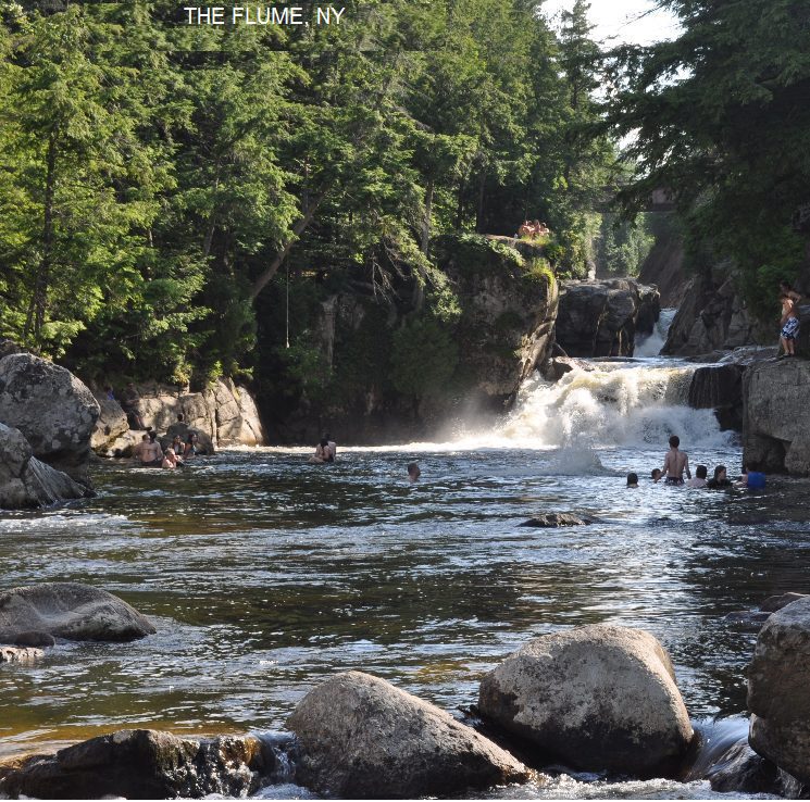
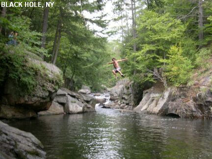
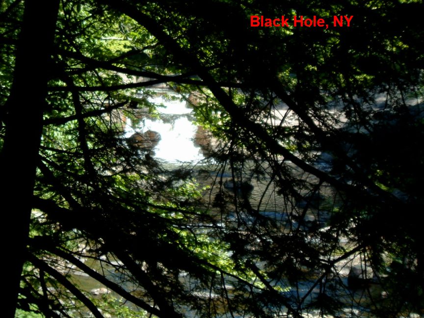
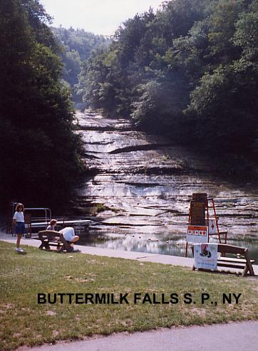
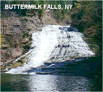
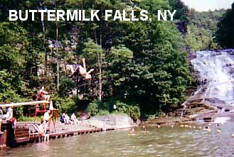
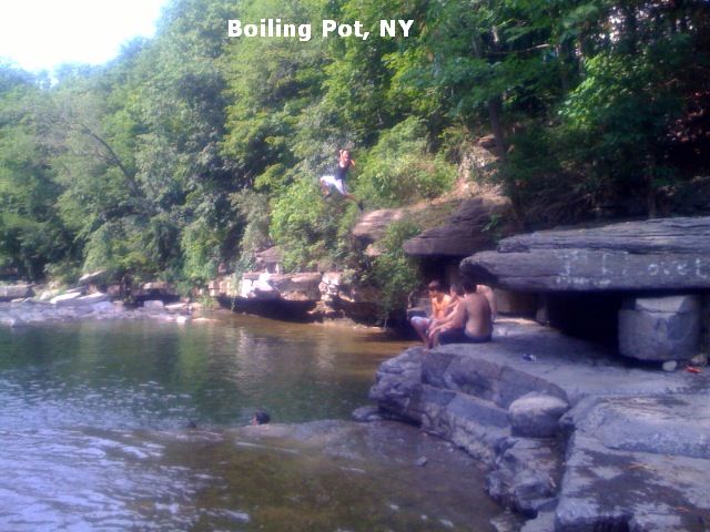
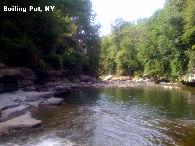
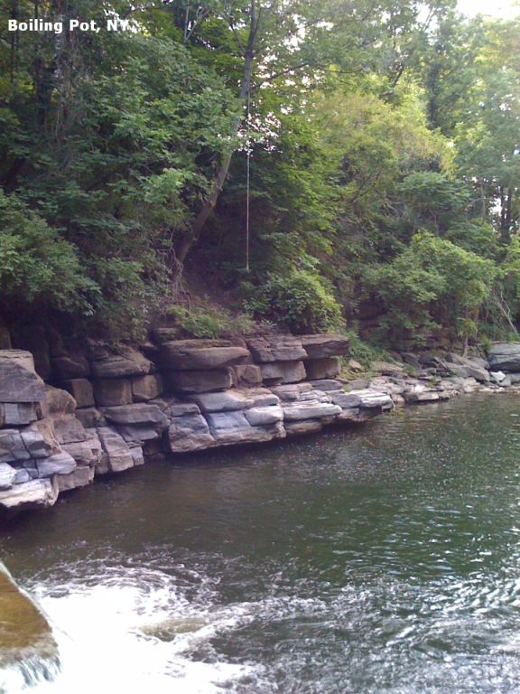
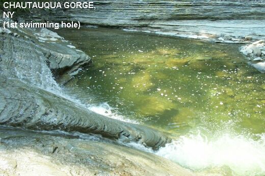
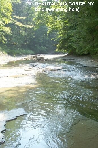
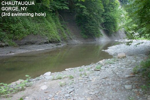
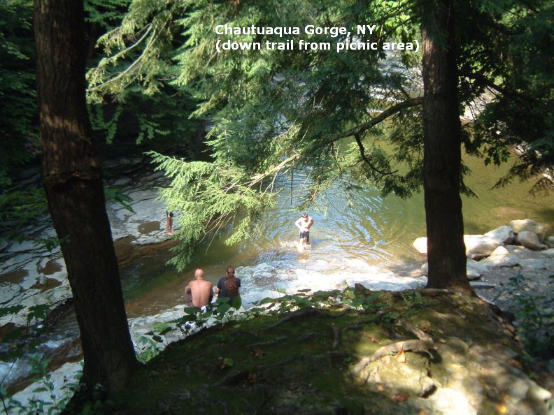
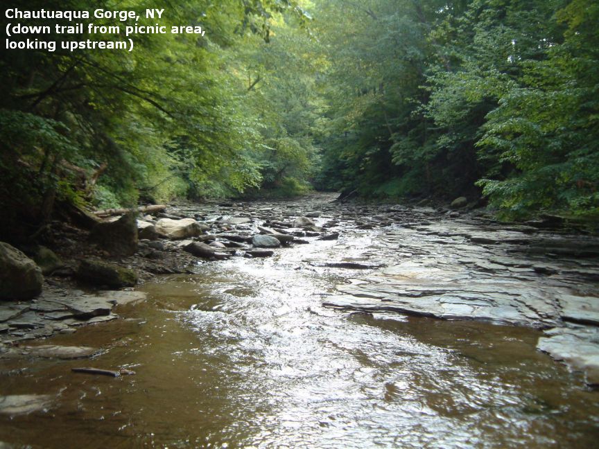
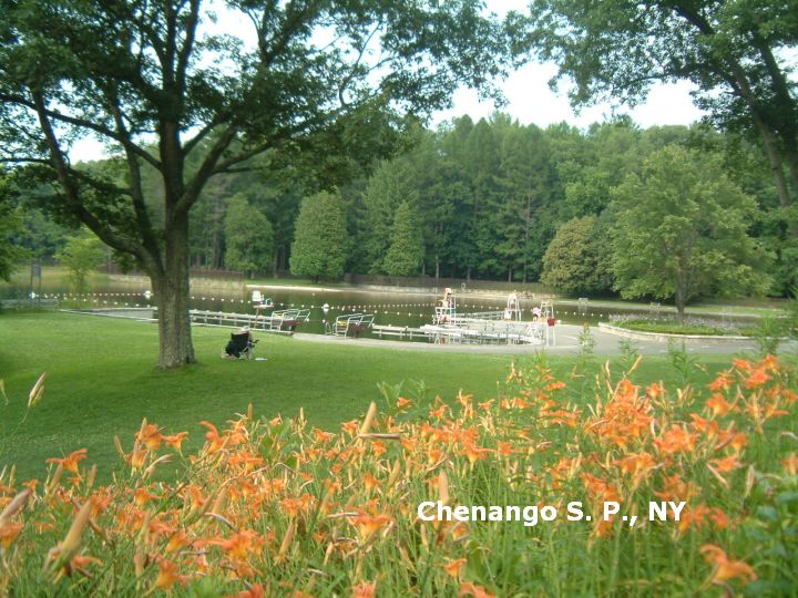
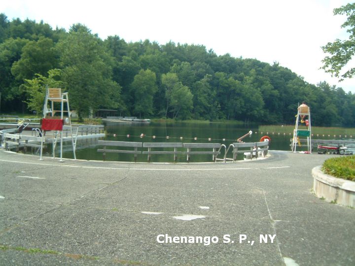
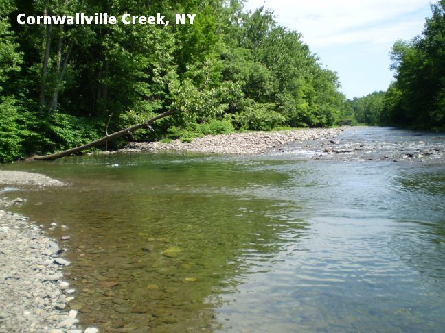
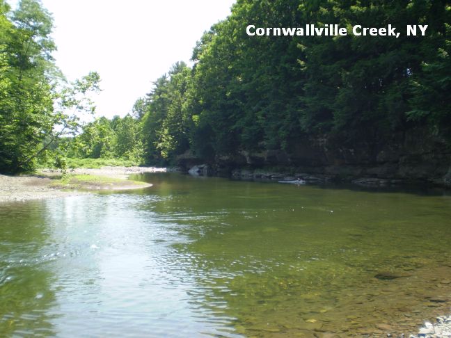
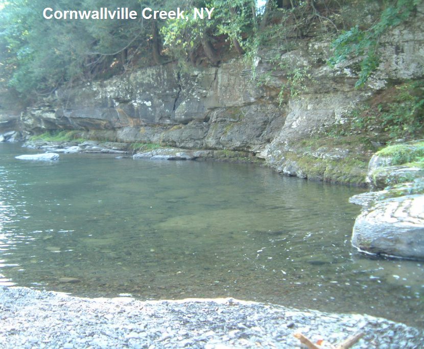
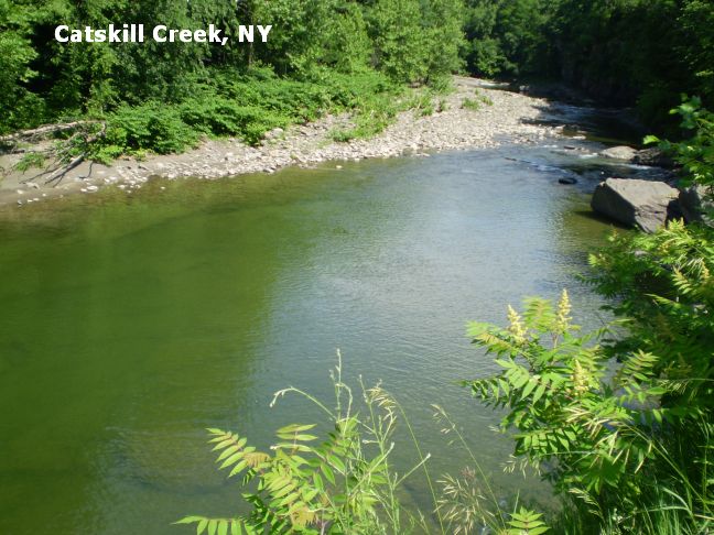
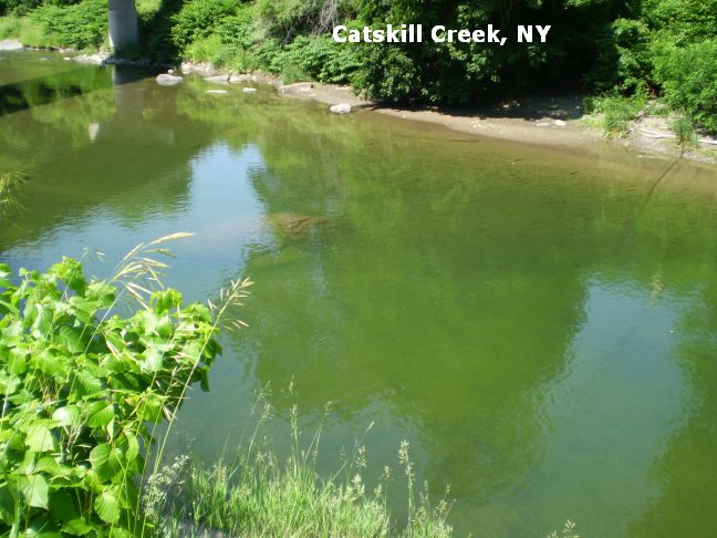
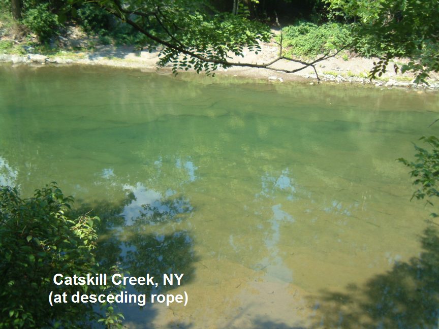
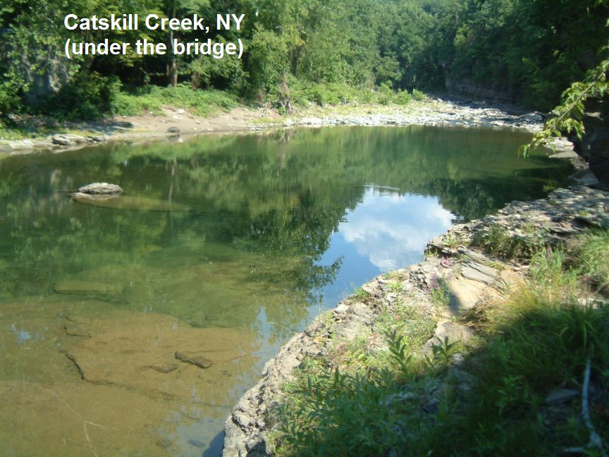
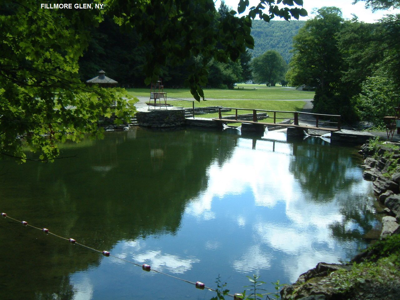
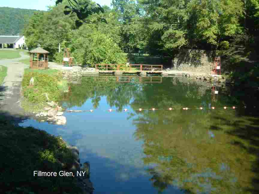
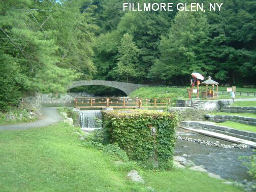
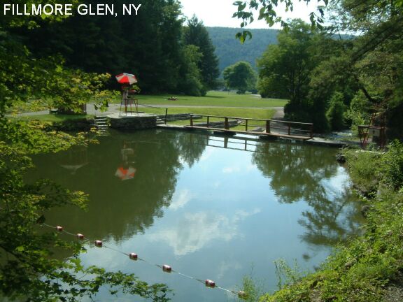
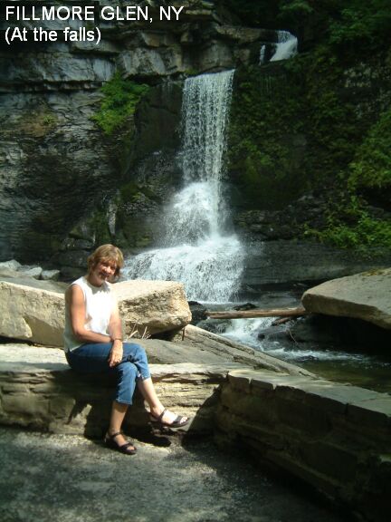
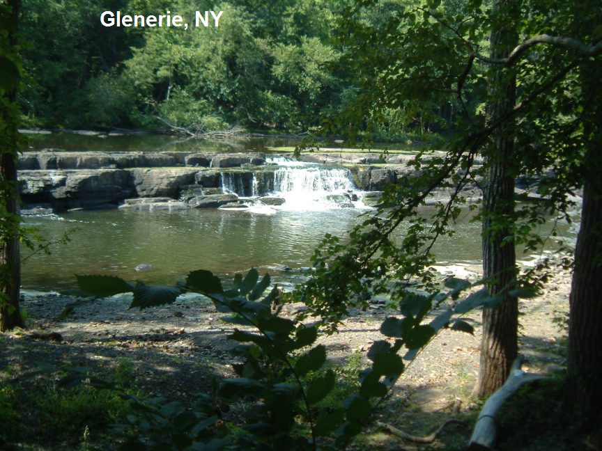
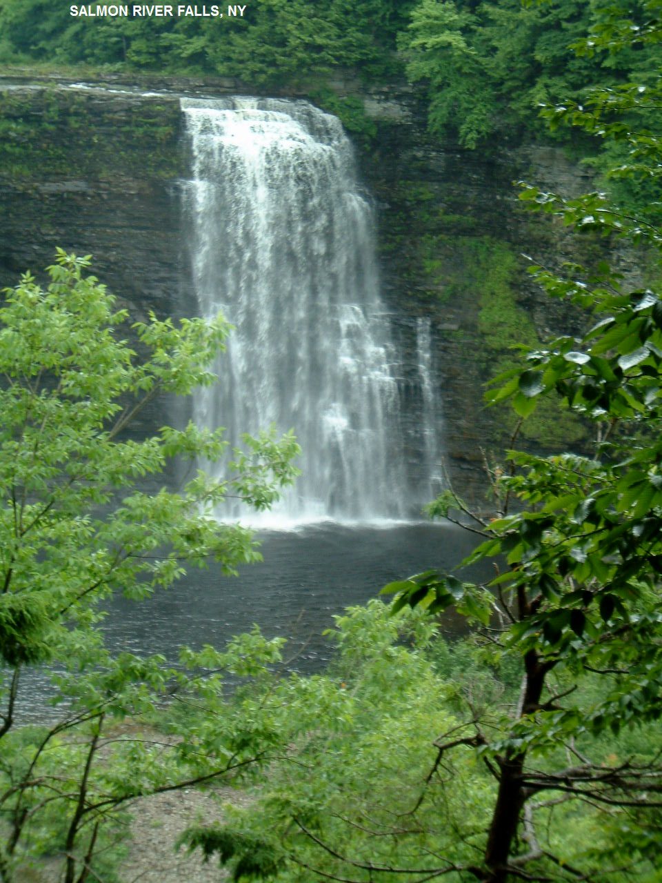
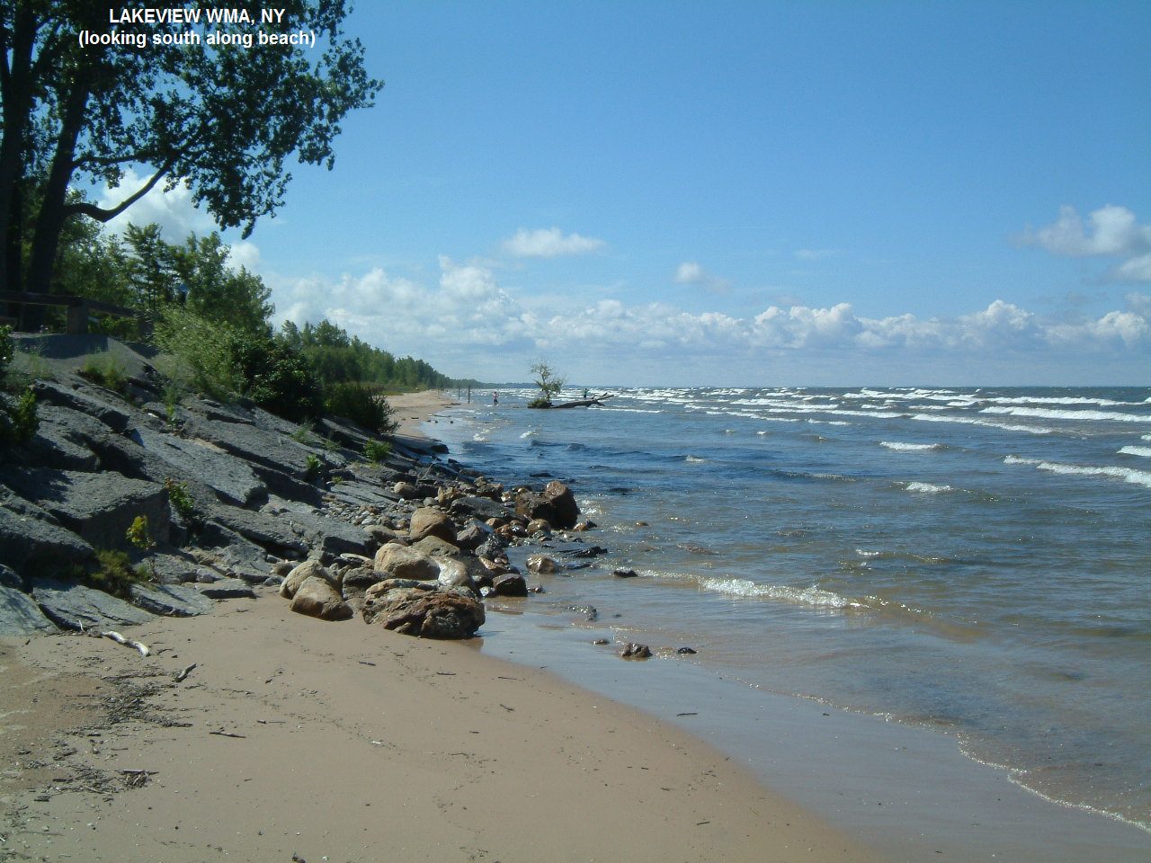
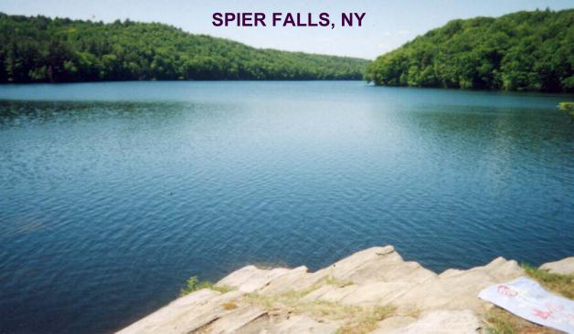
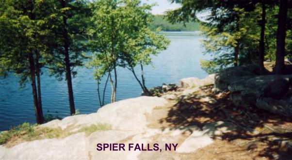
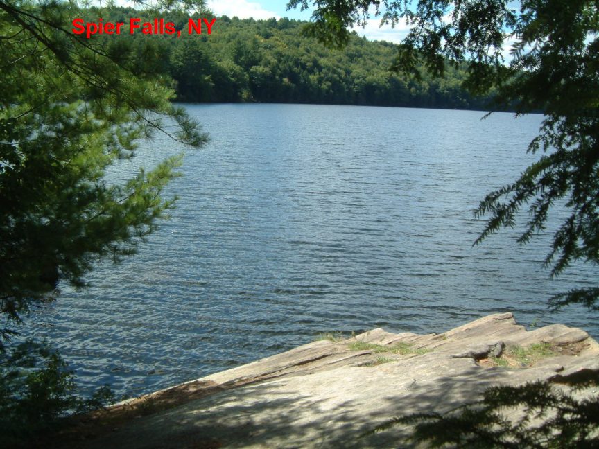
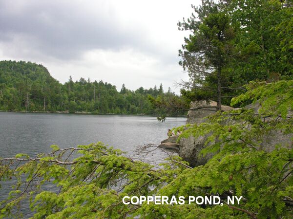
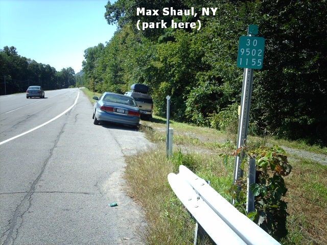
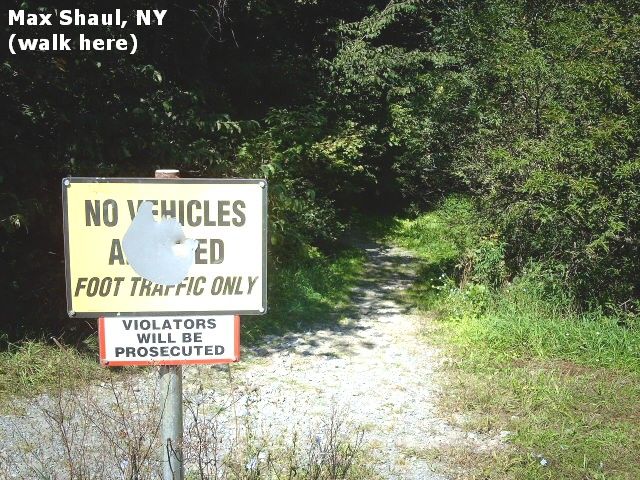
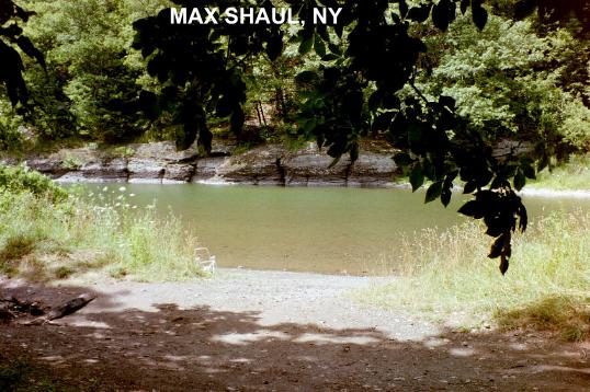
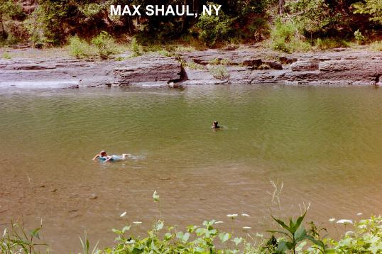
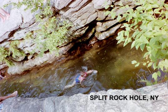
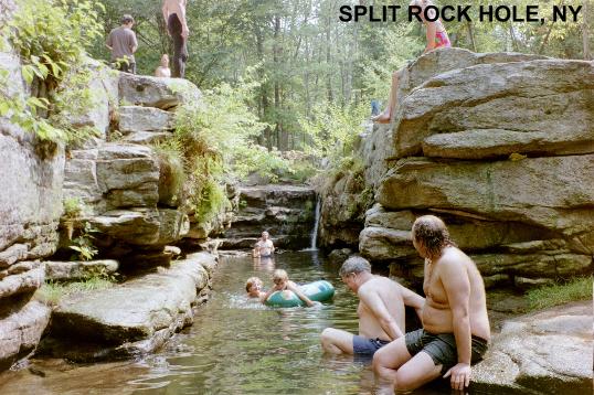
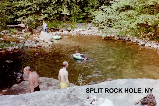
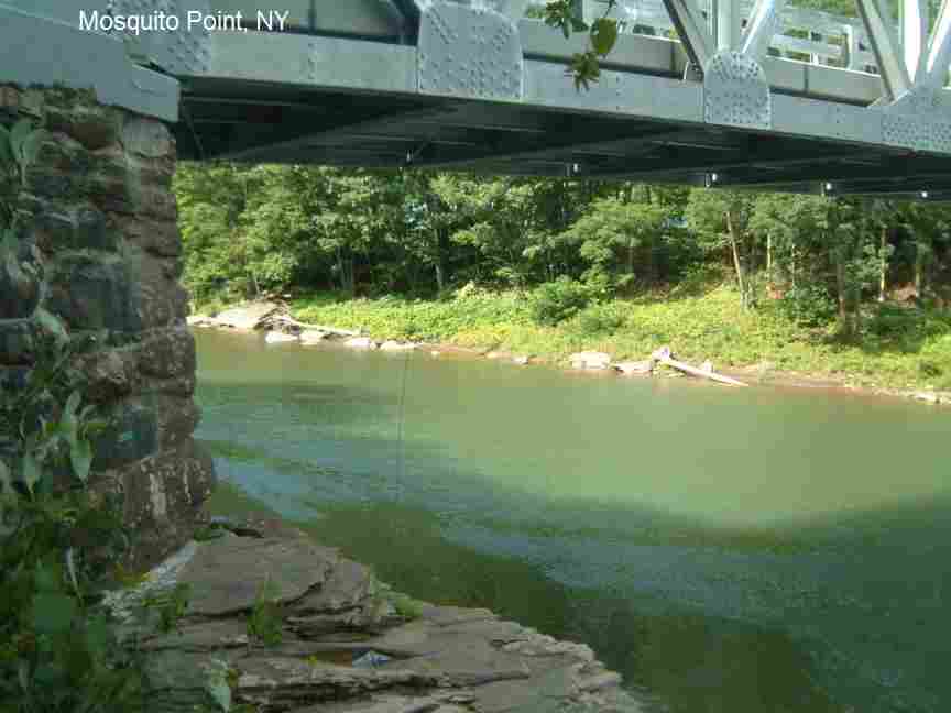
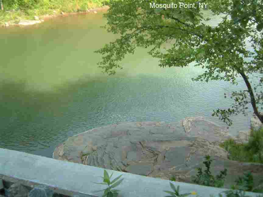
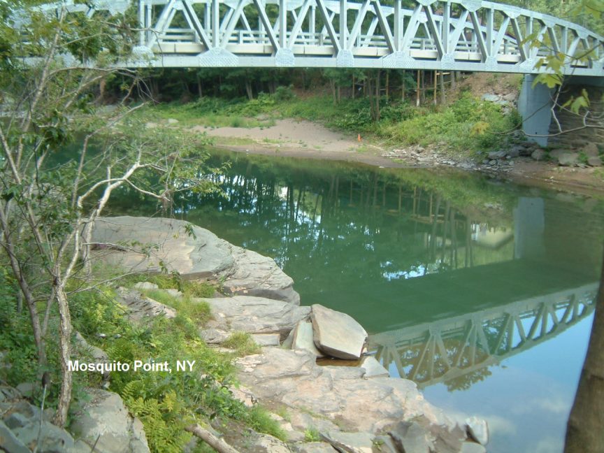
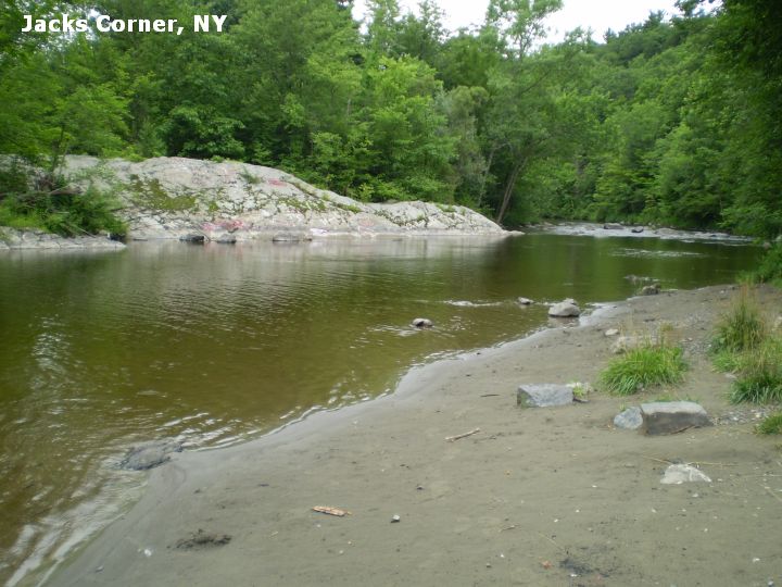
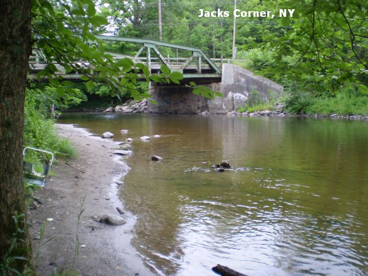
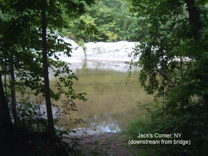
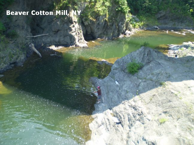
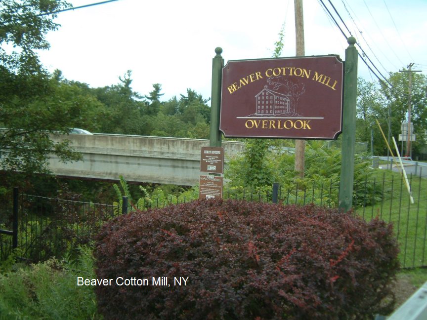
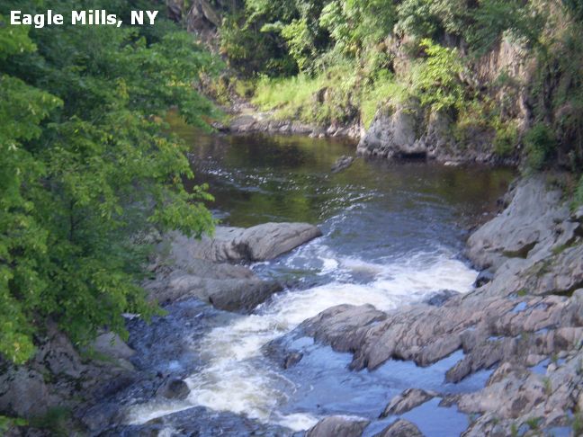
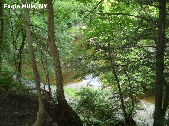
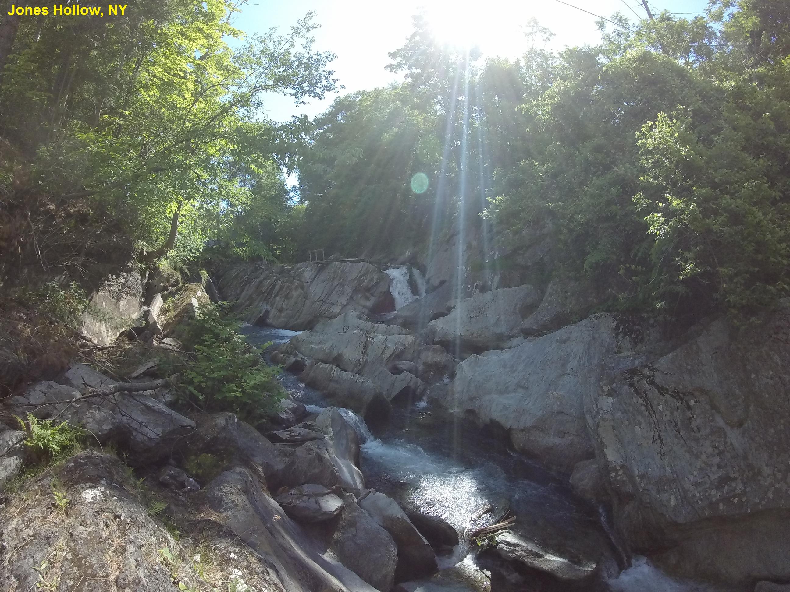
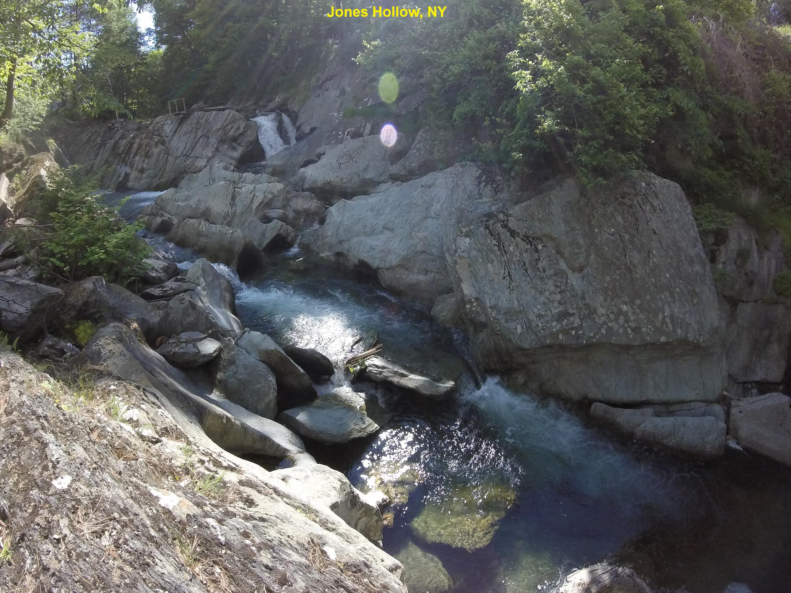
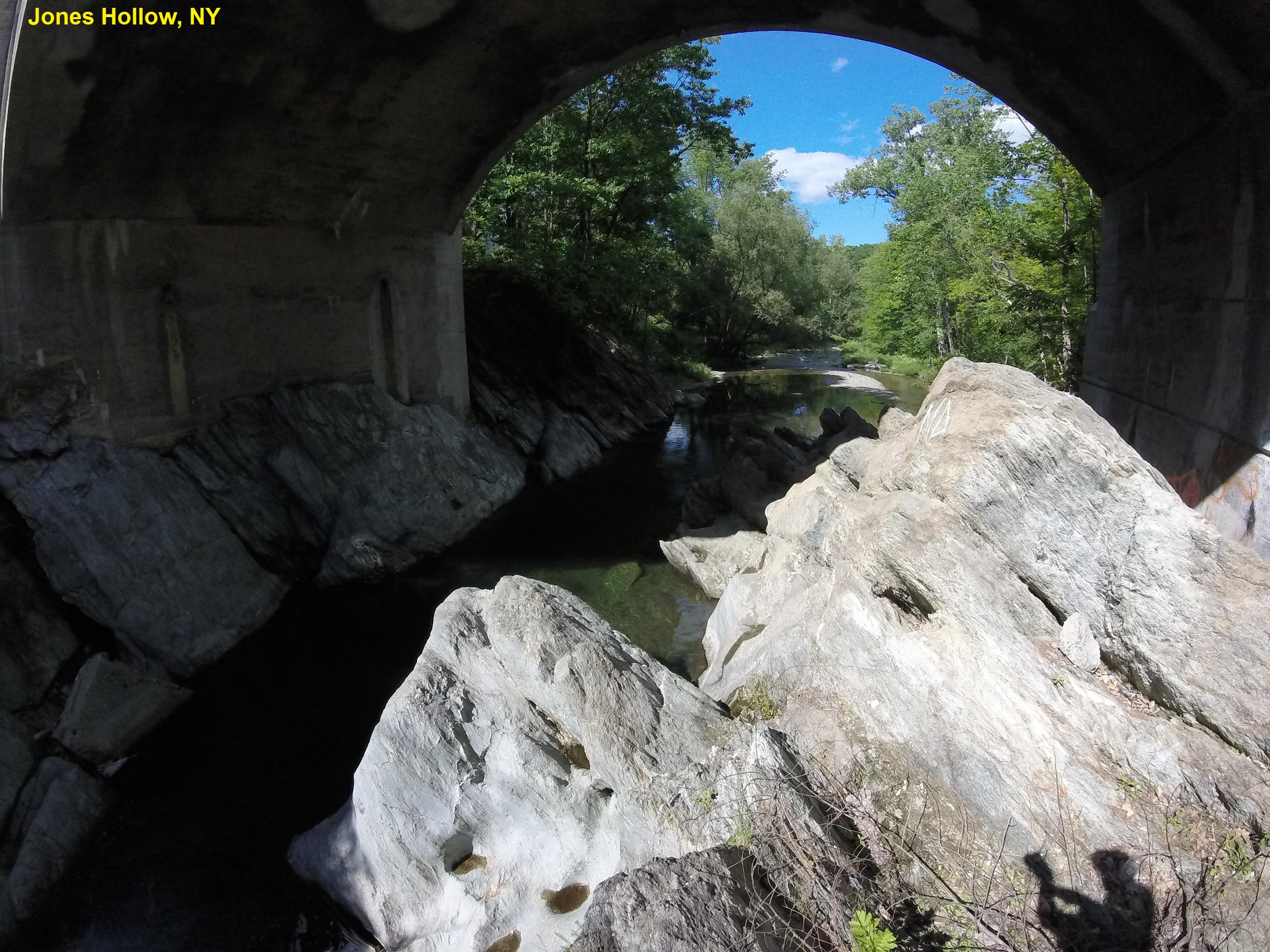
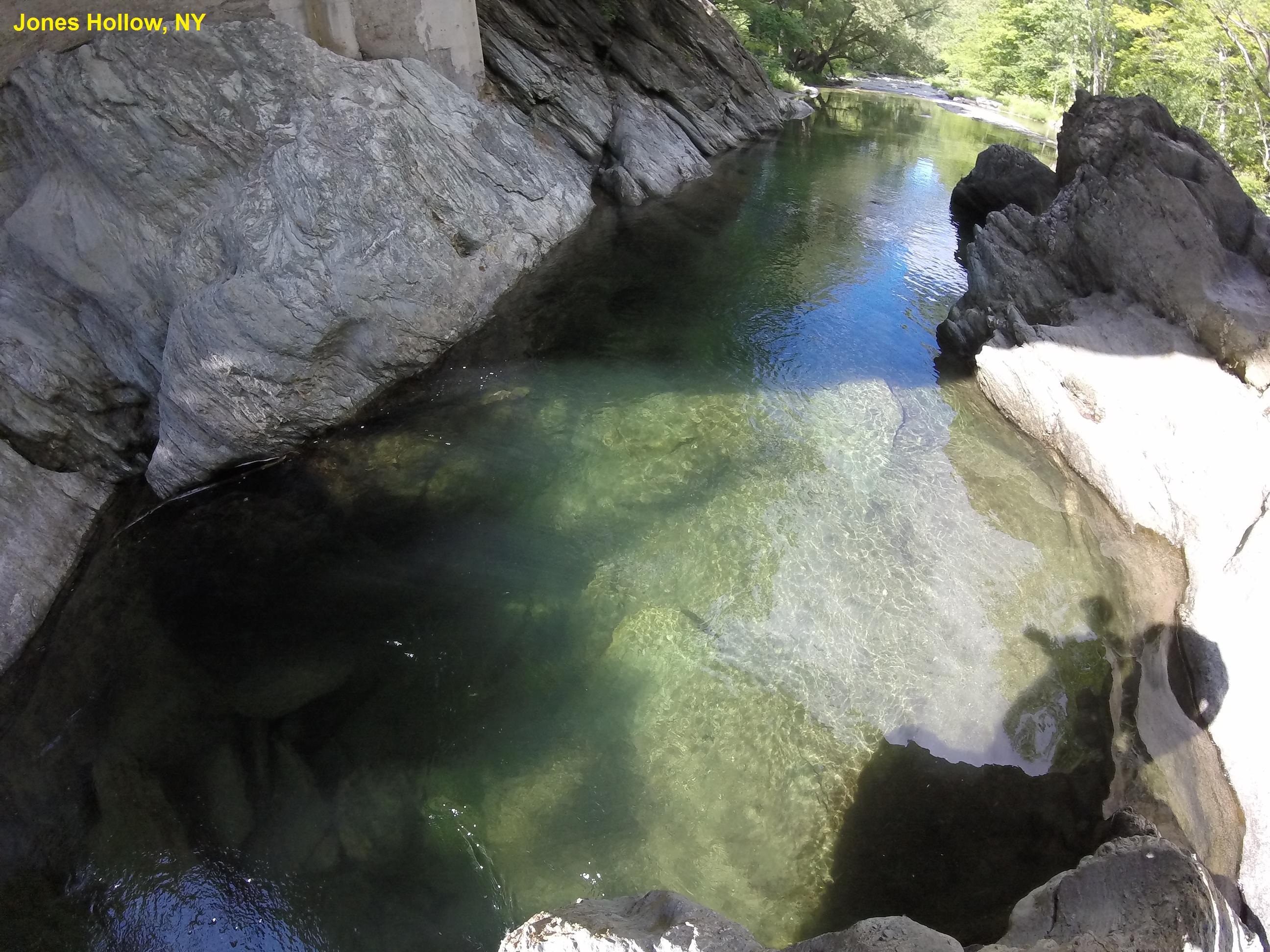
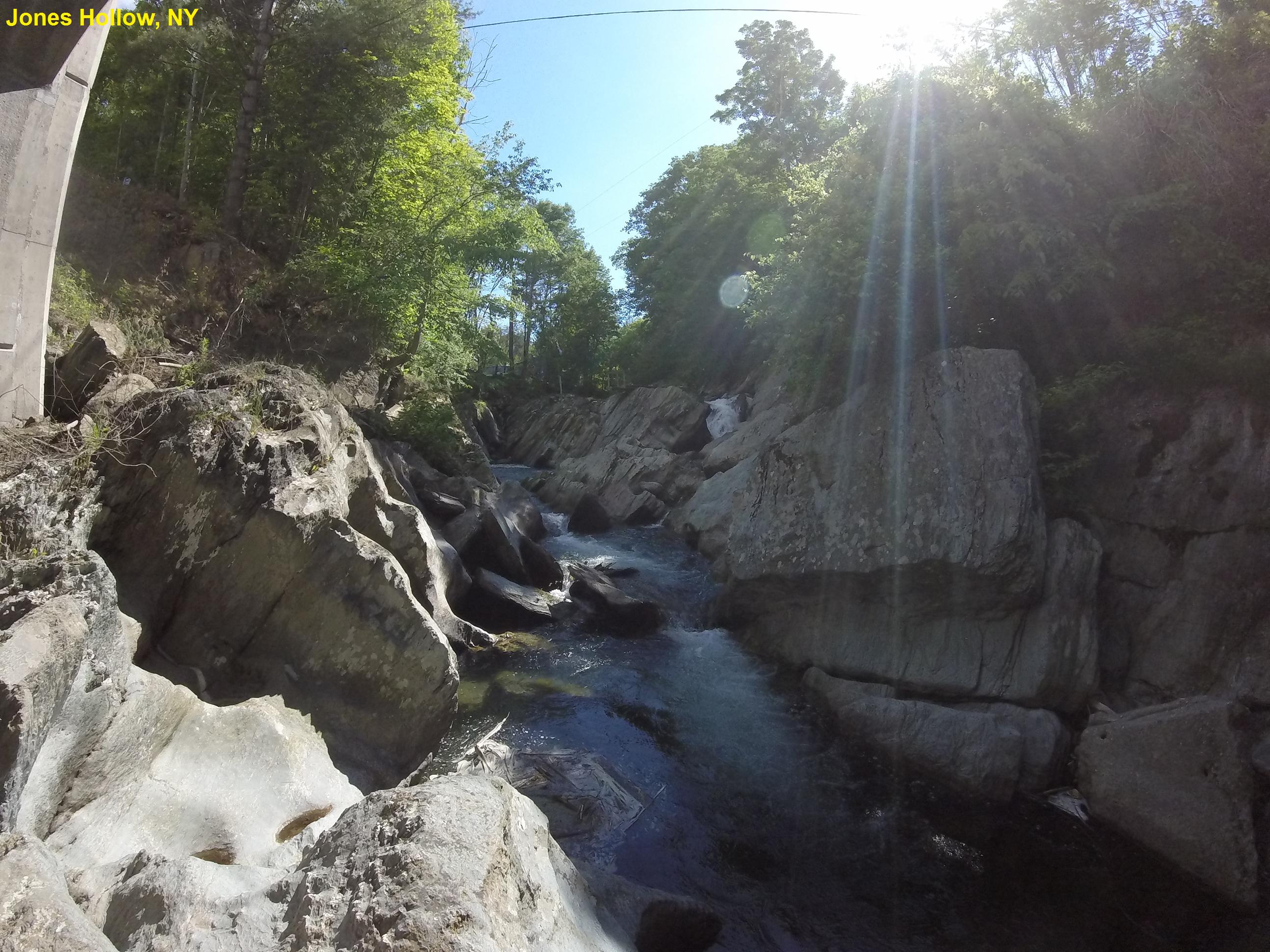
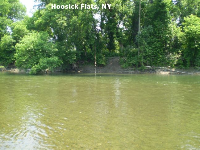
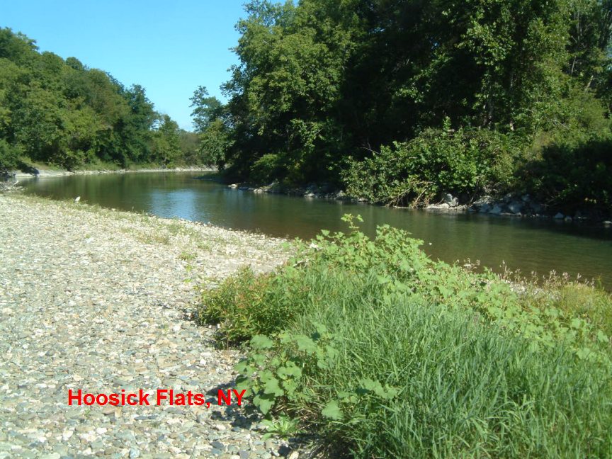
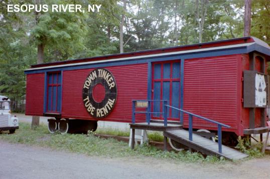
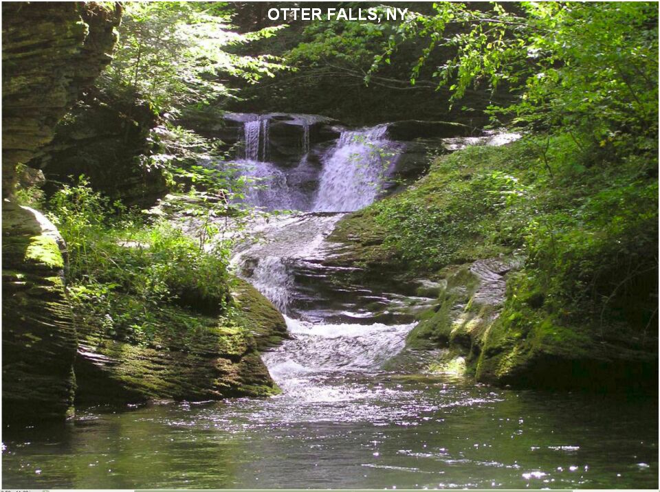
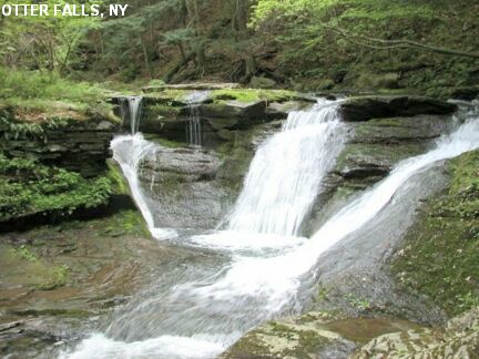
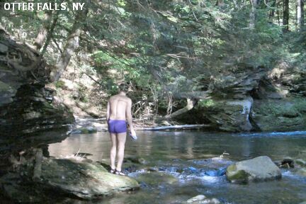
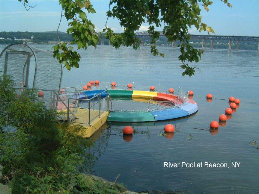
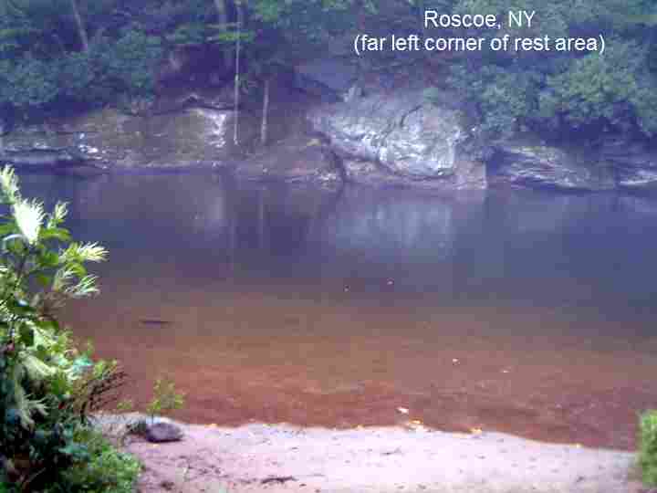
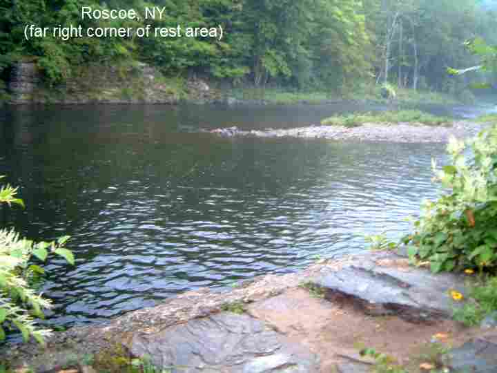
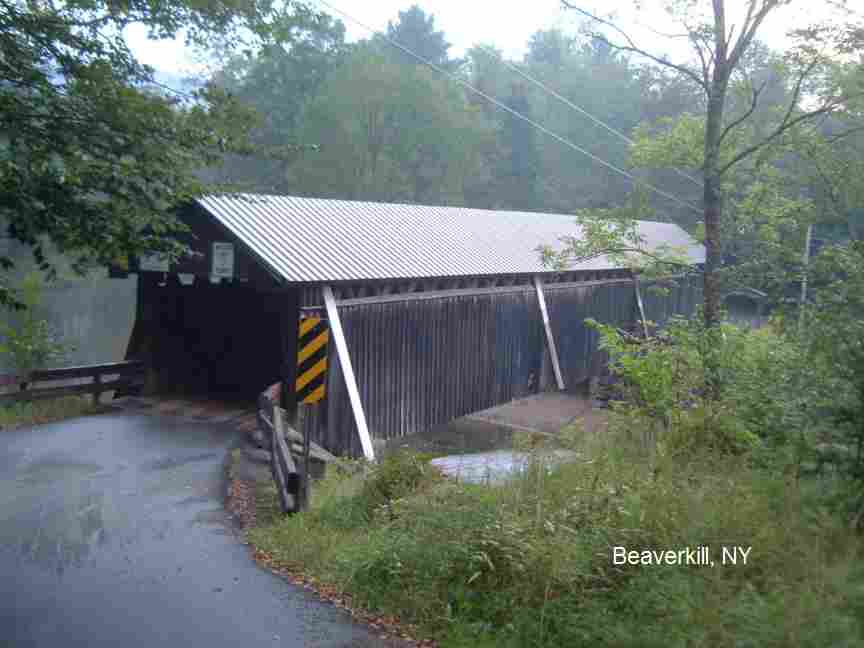
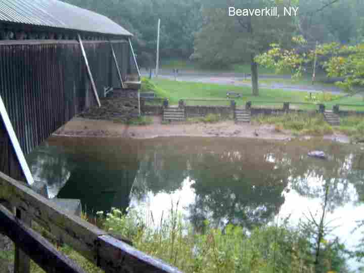
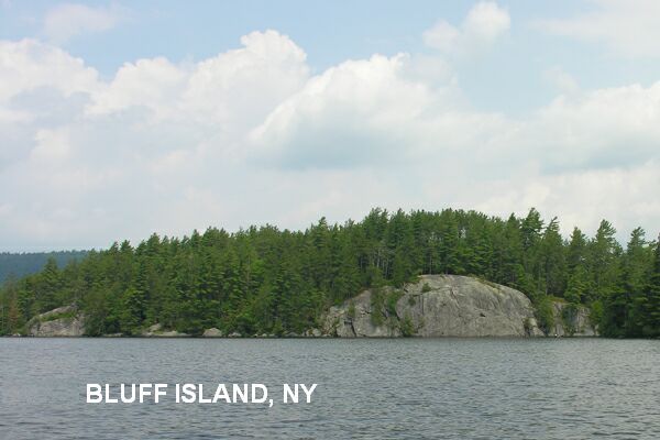
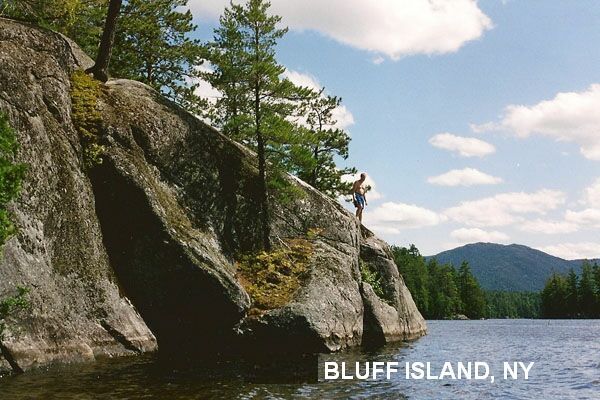
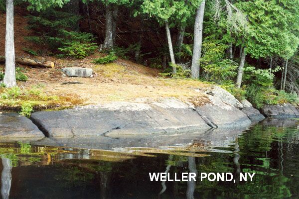
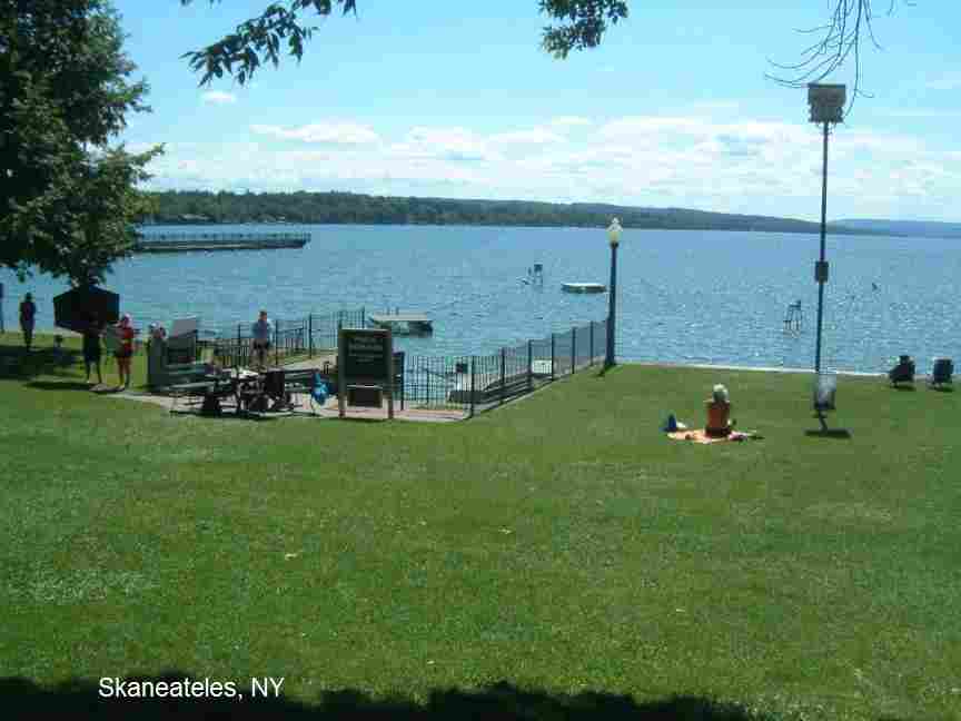
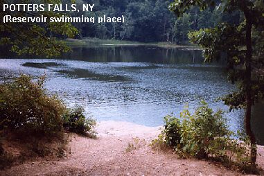
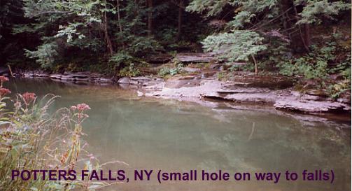
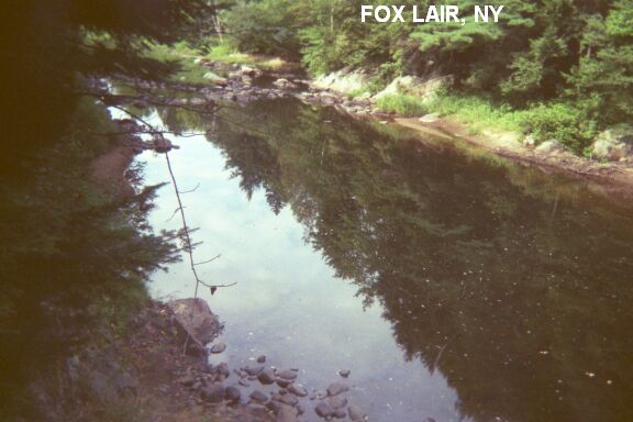
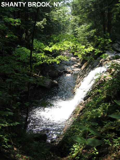
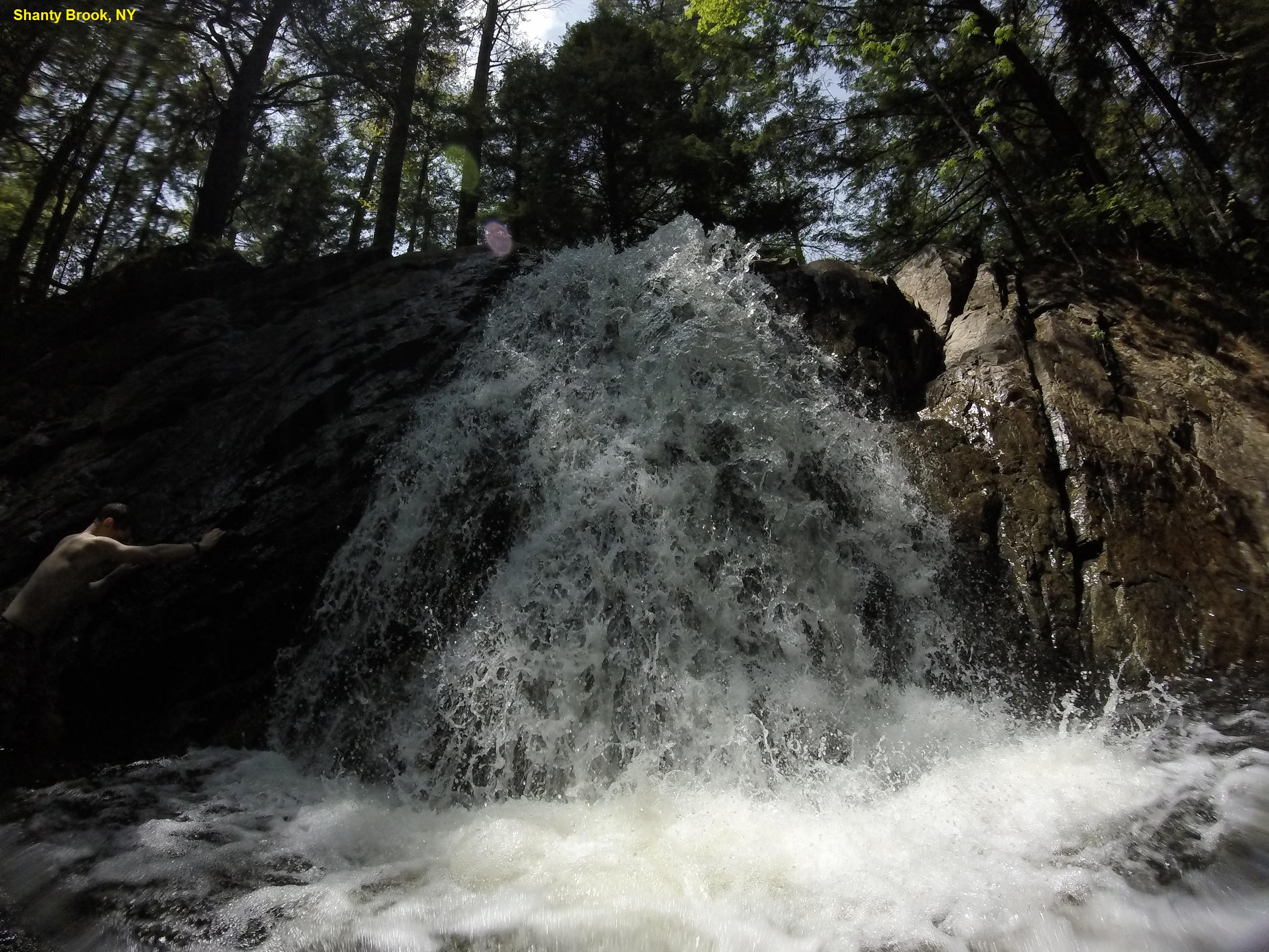
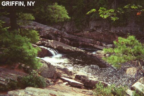
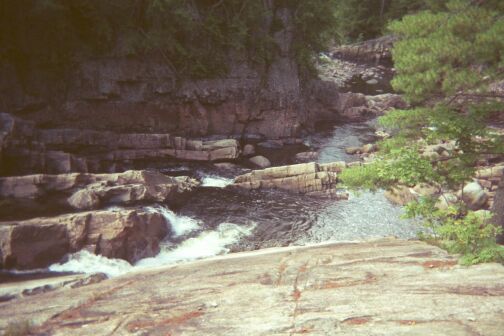
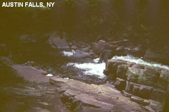
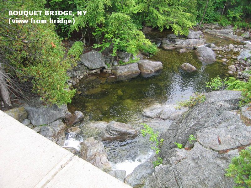
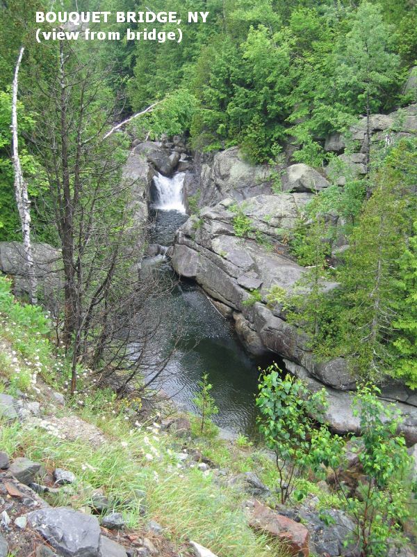
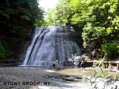
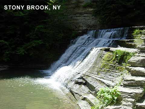
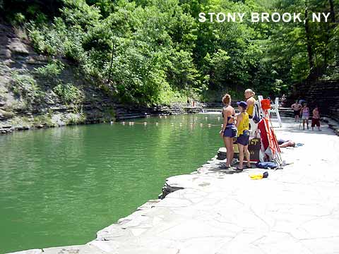
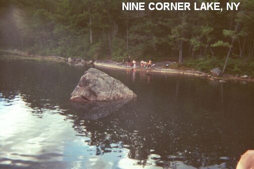
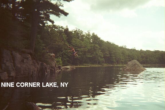
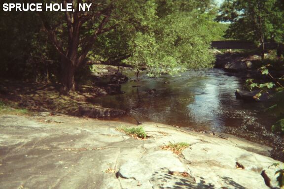
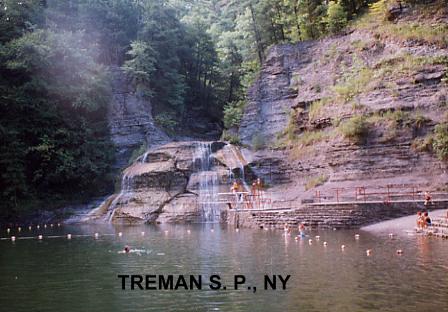
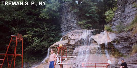
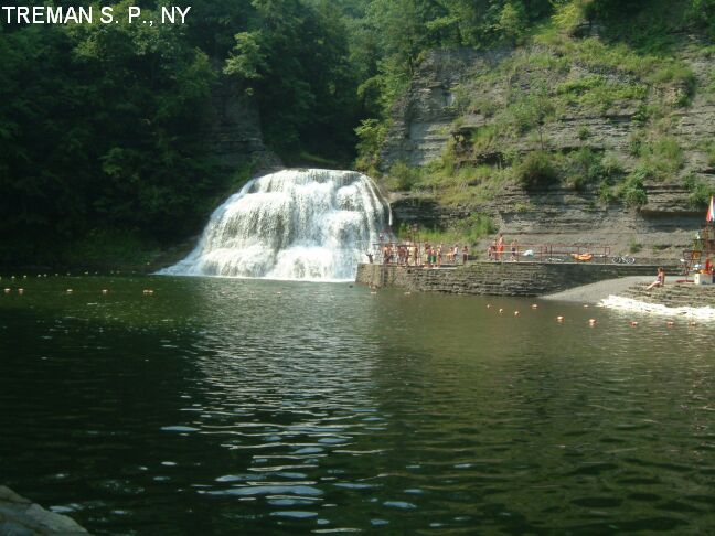
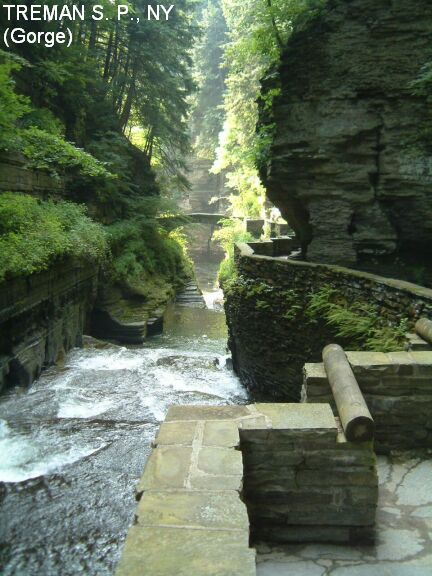
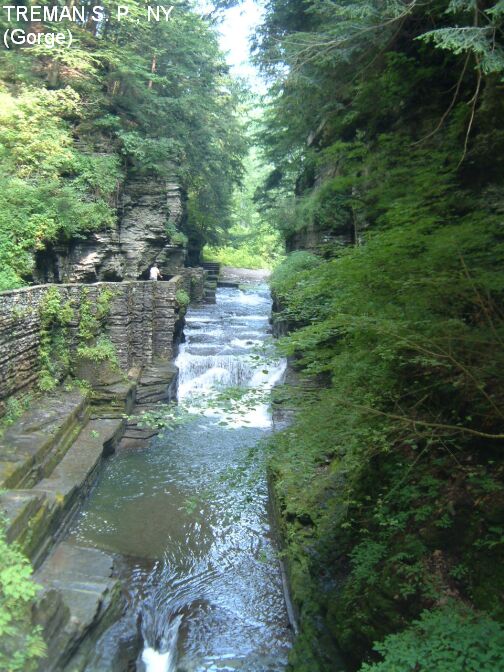
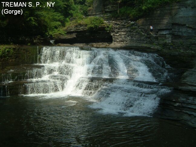
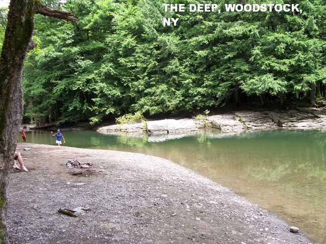
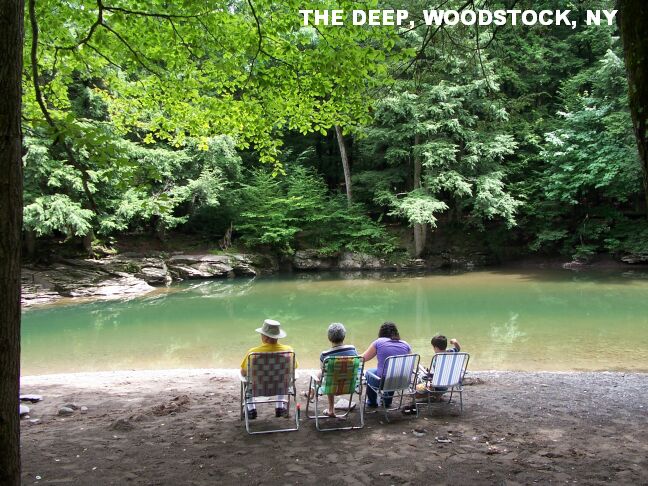
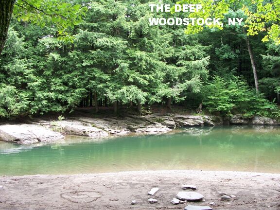