
NOVA SCOTIA & PEI SWIMMING HOLES |
|---|
Click here to see the home page and learn about swimming holes in other states
Click here for Halifax area beaches you can get to by bus .This swimming hole listing is by www.swimmingholes.org
|
| |
|---|---|---|
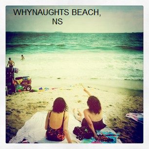
| TOWNS | HALIFAX, DARTMOUTH | |
| LAT, LON | lat=44.646826, lon=-63.374082 (source: measured by another) (accuracy:approximate) LINK TO GOOGLE MAP | |
| PROVINCE | NS | |
| WATER | Atlantic Ocean | |
| TYPE | Ocean | |
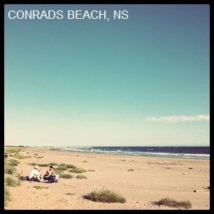
| DESCRIPTION | Very fine sand beach, beautiful swimming in the Atlantic Ocean (July-Oct only) | |
| AREAS | None | |
| SANCTION | Official | |
| FEE | None | |
| FACILITIES | Parking | |
| ACTIVITIES | Swimming | |
| PHONE | None | |
| CAMPING | None at site. | |
| BATHING SUITS | Customary | |
| DIRECTIONS | From Dartmouth, take Portland St/#207 out of town towards Cole Harbour. Pass all the crap stores. The road will turn into Cole Harbour Rd and then into Lawrencetown Rd. Continue through Lawrencetown and keep an eye out for Conrad Rd, which you will turn right onto and continue until you see the walkway to the beach. | |
| CONFIDENCE | Very confident | |
| VERIFIED | By another | |
| DATE UPDATED | 11/2012 |
This swimming hole listing is by www.swimmingholes.org
|
| |
|---|---|---|
| TOWNS | HALIFAX | |
| LAT, LON | lat=44.631826, lon=-63.650656 (source: measured by another) (accuracy:approximate) LINK TO GOOGLE MAP | |
| PROVINCE | NS | |
| WATER | Long Lake | |
| TYPE | Lake | |
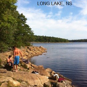
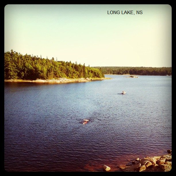
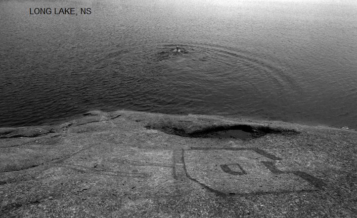
| DESCRIPTION | Beautiful, clean, secluded, refreshing, deep lake swimming - almost in the city. The park is little developed with few facilities at this time. WIKIPEDIA INFO. | |
| AREAS | Long Lake Provincial Park | |
| SANCTION | Official | |
| FEE | None | |
| FACILITIES | None | |
| ACTIVITIES | Swimming | |
| PHONE | None | |
| CAMPING | None at site. | |
| BATHING SUITS | Optional | |
| DIRECTIONS | From downtown Halifax, get to the rotary and take the St.Margarets Bay exit. Continue on that road for approx 7kms until you see water on your right. As you are descending the hill, park on the shoulder area to the right and find the access path on your left, it is quite worn and has a metal bike post. If you see the parking lot on your left you've gone too far although you can also park there and take that entrance. Either way you'll come to the lake PHOTO and can hike around further to the large rock wall PHOTO , PHOTO or continue onwards around the lake to your desired swimming spot. | |
| CONFIDENCE | Very confident | |
| VERIFIED | By another | |
| DATE UPDATED | 11/2012 |
This swimming hole listing is by www.swimmingholes.org
|
| |
|---|---|---|
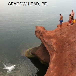
| TOWNS | SUMMERSIDE, BEDEQUE | |
| LAT, LON | lat=46.315695, lon=-63.810076 (source: measured by another) (accuracy:approximate) LINK TO GOOGLE MAP | |
| PROVINCE | PE | |
| WATER | Northumberland Strait | |
| TYPE | Ocean | |
| DESCRIPTION | Open ocean with a view of the Confederation Bridge and a lighthouse behind you. | |
| AREAS | None | |
| SANCTION | Unofficial | |
| FEE | None | |
| FACILITIES | None | |
| ACTIVITIES | Swimming, Jumping | |
| PHONE | None | |
| CAMPING | None at site. | |
| BATHING SUITS | Customary | |
| DIRECTIONS | From the bridge to Prince Edward Island, take the Summerside exit and then follow signs to Bedeque. Before you arrive in Bedeque, take Fernwood Rd/RT 119 for 6.9kms and then turn left onto Sea Cow Head Rd. for 500m. Take the 1st right onto Lighthouse Rd and follow until you see the lighthouse, ocean and parking. Enjoy. | |
| CONFIDENCE | Very confident | |
| VERIFIED | By another | |
| DATE UPDATED | 11/2012 |
This swimming hole listing is by www.swimmingholes.org
|
| |
|---|---|---|
| TOWNS | HALIFAX, WINDSOR, BROOKLYN | |
| PROVINCE | NS | |
| WATER | Varies-see below | |
| TYPE | Varies-see below | |
| DESCRIPTION | Swimming places in and near the famous Bay of Fundy and the town of Windsor, northwest of Halifax. For details, see DIRECTIONS below. | |
| AREAS | Bay of Fundy and Smiley's Provincial Park | |
| SANCTION | Unofficial | |
| FEE | None | |
| FACILITIES | Unknown | |
| ACTIVITIES | Swimming, jumping | |
| PHONE | none | |
| CAMPING | At Smiley's Provincial Park. | |
| BATHING SUITS | unknown | |
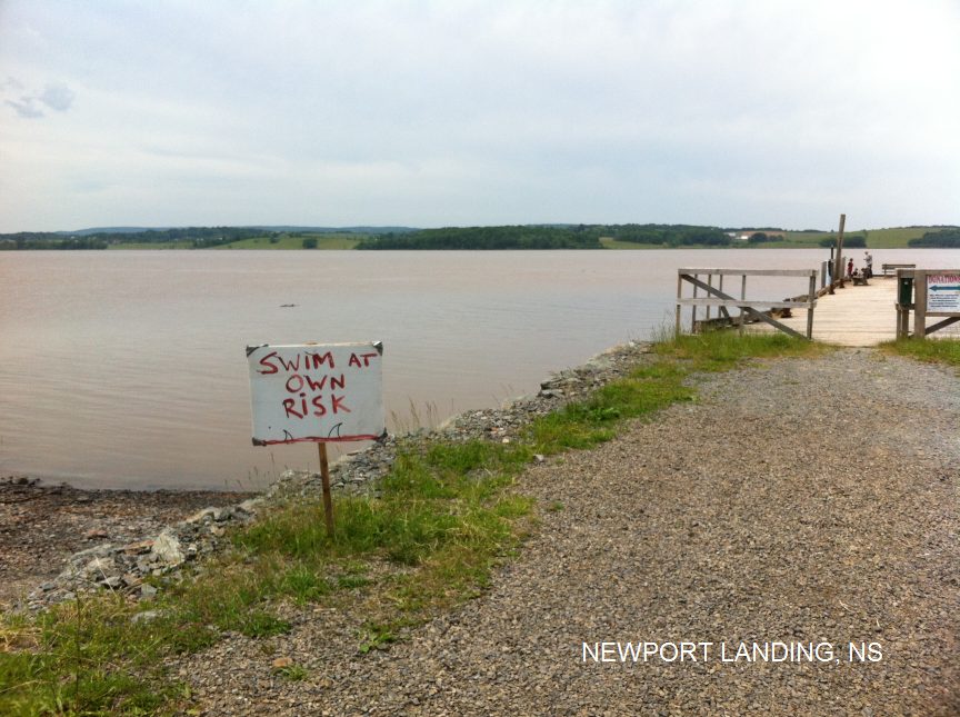
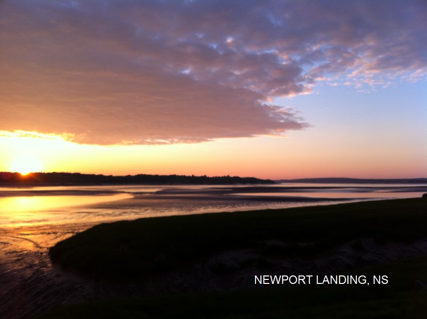
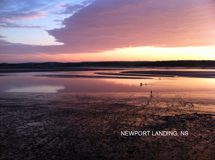
| DIRECTIONS | From Halifax, go northwest on RT 101 about 35 miles to just before Windsor, turn east (right) on RT 14E, then: NEWPORT LANDING [NEWP]: This from a visitor: "This is great swimming in the mighty Bay of Fundy at the Avon River. PHOTO , PHOTO , PHOTO . It's very muddy so be sure to check for depth before you jump and don't go out too far mud sliding. There may be people fishing on the wharf so be respectful of their space. CAUTION: Be very careful of the tides, they are honestly the largest in the world and cover A LOT of ground very quickly. Only mudslide at low tide and only dock jump at high tide. " To get here from the junction of RT 101 and RT 14E (above), go about 4 miles east on RT 14E, turn north (left) onto Avondale Rd, be careful to stay on Avondale for about 6 miles - until you see the dock and fairgrounds. Newport Landing and the swimming/mud sliding place is here. LAT, LON : lat=45.021706, lon= -64.131755(source: measured by another) (accuracy: approximate) LINK TO GOOGLE MAP. Pretty confident. Verified by another. Updated 9/2014. SMILEYS [SMIL]: Deep swimming hole in Meander River under iron girder bridge near (or in) Smileys Provincial Park. To get here, continue east on RT 14E from Avondale Rd. (above) about 5 more miles (jog left then right at Brooklyn to stay on RT 14E) to Smiley's Provincial Park. There is an iron girder bridge somewhere there and a deep swimming hole in the river below. Some people jump from the bridge. (Dont know exactly where this swimming place is.) No better directions. After you enter the park, if you take the first left into the campground, there is apparently a swimming place there in the Meander River. Not sure if this is the girder place referred to above. LAT, LON : lat=45.01418, lon= -63.96187(source: measured by another) (accuracy: approximate) LINK TO GOOGLE MAP. Pretty confident. Verified by another. Updated 9/2014. | |
| CONFIDENCE | Pretty confident | |
| VERIFIED | Verified by another | |
| DATE UPDATED | 9/2014 |
This swimming hole listing is by www.swimmingholes.org
|
| |
|---|---|---|
| TOWNS | HALIFAX, HUBBARDS | |
| LAT, LON | lat=44.642643, lon=-64.013153 (source: measured by another) (accuracy:approximate) LINK TO GOOGLE MAP | |
| PROVINCE | NS | |
| WATER | St. Margarets Bay | |
| TYPE | Ocean | |
| DESCRIPTION | Small strip of sandy beach, clear, refreshing, fair-tempered ocean that doesn't get too deep. | |
| AREAS | None | |
| SANCTION | Official | |
| FEE | None | |
| FACILITIES | None | |
| ACTIVITIES | Swimming | |
| PHONE | None | |
| CAMPING | None at site. | |
| BATHING SUITS | Customary | |
| DIRECTIONS | From Halifax, take the RT 103 South Shore Hwy. and continue until Upper Tantalon. Exit and turn left onto Hammonds Plains Rd / 213W. Turn right onto St. Margarets Bay Rd. and stay for approx. 17.5kms until you see beach. | |
| CONFIDENCE | Very confident | |
| VERIFIED | By another | |
| DATE UPDATED | 11/2012 |
HOME