LOUISIANA SWIMMING HOLES |
|---|
Click here to see the home page and learn about swimming holes in other states
This swimming hole listing is by www.swimmingholes.org
|
TOWNS | LAFAYETTE, KINDER, MITTE, OBERLIN |
STATE | LA |
WATER | Whisky Chitto Creek/Calcasieu River |
TYPE | Creek/River |
DESCRIPTION | Several long-time swimming places in creeks and rivers near Oberlin. For details, see DIRECTIONS below. |
AREAS | None |
SANCTION | Unofficial |
FEE | None |
FACILITIES |
None |
ACTIVITIES |
Swimming, rope swings, canoeing |
PHONE | None |
CAMPING | None at site |
BATHING SUITS | Customary |
DIRECTIONS |
| From Lafayette, take I-10 west to exit 44 then take RT 165 northeast to Kinder, then:
CONFIDENCE | Pretty confident |
VERIFIED | No |
DATE UPDATED | 2/20/2016 | |
|---|
This swimming hole listing is by www.swimmingholes.org
|
TOWNS | ALEXANDRIA, NATCHITOCHES, PROVENCAL | LAT, LON | lat=31.44411, lon=-93.09274 (source: measured by another) (accuracy:exact) | LINK TO GOOGLE MAP
STATE | LA |
WATER | Kisatchie Bayou |
TYPE | Large creek |
DESCRIPTION | A Forest Service recreation, picnic and camping area. Unofficial but customary swimming place or water-play depending on water level. Forest Service Web Site . | This description from a visitor: "This is the best water playground in LA. Kisatchie Bayou cuts through some sandstone strata, creating rapids and small falls below a bluff. Decades of stone moving by people in bathing suits have created a tubing chute at the center and a jacuzzi area just upstream, Further upstream are (sometimes) rope swings from trees and a bluff over a deep spot that is used for jumping (getting back up is a problem). Wade downstream and a succession of sandbars surround the stream which in some bends is deep enough for full body submersion (and much cooler water at the bottom). Moving water which stays up enough for at least part of the summer is very rare in LA.."
AREAS | Kisatchie National Forest, Kisatchie Ranger District |
SANCTION | Unofficial |
FEE | Parking fee |
FACILITIES |
Picnic tables, restrooms |
ACTIVITIES |
Swimming, tubing, jumping |
PHONE | Unknown |
CAMPING | Walk-in tent camping at site |
BATHING SUITS | Required |
DIRECTIONS | From the intersection of I-49 and RT 6 at Natchitoches, drive west on RT 6 for 7 miles. Turn left (south) on Louisiana RT 117 and proceed 16 miles to Forest Highway 59, Longleaf Trail Scenic Byway. Turn left (east) on FH 59 and go 7 miles to Forest Road 321. Turn right (south) on FR 321 and go 4 miles to Forest Road 366. Turn right (west) on FR 366 and proceed to the end of the road. |
CONFIDENCE | Very confident |
VERIFIED | No |
DATE UPDATED | 6/23/2007 | |
|---|
This swimming hole listing is by www.swimmingholes.org
|
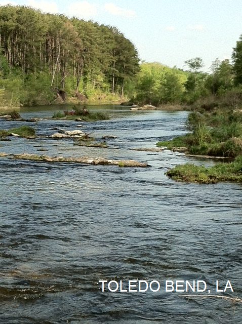
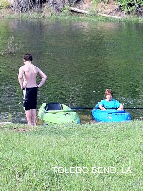
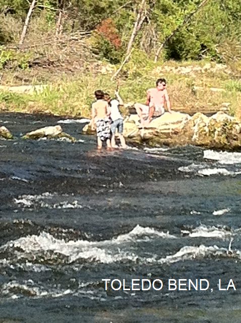
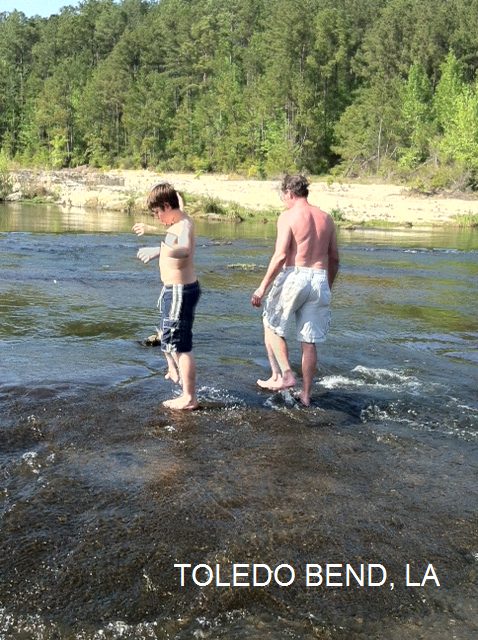
TOWNS | ALEXANDRIA, TOLEDO | LAT, LON | lat=31.19518, lon=-93.56519(source: map) (accuracy: approximate) | LINK TO GOOGLE MAP
STATE | LA |
WATER | Sabine River |
TYPE | River |
DESCRIPTION | Beautiful location on the Sabine River open to the public except when the water is very high. There are sandstone boulders, small rapids and rock ledges, clear, swift water and several deep swimming holes. The area is operated by the Sabine River Authority but is not advertised in any way. Swimmers, canoes and kayaks. |
AREAS | Sabine River Authority |
SANCTION | Unofficial |
FEE | None |
FACILITIES |
None |
ACTIVITIES |
Swimming, canoeing |
PHONE | Unknown |
CAMPING | None at site |
BATHING SUITS | Required |
DIRECTIONS | From Alexandria (on I-49), take RT 28 west about 50 miles to Leesville then turn right onto RT 171 north (Shreveport Hwy) and go about 8 miles to Anacoco. In Anacoco, take RT 111 west (Trigger Trapp Rd) about 10 miles then continue straight onto RT 392 (dont follow RT 111 where it turns south) and go about 5 miles, through South Toledo Bend State Park, and turn left (south) on RT 191 and go about 2 miles. Just after you cross the first spillway bridge, immediately turn left on the first gravel road on the left. This road will loop around and will parallel the Sabine River where there are sandstone boulders, small rapids and rock ledges. Park as indicated and hike several hundred feet back up the river bank to find clear, swift water and several deep swimming holes. |
CONFIDENCE | Very confident |
VERIFIED | No |
DATE UPDATED | 1/2013 | |
|---|
HOME